Dangerous human-made interference with climate: a GISS modelE study
Texte intégral
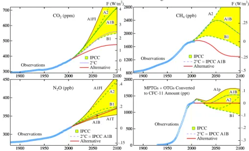
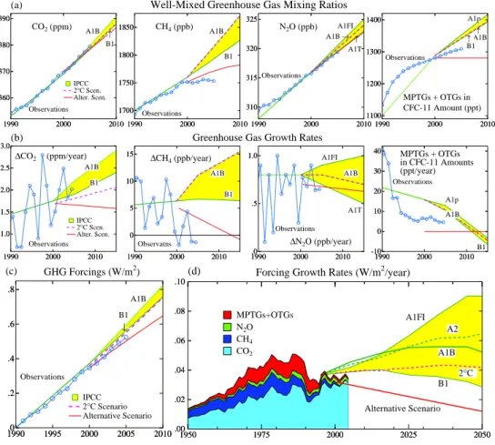
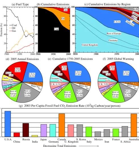
Figure


Documents relatifs
The present study uses two regional thermal indicators - thermal gradients and temperatures reduced to sea- level - to monitor the monthly evolution of minimum
-Details on quantitative analyses (e.g., data treatment and statistical scripts in R, bioinformatic pipeline scripts, etc.) and details concerning simulations (scripts,
In this work we presented a quantitative evaluation of the performances of 4 MLAs (BN, MLP, RF, and SVM) with different configurations applied in the detection of 7 driving event
The zoning map of liquefaction occurrence intensity in Babol city based on Sewmez and Gokojlou’s method illustrates that 2 zones with low liquefaction incidence
The time series of monthly global mean surface temperature (GST) since 1891 is successfully reconstructed from known natural and anthropogenic forcing factors, including
Most models suggest this trend in the tropical Indian thermocline is likely associated with the observed weakening of the Pacific trade winds and transmitted to the Indian Ocean by
of 3-hourly to daily precipitation extremes in the low-res- olution simulations increases with warming (not shown), suggesting shorter extreme precipitation events and thus a
Monthly climatology of VOS-derived sea surface (a) temperature and (b) salinity, and (c and d) the corresponding model-derived values along the mean shipping track crossing the
