Publisher’s version / Version de l'éditeur:
Vous avez des questions? Nous pouvons vous aider. Pour communiquer directement avec un auteur, consultez la première page de la revue dans laquelle son article a été publié afin de trouver ses coordonnées. Si vous n’arrivez pas à les repérer, communiquez avec nous à [email protected].
Questions? Contact the NRC Publications Archive team at
[email protected]. If you wish to email the authors directly, please see the first page of the publication for their contact information.
https://publications-cnrc.canada.ca/fra/droits
L’accès à ce site Web et l’utilisation de son contenu sont assujettis aux conditions présentées dans le site LISEZ CES CONDITIONS ATTENTIVEMENT AVANT D’UTILISER CE SITE WEB.
Technical Paper (National Research Council of Canada. Division of Building Research), 1962-10
READ THESE TERMS AND CONDITIONS CAREFULLY BEFORE USING THIS WEBSITE. https://nrc-publications.canada.ca/eng/copyright
NRC Publications Archive Record / Notice des Archives des publications du CNRC : https://nrc-publications.canada.ca/eng/view/object/?id=fec94e91-405f-4700-8d64-fcdb36d55d88 https://publications-cnrc.canada.ca/fra/voir/objet/?id=fec94e91-405f-4700-8d64-fcdb36d55d88
NRC Publications Archive
Archives des publications du CNRC
For the publisher’s version, please access the DOI link below./ Pour consulter la version de l’éditeur, utilisez le lien DOI ci-dessous.
https://doi.org/10.4224/20358573
Access and use of this website and the material on it are subject to the Terms and Conditions set forth at Avalanche hazard evaluation and prediction at Rogers Pass
NATIONAI NXSEARCH COIINCII CANADA
DIVISION OF BUIIDING RESEARCH
THE AVATANCHE HAZARD EVAIUATION AND PRNDICTION AT ROGERS PASS
b y
P. Schaerer
This ls a joint report of the Department of Prrblic Works
and the
National Research Council
I e c h n i c a l Paper No. 142 of the
Divlsion of Building Research
OT[AWA October 1962
PFEI;'ACE
the Irans-Canad.a Hlghrvay through Gl-acler Nationat frlt , Brltlsh columbia, was desieiled. and,-constructed. by the Federal nepartment of Rrblie lvorks. Because the hlghway would have to cross numerous avalanche paths, the D6pariment b e g a n r €s earry as L953, prellmlnary oblervatlons on the snow coverr weather and avalanche conditions that wou1d. be encountered. a n d in the winter of 1955-L9j6, establlshecl a regular observatlon program to_ provid.e the informatlon requlred for the specificatlon of the avalanche defences.
fn 1956, the Natl-ona1 Researeh Councl1, in response tg ? request from the Department of public trforks, supplred some of the special instruments requlred for the obseirrations. About that time, the Dlvision of nufldlng Research of the Councll re-clrited to lts staff a civll engtneer tralned tn Swltzerland ln road constructlon. The servicei of this engineer, I/lr. Schaerer, were offered to the Department of Rrblic woiks. 1n Lg57 he was' seconded. to that d.epartment and glven the task of recommendlng to them the avalanche d.efence roi trre highway. Through I\{r. Schaerer and valuabfe contacts with Dr. ivf. R: d.e eueriain,
Director of the Swiss Federal Instttute for Snow and. Aval6nche Research, the. valuable experlence of the swlss was applied to the problem at Glacier.
lhe dt'velopment of the avalanche defence for the Trans-canada llighway through the park area, and the associated snow-cover' weather and avalanche observations requlred for the specification of that defence, was the first proJdct of its kintt to be und.ertaken in canad.a, it is probabre tirat"thls project wirL serve as a rnodel- 1f siu.rilar pr6;ects should be undertaken ln the future. A11 too often, tha eiperience obtained in such work is not recorded 1n a forir that witt make it readify avafi-abl-e. rhe National Research counclr welcomed the chance to assist in the program at Glacler and to have the opportunlty to prepare such a record.
One very lmportant part of avalanche defence is the evaluation and prediction of ihe avaranche hazard. Arthough 1t was the responsibillty of the Parks Branch of the Deparfment of Northern Affairs and National Resources to organlze and operate thls servj.ce after the Highway was complefed, it was +-ecessary to pred.i-ct the character of this service 1n designlng the over-aIl defence system. Furthermore, such a seivice had to be available. d.urlng the period when the observations requlred. for specify_lng the d.efence lystem were made, and *rriib the d.e-fences_and Highway were constructed.. ftre experience obtained. 1n avalanche hazard. evaluation. 3nd. prediction-during that perioct, and the rore tlat it prays in the oi,er-iD-d;?;il;--Eystem,-i;----'
( i1 )
This report is one of a'series reporttng the work
at Glacier. It represents singularly close co-operation
between the Department of Public Works and the Divlsion of
Building Research, co-operation whlch it is a pleasure to aclarowled.ge in this way.
Ottawa
0ctober 1962
Robert F. legget, Director.
TABIE OI' CONTEW1S
TERRAIN CT,]MAIE
AVAIANCHES AT ROGERS PASS
SO]!M Fi]NDAMENTAI CONSIDERAIIONS TO THE AVAI,ANCIIE HAZARD EVAIUAIION AND PREDICTION
ORGANIZAIION OF THE OBSERVAIIONS CAUSES OF THE AVAI,ANCHES
AVAI,ANCHE WARNTNG
ANTICIPATED ORGANIZAIION AND RESPONSIBIIITIES O3 THE AVAI,ANCHE IVARI{ING SERVICE
ACKNOIVIEDM/IENTS REFERENCES
APPEMIX I: Selection of the Mountain Obsenratory APPENDIX II: Equipment and Method.s of Observations APPENDIX III: lhe Weather Forecast
APPENDIX IV: Mount Green Avalanche APPENDIX V: Crossover Avalanche
Fage
2
5
5
7
10 15 2 4 2 6 5L 12THE AVAI,ANCHE HAZARD EVAIUATfON AND PNXDICTION
AT ROGERS PASS
b y
P. Schaerer
fn the early 195Ots, conslderation was given to the
use of Ro8ers Pass as a possible route through the Selkirk
Range for the Trans-Canaila Hlghway. The Pass, the lowest anil
shortest route through the Se1klrks, 1s loeated between the
towns of Goltlen and Revelstolre in British Columbla. Ihe
summit of the ?ass 1s near the tovun of Glacler in Glacier N a t i o n a l F a r k ( l ' i 6 s . 1 a n d 2 ) .
The dlscovery of the Pass by Major A. B. Rogers
durin6 h1s survey for the Canadian Pacific Ratlway enableil
that company to complete the first raillvay link between
Eastezn Canada and the lllest Coast in l-885. The line throu6h the Pass was used r.lntil 1916 when it was abandonecl on the completion of the Connaugtrt [unneI.
Tkre valleys associated wlth the Fass are narrow antl
have steep sides. Because of heavy snowfall in the area
winter and spring avaLanches are a common occurrence. In
L951, the Department of Public Works, responsible for the
construction of the hlghway 1n Glacier National Farkr began a
stucty of the location of each avalanche slte and the condltlons
unil.er wirich the avalanches occur, Mr. N. C. Garclner was 1n
charge of these observations. In L956, when the declslon was
mad.e to constmct the highwdy through the Fass, the Department
of Prrbllc Slorks establisheil an avalanche observation statLon
at Glacier. Ihe observation program was enlarged to obtai:r
the info:rmatlon requlred. for the specification and d.eslp of
the clefence system. An avalanche hazard. forecast routlne
was established for the protection of the avalanche observers,
surveyors and constructlon crew.
ILre National. Research Corrncll, through its Dlvlslon
of Bu1ldlng Research, co-operateil in the or6anization of the
avalanche observation station. Inlttally, the Natlona1 Research
Councll cont'rlbuted information and apparatus for taking the
necessary weather and snow cover obserrrations; when the author
jolned the Snow and Ice Section of the Dtvislon of BulldLng
Research, the following responsibilities were assumed:
1. To make recommenil.ations on the typen locatlon anil
d.esi6n of the iiefence for each avalanche slte.
2. To assist in the organLzation and taklng of the
- 2
In April of 1957, the author was seconded to the Departnent of Public Works ancl Jolned the avalanche observatlon statlon at Glacier on a fulI-tlme basis. During the winters L957-L958 and 1958-1959 he was responslble for the snow cover, weather and avalanche observations that were made. Based on these observatlons and others taken prior to L957 , a d.efence plan was dravrrn up and recomrnend.atlons made for the defence at each avalanche slte (1). [he recommended d.efence plan lnclucled hlghway closure anit control of avalanches wlth exploslves. The eval-uation and pred.lction of the avalanche hazard ls therefore a necessary and integral parb of the avalanche defence. lhe Nationa] Research Council hail no responslbiltty for the organization of the avalanche hazard predlctlon and warning servlce requlred. for the hlghway but it was necessary to antlcipate the nature of this future servloe when estab-lishing the d.efence f or each avalanche site. It was consiclered that a record. of the nature of the future warnlng servlce that hacl been in mind when the reconmendatlons were prepared for the avalanche defence works, and a record of the experience gained in avalanche hazard, evaluation and forecasting for the Rogers Fass area wou1d. be valuabl-e to the people responsible for the avalanche warnlng service for the completed higlrway. Thls report contains this record. In it are presented:
(a) a d.escrlption of the weather and, snow cover obserratlons taken,
(b) a summary of experience galned ln naking the avalanche hazard, evaluatj-on and. forecast cluring the period when the NRC was alireetly assoctateal wlth the field observations,
(e) an outl-ine of the organization and dutles of the future avalanche wanring servlce whlch hacl been ln mind when plannlng the complete d.efence system. Responslbllltles for snow antl weather observations ancl for avalanche hazard evaluation and. forecast were trans-ferred from the Department of Publlc Works and the Natlonal
Research Councll to the Natioral Farks Branch of the Departnent of Northern Affalrs and National Resources on 2 October L959.
TERRAIN
The valleys (Iable I) ad.jolning Rogers pass rrrn in a general east-west d.irection. The mountain5, malnly of quartzite rocEr^!ith qtggp sides and. bands of bold criffs, rise between 8r0oo and loro0o ft above sea IeveI. water lias
carved. numerous gullies into the nountaln stdes and. has deposlted, d.ecomposed. rock in alluvial fans ln the valley below. Tlmber
3
covers most of the mountaln sid.es below 6500 ft except for the gu1l1es and nany areas where frequent avalanches hinder the g r o w t h o f t r e e s ( F i g s . 1 , 4 , 5 ) .
TABIE I
VAII,EY]S AND EIEVATIONS AT ROGERS PASS
Va1ley location Elevation above S e a l e v e l , ft Dlstance, mlles Columbla Rlver and. Beaver Ri-ver Bear Creek Golcl.en to Beaver Rlver junction Beaver River junetion to Rogers Fass Summlt 2600 2800 2800 4150 40
7
IllectlLewaetRiver Albert Revelstoke toCanyon to Glacier to
Rogers Pass Summlt
1500 2200 5800 4150 20 L8 1 . 6
fbe average wtdth of the valleys ls B0O ft at the
bottom. At some places the mountaln sid.es approach one
another to fo:m a narrow Y-shaped valley wtth the rlver fJ-owtng between the steep talus slopes ancl sharply rislng
rockfaces. One of these narrow clefi]-es lies between Mount Tupper
and. Morrnt MacDonald. on the east slde of Rogers Pass (tr'lg. 1) ana
another lnportant one is formed by the sldes of Fideltty and
Fortj.tude Mountalns at the west bound.ary of Glacler Natlonal
Park. Apart from two short sections, each 2 mlles 1ong, the
higlrway was constructed on the north sid.e of the valleys. ,
CIIIIATE
I. Cllmate Zone. - A. Rooh (2) has dlvlded the norrntaln
area of thFiildFffi-ffiited States lnto three different climatic
zones. Ohe Selkirk Mountains are i.:e the northern extensi-on of
the miildle zorae. [his zo\e is charactertzed, by heavy snowfal]-s
- 4
occaslonally below Ootr' and strong wlnds on the mountains.
2. Snowfall. - Rogers Pass ls in one of the highest
s n o r r y f a 1 1 a i f f i C a n a d . a . T h e a v e r a 8 e t o t a 1 s n o w f a 1 1 f o r t h e
winter, measured at Glaeler over a JO-year perlod, between
1921 and 1950, 1s 142 ln. The rnaxlmum total snovrfall obsenred
was 680 in. measured. in the wtnter of L953-54.
At the 4OOO-ft level of the valley snowfall usually begtns at the end of 0ctober and. ceases at the end of April.
Summer snovrfalls may occur on the rnountains at 7000 ft, but
this soon melts. At this altitude, for an average yearr snow
covers the 6rouncl from the end of September untll the enil of
June.
There are no yearly reeurring pertods of naxtmum
snowfall intensity. Snowfalls have been record.ed. dally for
one month and periods of two weeks duration have passed.
with-out snovdall. Storms with heav;' snowfalls are tnfrequent.
Dr.rrlng wj-nters of li6lrt snowfall two stonns may occur yieldlng
12 1n. of snow 1n a 24-hr periocl. Wlnters of heavy snowfall
proiluce 8 to 10 such storms. A snowfall of more than 20 in.
in 24 hr is a rare occurrence.
Ihe magnltucle and the frequency of the 24-}rr
snow-fa1ls at Glacier d.uring the winters between 1953 and 1960 are shovun ln lab1e II.
TASIE II
I'REQIIENCY OF SNO\qFAIIS AI GI,ACIER
-:i Recorils of the wlnter 1954-55 tnclude or13r snowfalls after 1 January 1955.
Wlnter
Number of Days with Snourfalls
Tota1 Snowfall of the Winter 1 n . less than 4 l n . 4 t o L 2 1 n . 12 to 20 ln. More than2 0 tn.
t957/54
5 6
55x
4 2
47
74
85
84
44 17* 30 T7 26 4 1 2 g!
3
13
I o I 6803ro
516 54L 32l. 442 168- ,
storns wltfr g hisb snoulfall rate are usually of shorb
d.uratlon. A day wlth !*gry snowfall is nomarry folrbwed by
a perlod of light snowfarl. Records from r91o to 1960
show-that the maxlmum total snowfaLl at Gracier for a 5-day perlod
was just under 70 in.
It is posslble that once in 20 years a winter with very heavy snowfall could occur when the above-mentioneit
snour-fall arnounts are exceecled.. on 21 January 1975, 15 in. of snow
were reoord.ed ln a 24-hr perlod., but thls extrene rate has not been obse:rred slnce.
1. Ienperqlhafe. - [he nean monthly winter temperatures
at GlaclerffiIO'-pr period. 1921 to i95o are glv6n b
T a b l e III.
TABIE III
MEAN IHJI}ERATURES OF TfITE WINTER MCIITIIS
Nov. D e c . Jan. F e b . March April
Mean lemperature,
otr' 2 5 . 2 1 7 . 5 L 3 . 6 1 8 . 6 26.8 35.8
The temperature 1s berow 0or only a few tines durdn8 the
wlnter and this cold. weather usually d.oes not contlnue for more
than a week. The lowest temperature ever measured. at Glacler
was -77oT,
tlhe-tenperature durlng a snowstorm nornarry ranges
between 20 and 52oT. After a sio:m has end.ed lt ls irsual-for thg 91ou$r weather to contlnue and. the temperature to
change-relatively slowly. rhe temperature frequentry rises d.untn! a
snowstorm and the snovnlfall in the varlelis chairges to rain.
-4. [1n{. - Most snorrrfalls are aceotrpanted by southerly
and weste::S-wtnd.s of variable speed. larle amounts of
snow-can drift over the mountaln rldges and be depostted. on ttre lee
slde. Heavy snoulfalls may occui with no srgnrricant wtnd.
AVAT,ANCHES AT ROGERS PASS
First stud.les revealecl that
- 6
the worst condltlons encountered. on hlghways and rallroads kept open during the winter ln the mountainous areas of
switze_rl-and, Austrla and western untted states. Ttre highway would have to cross the folrowing number of avalanche pitrrsl
9 sltes where avalanches of d.angerous slze occur nore than once each winter.
21 sites where avalanches of mlnor slze oacur onoe or more than once eaeh wlnter. large a'ralanches occur occasionally, but not every wlnter.
lJ sltes where avalanches occur only under severe con-dltions and not every winter. The avalanches would. b e large in nost oases.
51 sltes where avalanches occur only occaslonarly under severe condltlons. The snov'r that wou1d reach the highway would. usually be alrborme and. little would be deposited on the highway.
rOTAI
74 avalanche sltes.
In thls report, the location of the avalanche stte 19 given,_by the_hlgfiway n11ea6e fron the east bor:ndary of Glacler Natlonal Fark. Most or trre sites have a name-and h a v e been fully d e s c r i b e d . ( 1 ) .
flhe avalanche hazarcl ls very hlgh at the trryo
deflles where tlre va1Ley has a narrow- v-sfiape and. the hlglrway ls roeated at the bottom of the 1ong, ateep morrntain slcld. -These two most active avalanche areai are located.:
(a) 3elow Mount fupper between Mile 10 and MlIe Lt ( t r ' i g s . 3 and. l).
(b ) 0n the south slale of FldeLlty Mountaln lrunedlately west of Glacler Natlonal park.
Avalanches may reach the hlghway at both seettons durlng and, after every sl€nificant snowfair, particularly after snowfarls of more than 10 in. accompanrea ty wlnd.
Betlveen and. outsid.e the tnvo areas, the avaranche sltes are more scattered and the valley floor 1s wlder (rigs. 2 and 5). Avalanches reach the hi8hway only uniler bad condi-tlons' Dangerous ones usualry occir aiter Snowfalls of more than 24 Ln. anit duri_ng the snb',v rneLtlng period.
- 7
Period.s of Avalanclre Actlvlty
There are two avalanche perlocis each year. In the
first pertod, betrrueen early November and late February,
avalanehes are caused, mainly by snolvfalls, wind, action, and
rain in assoclation l-{itir snolvfalls. In the second period.,
between late lvlarch and mtd-May, avalanehes are caused. matnly by warm weather and melttng of the srrovri
Recorils sf the avalanches affecting the rallway ltne
betureen the year:s f910 ancl l-952 v'Iere studied ln the offtce of
the Divtsion E)rgineer of the Canadian Faciflc Railvray at
Revelstoke. The study revealed a cycle of some years of
heavy activity follorved by years of few avalanches. Avalanches
affecting the railv'ray l1ne between Stoney Creek and. the eas'b
portal of Connaught Tunnel, and between the west portal of the
tunnel and Il-lecil-Iewaet sid.ing during the perlod 1910-1960
are plotted in F1g. 6. The graph shov'rs periods of high avalanohe
activity with maxima I92O, 1935 and 1952. The observations
required. for the defence plannlng of the highvray appear to have been made during a period of low aval-anche activlty.
SOI,IE T'UNDAIVIEISTAL CONSIDERATIONS TO THE AVAIANCHE IIAZARD
EVAIUATION AI{D PREDICTION
[he technique of obse:rring different snow and
weather factors and evaluatlng from them the likelihooil of
avalanche occurrences is caIIed. ttavalanche hazard forecastlngfr b y t h e U.S. Forest Service. A n a v a l a n c h e l s c a u s e d b y
different factors vrhlch are closely interrelated. Cerbain
rules have been established through experlence concerning
the d.ependence of the avalanche hazard on these factors, but
the forecasting of avalanches is stlll an art, rather than a
science. It requires a certaln skll-l whlch lncludes a thorough
understand.ing of the behaviour of snow on the ground., the terraln, the weather in the rnorur'talns, and. their inter-relationshlp.
The hazard can be evaluated quite accurately for
the tlme of observatlon, but the prediction of the future
hazard. 1s only as good as the rveather forecast. In practlce,
the avalanche hazarcl forecaster has to assume that the weather
will follorry a certain pattern and his predlctlon ls based on
t h l s .
The author, famillar vuith the Srviss method of
avalanche hazard forecasting, r,vas pleased. to have the
oppor-tunlty to co-operate with people urho recelved. their training
ln avalanche hazard. forecas'clng from the United States Forest
- 8
the evaluation of the avalanche hazard. can be approached by
trnro different rnethods, the testin8 nethod and the analyblc
m e t h o d .
The festin8 Method
The testing method is the basis of technique used by
the Swiss Snow anii Avalanehe Research Instttute, anil is widely
used for avalanehe lvarning in other countries (5). fhe
avalanche hazard. forecast is based on sno',/v cover obserrations.
[hese observations, usually ealled the snow profile, show if
there are unstable layers which might collapse and cause
avalanches. ftre stability of the snow cover can be tested. at
any time when the conilitions war:rant it. Yfeather factors such
as snowfall, wind and temperature are used. to d.eternine its
stability between observations. Experience and tests have
sho'urnr. rryhich factors may lead to a fracture and. whlch conditions
contrtbute to stabilization. The simplest appllcation of the
testing nethod is the direct testing of the stabilitJ'of a
s l o p e .
This testing ne-bhod has the following ad.vantages:
(a) The actual- material, the snout on the ground, is
studied.. fhis materlal can be observed. by anyone
and its cond.itions are clearly irisible.
(b) It is universal ancl can be applied to any avalanche
a r e a .
(c) Mountaln ctlrnbers and.
feeling for snow need recognize whether -bhe l i k e l y t o s l i d e .
skie:rs who usually have a
only little training to
snow on a given slope is
The d.isad.vantages of the testlng method. are:
(a) Inaccurate detenninatton of the avalanche hazaril
if the stability of the slopes is not testecl
con-tinuously.
(b) A basic understaniling of snow behaviour under
iLifferent weather conditions and. terrain is required.
The Analytic Method,
The analybic method. has been d.eveloped mainly by t h e U.S. Forest Service (4r 5). I t w a s f o r r n d t h a t m o s t
- 9
or lmmediately after storms. A method. was clevelopeil, therefore,
by which the occur:renee of these direct action avalanches coulcl
be forecasted accurately. A number of different contributing
factors have to be observed. and the avalanche hazard 1s evaluated
from the magnitud.e of each factor. The stability of the origlnal
snow cover is only one of these. Ihe influence of each factor
is found. by analyzing the avalanche conditions over a few
winters. The forecasting rules in this report for spring thaw
avalanches, and also for Mount Green and Crossover avalanches
are examplils of the analybic method (Appendices IV, V). fkris
method is slmilar to that used. in forecasting the forest fire
hazard..
The analytic method has the following advantages:
(a ) Good results are obtained. f or the forecast of ctlrect
action avalanches. The chances of whether a d.irect
action avalanche wil1- occur can be predtcted. more
accurateJ-y than by the testing method'.
(b) After many years of experience rules can be found.
to evaluate the hazard for a given arralanche area. These mles can often be applied by an observer
with a little training. Rules for the time when
avalanches should be controlled by exploslves can
al-so be established. and be applied by the people in charge of this d^efence.
(c) The nethoil. is suitable for pred.icting the avalanche
hazard. when an accurate weather forecast is avallable,
The method has the following d.isad.vanta6es:
(a) Many weather observations are required. Numerous
instruments and. frequent observations may make
avalanch.e hazard, forecasting appear to be a special
science. Amateurs r such as skj.ers, may be
dis-eouraged. from obtaining the lcrowledge on avalanctre
occurrences necessary for their own safety.
(b) [he method. cannot predict some d'elayed' action
avalanches caused by changes in the snow covert
unless the observers consider very carefully the
stability of the snow cover.
(c) Ihere is a d.anger that avalanche forecasting will
become a mechanical process and human good. sense
will be 10st. Ihe factors that cause avalanches
are related. in such a complex way that it is
impossible to accurately express this relationship
analytieally, as there are always odd condltions to
-ro
(d) The value of factors ceiusing the avalanches in one area may not be the same ln another area. Ekperience gained. through observatj-ons over a few winters is usually recluired before this method can be applied t o a n y s i t e .
Most avalanche warning services use both methods. fhe avalanche hazard is baslcally evaluated. with the testlng method., and supplemented. by the analytic method to improve the accuracy, During the survey, the avalanche hazard, on Ro6ers Fass was evaluated and. pred.icted mainly by the testing nethod., with good resuLts. Rul-es could be established. at some sltes which allolved a nore accurate evaluation of the aval-anche hazard.. Ihe experience obtained in evaluating the avalanche ltazard, and the rules established are record,ed. in this report. ORGANIZATTON OF IHE OBSERVATIONS
Snow and. lTeather Observatlons
The head.quarters for the avalanche observation
stati-on was at Glacier in the camp of the Department of Public Yforks. Ihis station mad.e the required observatlons on the snow cover and weather, surveyed. the avalanches that occurred, and prepared the avalanche hazard. forecast.
The first problem was to select the sites for snow and weather observations. [he ideal observatory should be Iocated near the rrrpture zotae of the avalanches where the observations are representative of the avalanche area. Staff accommodation should be near the observation area so that
observatlons can be carried. out continuously and special measurements mad.e at any requlred time. fhis ideal site
would be on the mountalns belrueen 6000 and 7000 ft above sea level and 1000 ft higher than the valIey, with a building for the staff and access by road. or aerial tramlvay. Because time and. fund.s were not available for the construction of such a major project, and the survey of the aval-anches along the future highway was the more important task, it was d.ecld.ed. to establish the avalanche observatlon station in the val}ey. Sites were qhosen for daily observations and two additional sites were chosen at the altitud.e of the avalanche mpture zorae at which regular weekly observations or daily could be mad.e, when cond-itions warranted. it. Ihe principle of keeping the number of observations within the capacity of the obserua-tion group was applied at all times. Erperience showed that daily obserrrations should be kept to a minimum but that they s h o u l d b e r e l i a b l e a n d c o m p l e t e . A d e s c r i p t i o n o f e a c h o b s e r v a t i o n s i t e f o l l o w s .
- 1 1
Rosers Pass Summit. - the summit of Roeers Pass was chosen as
ffitory where a]-l basi6 observations vrere
m a d . e . It was l-ocated at an altitude o f 43OO ft in the middle of the 1200-ft wide valIey whlch runs from south to north
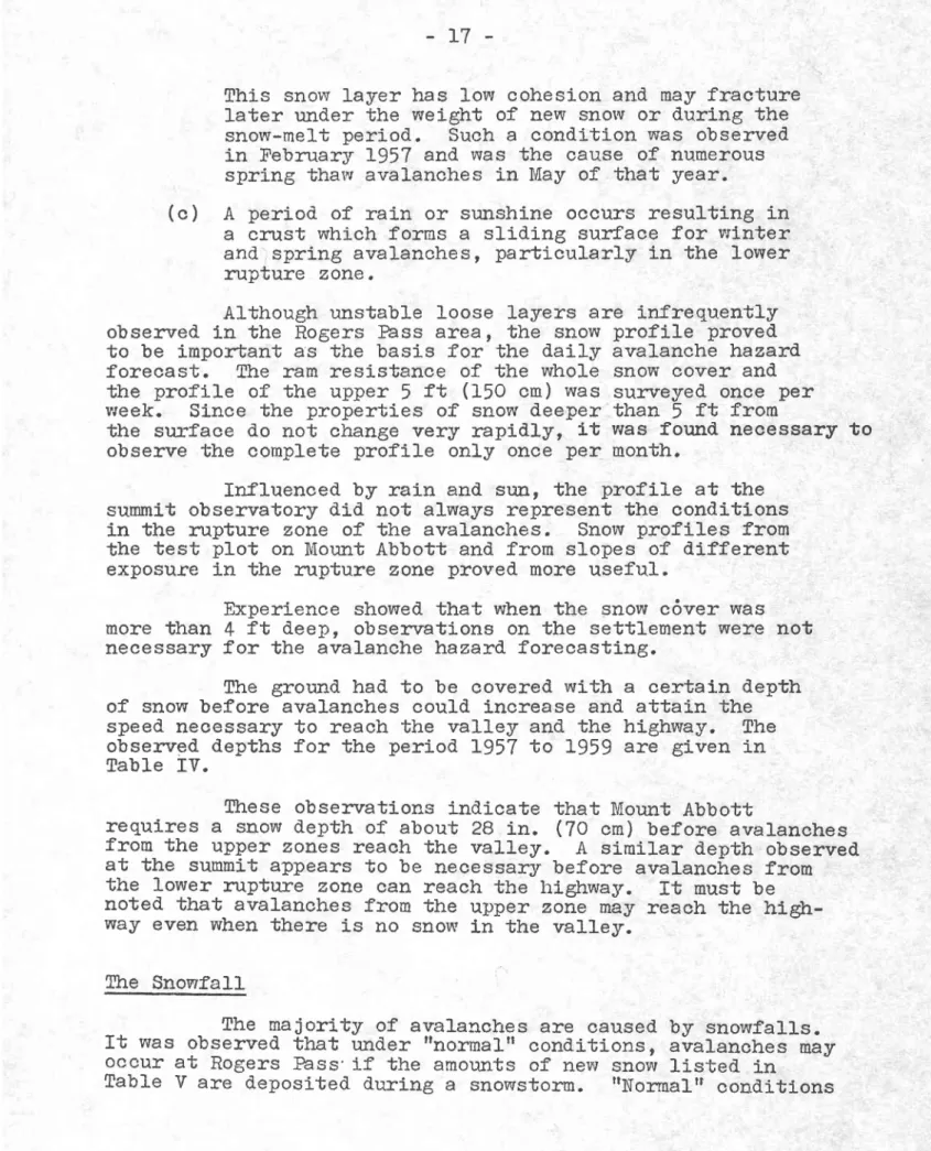
(Fig. 2). From this location the weather cond.itions on both sides of the pass could be observed. It was assumect that the future headquarters of the highrvay maintenance staff and. the avalanche warning serv'ice woulii be located. at the summtt of the pass, and it would be an advantage to have the observatory elose at hand.. A test plot 100 by 15O ft with a sma1l shelter and. instrument stand was established 1n October 1957 and
observatlons began in the winter of L957-1958 (Fig. 7). nai].y observations were mad.e betvreen 8 and I0 a.m. by patrols from Glacler.
Rogers Fass Summit 1s moderately exposecl to wind; observatlons on the depth of new snow had. to be mad.e tn a sheltered. area behind. the cabin. A protective fence was erected around the area where the snovi cover was studled, but lt was stiil ctisturbed by aniroals, particularly bears.
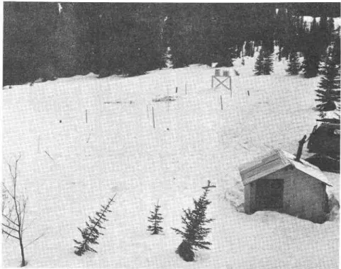
G1aeier. - The survey camp at Glaeier on the west side of ft@FPass, 3800 ft above sea level, was the head.quarters of the staff making the avalanche observations (Fig. B). It was 1o61ca1 that contlnuous weather and snow observations should. be made near the camp, particularly when temperature and precipitation observations have been made at Glabier for the past 40 years. Twice dai1y observatlons taken at Glacier indicated the weather condltions on the west sid.e of Rogers P a s s .
lIat Creek. - Flat Creek ls a park ward.en station on the west stre ofTogers Passr 9 miles fiom the summlt at an altitude of 51OO ft. nally obse:rrations were taken there by the warden o n a p l o t c l o s e to his house.
The purpose of these obserrations was to dete:rmine any d.ifference between the cond.itions in the Illeclllewaet
Valley anil those observed. at Glacier and at the summit.
Stq4ey Creek. - Stoney Creek is a park warclen statlon on the east sid.e of Rogers Fass, 6 uriles from the summit anil ,650 ft above sea l-evel. Daily observatj.ons were taken there by the
w a r d e n on a plot close to his house.
-ftre puryose of these observations was to d.ete:mlne any significant d.ifference between the conditions observed, on the sunmit andl on the east side of the pass.
I,[ount Abbott. - Possible sites for a mountain observatory are d:scusseffi Appendix I. l,{or:nt Abbott, 6800 ft above sea level-, was chosen because it lvas avalanche safe, a summer
- 1 2
t r a i l w a s avallable, a n d a c c e s s i n w i n t e r ryas short (F18. 2).
A cabin was built there in September 1956 (Fie. 9) ' and a
test plot was established on a terrace 200 ft below the cabln. A radlo telephone connected the observatory with the
head-quarters at blacier. The observatory was occupied continuously
durlng the winter of L956-57, but only cluring storms_and the
snow-ilelt period in the following two winters. Weekly
inspectlons were macle when no obsenrer lived there. The
observations taken at Mount Abbott indicated the snow cover
and. the weather condltions at the altitucle of the mpture zorae
for the avalanehes.
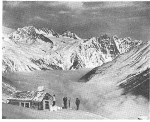
Balu Pass. - A second mountain observatory was established at
HfU-lh-s', 6600 ft above sea level (Fig. 1O). Test pl-ots
were staked out on both sides of the pass where the snow
profile was surveyed monthly durin6 the wintet L957-1958. A
babin was built at the summit of the pass in September 1958.
This observatory served prlmarily for winii observations as
Mor,mt Abbott was an unsatisfactory site for such measurements.
The winit speed and dlrection were measured with a standard
anemovane and recorcled on an Esterllne Angus fecorder in
December 1958 ancl January 1959. Special wind telemetering
equipment was developed for this observatory by-tl"-Radio anct
niectrical En6ineering Divlsion, NRC, and tnstalled i-n September
L959 (6). Information on the wind speed. and direction was
thus transmltted to Glacier by radio. The station performed'
well in the following winter, and needed. only occasional
lnspection. Ihe absence of ieing on the anemovane offered some
encburagement that the wlnil equipment mi6trt be installed on a
m o r e e x p o s e d a n d r e m o t e m o u n t a i n r r y i t h d i f f i c u l t a c c e s s t e.8., on the ridge of Mount Abbott.
An extenslrre study on the condltions causing spring thaw avalanches was conducted at Balu Pass in IVIay L959.
Observatlons at Rogers Pass Summit and at Glacier
The ilescription of the equipment and methods used.
for the Snow cover and weather observatlons are given in
Appendix II. The foll-owing daily observatj.ons were taken at
the two observatories:
- daily maximum tenperature - daily mlnlmum ternPerature
- temperature at the time of observation - depth of new snow
- density or specific gravity of new snow
- total snowfall from the beginning of a s t o r m ( s t o r n s t a k e )
Air temperature:
_r3
- settlement of new snow - ralnfall
Snow cover: - total snow depth
settlement of the snow cover
- snow temperature
- surface of the snow (e.g. soft, cmst )
- depth of penetratlon of a footprint
or depth of penetration of the flrst
section of the ramsond.e
- a shallow snowplt was dug ancl the harrcl-ness ancl shear strength of the
different snow layers were tested.
whenever such observations tvere requlred
Wind: - windspeed,
- wind. direction
- obsenrations on the dtrectlon and
the roagnltude of snow movements on
mor:ntain rid.ges (snow flags) and ln
the valley whenever vislbllity pe:mitted.
State of the lleather
Dally obsenratloas on precipitation ancl alr
tempera-ture were conttnued durlng the summer.
Ttre conplete proflle of the snow cover was surveyed.
twice a nonth on Rogers Pass Summit.
Obsenratlons at FIat Creek ancl Stoney Creek
The following daily obseirrations were taken at the
two park ward.en stations:
- maximum tempenature - minimun temperature - depth of new snow
- total snowfall from beginning of A storm
- ralnfall
- total snolY depth
observatlons were not mad.e on some cLays durlng the winter and
- t / _
Observations on l,{ount Abbott
The seme d.ally observations made at Rogers Pass Summlt and at Glacier were mad.e on Mount Abbott when the observatory
was occupied.. At other times, precipitation and temperature
$rere measured. with record.ing instruments. Ihe snow profile
was surveyed weekly. Special 0bs,e:rratlons
Ikre :mpture zones of avalanehes were visited
when-ever the avalanche hazarC made such vislts feasible. The
profiles of the snorr cover in these areas were stud.ied and
compared with the profiles taken at Rogers Fass Summit ancl
Mount Abbott. Record s
All observations were recorded on speclal forms
(I'igs. lL, L2, Li). fhe obseruations on the snorv cover and
the uueather were plotted against tlme. All record.s were
stored. at the avalanche observation station at Glacier and
were transferred. to the Departnent of Northern Affairs and.
National Resources on 2 October 1959. SurveJr of the Avalanghes
Record.ing all avalanches along the proposecl highway was the pri.mary work of the aval-anche obserrratlon station.
fhrese avalanches were surveyed. frequently by patrols ancl
recorded in a special boolc. lhose depositing snow near or on
the highway rtght-of-way rvere traced on location pIans. The
location of the fracture zorLe and. the path of sorre lmportant
avalanches yrere traced. on photographs (Fig. 14).
It was important to lceow not only the clate but the
hour when the avalanches had occurrecl. [he time could be
ob'r;ained. fairly accurately by daily and. often twlce daily
patrols betrryeen Nlile 11.5 and 17, and patrols through other areas when avalanches could be expected..
Personnel
The siaff of the avalanche observation station
averaged. six men during the winter and three during the sunmer. These nurnbers were required. for safety reasons. P.atrols through avalanche areas should be d.one by at least two or more men. At least two shor-rld be at the mountain observatory l'rhen occupied. during storm periods.
_ 1 5
It was found that half of the staff should have a 6ood }crovrledge of skiing and be experieneed in mou;rtain travel. ftre others need. only a fair lcrowledge in skilng but must be physicall-y fit for the work"
CAUSES OF THE AVAI,ANCHES
Observations shovred. that avalanches are caused by
the same factors as in other countries so that experlence galned by other organizations in the forecastlng of avalanches can
b e a p p l i e d t o Ro6ers Pass. In this section, the factors which contribute to the development of avalanches are summarized and those of particular lmportance for the avalanche hazard. fore-cast at Rogers Fass are emphaslzed. this sunmary ls not meant to be a general handbook on avalanche hazard. forecasting; it is ad.dressed. to those who require an lntroduction to the eon-ditlons at the Pass. The rules that are given here are based on all avallabLe obsenrations and. ean probably be improved wlth more experience.
Ruptgl:e Zones
Rogers Pass has an upper and lower zone from whlch a v a l a n c h e s c a u s t a r t to slide. A t e r : r a c e w i t h a s l l g h t lnc1ine, l o c a t e d b e t w e e n 55OO and 65OO ft divicles these two zones on m a n y o f t h e m o u n t a i n s l o p e s ( f i g s . 1 5 , 1 6 ) . I \ I o s t a v a l a n c h e s starting to slide in the lower zone nrpture on the cliffs or at the toe of c]lffs. The upper zorre contains steep slopes rlsing from 6500 ft to the mountain ridges. Many srnall avalanches that ori6inate in the upper zone stop on the
terrace between the tvro zones. A lcrolvledge of the two differ-ent mpture zones is important to predict avalanches caused by high temperatures. It was observed. frequently that the
temperature in the lov'rer zorae was high enough to cause avalancheso whereas ln the upper zor:e the temperature was so low that the
snolv lvas stilL stabl-e. Climate Areas
At Rogers Fass there are t'rvo major clLurate areas,
and the aval-anche hazard. for each shoul-d be evaluated. separately. T h e t w o a r e a s are:
the Tupper area on the east sid.e of t h e P a s s ,
t h e Illecillewaet V a l l e y on the west s i d e o f t h e P a s s .
- 1 6
Most snourstorms approach the Pass frorn the west and southwest and d.eposit a greater amount of new snow ln the rllecillewaet Ya}ley than in the Tupper area. observations during the two winters betrnreen 1957 and 1959 showed that the average total snowfaLl in the lupper area was 80 per cent of the snowfarl measured 1n the rllecillewaet vaIley. As less snowfall is required. to cause avalanches on Mount llupper, the avalanche hazard is usually about equal in both areas.
Occasional storms from the north and east deposit more snow ln the Tupper area than on the west side of Rogers Fass.
Observatlons at the summit give a 6ood tnd.ication of weather conditions on the east sicle of Rogers Fass. A special observatory in Stoney Creek is not essential, but
ad"ditional observations on the east side of Mount Tupper would b e u s e f u l for a control.
Generally higher preclpitation on the west side of Rogers Fass than that measured at the surnmit ind"icates a neecl for ad.ditional weather observations on the urest side, elther at Glacier otr at Frat creek. TLre dlfferenee in precipitation at Glacier and at Flat creek is not significant. slnce Flat Creek is a little wat:rner, rain sometimes falls here when there i s s n o u d a l l a t Gracier. G l a e l e r is, therefore, a more suitable station for weather obsetwatlons with the additlonal advantage of havlng been a cl-imatolo6ical station f or over {.0 years.
The Snovr Cover
Frequent snowfalls with fairly constant temperatuires during and after eaeh snowfall usualry produce a stabl-e snow cover. fhe typical snow profile has ralrers with increastng strength tovrard. the grouncl (Fig. l-1). -snow with a high degree _of netamorphism (depth hoar, sugar snow) forming layeis wifh low_ strength are not often obserrred. unstable layers causin8 avalanches may develop from the following conditions:
(a) Snolv covers the nountains in September and early October, and. cold weather with l1tt1e snowfall persists during October and November. Ihe snour in the avalanche rupture zones changes lnto depth hoar thus creating an unstable base for future snourfalls. lhis situation is typical for the Rocky Mountain area but appears only occasionall.y in the Selkirks. It was observed in the Rogers Fass area 1n the winter of 1957-58, but the unstable snov'r covered srnall areas onIy.
(b) Cold weather in January and February with a period of no snolfall for two or more weeks may cause con-sidei:abl-e metamorphism of the snow at the surface.
- L 7
This snow layer has lotnr cohesion and may fraeture
later under the weight of new sno$t or during the
snol-melt period. Such a condltion was observed
in Febmary L957 and. was the cause of numerous sprlng thavr avalanches in May of that year.
(c) A period. of rain or sunshine oecurs resulting in
a c:rust which forms a slid.ing surface for urlnter
and,spring avalanches, particularly in the Lower
mpture zone.
Although unstable loose layers are infrequently
observed. ln the Rogers Fass area, the snow profile proved.
to be imporbant as the basis for the daily avalanche hazard.
forecast. The ram resistance of the whole snoui cover and
the proflle of the upper 5 ft (150 cn) was surnreyed once per
ureek. Since the properties of snow d.eeper than 5 ft from
the surface d.o not change very rapidly, lt vras found necessary to
observe the complete profile only once per month.
Influenced by rain and surl, the profile at the
sumnit observatory did not always represent the conditions
in the mpture zo\)"e of the avalanches. Snow profiles from
the test plot on Mount Abbott and from slopes of d.ifferent
exposure 1n the mpture zone proved. more useful.
Experience showed. that when the snow c6ver was more than 4 ft d.eep, observations on the settlement were not necessary for the avalanche hazard. forecasting.
lhe ground. had to be covered with a certain depth
of snow before avalanches coulil i.ncrease and attain the
speed necessary to reach the valley and the highway. The
observed depths for the period L957 to 1959 are glven in T a b l e I Y .
Tfiese observations indicate that lfiount Abbott
requires a snow d.epth of about 28 in. (7O cm) before avalanches
from the upper zones reach the va}}ey. A simi-lar depth observed.
at the sumnit appears to be necessary before avalanches from
the l.ower nrpture zone can reach the highway. rt must be
noted. that avalanches from the upper zoie may reach the higb-way even when there is no snow ln the va1ley.
Ihe Snowfall
The majority of avalanches are caused by snowfalls.
It was observed that under ttnormal-tt cond.itions, airalanches nay o c c u r at Rogers hss'if t h e a m o u n t s of new snow liste<L in
- 1 8 TABIE IV
SNOIY DEPTHS WIIEN TNE FIRST AVAI,ANCHES REACHED THE VAIIEY
First Aval-anches from
the Upper Rupture Zone
Snow Depth on Mount Abbott 26 November T957 I November 1958 18 November 1958 24 October 1959 9 0 c m = 1 5 i n . 7 0 c m = 2 8 i n . 70 cm = 28 in. 2 8 i n . , e s t i m a t e d from observations mad.e on Fidelity Mountaln.
First Avalanches from
the lourer Rupture Zone Rogers Pass SummltSnow Depth on 1 2 D e c e m b e r 1 9 5 7 2O November 1958 2 1 N o v e m b e r 1 9 5 9 7 1 c m = 2 9 i n . 70 cm = 28 tn. 7 3 e m = 2 9 i n .
exist when the snorr cover is stable and the temperature is
below 12oT anil almost constant. The fl8ures 6iven in the
table are based on the experiences of three winters only.
Laek of information on the wind made lt difficult to analyze
observations frorn winters previous to 1957.
Comparisons betrrveen observations from Glacler anil Mount Abbott on the amount of snotry that fell d^uring a storrn
show only a slight difference betrrveen the amount measured on
the mountain and in the valley belotnr. In some storms more
snow falls on Mount Abbott than at Glacier and vice versa.
fhe dlfference is not large enough to influence the avalanche
hazard. forecast as it can be assumetl that the same amount of
new snow falls in the upper and loler avalanche mpture zones
as in the valley. When rain is measured in the va1ley and
snow is falling on the nountain it can be assumed that I 1n.
of rain corresponds to 12 in. of snoiv.
Rain folloyring a snourfall 1n the avalanche rupture
zones can start avalanches lvittrin one or two hours of its
beginnj-ng, If the snorsfall is not more than 12 in. the
avalanches will probably be small and will not reach the
highway. Most big avalanches that blocked rallway traffic
1n previous years resulu*ed from treavy snowfalls fol-lolved by r a i n ( e . 9 . on 17 Feb:ruary I93O, 9 to lO January 1913 and 24 to 26 January L915).
_ 1 9 TAB],E V
AMOUNTS Otr' SNOWFATI CAUSING AVAI/INCHES
llhe speclfic gravity of the new snolr ranges between 0.07 and. O,10. lkre average specific gravity of the new snow was 0.083 in the wlnter oI 1957-58 and 0.084 in the wlnter of 1958-59. New snow with speclfic gravitles lower than 0.07
and higlrer than 0.10 are more IlkeIy to cause avalanches. Snow wlth a low speclfic gravity will result in avalanehes before the amounts of snow inclicatecl in Tab1e VI are reached.
fotal Snowfall
I{ind
Influence Avalanche Hazaril Measurenent on stonm-stake Total for T2 hours 8 n ( 2 0 c m ) 1 0 t r ( 2 5 c m ) 1 0 r t ( 2 5 c n ) 1 4 " ( l 5 c m ) Strong wind' No Hazard. 2z Smal-l avalanctres at sltes where avalanches occur frequently, e . g . a t M o u n t l u P p e r . Ilazard for mountaln skiing. l O t r ( 2 5 c m ) 1 5 r r ( 4 0 c m ) 16 't ( 40cm; 2 } t t ( 5 O c m ) Strong wind No Hazard. 5: Minor
avalanches may occur at al]- krrown sttes. Smaller avalanches may reach the higlway at unprotectecl. sttes. 1 6 | l 2 2 t l
( 4 o c m 1
( 5 5 c n )
20n ( Socn) ( 7 0 c m ) 28tt Strong wind No wlnd H a z a r d 4: Majoravalanches may occttr at all Islotm sltes and may reach the highway.
12n (BOcrn) 40" (10Ocm1 Mostly without wind
Tlazard 5: Aval-anches of unusual size may reach the higftway at all lm,orqn ancl also at n e w s i t e s .
- 2 0 Winil
Vfind is a dominant factor 1n the build-up of an
avalanche situatlon. fhe direction of the prevailing wind
in the rupture zorTe detemlned in most cases whether a
certain avalanche would start to slide after a snowfall-. Observatj-ons at Rogers Pass Summit showed. the wind at this slte to be influenced by the mountains and direction
of the valley and not necessarily related to the direction
anii speed of the wind in the rupture zorae of the avalanches.
Therefore, observatl ons at an exposed site on the mountains
are required. During the winter of I95B-59t insufficient
observations were mad.e on Balu Fass to allow an adequate
correlation at all sites between the wlnd speed. and direction
and. avalanche occurrences.
Obsenrations at Rogers Pass Summit indicated that
a wlnd of speed 6reater than 8 rnph will influence the aval,anche
hazard. ILre infonnation collected during the avalanche survey
on the influence of wind on the avalanche hazard at some sites
is surnmarized in fables \rI and. \rII. This infomatlon was
obtained from observations on the drifting of snow on mountain
ridges and associated cornice formation and from the wlnd observations taken at the Balu Pass site.
TABIE YI
AVAI,ANCHES AFFECTED BY WIND
Avalanche Site HighwaY
M i l e \llind Direction
Favourable to Avalanche Occurrence Gullies at Mount MacDona1d
Tupper - Tinber Tupper 1 Pioneer Tupper-Minor Benches 1!lounds Crossover Tractor shed.
I,[acDonald. -We st shoulcler Avalanche Crest A b b o t t No. 7 Mount Green F i d e l i t y lanarl< l o . 2 - r l . . ' l 1 0 . 4 - 1 0 . 6 I J - . 3 1 1 . 4 1 1 . 6 1 2 .O - I 2 , 2 l ' 2 . 4 l..2.3 L 2 . 7 - L 3 , O ] - 4 . 5 - 1 5 . 0 L 6 . 5 1 7 . B 2 0 . 3 2 6 . O South
Ii[est, follovrlng the valley of Bear Creek
n t l | | t t | | l l Southwest to south t t n South to southeast E a s t Southwest to south West to southwes-b trIIest r,Vest
- 2 L TABIE VII
AVAI,ANCHES PROBABIY TNT'I,UENCED BY WIND
(but not enouFh observations to cgnflrm this)
Temperature
It was found that special attention 1s required
when the temperature d.uring a snow"fall is near 12oF, as any
rise in tenperature coulcl chan6e the snovrfall into rain, and.
create a serious avalanche hazard,, A snowfall with
tempera-tures below 20oF produced slow stabilization of the snow
c o v e r .
llre influence of temperature on sprlng thaw
avalanches is discussed in a special chapter. High
tenopera-tures in the spring cause the ice to melt and fa1l from the
cl-lffs, Fall1ng 1ce which reached the highway was observed
ln the Tupper-Timber Avalanche area, ilIiIe 10.4 to M1le 10.8. Illost of the time the temperature on the mountains
is lower than the temperature in the valIey. During some
lnportant snowfalls and sometimes in spring temperatures
were higher on the mountains. Experiences have shonrn that a
continuous record. of temperatures at high altiiud.e is a great
asset 1n avalanche forecasting. During the avalanche survey
it vuas necessary to occupy the observatory on Mount Abbott at
critical period.s to report the tenoperatrre and. other
informa-tion to the headquarters in the va11ey. It would be
useful-if the alr temperature at a mountain observatory could. be tel-ernetered.
Spring lthaw Avalanches
The term spring thaur avalanches is applled to those avalanches that occur in the spring due to loss of cohesion
of the snour when it melts. Spring thaw avalanches can be
Avalanche Site Highway MiIe Favourable Wlnd Direction
GrizzLy Cheops A b b o t t No. Junction Twins 1 3 . 4 l 4 . 5 - t 5 . 2 L 7 . 8 5 1 8 . 7 Southwest to south I t l l n t t Vfe st
West, following the
- 2 2
active on Rogers Pass and are more difficult to forecast
than direct action vrinter avalanches.
Ihe factors contributing to the start of spring
thaw avalanches tn 1957, L95B and 1959 were investigated. by J. C. Garland, a member of the avalanche obseryation stati.on, and the foll-owing infozrnation was obtalned:
I .
2 .
5 .
4 .
5 .
Spring thaw avalancl:.es occur in two Eroups. The
first group comes from the lower avalanche rupture
zone below 55OO ft and the second from the upper
rupture zone betleen 6500 ancl 80OO ft. The tlme
belnryeen the occurrences of the trnro groups depends
on the.weather. lhe second group or late spring
thaw avalanches follonred the first group or early
spring avalanches after 6 days in 1957, 20 ln 1958 and. 27 in 1959.
Sprlng thaw avalanches may start to sllde as a
snow-slab on unstable snoilr layers, on the ground.
or as loose snovr aval-anches. large sprlng thaw avalanches can be expected. when the snow proflle shows layers with low strength.
he temperature was 32"8 throughout the snow cover
in the rupture zotae when the spring thalv avalanches
occurred, This snow temperature was measured. at
Rogers Pass Summlt rvhen the cycle of the early spring thaw aval-anches began and on Morrnt Abbott
when the late spring thaw avalanches began. Iocal
s l l d e s o n south-exposed sunny slopes can.occur e a r l i e r .
When the early avalanches started, the ttaily
maximum alr temperature at Rogers Pass Surnmit was
in the fortl-es and had been continuously above
12"T for the previous 5 d.ays in 1959 and 25 d.ays t n 1 9 5 8 .
Ihe mean daily air tenperature was always above 32oT at Rogers Pass Summit on days when the early spring thaw avalanches ran, and on Mount Abbott when the l-ate spring thaw avalanches occurred. Humidity observatlons d.id. not appear to have any
bearing on the avalanches. Tkre mean humidity of
the air in daylight was relatively high when the
avalanchqg be6an, 'lI per cent in L957 and 89 per cent in 1SB, but in the followtng d.ays when
avalan-ches were running, the rnean humidity r,vas nelther
constant nor high. 6 .
_ 2 1
7. The general state of the weather dppeared to have
no influence on the start of avalanches. In 1957
the weather was cloudy; in 1958 there was ratn ancl snow, irr L959 1t was sunny.
8. Rain, unless particularly wallrnr d.icl. not appear to
influence the start of spring thaw avalanches.
9. In sprlng 1959 snolv compaction tests were macte with
the compactlon method. recommended by G. P. Williams
(7). ft was found that the compacted' d.ensity of the
snow in the fracture plane of the avalanche was as
h i g h a s 0 . 9 0 4 c o m p a r e d w i t h 0 . 4 f o r n o n - c o m p a c t e d ' snow. The compacted. denslty in other layers was between O.7 and 0.8 with a non-compacted density
of about O.4. This would j-nd.icate a high free water
content in the snow layer that collapses ancl in
that upon which the avalanche starts to slide. As
it is impractical to test the conpacted d'ensity ln
potential sllding layers, the eompaction test ls
not a useful observation in evaluating the avalanche
hazard..
10. When spring thaw avalanches are reLeaseil under the
influence of the sun on clear daysr they start to
s l l d e b e t w e e n 9 and 10 a.m. on east-exposed. slopest at noon on south, and between 5 and 6 p.m. on west-e x p o s west-e d . s l o p west-e s .
Ihe follourlng mles of thumb were established from
the above observations:
Before spring thaw avalanches occur the snow tempera-ture must be 52oT in a1l layers between the ground' and the
snow sUrface. After this temperature l-s reached., avalanches
w111 occur on the first or second day when the mean air
temperature ls above 52oF. fhe air temperature measured at
Rogers Pass indicates early sprlng thaw avalanches fron the
lower rupture zotte, while that measured" on Mount Abbott
inclicates late spring thar.r avalanches from the upper ruptu: e zQlae.
Special Avalanches
The oond.itions that caused avalanches at the Mount Green and the Crossover avalanche sltes were investigatecl..
Concluslons obtained are given tn Appendices IV and V. It
was recornmended that avalanches at these sites be controlled
by artillery fire and, therefore, the avalanche hazard. forecast
2 4
It was not possible to rnake a special study of
more avalanche sites because of insufflcient observatlons.
It would be useful if such studies could be made on the
following avalanches: Connaught G r t z z l y Cheops 1 MacDonald. We st-shoulder Avalanche Crest Junctlon F i d e l l t y AVAIANCHE WARNING
llhe Avalanche Hazard, Forecast
During the winters of L957-58 and 1958-59 the avalanche hazard. was evaluated twlce every day and more
frequently at critical tlmes. The following classtficatlon
of the avalanche hazard. was used: Degree O: No avalanehe hazard
Degree_J: Very low avalanche hazard..
Ilocal- avalanches may occur on steep slopes or ln
areas where drift snov{ has accunulated. TLre slidlng
snow nass would be sma1l and the slide path short.
Degree 2: low avalanche hazaril.
AvaLanches may oecur fron steep, rocky mpture zones and. may reach the valIey at the sites where avalanches
occur frequently.
Example of avalanches which may occur at hazard. 2z Ma jor lupper avalanches
MacDonald gullies
Small avalanches ln the tractor shed. gullies
Twins L e n t s
Ie8ree J: Medium avalanche hazard..
Avalanches may occur at all lmovrn avalanche paths and reach the valley at those sites where avalanches occur with an avet:age frequency of more than once per winter.
_ 2 5
Degree 4: High avalanche hazard.
Aval-anches of dangerous size that reach the
h16h-way may occur at al-I ]arorun avalanche sites. Avalancheg
with an average frequency of occurrence of once Ln 1 to 5 years may occur.
Degree 5: Very hlgh avalanche hazard.
Avalanches of dangerous size may oecur at aI1 lonovrn
avalanche sltes and may reach unusual size. AvalancheS
m a y a l s o o c c u r a t n e w s i t e s .
Thls classificatlon of the avalanche hazard proved.
satlsfactory for the two winters during whlch it was used.,
Ihe avalanche hazard, had to be evaluated separately for the two cllnate areas, I/lount Tupper and the Illec1llewaet V a l l e y . S o m e t l m e s it w a s n e c e s s a r y t o e s t a b L i s h a s p e c i a l a v a l a n c h e h a z a r d f o r s i n g l e a v a l - a n c h e p a t h s , € . 8 . , w h e n w i n d actlon hacl created a higher hazard. for some avalanche sites.
ftre different de6rees of avafanche hazard had the
f o l l o w i n g e f f e c t o n a c t i v i t i e s i n t h e R o g e r s F a s s a r e a :
De8ree I: Slrllng in the mountains and travelllng
ffi@-the aval-5nche areas was 6enerally safe.
D a n g e r o u s s l o p e s h a d t o b e c r o s s e d w i t h s p e c i a l e a r e .
There was no restrictlon on constructj-on work. Survey
work at the avalanche paths on l,{ount Tupper was stopped'. D e q r e e 2 : S k i i n e w a s r e s t r i e t e d t o s a f e r o u t e s . S i ' b e s w f f i a 1 a n c I r ' e s c o u 1 d b e e x p e c t e d . W e r e c r o s s e d . o n 1 y
when necessary and then very euicirllr. Constnrction and
survey work at those avalanche sltes was discontinued. Degree 5: Skiing was possible on lorown safe routes
onlt:---Tll traffic by constrttction and highway survey
crews through the lupper area were stopped.
Degree 4'. Travelling v'ras at a minimum. The avalanches
TEaETfr- occurred were observed. from safe routes.
Degree 5: A11 movernen'b through the avalanche areas was
f f i : r u e d ' . H a z a r d 5 n e v e r o c c u r r e d d u r 1 n g t h e s u r v e y .
It was assumed. that thls avalanche hazard.
classiflca-tlon would have the following effect on the operatlon of the
c o m p l e t e d h i g h w a y in the first s t a g e of defence: D e g r e e s 1 and. 2: No restrictlons.
^ a
- z o
Degree J: Snow-clearlng crews woulil have to be ready
t o c l e a r o c c a s i o n a l l i g h t a v a l a n c h e s o r b a n k s l i d e s from the highvray.
closed. to publ1c traffic. be continued with special
c l o s e i l t o a l l trafflc. b e d l s c o n t l n u e d .
Highway Closures
Durin6 the winters of 1957^58 and 1958-59 the avalanche hazard was forecasted as if the highway were in operation and the first stage of defence completed.. lhe esti-mated. closure times, given in Table VIII lnclude the tlme estimated for the removal of avalanche snovr from the hlghway.
If it is assumed that the first stage of the d.efence was not constrructeil, it is estlmated that for an average
winter the hlghlay would be closed. about 25 tlmes for a total of 75 d.ays betrryeen I Novernber and 15 May. One cl-osure might l a s t ten days.
Ulhen the highway was not consid.ered closed., minor avalanches d.id. affect the hi6hway at rupper-flmber (l\{tre 10.4 to 10.6). Table il{ gives the date and. eitent of these
avalanches.
To give ad.vance warnlng for the closure of the hlghway proved. d1ff1cult because an accurate weather forecast could not be obtained. Experience gained. with respect to the weather forecast ls glven in Appendix fII.
Rough estirnates, based. on available records, were maile of how rong the hi8hway woulcl have been crosed in the yearg previous to 1957 tf the flrst stage of d.efence had been conplete. Ihese are given in Table X.
ANTICIPAIED ORGANIZATION AND RESPONSIBIIITIES OF THE AVAIANCHE WARNII{G SERVICE
T o s p e c i f y the complete d.efence, it was necessary to foreeast the organLzation and. responsibllities of the future avalanche warning service. The basis of these predle-tions was the experience gained from the avaranche observa-tions in the Glacier area and discussions held with the staff of avalanche warrring services in the united states and Europe.
ne8lee 4: fhe highway would be
#
Snow-clearing operations woulct precaution.
lggqee l: The hlghway would. be
_ 2 7
Ikre info:mation contained. in this section is not presentecL as
a recommend.ation but rather as necessary baek6round. material
for a complete understanding of the basic principles adopteit
i n f o r m u l a t i n g t h e a c t i v e d e f e n c e s y s t e m ( F l E . 1 7 ) . TABIE VIII
ESTIIiIAIED CIOSIIRES OF THE HIGH\IIAY IN $ID WINIERS OI 1957-58 ANp 1958-59 llighway Closed. Date Time Highway Opened. Date Iime Drratlon of C l o s u r e , hr Cause of High Hazard, Avalanches on Hig[wa.y i n unproteeted a r e a s
L957 -5e
16 Jan O4OO 24 Jan O80O 19 Feb 1OOO 21 Feb 14OO 1958-59 20 Nov 1000 2 Dec 0600 18 Dec 0600 9 Jan 19OO 2 3 Jan 1500 2 8 Feb 2L3O 1 Apr 18OO 1 O A p r 1 0 1 0 28 Apr 2OOO 2 2 Feb 1800 0800 2000 f700 20 Nov 14OO 3 Dec O8O0 19 Dec 1000 IO Jan O7O0 24 Jan 0B0O Mar 0600 Apr 1400 A p r 2 1 3 0 Apr J-2OO 17 Jan 25 Jan 19 Feb l-2 11" 3 0B+
2 03 7
+o
3B 24 10 27 4 2 6 28 T 2 I7 Snowfall rwind Snorvfall rwind. Hi6h tempera-ture after snowfall Hieh tempera-ture and. raln Heavy snorvfall, p o o r visibility Snolfall,rain Snowfallrwind and. raln Snowfall, raln Snon'fallrwind Unstable snow cover Snowfall rrain Snol'.rfaI1 High tempera-ture Snowfall 2 minor 1 m a j o r none 1 minor minor none none I mecLium 2 minor 1 mlnor 1 rnedium 2 minor I mtnor I m a J o r I minor 6 r n a j o r I nedium- 2 8 fABIE IX
TIIPPER-TIMBER AVAIANCHES VfIIEN THE HIGI{WAY WAS OPEN
TAB],E X
ESTIMATED CIOSURE OF ITIE HIGHWAY IN TIIE IVIIiTERS OF 195]-59
-:r The number of d.ays closed and the maximum duration of one closure lnclude the time required. to remove the avafanche snow.
Responsibillties of the Avalanche Warning Service
It was antlcipated. that the avalanche warning serrice
wouLd have the following primary responsibilities:
(a ) To organize and take the snosr and weather o b s e r v a t i o n s .
( b ) T o e v a l u a t e and forecast the avalanche hazard.
Date !qldth on Hi6hway, ft Depth on Hi6hway I8 January L95B 2 1 n e c e n b e r 1 9 5 8 19 January 1-959 6 Febmary 1959 5 0 200 250 160 2 f t l f t 4 i-n. 1 f t Winter Nurnber ofC l o s u r e s -:rTotal number of
d.ays closed Maximum d.ur:ationof one closure d a y s L953-54 r954-55 1955-56 L956-57 L957 -5e L958-59 6 6 6 4 4 9 2 2 6 I