Global heat flow trends resolved from multiple geological and geophysical proxies
16
0
0
Texte intégral
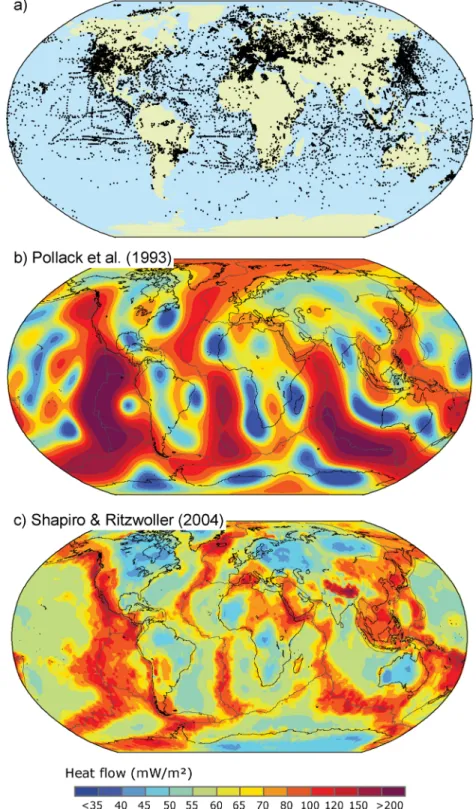
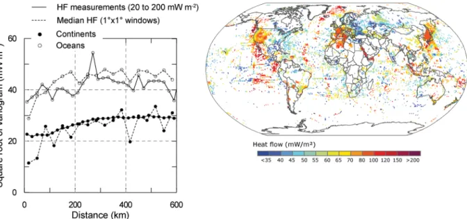
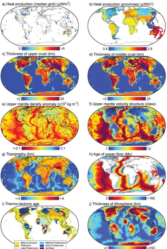
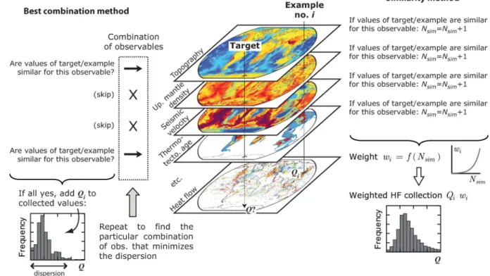
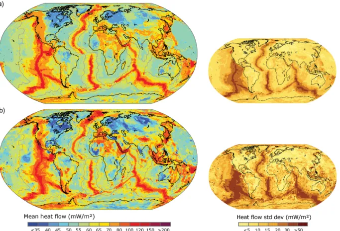
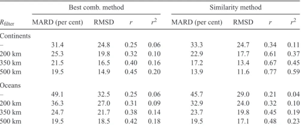
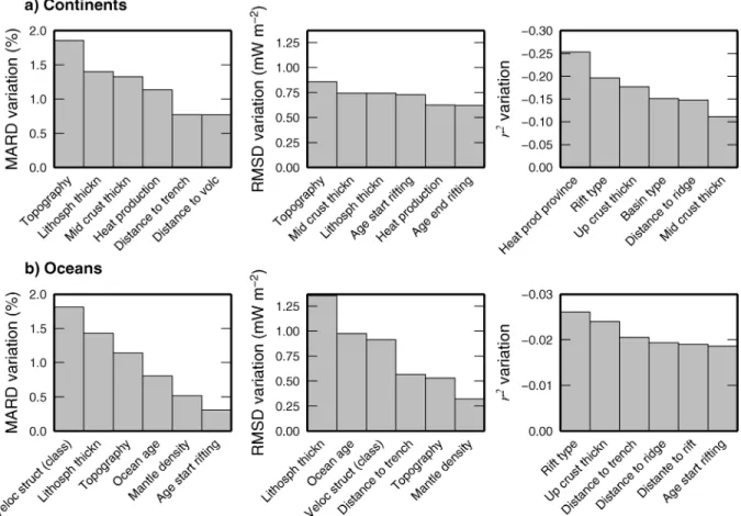
Figure
+5

Documents relatifs