Publisher’s version / Version de l'éditeur: PERD/CHC Report 35-60, 2005-09
READ THESE TERMS AND CONDITIONS CAREFULLY BEFORE USING THIS WEBSITE.
https://nrc-publications.canada.ca/eng/copyright
Vous avez des questions? Nous pouvons vous aider. Pour communiquer directement avec un auteur, consultez la
première page de la revue dans laquelle son article a été publié afin de trouver ses coordonnées. Si vous n’arrivez pas à les repérer, communiquez avec nous à [email protected].
Questions? Contact the NRC Publications Archive team at
[email protected]. If you wish to email the authors directly, please see the first page of the publication for their contact information.
NRC Publications Archive
Archives des publications du CNRC
For the publisher’s version, please access the DOI link below./ Pour consulter la version de l’éditeur, utilisez le lien DOI ci-dessous.
https://doi.org/10.4224/12328137
Access and use of this website and the material on it are subject to the Terms and Conditions set forth at
Ice-Related R&D Requirements for Beaufort Sea Production Systems
Wright, B.
https://publications-cnrc.canada.ca/fra/droits
L’accès à ce site Web et l’utilisation de son contenu sont assujettis aux conditions présentées dans le site LISEZ CES CONDITIONS ATTENTIVEMENT AVANT D’UTILISER CE SITE WEB.
NRC Publications Record / Notice d'Archives des publications de CNRC:
https://nrc-publications.canada.ca/eng/view/object/?id=6d707e66-0876-4481-ab81-2e84267a2d97 https://publications-cnrc.canada.ca/fra/voir/objet/?id=6d707e66-0876-4481-ab81-2e84267a2d97
Ice-Related R&D Requirements for
Beaufort Sea Production Systems
submitted to NRC-CHC
Ottawa, Ontario
PERD/CHC Report 35-60
by
B. Wright & Associates Ltd.
Executive Summary
This report presents the results of an assessment of ice-related R&D requirements for Beaufort Sea production systems. It has been prompted by a general renewal of interest in the opportunities that may become available for Beaufort oil and gas development projects in the future. As part of this work, key ice-related issues that arose during previous exploration activities in the Beaufort Sea are identified, along with the ice-related R&D needs developed in earlier studies. Discussions with representatives from industry, government and expertise groups have also been held as part of this work, to get their views on current ice-related uncertainties and challenges for potential Beaufort Sea developments.
The key ice-related R&D needs that have been identified in this assessment fall into the following topic areas:
• Design ice loads on fixed structures, including:
- global loads from extreme multi-year ice feature interactions
- grounded ice rubble formations & their effect on reducing design ice load levels • Vessel station-keeping in ice (e.g.: tanker loading) & related ice management aspects • Ice scour and its influence on the design of seafloor facilities
• The engineering implications of climate change on Beaufort Sea ice conditions • Improved oil spill countermeasures and clean-up methods in ice
• Improved EER methods for platforms operating in ice-covered waters
Other important messages received as part of this R&D requirements assessment include:
- a recognition that many of these ice issues are generic, and also of interest for offshore projects in other ice-covered regions of the world
- a recognition that collaborative and cooperative R&D work makes good sense in some ice issue areas, and interest in possible JIP approaches from some companies
- a recognition of the importance of resolving any outstanding technical issues in a timely manner, despite the view that environmental and socio-economic factors may be of more consequence for future Beaufort Sea projects
- a recognition of the ice-related R&D work that has been carried out through PERD and other programs, since the downturn in interest in the Beaufort Sea seen in the late 1980s - a warning about the need to manage expectations regarding potentially high levels of
industry activity in the Beaufort Sea, at least in the short term, because most companies have no firm plans at present, and are just beginning to revisit possible opportunities in the area
On the basis of this assessment work, four specific ice-related R&D thrusts are recommended for further consideration, and a suggested logic framework outlined for each one of them. These R&D thrusts are intended to address high priority ice issues where there is either limited information, or where a front-end synthesis of information would be both timely and beneficial. They include:
• Multi-year design ice loads on fixed structures
• Ice loads on structures surrounded by grounded rubble ice fields • Ice loads on vessels station-keeping in pack ice
• Engineering and operational implications of climate change on Beaufort ice conditions The PERD Ice Structure Interaction Advisory Committee (ISIAC) is seen as fostering these ice-related R&D initiatives, with groups such as NRC-CHC and DFO-IOS carrying out much of the work. Other topic areas like ice scour, oil spills in ice, and EER systems for ice-covered waters are also viewed as ones of high importance, but are considered as being well handled at the present time through other programs and initiatives.
Table of Contents
1.0 Introduction 1 2.0 Objectives 2 3.0 Approach 2 4.0 Background 2 4.1 General 24.2 Overview of Ice Conditions 4
4.2.1 Freeze-up Period 7
4.2.2 Winter Period 11
4.2.3 Break-up Period 13
4.2.4 Open Water Period 14
4.3 Overview of Previous Exploration Systems 14
4.3.1 Bottom Founded Structures 15
4.3.2 Floating Drilling Systems 22
4.4 Overview of Previous Production Concepts 23
5.0 Previous Evaluations of Beaufort R&D Needs 25
5.1 General 25
5.2 The APOA 25
5.3 The ESRF 26
5.4 1982 Beaufort Sea EIS 27
5.5 Industry Input to PERD in the Late 1980s 27
5.6 More Recent PERD Assessments of R&D Needs 28
5.7 PERD Responsiveness 32
6.0 Discussions with Companies 33
6.1 Basic Approach 33
6.2 Initial Responses on Ice-Related R&D Needs 35 6.3 Further Comments on Ice-Related R&D Needs 36
6.3.1 Fixed Offshore Structures 36
6.3.2 Floating Vessel Station-keeping in Ice 37
6.3.3 Seafloor Facilities & Pipelines 37
6.3.4 Marine Export Systems 38
6.3.5 Exploratory Drilling & Seismic 38
6.3.6 Physical Environmental Considerations 38
6.3.7 Other Considerations 39
Table of Contents (continued)
7.0 Summary of Ice-Related R&D Requirements 40
7.1 Key Ice Issue Areas 40
7.2 Resources & Approaches 42
7.3 Specific Ice-Related R&D Thrusts 43
7.3.1 Multi-Year Ice Loads on Fixed Structures 43 7.3.2 Rubble Formation & Ice Load Transmission through 44 Grounded Rubble Fields
7.3.3 Engineering & Operational Implications of Climate 45 Change on Ice Conditions
7.3.4 Loads on Station-keeping Vessels in Ice 45
8.0 Closure 50
Ice-Related R&D Requirements for Beaufort Sea Production Systems
1.0 Introduction
Over the past several years, there has been renewed interest in the hydrocarbon resources of the Canadian Beaufort Sea. It is well known that the region contains significant oil and gas reserves based on the results of exploratory drilling programs carried out in the 1970s and 1980s. During this period, more than 90 offshore wells were drilled in the area, with 21 significant discoveries being made. These discoveries confirmed the presence of about 1.5 billion barrels of recoverable oil and roughly 4 trillion cubic feet of gas in the Beaufort offshore. Potential hydrocarbon reserves in the area are considerably higher, and have been estimated to be in the range of 4 billion barrels of oil and 8 trillion cubic feet of gas.
Throughout the 1970s and early 1980s, various ingredients combined to support a bullish outlook for hydrocarbon developments in the Beaufort Sea, oil in particular. This atmosphere led to high levels of industry activity, substantial ice-related R&D initiatives, and rapid advancements in Arctic technology. However, no offshore development projects were actually undertaken. In this regard, there was a strong downturn in industry interest in the Beaufort in the late 1980s, caused by falling oil prices, high exploration and development costs, and the poor project economics that resulted. By the early 1990s, all offshore oil and gas activities in the Beaufort Sea were stopped, and the companies who had been involved turned their attention elsewhere.
Recently, industry has begun to revisit the opportunities that are available in Canada’s frontier regions, including those in the Beaufort Sea. This interest has been stimulated by the decrease in hydrocarbon reserves being seen world-wide, significant increases in the price of oil and gas, and the northern gas pipeline that is now being planned. At present, various companies are undertaking reviews of the Beaufort’s potential and thinking about new initiatives, with some companies being more advanced than others. For example, Devon will be drilling an offshore well in the shallow waters of the Beaufort Sea during the winter of 2005/06, the first one drilled since 1989. However, higher levels of exploration activity, and future developments, are by no means imminent.
Some of the technical challenges and uncertainties that are related to exploration and development activities in the Beaufort Sea have begun to re-surface, as a consequence of these new industry efforts. Many of the challenges involve ice problems since sea ice is the dominant environmental constraint in the Beaufort offshore. Over the past few years, some of these ice and technology issues have been addressed by PERD, but more-so by development projects in other parts of the world that are affected by ice, for example, in the Pechora Sea, the Caspian Sea and the offshore Sakhalin area. Fortunately, the Canadian expertise that was originally developed in conjunction with activities in the Beaufort Sea has been at the forefront of most of these recent international projects. However, the extreme ice conditions that are found in the Beaufort Sea present unique challenges, particularly the need to deal with multi-year ice.
Recognizing the resurgence of industry interest in the Beaufort Sea, NRC-CHC initiated a study to assess ice-related R&D requirements for future developments in the region, with PERD funding. The purpose of this work, which was carried out by B. Wright & Associates Ltd., is to identify the ice-related uncertainties and challenges that currently stand in the way of developing hydrocarbon resources in the Beaufort, ones that R&D may help to overcome. This information is required for input into the R&D planning cycle of PERD’s Ice/Structure Interaction Committee. The results of the study are summarized in this report.
Ice-Related R&D Requirements for Beaufort Sea Production Systems
2.0 Objectives
The main objectives of this study are:
• To detail the ice-related uncertainties and challenges that are associated with developing Beaufort Sea hydrocarbon resources.
• To identify the relevant ice-related R&D work that could be performed to help mitigate or eliminate the uncertainties.
• To provide a plan for ice-related research that would be useful to support the design of future production systems in the Beaufort Sea
Although the work has focused on ice-related problems for Beaufort Sea developments, some of the other issues that have arisen as an outgrowth of study have also been identified.
3.0 Approach
The approach that was taken in the study work was subdivided into three main tasks. They are briefly highlighted as follows:
• review the key ice issues that were identified over the course of exploration activities in the Canadian Beaufort Sea during the 1970s and 1980s, in the context of their importance to production systems
• hold discussions with representatives of the oil industry to determine their perspective of ice-related R&D issues for potential development projects in the Beaufort Sea
• prepare a research plan to provide guidance on the type of ice-related research that would be most beneficial for future production systems, including specific research areas with clearly defined objectives
4.0 Background
4.1 General
The Beaufort Sea is a very remote region, lying well to the north of any major Canadian centers. Its physical environment is recognized as being one of the most hostile in the world. In winter, the area is characterized by low temperatures, a severe sea ice cover, and short daylight hours. The summer is more benign, with a short open water season, warmer temperatures, low to moderate winds, and small waves being typical. However, periods of poor visibility and fog, storms waves in fall, and the potential for heavy pack ice intrusions from the north are all factors of concern during the open water period.
Ice-Related R&D Requirements for Beaufort Sea Production Systems
Ice scouring on the seafloor, weak foundation conditions (in some areas), sub-sea permafrost, and the presence of hazards such as shallow gas and hydrates are additional factors of note. Along with these physical environmental constraints, the area’s sensitive biological environment should also be recognized. Clearly, all of these environmental influences must be accommodated in the design and operation of any production systems that are intended for use in the Beaufort Sea. A geographical reference map of the Canadian Beaufort Sea is given in Figure 4.1. The significant oil and gas discoveries that have been made in the region are also indicated in this figure.
Figure 4.1: Geographical reference map of the Canadian Beaufort Sea, with the significant oil and gas discoveries made to date shown (from Dingwall, 1990).
This offshore region can be subdivided into several different areas, based on water depths and ice conditions, along with technology issues. These areas are briefly highlighted as follows.
• A shallow near-shore zone, from the coastline to about 20m of water, which is covered by landfast ice in winter. This is the offshore area where Esso Resources carried out most of their exploratory drilling, and where Devon will be drilling over the winter of 2005/06. • An intermediate zone, from roughly 20m to 100m of water, which is covered by moving
pack ice in winter. This is the offshore region where Dome Petroleum and Gulf Canada Resources carried out most of their exploratory drilling during the 1970s and 1980s. • A deep zone over the continental shelf and slope, in water depths from roughly 100m to
several hundred meters or more, which lies close to (and often within) the permanent polar pack in winter. Although no exploration activities have been undertaken in this deep water area to date, it does contain potentially large hydrocarbon reserves.
Ice-Related R&D Requirements for Beaufort Sea Production Systems
It is well known that significant exploratory drilling programs were conducted in the shallow and intermediate waters of the Beaufort Sea during the 1970s and 1980s, with Dome Petroleum, Esso Resources Canada and Gulf Canada Resources being the main players. Over this period, a good understanding of the ice and other environmental conditions in the region was gained through data acquisition programs, R&D initiatives and direct operating experience. Novel drilling systems were designed, constructed and employed to drill wells on both a seasonal and year round basis. Various production systems were also conceptualized and engineered, but never put into place. A great deal of ice-related knowledge, technology and “know-how” for the Beaufort was developed at the time, which has been subsequently used to assist with in-ice projects elsewhere in the world. However, a number of important ice issues were never fully resolved, and still remain today. In order to provide some context for the R&D requirements that are highlighted later in this report, a brief overview of ice conditions in the Beaufort Sea is first given, since ice-related problems are the main focus of this study. Highlights of the technology that has been used in the Beaufort are outlined next, to give some sense for what was actually achieved. A few comments about the ice-related issues and uncertainties that were seen at the time of these earlier activities are provided within this background information, along with some of the R&D needs that have been identified in previous work.
4.2
Overview of Ice Conditions
The primary environmental constraint in the Beaufort Sea is sea ice, since the area is normally ice covered for at least nine months of the year. The annual ice conditions can be subdivided into four basic periods, freeze-up, winter, break-up, and the short open water season in summer. During the freeze-up, winter and break-up periods, three different ice zones are evident in the general region, as shown in Figure 4.2. They include the landfast ice zone, the transition (or seasonal) pack ice zone, and the permanent polar pack. Since the ice conditions in these ice zones are very different, they represent distinct types of in-ice operating regimes. In this regard, any planned exploration or development activities in these three ice zones (and their water depth ranges) will likely involve somewhat different types of technology.
In the landfast ice zone, which typically covers the area from the shoreline to about 20m of water, the following ice-related points should be noted:
- the landfast ice cover is comprised of first year ice and contains significant areas of ridged and rubbled ice, particularly towards its outer edge
- the landfast ice is quasi-stable over the course of the winter, but it does undergo sporadic movements, with typical displacements of a few meters to tens of meters (or more)
- extreme ice feature interactions within the landfast ice zone are unlikely (e.g. with large multi-year ice floes), since the presence of very thick ice features is limited by water depth - seafloor scouring from first year ridge keels is quite common in the mid to deeper water
parts of the landfast ice zone, in water depths from roughly 10m to 20m
- various on-ice construction and transportation activities are generally feasible in landfast ice, at least in its smoother near-shore areas
- the landfast ice zone is a comparatively easy part of the Beaufort Sea to design structures for, and to operate in, but is certainly not without its particular ice issues
Ice-Related R&D Requirements for Beaufort Sea Production Systems
Figure 4.2: Winter ice zones in the Canadian Beaufort Sea.
The transition ice zone, which includes the intermediate water depths of the Beaufort Sea, offers a more difficult array of ice problems to deal with. In this area:
- the pack ice cover is mainly comprised of first year ice floes, but it can contain significant concentrations of multi-year ice (and very rarely, some ice island fragments)
- this pack ice is in near continual motion throughout the winter period (unlike the quasi- stable landfast ice cover), and can move in any direction over time scales of days
- during winter, the pack ice in the transition zone can contain leads and openings when the winds are offshore, but it can also be “tight” and subject to significant ice pressure events when the winds push the ice cover against the landfast ice edge
- extreme ice feature interactions, involving large multi-year floes that can contain ridges of 20m to 30m in thickness (or more), are much more likely in the transition zone than in the Beaufort’s shallower water areas, and are a key concern for the design of fixed structures - seafloor scour by first and multi-year ridge keels is also prevalent in the shallower parts of
the transition zone, in water depths from roughly 20m to 35m
- in-ice (or on-ice) construction activities are very difficult and generally not feasible in the transition zone in winter, due to its moving ice cover
- this is generally a more difficult area to design exploration and production systems for, and to operate in, as compared with the more sheltered landfast ice zone
The deeper waters that lie further northwards offer even more significant ice-related challenges. These northerly areas are close to or under the polar pack and, to date, are totally unexplored. The polar pack ice in the deeper water of the Beaufort Sea remains mobile throughout the winter, and the multi-year ice that comprises the polar pack ice cover is the obvious design issue. A positive aspect in the deeper parts of the Beaufort is that there is no seafloor ice scour, due to water depth.
Ice-Related R&D Requirements for Beaufort Sea Production Systems
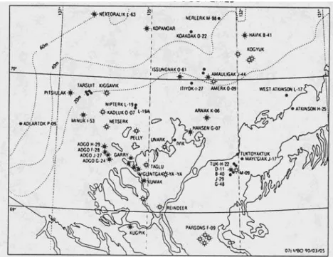
A generalized schematic that shows a representative cross-section of the Beaufort Sea’s landfast and transition (or seasonal) ice zones in winter is presented in Figure 4.3. A few photos of typical ice conditions in these ice zones are given in Figures 4.4 and 4.5, to provide a visual feel for them.
Figure 4.3: A schematic cross-section of the landfast zone ice in winter.
Ice-Related R&D Requirements for Beaufort Sea Production Systems
Figure 4.5: Representative views of ice conditions in the transition ice zone in winter.
4.2.1 Freeze-Up Period
The Beaufort Sea normally begins to freeze-up in early to mid October, with new ice forming in its shallow near-shore waters and progressively growing seawards. At the same time, or shortly thereafter, new ice also begins to form in the deeper water areas adjacent to the permanent polar pack, spreading southwards from there, and quickly merging with the shoreward ice cover. By late October, the entire region is generally covered by thin pack ice that has a blend of ice thicknesses, up to 30 cm or so. During this early stage of freeze-up, the ice cover remains mobile throughout the Beaufort, except in some of the sheltered bays and inlets along its coastline. Leads, openings and some rafted areas are common in the newly forming ice cover at this time, although ridges are infrequent, because the ice is still quite thin.
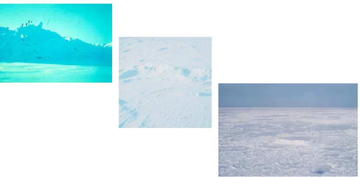
It is noteworthy that polar pack ice intrusions from the north, and strong storm winds, are most common at this time of the year. Storm winds can disperse the newly growing ice cover and create large waves, while old ice intrusions can quickly turn easy ice conditions into an ice situation that is very severe. Several representative views of ice conditions during the freeze-up period are shown in Figure 4.6.
Ice-Related R&D Requirements for Beaufort Sea Production Systems
The early freeze-up period is of little consequence in terms of the design of production systems, except for the old ice intrusions and storm wave events that may occur during this time period. However, it is of considerable importance for various construction, structure deployment (or de-mob) and supply operations that are based on the use of conventional vessels, since these types of operations will be impeded or precluded, even by light ice.
Figure 4.6: Representative views of ice conditions during the freeze-up period.
Over the course of the drilling activities that were carried out in the Beaufort during the 1970s and 1980s, a number of ice-related issues began to arise for the early freeze-up period, primarily in relation to operability in early freeze-up conditions. Some of the more important considerations are briefly highlighted as follows:
• how could some of the operations (construction, supply, mob and de-mob, etc.) that were normally conducted in open water conditions be extended into the freeze-up period
• what blend of equipment (conventional or ice-strengthened vessels) and ice management support would allow this extension of operations, and how much additional working time could be gained
• in the event of an emergency situation, how could personnel be safely evacuated from offshore structures in thin moving ice conditions
• would newly forming ice prevent old ice floes from entering the shallower water areas of the Beaufort, thereby reducing the potential for old ice interactions in the near-shore zone • would the near-shore ice conditions that developed during the freeze-up period impede or
preclude vessels that were operating further offshore from accessing their over-wintering sites (in Tuk harbor, McKinley Bay, Herschel Basin, etc.)
Ice-Related R&D Requirements for Beaufort Sea Production Systems
As the freeze-up period extends into November and early December, ice conditions in most parts of the Beaufort Sea progressively become more difficult in terms of the thicknesses and degree of ridging in the ice cover, precluding any operations with vessels that do not have ice strengthening. Air temperatures continue to decrease, along with the number of daylight hours, which fall to zero with the onset of the polar night. Over this time frame, the landfast ice cover begins to take hold in the Beaufort Sea’s shallower water areas, moving northwards in a series of discrete steps. This progression is caused by periodic onshore winds that move growing pack ice in the transition zone shoreward, where it interacts with more southerly landfast ice edge. This process creates bands of ridges where the fast ice edge resides at the time, with some of the keels of the ridges being deep enough to ground on the seafloor. These ridge zones (see Figure 4.7) tend to stabilize the ice cover lying shoreward of them. By late December, the landfast ice zone typically extends between 50 and 60 km offshore to the 20m water depth contour, where it generally remains stable for the rest of the winter.
Figure 4.7: Views of the types of ridge fields that stabilize the landfast ice cover, as it grows seaward to the 20m water depth contour over the course of the freeze-up period.
Near-shore, the landfast ice cover is generally quite smooth, but it typically contains increasing numbers of pressure ridges in its middle portions and outwards, towards its outer edge. Most of the ridges and rough ice areas that are found within the landfast ice zone are formed during the mid to late freeze-up period, and its overall complexion changes little over the subsequent winter period, with the exception of its thickness.
Ice-Related R&D Requirements for Beaufort Sea Production Systems
During the mid to late stages of freeze-up, the ice in the Beaufort’s transition zone also undergoes significant ridging and rubbling, due to relative motions within its moving pack ice cover. At this time, onshore movements of the pack ice can cause ice pressure events of varying durations and intensities, which can be a serious impediment to various marine operations, even those involving well powered ice-capable vessels.
Based on some of the experiences that were gained with offshore activities in the Beaufort during the mid to latter parts of the freeze-up period in the 1970s and 1980s, a number of important considerations arose. They included both design and operational issues, and are briefly highlighted as follows.
Shallower Water Depths – the Landfast Ice Zone
• when will landfast ice form at a particular location, and thereby offer a “calmer” and more protected in-ice operating environment for a structure
• what structure freeboard and form is needed to prevent ice pile-up and overtopping events on a structure’s working surface when the ice cover is still mobile (and also, green water overtopping during storm wave events)
• when will grounded ice rubble first form around a structure, how stable will the grounded ice rubble be, and will it reduce ice loads and the potential for other adverse ice effects • when can ice roads first be built and utilized, and in what water depths are roads, aircraft
landing strips and so forth feasible to construct, recognizing ice thickness and roughness constraints, and what role can spray ice technology play in these types of activities Intermediate Water Depths – the Transition Ice Zone
• how late can in-ice drilling operations with very capable floating systems like the Kulluk actually proceed into the late freeze-up and early winter periods, and how long can in-ice station-keeping operations be successful (at that time, with a view to required relief well drilling capabilities)
• can potentially hazardous ice conditions be adequately detected, monitored and forecasted in the range of adverse environmental conditions on hand (e.g.: fog, darkness, snow and so forth)
• how to deal with the potential for oil spills in the ice conditions that are expected, and also with EER requirements, particularly for bottom founded drilling systems that do no have attendant icebreaking vessels
Again, mid to late freeze-up ice conditions are of little consequence in terms of ice loads on the Beaufort Sea structures designed for year round operations, but in the past, were of more importance for floating drilling system operations, and various operational considerations at this time of the year.
Ice-Related R&D Requirements for Beaufort Sea Production Systems
4.2.2 Winter Period
The first year ice comprising the ice cover in the Beaufort Sea’s landfast and transition ice zones normally grows to thicknesses of between 1.6m and 1.8m over the course of the winter period. A large range of first year ridge sizes is also commonly seen in these areas in winter. For example, in the landfast ice zone, many ridges with sail heights in the range of 3m to 4m (or more) can be seen which are grounded in 10m to 20m of water, as noted above. These types of ice features can scour the seafloor, but are not a real threat to structures in the landfast ice, due to its limited movements, and the fact that grounded ice rubble fields usually form around them.
Multi-year ice floes and on rare occasions, small ice island fragments, may also be incorporated into the deeper parts of the landfast ice zone in some years, after drifting in the during the fall ice freeze-up process. However, the thickness of these extreme features is limited by water depth and should they occur, they are much less severe than what can be found drifting in the pack ice cover further offshore, in the Beaufort’s intermediate to deeper waters areas. Figure 4.8 shows examples of some of the types of extreme ice features that can be found in the landfast ice zone in winter.
Figure 4.8: A large grounded first year ridge (upper left), a multi-year ice floe (middle), and an ice island fragment (lower right) observed in the Beaufort’s fast ice zone in winter.
In the transition zone pack ice cover, the range of extreme ice features that can be encountered is more severe. They include very large first year ridges, substantial multi-year ice features and, on rare occasions, ice islands (or their fragments). These types of ice features, particularly multi-year ice or ice island formations (see Figure 4.9), are of high importance in terms of potential design ice loads on fixed structures in the intermediate and deeper waters of the Beaufort Sea. Previous studies have shown that multi-year ice floes can be sizable (a few kilometers in diameter) and very thick over most of their area.
Ice-Related R&D Requirements for Beaufort Sea Production Systems
Figure 4.9: Extreme ice features that can be found drifting in the Beaufort Sea’s transition ice zone in winter (multi-year ice left and center, and ice island fragment on the right).
In the mid 1980s, so called multi-year ice hummock fields were being cited as the extreme ice features that could give rise to the governing design global ice load on Beaufort Sea production structures located in the transition zone. Ice islands were also recognized as being hazardous, but were considered to be rare ice loading events that would be identifiable well in advance. At the time, the deemed response to any ice island occurrences would be a shut down in operations and evacuation of people, well in advance of a potential ice island interaction. However, as industry’s interest in the Beaufort Sea began to wane, these topic areas were not pursued too much further. Clearly, a substantial experience base has been developed with the design and operation of various drilling structures in both the Canadian and Alaskan Beaufort Seas in winter. However, a number of ice-related uncertainties and issues remain, which are highlighted as follows:
• the nature and extent of grounded ice rubble fields that may form around structures in first year ice, when they may occur, and their influence in terms of mitigating ice load levels • multi-year ice feature statistics, including multi-year ice hummock fields, and the risk of
interactions between these types of extreme ice features and offshore structures
• the ice loads that may result from direct interactions between multi-year ice floes with “bare” structures, and the full scale ice failure behaviors underlying these loads
Ice-Related R&D Requirements for Beaufort Sea Production Systems
Other key issues that were evident during previous Beaufort Sea operations, and still are, include: • oil spill behavior and clean-up in moving winter ice conditions
• EER approaches in moving winter ice
Additional topic areas that have always been of high interest for potential offshore developments include:
• low cost offshore production structures
• seafloor ice scour from first year and multi-year ice features, and how best to design sub-sea pipelines and other sub-seafloor facilities to contend with this risk
• the possibility of year round vessel operations in ice, including the tanker export option
4.2.3 Break-up Period
Ice break-up in the near-shore waters of the Beaufort Sea normally begins in the mid June to early July period, with near total ice clearance typically seen in water depths to about 20m by late July. The break-up process starts with a general weakening of the ice cover, together with melting of its surface, caused by rising air temperatures and long daylight hours. Immediately adjacent to the shoreline, significant melting is first seen, which is enhanced by run-off from the Mackenzie River in many areas. Concurrently, the pack ice in the transition zone to the north of the landfast ice begins to move offshore, under the influence of winds from the east and south. Large sections of the landfast ice cover tend to fracture and then drift northwards during this period. Diminishing ice concentrations and floe sizes are typical as break-up proceeds. The ice break-up process normally clears all of the ice from the shallow southern portions of Beaufort Sea by late July, and from the more northerly intermediate water depth areas over the early August period.
Some of the more important issues that arose during earlier Beaufort Sea activities in relation to the break-up season included:
• the question of whether spray ice platform lifetimes could be extended into the break-up ice period, and perhaps beyond into the open water period (primarily from the standpoint of relief well drilling system capabilities)
• the question of how early operations with “low or no ice class vessels” could begin, and the levels of ice management that may be needed to enhance these types of operations. The experience that was gained at the time showed that earlier starts to various offshore operations in the Beaufort Sea were generally more difficult to achieve than extensions to operations over the freeze-up period. In this regard, the large, thick and heavily deformed ice floes seen during break-up presented much heavier and often more variable conditions than those seen in fall.
Ice-Related R&D Requirements for Beaufort Sea Production Systems
4.2.4 Open Water Period
In the southern Beaufort Sea, the open water season usually lasts for about three months, from mid July to mid October. In terms of its physical oceanography, the region is relatively mild when compared to most other offshore areas of the world. In summer, typical wave heights are low, in the range of 1m or less. Extreme wave of 6m to 7m can occur during severe fall storm events but are rare, since wind fetches are usually limited by ice. Currents in the area are also typically weak, in the range of 0.2 m/sec or less. However, the Mackenzie River outflow has a strong influence on currents in the Beaufort’s near-shore waters, particularly in the area of its outflow from the Delta. Although the open water season is usually quite quiescent, heavy pack ice can move into the near-shore waters of the Beaufort Sea under the influence of strong winds from the northerly quadrants. In part, these ice intrusions result in the high degree of variability that is seen in the length of the open water season that is seen from year to year. When they do occur, most commonly in fall, these ice intrusions can bring thick remnant first year ice and multi-year floes from the polar pack into the Beaufort’s coastal waters and result in very adverse ice conditions, particularly in the transition zone area. Fortunately, this heavy pack ice generally tends to ground in 15m to 20m of water as it moves ashore, and is a lesser concern in the Beaufort Sea’s shallower inshore waters. In these shallow water areas, any drifting old ice floes that may be found are typically small, and their thicknesses and degree of ridging not excessive.
Past experience has shown that the Beaufort Sea’s open water season is not very predictable. Ice break-up and freeze-up time frames can be earlier or later than normal in any given year, and pack ice intrusions can occur at any time. In this regard, and also in terms of year round ice conditions, the potential effects of climate change on Beaufort Sea ice conditions has become a key issue. The open water window that is available to mob and de-mob vessels and structures into the Beaufort around Point Barrow, or from the east, is another matter of importance. Also, the question of open water storm waves should not be overlooked, particularly if more extensive open water situations and potentially larger storm wave events become a consequence of climate change.
4.3
Overview of Previous Exploration Systems
The design and operation of exploration systems in the Beaufort Sea required new knowledge and special technology, most of which has been developed in Canada. When offshore activities were first undertaken in the early 1970s, it was not known how the technology would unfold, only that new methods would be required, due to the severity of the Beaufort’s environment. Despite the ice and other environmental constraints, industry developed the capabilities to safely conduct drilling operations in the Beaufort, and did so from the mid 1970s to late 1980s.
Bottom founded structures were used to drill wells in the Beaufort Sea’s shallow to intermediate water depths on a year round basis, while floating drilling systems were employed to work in its mid to deeper water areas seasonally. In order to resist the large forces imposed by the winter ice cover, the bottom founded structures had to be massive, with their size and weight providing the necessary sliding resistance to counteract lateral ice loads. In contrast, the mooring capability of the floating drilling systems limited their operations to the late break-up through late freeze-up period, when ice conditions were comparatively light.
Ice-Related R&D Requirements for Beaufort Sea Production Systems
4.3.1 Bottom Founded Structures
Artificial Islands
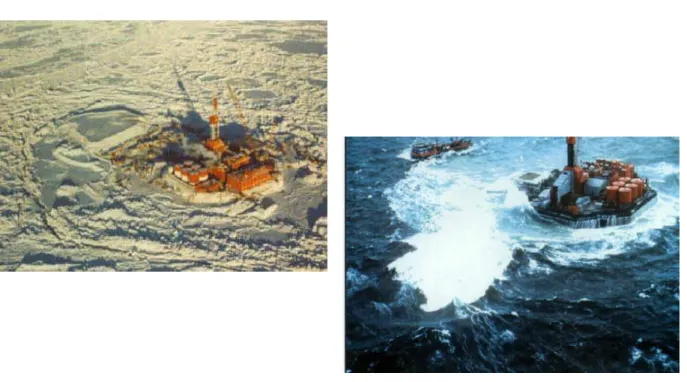
Artificial islands were the first type of structure used for exploratory drilling in the Beaufort Sea. Initially, they were built in the sheltered near-shore areas of the Beaufort, where shallow waters and early landfast ice growth were characteristic. Some were constructed by dumping gravel fill through the ice, but most were built from locally dredged sand during the open water season. They had typical surface dimensions of about 100m in diameter and generally low freeboards, in the order of a few metres, sloping down to the waterline. Drilling equipment, other topsides facilities and consumables were mobilized to the islands once they had been constructed, either by barges in open water or over ice roads in winter. Figure 4.10 provides views of some of the artificial islands that were constructed for offshore drilling in the Beaufort Sea.
Figure 4.10: Several artificial island drilling structures in the Beaufort Sea.
The artificial islands built in shallow water areas, which required modest fill volumes, performed well, and as experience was gained, the technology was extended further offshore. However, with increasing water depths, the fill volumes needed for island construction became substantially larger, and their costs considerably higher. Also, the time frame needed to build an artificial island in waters depths in the range of 15m or more exposed them to the potential for storm waves and significant erosion near the end of the open water season in fall, during the critical phase when they were nearing completion. The deepest artificial island was constructed at the Issungnak site, in 18m of water, and took two years to build. As it was being completed in the fall of the second year, a considerable part of its above water volume was eroded during a fall storm wave event, although it still functioned well as a drilling platform the following winter.
Ice-Related R&D Requirements for Beaufort Sea Production Systems
It is well known that grounded ice rubble fields invariably formed around these artificial islands, as the result of ice failures against their beaches during the early freeze-up period, when the newly growing ice cover was still mobile. In shallow water locations, where the landfast ice stabilizes shortly after freeze-up, these rubble formations were generally only a few tens of metres in extent, and the ridge sail heights they contained were not particularly high. However, in the deeper water areas where the ice remained mobile for longer, the rubble fields that surrounded artificial islands were considerably larger, a few hundred metres (or more) in extent. Sizable ridges and hummocks were also seen within these larger ice rubble formations which were firmly grounded on the island slopes. Once formed, these grounded ice rubble fields remained stable until the landfast ice cover broke up the following spring. They were beneficial in the following two ways:
• the rubble that formed immediately adjacent to artificial islands over the early stages of freeze-up (when the ice was thin), provided a buffer against direct ice action, moved the ice failure zone outwards, and provided protection against potential ice ride-up or pile-up onto their working surface
• later in the winter, once landfast ice had formed around them, they promoted mixed modal ice failures (at lower load levels than crushing) at their outer boundary, and also tended to absorb some of the applied ice loads, through load transmission to the seafloor
It is noteworthy that the North Star oil production platform, which has been in service since the late 1990s in 12m of water in the Alaskan Beaufort Sea, is a large artificial island.
Tarsuit CRI
The next type of bottom founded structure that was designed for offshore drilling operations in the Beaufort Sea was the Tarsuit Caisson Retained Island (CRI). This concept was a logical extension of artificial island technology, and was developed to reduce costs and shorten the construction time frames as exploration moved into the Beaufort’s intermediate water depth areas. The Tarsuit CRI was a hybrid structure, consisting of four shallow concrete caissons that were set down on a large sub-sea berm. The caissons were roughly 70m in length, 15m in width and 11m in height, and were placed to form a square enclosure on a pre-constructed sand berm, built to a height of 6m below sea level. The hollow caissons and the central core area between them were then filled with sand, to provide adequate sliding resistance against horizontal ice loads.
The Tarsuit CRI was deployed at a drilling location in about 20m of water. As configured, it had a surface area of 70m x 70m, which was small, and an above water freeboard of 5m. The drilling rig and stacked trailer modules that formed its topsides were mobilized to the CRI by barge in the fall, and then erected on it. The Tarsuit CRI was designed to withstand the forces from both first-year and multi-year ice and, in concept, for storm wave events during the Beaufort Sea’s open water season. Views of the Tarsuit CRI are shown in Figure 4.11 in both winter ice and open water wave conditions.
Ice loads measured on the structure when it was drilling, and also over the following winter, showed the beneficial effects of the grounded rubble fields that formed around it. The first ice pad was also built in the rubble at Tarsuit to provide relief well drilling capability. It is interesting to note that storm wave effects on this structure were actually more of a problem than ice action.
Ice-Related R&D Requirements for Beaufort Sea Production Systems
Figure 4.11: Views of the Tarsuit CRI and its relief well pad in landfast ice conditions in winter (upper) and in storm wave conditions during the open water season (lower).
Esso CRI
Esso designed and constructed a second type of caisson retained island for drilling operations in the Beaufort Sea, shortly after the Tarsiut CRI was used. Again, this caisson was intended for use in the shallow to intermediate water depth range (12m to 25m), where artificial islands were costly and time consuming to construct. It was a steel structure that consisted of eight sides, held together by a cable system, to form an octagonal ring. When deployed, the steel ring was placed on a pre-built sub-sea berm and filled with dredge sand to achieve the necessary sliding resistance. The surface diameter of this CRI was about 90m. Its draft was 8m to the top of the berm on which it sat, and it had an above water freeboard of 5m. There was a small outward sloping ice and wave deflector at the top of its outer walls. As with artificial islands and the Tarsiut CRI, the drilling rig and trailer modules that formed its topsides were mobilized to the structure by barge in the fall, and then erected on it. The Esso CRI was designed to withstand the forces from first-year and some multi-year ice interactions. In shallow water deployments, it was also intended to withstand storm wave effects during open water operations.
This CRI was used to drill wells at several locations in the 14m to 25m water depth range, where it was exposed to moving pack ice well into the late freeze-up period. As a result, large grounded rubble fields formed around it, as shown by the views in Figure 4.12. These rubble fields, which were several hundreds metres in extent, were heavily deformed, with high ridges and hummocks in many areas. After their formation, they remained stable until break-up. On one occasion, in a unique freeze-up circumstance, some ice blocks did overtop part of the Esso CRI.
Ice-Related R&D Requirements for Beaufort Sea Production Systems
Figure 4.12: Views of the Esso CRI and the grounded ice rubble fields that formed around it.
SSDC
The SSDC (single steel drilling caisson) is another structure that Dome used to conduct drilling operations in the Beaufort Sea in the 1980s. It was constructed from an existing tanker by cutting off the vessel’s bow and stern sections, and strengthening the remaining vessel mid-body along its sides and bottom, to withstand ice loads and other types of forces. In terms of its dimensions, the SSDC is about 160m in length, 55m in width, and 25m in overall height. It is actually a shallow caisson that, when first used in the Canadian Beaufort Sea, was deployed on a large submerged berm at a draft of 8m. This resulted in a structure with an above water freeboard of about 17m. The SSDC was developed for use as a year round drilling platform at locations in the 20m to 40m water depth range. In principle, it was designed to be capable of withstanding the loads from first and multi-year ice in the transition and landfast ice zones, as well as the effects of storm waves. However, for its first two deployments at locations in the Beaufort’s transition zone, spray ice pads were constructed in the rubble fields that formed around it, to increase its resistance for potential multi-year ice floe interactions. Since no old ice interactions actually occurred during these deployments, the SSDC only gained experience with first year ice action at these sites. After two years of use for drilling operations in the Canadian Beaufort Sea, over the winters of 1982/83 and 1983/84, a large steel mat was constructed for the SSDC. This mat took the place of the dredged sub-sea berms that the unit was set on in its first two deployments, and allowed the structure to be used for drilling operations in the landfast ice off Alaska, where dredging is not permitted. The SSDC drilled five wells in the Alaskan Beaufort, in 11m to 21m of water.
Ice-Related R&D Requirements for Beaufort Sea Production Systems
Several views of the SSDC are shown in Figure 4.13. Here, it should be noted that Devon is using the SSDC (now called the SDC) to drill their Paktoa well in the Canadian Beaufort Sea during the 2005/06 winter period. This location is in 12m of water, and is situated in the landfast ice zone in winter.
Figure 4.13: Views of the SSDC and its ice pad in winter pack ice conditions in the Canadian Beaufort (left), and as deployed in the Alaskan Beaufort Sea with its MAT (right).
Molikpaq
The Molikpaq is a mobile arctic caisson that was designed and constructed for year round drilling operations in the Beaufort Sea. It is a deep steel caisson with a hull depth of 29m, base dimensions of 111m x 111m, and deck dimensions of 73m x 73m. As built, the lightship displacement of the caisson was 31,000 tonnes, with a lightship draft of 5.2m. When operating in the Beaufort Sea, the Molikpaq was generally deployed on a sub-sea berm. Its internal core was filled with sand to provide a high level of sliding resistance against horizontal loads. The structure was designed to withstand the forces from both first-year and multi-year ice interactions, as well as the extreme storm waves that can occur in the Beaufort Sea open water season.
The water depths in which the Molikpaq could operate ranged from 10m to 40m. For shallow water deployments, the caisson was set directly on the sea floor, for example, at the Isserk location in 12m of water. At deeper locations, a sub-sea berm was built to the necessary height to provide an acceptable on bottom weight and above water freeboard for the structure, once it was deployed. At the Tarsuit P-45 and Amauligak I-65 locations, in water depths of about 35m, the caisson was set down on sub-sea berms at a draft of about 20m. This resulted in an above water freeboard of roughly 10m to the Molikpaq’s main deck, and 15m to the top of its upper wall ice deflector.
Ice-Related R&D Requirements for Beaufort Sea Production Systems
Due to the Molikpaq’s deep set down draft at these two Beaufort Sea drilling locations, grounded ice rubble did not form around the caisson, and it was exposed to direct ice action from moving winter pack ice over the course of two winter seasons. This included interactions with multi-year ice floes at the Amauligak site that occurred during winter of 1986. In this regard, it is important to note that the Molikpaq is the only offshore structure to experience multi-year ice loading events to date. Although the old ice floes that impacted the structure were not particularly severe, the ice load levels were high in comparison to first year ice loads, and the Molikpaq was severely tested. Representative views of the Molikpaq in moving pack ice conditions are given in Figure 4.14, which include ones of multi-year ice crushing against the caisson. After working in the Canadian Beaufort during the 1980s, this caisson was sold and is now being used as a production platform in the ice-covered waters off Sakhalin Island.
Figure 4.12: Views of the Molikpaq in moving winter pack ice in the Beaufort Sea’s transition zone. Because no grounded ice rubble fields formed around this caisson when it was deployed at deep draft (20m), it experienced direct ice action against it, including a few multi-year ice interaction events.
Spray Ice Platforms
In the late 1980s, spray ice technology was also developed and utilized to construct ice pads that were used as low cost drilling platforms in the Beaufort Sea. Two such ice pads were built in the Canadian Beaufort, and a considerable number off the Alaskan North Slope, in water depths to about 8m. These spray ice pads performed well, but were clearly temporary structures, since they melted in the summer. Several views of spray ice pads are shown in Figure 4.15.
Ice-Related R&D Requirements for Beaufort Sea Production Systems
Figure 4.15: Views of the spray ice pads used as drilling platforms in the Beaufort Sea.
The artificial islands and caisson structures that have been highlighted above generally performed well, and allowed year round drilling in the Beaufort Sea’s landfast and transition ice zones. As their deployment locations progressed further offshore from the shallow to the intermediate water depths of the Beaufort, they were exposed to moving ice for the majority of the freeze-up period, and at sites in more than 20m of water, have withstood moving pack ice throughout the winter. The full scale ice/structure and ice load information acquired through monitoring programs on and around these structures has provided invaluable input for design improvements and technological advancements.
However, it is important to note that none of the structures used in the transition zone experienced the type of extreme design ice features that should be expected for production platforms deployed over 20 to 30 year development project time frames. The Molikpaq caisson came the closest, since it did experience five multi-year ice floe interactions during the winter of 1986. However, the old ice features that it encountered were by no means extreme. Also, although sloped structures are preferred by some, as a means of reducing ice loads from extreme ice features through flexural ice failures, there is no full scale experience with them.
Ice-Related R&D Requirements for Beaufort Sea Production Systems
4.3.2 Floating Drilling Systems
Drillships
Relatively conventional drillships were used for exploratory drilling in the mid to deeper water areas of the Beaufort from 1976 until the late 1980s. Although these vessels were ice strengthened to Baltic Class 1A Super levels, their operating season was limited to the open water and early freeze-up periods. Four drillships (Canmar’s Explorer fleet) were used in the Beaufort Sea, all having displacements of about 15,000 tonnes and overall dimensions of roughly 100m x 20m x 9m. Each vessel was deployed with an eight point mooring system comprised of 2 3/4 “ wire lines (four bow and four aft) that came off the deck and through the waterline (except for the Explorer 4, which had underwater fairleads). These lines were equipped with remote anchor releases (RARs) that allowed the drillships to quickly disconnect from their anchors and move off location, should difficult ice or storm wave conditions occur. The overall mooring system capacity of the drillships was in the order of 100 tonnes. Once moored, these drillships were aligned in a fixed direction and could not reorient themselves in response to changing ice drift directions without moving off location. From an ice management perspective, typical support for drillship operations consisted of one or two CAC 4 supply vessels and at times, the Robert Lemeur (CAC 3) and/or the more highly powered Kigoriak (CAC 2) icebreakers.
Canmar’s drillships conducted drilling operations at more than 40 different sites in the Beaufort and Chukchi Seas, in water depths ranging from roughly 20m to 80m. The majority of these wells were scheduled for the summer and early fall periods, when open water and relative light ice conditions are common. However, with ice management support, the drillships sometimes worked in moderate to relatively high ice concentrations during ice intrusions, provided the pack ice was managed into small pieces and could easily flow around them. Representative views of drillship operations in Beaufort Sea ice are shown in Figure 4.16
Ice-Related R&D Requirements for Beaufort Sea Production Systems
Kulluk
The Kulluk is a conical drilling unit that was purpose built for extended season drilling operations in the Beaufort Sea. It was designed as a floating barge with integral drilling (and other) facilities on its deck, a capable mooring system, and a strong hull that was strengthened to Arctic Class IV (CAC 2) standards. The Kulluk was designed with a unique circular shape and an inverted conical hull form, to accommodate ice action from any direction equally, and to fail the oncoming ice in downwards flexure at low load levels. It was also designed with an outwards flare near the bottom of its hull, to ensure that broken ice pieces would clear around it and not enter its moon-pool or get entangled in its mooring lines. It has a radially symmetric mooring system comprised of twelve 3½ “ wire lines that run through the hull to underwater fairleads near the bottom of the Kulluk’s hull. Each line was connected to large anchors (typically 15 tonne Bruce anchors) and had remote anchor releases (RARs). The overall mooring system was designed to withstand global ice loads of 750 tonnes while drilling operations were underway, and allow station-keeping in storm waves up to 7.2m. In terms of its dimensions, the diameter of the Kulluk is 81m at its main deck level and about 70m at the waterline. It has a height of 31.5m from the bottom of the hull to its elevated drill floor, and a freeboard of about 5m to its gunnels. The Kulluk’s minimum and maximum operating drafts are 10m and 12.5m, respectively. The vessel’s lightship displacement is 17,510 tonnes and it has a variable load capacity of about 7,000 tonnes.
When it was operating in ice, the Kulluk was always supported by very capable ice management vessels. The support fleet consisted of the Terry Fox and Kalvik icebreakers (25,000 HP CAC 2 vessels), and the Ikaluk and Miscaroo AHTS vessels (also CAC 2 icebreakers, with about 15,000 HP.) Two to three of these vessels typically supported the Kulluk when it was drilling, depending on the severity of the ice conditions. It is important to note that ice management support was a key contributor to the overall success of the Kulluk, and enabled drilling operations in very heavy ice conditions.
The Kulluk was used to conduct exploratory drilling operations in the Beaufort Sea in its deeper water areas (20m to 60m) from 1983 until the early 1990s. During this period, it worked in a wide range of pack ice and open water conditions, from late May until late December, and significantly extended the drilling season that was available to drillships. The Kulluk has been in “cold storage” in a sheltered location in the Beaufort Sea since it last worked off the Alaskan coast in 1993. Several views of the Kulluk and its support icebreakers during drilling operations in ice are shown in Figure 4.17.
4.4
Overview of Previous Production Concepts
Extensive engineering studies were also carried out on various Beaufort Sea production systems in the 1970s and 1980s, as part of industry’s activities. These studies included development system components such as offshore structures to resist ice, offshore pipelines to cope with the effects of ice scour and permafrost, and marine systems for different offshore construction activities and for the transportation of oil by tankers. As noted earlier, the plans that were being developed for oil production from the Beaufort Sea were quite well advanced at the time, but were shelved in the late 1980s, due to low oil prices and poor project economics.
Ice-Related R&D Requirements for Beaufort Sea Production Systems
Figure 4.17: Views of the Kulluk and support icebreakers operating in managed ice conditions.
Some of the oil development approaches that were being pursued, and discussed in public venues at the time, are briefly highlighted as follows:
• A Dome concept, involving the use of massive dredged Arctic Production and Loading Atoll (APLA) and highly ice-capable tanker fleet, for year round oil production and export from the Beaufort Sea’s transition zone. The APLA structure was an extension of artificial island technology and, in principle, was designed to withstand all extreme ice features (i.e.: multi-year hummock fields and ice islands). It had a large amount of oil storage and would be configured in a horse-shoe shape, to allow tanker access and loading within its protected central portion. This and other development concepts, from the early 1980s time frame, are described in the Beaufort Sea EIS (1982).
• Gulf Canada’s Amauligak development concept, which involved the use of a large GBS drilling and production platform, a sub-sea oil pipeline to North Point, and an onshore pipeline to the south, also for year round oil production from the transition zone area. Two alternative structures were considered at the time (in the mid 1980s), the CRI which was an extension of the technology used in the Tarsuit CRI, and the MSOB (monolithic structure on a berm) which was an extension of Molikpaq caisson technology.
• Gulf’s lesser scale oil development project for Amauligak, which involved the use of the Molikpaq caisson with some onboard oil storage, and ice capable tankers offloading oil and exporting it around Point Barrow on a limited seasonal basis.
The Amauligak-type development approaches, and another scheme that involves the production of near-shore oil reserves (in the landfast ice zone) using of a low cost structure and a small diameter pipeline to shore, and then down to Norman Wells, have also been reviewed in some of the R&D Planning studies conducted by PERD in the 1990s (e.g.: Croasdale, 1994).
Ice-Related R&D Requirements for Beaufort Sea Production Systems
5.0
Previous Evaluations of Beaufort R&D Needs
5.1 General
A number of evaluations of Beaufort R&D needs have been carried out in the past, some focusing on ice-related problems, and others being broader in scope. Some of the initial assessments were produced by the oil industry in the 1970s and 1980s, with the range of ice-related projects undertaken within industry being a direct reflection of their needs. More recent evaluations of R&D requirements for Canada’s frontiers were also conducted by PERD during the 1990s. A few comments about these initiatives are provided here, as additional background, starting as far back as the R&D work undertaken by the APOA several decades ago. It is interesting to note that most of the ice-related R&D themes outlined in these earlier evaluations have not changed significantly over the years, although progress has been made in many of the key topic areas.
5.2 The
APOA
When offshore exploration activities were about to be undertaken in the Canadian Beaufort Sea, a significant R&D program was initiated by the Canadian oil industry, often with the collaboration of government agencies and scientists. Some of the basic research that was first conducted was directed towards environmental conditions in the near-shore waters of the Beaufort, ice mechanics and seafloor conditions. The thrust of this initial R&D work, which began as early as 1969, was to develop appropriate design criteria for the structures being considered for exploratory drilling and future production operations in the shallow waters of the Beaufort Sea.
At the time, the industry players that were interested in the Beaufort Sea (and High Arctic area) recognized the need for collaboration and formed the Arctic Petroleum Operators Association (APOA) in 1970, specifically to conduct joint industry research projects (JIPs). Over the course of its fifteen year existence, the APOA carried out well over 200 projects that were related to various Beaufort Sea problems, ranging from ice conditions, to ice loads, to various structure designs and operations in ice. The nature of the APOA and the range of JIPs that it carried out are described in Hnatiuk & Wright (1981), with listings of APOA projects (and other industry ice studies) updated in Wright (1993). One major undertaken under the auspices of the APOA was the Joint Industry-Government Beaufort Sea Environmental Project, conducted in 1974 and 1975. It involved a wide range of topic areas, from physical environmental conditions in the Beaufort, through the region’s biological regime, to oil spill behavior and countermeasures in ice. This work was a precursor to Dome’s entry into the deeper waters of the Beaufort Sea with their drill-ship fleet, and part of the approval process required to allow these deeper water drilling operations.
The APOA (and its parallel AOGA group in Alaska) was a very good vehicle to foster cooperation between oil companies, to consider various R&D needs, and to conduct ice-related and other R&D projects on a jointly funded basis. The emphasis of the R&D that was carried out by the APOA was largely on the development of knowledge that could be applied to achieve safe and sound operations in the Beaufort Sea (and High Arctic). The research collaboration that was achieved by the APOA is highlighted here, since it is a prime example of how industry (and government) has successfully conducted joint research in the past, when there was a common need.
Ice-Related R&D Requirements for Beaufort Sea Production Systems
5.3 The
ESRF
In the mid 1980s, as industry’s interest in the Beaufort Sea and Arctic Islands regions began to wane, the APOA was absorbed into the Canadian Petroleum Association’s Frontier Division (now CAPP), where its R&D focus was quickly lost. This was partly the result of the creation of the Environmental Studies Research Fund (ESRF) that was supported by an industry levy. The basic intent of the ESRF was to more equitably spread R&D costs relating to various environmental and social matters over all acreage holders in various frontier regions of Canada.
Although some ice-related R&D work was carried out by the ESRF over the next few years, it was less focused on satisfying engineering needs than most APOA projects had been. Moreover, social and biophysical issue areas began to occupy more of the ESRF’s annual budget. In this regard, equal government and industry responsibility in determining how best to allocate the funding that was provided to ESRF was not always smooth, since different individuals (and their departments) had different interests and priorities.
In the late 1980s, small working groups that were comprised of a few industry and government representative were formed to discuss and direct some of the ESRF’s expenditures in topic areas such as ice scour, physical environmental matters (wind, wave, iceberg and sea ice issues), and oil spill countermeasures. These groups spawned a number of good ESRF projects related to these types of physical environmental considerations in the late 1980s and early 1990s. However, much of the work was directed towards East Coast problems area, since the Beaufort Sea and studies relating to it were loosing priority at the time.
It is noteworthy that one ESRF project dealing with the collection and assessment of extreme multi-year ice feature data in the Beaufort Sea was undertaken in 1992. This study can be viewed as a precedent for the type of ice-related work that could be carried out under the auspices of ESRF in the future.
Over the past few years, some ESRF funded work has been done in the Beaufort. However, this work has been focused on biological issues, and has dealt with various marine mammal and fish considerations. Discussions about ESRF projects and funding were held with CAPP as part of this ice-related R&D assessment. The feedback received from CAPP suggested that sea ice and other physical environmental studies for the Beaufort Sea could be reintroduced to the ESRF, as long as there was industry support to see them carried out under this venue. In this regard, much of the iceberg related work done through ESRF for the Grand Banks area was cited as a clear parallel. The question of using ESRF funding for ice-related studies in the Beaufort Sea was also raised with some of the oil company representatives that were interviewed as part of this work. Some of them felt that ESRF funding should not be overlooked as an option to promote necessary ice-related R&D work in the Beaufort Sea. However, they pointed out that an industry “champion” would likely be needed to redirect ESRF funds in this manner. They also noted that the current distribution of Beaufort acreage holders, and the resultant ESRF levies on each one, would likely be an area of concern, because the level of interest within many companies who have retained in their share of lands in the region has been largely dormant for some time.