Publisher’s version / Version de l'éditeur:
Vous avez des questions? Nous pouvons vous aider. Pour communiquer directement avec un auteur, consultez la première page de la revue dans laquelle son article a été publié afin de trouver ses coordonnées. Si vous n’arrivez pas à les repérer, communiquez avec nous à [email protected].
Questions? Contact the NRC Publications Archive team at
[email protected]. If you wish to email the authors directly, please see the first page of the publication for their contact information.
https://publications-cnrc.canada.ca/fra/droits
L’accès à ce site Web et l’utilisation de son contenu sont assujettis aux conditions présentées dans le site LISEZ CES CONDITIONS ATTENTIVEMENT AVANT D’UTILISER CE SITE WEB.
Internal Report (National Research Council of Canada. Division of Building Research), 1956-07-01
READ THESE TERMS AND CONDITIONS CAREFULLY BEFORE USING THIS WEBSITE.
https://nrc-publications.canada.ca/eng/copyright
NRC Publications Archive Record / Notice des Archives des publications du CNRC :
https://nrc-publications.canada.ca/eng/view/object/?id=1e23c80d-6747-4e51-b929-7383869d510e https://publications-cnrc.canada.ca/fra/voir/objet/?id=1e23c80d-6747-4e51-b929-7383869d510e
Archives des publications du CNRC
For the publisher’s version, please access the DOI link below./ Pour consulter la version de l’éditeur, utilisez le lien DOI ci-dessous.
https://doi.org/10.4224/20386607
Access and use of this website and the material on it are subject to the Terms and Conditions set forth at
Permafrost investigations in Northern Manitoba and Quebec-Labrador: 1955
CANADA
DIVISION OF BUILDING RESEARCH
PERMAFROST INVESTIGATIONS IN NORTHERN MANITOBA AND QUEBEC-LABRADOR :
1955
by
R.J.E. Brown
ANALYIED
(This report has been prepared for Information and Record Purposes and is not to 「セ referenced
in any Publication)
Report No.
82
of the
Division of Building Research
Ottawa July
1956
The author is a research officer in the Permafrost Section of the Division of Building Research, nセエゥッョ。ャ
Research C?uncil where he is doing research on the distribut10n of permafrost in Canada.
One of the main projects under this general
research program is the mapping of the southern boundary of permafrost in Canada. Data are being obtained by
reviewing available literature, circulation of a permafrost questionnaire throughout the North, studying aerial photo-graphs and conducting field investigations.
This report records the results of permafrost field investigations by the author at four locations in northern Manitoba and two locations in Quebec-Labrador
during the ウオュセ・イ of
1955.
Because transportation facilities were critical in these northern areas, it was possible tospend only a few days at each place. It is the Division's hope that more detailed investigations will be possible
in subsequent summers.
Ottawa July
1956
Robert F. Legget Director
1. Permafrost and Related Features at Cranberry 1,1. Location and Site . . . • . . . 1.2. Frost Conditions in Granular Townsite
1.3.
Permafrost in the Muskeg .Portage, Manitoba
·
. .
.
.
.
. . .
Terrace . 11 2 2. Permafrost and Related f・。エセ・ウ at Flin Flon, Manitoba
2.1. Location and Site . • . . . -. • . c • • • • • • • • 3
2.2. Permafrost at Flin Flon . • . • . . . • . . . 3
2.3.
Frost Conditions in the Muskeg Near Flin Flon • . • . .4
4.
3.
Permafrost セョ、 Related Features at LYnn Lake, Manitoba3.1.
Location and Site • . • • . . • • . • • . • . .3.2.
Permafrost in the Sand . . • • . . . .3030
Permafrost Data of Sherritt-Gordon Mines Limited3.40
Permafrost in the Muskeg . . . •0 0
.
Permafrost and Related Features at Bird, Manitoba4 01.
Location and Site ••0 . . . .
0 0 .
4
02 . Permafrost along the Railway . . . . • . .4.3.
Permafrost in the Nelson River Valley 0 • •5.
Permafrost and Related Features at Knob Lake, P.Q.4
· ·
·
5
o·
·
5
·
·
·
5
6 6 76.
_. 501.
Location and Site c·
·
·
.
.
0
·
· ·
·
·
0
·
·
95 02.
Mining Operations·
·
·
· .
.
·
· · ·
· ·
·
·
·
95.3.
Permafrost in the Iron Mines •·
· ·
·
·
·
·
·
10
5.4.
Problems presented by Frozen Ore.· ·
·
·
·
·
·
11
5.5.
Permafrost Investigations at Ferriman's·
·
·
· · · ·
·
11
Soil Conditions west of Knob Lake, P. Q.
6 01.
Location.
.
. ·
·
·
·
· ·
12
6.2.
Location No.1
·
·
·
·
·
· ·
·
e'·
· · ·
·
12
6.3.
Location No.2
· ·
·
·
c0 0 0
·
·
·
·
12
7.
Soils at Great Whale River, P.Q. 7.1. Location and Site . • • . 7.20 Frost Conditions • 0 0 0 0 0 D 1213
8.
Conclusion801.
Regional Distribution of Permafrost.'0 • • • . . .
8
02 . Local Distribution of Permafrost , . . . 0 • • • •8.30
Meteorological Data • • • . . . • . • 0 • • • • Acknowledgments14
14
15
16
Appendix A - Cranberry Portage, Manitoba A.I. Location
A.2. Site and General Features A.3. Population and Activities Appendix B - Flin Flon, Manitoba
B.I. Location
B.2. Foundation Conditions
B.3. Population and General Features Appendix C - Lynn Lake, Manitoba
C.I. Location C.2. Site C.3. History
c.4.
Population and Activities C.S. Administrationc.6.
The TownQUEBEC-LABRADOR :
1955
by R.J.E. BrownIn July
1955
permafrost investigations were conducted in several lo;;ations in northern Manitoba. Visits were made to Cranberry Portage and Flin Flon, 54 and 100 miles northwest of The Pas respectively. Several days were spent in the new mining town of Lynn Lake, 180 miles north of Cranberry Portage. A journey was made on the Hudson Bay Railway from The Pas to Churchill, Permafrost investigations were conducted along the railway at Bird, 150 miles south of Churchill.In August
1955
permafrost investigations were conducted in several locations in Q.uebec-Labrador. Visits were made to the iron ore ITlining development at Knob Lake in the interior of Ungava, two locations 90 and 150 miles west of Knob Lake イ・ウーセ」エゥカ・ャケL and Great Whale River on the east coast of Hudson Bay.1. Permafrost and Related Features at cイ。ョ「セイイケ pッイエ。セ・L
Mani t·oba.
1.1
Location and SiteCranberry Portage is situated in northwestern Manitoba at
54035'
N., 101023'
W., on the C.N.R. line between The Pas and Flin Flon. It is54
miles north of The Pas and 39 miles southeast of Flin Flon. It is on the East Arm of Lake Athapapuskow on the portage route between this lake and First Cranberry Lake, which is11
feet higher than Lake Athapapuskow and about three-quarters of a mile to the east (Fig. 2) • Lake Athapapuskow has an elevation of956
feet above sea level.The tCliL '..183 just north of the southern boundary of the
Precambrian Shield. To the south are broad expanses of flat muskeg
wi t h many Lakes , "'o the north are rock hills and knolls with many lakes, deposits of muskeg and thin patches of soil. The site of the town is in the middle of a mile-long terrace of granular material which rises from Lake Athapapuskow to a height of
30
to40
feet. The material .i.s pred:Jminantly sand but there are angular stones and boulders up to 1 f co t in d:i:l;Yle1:·er.rhis land form offers the best building sitein the?,rea.
1.2 Frost Conditlcns in Granular Townsite Terrace
According to local inhabitants, winter frost penetrates to a depth of 6 to B fs-st in t he gr-anuLan terrace. The ground does not remain frozen t.r.r-ough t ne su.mmer in this land form. The Manitoba Government is erecting a new house for the Department of Mines and Natural Resources on the side of the terrace near Lake Athapapuskow. The excavation is
8
feet deep at the back of the house and6
feet deep 2Lt the front and nc frozen ground was encountered.Several borings were made in the granular terrace on July 21,
1955,
with a Hoffer soil probe and screw-type hand soil auger. Two holes were advanced in the school yard. The vegetation consisteo of grass up to 2 feet high and scattered patches of moss. The soil was an unfrozen moist-brown silt with fine sand and random angular stones. Large stones below a depth of5
feet prevented further penetration.A local inhabitant dug a pit 2 feet 6 inches deep in his parking lot at the beginning of JUly and claimed that frozen ground encountered at that depth prevented further penetration. On July 21,
1955
a hole was advanced from the bottom of the pit with the hand auger to a depth of 9 feet 6 inches below the surface. The カ・ァ・エ」[BGGGNluョLNセ⦅ •.spruce and birch セー to 30 feet high and willcw up to 10 feet high with low shrubs and grass up to 2 feet high and scattered patches of moss. To a depth nf 5 feet 6 inches the soil was an unfrozen moist-brown silt with scme fine sand and clay. From
5
feet6
inches to9
feet6
inches the セッゥャ was an unfrozen moist-brown medium sand with some silt.1.3 Permafrost in the mオウセ・ァ
In
the muskeg-filled depressions in the Precambrian Shield and in the muskeg expanses to the south, permafrost is widespread and was encountered just below the surface cover. A local inhabitant reported that frozen ground was encountered in the muskeg in post holes along the railway south to Simonhouse (10 miles south ofCranberry Portage) but that none was found south of that settlement. At Simonhouse frozen ground is
4
feet below the surface in July.On July 20,
1955
permafrost investigations were conducted in a muskeg area in a depression in the bedrock 200 yards east ofm。セNゥエッ「。 Highway Number 10, 2 miles north of Cranberry Portage.
The vegetation on the ID.olls and ridges of bedrock consists of dense stands of spruce and poplar up to 25 feet high, scattered alder up to 10 feet hlgn, shrubs up to
5
feet high, and a ground cover of moss. On the muskeg, the vegetation consists of scattered spruce and poplar up to15
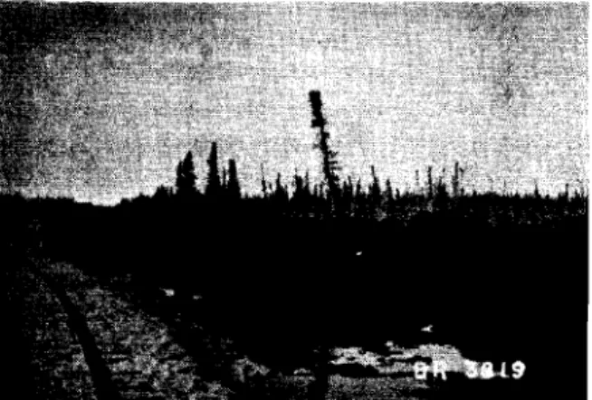
feet high with some tamarack and low-woody shrubs (Fig. 14). The ground cover is moss and grass under 2 feet high.The surface of the muskeg consists of moss hummocks 6 inches high. Frozen ground was encountered
6
inches below the surface in the hummncks and 12 inches below the surface in the depressionsbetween hummocks indicating the flat nature of the permafrost table. Small pools of surface water, each a few feet square, are
scattered throughout the muskeg area. The soil under these areas was un-frozen to a depth below
9
feet. From the surface to a depth of 1 foot the material is QQカゥョセ ケ・ャャッキゥウィMセイ・・ョ moss. From a depth of 1 foot to 7 feet 6 inches the material is unfrozen wet amorphous granular and fine fibrous non-woody organic mat crLaL, Below 7 feet 6 inches thesoil is an セセセイッコ・ョ キ・セ ーャ。ウエセ」 grey-blue セャ。ケN
On July 21, 1955 permafrost investigations were conducted in セ
muskeg area 100 yards west of the railway track, one m!le south of Cranberry Portage. The topography is flat to slightly rolling with scattered rock outcrops.
The vegetation consists of white spruce up to 20 feet high, tamarack 15 feet high, alder 2 to 6 feet high and ground cover of moss, Labrador Tea and pitcher plants. There are scattered open tracts of grass 2 feet high (Fig. 15).
In the wooded muskeg, the ground is covered with moss hwnmocks 12 inches high. The depth to frozen groWld is 18 inches from the tops of the hummocks and varies from 18 inches to below
3
feet in the depressions between hummocks.In the wetter grass-covered open areas the material is unfrozen to a depth below
9
feet. From the surface to a depth of6
inches the material is living red and yellowish-green non-woodyfibrous moss. From a depth of 6 inches to 5 feet 6 inches the material is unfrozen wet amorphous granular and fine fibrous non-woody organic material. From a depth of 5 feet 6 inches to 7 feet 6 inches the soil
is unfrozen wet brownish-grey clayey silt. From a depth of 7 feet 6
inches to 10 feet
6
inches the soil is unfrozen wet brownish-grey to blue highly plastic clay. Penetration was not possible below a depth of 10 feet 6 inches because of large stones or bedrock.2. Permafrost and Related Features at Flin Flon, Manitoba 2.1 Location and Site
Flin Flon is situated in northwestern Manitoba at
54° 46
1 N.,101° 521 W., at the end of the C.N.R. line from The Pas. The
rail-way station has an elevation of 10g8 feet above sea level. The town and mine bUildings are in Manitoba just inside the Manitoba-Saskatchewan boundary but the ore bodies are in Saskatchewan (Fig.
3).
The site is predominantly bare rock ridges and knolls with patches of muskeg in depressions in the bedrock.2.2 Permafrost at Flin Flon
When the town was founded in 1929, there was a permafrost condition in the muskeg. This condition has disappeared over the years from the accwnulated heat loss from the many buildings. The chief building problems have been concerned with muskeg and 「・、イッ」ォセ
Winter frost penetrates to a depth of
6
to8
feet in road-fill areas but it may be only3
to 4 feet in areas of shallow soil. Minimum air temperatures reach -30°F. to -40°F. during the coldest part of the winter. Winter frost persists into late June or early July.(R.F. Comstock, town engineer, reported that this was the condition in
2.3 Frost Conditions in the Muskeg Near Flin Flon
Several borings were made with a Hoffer soil probe and screw type hand auger in a muskeg area adjacent to Manitoba Highway Number 10,
9
miles southeast of Flin Flon on July 23, 1955. This highway was built in 1951 during which time a road allowance about 100 yards wide was cleared. One hole was advanced in the undisturbed area just outside the road allowance. Two holes were advanced in the road allowance area. Frozen ground was not encountered in any of the holes.In the undisturbed area beyond the road allowance the vegetation 1s black and white spruce up to 50 feet high with alder up to 15 feet high and ground cover of grass 1 foot high
with moss and Labrador Tea. In the hole in this area, the material from the surface to a depth of 5 inches is moist living brown non-woody fibrous moss. From a depth of 5 inches to 2 feet the
material is moist black granular and non-woody fibrous organic material. From a depth of 2 feet to below 4 feet the s011 is moist-brown nodular
clayey silt.
One hole in the road allowance was in an area which
supported tree growth before the road was constructed (Fig. 16). The present vegetation is spruce up to 6 feet high, tamarack, ?lder, fi""e-weed and patches of grass up to 3 feet high. From the surface to a depth of 5 inches the material is moist living brown non-woody fibrous moss. From 5 inches to a depth of 5 feet the material is black
granular and non-woody fibrous organic material. From 5 feet to an unknown depth, the soil is brownish-grey silty clay which was more plastic than 1n the previous hole in the undisturbed area.
The second hole in the road allowance is in a boggy area having surface water. The vegetation consists of weeds and grass up to 3 feet high. From the surface to a depth of 7 feet the material is wet black ァイ。ョオャ。セ and non-woody fibrous organic material. From
7
feet to an unknown depth the soil is plastic brownish-grey silty clay.
3.
Permafrost and Related Features at Lynn Lake, Manitoba 3.1 Location and SiteLynn Lake is situated in northwestern Manitoba at 56° 51' N., 1010
03' W., at the end of the C.N.R. line extending north from Cran-berry Portage for 184 miles (Fig. 4). Most of the townsite is
located on a granular deposit on the side of a gently sloping ridge of bedrock. The lower part of the town is built on a shallow muskeg deposit, up to 5 feet deep, overlying sand and silty sand. The
town 1s bounded on the east by Lynn Lake and on the west by West Lynn Lake. These lakes are Joined by a narrow creek on the northeast edge of the town. The water level of Lynn Lake has an elevation of 1195
t 25 feet above sea level. The airport, which is about one m1le west of the town 1s built on an esker which can be traced to the north and
south for many miles. The average width of the esker is 40 feet. It fans out near the town to a width of about one-half mile. The airport is built on this wider portion. To the east of the granular deposit on which the townsite is located is exposed bedrock and to the west is muskeg.
3.2 Permafrost in the Sand
When the townsite was first being developed, the shallow muskeg overlying the sand was frozen. It was stripped anQ the frost receded into the sand. The distribution of permafrost in the Lynn Lake area is sporadic. When excavations were advanced for basements, some encountered permafrost and some did not. Where permafrost was encountered, the excavations were advanced by thawing. There have been no foundation problems because the small amount of water released by thawing drained away qUickly and foundations are solid now.
3.3 Permafrost Data of Sherritt-Gordon Mines Limited
Exploratory drill holes advanced by Sherritt-Gordon Mines
Limited revealed the sporadic distribution of permafrost. Where perma-frost was found its vertical extent averaged
15
feet. In one hole, which was drilled to a depth of 120 feet, water seeped in and froze in the bottom of the hole.3.4
Permafrost in the MuskegOn July 28,
1955
the permafrost investigations were conducted in the muskeg area about 300 yards northwest of the Fairview Hotel, which is on the main street. This flat muskeg area extends westward to West Lynn Lake.'rhe vegetation consists of open stands of spruce up to
40
feet high averaging 20 feet in height. There are also scattered tamarack up to 15 feet high with a few alder and willow up to6
feet high. There are two types of ground cover: The first consists of moss hummocks up to 18 inches high with Labrador Tea, lichen and berry plants. The second consists of grass up to 2 feet high in open areas.In the moss covered areas the depth to permafrost varies from 12 to 30 inches. In the tops of the hummocks, the depth to frozen ground is 18 inches. In the depressions between the hummocks the depth is about 30 inches. In some depressions, granular material consisting mostly of unfrozen sand, was encountered at a depth of 30 inches. Any frozen mus-keg that was encountered displayed no discernible ice segregation and was well bonded.
A boring was made with a ウ」イ・セャMエケー・ hand auger in one of the grass covered open tracts (Fig. 17). From the surface to a depth of
4
inches the material is yellowish-green living moss. From a depth of4
inches to 1 foot the material iA moj:t light-brown dead moss. From a depth of 1 foot to3
feet6
inches the material is an unfrozen and wet brown amorphous granular and woody fine fibrous organic material. From a depth of 3 feet 6 inches to 8 feet 6 inches the soil is unfrozenand wet brownish-grey clayey silt with some fine sand. From a depth of
8
feet6
inches to9
feet the soil is an unfrozen and wet fine sand. Below9
feet, where the auger met refusal, the soil is an unfrozen and wet fine sand with stones.In these open tracts there are isolated plateaux of moss
hummocks in which there was a small island of frozen ground at a depth of
18
inches (Fig.18).
In one such plateau, which is about 2 feetabove the general muskeg level, frozen ground varies from
18
inches below the surface on the south side to 6 inches below the surface on the north side.4.
Permafrost and Related Features at Bird, Manitoba4.1
Location and SiteBird, Manitoba is a railway siding on the Hudson Bay Railway at Mile
347
north of The Pas. It is situated at56
030'N. 94
014'W.
308
feet above sea level (Fig.5).
The area investigated extends along the Hudson Bay Railway from Mile347
to Mile351.
The soil is predom-inantly shallow muskeg overlying sand and fine-grained soils. The deepest muskeg in this area is3
feet6
inches. At Mile349.5
the Limestone River crosses the railway. It has cut a valley about100
feet deep exposing banks of s.ilt clay and fine sand with random pebbles. 4.2 Permafrost along the Railway
A flat sandy gravel plain about
300
yards wide extends north from the railway for about one-third of a mile at Mile348.3
(Fig.19).
Adjacent to this deposit to the east is a gravel borrow pit about one-third of a mile long. About one-half mile to the northeast, just north of the Limestone River is another borrow pit about the same size. No permafrost was encountered in these granular areas.
At Mile
348.3
a railway siding was constructed in July,1955.
Several feet of muskeg were stripped and Riled up beside the Nァセ。vセャ fill which was subsequently laid down (Fig. 20). On August 2, tne ヲイッウセ had risen 1 to 2 feet in the bulldozed muskeg. In the オョ、ゥウエオイ「・セN。イ・。
adjacent to the siding, the vegetation consists of open ウエ。ョ、ウセッヲ spruce up to
15
feet high with ground cover of moss hummocks and scatteredlichens. In this area the depth to permafrost varies from 1 foot to ャセ
feet. Scattered through this area are small patches of ground saturated with water. The depth to permafrost averages4 feet. The soil beneath the muskeg is frozen silty sand with small random stones.
At Mile
347.5
the vegetation consists of scattered spruce and alder up to 8 feet high and shrubs up to 2 feet high. In this area there are several peat ridges about18
inches high having a vegetation cover of very small spruce, lichens, Labrador Tea and grass. In this area the muskeg is black decomposed amorphous granular organic material.In the peat ridges the depth to permafrost was 18 inches but in the water-filled depressions below the peat ridges the depth to permafrost was
4
feet or more.At Mile
351
the vegetation is mixed spruce and poplar with low shrubs and grass. The soil is well-drained claypy silt with fine sand and random stones. Frozen ground was encountered below the 3foot depth.
At Mile
351.3
the vegetation is scattered spruce and alder up to 6 feet high with an undergrowth of grass, lichens and mosses. The organic soil varies in depth from 2 feet9
inches to3
feet.The bottom 2 to 3 inches of the muskeg was frozen in scattered patches throughout the area.
At a Manitoba Government Survey camp on the slope of the Limestone Valley at Mile
350
the soil is a fine セッゥウエ sand with some silt and random angular stones up to 6 inches i1. diameter. Where there is a ground cover of moss, frozen ground was encountered at a depth of 2 feet.4.3
Permafrost in the Nelson River ValleyThe Limestone River empties into the Nelson River ャセ miles below its intersection with the Hudson Bay Railway at Mile
349.5.
A survey party of the Manitoba Government was examining the Nelson River for hydro-electric power potentialities 9 miles downstream from the mouth of the Limestone River just above Limestone Rapids. Anorthwest-southeast section was taken across the Nelson River from the southeast facing bank セッ the northwest facing bank. The depths to frozen ground encountered are given in the f'oL,owing table.
It appears from this table that ground cover and soil type were the critical factors in determining the depths to frozen ground along the traverse. The depths to frozen ground under moss cover in organic soil were much less than those in mineral soils with thinner and scattered moss cover.
DEPI'HS TO FROZEN GROUND.
-
Depth to Depth toFrozen Ground Frozen Ground
Location Soil on June 29/55 on July 26/55
-
2000 feet NW of Moss andSE facing bank organic 9 inches 18 inches
1200 feet NW of Moss and
SE facing bank organic 12 inches 1 foot 9 inches
400 feet NW of Moss and
SE facing bank organic 1 foot 3 inches 1 foot 3 inches
Top of SE Sand and
facing bank gravel 2 feet 6 inches
35
feet b sLow Clayey sand tvp of Si:!: abovefacing bank yellow silt 1 foot 3 inches 17 feet i>
ECentre of
ャセ Island on NW
facing bank Sandy clay 2 feet 3 inches 3 feet
.1
...
_SE side of Sand and
island gravel 7 feet
NV/ fac ing bank 100 feet below ,top(1.e.184
feet above bottom) Clay 1 foot 4 inches 3 feet
Top of NW
5. Permafrost and Related Features at Knob Lake, P.Q. 5.1 Location and Site
The town of Schefferville (Knob Lake) is situated in the centre of the Quebec-Labrador Peninsula at UセP 48'N. 66 0 49'W. (Fig. 6). Its elevation is approximately 1800 feet Lbove sea level. It is connected to Seven Islands on the Gulf of st. Lawrence by a 360 mile long railway line.
The soil at the townsite consists of a few feet of coarse sand and gravel overlying highly contorted strata of shale and slate. In some areas where bedrock is at the surface it has been broken into fragments to a depth of several feet. No permafrost has been encountered at the townsite, or in the immediate Vicinity at the airstrip and the extensive muskeg area adjacent to the airstrip.
5.2 Mining Operations
The mining operations at Knob Lake consist of four phases ending with the shipment of the ore to Seven Islands by rail:
1. Blasting
2. Loading trucks
3. Pr-eLfrrnr.ar-y crushing 4. Loading ore trains
1. Blasting
Two types of rigs are used for drilling holes for blasting: (a) churn-type drill. Many of these have been discarded in
favour of ....
(b) rotary-type drill which bores a 9-inch hole mucn ,more quickly and effectively than the churn drill.
2. Loading Trucks
After the ore is blasted, it is loaded by electric 7 cubic-yard capacity power shovels into 35 ton Euclid trucks which can each carry 35 tons of ore. These trucks carry the ore to a screening and crushing plant.
3. Preliminary Crushing
The screening and crushing plant is 10catAd beside the railway. Rp0'1118t.;nns require the ore to be in chunks less than 4 inches in
diameter.
4.
Loading Ore TrcinsThe ore is carried on a conveyor belt and dumped into hopper cars each having a capacity of about
go
tons. Each train consists of 3diesel locomotives and about 100 ore cars. During 1955 the Iron Ore Company is aiming for an output of 9 million tons. About 10 ore trains are shipped out daily.
5.3 Permafrost in the Iron Mines
The distribution of permafrost in the Knob Lake area appears to be sporadic. Frozen ground has been encountered in many of the ore faces exposed by blasting. Three exposed frozen ore faces were examined on August 14, 1955:
1. Ruth Lake Mine No.3
The exposed ore face at Ruth Lake Mine No.3, displaying red and yellow hematite, was 25 feet high above which there had been 2 feet of unfrozen granular overburden consisting of 'a red sandy;ravel with
silt. The stones varied in size up to 6 inches in diameter and were both angular and rounded. The original vegetative cover was scattered spruce up to 15 feet high with a ground cover of moss 6 inches deep.
This ore face had been exposed by recent blasting and there were chunks of frozen ore up to 4 feet in size which were being allowed to thaw.
Ore segregation in the ore face consisted mostly of vertical, with a few horizontal and diagonal ice lenses varying in thickness from one-quarter to three-eights 01 an inch HdセNゥ」・ segregation
-U.S. Corps of Engineers Classification). The セャウエ。ョ」・ between individual lenses averaged 3 inches. The estimated moisture content was reported to be 10 per cent. (The Iron Ore Company computes moisture content as a percentage of total weight of ore).
2. gagnon Aine (First Ore Face Examined)
At a frozen ore face examined at this mine there was originally 2 feet of unfrozen granular overburden consisting of a red sandy gravel with silt. The stones varied in size up to 6 inches in diameter and were both angular and rounded. The original vegetative cover was
scattered spruce up to 15 feet high with a ground cover of moss 6 inches deep. This ore face, consisting of red, yellow and blue hematite, had been exposed by blasting recently and there were chunks of frozen ore up to 3 feet In diameter.
Ice segregation in this face consisted of vertical horizontal and diagonal lenses varying in thickness from three-eights to
one-half inch Hdセ ice segregation - U.S. Corps of Engineers Classification). The distance between individual lenses 。カ・イ。セ・、 one inch. The estimated moisture content (moisture over total weight) was estimated to be 15 per cent.
3.
Gagnon Mine (Second Ore Face Examined)Ice segregation occurred here in overburden of red and green shale covering the ore to a depth of 20 ヲ・・エセ The shale had been contorted and tilted.
Ice lenses averaging one-half inch thickness filled one
horizontal cleavage and a vertical crack perpendicular to and adjoining the ice-filled cleavage. About 5 feet to the left was a horizontal lens of slightly milky but otherwise clear massive ice extending for a distance of about 5 feet. Both of these ice inclusions were covered with about 8 feet of shale overburden (Fig. 21).
5.4 Problems Presented b;y fイGッLセ」ョ⦅ Ore
The frozen ore presents serious problems to the mining operation at several stages. Much of it breaks into very large
unmanageable chunks weighing many tuns when blasted and these chunks require a very long period of time to thaw. In some instances, the power shovels are able to scrape off small chunks of frozen ore from the ore face but this is laborious and slow. One method is employed which works fairly well. A pear-shaped steel ball called a frost ball weighing several tons is dropped on the ore chunks by a crane. After three or four blows, the ore is usually sufficiently broken up to
facilitate loading. However, the frozen ore chunks are usually larger than the 4-inch limit allowed for loading in the ore trains as it is difficult to crush some of the larger chunks.
5.5 Permafrost Investigations at Ferriman's
On August 17, 1955, permafrost investigations were made at Ferriman's, about 5 miles from Burnt Creek where ・クーセッイ。エッイケ work has been done and the Iron Ore Ccmpany expects to begin mining operations in 1956.
The' purpose of the investigations was to examine any surface manifestations of the frozen ground which might indicate its areal extent and thus facilitate the mining operations.
The investigated area is above the treeline, which is qUite sharply defined in the Knob Lake area at an altitude of 2,300 feet above sea level. Below this level there are spruce trees in stands up to 15 feet high above which is alpine tundra vegetation consisting of short grass, mosses and lichens up to
6
inches deep (Fig. 22). There are several gullies up to 30 feet deep with scattered scrubby willow and alder growth up to a few feet in height.There are scattered areas of shallow mineral soil formed in situ on the bedrock. The most marked feature of the bedrock is that it is severely fragmented by frost action (alternate freeZing and thawing). In some areas, gullies are partially filled vith
r-ock fragments which have slumped down from higher levels.
No distinctive permafrost features were found. The only
features which sgggested frost action, apart from the fragmented bed-rock, were of two types:
1. s」。エエセイ・、 over the surface in many areas were patches,
1 to 2 feet in diameter of shallow mineral soil formed in situ and partially covered with small flat angular rock fragments up to 2 inches in diameter. These patches re0srnbled frost boils in appearance and there was a
oartial sorting of fragments with most of the larger ones lying toward the perimeter.
r:
c... • Two small ponds, less than 50 feet in
up revealing bottoms of fine-grained fragments up to 6 inches in diameter. fragments wer-e sorted into incomplete rings.
diameter, had dried soil with large rock
Many of these stone polygons or
The vertical shaft extended into the bedrock in 1948 revepled frozen groQDd to a depth of 100 feet. This shaft is now almost filled with water and has been boarded up. However, this shaft and other pits excavated in the area revealed a high quality of blue hematite ore at about 65 per cent grade.
6.
Soil Conditions west of Knob Lake, P.Q.6.1 Lccat Lon
VisitA ",,Jere made to two locations west of Knob Lake.
Location No. 1 is go miles west of Knob Lake and Location No. 2 is 150 miles west of Knob Lake (Fig. 1).
6.2 Location No.1
'I'he d e pt h of muskeg averaged 18 inches and was underlain by bedrock. In some qreas the vegetation cover was light-green lichen about 6 Lnches thiCK on bedrock. Tree growth was predominantly scattered spr-uce less t han 15 feet high. No frozen ground was encountered ner-e .
6.3
Location No.2Vegetation and soil cond: tions were similar to Location No.1. No frozen groucd was encountered here.
7.
Soils at Great Whale River, P.Q.7.1 Location ane" Site
1'." si.t.uat.ed on the series of beach ridges which form a
エイゥ。ョァオャセセ Band deposit on the north bank of the Great Whale River (Fig. 23). The series of parallel beach ridges run in a northeast-southwest direction parallel to the present shorel.ine. Each '3.re about 6 feet high and extend for a distance of one to two mjles.
The vegetative cover consists of lichens and mosses about 3
nehes deep lying on che sando Polygonal cracks caused by desiccation cover the serface.
kl the landward sLde of this t.r-Langul ar- deposition, the Precambrian bedrock outcrops about
75
feet above the present water level of Hudaon Bay0 The highest beach ridge is located at thise Levat Lon , .rust beLow this elevation on the sand deposition are scattered oLowout a and a f'ew dunes. The sand area is devoid of tree
gr-owt.h0
Along the south bank of the Great Whale River there is a deposit of sand extending in an east-west direction about one mile wide and five miles long. This deposit is about 50 feet above the present river level. The apparent dip of strata in the sand is about
5
degrees toward the west. streams from the higher bedrock to the south have cut narrow and steep-sided V-shaped valleys into the sand.The soil throughout the triangular area on the north side of
the Great 1,'Iha1e River is rnedLurn to coarse-clean sand with practically
no fines. The moisture content of the sand varies from 2 to 3 per cent.
pイcSセ penetration in the winter is about
13
feet. ThefOI''?!1lC';ct ーイGHIセセB]Zュ it" ccmpact Lon of the airstrip which was laid in
t he a 1.tlJJY'.:r ."i9':: 4セ [;,r'r..g t.he break-up of 1955 the airstrip was unser-v e3bl,:c fer " . NセGiィZuNe 'cr).6 sane was t.hawLng cut. The
エQQfᄋセセア・、ZZZS c c i.ld イセ[」Iイ セセGiᄋGMセ 」Gヲイ[セILGZ[H[エHZᄋセ enough t c pe r-ml.t a Lr-c r-af t to .:take·
of'fII g」イイセHセゥZエ」エ セセN」Gイセ セLGNGL⦅ZG^ セ エイNゥセー is cent Lnui.r.g but et i l l present s .gx ,.,
ーイ」「セlRtセ Event1Js l l y it セAゥNLャャ be pavedo
?here Ls ro pe rrnar r-oat at Greai . Whale .Lver , Dr. Cour-temanche of the エ[ョゥカ・イZセ\エエ[ケ of 1'e2'.] who carried out beg borings in northern
Quebec during the aummer of 1954 reported that he encountered the most
sout.he.rr, ccc urr-ence n,:;rmaf'rOfJC
J
Ui<t north of Port Har-r-Lson which ison the east ウィセイ・ of ィオ、ウッセ 5ay about 300 miles north of Great Whale
8', Conclusion
General observations on the distributiOn and occurrences of permafrost encountered in the investigations in northern Manitoba and Quebec-Labra.dor can be divided into two categories. In the first place, the distribution of permafrost varies throughout the parts of central Canada to which visits were made. In the second place, the distribution of permafrost varies within any particular area and depends upon the local physical features such as soil and vegetation types.
8.1 RegionaJ. Distribution of Permafrost
For purposes of this discus6ion the ar-ea (Df investigation can be divided into the section west of Hudson Bay (nanat ooe ) ano the area east of Hudson Bay (Quebec-Labrador). Frczen ground is ュッセ・ widespread in Manitoba than at the same latitude in Quebec-Labrador.
Reports from the construction of the Quebec North Shore and Labrador Railway indicate that the frozen ground at Knob Lake is
approximately at the southern boundary of permafrost in Quebec-Labrador. In the iron workings at Knob Lake, permafrost occurs in sporadic
islands and none was encountered in the townsite. No permafrost' was encountered at Great Whale River, P.Q., and none has been found at Goose Bay, Labrador, both of which are at approximately the same latitude as Knob Lake.
West of Hudson Bay, permafrost is more widespread at Cranberry Portage than at Knob Lake although both settlements are at the same latitude. Cranberry Portage appears to be near the southern boundary of permafrost because no permafrost was reported south of Simonhouse whicr is 10 miles south of Cranberry Portage. No permafrost was encountered at Flin Flon which is 40 miles northwest of Cranberry Portage nor in an undisturbed area
9
miles southwest of Flin Flon.8.2 Local Distribution of Permafrost
Several physical fa.ctors influence the distribution of perma-frost within the particular areas that were investigated.
'I'he so11 type has pronounced influence on the dLst r-Lbut Lon of permafrost and the depth of the thawed layer. In organic and
fine-grained soils, the thawed layer is less than three feet where the frozen ground is encountered. In coarse grained soils such as the granular deposits at Bird, the thawed layer is very deep and in some places
extends into the clay whi.ch under-Lays it at depths of 15 feet and more.
At Cranberry Portage, no permafrost was encountered in the granular terrace on which the settlement was located although it is widespread in the muskeg surrounding it. '
The vegetative ground cover has pronounced influence en ehe depth of the thawed layer in soils where frozen ground was encountered. The
thawed layer is much shallower under a moss cover than under a grass cover. At Lynn Lake, the thawed layer is below three feet in silty sand supporting grass whereas it is less than one foot in silty sand supporting moss cover.
Surface water is another factor which influences the
distribution of frozen ground. In several areas, regardless of the type of soil, frozen ground is not encountered beneath a pool of water to a depth of over
9
feet whereas it is found within a few feet or inches of the surface in soil adjacent to the pool.The direction of exposure is also important in the depth of the thawed layer. At Lynn Lake and Bird, small isolated islands or wedges of frozen ground were encountered in peat plateaux rising 2 to 3 feet above the general level in an area otherwise devoid of frozen ground. In these plateaux, the depth to permafrost on the south side averages 18 inches and on the north side it averages
6
inches.8.3 Meteorological Data
Meteorological data for some of the investigated areas were obtained from the Meteorological Division, Department of Transport.
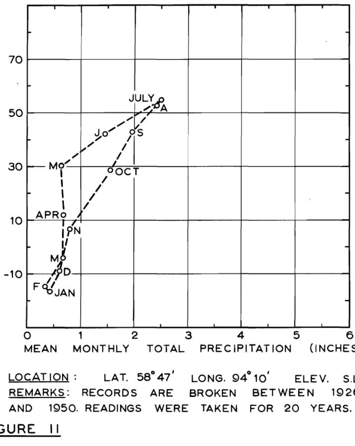
By using mean monthly temperatures and precipitations, hythergraphs were plotted for these arpas (Figs.
8
to 12 inclusive). There are no meteorological data for Bird, Manitoba, but records were available at Gillam which is only twenty miles southwest of Bird on the Hudson Bay Railway. No data are available for Cranberry Portage. The closest station is at Flin Flon.Of the areas investigated Flin Flon has the highest temperatures in winter and summer. Unfortunately no data are available for
Cranberry Portage which is 40 miles southeast of Flin Flon. A comparison of data between these two stations would be of interest because permafrost is widespread in the area around Cranberry Portage but not in Flin Flon.
The air temperatures of the stations examined on the west side of Hudson Bay are more extreme than those on the east side probably because of the moderating effect of Hudson Bay on the Quebec-Labrador side. Thp west side has higher ウセュ・イ and lower winter temperatures than the east side. However, the stations on the east side receive twice as .nuch precipitation as those on the west side.
ACKNOWLEDGEMENTS
The author wishes to express his appreciation to the following organizations and persons for their valuable assistance rendered in the course of the summer's research program: The Bell Telephone Company of Canada and in particular Mr. B.C. Nowlan, Planning Engineer of the
Special Contracts Department; The Royal Canadian Air Force and in particular Squadron Leader H.D. Monteith; Mr. R.F. Comstock, Town Engineer of Flin Flon, Manitoba; Mr. C.R. Neely, Town Administrator of Lynn Lake, Manitoba; Mr. H.E. Neal, Geologist of The Iron Ore Company of Canada Limited at Knob Lake, P.Q.
Cranberry Portage, Manitoba Al. Location
Cranberry Portage is situated at 540
35'N. 1010
22'W. on the East Arm of Lake Athapapuskow on the portage of an old fur trade route between this lake and the Cranberry Lakes. It is on Manitoba Highway 10, 54 miles north of The Pas and 39 miles southeast of Flin Flon. It is also on the main C.N.R. line from The Pas to Flin Flon. Lake
Athapapuskow has an elevation of 956 feet above sea level.
A2. Site and General Features
The terrain is bedrock, scattered deposits of glacial material and muskeg, and many lakes. Cranberry Portage is built on a sand ridge running north and south, rising up from Lake Athapapuskow. Lake
Athaoapuskow has a shoreline of 1,400 miles and is 18 miles across at
ゥエセ widest point. To the northeast of the town is the First Cranberry Lake, the elevation of which is 11 feet higher than Lake Athapapuskow. The Cranberry Lakes are in the Churchill River watershed whereas Lake Athapapuskow is in the Saskatchewan River watershed.
The village of Cranberry Portage has one main street leading from the railway track and intersecting Highway No. 10 at right angles. All the business establishments are on this main street. Several narrow streets run perpendicular to the main street, on which the private
residences, churches and school are located. The buildings have no planned layout and tarpaper shacks and log cabins are adjacent to
modern-frame buildings. The business establishments include one hotel with beer parlour, two general stores, two cafes, two grocery stores, two garages, shoe repair shop, poolroom, theatre, drug store and rail-way station. There is also a curling rink, -a community hall, two
churches (Presbyterian and Roman Catholic), a public school
(9
grades) and several tourist lodges. The Department of Mines and NaturalResources of the Manitoba Government maintains a number of bUildings on the lake-front. Several instances of differential settlement were noted but these were due to deterioration of foundations made from untreated timber rather than frost action or soil settlement.
A six hundred foot strip of land along the lake front (Lake Athapapuskow) has been set aside as a public park. This is now being developed into picnic and camping grounds. Beach facilities include swimming and boat rentals.
A3. Population and Activities
The population of Cranberry Portage is 350 in an area of about 10 square miles. The Indian population is largely half-breed Cree Indian known as "Net is" .
Local ind.lstries jnclude railway maintenance, lumbering, pulpwood and some 」ッュュ・イ」ゥ。セ fishing. At one time there were 20
」ッュセ・イ」ゥ。ャ fishing concerns at Cranberry Portage. Since the high-way was constructed in
1951,
the tourist industry has become animportant economic factor. Approximately 6,000 to 7,000 tourists (mostly American) visited this area in
1954
and a record number is expected in1955.
Without exception, people encountered were very co-operative and friendly. 1w( men are worthy of special note and are described as follows:
"CarLbou" Bill Ance r is a man of about sixty years who is a freelance reporter for various newspapers during the winter and
operates a parking lot at Granberry Portage for American tourists during the summer. He lives in a log cabin filled with curios of the north (animal furs, skulls, teeth, claws etc.). and photographs of northern people and animals. He has cycled aCl:OSS Canada and has also put his cabin rnl wheels and taken it over the same route. In
1942
he appeared on the cover of one of the issues of "The Beaver" which is published monthly by the Hudson's Bay Company.Mr. Streamer is a man of 70 years and is one of the original pioneers of Cranberry Portage. He came to Cranberry Portage in
1928
and opened a h2rdware store, poolroom and barber shop while the town was still in its infancy. At that time, the town was on the shore of Lake Athapapuskow and there were some native shacks on the ridge. In1929
these tuildings on the ridge were destroyed in a forest fire but the buildings along the lake-front were spared. The townsite waL later moved up on the ridge to its present location. Twenty-five years ago Mr. Streamer recommended that the government set aside a 500 foot strip along the lake-front for a park. Eventually a 600 foot strip was E SZセ。「ャゥウィ・、 and is now be ing developed. Mr. St r-eame: is the proprietor of one of the general stores and is the postmaster and local magistrate. He also owns the Bayview Playhouse and other property in the area.Flin Flon; Manitoba Bl. Locat"Lon
FIJ.,n Flon is situated on the Manitoba-Saskatchewan boundary at
54
046'N.
101052'W. The town is in Manitoba but the main ore body of the Huc aon Bay Mini.ng and Smelting Company is in Saskatchewan. Flin FloD is at the end of Manitoba Highway No. 10, 100 miles north-west of The Pas and at the end of the G.N.R. line from The Pas.
The railway station has an elevation of
10g8
feet above sea level. There iE also access by wheel and float equipped aircraft.B2. Foundation Conditions
[/lost of the bu.i.LdLng r oundat.Lone are on rock outcrops. There are also clay denosits and some muskeg. Bedrock is by far the most predominant feature of the area (Fig. 24).
B3. Population and General Features
The population of the Flin Flon area is 13,500 which includes Creighton (about 1 mlle e out.nwe st 1 in saskatchewan) and the suburb of
Channing, It is the third largest community in Manitoba and is an incorporated town. It was founded in
1928.
The chief industry is the Hudson Bay Mining and Smelting Compary LI1TjJ.ted, but there is also some commercial fishing, trapping and 1unber-Lng aSvJell as the tourist industry. The town has some 175 「セウゥョ・ウウ establishments, two daily newspapers, The Daily Miner and The Daily Reminder, nine ーオ「ャャセ schools and one high school, a 1000 watt r-ad Lo 2t-·So::;jon (CFliR), ten garages, four hotels, one motel, three
movie t.he at.r-es, and one hospits.lo 'I'her-e are numerous churches, representing most of the major denominations. The town is policed
by a Ro C . I v 1 . P . J . e C a c h m e n + · 0 men. Wi-thin the town is the Phantom
Park area :1" rudIng a 「ウ。LGセャG[L swtmmlr.g and boating facilities, tennis c ourte ar« 9 --.h.cl\?solf':'oJ_rse" ゥセ|x[Zx」 14 miles s out.hwe st of town is
Lynn Lake, Manitoba
Gl. Location
Lynn Lake is approximately J84 miles north of Cranberry Portage at
56
051'N. 1010
03'W. Access is by C.N.R. railway or by wheel and float-equipped aircraft.
C2. Site
The town is located on a granular deposit on the side of a gently sloping ridge of bedrock (Fig. 25). The lower part of town is built on a shallow "'1uskeg deposit overlying sand and silty sand. It is bounded on the east by Lynn Lake and on the west ty West Lynn Lake. These lakes are joined by a narrow creek on the nurtheast edge of town. The water level of Lynn Lake has an elevation of 1195 セ
25 feet above sea level. About 4 miles to the west of the town, an airport is located on an esker which has fanned out to sufficient width to accommodate a runway.
C3. hゥウセッイケ
Prior to 1950, Lynn Lake consisted entirely of a mining camp of Sherritt-Gordon Mines Co. Ltd. When it was discovered that ore reserves at Sherridon, Manitoba were depleted, the decision was made to move the town of Sherridon to Lynn Lake. The first six houses wer-e brought in by tractor train on the 167 mile long wtntrer- road
during the winter of 1949-50. Four houses were brought in during the winter of 1950-51; seventy-two houses were brought in during the
winter of 19j1-52; and sixty houses, 1 bank, 1 school, 2 churches and 3 stores were brought in during the winter of 1952-53.
Each house was insured for a waiver of $200.00. The
buildings stood up very well during the move, and no claLms were made. The move was financed by Sherritt-Gordon Mines Co. Ltd., the money being repaid in monthly instalments by individual house owners. Although the company owned the houses in Sherridon, they are all privately Jwned in Lynn Lake.
The community at Sherridon consisted of apprOXimately 1,350 people which included Sherridon itself and Cold Lake about 1 1/4 miles away. The mine at Sherridon began to produce in 1929, was closed in 1932 during the depression, and reopened in 1937. The ore reserves ran out in the early 1950'S just as the Lynn Lake development bsgan. At present there are 400 to 500 people remaining at Sherridon where the only industries are fishing and trapping. The Cambrian Hotel, a structure of 4 storeys, is still open catering mainly to tourists.
C4. Population and Activities
The present population of Lynn Lake is 1,300 and is increasing
。セ the rate of 200 to 300 per year. The town is being planned for an ultimate population of 2,000 people.
The chief industry is the mine which employs 410 people. There is some 」ッュセ・イ」ゥ。ャ fishing in the area and Lynn Lake ウィセIウ out
2,000,000 pounds of fish per year. Present plans are to buiJa a road
to Reindeer Lake which is about 80 miles northwest of Lynn LaKe. Fifteen miles of this road are already constructed. Since Reindeer Lake is partly in Manitoba and partly in Saskatchewan, the road will be financed jointly by the two provinces.
C5. Administration
The 。、ュゥョゥウエイセエゥカ・ set-up at Lynn Lake is a new experiment
by the Ivlanitoba government. A similar experiment is being made at Snow Lake. A resident administrator Mr. C.R. Neely was appointed by charter. He was the town manager at Sherridon and was in charge of
the move to Lynn Lake. There is also an agreement between the province, the mine and the administrator outlining the duties of the administrator and duties and responsibilities of the mining company.
Under this agreement the mining company provides all capital development ',,[i thout CDSe to the town: schools, roads, water supply,
sewerage system, and the electrical system. Subsequent maintenance costs will be met by the town through taxation of the inhabitants. In addition, the mining company must pay the town a sum of $120 per year per mining employee resident. In actual practice they pay more.
Under the agreement the people have the right to become a municipality if they wish. An advisory committee of 5 members is
appointed by the I·lanitoba government to assist the r-es Lderrt administrator The adm.ln.lstr-ar or- ' s j urisdict ion extends over a total area of 400 square miles. Policing is done by a detachment of two R.C.M. Policemen, one for the town and one for the rest of the district.
cs.
The TOVHlUnder the town's zoning laws three residential and two commercial dLstr-Lc t e have been established. r'Iany private homes and cornmercial establishments are currently under construction.
The water supply is obtained from West Lynn Lake and is
distributed through a circulating system. The '.'rater mains are situated
9 feet below the gr-ound sur-f'ace , At present, sewage is car-r-Led to a septic tank situ.ated between the townsite and Lynn Lake. Future plans call for a barrier between Lynn and West Lynn Lakes so that Lynn Lake can be drained for mining operations beneath the lake bot/com. At, the present time, some of the older houses are not yet connected to the water and sewerage systems.
The houses are mostly single storey and of frame construction.
Many of the itome owners are only now putting in basements. Although
there 1s little landscaping to date, a few poeple have begun to built
up a lawn and to pLanc shrubs,
The Fairview Hotel was completed in January
1955.
Most ofthe stores are new and were built. during the summer- of
1955.
Business・ウエ。「ャゥウィュ・ョセウ in the town include a jewellery store, a drug store, a
Hudson's Bay store, a general store, 2 dry goods stores, a bfnk, and
a ueauty parlour. The theatre is also new and is of quonset construction.
It seats 450 people and the acoustics appear to be quite good.
'I'he community has j'lst completed a cur-Lf.ng rink and a skat ing
r-Lnk bot.h LセLMヲ quonset c onet.r-uctr.on and a commun Lty hall it', in the
planning scage. There are 4 churches. The railway station is about a
mile from town near the mill.
The mi.n.mg company began exploration in the Lynn Lake area
in 192c
r.
Equipment was brought in by tractor train on the winter roadand the mill was constructed. Production began in December
1953
uponcompletion of the railway.
The ore CODGists chiefly of pent12ndite, a nickel bearing mineral, with secondary deposits of chalcopyrite, a copper bearing
mineral, and small deposits of cobalt and silver mlneralso The reserve
of the deposit. is est imat.ed at 14,000,000 tone" 'I'hLs reserve is expected
to laet 20 years.
There are two are bodLesセ the 'IA" body at the t own and the
IIEL!! are LJdy about two miles southeast of the town. The IiELl! ore body
has higher' grade ore 0 The "A '\ shaft goes down 1,700 feet with levels
every 75 feet, The lip,i! shaft has two ore cages each wLt h a capacity of
:5 tons o
The capacity of the mill is 2,400 tons of ore per day but it
is running through only 1,900 tons per day while further development
of the mine is being undertaken. Sherritt-Gordon Mines has patented
its own leaching process for concentrating the are and recovery is
about 85 per cent.
The ore is crushed down to particles of i-inch diameter before
being fed into the ball mills. Subsequent concentration is by the
addition of chemical reagents and the regular process of flotation. Nickel and copper concentrates are shipped out separately.rraces of
cobalt and silver are t cund in these c onc enr.r-at.e e . Concent:r:-ates are
dried in an oven before being loaded into the cars. The nickel
The !ly production of che mill is one car of copper
concentrate Fョセ b co セ cars of nickel concentrate. Each car has
a capacity of 40 tons. Some of the nickel concentrate is loaded into
hopper cars and sent to Coniston, Ontario while some is shipped in
box-cars to Fort Saskatchewan. All copper concentrate is put into
....
ᄋ⦅ᄋ⦅ᄋ⦅ᄋ⦅ᄋ⦅ᄋ⦅N⦅N⦅N⦅NlN⦅N⦅NMjZᄋセセセ⦅i
.
I til...
..J i o TITLEMAP OF EASTERN CANADA
DRAWN: RJE B APPROVED:
DBR. REPORTS 82
f
95fZ.fI:... DATE:OCT.5/55 SCALE: 1"'185MI.
DRAWING No.
N
@
(j)
ROCK HILLS WITH BOG FILLED
EXPANSES
Manitoba Hlvhway No.IO
CRANBERRY PORTAGE
MANITOBA
2 liiiiiiiiiiiiiill!!!!!!!!!!!!!!!!!!I;;iiiiiiiiil!!!!!!!!!!!!!!!liiiiiiiiiiiiiiiiiiiiiiiiiiiiiiiiiiiiiiiiiiiiii MILES LEGEND セ Cranberry Portave1:::'(:1 Fin.. and Granular Material
o 1/4 1/2 3/4
FIGURE
2
From RCAF Air Photo A13904- 68 TITLE MAP OF CRANBERRY PORTAGEt M NITA OBA DBR. RPTS.82 & SlS DRAWING No.
"
.-':f
CrtlQhtonMANITOBA
LEGENDセ
..
BUilt-up AreaHudlon Boy MinlnQ And
SmeltlnQ Company Limited
o 1/2
N.B. Terrain is bare rock hllil
FIGURE 3
From RCAF Air Photo A13879-50
TITLE
MAP OF FUN FLON, MANITOBA DBR. REPORTS 82"95 DRAWING No.
N LEGEND
セ
•
[IT]
N.B. FIGURE 4 OF RAILROAD ANDセ
LYNN LAKE
MANITOBA
o
1/4 1/2 3/4 Built-up Area Sherriff-Gordon Mines Company limited SandTerraIn Is rocky hilll and mUlke..
"EL" Shaft
From RCAF Air Photo A1I080-191
TITLE
MAP OF LYNN LAKE1 MANITOBA DBR. REPORTS 82 &95
DRAWING No.
N
FLAT MUSKEG EXPANSE WITH NO LAKES
FLAT MUSKEG EXPANSE WITH NO LAKES
BIRD
MANITOBA
LEGEND
Gravel Pit
o
1/4 1/2 3/4 Sand and GravelFIGURE 5
From RCAF Air Photo A14126-37
TITLE
MAP OF BIRD, MANITOBA
DRAWN: RJE B CHECKED-; " ':\ • T
DBR. REPORTS 82 & 95
DATE:OCT. 7/55 SCALE:1 14 0 000
DRAWING No.
KNOB LAKE
PROVINCE OF QUEBEC
LEGEND
McGill Subarctic Research Laboratory
Terrain II predominantly northwest-Iauthealt paralle' ridges and troughI
•
N. B.MUlkeg
Quebec North Shore and Labrador RallwaJ
Road
o
1/4 1/2 3/4FIGURE 6
From RCAF Air Photo A 13866-57
TITLE
MAP OF KNOB LAKE, P.Q. DBR. REPORTS 82 & 95 DRAWING No.
o » z » セ s ):
o
<
(J)-
o
z
o
"T\ OJ C ro
z
G) :0 rrt (J) rrt>
::0o
:I•
z
セ
-o
z
>
r :0 rrt (J) rrt>
セ
:Io
o
c
z
o
-r FIGURE 7
From RCAF Air Photo A 14U57-85
2
o 1/4 1/2 3/4 I , MILES
HIGH KNOBBY HILLS OF BARE ROCK
GREAT WHALE RIVER
PROVINCE OF QUEBEC
Pr..ent BeachElevated Beach Line Sand Dun..
Sand Depollt
Settlement of Great Whale River
l'I'I :a c.. セ / OiBGOセBセO_ᆪ N
'"
J> I I III セ 0I
HUDSONセ
'"
I
-:./,////X/.J,:'/'Av, HIGH KNOBBYR (i) '" :;0
I
I
.r>
.///B'/,r.'/A O[NGセW J'\ HILLS OF IT\ B A Y セBZB|i J> -4 セ / " . / ..,,-., セM , .',
..-,.,
... M[NMセ r : ... BARE ROCK セ セ セ J> ." r セ IT\ <セゥ
..
セ セ10
セ セセ
ッ n OJ :-t ::u ;:::: ::u 01 'lJ 01 .... VI セ 1;; ;;.. 01 • J\) ..ofll-oセ
LEGEND o U'I I o セ セ ----o I'7777:l m ::0 r.LL.L.C..I :0セ
c==J CD Z セ セ Gl N Z !J"'""'u, セ WP「MMMMMMKMMMMMKMMMMセMM⦅⦅K⦅MMM⦅⦅⦅イ⦅⦅⦅MM⦅⦅⦅⦅⦅⦅エ
.
z
<{w
セ-1 0
セMMMKMMMMKMMMMKMMMMMMMKMMMMKMMM⦅⦅⦅⦅iw
JULY,\, 0:: f-1
セoa
セ
セZMpj
<{ 0:: 50 Mo
...
;,0
5- - - 1 - - - + - - - + - - - 1 W 1"'// a.. セOセ
セ
"t
a c T
I- 30 APRd'1r
I'
I
:E
f- /I
I-I
jN
6
10hセM]MM]MmセOMMKMMMM⦅K⦅⦅⦅MMMKMMM⦅⦅K⦅⦅⦅MM⦅⦅エMMM⦅i
セ' I
\ I
fセ_d
セjan
.
I I I Io
1
2
3
4
5
6
MEAN MONTHLY TOTAL PRECIPITATION (INCHES)
LOCATION: LAT. 54°46' LONG. 101°52' ELEV. 1098' REMARKS: TEMPERATURE RECORDS FROM 1928-1950 PRECIPITATION: SUMMER-24 YEARS OF RECORDS
WINTER - 4 YEARS OF RECORDS.
FIGURE
8
HYTHERGRAPH
FOR
FLIN
FLON, MANITOBA.
BASED ON RECORDS FROM 1928- 1950.
-
u, 070
-
w
a::
:J セ <{50
a::
Wa..
セw
セ30
>--l I セ Z 010
セz
<{ W-10
セ "'"--
::.::;::. ...0J
ULY-A
0::::'セMMMMMMセMMMM
Jo-
...
/ p--
...
" , / '.
セ ... Me;,..·· ..",... ..",05-
-\
--,
--
10--'-JOOCT 1\ /AP1
-
" , -OBLOセn M9 \;
,\
- I
\
-I
00 F? / ',,,I' I / ' "I /
6J'AN -I I I I Io
MEAN 1 2 MONTHLY TOTAL3
4
PRECIPITATION5
6
(INCHES) LOCATION: LAT.56°51'
FIGURE 9
HYTHERGRAPH
FOR
LYNN
LAKE, MANITOBA.
BASED ON RECORDS FROM
1952 - 1955.
-
I..L 070
--W 0:: ::>.-
セ50
0:: Wa..
セ W.-
30
>-...J::r:
.-z
10
0z
z
セw
-10
セ-
--
_-..::r0JULY -Aq---1--......
Jo...... -r
Js
,/ ,/ I- , /"
-Ml
),/,,"
"
J 90CT,
,
/
I
f-APRc(I
I
-\
IbN\
IIMb
i-I
j-/
I
FcJPD
\ / b$AN セ -I I I I I Io
1
2
3
4
5
6
MEAN MONTHLY TOTAL PRECIPITATION (INCHES) LOCATION: LAT. 560
21
LONG. 94 42o • ELEV.453•
FIGURE 10
·HYTHERGRAPH
BASED ON RECORDSFOR
GILLAM,
FROM 1943 -1953.MANITOBA.
DBR. REPORT 82.-
u, 70 0...,
w
a::
::> 50セ
Ir W o, セ 30w
....
セ
::r:
....
10z
0 セz
-10 <{w
セ I- -julyセ"'i'
A ", / ' J0"'''
d's
I- セ,
-セO / / セO P - - MO/I
oOCT,
I I-,
I
-I
,
I APRo NセI
P'N l-I/
-Mg/fO
"
FOrlJAN ... -Io
1
2
3
4
5
6
MEAN MONTHLY TOTAL PRECIPITATION (INCHES)
LOCAT ION: LAT. 58° 47' LONG. 94° 10' ELEV. S.L. REMARKS: RECORDS ARE BROKEN BETWEEN 1926 AND 1950. READINGS WERE TAKEN FOR 20 YEARS.
FIGURE
II
HYTHERGRAPH
FOR
CHURCHILL, MANITOBA.
BASED ON RECORDS FROM 1926 TO 1950
..-... LL o
-- 70
w
a::
:::>...
«
a::
50
Wa..
セw
...
30
セ
I...
Zo
10 セz
«
w
-10 セ セ-""
-セッjuly;!cf4.-d',A
",""
V
..,,""
セBL ッセ-.." \ Mo"" \ \
セIoct
.
,
\
I
セ APRo,,
I
-)N'"
-'"
,..)
セLNN M i- Do'" /,
-/lo'F
I'
OJAN f- -I I Io
MEAN 1 2 MONTHLY3
TOTAL4
5
PRECIPITAT ION 6 (INCHES) LOCATION: LAT. 54 48o , LONG. 66o 49,FIGURE
12
HYTHERGRAPH
FOR
KNOB
LAKE,
P.
Q.
BASED ON RECORDS FROM 1948 -1955.
-セ
-
70
Wa:
::>
セ
50
a:
w
Q. セ W.-
30
10
z
<{w
-10
セ-
-I- -JULYo__Mセッa -'-
",' , - ' セJfl-"
?S セ /.,
-/ I'"
pOCT
M?
.
,--'
I I-'
o'N.
I
-'"
APRf /'" / I'"
I
セGPO
-
MP
I
-I I I I Fo-セMMッjan-
-I I I I I Io
MEAN 1 2 MONTHLY3
TOTAL4
5
PRECIPITATION6
(INCHES) LOCATION: LAT.55°17'
ELEV. S.L.FIGURE
13
HYTHERGRAPH
FOR
GREAT
WHALE
RIVER. P.Q.
BASED ON RECORDS FROM
1925 - 1950.
2 miles north of Cranberry Portage, Manitoba. Frozen ground was encountered from
6
to12
inches below the ground surface on July20, 1955.
Note rock ridge in background.Fig.
15
Open grass covered tract in spruce, tamarack stand on muskeg, one mile south of Cranberry Portage, Manitoba. OnJuly
21, 1955
frozen ground wag encountered fromIt
to3
feetbelow the ground surface in the forested area.
In
the grass covered area the ground was unfrozen below a depth of9
feet.was encountered on July 23,
1955
in either the forested or non-forested area.Fig.
17
Grass covered tract on muskeg at Lynn Lake, Manitoba. On July 28,1955
the ground was unfrozen to a depth below9
feet from the surface. Frozen ground was encountered fromIi
to 3feet below the ground surface in the surrounding forested area.
On July 28,
1955,
frozen ground was encounteredIi
feet below the surface on the south side (view taken facing north) and 6inches below the surface on the north side.
Fig.
19
Gravel plain at Bird, Manitoba. No frozen ground was encountered here on August3, 1955.
Ii
feet into this disturbed material. The depth to frozen ground in the undisturbed muskeg varies from 1 foot toIf
feet.Fig. 21 Massive ice in iron ore deposit at Knob Lake, P.Q. on August
14, 1955.
(2,300 feet above sea level) at Knob Lake, P.Q. on August
14,
1955.
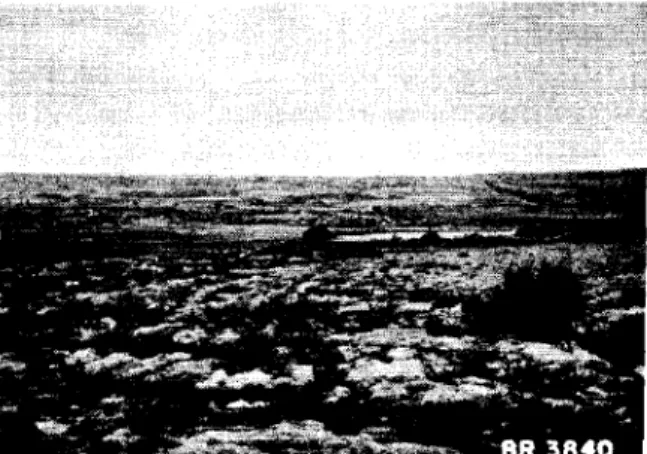
Fig. 23 View west to Hudson Bay on August 20,
1955
from the Precambrian Upland toward the settlement of Great Whale River, P.Q. situated on a sand plain at the mouth of the Great Whale River. No permafrost was encountered here.July
21, 1955.
Note the utilidors carrying the service lines on the surface of the bedrock.Fig.