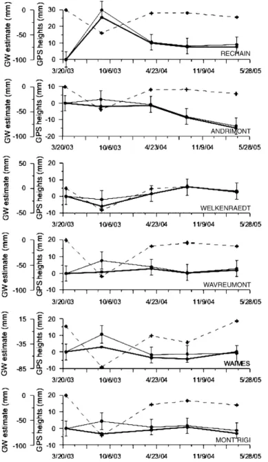
Seasonal height change influence in GPS and gravimetric campaign data
Texte intégral
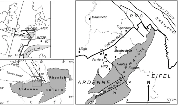
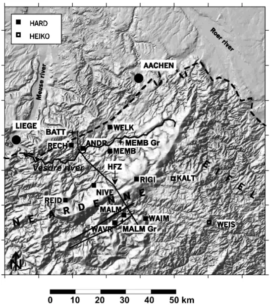
Figure


Documents relatifs
We use (i) on one hand the IERS (International Earth Rotation and refrence systems Service) C04 series (obtained combining mainly VLBI and GPS measure- ments), and (ii) on the
As a means of linking the in situ data measured on gondola G3 with ozone profiles retrieved from remote measurements made at the ground, an average profile
The 8th International Comparison of Absolute Gravimeters (ICAG-2009) and the associated Relative Gravity Campaign (RGC2009) took place at the Bureau International
L’analyse des résultats de cette étude menée sur le comportement au jeune âge de liants binaires et ternaires, a mis en évidence que la substitution du ciment par du
When exposed to the hydrodynamic pressure field generated by surface water waves, the voltage output from the 7.8 mm thick CBPDMS foam sensor array was found to
3: (a) Cubic samples in the compacted cylinder, showing the orientation of the shiv ; (b)simple compression parallel with the compaction process ; (c).. simple compression
Imagine it in your mind, picture the Santa Catarina River full of life, a linear park in the middle of the city, a strip of land full of incredible urban and recreation spaces:
Dans chaque dossier médical, pour des salariés exposés à un agent cancérogène, mutagène, toxique pour la reproduction sont précisés la nature du travail effectué, la durée
