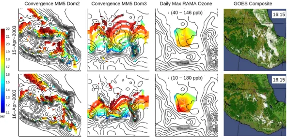
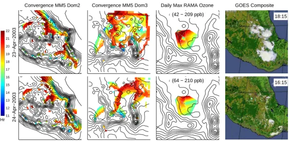
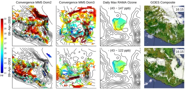
Distinct wind convergence patterns due to thermal and momentum forcing of the low level jet into the Mexico City basin
37
0
0
Texte intégral
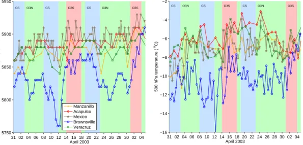
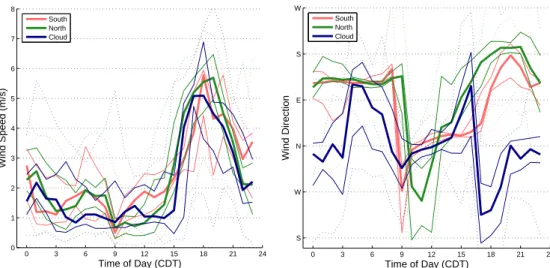
Figure


+7


Documents relatifs
