1
DESIGN PROJECTIONS FOR A COMMUTER FERRY TERMINAL AND COMMERCIAL PIER IN PORTLAND, MAINE'S HISTORIC URBAN WATERFRONT
by
Eric Paul Schmidt
Bachelor, Landscape Architecture University of Oregon, 1974
Submitted in partial fulfillment of the requirements for the Degree of MASTER OF ARCHITECTURE at the MASSACHUSETTS
0
INSTITUTE OF TECHNOLOGY June 1981Eric Paul Schmidt February 23, 1981
The author hereby grants to M.I.T. permission to reproduce and to distribute publicly copies of this thesis document in whole or in part.
Signature of Author ... .- .. . ... ...
Eric Paul Schmidt Department of Architecture
Certified by,
p p .. .No...
SHUN KANDA,, Professor of Architecture
~f) Accepted by .,
Thesis Supervisor
... a. .- ...
SANDRA HOWELL, Chairperson
Departmental Committee for Graduate Students
MASSA SETTITUTE
MAY 2 8 1981
LBARIES
I
MITLb ries
Document Services Room 14-0551 77 Massachusetts Avenue Cambridge, MA 02139 Ph: 617.253.2800 Email: docs@mit.edu http://Iibraries.mit.edu/docsDISCLAIMER OF QUALITY
Due to the condition of the original material, there are unavoidable
flaws in this reproduction. We have made every effort possible to provide you with the best copy available. If you are dissatisfied with this product and find it unusable, please contact Document Services as
soon as possible.
Thank you.
The images contained in this document are of
the best quality available.
~~N. t~
2
~ :~A
-y I -4p ,4 A/1 ~~2
1, ~ - r-~ .L* --s~
.- ... s41, - 7 rr ri1
IIV o --44j 1T I -t I r -i 1r ~%;~4 -# -~ ,--4 - --I U 4 ~d
~~t~LFDesign Projection For a Public Place
Ferry Terminal Building and Commercial Pier
Abstract
3
DESIGN PROJECTIONS FOR A COMMUTER FERRY TERMINAL AND COMMERCIAL PIER
IN PORTLAND, MAINE'S HISTORIC URBAN WATERFRONT
by
Eric Paul Schmidt
Submitted quirements
to the Departm for the Degree
The work is based on a design project: to connect the grid urban form, and its
asso-ciated buildings, and their uses, to the larger Maine (natural) landscape, and its forms. These two contextual categories will strongly influence the evolution of
the pier site design and ferry terminal design.
ent of Architecture on Feb 23, 1981, in partial of Master of Architecture.
* The thesis presents my attitude toward the assemblage of buildings and landscape forms. The assemblage process is the subject of this thesis; its evolution re-sponds to the conditions and needs within the existing context, and is stated in the programmed requirements. The object of this thesis will be the collection of
de-sign process drawings.
fulfillment of the
re-* The focus of the thesis is a design explo-ration for the development of a ferry ter-minal, a "town room" at the water's edge that is simultaneously functioning as a transportation facility, and an aggrega-tion of varied mixed uses for the public and private sectors. It responds and fits into the existing surrounding context.
* This work investigates a possible design projection for a commuter ferry terminal and adjacent mixed-use commercial areas on a pier "finger" extension from the histor-ic waterfront area in Portland, Maine.
Thesis Supervisor... Shun Kanda
Title .... ... Professor of Architecture
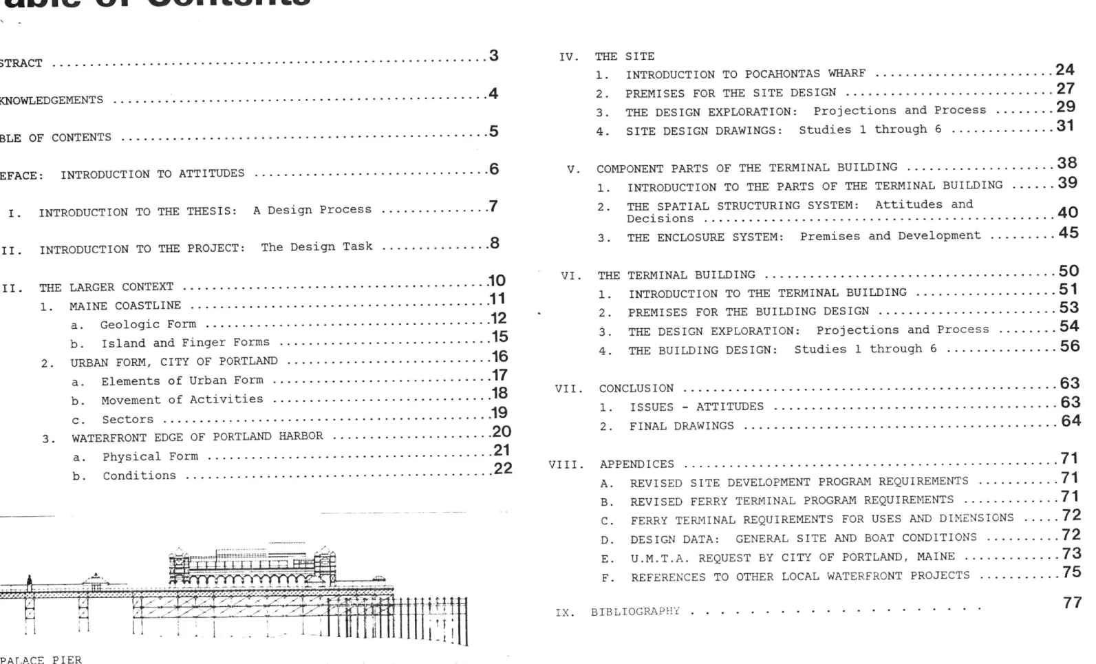
... ... 110101,0''TOTO c El T I 0 ru "i x AX y XXXXXX L l ... ... ... PALACE PIER
I.
Acknowledgements
This thesis is the result of eight months of sporadic drawing, and design explorations. At this point I would like to acknowledge those people who proved influential and supportive during this period of aca-demic work at M.I.T.; in particular, those faculty and students whom I actively engaged as well as benignly neglected during this time:
Shun Kanda advisor, friend, Professor of Architecture, for his continued support and guidance in the development of this thesis; also for his support and assistance in my teaching endeav-or at M.I.T.
Barry Zevin friend, advisor, Professor of Architecture, for his continued assistance and critical eye in the development of this thesis; and also for his support and assistance in my teaching endeavor at M.I.T. Maurice Smith Jan Wampler Chester Sprague Warclaw Zalewski Imre Halasz Richard Tremaglio Leon Groisser John Habraken
Professors of Architecture and friends, for their inspiration and prodding in and out of design studio.
Professors of Architecture, friends, for gui-dance and clarifying those questions blocking my progress.
for trusting my untested teaching abilities and hiring me to teach the graduate design information workshop, academic year 1980-1981.
Denise G. Mary M. Joann S. David B. John S. Phil B. Caroline L. Linda M. Laura W. Bobby R., Bill G., Denise G., Marla G., Steven C., Susie B., Donald M., Lyle M.,
Pat M., Mike M., Mary L., Katri K., Phoebe W., L.B., B.J., Beek, Mike L.; Doug B
Angela Danadjieva Tom Koenig Lawrence Halprin Grant Jones Jerry Diethelm Ronald Lovinger Carl Schmidt
friends, fellow architecture students; for taking me seriously in the graduate design information workshop, forcing me to explain the M.I.T. jargon and design philosophy, working intensely throughout the course and not bitching at the assignments or lectures.
friends, who dragged me away from my archi-tecture studies to live a little.
friends and fellow professionals, whose in-sight, guidance and support got me started and gave me a chance to test my design abili-ties in the real world.
grandfather, who at the age of 86 is still practicing architecture, who was my earliest reference to drawing and architecture and whose continual support, wisdom and kindness will always be with me.
Table of Contents
ABSTRACT...
ACKNOWLEDGEMENTS...
TABLE OF CONTENTS ...
PREFACE: INTRODUCTION TO ATTITUDES
I. INTRODUCTION TO THE THESIS: A Design Process...
II. INTRODUCTION TO THE PROJECT: The Design Task...
III. THE LARGER CONTEXT ... 1. MAINE COASTLINE ... a. Geologic Form... b. Island and Finger Forms
2. URBAN FORM, CITY OF PORTLAND
a. Elements of Urban Form b. Movement of Activities
c. Sectors... 3. WATERFRONT EDGE OF PORTLAND HARBOR
a. Physical Form... b. Conditions...
.3
.4
.5
.6
.7
.8
.10
.11
.12
.15
.16
.17
.18
.19
.20
.21
.22
IV. THE SITE
1. INTRODUCTION TO POCAHONTAS WHARF ...
2. 3.
4.
PREMISES FOR THE SITE DESIGN... THE DESIGN EXPLORATION: Projections and Process SITE DESIGN DRAWINGS: Studies 1 through 6 ...
V. COMPONENT PARTS OF THE TERMINAL BUILDING...
1. INTRODUCTION TO THE PARTS OF THE TERMINAL BUILDING
2. THE SPATIAL STRUCTURING SYSTEM: Attitudes and Decisions ... 3. THE ENCLOSURE SYSTEM: Premises and Development ..
VI. THE 1. 2. 3. 4. TERMINAL BUILDING ... INTRODUCTION TO THE TERMINAL BUILDING... PREMISES FOR THE BUILDING DESIGN... THE DESIGN EXPLORATION: Projections and Process THE BUILDING DESIGN: Studies 1 through 6...
VII. CONCLUSION... 1. ISSUES - ATTITUDES...
2. FINAL DRAWINGS- - - --...
VIII. APPENDICES...
A. REVISED SITE DEVELOPMENT PROGRAM REQUIREMENTS
B. C. D. E . F. PALACE+I
tE
PALACE PIERREVISED FERRY TERMINAL PROGRAM REQUIREMENTS... FERRY TERMINAL REQUIREMENTS FOR USES AND DIMENSIONS DESIGN DATA: GENERAL SITE AND BOAT CONDITIONS .... U.M.T.A. REQUEST BY CITY OF PORTLAND, MAINE...
REFERENCES TO OTHER LOCAL WATERFRONT PROJECTS...
IX. BIBLIOGRAPHY . . . . . . . . . . . . . . --.-.-....
5
24
27
29
31
..
38 ..39
40
45
50
51
53
54
56
63
63
64
71
71
71
72
72
73
75
77
.. . .Preface
Introduction to Attitudes
I have certain images and emotions associated with the daily com-muting I had to make between the islands of the Puget Sound and Seattle. These mental references helped to initiate the design exploration of a new ferry terminal for the city of Portland, Maine.
The ferry terminal in Seattle is located at the periphery of the urban core. It serves an important function as a terminus for travel on water as well as a gateway to the city. As a transition zone it must orient travellers who, within the distance of a quarter mile have made a complete change in their physical environment. Tall forests of Douglas Firs and stretches of water are replaced by high-rise buildings and lengthy streets. Re-orienation to a new organizational structure re-quires that both the new fabric and the context left behind be present within the building and site forms. The terminal must incorporate in its organizational territory elements of the urban framework and forms of the natural landscape.
This thesis explores the possible three-dimensional forms and or-ganizations of a transitional territory/landscape. The intention is to
define a built structure "framework" for the new ferry terminal facility which will locate "zones" of public and private activities. Further physical articulation of the "zones" is achieved according to their specific use-form.
The thesis is divided into four sections. The first contains a brief study and evaluation of the larger physical context and its impact on the organization of the building and site. The second section ex-plores the location of various use-forms on the site. The components of the building form are considered in the third section and in the final
the section the overall building organization and forms are developed. The thesis is a visual record of the evolution of certain attitudes I have towards the generation of three-dimensional forms. The emphasis is on the process of translating my images, attitudes and principles of design into a physical form solution.
Introduction to
the Thesis
A Design Process
This thesis project is a design projec-tion based on a program originating from an Urban Mass Transit Authority (U.M.T.A.) grant request by Portland Planning Department for the study and construction of a new commuter ferry terminal (see Appendix E for program requirements). In addition to the Planning Department's projections for the original terminal and site program, I enlarged the requirements to include additional functions I feel are supportive of a more complete and appropriate design solution. These require-ments call for new commercial, retail and office space, expansion of the existing mari-na and aquarium facilities, and a new urban park at the water's edge. I envision the new mixed-use and transit facility as one of the major nodes of public activity for the city. It will draw tourists from the histor-ic distrhistor-ict shopping area, offhistor-ice and water-front workers, yacht and power boat users, as well as the daily commuters, to a common place which will offer them a wide variety of public and private activities (see Appen-dix A for the additional program functions).
I used a real project program as a starting point from which I could explore certain issues and attitudes I have towards the assemblage of three-dimensional forms for a public building and its site.
7
These three-dimensional forms are devel-oped through the combination of three areas of design exploration. These are: (1) the development of the site forms; (2) the major parts of the terminal building (the enclosure and spatial structuring system); and (3) the overall physical form and organization of the building.
It is my intention to focus on the sim-ultaneous exploration in these three areas and to test certain design principles associ-ated with them. Through the integration of these principles associated with the three areas of exploration, I hope to achieve a greater continuity and extension of the
building-to-landscape relationship and vice versa. At the same time, certain principles which are applicable to individual parts of the building form or landscape form were explored, developed and utilized, so that within the continuum of building-landscape can be found distinct object pieces that re-late to specific forms and uses.
1. The development of site forms in-cludes the groundwork from which the larger building form evolved. During this process, three contextual physical references were considered and analyzed, and the information incorporated into the development of land-scape as well as building forms. These ref-erences were: (a) the larger natural land-scape of the marine coast; (b) the urban structure of the city of Portland; and (c) the waterfront edge of Portland Harbor.
2. The form framework and the building
envelope became the testing areas for many smaller design decisions. The form framework or spatial structuring of the building is the point from which the evolution of use terri-tories began and the distinction between pub-lic and private zones was established. Cir-culation networks were also explored and developed. The study of the building envel-ope included the investigation of vertical surface and uses along this edge, as well as roof forms and the volumes or massing of the total building form. These edge conditions were of primary importance. The represented location where the building envelope could expand with new use territories or reduce in size its uses and volume, as needed. This "margin" of growth or reduction relates di-rectly to the seasonal fluctuation in the number of people using the terminal and ac-commodates the increase in the tourist
popu-lation during the summer months.
3. The overall physical form and or-ganization of the building developed from the synthesis of the previous two areas, and is the result of the process of simultaneous exploration of principles that were mentioned earlier. In the early stages of exploration, the principles associated with the site pre-dominated and had a greater influence in
determining the basic form of the building. In the later stages of exploration, the two study pieces of the terminal building became more important in affecting the physical form and the location of internal functions.
Introduction to
the Project
The Design Task
The basic design task is outlined in the U.M.T.A. grant written by the City Planning Department of Portland, Maine. It requests federal funds to assist in the planning and construction of a new "Intermodel
Tranporta-TAX ASSESSOR MAP OF SITE AREA
Z-'*
K-8
tion Facility" (see Appendix E). In the text several functional requirements for the ter-minal are listed, such as square footage and use requirements for the building and boat moorage areas.
A brief introduction of the existing terminal site which generated this grant re-quest is as follows: the needs of the ferry terminal and its users are expanding beyond the available existing wharf space. In
addi-Site map -01 ____
I
- . .-. .-. ... ... . 6. ....
....
.
.
.
.
.
..
.
.
.T.
%
..
.
.
. . . . ... . . . . . . .. ....... N 0 1 noA ... .... . ....... . . .. . .. . .. ... . .. . . . . . ... .. ... .. .. .. ... . . .... . . . . .. . . . .. . . . . . . . .. . . . . . . . . . . . . . . . **1 -rtion, the poor physical condition of the existing piers and decking along the edges, and the dilapidated terminal, forced the planning department to recommend relocation
and new construction. The new site, named Commercial Wharf, lay adjacent to the exist-ing site. In its present condition, the landfill is used as an auto parking area. A small bank occupies a corner of the under-utilized site. This is especially true since
r -
-L I Llv -~<~ I
T-%.
-~411
TT. t7
its location is more central to the downtown business district and is situated at the end of the major pedestrian street extending from the redeveloped historic core of the old downtown. The City Planning Department's major concern for this project is the devel-opment and expansion of a comprehensive pub-lic transportation facility geared primarily to the water ferryboat system. Its secondary goal is to assist and integrate, where plaus-ible, with the adjacent landowner in order to create a complementary joint development.
It is this joint development idea that became the central theme for my thesis design task. The design task evolved into a mixed-use development, incorporating the original transportation requirements requested by the city with an alternative mixed-use develop-ment. The commuter terminal remained the single most important piece of the program, while the private mixed-use remained secon-dary but more interconnected with the termi-nal facility. The new mixed-use development includes major new offices, commercial retail space, as well as expansion and new facili-ties for the existing aquarium, existing marina and a new urban waterfront park (see Appendix A for thesis program).
The specific features I envisioned for the development of the site were the
follow-ing:
1. to create an opening in the commercial urban wharf edge and create on the waterfront an urban park as a terminus to the major pedestrian street extending
9
from the historic redevelopment area; 2. to re-connect the "actively populated" part of downtown with the waterfront without developing a shuttle bus or a park dependent on autos;
3. to construct a medium-size hotel of be-tween 250 and 300 rooms adjacent to the terminal site between Commercial Street and the old armory building, and to renovate the old armory as exhibition space for the hotel and city;
4. to create a mixed-use complex which in-creases the diversity of uses as well as duration of time on a yearly and daily basis in which people will occupy the
site without adverse conflict with the transportation facility;
5. to increase the commercial and retail activities which cater to the needs of the daily island commuter;
6. to develop more extensive marina facili-ties by including more boat moorage space, a yacht club, custom docks, res-taurant at the end of the pier, and maintenance docks,
7. to create a new terminal facility which is more than one large waiting room with a snack bar and storage area; instead, to create the new terminal as an inte-gral part of the larger commercial de-velopment.
p" l ca1OtioI1 iin ed of reua
LEGE- v
-VIA
'K
The Larger
Context
As a preface to the central thesis topic an exploration and analysis of the urban form and regional landscape were compiled. The purpose of this preliminary study was to provide a reference of the larger context, its overall form and organization, as well as to collect information from the larger con-text such as land use, traffic patterns, building uses and density, which pertained to the site development. The study was broken up into three areas: (1) the physical structure and form of the Maine coastline;
(2) the urban fabric and land uses of the city of Portland, Maine; and (3) the water-front wharf edge, its physical condition, forms and various commercial uses.
Maine Coastline
The coastline's organizational structure can be easily observed on navigational charts or geologic contour maps. The glacially formed landscape of Maine consists of a series of drumlins (figure) which extend from the land (ground) into the Continental Shelf. The Maine coastline edge is a transitional zone in which the groundform changes from the land to sea. The patterns evident in this landscape are used in analogous form as
fundamental organizing principles for the ferry terminal site and building. The fol-lowing seven items are the dominant prin-ciples found in this natural landscape and
incorporated into the terminal design.
1. The landscape organization of drum-lins follows a rigid pattern across the Maine landscape and into the ocean. These long and narrow glacial hills all share a common direction of ±150/180 in their long axis. The repetition of these forms creates a directional field; an easily legible land-scape. This field serves as a physical link, creating a continuity of land and sea. The pattern of the drumlin fingers at the sea is reinforced and extended by the islands. These islands imply the continued directional
field and extend the spatial dimensions and territory of the fingers. In the development of the site two major directional fields were
established. -W 1- -- - - / -- /A .' -4k - ' -4-- - -- -- - -. m - --"--- -.- . - -I-- * --7 ~ - - - - --- - - --. -* - --A - - -- -- - --
--
~-
-
-.
-
- - - - --- - -- -- - -iZ ~ - - - -k - . - - - -. ~ -- -c,Maine Coastline
Geologic Form
2. The peninsula of land upon the city of Portland is located is a of the directional field of drumlins
rectilinear form of the urban grid r directly to the edge conditions of th insula. Therefore, the streets run parallel or perpendicular to the dire
field of the landscape. The wharf ed tend the urban grid in a manner sim: that in which the drumlin fingers ongoing landscape field.
buildings) landscape) rectional in either field ext jects (ma (the ur which follow parallel toI field reinforce a continu form, whereas objects perpendicular directional field are discontinuous a associate, stopping the ongoi
tion. These principles of disassociation were employed design exploration.
3. The island
ng field continui through
forms are surrou a territory surrounding them which is sition zone between the islands (figu the deeper ocean (ground). This tida is of distinct form, material, and ele Its overall boundary form is contro both the island (figure) and the
(ground); a distinct, identifiable ter It serves as an extension of the isl implies a connection and continuity t
islands in the field organization. as a transitional zone according to th
.. . . . -. ,... ' g6 6 C9 - 6 k.. ~ ~00 -A -- z-N 9... ) ... OVHD P 1$' portion, ~LE- esons . - 0 '9' 60' ' C' Pp ges
e
V- - - , - .; ,-T0 6_ 0 r9 0, .. ... .. to- tht-~ .~* ' Iv ... . . ... ... 0 . \ (9 vtion. l o c e a n.... .. . . .. .. . It ats ,6- '-9j ~ 2 -C-9bi * fh dvI~ , r-2 cl 'Lk NON4 O * *\ * G ~ '~ ? 62 1 1 00 of 2 ~ cc,2 * 3U' 1 10 '9 i es~ ?
i
10 2"1 e J o .2F iLW\\ 19 //oa, 2" 1 /106' 09 10'' 0' 9> -- -/ ,A) q0 "I (~~'~ ~WI \101 .00 10" ~\'2 '3 ~K2 y('~? 10 20 10 \ 410 ro b C 10P I -)) < 10 (W& 9 *~0 LI * D 6'Ct')
100 1 hA I 1)11 -1 ~9'9' * WI~ /
\\\/
~2% Alfluctuation, becoming either a part of the land or the sea. The new decking on the terminal site is analogous to this zone. It is a transition between building, existing landfill and/or water. It is an extension of both building and landfill and its edge is controlled by the water-related uses.
4. The physical forms of individual islands, as well as clusters of islands, define potential containment "U" forms where harbors could occur. These sheltered use
areas have a maximum protected and usable edge. Continuous "U" shapes or partially complete "U" shapes were employed at all scales of the site and building design to define containments for specific use areas. 5. In the directional field there can be found islands and finger peninsulas which extend past one another. These passing forms can be either in an actual physical overlap-ping of land masses or an implied overlap by an extending chain of islands. These two types of passings or overlapping reinforce the physical form and extend both the zone of influence and the direction of the physical territory of the drumlin. These two basic principles of overlapping of physical forms and of passing connections portray two types of continuities of physical form. These principles were applied to the building form and site form at all scales of exploration.
CASCO BAY Navigational Chart
/ / - %, ('20 5 16 51S 1 12~6 3 ,o.3,3 ~3 NICUPOLA ~ - (SCH.) '4 234h2r -. 69 46 n , eit{ 2 5 4 5'245 '5 es - CHed ROSS-24 2 oDoph a8 78 11 0NK4 Y* 5 74 82 626 V69 65' 97 85 82 92 103 9 94 92 102 84 38 02 /
-4 -- 341 4I4 ' §/29 1/da''/ /- . rCove
o341 o 54-4"4" 44o n.t S 43 24 441 2 3 H 23422 4 5
42/
8 4423 Jns)d318 4 1 3 20 4 o424S1 272 3 N"8 471s21 C E ~ g 4 w sen a 26--4 s s1 Chb Sde4 029s S2 497 -1sl n82s37 3..3 5 442 47 23918---46 44 Jenk"rssog 61 4 -.... ~1 55 4sc6 ,6 N51.-r w 3 rPt 5 45 223N 56 49200 2 31Rs 46 r/7as Ed2 2 382 3 S .2N 3 72-7 2~~~4 R2"6 /1-47Gh7 544 429s 46 sc E L (oCH .6TACK ov 3447co 5623 a3 45s 5 767 2S7425 20 2: 454 7 AstRn50 38 7Maine Coastline
Island and Peninsula Form
6. The finger form of land and the ocean inlets along the coastline portray a pattern of reciprocal physical forms between land and sea. The reciprocity is never a 1:1 ratio of solid to void as is the graphic yin/yang image. Instead, one form domi-nates by position or sheer physical size, and this dominant form tends to determine the location of the primary activities. Within the organization of the site and its water edge and the terminal building and its faci-lities, I employed a similar system of reci-procity in order to identify and integrate
certain associative use areas.
7. The drumlin is a three-dimensional form which is a continuous three-dimensional "figure" of the "ground." It depicts both a growth direction and movement direction. Even as the groundform varies from landscape to ocean (water) the drumlin form continues from one territory to the next, thus inte-grating the edge zone of the coastline. On the site, the three-dimensional building form is the continuity as it extends its form from one territory (the decking area) to another
(the landfill or water).
12-....8.. ... 9... ... . ~6. .30. c - ' ~ ,* 6' *.A ... : .. . .... .. ... .. .... 18 6-.... 12 6'... 1-10 ~Me Ae n, 244-4 Oil: . ... ......... . . . . . .. .. .. 2.. ... 36- g 1-1 6so 6' D 6 .! D
"12 E9'W i~
?~B A 'CASCO BAY Navigational Chart
Urban Form, City of
16
CITY MAP FOR CONTEXT
Portland(by
Portland Chamber of Commerce)The structure of the city of Portland is a typical American urban form. Its basic layout of street grids responds to the gen-erally rectangular peninsula upon which it
is located. The grids are shifted to respond -Ot
to the local variations in the topography. . 2
The blocks are also rectilinear forms, which
are further subdivided into rectangular par- 36
cels. The overall form, a discontinuous
field organization, is the antithesis of the *A C
larger landform. It is also a continual sub-division of pieces into smaller cellular
forms, which when added together define only *3- / a local territory. It creates an object- \
oriented field with each object being a totality in itself.
The design of the site incorporated the /
dimensional and grid form of the city only at 3
its edge along Commercial Street as a way toAt integrate site with city and complete the
existing street enclosure. The urban edge s
form alternates between built forms and the 77
landscape of the site, thus creating a
reci-procal transitional edge between city and 0
CMA UV
site. The object making associated with the urban blocks was incorporated in the mooring slip area as well as along the Commercial Street edge. These cellular pieces were located in the extended urban grid field.
There are three basic areas of the urban --- 1
environment that were observed as functional
^~----_~_--~-Urban Form
Elements of Urban Form
URBAN CONTEXT FOR SITE
(Prepared by Portland Planning Commission)
17
a) Building Density: Building Form
vs. Ground From and Ciculation;
b) Walls and Objects: Where
Several Buildings Established a
Vertical Wall or as an Object
alone;
c) Open Spaces, Large and Small
Streets, Plazas, Squares, Major
Pedestrian Streets, Alleys.
Urban Form
Movement Activities
a) Pedestrian
b) Vehicular
c) Parking
d) Service.
18
URBAN CONTEXT FOR SITE
(Prepared by Portland Planning Commission) 'N> L OF u
0
1
1:E1
10
EDa
JLEGEND
i,:
J L
A -. .I. .4 .- A £ -T..4T4 S (~ ~ M..A..4.0
-k
LI
.
7NUrban Form
Sectors
19
a) Uses
b) Core Areas
c) Focus
d) Water and Landscape.
URBAN CONTEXT FOR SITE
(Prepared by Portland Planning Commission)
Waterfront Edge of
Portland Habor
Existing and uses
pier warehouse building
Existing pedistrian ferryboats
Pier nal, cent
entry to existing auto ferry looking north toward the city pier to new site)
20
forms
I!
(adja-Waterfront Edge
Physical Form
21
The waterfront form of Portland is a typical nineteenth-century wharf/pier edge.
Its almost perpendicular direction to the major commercial street at the water's edge and creates an area where the maximum number of boat slips could occur within a minimum length of street. The wharves and piers ex-tend the streets and uses of the city. The
waterfront edge form is analogous to the landscape form of the Maine coast. The form of the wharf is reinforced through the ag-gregation of building masses. The buildings share the wharf's directional field and rein-force it through the vertical walls. Yet each building use is separate and is identi-fiable through the individual roof forms.
6E)~ 01~ F- -. = -2Y'9_~IFpj -I ~**.'~ I -Ii %II JI ii -~ <A ,* 2 r~O -~ ~ - -~ * ~ i.f+~ ~ *~ ;~; .~ -~g J!- -~ Ell C2 , c,~- ~1 C-~
22
Waterfront Edge
Conditions
EDGE CONTEXT FOR SITE
(Prepared by Portland Planning Commission)
The Site
23
Existing site looking south from sixthfloor of building across Commercial Street from site
Introduction to
Pocahontas Wharf
The site, known as Pocahontas Wharf and/ or Commercial Wharf, consists of a landfill area and pier edges, some of which have been partially destroyed by fire. The lot meas-ures 350 feet across the entrance along Commercial Street and has an allowable length of 1000 feet, from the street edge to the channel pierhead limit line established by the U.S. Coast Guard. Presently, the land-fill portion stretches out 500 feet from the street edge and an additional 200 feet of marina decking and moorage slips extend from the landfill, so that approximately 300 feet separate the end of the existing site from the pierhead limit line.
The site is located adjacent to the southern end of the recently renovated his-toric downtown district of the city of Portland. It occupies a central position along the rows of wharves and piers in the waterfront. Its longer axis lies 30* east of magnetic north/south axis.
The site is presently being used as a parking lot which serves the nearby water-front shops and the small marina located at the wharf's edge and a small two-story build-ing is presently occupybuild-ing the street edge of the site.
TRACINGS OF THE DESIGN PROCESS, 1" = 100' reduced to 1" = 200'
__4
C. Auto and pedestrian ferryboat uses gener-ating two distinct field directions; Sketch #1
Extending the pier with real groundform islands of rock and dirt connected by a decking system
N
fill
#11
'ISite for new hotel across Commercial Street from existing site
Existing pier and pedestrian loading area for ferryboats
S a a a S S -a a .0 a a S a S 0 0 0 a 0 0 0 0 0 0 a I .3
overlapping two major directional fields one over the other
I
Organization of uses on site all reinforc-ing the directional grid of the piers
26
VLZZ
a a 3c~ a'0 a a * 3 3 3 a a S 0 0 a 0 ) 3 3 3 3 3Exploration in directional changes for various transportation facilities
8
/
8Overall site dimensions and use divisions, i.e., the nine-square grid
Premises for the Site
Design
Developing the site design (ground form) was the primary task in the early stages of thesis work. The existing two-acre landfill site had to be extended as the new terminal program evolved and expanded. This
addition-al ground plane (virtuaddition-al ground) consists of decking and piers, which doubled the surface area available for development. As a result, the range of possible design solutions for the overall site increased.
During these early stages of develop-ment, several guidelines regarding form, use and spatial organization of the terminal building were hypothesized. These specific design decisions helped to reduce the poten-tial for confusion and conflict when consid-ering the numerous possible preliminary site forms and types of organization. These deci-sions also helped to integrate the site design process and the building design pro-cess early on. The guidelines developed for the terminal building specified:
1. that the terminal and its facilities serve as a gateway for travelers, tour-ists and commuters entering both the city and the islands along the Maine coast;
2. that the building have a distinct use among the other piers found on the waterfront and have its own identifiable three-dimensional physical form;
27
Private marina and public ferry facility share common side of pier; auto ferry closer to city street edge
<-Private marina and public ferry facility share common side of pier; auto ferry is further out on finger, pedestrian ferry closer to city street edge
3. that the building accommodate both ped-estrian traffic and vehicular traffic, with minimal conflict;
4. that the building and site create a new terminus for the recently redeveloped historic district of downtown Portland by opening up the water's edge to the public and creating a large, open area at the sea;
5. that the actual terminal be integrated with various commercial retail and office spaces in order to provide an in-crease in the types of activities avail-able;
6. that the additional functions and square footage for space create a transporta-tion facility in which the circulatransporta-tion becomes more than a network of corridors and lobbies;
7. that the main terminal space be designed to function as "town meeting room" and a
central lobby waiting room;
8. that the building form consist of an ag-gregation of smaller forms, similar to New England farm complexes as well as wharf fishing and shipping developments, also acknowledging the formation of the Maine coastal landscape;
9. that the building be a three-dimensional extension of the new pier decking from the existing fill.
28
Private marina and public ferry facility have separate sides of pier; auto ferry
closer to city street edge
Building mass as central spine separating auto use and pedestrian use of site
The Design
Exploration
Projections and Process
The final site design emerged after sev-eral phases of exploration involving specific building pieces, as well as the overall organization. The new enlarged program re-mained constant; the numerous use areas and their associative sizes did not change, even as various site forms and organizations were tested. Various uses were grouped together as aggregations of physical form associa-tions. Once established, they also remained constant. This chapter defines the dominant principles which influenced the evolution of the site design and illustrates the relation-ship between these principles and specific physical forms and organizations. These principles are the major physical form tasks and are not the complete range of issues from which I worked. Several of the site forms developed from references to other projects which are listed in the Appendix. The prin-ciples which guided my design explorations were:
1. to organize the site according to the strong axes of the waterfront edge and the urban grid form of the city (fig-ure);
2. to support and extend the existing north/ south axis of the urban grid and waterfront edge that is reinforced by
29
the landfill through the use of the new decking (figure);
3. to create a second major direction, 30* off the north/south axis, for the new terminal building, in order to intensify the differences of its form and use from those of structures on adjacent piers
and wharves (figure);
4. to offset the two major axes of the site (north/south and 30* off north/south) with two minor axes perpendicular to the major field directions and which begin to set up a hierarchy of movement and
forms (figure);
5. to establish three distinct zones on the site: (i) the primarily public edge on the east side of the site, which is as-sociated with the terminal; (ii) the mostly private, west side with the mari-na yacht club; and (iii) the central park space, which serves as territory that can -be either public or private by defining and being defined by the edges of either the public and private zones ("slack"). The distinction of zones helps establish a hierarchy of uses and increases the legibility of a site that tends to be rather flat;
6. to establish types of physical form and use within the boundaries of the program which respond to the larger context of the urban form of Portland and the land-scape form of the Maine coast. Specifi-cally: (i) the territory along
Commer-cial Street will respond to the layout of forms and the functions of the city; (ii) the area consisting of new decking and piers will be associated with coast-al forms and the use of water vessels; and (iii) the central area will be the location of the terminal building which serves as a transitional form between the new decking and the existing
land-fill;
7. to articulate and intensify differences in physical structures and uses between: (i) the existing landfill and the new decking; (ii) the terminal building and the retail space (Commercial Street); (iii) the floating marinas and the fixed ground (landfill and decking); (iv) the decking (virtual ground) and the land-scape (fixed ground); (v) the relation-ship of the existing landfill to the urban landscape; and (vi) the relation-ship of the new decking to the terminal building and other facilities;
8. to interlock use areas on the site by utilizing reciprocal forms, so that ex-tensions of the water-related forms (e.g., the aquarium) reach into the ur-ban grid territory of the street edge; and pieces of the urban fabric (com-mercial, retail, office spaces) are found on the site and influence the ter-minal building itself;
9. to establish differences of three-dimen-sional physical form according to the
three distinct use zones on the site. The major public zone is primarily a vertical massing, while the major pri-vate zone is a horizontal built form which includes the decking and the mari-na moorage slips. These volumetric and planar differences also evolved from views across the site, shadows, and sun penetration. For each use activity, a horizontal, vertical massing and solar orientation of this mass were chosen to either maximize uses or minimize adverse impacts of use territory;
10. to reinforce the form of a harbor as a semi-enclosed protected territory in three distinct areas on the site; (i) the park space; (ii) the boat marina; and (iii) the ferry terminal dock. In each instance, the planar areas are de-fined by either an enclosure of continu-ous built form, or a series of larger three-dimensional built objects, or an intensification of the ground form edge
(for example, the new decking);
11. to establish (image and physical form references) between the overall site form of the project site, with the con-text of the Maine coast form, as a co-herent and formal territory of fingers of land, inlets and islands that follow the northeast/southwest directional field and extend it into the sea.
TRACINGS OF THE DESIGN PROCESS, 1" = 100' reduced to 1" = 200'
30
"Vt-I,
Auto and pedestrian ferryboat uses gener-ating two distinct field directions; Sketch #2 A 4-- _ -i k-I
31
Site Design
Drawings
9/18/80 9/26/80 10/1/80o Preliminary building masses; circulation networks for
pedes-trians and vehicles; and the basic territory zones of land-fill, decking and building.
o Two major pedestrian pathways connect from the hotel and
urban core area as well as from the aquarium and major entry plaza space on Commercial Street; to the ferry terminal.
o Vehicle circulation wraps around both the ferry terminal and
the office building on Commercial Street.
o Ferry dock area in harbor defined by building masses (ob-jects).
o Vehicle circulation changes to support both the dimensional
forms of the urban grid but also the directional field es-tablished by the landfill.
o Drop-off area further removed from terminal area. o Marina definitions begin to evolve.
O Terminal becomes direction with the pier fingers.
o Separation of auto ferry slip from other decking direction
occurs.
o Sketch, continued refinement of harbor edge and containment
form.
o Increase of decking at end of pier, creating a larger
vir-tual ground with the urban grid geometry.
o Terminal building changes directions to associate with the
angle direction of the ferryboat direction and aquarium.
o Vehicle circulation changes to reinforce the new terminal
direction.
10/7/80 0 First pass at the form framework or spatial structuring
system at the site scale.
* The terminal building area is the focus for the intersec-tion of all these bay systems.
* Each framework spine is asymmetrically loaded and partially open for passage through it.
SITE PLAN
10/17/80 0 Dimensional bay for the edge enclosure of various use
ter-ritories evolves. The overall edge condition develops.
o Physical overlapping of uses and groundform continues to
evolve.
o Circular containment forms evolve in three areas; the two
major entries to the site and the terminal building.
10/22/80 0 Prelminary final site plan.
o Major park space evolves in the central area connecting the
Commercial Street edge with the end of the landfill and to the water. Major "slack" space.
o Further edge refinement of the (virtual ground) decking
ter-ritory along the east and west sides.
o Greater dimensional separation between the auto and
passen-ger ferry slips. From 1:2 to 1:4 ratio.
o Commercial spine increases in its overall definition. o Further change at the end of the pier.
32
200
-4 -I .0 'N - --J-~ -~.SITE DESIGN DRAWINGS, 1" = 50'
reduced to 1" = 100'
09/18/80 - Circulation of auto responding in form to the two major directional fields (decking is clear; ground is dark)
40
--locil
v
j. to
L
,Ij/
/
SE 26 18SITE DESIGN DRAWINGS, 1" = 50'
reduced to 1" = 100'
09/26/80 - Basic agreement of site design with change in aquarium barge di-rection
-I
33
34
2 k -d~T
r ~4j'V
I.~,.
i
~-1~I,
10/01/80 - Major uses identified as "rocks"
defining the harbor area for the pedestrian ferry's floating cov-ered dock
SITE DESIGN DRAWINGS, 1" = 50'
reduced to 1" = 100'
I
'S
35
"a I~4 'S.. ?ft 'U 9. 'I ~9K;
It 044 A1 -2 l . A.SITE DESIGN DRAWINGS, 1" = 50'
reduced to 1" = 100'
10/07/80 - Exploration into the column grid and bay system of the two major direction fields
r,
/
-I
/
r
SITE DESIGN DRAWINGS, reduced to 1" = 100'
1" = 50' 10/17/80 - Exploration into the edge enclo-sure; overall form is outlined and defined, uses located on site
36
NN W ut- i -- I-~ 44.I4L A 1 li. " I -P . -r-M& -m 16r I ll 14OEr 7*0 L-N I ELLET, * -l-\4k No-Fig-fAt kAV&kFJ
jI 77 At,A7*
..-I AM/, F, lip .. "37
'c~ ~~'A4P~O ~'jyrae~'r~ ~qA~f~
qL aT
-AN
--
>
.\-i
1
-
j4
[
L
/
A..-SITE DESIGN DRAWINGS, reduced to 1" = 100'
1" = 50' 10/22/80 - Preliminary final site plan
-J v50 0u 6 Sao oCT 22 ,~AA).
4
Component Parts
of the Terminal
Building
38
Reference for overlapping of structure system and enclosure system
PALACE PIER
PALACE PIER Reference
system and
for enclosure system, structure building "margin"
mow
T.-t
4
Introduction to the
Parts of the Terminal
Building
The material in this section predomi-nantly serves as an avenue for exploring the smaller-scale components of the larger over-all building form. Along with defining spa-tially the overall building form, these two studies are also physical form explorations in themselves. The Spatial Structuring System is a study of the physical form pieces which combine to define a "form framework" or
"footprint" of the building. This physical form is the primary indicator by which the building user is able to understand the spa-tial organization of the building as well as to sense his location within it. The second area of study is the Envelope or Enclosure System of walls and roof planes which define the exterior surface of the building. At different locations this enclosure system is extendable. This zone or "margin" for growth
is a territory which can adapt to become either indoor or outdoor space, depending on the season. This study also includes as one if its parts an exploration of a partial building elevation or facade, which develops the visual image of the building.
These two studies are also explorations into the range of possible construction mate-rials and their connections. The studies in this section have equal importance and influ-ence, with the site form and context, in
de-39
termining the overall form of the building. In both these studies references to other buildings and landscape forms aided in the
design exploration.
This section does not include all the issues involved in designing these two spe-cific pieces. The two pieces are best seen in the supportive role they play in the
over-PALACE PIER
all design form of the terminal. Although these two studies are presented separately in the thesis, they are, in fact, physically in-terlocking elements and extend into each other's territories. It was for the purpose of explaining in detail these two generic types that they appear separately in the thesis text.
Reference for new decking and wind screen device
The Spatial
Structuring System
Attitudes and Decisions
The development of the spatial structur-ing system included a study of the general form framework as well as the non-structural but permanent, built enclosure elements such as walls, screens and partitions. It is at this point in the development of the overall form of the terminal building that the human' scale is introduced by way of specifically-proportioned structural elements and mate-rials. Introducing the human scale and de-termining the layout of the form framework both begin to clarify the size and shapes of
internal use territories; containment forms (walls, screens, etc.) will then determine the final dimensions of territories that either reinforce the framework system or set up a new directional field within it. The new directional field refers back to one of the three other directional fields on the
site (see page
In developing the spatial structuring system, I chose to emphasize one feature of it, the public path framework, which is the major determinant in the design of public transportation facilities. Overall, the form framework was not developed in as great de-tail as the public path framework; however, parts of it were elaborated locally, when pertaining to parts of the public path sys-tem. The premises considered in the
explora-40
tion and development of the spatial structur-ing system are:
1. to organize and develop an overall ca-dence for the terminal building, its use territories and paths of circulation, through a system of bays. The size and spacing of the bays usually denotes dif-ferent use areas within the building. In this way, the user is given clues tc help him understand his location on the site. This legibility of spatial organ-ization is especially important in a
6
-Ag'
~-r
Column system for pedestrian expressway,
revised section ii __ ~44L~4 /~"c~(4i~ ~AY £ A (4 A. V A r * 'AA~j
I
/I 2i> ~ 4. -I.0
t.11'
I
L .1!I
-l
I.building whose design is generated by circulation and whose function is faci-litating transportation. The bay system helps to visually and physically organ-ize a circulation network that includes seven major entrances, four different major and minor axes, and two large
col-lection areas;
2. to develop three post-and-beam form fam-ilies that are the components of the structural bay system and that define the three distinct areas in the build-ing: (i) the public pathways; (ii) the various public and private use terri-tories adjacent to the circulation paths; and (iii) the transitional areas in which there occurs a shift in the directional field or a change in use. The dimensions of the post-and-beam form
families relate both to the site condi-tions (a soil with poor load-bearing capacity) and to the human scale. The path system framework is based on an
elongated bay, twelve feet wide and twenty feet long, that reinforces the direction of pedestrian movement. The public and private use territories are organized on a nearly square bay, eight-een feet by fifteight-een feet. In the tran-sitional areas a "free column" system was employed, to reflect the variable nature of the form framework at this lo-cation and to facilitate the shift from one bay system to the other. The bay types are repeated and assembled in
order to create two types of use
terri-41
4t,,
Column tree systems and their footprints
~-+ Li
2
-'1.1 ...
tories. The smaller territories relate and refer to the human scale and uses associated with small numbers of people, for example, offices, ticket booths and locker facilities. The larger terri-tories refer to the dimensions of ferry boats themselves and to uses associated with large numbers of people: restau-rants, the lobby space and commercial facilities. From these two forms evolved several intermediate forms. Around each bay is found a "slack space" of either three feet or six feet to al-low for freedom in location of indivi-dual bays according to user needs.
3. to overlap and integrate the form frame-work with the building envelope. For example, at the several entries to the building, the public path framework ex-tends beyond the weather wall and along the enclosure wall. This visually and physically integrates the two systems and extends internal paths of circula-tion onto the decking, thus reestablish-ing the integration of building and site;
4. to extend and develop the use areas com-prised of non-directional (fifteen feet
by eighteen feet) bays beyond the
build-ing envelope in order to create the "margin" territory along the edge of the building. It is here that the internal space may expand according to seasonal changes. The "margin" territory also provides the possibility for future
growth of the terminal building.
A
iT
-r
T.
+-T
p
~t
ii4
r~i
_
Scheme two: concrete post and beam with concrete capital pieces
_ __--
VV
43
_
Li-
-~6
p
11+~P
6~wNt~
Family form for bay system trees; one-and story concrete columns one-and
two-story steel columns for upper floors -I- -1-- - 1--F__
ii
I I
vrf.-rT /~44
I I
60WAH '
NKY--K44tA10N
1rgo4Y0
iV X1
7-o'444
X16-//W
TModular
bay spacing; layout for both the4use territories 15' x 18' grid and the
The Enclosure
System
Premises and
Development
The enclosure system study is the ex-ploration of the edge territory of the build-ing. This extendable weather wall is res-ponsive to the local climatic conditions and internal uses. As a spatial zone, it occu-pies the territory between the internal use areas of the building, and the external deck-ing and landscape forms. At the same time,
it is a part of both territories.
The study of the building enclosure also includes an exploration of the overall mass-ing of the terminal buildmass-ing. The massmass-ing of a building is its most important visual fea-ture and offers clues to identify internal uses and their relationship to the overall spatial organization. This study also fol-lows the evolution of a partial elevation which, along with several other built refer-ences, assists in formulating a visual image for the terminal building that supports and expresses the overall form and organization. A study of the enclosure system is real-ly an exploration of a three-dimensional edge zone, and the range of possible conditions in this zone may, in itself, become the focus of a thesis project (see theses by David Cylkowski, 1976, and Zorrie Zimmerman, 1980). In this section, however, only major issues that guided the development of a
three-45
I
iAI
Column tree system for use territory and pedestrian promenade through building and
edge enclosure system
4
A
Early section cut through commercial spine
46
TAF4
TY
f4A
V
-l4WP
- _--4
j t(
47
TU[
F4WINrtm
1
OWY
f-
T
K
421
-I
-j
;~ ~4 1Jdimensional building edge are considered. These are:
1. to develop a building edge that responds to the variety of climatic conditions of the site. This ensures the creation of different physical forms for each eleva-tion (north, south, east, west) that re-flect the different exposure conditions. The variance will be manifested in the
amount of glazing and overhang of roofs as well as in the nature of materials and the use of sun-screening devices. The three climatic factors affecting the
48
elevation are: (i) the angle of the sun and the subsequent shadows thrown by projecting building masses; (ii) the direction and force of winds from the ocean into the mouth of the river har-bor; and (iii) the rain and snow which are propelled against the surfaces of the building. The development of
build-ing edges and the entire massbuild-ing is a major consideration in the design of a building exposed to such severe weather conditions;
2. to create, as part of the building edge,
a zone which is capable of responding to specific user needs which may vary from season to season. This "margin" has a depth of eight feet and its boundaries may be defined by either the form frame-work systems or pieces of the enclosure system. It allows for the expansion of the directional (twelve feet by twenty
feet) and non-directional (eighteen feet by fifteen feet) bay systems and sets up a new, temporary screening system, but differs from it by virtue of the nature
of the screening material(s) used;
ELEVATION STUDIES OF TERMINAL BUILDING AND COMMERCIAL SPINE (looking west), 1" = 16'
re-duced to 1" = 32'
qTv