Université de Montréal / University of Montreal
Blood, Fire and Fertility:
Human Remains and Ritual Practices at the Temple Pyramid Groups of Cantona, Puebla, Mexico
Par / By: Pascale D. Meehan
Département d’anthropologie / Department of Anthropology Faculté des arts et des sciences / Faculty of Arts and Sciences
Mémoire présenté à la Faculté des arts et des sciences en vue d’obtention du grade de Master en sciences (MSc) en anthropologie / Thesis presented to the Faculty of Arts and Sciences for the obtention of the grade of Master in Science (MSc) in anthropology
Mai 2010 / May 2010
Université de Montréal / Univeristy of Montreal Faculté des arts et des sciences / Faculty of Arts and Sciences
Ce mémoire intitulé / This thesis entitled
Blood, Fire and Fertility:
Human Remains and Ritual Practices at the Temple Pyramid Groups of Cantona, Puebla, Mexico
présenté par / presented by Pascale D. Meehan
à été évalué par un jury composé des personnes suivantes / was evaluated by a jury comprised of the following persons :
Claude Chapdelaine président-rapporteur / chair
Louise I. Paradis
directrice de recherche / research director Paul Tolstoy
Abstract
The prehispanic city of Cantona, located in the Valley of Oriental in the state of Puebla, Mexico, reached its first cultural apogee between 150 B.C. - 600/650 A.D. During this time, ceremonial complexes such as Temple Pyramid Groups and ballcourts were constructed. These served as the location for a number of rituals involving the beheading, dismemberment, defleshing, flaying, boiling, burning, and in some cases, the consumption of sacrifice victims. Other human body treatment included the burial of individuals in flexed seated positions. To better understand the ritual mortuary treatment of human bodies at Cantona, the finds are compared with data from three neighboring areas: the Valley of Mexico, Puebla-Tlaxcala, and the Gulf of Mexico. From this information, it can be deduced that most of discoveries at Cantona are the remains of rites dedicated to deity communication and fertility while those of individuals in flexed, seated positions belong to religious actors.
Keywords: Mesoamerica, Classic period, Cantona, temple pyramid, sacrifice, cannibalism, ritual, bloodletting
Résumé
La ville préhispanique de Cantona, située dans la vallée d’Oriental dans l’état de Puebla au Mexique, atteignit sa première apogée culturelle entre 150 av. J.C. et 600/650 A.D. Durant cette période, des complexes cérémoniaux comprenant des groupes de pyramides-temples et des terrains de jeu de balle furent construits. Ces installations servirent au déroulement de nombreux rites au cours desquels les victimes de sacrifices étaient décapitées, démembrées, décharnées, écorchées, bouillies, brûlées et, dans certains cas, consommées. D’autres traitements du corps humain comportent l’inhumation d’individus en position assise et repliés sur eux-mêmes. Pour mieux comprendre le traitement mortuaire rituel des corps humains à Cantona, les découvertes faites sur place sont comparées aux données datant de la même époque obtenues dans trois régions voisines : la vallée de Mexico, Puebla-Tlaxcala et le golfe du Mexique. A partir de ces renseignements, on peut en déduire que la majorité des découvertes faites à Cantona sont les restes des dépouilles et offrandes provenant de rites destinés à la communication avec les dieux et à l’obtention de la fertilité, tandis que les dépouilles des individus en position assise appartiennent à des prêtres ou à despersonnages religieux.
Mots clés : Mésoamérique, période classique, Cantona, pyramide-temple, sacrifice, cannibalisme, rite, rituel, saignée
Resumen
La ciudad prehispánica de Cantona, ubicada en el valle de Oriental dentro del estado de Puebla, Mexico, tuvo su primer apogeo cultural entre 150 a.ne. y 600/650 d.n.e. Durante ese periodo, se edificaron gran número de complejos ceremoniales tal como Grupos de Templo Pirámide y canchas de juego de pelota. Estas construcciones sirvieron como sitios rituales en donde se llevaron a cabo gran número de ritos, los cuales, en parte, consistían en decapitar, desmembrar, descarnar, desollar, hervir, quemar, y, en algunos casos, comer a las víctimas humanas de los sacrificios. En otros casos, los cuerpos humanos fueron encontrados en posición flexionada y sentada. Para entender mejor el tratamiento ritual de cuerpos humanos en Cantona, estos descubrimientos fueron comparados con información obtenida de tres regiones cercanas: el Valle de México, Puebla-Tlaxcala y la Costa del Golfo. Esto permitió deducir que la mayoría de los hallazgos en Cantona representan los restos de ritos dedicados a la comunicación con divinidades y a la fertilidad, mientras que los individuos encontrados en posición flexionada y sentada corresponden a sacerdotes o actores rituales difuntos.
Palabras clave: Mesoamérica, clásico, Cantona, templo pirámide, sacrificio, canibalismo, ritual
Contents
Introduction. . . 1
Research Design. . . 2
1. The Archaeological Site of Cantona: An Overview . . . 6
1.1 History of Archaeological Investigations at Cantona . . . 6
1.2 Site Location and Time Period . . . 7
1.3 Architectural Characteristics . . . .9
1.3.1 General Overview . . . 9
1.3.2 Construction Methods. . . .10
1.3.3 Streets and Roads. . . 11
1.3.4 Residential Complexes. . . 12
1.3.5 Civic and Religious Constructions. . . 13
1.3.6 Ballcourts . . . 15
1.4 Economic Activity: The Obsidian Trade . . . 15
1.5 Social Organization . . . .17
1.6 Cantona Summary . . . .18
2. Excavation and Discoveries at Cantona’s Temple Pyramid Groups. . . 19
2.1 Excavation . . . .19
2.2 Dating . . . 20
2.3 Temple Pyramid Group Finds. . . .. . . 22
2.3.1 The Central Plaza (Plaza of the Fertilization of the Earth). . . . 22
2.3.2 Cantona Ballcourt Complex 1 . . . .23
2.3.3 Cantona Ballcourt Complex 5 . . . 24
2.3.4 Cantona Ballcourt Complex 6 . . . 27
2.3.5 Cantona Ballcourt Complex 7 . . . 28
2.3.6 Cantona Ballcourt Complex 8 . . . 29
2.3.7 Cantona Ballcourt Complex 9 . . . 30
2.3.8 Architectural Unit 12. . . .30
2.3.9. Architectural Unit 71. . . .31
2.3.10 Architectural Unit 72. . . 34
2. 4 Review of Offerings and Finds at Cantona’s Temple Pyramid Groups .35 2.5 Cantona Iconography and its Association with Temple Pyramid Group Burials. . . .39
3. Culture, Ideology and Mesoamerica. . . 56
3.1 Concepts of Culture and Ideology. . . .56
3.2 Ideology, Ritual and State . . . 57
3.3 Cultural Contacts: Why Put Cantona in Context?. . . .61
4. The Valley of Mexico: Teotihuacán. . . .71
4.1 The Importance of Teotihuacán. . . 71
4.2 Iconography and Ideology. . . 73
4.3 Human Burials Associated with Monuments and Temple Pyramids. . . 80
4.4 Valley of Mexico Summary. . . 85
5. Puebla-Tlaxcala. . . .89
5.1 The Importance of the Puebla-Tlaxcala Area. . . .89
5.2 Iconography and Ideology. . . 91
5.2.1 Xochitécatl and the Late Preclassic Period. . . .91
5.2.2. Cholula. . . 92
5.2.3. The Late Classic Period: Cacaxtla. . . 96
5.3 Human Burials Associated with Monuments and Temple Pyramids. . . 98
5.4 Puebla-Tlaxcala Summary. . . 100
6. The Gulf Coast Region. . . 103
6.1 The Importance of the Gulf Coast. . . .103
6.2 Iconography and Ideology. . . .104
6.2.1 Late Preclassic/Classic Period Iconography with Text. . . 104
6.2.2 Ballgame Iconography and Sacrifice. . . 108
6.2.3 The Late Classic Period: El Tajín. . . .110
6.3 Human Burials Associated with Monuments and Temple Pyramids. . . 114
6.4 Gulf Coast Summary. . . 116
7. Interpreting Human Remains and Ritual Body Treatment in Cantona within the Mesoamerican Context. . . .118
7.1 Individuals in Flexed, Seated Positions. . . 120
7.2 Human Skulls. . . 123
7.3 Dismemberment and Defleshing. . . .126
7.4 Flaying. . . .129
7.5 Boiling and Burning. . . 131
7.5.1. Cannibalism . . . 133
7.6 Human Heart Extraction. . . .135
7.7 Summary of Human Remains and Ritual Practice. . . 135
8. Towards a Holistic Understanding of Cantona’s Temple Pyramid Groups.137 8.1 Bloodletting, Sacrifice and Fertility. . . 138
8.2 The Temple Pyramid Group. . . 142
8.3 Final Thoughts and Future Investigation. . . .144
Figures
Figure 1. Map of central Mesoamerica showing important Classic period sites. . . 7
Figure 2. Map of Cantona. . . .9
Figure 3. Asymmetry in Cantona’s construction in temple pyramid. . . 9
Figure 4. Differential use of colored stone at Cantona. . . .10
Figure 5. Paved Road in Cantona’s Southern Zone. . . 11
Figure 6. Plan of Elite Residence (Housing Unit 12). . . 13
Figure 7. Plan of Cantona Ballcourt Complex 6 . . . 14
Figure 8. Phallus sculptures found at base of Central Plaza Pyramid stairs. . . .23
Figure 9. Excavated area of CBC5 summit with burials and stone cistas indicated. . . . 25
Figure 10. Cantona Ballcourt Complex 7. . . 28
Figure 11. Excavated area of U71-1 summit . . . .32
Figure 12. Greenstone duck pendant from U71-1. . . 33
Figure 13. Burial with dismemberment and partial exposure to fire, U71-1. . . 35
Figure 14. Worn and broken mano and metate from U71-1. . . .38
Figure 15. Flexed burial with ceramic pot offering. U71-1, Burial 17. . . .39
Figure 16. View of Cerro de las Águilas from Cantona Ballcourt Complex 5. . . .40
Figure 17. Rock painting of maize plants from Cerro de las Águilas. . . .41
Figure 18. Pecked Cross Symbols from Uaxactun and Teotihuacán. . . 69
Figure 19. View of the Pyramid of the Sun and the Avenue of the Dead, Teotihuacán. .71 Figure 20. Tepantitla Mural Bottom Panel, Teotihuacán. . . 74
Figure 21. Tepantitla Mural, Top Panel, Teotihuacán. . . .75
Figure 22. Detail of Feathered Serpent Pyramid Facade, Teotihuacán . . . 77
Figure 23. Detail of Mural from Agriculture Temple, Teotihuacán . . . .78
Figure 24. Position of bodies at the summit of the Feathered Serpent Pyramid. . . .83
Figure 25. The Great Pyramid of Cholula with Popocatepetl Volcano. . . .. . . 92
Figure 26. Drinkers Mural, Cholula (detail) showing ritual drinker with attendant. . . 94
Figure 27. Individual with conch shell, Building A, Cacaxtla. . . .96
Figure 28. Detail of Battle Mural, Cacaxtla. . . .97
Figure 29. The Tuxtla Statuette . . . .. . . .105
Figure 30. La Mojarra Stela 1. . . .106
Figure 31. Veracruz palma showing dismembered body. . . .109
Figure 32. Sacrifice scene. northeast panel of the Southern Ballcourt, El Tajín. . . 111
Figure 33. Penis perforation scene, southeast panel of the Southern Ballcourt, el Tajín. 112 Figure 34. 13 Rabbit overseeing sacrifice, Building of the Columns, El Tajín . . . .114
Figure 35. Artist’s rendition of Cerro de las Mesas Burial. . . .115
Figure 36. Mortuary bundle with offerings, Magliabechiano Group. . . .121
Figure 38. Image of Titli feast, Magliabechiano Group. . . .126
Figure 39. Dismemberment scene using hafted blades, Florentine Codex. . . 128
Figure 40. Xipe Totec Ritual. . . .129
Figure 41. Ritual cannibalism in front of Temple of Mictlantecuhtli. . . .133
Tables
Table I. Ceramic Sequence at Cantona. . . .21
Table II. Summary of Finds from Temple Pyramids at Cantona. . . 43
II.a. Summary of Pyramid finds associated with the Central Plaza. . . .43
II.b. Summary of Temple Pyramid finds at Cantona Ballcourt Complex 1. . . .43
II.c. Summary of Temple Pyramid finds at Cantona Ballcourt Complex 5. . . .44
II.d. Summary of Temple Pyramid finds at Cantona Ballcourt Complex 6. . . .48
II.e. Summary of Temple Pyramid finds at Cantona Ballcourt Complex 7. . . .48
II.f. Summary of Temple Pyramid Finds at Cantona Ballcourt Complex 8. . . 49
II.g. Summary of Temple Pyramid Finds at Cantona Ballcourt Complex 9. . . 49
II.h. Summary of Temple Pyramid Finds for Architectural Unit 12. . . 50
II.i. Summary of Temple Pyramid Finds for Architectural Unit 71. . . 50
II.j. Summary of Temple Pyramid Finds for Architectural Unit 72. . . 55
Table III. Differential Human Body Treatment in Cantona and the Three Comparison Zones. .118 Table IV. Traits in Common between Regions: Human Remains Only. . . .119
Abbreviations, Definitions, and Symbols % percent
ºC degrees centigrade
alfarda A low inclined ramp found on either side of pyramid steps. altepetl A fertile hill that contains water or through which water flows.
C14 carbon-14
cajete A deep earthenware pot or bowl.
cantera A soft white stone resembling limestone.
cista A grave or container consisting of four lateral walls built of stone, sometimes
closed with a stone cap. cm centimeters
cuauhxicalli A stone container used as a receptacle for human hearts obtained during
human sacrifice. ha hectares
INAH Instituto Nacional de Antropología e Historia km kilometres
m meters
mm millimetres
malpaís A Pleistocene-era lava flow of andesite and basalt over which only a shallow
layer of topsoil has accumulated.
mano A hand-held stone used to crush and grind food. Usually paired with a metate. metate A flat stone slab paired with a mano and used as a grinding implement.
molcajete A mortar-like grinding implement.
tablero A flat panel that, with a talud, forms part of a common architectural feature of
prehispanic pyramid faces. Is often decorated with engravings or painted.
talud A flat slanted surface, usually referring an inclined wall. With a tablero, forms
part of a common architectural feature of prehispanic pyramid faces.
tecajete A stone mortar-like grinding tool. tejolote A hand-held pestle-like grinding tool.
tranchet A triangular or rectangular obsidian blade whose cutting edge is not retouched but whose other sides are shaped by pressure flaking.
To my parents for their unwavering encouragement and support.
I would like to take this opportunity to thank first and foremost my research director Louise I. Paradis for her continued guidance and faith in my abilities. I am additionally indebted to Ángel García Cook and Yadira Martínez Calleja who allowed me to join their
team, participate in their excavations, and who shared their invaluable insight on Mesoamerica and Cantona. To these three individuals, my deepest appreciation. I would also like to extend my gratitude to the entire August to December 2009 Cantona
excavation team, especially to Don Gustavo, Don Roberto and Oscar for their good humor and attention to detail, and to everyone else who made me feel at home.
The first millennium A.D. ushered in a period of population growth and cultural development previously unseen in Mesoamerica. In the Valley of Mexico, the powerful city of Teotihuacán grew to cover 20 km² reaching a population of as many as 125,000 people at its peak (Ortiz, Rodríguez, and Morales 2010:169). Along the Gulf Coast, trade networks inland and over water moved imports and exports throughout the region while in cities such as El Tajín spiritual leaders participated in a ritual ballgame in which deities and humans interacted to maintain the cosmic order. In the southwest, the Zapotec inhabitants of Monte Albán built a high city surrounded by mountains, while in the lush southern Maya region, city-states of gleaming white stone and red plaster engaged each other in ritual warfare. It is within this dynamic environment that the city of Cantona, located in the Oriental basin in the modern state of Puebla, grew to its first period of cultural expansion, transforming itself from a small local center into a highly urbanized city complete with temple pyramids, plazas, and ballcourts, all surrounded by a network of elite and commoner residences.
Recent excavations at Cantona’s Temple Pyramid Groups shed light onto the religious practices carried out by the city’s ruling class and serve to better understand the dominant worldview held by Cantona’s inhabitants. The temple pyramid finds at the site consist largely of human bone remains. Burials most often include individuals seated in flexed positions or irregular concentrations of bones and fragments, most of which present cut marks, traces of dismemberment, and evidence of having been exposed to fire. The abundance of human remains associated with Temple Pyramid Groups is countered, however, by the almost total lack of visual and textual references to events that can be linked to, or help explain, these discoveries. In fact, there are very little iconographical elements in Cantona in general. In the absence of contemporary representations related to these burials, how then can the finds at Cantona’s Temple Pyramid Groups begin to be understood?
Research Design
The analysis of the Temple Pyramid Group finds must draw from data obtained beyond the site’s borders, by comparing excavation results from Cantona with temple pyramid finds and associated practices in neighboring regions for which more information is available. The regions chosen for this study are the Central Mexican Plateau, exemplified by the city of Teotihuacán, the Puebla-Tlaxcala block and the Gulf Coast area. These regions shared exchange corridors with Cantona and in some cases were direct trading partners with the city. These trade throughways allowed not only for the commerce of portable goods but also for the exchange of ideas, beliefs and practices. For each of the three areas mentioned, the dominant iconography and ideology will be examined in conjunction with the human remains located in ceremonial structures. This information will then be compared to the Temple Pyramid Group discoveries made at Cantona. Based on this analysis, this study will put forth the hypothesis that the temple pyramids and ceremonial structures at Cantona served as loci for rituals dedicated to deity communication whereby events involving bloodletting and human sacrifice were made in order to obtain continued agricultural fertility.
Before continuing further, it is important to clarify that this is meant to be a preliminary study and the conclusions reached here are put forth in order to open a discussion rather than provide a definite answer to a question. The bulk of the data from Cantona that will be presented is the result of fieldwork carried out by the author as a member of the Cantona Archaeological Project (PAC) team during the months of August through December 2009 as well as from information gathered from excavation reports filed by previous investigators with Mexico`s National Institute of Anthropology and History (INAH). During the August-December 2009 field season, osteological elements could only be briefly examined in the field before being packaged and shipped to Mexico City where they currently await a much more thorough analysis. One of the few publications about the site, a small book by Jorge Talavera, Juan Martín Rojas and Enrique García (2001) sheds valuable light on the treatment of human and animal bones in Cantona and helps provide a Cantona-specific context essential to this work. This study merely intends to offer one possible explanation of the data as it is currently
understood. The results obtained from more detailed investigations of recently excavated archaeological elements from Cantona will undoubtedly alter our understanding of the site and force the revision of current interpretations.
The first chapter of this work provides an overview of the city of Cantona, including a brief summary of previous archaeological investigations, and locates the site in time and space. The area where Cantona is situated was occupied continuously between 600 B.C. to approximately 1000 A.D. but the construction and use of the Temple Pyramid Groups reached its apogee during the Late Formative through the Middle Classic Periods (between 150 B.C. and 650 A.D.). This is the time period which this work will focus on. Since Cantona is a relatively little-known site, the city’s architectural features, economic base and social make-up will be reviewed, providing the reader with the necessary information in order to situate the Temple Pyramid Groups and pyramid offerings which are the main foci of this study.
The second chapter describes the archaeological discoveries located at Cantona’s ceremonial constructions. In all ten Temple Pyramid Groups examined, a large number of human remains were discovered which yield invaluable information about Cantona’s temple pyramid rites. The chapter begins by detailing the discoveries made in each of the ten Temple Pyramid Groups. An overview of the human remains is then provided, discussing points such as age, sex, and differential mortuary treatment between the numerous burials. It is observed that individuals located in a flexed, seated position follow a certain burial pattern and do not appear to have undergone the violent decapitation, defleshing, dismemberment, flaying, exposure to fire, and possible cannibalism that is observed in the other Temple Pyramid Group finds. The very limited iconography available from Cantona from the time period in question is also analyzed and serves to provide a weak indication that the Temple Pyramid Group rites were conducted with agricultural fertility in mind.
In the third chapter, the discussion will focus on contextualizing Cantona within the broader Mesoamerican sphere inside of which the city was developing. This section will first discuss concepts of culture and ideology as well as ideas surrounding ideology, ritual and the state. Since most Classic Period Mesoamerican groups were organized into state societies and Temple Pyramid Groups were sacred spaces to which access was
restricted, the role of individual actors and elite leaders in a culture’s religious practices will be discussed. The value of putting Cantona in interregional context will then be addressed by highlighting the fact that the iconographic evidence available from Cantona offers only a very tenuous understanding of the ceremonies conducted at the Temple Pyramid Groups. Established trade networks between Cantona, the highland region and the Gulf coast however, allowed for the movement of goods but also of beliefs and ideologies between groups and Cantona would have been influenced by neighboring polities. The absence or presence of practices similar to those discovered at Cantona in neighboring areas where the ritual ideology is better known, will help to further understand the ceremonies conducted at Cantona’s Temple Pyramid Groups.
The third chapter will address the iconographic and archaeological evidence of Mesoamerican ideological and ritual themes. Here, the concepts of “ideology” and “ritual” as well as the Mesoamerican conception of the body and death will be discussed. Artistic depictions and archaeological finds from Teotihuacán, the Gulf Coast and the Maya area will be used to address ideological currents in these areas. Ritual body treatment as observed in archaeological contexts and in iconography will be examined and the presence of symbolic elements such as shells or prismatic blades associated with ritual deposits will also be discussed as it relates to the ceremonies practiced.
Chapters 4, 5 and 6 each examine the ideology and iconography as well as the human remains located in temple pyramids, altars and large ceremonial spaces in three distinct geographic areas around Cantona. Chapter 4 focuses on the Valley of Mexico, dominated in the Classic Period by the city of Teotihuacán. At its peak, Teotihuacán was the largest city in Mesoamerica and enjoyed a great amount of political, economic and religious influence that stretched into modern-day Guatemala. The region directly to the east of the Valley of Mexico is the Puebla-Tlaxcala block, which is discussed in Chapter 5. This region, criss-crossed by trade routes that connect far-off regions of Mesoamerica, is the one in which Cantona itself is located. Demographic changes in this region at the end of the Formative Period led to the depopulation of previous population centers and fueled the growth of cities such as Cholula which also became a very important cultural center during the Classic Period. Two other sites, Xochitécatl (Late Formative) and Cacaxtla (Late Classic) provide further information about Puebla-Tlaxcala religious and
ritual beliefs. The final region discussed in these chapters is the Gulf coast area, detailed in Chapter 6. Cantona is located at the crossroads between the highlands and the Gulf and a large amount of evidence indicates that Cantona and the Gulf were important exchange partners. Texts from Tres Zapotes and La Mojarra as well as iconography from El Tajín and human remains from Cerro de las Mesas all provide clues as to the ideological beliefs of the Gulf Coast inhabitants during the time period in question. The information about ideological beliefs and associated mortuary treatment from these areas will be used to understand in much more detail the Temple Pyramid Group finds at Cantona.
The seventh chapter takes the information obtained from Cantona as well as from the three surrounding regions and draws upon further examples from conquest-era texts to provide a much more detailed analysis of the human remains at the summit of the Temple Pyramid Groups at Cantona. The chapter is broken into sections discussing the various mortuary treatments at Cantona and whether they relate or not to the known ritual acts from neighboring polities. The burial of flexed, seated individuals is the first of the finds to be explained, followed by human skulls, evidence of dismembering and defleshing, flaying, boiling and burning, and concluding with human heart extraction.
The eighth and final chapter summarizes and concludes the analysis of the discoveries made at Cantona’s temple pyramids, first within the context of Cantona itself and then within the larger Mesoamerican world. The concepts of bloodletting, sacrifice and fertility which are consistently present throughout the Mesoamerican worldview will be discussed in relation to Cantona. By means of these analyses and comparisons, the ceremonies conducted at Cantona will be seen as careful burial of religious actors (in the case of the seated, flexed burials) or as rites conducted to achieve communication with supernatural beings, channeling regenerative power and thus ensuring the continued fertility and prosperity of the region. The importance of the Temple Pyramid Groups as the sacred locale where these ceremonies were conducted will also be reflected upon and proposals for further investigations will be made.
1.
The Archaeological Site of Cantona: An Overview 1.1 History of Archaeological Investigations at Cantona
Cantona’s first appearance in the historical record occurs at the end of the 19th Century where it is briefly mentioned in an article by Enrique Juan Palacios. The Swiss-born Henri de Saussure however, is generally considered as the first “discoverer” of Cantona, as he was the first person to locate the site geographically, visit it and describe it. In the first half of the twentieth century the site was periodically mentioned by Miguel Sarmiento who visited it to take photographs and draw up sketches. Sarmiento also published a short article about Cantona in a Puebla newspaper. Other archaeologists and researchers such as Paul Gendrop, Ignacio Marquina and Eduardo Noguera continued to show interest in the site throughout the first half of the twentieth century (García Cook and Merino Carrión 1996b:4).
Beginning in the mid 1900s, the site was the target of heavy looting, conducted mainly under the direction of a certain Señor Limón, a wealthy landowner from the region who, as local urban legend has it, traveled as far as Germany, Austria and Egypt selling stolen pre-hispanic artifacts. With the creation of the Puebla Institute of Anthropology and History (Instituto Poblano de Anthropología e Historia) in 1959 however, Cantona became the subject of increased academic interest. Fausto Marín Tamayo, the first director of the IPAH designed a project with the intent of better investigating the archaeological site. Although Marín Tamayo’s project was never realized, other investigators such as Eugina Shepperd and Franz Turner both studied the zone, and Turner’s results were published in a Puebla newspaper. In the 1970’s Peter Tschol and Herbert Nickel collaborated in the creation of an archaeological and ethnohistorical catalogue of the Puebla-Tlaxcala region in which they offer ample historiographical information about the site. Diana López de Molina is credited with beginning the mapping of Cantona in the 1980s, conducting a number of fly-over’s to obtain aerial photographs as well as carrying out ground surveys. In this way, López de Molina was able to map 80% of the site (García Cook and Merino Carrión 1996b:4). In
1992, a new project, whose aim was to study the origins and development of Cantona was planned and, in compliance with government instructions, a selected portion of the site was excavated, restored and opened to the public in 1994 (García Cook 2009:115). Since then, a survey area of the entire city has been carried out and exploration and reconstitution of the site has continued with the restoration of selected roads and buildings appreciable during a three hour long tourist walk through the city. Excavations carried out at the top of temple pyramid U71-1, which served as the springboard for this thesis, were conducted within the excavation-restoration framework that is the current basis for archaeological investigation at Cantona.
1.2 Site Location and Time Period
The archaeological
site of Cantona stretches over more than 12 km² and is located on the eastern edge of Mexico’s central highlands in the Valley of Oriental in the modern state of Puebla, about 115km west of the Gulf Coast (Figure 1). The climate is temperate and dry, with only 700mm of rainfall per year and an average temperature of 16ºC (García Cook and Merino Carrión 1998:191). The site is located on a malpaís, a Pleistocene-era lava flow of andesite and basalt over which only a shallow layer of topsoil has accumulated. The vegetation in the area includes tall grasses and palms, yuccas and scattered coniferous trees. Despite the fact that vegetation has grown in the area for several million years, very little sediment has built up so that the majority of the site contains thin soil of poor quality or no topsoil at all (García Cook and Merino Carrión 1996a:61). The region is, however, rich in volcanic stone as well as dark volcanic obsidian glass which was highly coveted in Mesoamerica. In the area
Figure 1. Map of central Mesoamerica showing important Classic Period sites.
surrounding the site, clay and limestone deposits are also common. Fresh and saltwater lakes provide lacustrine resources and during the rainy season temporary streams carve their way through the countryside (García Cook and Merino Carrión 1998:191).
The site of Cantona appears to have been occupied continuously from 600 B.C. through 1000-1050 A.D. In 2003, newly obtained carbon-14 dates helped establish the phases of occupation at the site, dividing occupation into Cantona I (from 600 B.C. to 50 A.D.), Cantona II (from 50 to 550-600 A.D.), Cantona III (from 550-600 to 900 A.D.) and Cantona IV (from 900 to 1000-1050 A.D.). Very few details have been established about Cantona I. Ceramics and figurines dating from this period have been found but, for the moment, little is known about the architectural elements and social dynamics pertaining to this time period. The Cantona II phase marks the first period of major expansion at the site, due in large part to demographic changes that affected the entire highland area. With the decline of the Tezoquipan and Payuca cultures, people were drawn to newly emerging sites; among them Teotihuacán, Cholula and Cantona. The population inflow fueled Cantona’s existing local and regional exchange system which was heavily reliant on the obtaining, working, and moving of obsidian. For Cantona, this period ushered in an era of high social complexity accompanied with increased site size. By the middle of Cantona II, the site was home to perhaps as much as 50,000 inhabitants and grew to contain twenty ballcourts (García Cook 2003:311-313, 2004:93-97).
There is strong indication that a coup d’état rocked the city around 550-600 A.D., resulting in the almost complete elimination of Cantona’s already weak theocratic character and the accession of a much more militarized government. Despite the political upheaval, the site continued to expand its regional and mercantile control during the Cantona III period, reaching its maximum size and its largest population of between 87,000 to 93,000 people around 800 A.D (García Cook et Martínez Calleja 2008:133). At contemporary moments in the highlands, militaristic and defensive sites such as Xochicalco and Cacaxtla were also experiencing population growths. Around 900 A.D., at the start of Cantona IV, the city began to decline and was completely abandoned by the years 1000-1050 A.D. As of yet there are no C14 dates available for Cantona IV and it is possible that the estimated duration of this phase is too long (García Cook 2003: 313, 2004:93-97, García Cook et Martínez Calleja 2008:133).
Figure 2. Map of Cantona. (From Martínez Calleja
2004:138)
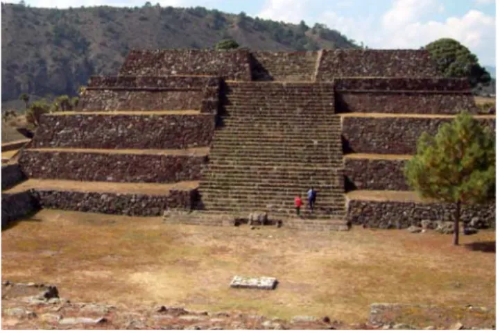
Figure 3. Asymmetry in Cantona’s construction as seen by comparing the right and left sides of the temple pyramid staircase. (Photograph: Isabelle Meehan).
1.3 Architectural Characteristics
1.3.1 General Overview
Seen from above, Cantona’s general layout resembles the number seven (Figure 2). The site can be divided into three sectors, the Northern Zone (corresponding to the top bar of the 7), the Central Zone (the upper half of the 7’s downwards slash) and the Southern Zone (the lower half of the downwards slash). Most of the archaeological work at Cantona has been carried out in the Southern Zone which covers an area of about 80ha and contains the Acropolis - the site’s main civic and ceremonial center. The construction of the site was done in accordance with the area’s topography so that pyramids, plazas, residences and roads follow the layout of the low hills and natural depressions of the
malpaís. The effort made to adapt to the natural terrain results in constructions which are
highly asymmetrical; a temple pyramid constructed on a slope may have five superimposed platforms on its downhill face but only two platforms on the uphill side. In certain cases, all four sides are built with a different number of platforms. Cantona’s architects seem to have embraced this lack of symmetry which was heightened in certain pyramid’s
balustrades of the same staircase did not have the same form (Figure 3). This asymmetry, constant throughout the site, is highly unusual in Mesoamerica and rejects the aesthetic and architectural norms of the Classic Period, when most of Cantona’s temple pyramids were built. Cantona was a highly fortified city and became increasingly so in the Late Classic Period. At its height, ditches and palisades surrounded the site and were also present at different points within the city’s borders. Watch towers and checkpoints were placed along Cantona’s main axes and entrances, allowing both the surrounding area and the interior of the city to be monitored (García Cook 2004:98-99, García Cook and Merino Carrión 1998:61, Nalda 1998:34).
1.3.2 Construction Methods
None of the walls or structures within Cantona were constructed with cement or mortar to hold the stones together. Instead, large and medium stones were placed on top of one another with small stones
filling in the gaps. As a result, no wall in Cantona over 50cm tall is completely vertical; generally walls have a slight backwards slope. In the case of the temple pyramids, all the platform faces (taludes) are sloped at varying degrees. To avoid having the weight of the building resting on the construction’s facade, thick retaining walls made of flat
stones were constructed inside the pyramid, upon which the platform faces leaned (García Cook 2004:98-100). Contrary to what is found in Teotihuacán and other Mesoamerican sites, there is no indication that the exteriors of Cantona’s buildings were ever covered with smooth earth or plaster. Rather, construction facades were decorated by means of manipulating the color and texture of the stones used (Figure 4). Basalt, generally black, blue or gray in color, was the stone most commonly used to build walls.
Figure 4. Differential use of colored stone in altar with white
cantera for the stairs and gray basalt for the platforms (Photograph: Isabelle Meehan).
Rust-red tezontle adorned building faces while whitish-gray cantera was used for steps and balustrades as well as for floors and pathways in elite homes. Bright white limestone appears more closely associated with areas linked to ceremonies and religious rites – it was used as ballcourt markers and flat gravestones and was also carved into sceptre-like objects and other elements associated with power (García Cook 2004:99-100). A prehistoric quarry of volcanic stone was located at Cerro de las Águilas about 300m southwest of the site’s border. The quarry is connected to one of Cantona’s roads by a 500m causeway along which stones were most likely transported (García Cook 2003:317).
1.3.3 Streets and Roads
The inside of the city of Cantona was criss-crossed by a complex network of avenues, streets, walkways, alleys, landings and sidewalks all of which were paved and built directly at or below ground level or on raised embankments (Figure 5). The majority of this network was put in place during Cantona II and Cantona III, although certain routes in the Acropolis date back to Cantona I. In the Acropolis, the pathways and avenues were constructed below ground level, often surrounded by walls whereas streets in the residential areas were generally elevated from 0.8 – 2.8m above the ground.
These were also marked by lateral walls. Roads were outfitted with stairs and ramps to facilitate movement over the uneven terrain. In all, 823 different roads and pathways have been identified at Cantona, although many more probably existed. Of the 823 known, fifteen can be considered avenues. These avenues were major city arteries and followed trajectories over 500m long, twelve of which converged inside the Acropolis.
The movement of people inside Cantona was highly controlled by a number of checkpoints located at the entrance of the city, throughout the residential zones and
Figure 5. Paved Road in Cantona’s Southern Zone. (Photograph: author).
around the Acropolis. There existed about twenty gates to enter Cantona’s Southern Zone, but there were only nine or ten access-points to the Acropolis. Entrance areas were often marked by guard platforms measuring about one meter in height and containing one or two rooms (García Cook and Merino Carrión, 1996a: 72-73, 1998:205-208, Martínez Calleja 2004:134-136).
Despite the fortifications and high walls, the city of Cantona was connected to the surrounding region by a dozen paved roads, most commonly located to the south and east. These roads also served to cross the difficult malpaís terrain with more ease. It appears that these paths linked Cantona to more agriculturally and resource-rich areas outside the malpaís. Agricultural production in the valleys to the west of Cantona would probably not have sufficed to support the large city’s population. In the region directly to the south however, turning towards the Sierra de Citlaltepec, the Pico de Orizaba and the Cofre de Perote mountains, the soil was rich and produced high yields of corn and beans. The prehispanic towns in this area share architectural characteristics with Cantona including cobblestone roads and ballcourt complexes. The ceramic assemblages found in this region are also identical to those discovered at Cantona. It is quite possible then that populations to the south and south-east of the site helped to provide for the needs of Cantona’s population through exchange or the paying of tribute (García Cook 2003:339, 2004:99-101, Martínez Calleja 2004:130).
1.3.4 Residential Complexes
Like the civic and ceremonial structures, the residential buildings in Cantona also followed the natural terrain. In the Southern Zone, right beneath the Acropolis (which was built at the highest point of the site), sit a large concentration of elite homes, while further down slope and located at a greater distance from the main civic and ceremonial center, commoner homes become more frequent. This model is found elsewhere in the site where elite residences are located on higher terrain and on hill slopes while commoner housing is located on lower-lying areas. Elite houses were distinguished from commoner homes by their size and the number of rooms associated with them. Generally, the elite lived in two or three-room complexes measuring about 750m² with a
paved courtyard in front. Inside this structure, there was only one large habitational unit platform, averaging 72m² (Figure 6). In contrast, non-elite habitational units covered an average area of about 900m² but contained 2 to 6 platforms for the construction of multiple homes, indicating a more cramped living area possibly reserved for members of an extended family (García Cook 2003:319, García Cook and Merino Carrión 1996a:64-65, Martínez Calleja 2004:126-129).
All homes, whether elite or non-elite, shared a number of characteristics. All were constructed on foundations that levelled the ground on which the house was to be constructed. Each unit was surrounded by tall walls and narrow alleyways that ran between the walls and connected every home to a larger street. Stairs, ramps, and “private” walkways were also used to access roads. Inside the residential compound, the courtyard was the main center of activity where the majority of domestic tasks took place. When a member of the family died, he or she was buried in a wall or under the house floor, thus remaining with the family. This funerary pattern, associated with household burials, is very different from the human mortuary treatment observed at Temple Pyramid Groups (García Cook and Merino Carrión 1998:203, Martínez Calleja 2004:130).
1.3.5 Civic and Religious Constructions
The largest and most impressive constructions at Cantona include buildings which were used for civic or religious activities. Among these are two large open plazas, measuring 200m x 80m and 160m x 70m, located between the Central and Southern Zones of the site. Each was surrounded by a low wall and contained low platforms. These two open areas may have served as market places or as areas for merchandise exchange (García Cook and Merino Carrión 1998:197). Also within the category of civic and religious constructions is the Temple Pyramid Group – a general term which is used
Figure 6. Plan of Elite Residence (Housing Unit 12).
here to describe a temple pyramid and the platforms, plazas and constructions directly associated with it. Many of the Temple Pyramid Groups follow a structural organization unique to Cantona known as a Cantona Ballcourt Complex (CBC). These complexes are composed of step-platform temple pyramids at one end, which open onto one or two plazas. The plazas are surrounded by superimposed walls and sometimes contain an altar in the center. On the side opposite the temple pyramid, the plazas link to a ballcourt whose axis follows that of the complex (Figure 7). The pyramid-plaza-ballcourt pattern is found repeated thirteen times in Cantona, six examples of which are located within the Acropolis (García Cook and Merino Carrión 1998:200, Martínez Calleja 2004:132). As all constructions at Cantona, these complexes follow the natural topography and ballcourts are always located on slightly lower ground than the temple pyramids, emphasizing their sunken nature in comparison to the pyramids’ height.
Not all the administrative and religious constructions at Cantona follow the Cantona Ballcourt Complex layout. Architectural units such as closed plazas, individual pyramids and ballcourts which do not belong to any aligned group, are found throughout the site. Within the Acropolis, three of these units have been excavated and restored. These are the Central Plaza (also called the Plaza of the Fertilization of the Earth due to the number of large sculpted stone phalluses found there), the East Plaza (El Mirador), and the Palace. Each of these units contains a pyramid with a central staircase at one end and has low, two-tiered walls which border the associated plaza. As with the other constructions at Cantona, the pyramids are highly asymmetrical in accordance with the terrain, so that the pyramid associated with the Central Plaza has three tiers on one side but its east (and main) facade has five. The front (west) face of the East Plaza pyramid has three superimposed levels while the north and south faces have nine tiers each. In
Figure 7. Cantona Ballcourt Complex 6 with aligned temple pyramid, plaza, and I-shaped ballcourt. (From García Cook and Merino Carrión
contrast, the east side only has one level before the top. The pyramid stairs are also different – some of them, such as that of the East Plaza pyramid have wide stone borders while the temple pyramid at the Palace has two stairways without borders as well as a ramp to access the top (García Cook and Merino Carrión 1996a:69-71, 1998:197-200, Martínez Calleja 2004:132).
1.3.6 Ballcourts
Twenty-five ballcourts have been found at Cantona, the highest number known for any site in Mesoamerica. Fourteen of these ballcourts are part of Cantona Ballcourt Complexes and nineteen are found in the site’s Southern Zone. Other ballcourts are located within residential zones or in the Central and Northern Zones and are associated with secondary civic and religious complexes. Despite the large number of ballcourts, as of yet there is no indication that all were used at the same time. These courts, like the temple pyramids, have unique characteristics which distinguish one from the other. There is a wide variety in the size of the courts as well as in the angle of the walls and the court’s orientation. Generally, the center of the ballcourt was indicated by round limestone markers which number anywhere between one and five, depending on the court (García Cook and Merino Carrión1996a:68-69, 1998:200-203).
1.4 Economic Activity: The Obsidian Trade
The natural landscape of the central Mexican highlands is composed of mountain peaks and narrow valleys, dotted with extinct and still smouldering volcanoes. An anecdote recalls that when the King of Spain asked Hernán Cortés to describe the Mexican topography, the conquistador crumpled a piece of paper and, opening it back up, handed it to the monarch. Although this episode is most likely fictional, it offers a relatively realistic way of envisioning the Mexican landscape. Despite the lack of native pack animals and the potential challenges involved in trading in such an environment, prehispanic Mesoamericans were adept in moving a large variety of goods from one place to another, making full use of waterways, valleys and mountain passes.
In their article Investigación arqueológica en Cantona, Puebla, Ángel García Cook and Leonor Merino Carrión (1996a:56) propose the existence of a prehispanic exchange corridor about 10 km wide running through the rugged Mexican highlands. This so-called “Teotihuacán Corridor” began near the modern town of Apizaco and ran south-east towards Huamantla. There, the passageway forked, one route descending towards modern-day Acatzingo, Puebla, and continuing towards the states of Guerrero and Oaxaca while the other, larger route turned east and made its way to the Gulf Coast. North of Apizaco, the path was easy to Teotihuacán and the large city utilized this corridor to move goods to and from its core. Small Teotihuacán enclaves identified along the corridor support the theory that it was by means of this route that Teotihuacán remained in contact with neighboring regions, Puebla-Tlaxcala and the Gulf coast in particular (García Cook and Merino Carrión 1996a:15). A recent GIS study by David M. Carballo and Thomas Pluckhahn (2007) maps the plateaus, valleys, mountains and volcanoes of the area and, calculating that the movement of people and goods would have been carried out on foot, determines that the fastest and easiest way to arrive at the Gulf Coast from the Valley of Mexico and the highlands is through the use of the Teotihuacán Corridor. It is very unlikely, however, that Teotihuacán held exclusive rights to the passageway and it appears that Cantona, located 30 km from the corridor’s edge, also made use of this thoroughfare.
A large part of Cantona’s commerce involved the working and trading of obsidian. As Nicholas J. Saunders (2001:221) states, this “dark volcanic glass, [...] in the absence of metal tools, underwrote the economic and symbolic life of every major Mesoamerican culture for some three thousand years”. Obsidian is obtained from ancient lava flows where the material can be mined or simply collected from the surface. It can be worked to form razor-sharp blades which were used as the Mesoamerican tool par
excellence in both domestic and ritual contexts (Hirth 2006:3). This coveted material was
also believed to possess supernatural qualities and in the Postclassic Nahua world, the glass was thought to be an embodiment of the “cosmic and earthly identity” of the inhabitants near its source. Obsidian was also associated with one of the Aztecs’ most powerful deity, Tezcatlipoca, whose emblem, a smoking obsidian mirror, symbolized power and rulership (Saunders 2001:222).
Cantona is located 7 km away from Zaragoza-Oyameles, an extremely rich source of the highly coveted dark black glass. The close association between Cantona and Zaragoza-Oyameles obsidian is seen in Neighborhood 3 of the city’s Southern Zone. This neighborhood, which covers over 13.5 ha, contains 332 workshops specialized in obsidian working, especially the creation of nuclei and prismatic blades. Starting in the late Preclassic and continuing through the Classic Period, Zaragoza-Oyameles obsidian pre-forms are found in Gulf Coast sites such as Palo Errado and Tres Zapotes as well as in the Chalcalapan region of Veracruz, Matacapan, and elsewhere in the Sierra de los Tuxtlas area. Zaragoza-Oyameles obsidian has been located along the southern Veracruz lowlands up to 150 km away from its source, and lesser amounts were traded inland into the Puebla-Tlaxcala region. Although green Pachuca obsidian and gray Otumba obsidian, both believed to have been mined and controlled by Teotihuacán, are also found along the Gulf Coast, these do not appear as frequently as the Zaragoza-Oyameles type. In Palo Errado and other central Gulf Coast sites, Zaragoza-Oyameles obsidian is the dominant material used in stone tools and it is found in both domestic and ritual contexts. It is no coincidence that the large increase of Zaragoza-Oyameles obsidian in the Gulf Coast in the late Preclassic Period occurs around the same time as Cantona’s first population boom, towards the end of Cantona I/beginning of Cantona II, during which the site asserts itself as a regional power and expands its exchange networks (García Cook 2004: 104, Knight and Glascock 2009, Stark et. al 1992:234).
1.5 Social Organization
García Cook (2003:341) describes the population of Cantona has having been divided among three general social ranks. At the top was the ruling class which collected tribute from satellite settlements, set up and administered city defenses, and controlled the production and movement of obsidian objects for both internal city consumption and export. This group would have been comprised of Cantona’s top political, religious and military minds. As elsewhere in Mesoamerica, it is probable that there existed no clear distinction between these many functions and that the city’s governors were simultaneously political leaders, religious authorities and military generals.
The second social class at Cantona was an intermediary class composed of architects, engineers, middle-rank soldiers, specialized obsidian craftsmen, and merchants. Also included in this group were second-tier priests or religious figures who would have ranked higher than the general population although without the same power as the supreme rulers.
The more populous lower class would have been made up of miners, masons and architectural laborers. Since Cantona has little agricultural soil, it is unlikely that many residents of the site would have been full-time farmers although some may have worked the land immediately surrounding the site.
1.6 Cantona Summary
During the late Preclassic and Classic Period, the city of Cantona was a growing regional power. With an increasing population, more residences and new administrative and ceremonial complexes were built in accordance with Cantona’s unique architectural aesthetic. Rather than embrace the use of symmetry and decorate floors, walls, and pyramid faces with white or brightly painted stucco as was common in neighboring areas, Cantona’s architects manipulated the colors of the locally available stone to create a city that mimicked and followed the contours of the natural landscape. The city’s main civic and ceremonial center contained a high number of Temple Pyramid Groups among which were Cantona Ballcourt Complexes, a unique building configuration containing an elevated temple pyramid, a plaza and a ballcourt. These structures, predominantly located within the Acropolis, were among the many civic and ceremonial buildings that dominated the site. A complex network of paved streets and roads connected each section of the city to the rest and extended out across the malpaís, linking Cantona to more fertile regions to the south and east. Cantona also quarried, worked and traded obsidian, especially with polities in the Gulf Coast by means of the “Teotihuacán Corridor” near which it was located. The constant flow of ideas that accompanied the movement of material goods would have streamed through the city, influencing and contributing to the practices and beliefs of the inhabitants of Cantona.
2.
Excavation and Discoveries at Cantona’s Temple Pyramid Groups
2.1 Excavation
The contents of the Temple Pyramid Groups at Cantona have been intermittently studied. Since the goal of the Cantona Archaeological Project has been the survey and restoration of the site to build it up as a tourist destination, temple pyramid summits have often only been excavated by means of one to three 1x1m or 2x2m test-pits. A few pyramid summits, however, have been more thoroughly excavated; these include the summit of the Cantona Ballcourt Complex 5 and, more recently, the structure U71-11 located directly across CBC 5 on the other side of Avenue 1, one of the largest and longest of the site. Often, temple pyramid summit excavations begin by marking an initial test-pit in the center of the building or near a sub-surface structure if any can be discerned. The pit is then expanded according to the elements found, always along one or two meter grids. Elements are photographed and drawn in situ before being bagged and tagged and brought down to the on-site laboratory and storage area where all elements are washed, labelled, sorted, and stored. During the excavation of U71-1, the majority of drawings were made at a 1:10cm scale so that burial elements could be drawn in relative detail while still allowing each drawing sheet to be pieced together to form a comprehensive whole. Burials were numbered in the order that they were discovered and examined briefly in the field before being sent to Mexico City to be more thoroughly analyzed.
General pyramid stratigraphy is relatively uniform from structure to structure. A thin surface layer (5 to 10 cm thick) of humus and small stones is followed by a fill layer of sandy loam mixed with medium to large size rocks. This layer is on average one meter thick and is where the majority of burials occur. In the case of U71-1, the fill layer covered a 30-40cm thick stratum of overlapping mud floors and layers of hard-packed
1
U71-1: In the nomenclature used to identify buildings in Cantona, ‘U 71’ represents “Architectural Unit number 71” while the number after the dash stands for an architectural element within the unit such as a plaza or platform. In most cases the number one after the dash identifies the largest element in the unit, in this case the temple pyramid.
earth entirely free of rocks and containing very few artifacts. Beneath this last layer was the natural hill surface, containing large outcrops and yellow sandy soil. In U71-1, four burials were found among the natural rocks, two of which were seemingly placed in spaces between large outcrops.
2.2 Dating
Carbon samples found during the excavations were carefully packaged and sent to Mexico City to be analyzed. C14 dating results from earlier excavations indicate the pyramids were in use during the Late Preclassic and Classic Periods. Since the results from dating the carbon samples obtained from recent excavations such as at U71-1 will not be available for some time, the pyramid summit was dated using pottery typology. Cantona pottery is usually a monochrome shade of black, red or brown, and the most common forms include vases with high walls and cajetes (bowls). The majority of ceramics from Cantona appear to have been manufactured locally and do not present dramatic changes in form or in fabrication processes from Cantona I to Cantona III, although the quality of the workmanship decreases over time. There are a few ceramic types which existed only during smaller, more specific time intervals, such as Águila incense burners and Paxtle funerary urns whose maximum dates range from 150 B.C. to 100-150 A.D. Most of the complete ceramic pieces come from offerings associated with certain buildings such as residences and temple pyramids, or with burials.
Pots and vases generally lack handles but have one or two perforations around the top edge through which a string could be attached for hanging. As of yet, a specific ceramic “Cantona culture” has not been identified since the majority of ceramics at the site resemble typical domestic pottery from populations living throughout this area of the
Altiplano. Certain examples, however, present characteristics common to other areas
such as coastal Veracruz or the Oaxaca region. These items are likely to have made their way to Cantona through exchange routes and trade networks that existed between these areas. As of now, ceramic figurines, which are common throughout Mesoamerica, have been found only in small numbers in Cantona and are generally holdovers from the
Preclassic era and incorporated into construction fill (García Cook and Merino Carrión 1998:201, García Cook 2004:104-105, Merino Carrion and García Cook 2007).
The difficulty with dating structures based on pottery sherds and ceramic analysis alone is precisely that, in Cantona, ceramic types representing different time periods are highly similar. Types such as Payuca Rojo, Poleo and Xaltipanapa, who together cover a time span from 250 B.C. – 800 A.D., have color, slip, and hardness characteristics which overlap, making definite identification of specific sherds a difficult task. A recent review of ceramics at Cantona has also caused a revision in the dates of ceramic time periods. The dates obtained for the use of U71-1 are based on an updated ceramic sequence (Table I), provided by Ángel García Cook (personal communication). Based on ceramic analysis, it was determined that the majority of ceramic sherds associated with the summit of the temple pyramid date from Cantona II, corresponding to the time C14 dates indicate other pyramids at the site are being used.
Table I. Ceramic Sequence at Cantona
Ceramic Type Date Cantona Period
Sotolaco 1050/1000-700/650 B.C. Pre-Cantona
Tezontepec Rojo 750/600-300/200 B.C. CI
Tezontepec Negro 700/650-200/100 B.C CI
Payuca Rojo 350/250 B.C.-100/150 A.D. Late CI/Early CII
Mancuernas 200/150 B.C.-200/250 A.D. Late CI/Early CII
Aguilas Incensarios 150 B.C.-100/150 A.D. Late CI/Early CII Paxtle Urna Funeraria 150/100 B.C. -100/150 A.D. Late CI/Early CII Poleo 150/100 B.C.-100/150-550/550-900 A.D. Late CI/Early CII
Xixiltepec 150/100 B.C.-400/450 A.D. Late CI/CII
Tlachichuca 100/50 B.C. -500/600 A.D. Late CI/CII
Izoteno 50/100-600/650 A.D. CII
Molongo 50-600 A.D. CII
Zalayeta 100-600 A.D. CII
Techachalco 250/300-600/650 A.D. CII
Ocotitla Ollas Festonadas 250/300-600/650 A.D. CII
Ocotitla Tricromo 300/350-600/650 A.D. CII
Mastaloya 300/350-650/700 A.D. CII/Early CIII
Alchichica 350/400-650/700 A.D. CII/Early CIII
Tetipanapa 400-650/700 A.D. CII/Early CIII
Tetepongo 450/500-800/850 A.D. Late CII/CIII
Xaltipanapa 500-800/950 A.D. Late CII/CIII
Texcal 400/500-1000/1050 A.D. Late CII/CIII
Texcalteno 450/500-1000/1050 A.D. Late CII/CIII
Tepeyahualco 450/500-1000/1050 A.D. Late CII/CIII
Xonacatlan 550/600-850/900 A.D. CIII
Ocotepec 550/600-900/950 A.D. CIII
Cuyuaco 550/600-900/950 A.D. CIII
Micuautla 600/650-900/950 A.D. CIII
Tepetolo 600/650-900/950 A.D. CIII
Tenextepec 600/650-1000/1050 A.D. Late CIII/CIV
Xalapazco 500?/700-900 A.D. CIII
Xalapazquillo 650/700-850/900 A.D. CIII
Izote Rojo 700/750-1000/1050 A.D. CIII/CIV
2.3 Temple Pyramid Group Finds
The information discussed below pertains to ten Temple Pyramid Groups in Cantona’s Southern Zone. These include the temple pyramid associated with the Central Plaza and the temple pyramids associated with Cantona Ballcourt Complex 1, Cantona Ballcourt Complex 5, Cantona Ballcourt Complex 6, Cantona Ballcourt Complex 7, Cantona Ballcourt Complex 8, Cantona Ballcourt Complex 9, Architectural Unit 12, Architectural Unit 71, and Architectural Unit 72. All but one (CBC 9) are located in the Acropolis. Tables II.a. through II.j. at the end of the chapter offer more details about burials located at the temple pyramid summits and platforms being discussed and the summary below provides information about the Temple Pyramid Group as a whole.
2.3.1 The Central Plaza (Plaza of the Fertilization of the Earth)
The Central Plaza, located in an elevated point of the Acropolis, was in use between 150 and 600 A.D. The plaza is bordered by stepped platforms which run along its edges and by a temple pyramid on its western side. The architectural unit is accessible by a set of stairs located opposite the temple pyramid which faces east, “looking” into the plaza. Two burials located at the summit of the main structure include human bones that have been boiled, present cut marks, and indicate evidence of consumption by humans. One of these burials was also associated with a cache of unique offerings including forty-eight deer scapulae (also with cut marks), two prismatic blades with heat fractures, a slicer, nineteen obsidian tranchets2 and an elliptical obsidian knife. The presence of this specific toolkit associated with cut human bone allows Talavera, Rojas and García
2 Tranchet: A triangular or rectangular obsidian blade whose cutting edge is not retouched but whose other
Figure 8. Phallus sculptures found at base of Central Plaza Pyramid stairs. (From García Cook and Merino Carrión 1998:211).
(2001:114) to conclude that human sacrifice and dismemberment occurred at the top of the Central Plaza’s temple pyramid.
The temple pyramid summit however, is not the only area of the Central Plaza where human remains were found. In the pyramid stairs, an offering of human skulls and long bones was also located along with ceramic elements and tranchets. In the floor of the plaza itself, Talavera, Rojas and García (2001:113) note the evidence of cannibalism as well as animal long bones with cut marks. These were found with prismatic obsidian blades associated with ritual
bloodletting. Among the most striking discoveries made at the Central Plaza are nine large phallic stone sculptures buried at the base of the
temple pyramid stairs (Figure 8). This discovery gives the plaza its second name (Plaza of the Fertilization of the Earth) and clearly demonstrates the presence of a fertility cult in Cantona.
2.3.2 Cantona Ballcourt Complex 1
The temple pyramid of CBC 1 rises on the east end of the complex, opening into a large enclosed plaza containing an elevated platform. A ballcourt to the west of the plaza, opposite the pyramid, closes the complex. The excavations at the summit of the temple pyramid at CBC 1 uncovered eight burials, three of which are represented by individual human skulls. Three other burials include concentrations of bones in an irregular arrangement; the bones in one of these concentrations have been burnt and those of a second arrangement belong to a young child of about four years old. The last two burials were found in a flexed and semi-flexed position, oriented towards the north-west, and “facing the ballcourt” (García Cook, Martínez Calleja, and Zamora Rivera 2005:13-17). Associated with these burials were a number of ceramic vessels mostly of Tlachichuca and Mancuernas styles which date the finds to around 150 B.C.-500 A.D.
Also found with one of the skull burials was a jaguar-shaped ocelocuauhxicalli - a stone vessel which was used as a receptacle for hearts obtained through human sacrifice.
2.3.3 Cantona Ballcourt Complex 5
The entire CBC 5 consists of more than thirty architectural features and structures, built and modified over three construction periods stretching 800 years, from 200-1000/1050 A.D. The most important of these features are the temple pyramid, Plaza I, Plaza II, and the ballcourt. The ballcourt is located on the west extremity of the complex where it joins with one of the Acropolis’ streets on its west end and to Plaza II on its east end. Plaza II, which is delimited by stepped platforms, connects by means of a staircase to Plaza I which is on higher ground. The circumference of this plaza is also bordered by platform walls and a stepped altar is located in its center. The temple pyramid is the highest point of the complex, located on the east side of Plaza I, opposite Plaza II and the lower-level ballcourt (García Cook and Merino Carrión 1997:3-4, Talavera, Rojas and García 2001:100). Thirty-three burials have been located at the summit of this temple pyramid, making it the pyramid with the greatest amount of human remains at Cantona thus far (Figure 9).
The majority of the burials from CBC 5 were placed in a seated, flexed position. Of the seven seated burials where orientation was indicated in the excavation report, there seemed to be no fixed pattern as two were oriented north, two west, one northeast, one east and one southwest. Fifteen seated, flexed burials were clustered in groups along the east side of the pyramid, following a very general north-south axis. In addition to the flexed burials, there were ten irregular concentrations of human bone, three of which showed traces of dismemberment and two of which contained bones which were exposed to fire. One isolated human skull was discovered and was oriented towards the south.
Figure 9. Excavated area of CBC5 summit with burials and stone cistas indicated. (From García Cook and
Merino Carrión 1997:33).
Prismatic blades are found throughout the excavated area and associated with a number of burials. Ocotitla style pottery found in Burial 22 and Burial 41 (where the seated individual was actually holding the vessel in his hands) dates the burials to around 300-600 A.D. (García Cook and Merino Carrión 1997). In Cantona, Ocotitla pottery has always been found in burial contexts and was common elsewhere in the highlands, namely in north-eastern Tlaxcala during the Tenayecac cultural phase (100-650 A.D.), where it has also been found predominantly in human burial contexts. A similar style is also known to have existed in Teotihuacán (Merino Carrión and García Cook 2007:151-154, García Cook 1981:263). An anthropomorphic cuauhxicalli (stone receptacle for
placing extracted human hearts) was also located, associated with Burial 24 as well as a Tlaloc effigy vessel with Burial 39.
Within the large quantity of finds located at the temple pyramid summit of CBC 5, those of Tomb 3 and “Element 1”, are of special importance. Tomb 3 is a walled, circular structure, built on a hardened ash-and-water floor. Burials 21, 22 and 23, consisting of five dismembered individuals and an isolated human skull, were located inside the structure. Along with the human bones, the tomb contained a large number of offerings including five ceramic vessels, a number of stone axes, tecajetes (mortars), grinding implements, a pendant made of blue stone as well as a number of greenstone and shell beads. All these elements were arranged around a central conch shell trumpet (Pleuroploca gigantea) on top of which a small greenstone pendant depicting a woman with folded arms was placed (García Cook and Merino Carrión 1997:39-45).
The second find that stands out was named “Element 1” by García Cook and Merino Carrión (1997:47) during their excavation of the temple pyramid summit. Element 1 is a cylindrical shaped well, dug into the pyramid fill above the structure’s mud floor layer. The structure was filled with basalt and cantera stone and contained large amounts of ash. Burial 4, a multiple burial of dismembered and burnt individuals, was located inside the well along with ceramic vessels, deer and dog bones, obsidian fragments and grinding stone pieces. Three fragmented limestone rods, interpreted by the excavators as broken sceptres, were also included in the mix. The remains of three basalt sculptures, representing individuals in a seated position, were also discovered in the structure. These sculptures were intentionally broken and decapitated, their facial features chiseled away before being dumped with the remainder of the elements into this large ‘bonfire’. This discovery has been interpreted as the remains of a coup d’état which would have occurred sometime around 600-650 A.D., at the onset of the Late Classic Period. It is also around that time that Cantona became increasingly militaristic and that many of the temple pyramids stopped functioning as places of religious action.
Excavations at CBC 5 were not concentrated only at the summit of the temple pyramid. Other finds were made among the platforms bordering Plaza I and Plaza II as well as along those surrounding the ballcourt. Burials 7 and 8, located at the base of the