HAL Id: hal-02370055
https://hal.univ-lorraine.fr/hal-02370055
Submitted on 19 Nov 2019
HAL is a multi-disciplinary open access
archive for the deposit and dissemination of
sci-entific research documents, whether they are
pub-lished or not. The documents may come from
teaching and research institutions in France or
abroad, or from public or private research centers.
L’archive ouverte pluridisciplinaire HAL, est
destinée au dépôt et à la diffusion de documents
scientifiques de niveau recherche, publiés ou non,
émanant des établissements d’enseignement et de
recherche français ou étrangers, des laboratoires
publics ou privés.
International Ocean Discovery Program Expedition 354
Preliminary Report Bengal Fan
Christian France-Lanord, Volkhard Spiess, T. Schwenk, Adam Klaus, R.R.
Adhikari, S.K. Adhikari, J.-J. Bahk, A.T. Baxter, J.W. Cruz, S.K. Das, et al.
To cite this version:
Christian France-Lanord, Volkhard Spiess, T. Schwenk, Adam Klaus, R.R. Adhikari, et al..
Inter-national Ocean Discovery Program Expedition 354 Preliminary Report Bengal Fan: Neogene and
late Paleogene record of Himalayan orogeny and climate: a transect across the Middle Bengal Fan.
International Ocean Discovery Program, 2015, �10.14379/iodp.pr.354.2015�. �hal-02370055�
International Ocean Discovery Program
Expedition 354 Preliminary Report
Bengal Fan
Neogene and late Paleogene record of Himalayan
orogeny and climate: a transect
across the Middle Bengal Fan
30 January–31 March 2015
Christian France-Lanord, Volkard Spiess, Adam Klaus, and the Expedition 354 Scientists
May 2015
Core samples and the wider set of data from the science program covered in this report are under moratorium and accessible only to Science Party members until 7 September 2016.
This publication was prepared by the International Ocean Discovery Program JOIDES Resolution Science Operator (IODP JRSO) as an account of work performed under the International Ocean Discovery Program. Funding for the program is provided by the following implementing organiza-tions and international partners:
National Science Foundation (NSF), United States
Ministry of Education, Culture, Sports, Science and Technology (MEXT), Japan European Consortium for Ocean Research Drilling (ECORD)
Ministry of Science and Technology (MOST), People’s Republic of China Korea Institute of Geoscience and Mineral Resources (KIGAM)
Australia-New Zealand IODP Consortium (ANZIC) Ministry of Earth Sciences (MoES), India
Coordination for Improvement of Higher Education Personnel, Brazil
Disclaimer
Any opinions, findings, and conclusions or recommendations expressed in this publication are those of the author(s) and do not necessarily reflect the views of the participating agencies, Texas A&M University, or Texas A&M Research Foundation.
Portions of this work may have been published in whole or in part in other International Ocean Discovery Program documents or publications.
Copyright
Except where otherwise noted, this work is licensed under a Creative Commons Attribution License. Unrestricted use, distribution, and reproduction is permitted, provided the original author and source are credited.
Citation:
France-Lanord, C., Spiess, V., Klaus, A., and the Expedition 354 Scientists, 2015. Bengal Fan: Neogene and late Paleo-gene record of Himalayan orogeny and climate: a transect across the Middle Bengal Fan. International Ocean
Discovery Program Preliminary Report, 353. http://dx.doi.org/10.14379/iodp.pr.354.2015
ISSN
Expedition 354 participants
Expedition 354 scientists
Christian France-Lanord Co-Chief Scientist
Centre de Recherches Pétrographiques et Géochimiques
Centre National de la Recherche Scientifique (CNRS)
BP 20, 15 Rue Notre-Dame-des-Pauvres 54500 Vandoeuvre les Nancy Cedex France cfl@crpg.cnrs-nancy.fr Volkhard Spiess Co-Chief Scientist Department of Geosciences University of Bremen Klagenfurter Strasse 28359 Bremen Germany vspiess@uni-bremen.de Tilmann Schwenk Shorebased Scientist Department of Geosciences University of Bremen Klagenfurter Strasse 28359 Bremen Germany tschwenk@marum.de Adam Klaus
Expedition Project Manager/ Staff Scientist
JOIDES Resolution Science Operator International Ocean Discovery
Program
Texas A&M University 1000 Discovery Drive College Station TX 77845 USA aklaus@iodp.tamu.edu Rishi R. Adhikari Organic Geochemist MARUM University of Bremen Leobener Strasse 28539 Bremen Germany radhikari@marum.de Swostik K. Adhikari Sedimentologist Department of Geoscience Shimane University Matsue 690-8504 Japan swostik_adhikari@hotmail.com Jang-Jun Bahk Sedimentologist
Petroleum and Marine Research Division
Korea Institute of Geoscience and Mineral Resources (KIGAM) 124 Gwahang-no Yuseong-gu Daejeon 305-350 Republic of Korea jjbahk@kigam.re.kr Alan T. Baxter Paleontologist (nannofossils) School of Environmental and Rural
Science
University of New England
Earth Sciences Building C02, Room 211 Armidale NSW 2351
Australia
alan.baxter@une.edu.au
Jarrett W. Cruz
Paleontologist (nannofossils) Department of Earth, Ocean and
Atmospheric Sciences Florida State University 1806 Atkamire Drive Tallahassee FL 32304 USA
Jwc09e@my.fsu.edu
Supriyo Kumar Das Department of Geology Presidency University 86/1 College Street Kolkata 700073 West Bengal India sdas.geol@presiuniv.ac.in das.supriyo.kumar@gmail.com Petra Dekens Paleontologist (foraminifers) Department of Earth & Climate
Sci-ences
San Francisco State University 1600 Holloway Avenue San Francisco CA 94131
dekens@sfsu.edu
Wania Duleba
Paleontologist (foraminifers) EACH/USP and Instituto de
Geociencias
Universidade de Sao Paulo Laboratorio de Micropaleontologia Rua do Lago, 562 Sao Paulo, SP 05508-0800 Brazil waduleba@gmail.com Lyndsey R. Fox Paleontologist (foraminifers) School of Earth and Environment University of Leeds Leeds LS2 9JT United Kingdom eelrf@leeds.ac.uk Albert Galy Inorganic Geochemist
Centre de Recherches Pétrographiques et Géochimiques
Cenre National de la Recherche Scien-tifique (CNRS)
BP 20, 15 Rue Notre-Dame-des-Pauvres 54501 Vandoeuvre les Nancy Cedex France
agaly@crpg.cnrs-nancy.fr
Valier Galy
Organic Geochemist
Department of Marine Chemistry and Geochemistry
Woods Hole Oceanographic Institution 360 Woods Hole Road, MS#4, Fye 107D Woods Hole MA 02543
USA
Junyi Ge
Physical Properties Specialist Institute of Vertebrate Paleontology
and Paleoanthropology Chinese Academy of Sciences 142 Xizhimenwai Street Beijing China gejunyi@ivpp.ac.cn James D. Gleason Inorganic Geochemist
Department of Earth and Environmen-tal Sciences
University of Michigan 2534 C.C. Little Building 1100 North University Avenue Ann Arbor MI 48109-1005 USA
jdgleaso@umich.edu
Babu R. Gyawali
Paleontologist (nannofossils) Department of Earth Science Tohoku University
Aramaki Aza Aoba 6-3, Aoba-ku Sendai 980-8578 Japan gyawali.b@dc.tohoku.ac.jp Pascale Huyghe Sedimentologist ISTerre 1381 rue de la Piscine University Joseph Fourier 38041 Grenoble
France
pascale.huyghe@ujf-grenoble.fr
Guodong Jia Organic Geochemist
Guangzhou Institute of Geochemistry Chinese Academy of Sciences 511 Kehua Street, Tianhe District Guangzhou 510640 China jiagd@gig.ac.cn Hendrik Lantzsch Sedimentologist University of Bremen FB5, GEO, Room 2540 Klagenfurter Strasse 28359 Bremen Germany lantzsch@uni-bremen.de M.C. Manoj Sedimentologist Marine Micropalaeontology
Birbal Sahni Institute of Palaeobotany 53 University Road
Lucknow, Uttar Pradesh 226007 India
manoj.mcm@gmail.com
Yasmina Martos Martin Staff Scientist Trainee
International Ocean Discovery Program 1000 Discovery Drive College Station TX 77845 yasmartos@gmail.com Laure Meynadier Paleomagnetist
Institut de Physique du Globe Université Paris Diderot Sorbonne Paris Cité 1 rue Jussieu 75005 Paris France meynadier@ipgp.fr Yani M.R. Najman Sedimentologist
Lancaster Environment Centre Lancaster University
Lancaster LA1 4YQ United Kingdom
y.najman@lancs.ac.uk
Arata Nakajima
Physical Properties Specialist Department of Geology and
Mineralogical Sciences Yamaguchi University 1611-1 Yoshida Yamaguchi Japan arata.nakajima@gmail.com Camilo Ponton Sedimentologist
Department of Earth Sciences University of Southern California 3651 Trousdale Parkway, ZHS-117 Los Angeles CA 90089 USA cponton@usc.edu Brendan T. Reilly Paleomagnetist
College of Earth, Ocean and Atmospheric Sciences Oregon State University
104 CEOAS Administration Building Corvallis OR 97331
USA
breilly@coas.oregonstate.edu
Kimberly G. Rogers Sedimentologist
Institute of Arctic and Alpine Research University of Colorado at Boulder 4001 Discovery Drive Boulder CO 80303 USA kgrogers@colorado.edu Jairo F. Savian Paleomagnetist Departamento de Geologia Instituto de Geociências
Universidade Federal do Rio Grande do Sul
Avenida Bento Gonçalves, 9500, Prédio 43126, Sala 206B
Campus do Vale, Agronomia Porto Alegre 91501-970 Brazil
jairo.savian@ufrgs.br
Peter A. Selkin Paleomagnetist
School of Interdisciplinary Arts and Sciences
University of Washington, Tacoma 1900 Commerce Street, Box 358436 Tacoma WA 98402
USA
paselkin@uw.edu
Michael E. Weber
Physical Properties Specialist Geologisches Institut Universität Kõln Zuelpicher Strasse 49a 50935 Cologne Germany
Trevor Williams
Downhole Measurements and Physical Properties Specialist
Borehole Research Group
Lamont-Doherty Earth Observatory of Columbia University PO Box 1000, 61 Route 9W Palisades NY 10964 USA trevor@ldeo.columbia.edu Koki Yoshida Sedimentologist Department of Geology Faculty of Science Shinshu University Asahi 3-1-1 Matsumoto 390-0812 Japan kxyoshid@shinshu-u.ac.jp
Education and outreach
Diane HananoEducation Officer IODP-Canada
University of British Columbia #2020 - 2207 Main Mall Vancouver BC V6T 1Z4 Canada dhanano@eos.ubc.ca Lisa Strong Education Officer
Lisa Strong, Video/Multimedia Producer
Strong Mountain Productions Marin California 94965 USA
lisa@strongmountain.com
Siem Offshore AS Officials
Steve BradleyMaster of the Drilling Vessel
Wayne Malone
Offshore Installation Manager
Technical suport
Lisa Brandt
Chemistry Laboratory James Cordray
Marine Computer Specialist Lisa Crowder
Assistant Laboratory Officer Benjamin Daniel
Marine Laboratory Specialist (temporary) Seth Frank X-Ray/Microbiology Laboratory Timothy Fulton Imaging Specialist Clayton Furman Schlumberger Engineer Randy Gjesvold
Marine Instrumentation Specialist Sandra Herrmann
Assistant Laboratory Officer Michael Hodge
Marine Computer Specialist Dwight Hornbacher Applications Developer Hannah Kastor Curator Zenon Mateo Core Laboratory Stephen Midgley Operations Superintendent William Mills Laboratory Officer Beth Novak Paleomagnetism Laboratory Sonja Storm
Marine Laboratory Specialist Garrick Van Rensburg
Marine Instrumentation Specialist Jean Wulfson
Publications Specialist Hai Zhao
Abstract
International Ocean Discovery Expedition 354 to 8°N in the Bay of Bengal drilled a seven site, 320 km long transect across the Ben-gal Fan. Three deep-penetration and an additional four shallow holes give a spatial overview of the primarily turbiditic depositional system that comprises the Bengal deep-sea fan. Sediments originate from Himalayan rivers, documenting terrestrial changes of Hima-layan erosion and weathering, and are transported through a delta and shelf canyon, supplying turbidity currents loaded with a full spectrum of grain sizes. Mostly following transport channels, sedi-ments deposit on and between levees while depocenters laterally shift over hundreds of kilometers on millennial timescales. During Expedition 354, these deposits were documented in space and time, and the recovered sediments have Himalayan mineralogical and geochemical signatures relevant for reconstructing time series of erosion, weathering, and changes in source regions, as well as im-pacts on the global carbon cycle. Miocene shifts in terrestrial vege-tation, sediment budget, and style of sediment transport were tracked. Expedition 354 has extended the record of early fan deposi-tion by 10 My into the late Oligocene.
Introduction
Of regions where tectonics and climate interact, southern Asia seems to illustrate their possible influences on each other more dra-matically than any other region. The high elevation of the Tibetan Plateau and the rapid rise from the lowlands of northern India across the Himalaya profoundly affect both the average temperature structure of the atmosphere responsible for the seasonal winds and the distribution of precipitation that characterize the south Asian monsoon (Molnar et al., 2010; Boos and Kuang, 2011). Concur-rently, monsoonal precipitation along the Himalaya generates one of the most important erosion fluxes of the planet. This surface mass transfer acts on the thermal structure and stress field of the mountain range and partly controls its morphology (Avouac and Burov, 1996). Finally, the erosion processes contribute to the global atmospheric CO2 drawdown responsible for Cenozoic global cool-ing (Fig. F1) through organic carbon burial and silicate weathering. However, if the Tibetan Plateau and the Himalaya have influenced climate during Cenozoic time, the evidence suggesting such an in-fluence is wholly inadequate to understand quantitatively how these geographical features have developed through time. This inade-quacy is mostly due to the fact that direct records of the erosion of the mountain range are rare or limited in duration, so there is no consensus on the mass accumulation rate generated by the Tibet-Himalayan erosion to date (Métivier et al., 1999; Clift, 2006). Be-cause of the lack of adequate sedimentary archives, the early stages of Himalayan evolution since the continental collision ~55 My ago to the Miocene are essentially unknown.
Expedition 354 was proposed to obtain data that can not only test hypothetical links between climate and tectonics but also pro-vide new data not easily acquired but relevant for understanding a number of Earth processes. This expedition focuses on the ero-sional record of the Himalaya and on the development of the Asian monsoon over Cenozoic time. Because geology lacks the tools for determining paleoelevations except in unusual and ideal circum-stances, the sedimentary record of material eroded from a moun-tain belt holds the least ambiguous record of its paleotopography. Approximately 80% of the material eroded from the Himalaya was
deposited in the Bay of Bengal, which therefore hosts the most com-plete record.
Reconstructing accumulation rates from fan deposits is chal-lenging because (1) the 2500 km length of the fan leads to variable thickness and onlap time from north to south and (2) the nature of fan deposition means that accumulation at a given location is highly discontinuous and hence cannot capture a regional trend of accu-mulation. For these reasons, this expedition is based on an east– west transect approach with a large number of holes covering younger timescales. As the transect crosses the fan at 8°N latitude (middle fan), Paleogene deposits, if they exist, are in reach of rea-sonable drilling depths. The transect is anchored on the western flank of the Ninetyeast Ridge with a deep hole located to recover the oldest fan deposits. From there, the transect extends west across the central axis of the fan and ends at Deep Sea Drilling Project (DSDP) Site 218 above the 85°E Ridge. To resolve characteristics of fan con-struction during the Quaternary, a spacing of ≈50 km between sites was chosen based on the typical width of channel-levee systems.
During Expedition 354, seven sites were drilled on an east–west transect at 8°N (Figures F2, F3, F4, F5, F6; Table T1), including
• One deep site to ~1200 meters below seafloor (mbsf) to recover a complete sequence of fan deposits, in particular to reach pre-fan deposits (Site U1451);
• Two sites to ~900 mbsf (Sites U1450 and U1455) complement-ing Site U1451 to provide a transect of three sites across ~300 km to recover Pliocene and upper Miocene sediment to study Neogene fan evolution and the impact of the monsoonal system on sediment supply and flux; and
• Four dedicated shallow sites to 200–300 mbsf to recover a com-plete terrigenous record of the Himalayan flux over the last 1–2 My, complemented by the shallow portion of the other three deep-penetration sites.
During Expedition 354, the original transect of six sites was comple-mented by a seventh, alternate site (U1454) west of Site 218 that ex-tended the transect to ~300 km.
Expedition 354 builds on knowledge acquired during earlier drilling and seismic exploration of the Bengal Fan (DSDP Leg 22; Ocean Drilling Program [ODP] Leg 116; and R/V Sonne Cruises SO93 [Legs 1–3], SO125, SO126, and SO188 [Legs 1 and 2]) and on current studies of the tectonic, geologic, geomorphological, and sedimentological processes acting on the Himalaya, the floodplain and delta of the Ganga-Brahmaputra, and the Bengal Fan. This ex-pedition is one part of an integrated effort for International Ocean Drilling Program (IODP) drilling syntectonic basins around the Hi-malaya to improve our knowledge of monsoon evolution and its in-teraction with Himalayan growth and erosion. This includes in particular IODP Expedition 353 (Indian Monsoon) and IODP Expe-dition 355 (Arabian Sea Monsoon) on the Indus Fan.
Background
Geological setting
The Bengal Fan covers the entire floor of the Bay of Bengal (Fig.
F2), from the continental margins of India and Bangladesh to the sediment-filled Sunda Trench off Myanmar and the Andaman Is-lands and along the west side of the Ninetyeast Ridge. It spills out south of the Bay of Bengal at its distal end to ~7°S. Another lobe of the fan, the Nicobar Fan, lies east of the Ninetyeast Ridge, but it
ap-parently was cut off from its primary source of turbidites, the head of the Bay of Bengal, during the Pleistocene by convergence be-tween the northern end of the Ninetyeast Ridge and the Sunda Trench. The northeastern edges of the fans are subducted, and some of the Tertiary turbidites cropping out in the Indo-Burman Ranges of Myanmar, the Andaman and Nicobar Islands, and the outer arc ridge off Sumatra are interpreted as old Bengal and Nico-bar Fan sediments.
Following the initial bathymetric discovery of the fan extension by Heezen and Tharp (1966), the Bengal and Nicobar Fans were de-lineated and named by Curray and Moore (1974), who also noted two horizons in reflection and refraction seismic data that pass into unconformities over the exposed and buried hills of folded sedi-ments in the southern part of the fan and over the Ninetyeast Ridge. They concluded that these two horizons are regional and used them to divide the sedimentary section into three units in the Bay of Ben-gal. The ages of these unconformities were tentatively determined to be uppermost Miocene and upper Paleocene to middle Eocene during Leg 22 (Moore et al., 1974; Shipboard Scientific Party, 1974) at Sites 218 and 217, respectively (Fig. F2). Curray and Moore (1974) interpreted the older unconformity as having been initiated by the India-Asia collision, with the pre-Eocene sedimentary unit consisting of pelagic sediment and terrigenous material derived from India before the collision. Hence, the upper two sedimentary units define the Bengal Fan sensu stricto. Curray and Moore (1974) associated the upper Miocene unconformity with intraplate defor-mation, probably correlated with a plate edge event. These tentative age assignments were further confirmed and refined by later drilling during ODP Legs 116 and 121 (Cochran, Stow, et al., 1990; Peirce, Weissel, et al., 1989), although the interpretation and significance of the older unconformity and the time of initiation of Bengal Fan de-position and progradation remain very controversial.
The older unconformity was drilled and sampled only on the Ninetyeast Ridge. Correlation of this unconformity off the ridge into the fan section is possible along some but not all seismic lines (e.g., Gopala Rao et al., 1994, 1997; Krishna et al., 1998; Schwenk and Spiess, 2009). Leg 22 sites sampled the older unconformity. DSDP Site 215 showed a hiatus from early Eocene to late Miocene (Fig. F7). DSDP Site 211, located at the eastern distal edge of the Nicobar Fan, showed a hiatus from some time after the Maastrich-tian until the Pliocene. The overlying younger sections are inter-preted as distal fan.
Eocene initiation of Bengal Fan deposition is also suggested by the geology of Bangladesh, the Indo-Burman Ranges of India and Myanmar, and the Andaman-Nicobar Ridge. Hydrocarbon explora-tion onshore and offshore from southeastern Bangladesh (e.g., Kingston, 1986) shows total sediment thicknesses calculated from gravity to be >20 km, apparently with the Eocene and Oligocene Disang Series of deepwater shales and turbidites overlying oceanic crust. These are in turn overlain by Neogene prograding deposits of the Bengal Delta and the Ganga-Brahmaputra (Jamuna) river sys-tem, the Meghna River, and their ancestral rivers. Some of these rocks are mildly metamorphosed and uplifted into the accretionary prism in the Indo-Burman Ranges, with some sparsely fossiliferous flysch units correlated with the Disang Series (e.g., Brunnschweiller, 1966; Bender, 1983; Najman et al., 2008). Similar turbidites, the An-daman Flysch or Port Blair Formation, are found in the AnAn-daman and Nicobar Islands, again usually assigned to Eocene and Oligo-cene ages (e.g., Karunakaran et al., 1975; Acharyya et al., 1991) and interpreted to represent parts of the early Bengal Fan, some of which are incorporated into the Sunda arc accretionary complex.
The initiation of deposition and progradation of the Bengal Fan followed the collision of India with Asia and the formation of a large proto-Bay of Bengal. Continued convergence of the Indian and Aus-tralian plates with the Southeast Asian plate reduced the size of the bay and focused the source of turbidites into the present Bengal Ba-sin, Bangladesh shelf, and the Swatch-of-no-Ground (SoNG) shelf canyon (Curray et al., 2003).
Fans grow by progradation, and the first sediments are depos-ited at the mouth of a canyon and at the base of the slope, typically the continental slope. With time, fans prograde farther from the original base of the slope. Our limited information suggests that the Bengal Fan has prograded, as shown in Figure F7. The oldest rocks interpreted as Bengal Fan in the Indo-Burman Ranges are early Eo-cene; the oldest such turbidites in the Andaman and Nicobar Is-lands are middle Eocene. Sites 215 and 211 revealed upper Miocene and Pliocene turbidites, respectively. Neither Site 218 nor the Leg 116 sites reached the base of the fan. The interpretation that the Eo-cene unconformity marks the base of the fan suggests that it may represent a hiatus of variable duration (Fig. F7).
Sediment delivery into the Bengal Fan originates from the SoNG (Kottke et al., 2003; Michels et al., 1998; Palamenghi, 2011), which represents the only feature of this kind today. Sediments from the Ganges, Brahmaputra, and Meghna Rivers are transported to the mouth and then westward by currents parallel to the delta front (Kudrass et al., 1998). Approximately one-third of the Himalayan material is stored in the floodplain, and a significant portion is con-structing a prograding shelf sequence (Goodbred et al., 1999). The remaining portion, approximately one-third, enters the SoNG, for example, by coast-parallel currents, partially initiated by storm events (Kudrass et al., 1998), to be finally delivered to the Bengal Fan.
Mechanisms of this transport, which must be associated with the initiation of turbidity currents, are largely unknown. However, sediment physical data for 47 cores along the 3000-km-long trans-port path from the delta platform to the lower fan distinguish differ-ent turbiditic environmdiffer-ents (Weber et al., 2003). One of the main characteristics of the Bengal Fan is channel-levee systems of re-markable size (e.g., Hübsher et al. 1989; compilation by Curray et al., 2003). They are believed to form from mostly unchannelized tur-bidity currents. If they are able to erode the seafloor to the degree that an incision forms, subsequent turbidity currents are confined. As a consequence, erosion is enhanced, the cross section of the tur-bidity current is further constrained, and turbulent energy can be maintained over very long distances. If sufficient fine-grained mate-rial is incorporated in the suspension cloud, spillover deposits can form a triangular-like shape because the sedimentation decreases with distance from the channel axis (levee), constructing a channel-levee system.
For the Bengal Fan, these turbidity current characteristics were described in detail along the active channel by Hübscher et al. (1997), Weber et al. (1997, 2003), and Schwenk et al. (2003, 2009). Work by Hübscher et al. (1997) and Schwenk and Spiess (2009) con-firms an overall similarity of channel-levee complexes and their ge-ometries, scales, and distribution downfan between 8°N and 16°N. Weber et al. (1997) shows that these levees can build up over several thousand years. Schwenk et al. (2003) further demonstrate that the evolution of these deep-sea channels led to a pronounced, mean-dering formation of cut-off loops and their subsequent fill. In this sense, the drilling transect well represents characteristics of Bengal Fan architecture, whereas the sediment delivery system will likely
reveal a pronounced spatial and temporal variability over relatively short time periods.
Interlevee sediments are assumed to represent a lobe of progra-dational coarse-grained silty to sandy facies with the channel termi-nation upslope, as it may occur, for example, after a channel avulsion. Subsequently, levee units form after the establishment of a channel, which typically erodes into previously deposited units. At the early stage, wedge-shaped units of high reflectivity may form from coarser grain size because of limited channel depth. The wedge-shaped units of lower reflectivity are supposed to be caused by overspill and flowstripping from turbidity currents that pass through the channel, likely originating at the SoNG on the Bangla-desh shelf. Levee sediments are supposed to be mostly composed of silty to clayey material with a tendency to fine upward with increas-ing levee height. Hemipelagic units form when sediment supply is shut down or distal, thus creating a layer of almost constant thick-ness throughout large areas of the fan.
So far, distal (Leg 116) and middle fan sediments were demon-strated to reflect Himalayan geological sources (Stow et al., 1990; France-Lanord et al., 1993) and were used to track the evolution of the erosion rate of the Himalayan range (Copeland and Harrison, 1990) and the paleovegetation of the basin (France-Lanord and Derry, 1994; Galy et al., 2010) and to scale the impact of Himalayan erosion on the long-term carbon cycle through silicate weathering and organic carbon burial (France-Lanord and Derry, 1997).
Seismic studies/site survey data
The original IODP proposal for this expedition (552) was based on a single 500 km long multichannel seismic line at 8°N (GeoB97-020/027), which was acquired during R/V Sonne Cruise SO125 in 1997 (Spiess et al., 1998) to gain a better understanding of the buildup of the fan with respect to channel-levee geometries and stacking patterns (Fig. F3). For stratigraphic calibration, this seismic profile crossed DSDP Site 218, where sediments were cored and dated to the middle Miocene at 773 mbsf.
To further support IODP Proposal 552, a dedicated presite sur-vey during R/V Sonne Cruise SO188-1 was carried out in June–July 2006. This cruise collected multichannel seismic, swath bathymet-ric, and Parasound subbottom profiler data on crossing lines through Sites U1449, U1450, and U1451 (proposed Sites MBF-6A, MBF-2A, and MBF-3A, respectively). These additional data pro-vided further understanding of the spatial variation of sediment structures, particularly the underlying complex structures of buried channels (Figures F3, F8). Shallow-penetration sediment cores were taken at selected sites to complement the data already available from Site 218 (Site U1455).
The long seismic reflection Profile GeoB97-020/027 (Fig. F3) was interpreted with respect to the presence of channels, channel-levee systems, and seismic stratigraphy (Schwenk and Spiess, 2009). Several major reflectors and unconformities were traced across the drilling transect, revealing increased average sedimentation rates as a function of distance from the basement ridges at 85°E and 90°E. Age constraints provided by correlation to Site 218 suggest that the shallow-penetration sites (U1449, U1452, U1453, and U1454) ex-tend to near the Pleistocene/Pliocene boundary and the mid-depth penetration sites (U1450 and U1455) extend to at least 8 Ma. Our deepest penetration and easternmost site (U1451) was selected to provide prefan sediments by drilling through the regional Reflector P (Eocene unconformity).
For Expedition 354, these data were reprocessed to improve lat-eral resolution from 20 to 10 m and vertical resolution to a higher
bandwidth through conservative filtering and advanced noise sup-pression. Data examples shown in this report originate from these new data sets, which are superior to the original data set used by Schwenk and Spiess (2003).
Swath bathymetric data were acquired during Cruise SO125 us-ing a Hydrosweep DS System and durus-ing Cruise SO188-1 usus-ing a Simrad EM120 echo-sounder system. The total multibeam cover-age width is now 19 km, increasing in those areas where crossing lines were shot. Although bathymetry reveals a clear picture of the recent or Quaternary channel systems in the area, this information only applies to the upper few tens of meters of the section, which is otherwise a mix of stacked older channels and interlevee sequences. Digital Parasound subbottom profiler data (4 kHz) were also rou-tinely collected during both cruises.
Scientific objectives
Expedition 354 was designed to reconstruct the erosional his-tory of the Himalaya and its bearing on the development of the Hi-malaya and Tibet as topographic features and to document the relationship between erosion and climate throughout long-term and short-term fluctuations of the Indian monsoon as recorded in the Bay of Bengal.
1. Calibration of Neogene to present changes
Although the Miocene to recent sedimentary records in the Bengal Fan suggest that since 18 Ma Himalayan erosion was compa-rable to the actual regime in many ways, tectonic and climatic changes have occurred that are both likely to have influenced sedi-mentation in the Bay of Bengal. This includes upper Miocene changes in accumulation rate, continental vegetation, and weather-ing intensity that are documented both in the continental basin and the Bengal Fan (e.g., Quade and Cerling, 1995; France-Lanord et al., 1993; Burbank et al., 1993; France-Lanord and Derry, 1994; Mar-tinod and Molnar, 1995; Clift et al., 2008; Galy et al., 2010). The de-velopment of intense channel-levee deposition in the Bengal Fan starts appearing in the upper Miocene or Pliocene and is also the mark of major change in sediment delivery to the Bay of Bengal (Schwenk and Spiess, 2009). During the late Pliocene, global cooling led to the growth of ice sheets in the Northern Hemisphere, which appears to be related to a global increase in detrital sedimentation rate and grain size (Zhang et al., 2001). Although the reality of this change has been questioned (Willenbring and von Blanckenburg, 2010) the evolution to higher climate instability should prevent an equilibrium state of fluvial and glacial basins and trigger their ero-sion. Such changes were observed in the distal Bengal Fan around ~0.8–1 Ma when the 100 ky cycle became strong. This expedition documents this critical period in the Earth’s most intense erosion system, as tectonic and climate changes have left signatures in accu-mulation rates, grain sizes, physical properties, clay mineralogy, iso-topic ratios, organic carbon burial, and so on, that will be tracked with postexpedition studies.
First, to what extent are variations in accumulation rates, clay mineralogy, and grain sizes from ODP Sites 717–719 (Fig. F8) rep-resentative of other parts of the fan? Because those holes only re-covered sediments from the most distal parts of the Bengal Fan within a growing syncline, sedimentation might have been affected both by the large distance from the source and by the barrier im-posed by the surrounding anticlines. The decreases in accumulation rate and grain size at ~7 Ma and the synchronous increased per-centage of smectite (Bouquillon et al., 1990) suggest that if the
mon-soon strengthened at that time, it apparently did so without creating a more energetic erosive system, as might be expected from the strong seasonal precipitation of the monsoon. Obviously, if we find the same pattern of low accumulation rates, small grain sizes, and a large percentage of smectite at 7–8 Ma in the holes cored at 8°N during Expedition 354, we must consider the possibility that if the monsoon strengthened at that time, it did so by decreasing, not in-creasing, erosion rates. If we find a sediment history different from that at Sites 717–719, it is possible that the sedimentary record at the distal edge of the fan does not record faithfully the changes in-put at the source of the fan.
The present-day monsoon, if named originally for the seasonally steady winds over the Arabian Sea, also evokes the image of heavy rain over the Indian subcontinent. We have no evidence to date, or perhaps conflicting evidence, showing that precipitation increased over the Ganga and Brahmaputra drainage basins and the Bay of Bengal at 7–8 Ma (Derry and France-Lanord, 1997; Dettman et al., 2001) despite enhanced Indian monsoon seasonality over this pe-riod (Zhisheng et al., 2001). Assessing paleomonsoon intensity is challenging and can be tracked with two approaches. First, the effi-ciency of sediment transport from the Himalaya to the Bay of Ben-gal is somewhat controlled by the seasonality and intensity of rainfall that trigger high river discharge (Lupker et al., 2011). This transport in turn exerts control on sediment fluxes to the Bay of Bengal that can be traced by accumulation rates. Second, δ18O in
planktonic foraminifers deposited in the Bay of Bengal in the late Quaternary is related to precipitation amounts (Duplessy, 1982). If these microfossils can be recovered, they will provide another tool to assess the strength of the monsoon.
The main reason for drilling more than one site at 8°N is to min-imize the effects of (1) varying sedimentation rates associated with pronounced increases in the vicinity of the active channel over time and (2) the migration of the active channel, hence avoiding biases that one site (or a set of adjacent sites) might give. Although the main focus of these sites is on the changes near 7–8 Ma, obviously we will obtain a Himalayan erosion record over a longer period that will allow analysis of the Himalayan response to monsoon fluctua-tion over the early Miocene, as proposed by Ramstein et al. (1997) and Fluteau et al. (1999), or Oligocene (Licht et al., 2014).
In addition, we plan to study other temporal and spatial varia-tions in the sediment over the last 7 My. Site 218 and sites cored during Leg 116 show changes that possibly reveal other variations in the erosion regime. Data from Kroon et al. (1991) show a dip in the abundance of Globigerina bulloides at ~5 Ma, which might indicate a lull in the monsoon, the temporary dominance of another upwell-ing-sensitive foraminifer (Kroon et al., 1991), or some other inade-quacy of G. bulloides to measure monsoon strength. We also seek quantitative measures of the interaction between climate change and sedimentation associated with global cooling and the onset of Northern Hemisphere glaciation at ~2.7–3.3 Ma and with the change from precession and obliquity-dominated climate variations to the strong 100 ky cycle at 0.8–1.2 Ma. The latter change appears to be marked by changes in deposition rates, grain sizes, and clay mineralogy at Sites 717–719 (France-Lanord et al., 1993). Again, one objective is to decide how representative the results from Sites 717–719 are. The same proxies for monsoon strength and erosion will be available for study of this period. The results from Sites 717– 719 reveal no evidence of a change in erosion rate at 2.7–3.3 Ma, in contrast with what might be expected if glacial erosion were im-portant and increased at that time. Moreover, if the only imim-portant change in sedimentation rate, and hence presumably in erosion rate,
occurred at 0.8–1.2 Ma, such a change would provide a clue to what kind of change was important. We anticipate being able to resolve temporal variations on the timescale of orbital variations, but obvi-ously we must expect significant variations in sedimentation rates. Hence, the seven site transect approach was designed to resolve as completely as possible the time record for a given time slice.
The 7 Ma transition is also marked by an expansion of C4 photo-synthetic plants in the Himalayan basin (Quade et al., 1989). Al-though C4 plant expansion may result from a global decrease in atmospheric pCO2 (Cerling, 1997), studies suggest that PCO2 was
already low at that period (Pagani et al., 1999; Beerling and Royer, 2011). In the latter hypothesis, C4 plant expansion would instead
re-quire an adaptation to more arid conditions in the floodplain. Sedi-ments sampled during Leg 116 show close links among variations in clay mineralogy (smectite/illite ratio), total organic carbon, and δ13C (C3 versus C4 plants) (Fig. F9) (France-Lanord and Derry, 1994;
Freeman and Colarusso, 2001). These relationships suggest changes in sediment provenance, with a mountain end-member delivering material unaltered with low organic carbon content of C3 type and a floodplain end-member delivering altered material with high or-ganic carbon content of C4 type. If confirmed by new drilling at the scale of the entire fan, such relations would favor the hypothesis of a regional climate change to dryer conditions. Combining these with more sophisticated molecular and isotopic biomarkers (e.g., Galy et al., 2011; Contreras-Rosales et al., 2014) will reveal more accurately the link between monsoon intensity and plant distribution as a function of sediment origin.
2. Forcing of the carbon cycle and climate
Drilling the Bengal Fan should allow investigation of the effect of Himalayan erosion on the global carbon cycle, which has been debated (e.g., Raymo and Ruddiman, 1992; France-Lanord and Derry, 1997; Galy et al., 2007; Goddéris and Donnadieu, 2009). Ero-sion tends to consume atmospheric carbon by two mechanisms. First, weathering of silicates produces fluvial alkalinity flux that can later precipitate as carbonate in seawater. Second, plant debris and organic carbon are transported with the particulate flux and can be buried in deep-sea sediment. Ultimately, both mechanisms will take up carbon from the atmosphere and store it over long periods in the sedimentary reservoir. Observation of modern fluxes of erosion and of Bengal sediments suggests that the Himalayan erosion mostly consumes atmospheric CO2 through burial of organic carbon
pref-erentially to silicate weathering. Nevertheless, it remains impossible to assess the magnitude of these processes at a global scale because past fluvial fluxes are unknown. Sediment volume and geochemis-try can provide direct and interpretable records of these fluxes if their accumulation rates in the Bengal Fan can be determined with sufficient accuracy. Our transect of drill sites at 8°N was designed to document the regional scale of such fluxes during the Neogene that can be extrapolated throughout the entire fan. The deepest penetra-tion Site U1451 was designed to allow explorapenetra-tion of weathering and carbon burial prior to the Neogene.
3. Sampling of the oldest sediment of the fan
Scenarios of the timing and geometry of the collision between India and the rest of Eurasia suggest that collision in the western Hi-malaya occurred between 50 and 55 Ma, and perhaps later (~45 Ma) in the eastern Himalaya, near Everest for example (Rowley, 1996, 1998). However, there are contrasting models for the slowdown of Indian plate motion and the geometry of the collision (e.g., Dupont-Nivet et al., 2010; Van Hinsbergen et al., 2011; Aitchison et al., 2007;
Zhang et al., 2012). When the Himalaya emerged as a mountain range, however, remains less certain. Extending the record of sedi-mentation back in time should allow determination not only of when erosion began but also of when erosion penetrated deep enough into the crust to expose rapidly cooled minerals. In particu-lar, we should be able to determine cooling ages of minerals whose closure temperatures are different, and from the isotopic signature, we should be able to identify what rock of the Himalaya has eroded. Differences between cooling ages and stratigraphic ages will then al-low estimates not only of when erosion began but also of when ero-sion exhumed rock from different depths (Copeland and Harrison, 1990; Corrigan and Crowley, 1992; Galy et al., 1996).
Determining when emergence of the Himalaya took place might not provide any surprises. Nevertheless, recall that all of the rock cropping out in the Himalaya was carried by the Indian subconti-nent and scraped off it following collision with Eurasia. Thus, given India’s convergence rate of ~50 km/My toward Eurasia since 45 Ma, if collision occurred at 45 Ma but erosion began only at 35 Ma, we might infer that as much as 500 km of intact lithosphere was sub-ducted beneath southern Eurasia before a significant mountain range formed. Conversely, if deposition of rock with a Himalayan isotopic fingerprint began shortly after 45 Ma, we must infer that some off-scraping of Indian crust occurred early in the history of the collision to build the initial Himalaya. Finally, we can imagine a flux of sediment early in the history of the collision, but of Tibetan, not Himalayan, origin. This would suggest some not necessarily easily quantified subduction of India beneath southern Tibet before thrust faulting within India created the Himalaya.
The well-known increase in the 87Sr/86Sr ratio of seawater
begin-ning at ~40 Ma (DePaolo and Ingram, 1985; Hodell et al., 1989) is commonly attributed to increased erosion and weathering in the Himalaya (Edmond, 1992; Galy et al., 1999; Krishnaswami et al., 1992). A strong Himalayan signature, not only beginning at ~38 Ma but also contributing a pulse near 18 Ma (Richter et al., 1992), should, therefore, be corroborated in the sedimentary record of Hi-malayan erosion. This would be supported if detrital silicates with high 87Sr/86Sr ratios increased both at ~40 Ma and near 18 Ma. By
extending the sedimentary record in the Bay of Bengal through the Oligocene, we can examine the hypothesized correlation of the in-creased marine Sr isotopic ratio at 18 Ma with weathering of Hima-layan rock rich in radiogenic strontium. If we can sample the early history of Himalayan erosion, we can test the assumption that the increasing Sr isotopic ratio beginning at ~38 Ma also results from weathering of Himalayan rock. The sensitivity of the seawater Sr isotopic budget to the Himalayan flux is so high (Galy et al., 1999) that the seawater evolution through time provides a unique system where erosion rate may be estimated using a proxy other than accu-mulation rates.
The Bengal Fan is one of the thickest sediment sections in the world, and it is far too thick to sample the very old section. The old-est part of the fan sampled to date was at Site 718 more than 2500 km from the present apex of the fan, where early Miocene sediment (~17 Ma) was recovered. Because of its southern position and great water depth, this site is not adequate to penetrate the “oldest” sedi-ment derived from the Himalaya because the fan may not have pro-graded so far south (e.g., Curray, 1994). Our deepest proposed site (U1451; proposed Site MBF-3A) is located on the west flank of the Ninetyeast Ridge, ~1300 km from the thicker section of the fan, where the section is thinner and where a possible Paleocene–Eo-cene unconformity (“P” horizon) could be reached at a reasonable depth (Curray et al., 1982).
4. Fan architecture and spatial depocenter variability
Since the Pliocene, sedimentation in the Bengal Fan has been dominated by deposition in channel-levee systems (Schwenk and Spiess, 2009). During this period, it appears the fan was built by an accumulation of lenses corresponding to distinct channel-levee epi-sodes intercalated by more slowly accumulating intervals of fine-grained sediment (Fig. F3). Channels carry a flux of sediment for a brief period, apparently only for approximately thousands of years, and then fill with sediment as portions are abandoned and a new channel is cut into the levee system or outside it. Thus, tion at any point is likely very irregular. In the upper fan, accumula-tion varies from rates >30 m/ky for periods as long as 3000 y (Hübscher et al., 1997; Michels et al., 1998; Spiess et al., 1998; Weber et al., 1997) to very low accumulation rates in intervening periods. Nd-Sr isotopic signatures and bulk mineralogical and geochemical properties demonstrate that sediment accumulated in levees is dominated by Himalayan material, whereas very low accumulation hemipelagic deposits have distinct isotopic signatures in the upper fan, showing that other sources are mixed with Himalayan flux (Pierson-Wickmann et al., 2001). Determining the distribution and typical lifetime of depocenters is vital for interpreting the older sed-imentary record of the fan and assigning different types of sedimen-tary facies and successions found in deep drill holes to structural units. To address this objective, the six planned sites distributed over a 200 km transect were designed to obtain sufficient spatial resolution on the basis of a typical width of a channel-levee system on the order of ~50 km. The shallower, ~300 m penetration sites will record the stacking of more than two systems.
Expedition 354 was designed to significantly improve and refine the poor existing age constraints (currently based only on spot-cored Site 218) of the stratigraphic and structural elements identi-fied in the seismic data. This improvement is especially critical for constraining the transition from early sheet-like turbidite deposi-tion to the onset of channel-levee systems that occurred in the latest Miocene (Schwenk and Spiess, 2009). Because most surface chan-nels reach this part of the fan, it is believed that this marks the start of the development of channel-levee systems on the Bengal Fan generally (Fig. F3). Two reasons might be responsible for the onset of the channel-levee systems: (1) the initial creation of a canyon as point source or (2) changes in grain size of the delivered sediments transported by turbidity currents to the fan. The three drill sites tar-geting recovery of late Miocene sediments (Sites U1455, U1450, and U1451) will prove whether there were changes in grain size (as in-terpreted from Leg 116 results) and whether the onset of the chan-nel-levee systems represents the first margin setting with a canyon and probably associated delta. Additionally, because several levees will be penetrated, new insights about the lifetime of distinct chan-nel-levee systems will be gathered, which is so far only known for the active channel in the upper fan (Weber et al., 1997).
Additional objectives
Although Expedition 354 has been designed principally to docu-ment (1) Himalayan evolution and interactions with Indian mon-soon evolutions and (2) turbiditic fan construction, drilling the Bengal Fan will allow additional important objectives to be ad-dressed. This includes fan hydrology, Bengal Basin deformation, and deep biosphere issues.
Fan hydrology and hydrochemistry
The Bengal Fan is a major sedimentary reservoir filled by conti-nental material including clays and organic matter that are likely to
evolve during diagenesis. Pore water chemistry and O-H isotopic compositions documented on Leg 116 cores revealed a high vari-ability of compositions that imply that low-salinity fluid is released through dehydration reactions probably deeper than in the cored sections and that fluid advection occurs under thermoconvective conditions at least in that portion of the fan (Boulègue and Barriac, 1990; Ormond et al., 1995). There are also indications for diverse diagenetic reactions that release significant amounts of Ca and Sr in the pore water reservoir. Pore water analyses, physical properties, and downhole measurements will constrain the magnitude of com-paction, dehydration reactions, and possible fluid transfer. This will lead to refined estimates of geochemical fluxes from the fan to the ocean.
Bengal Basin deformation
Throughout the Neogene, the Bengal Basin underwent signifi-cant multiphase deformation that resulted in the folding of the plate between the Ninetyeast Ridge and the 85°E Ridge (Krishna et al., 2001). In addition to the Miocene and Eocene unconformities (Cur-ray et al., 2003), site survey data revealed two additional regional unconformities. Using the Site 218 age control, these were dated as Pleistocene and Pliocene, respectively (Schwenk and Spiess, 2009). These unconformities are interpreted to be equivalent to unconfor-mities found in the central Indian Ocean, which are related to defor-mation events of the ocean lithosphere there (Cochran, 1990; Stow et al., 1990; Krishna et al., 2001). Additionally, several faults were identified in the seismic data, especially above the western flank of the Ninetyeast Ridge. These faults terminate within Pleistocene sediments, which also suggests tectonic events at least until the Pleistocene. As Site 218 dating is poorly constrained, we expect Ex-pedition 354 results to allow more precise dating of unconformities and fault terminations, which in turn will improve the understand-ing of deformation events in the Bengal Basin.
Deep biosphere
Deep biosphere objectives were not specifically planned as a pri-mary objective of this expedition, but specific sampling was con-ducted to document bacterial activity near the surface of the fan and at depth. These samples will allow us to explore the impact of terrig-enous flux on bacterial development. The Bengal Fan represents one of the largest fluxes of terrestrial matter to the ocean with rela-tively fast accumulation. The apparent high preservation of terrige-nous organic matter is a peculiar aspect of Bengal Fan sedimentation (Galy et al., 2007). Microbial activity is intimately in-tertwined with diagenesis and organic carbon degradation. Because preservation and burial of organic matter is one crucial parameter of the impact of Himalayan erosion on the carbon cycle, there is high interest in studying these processes.
Operations plan/drilling strategy
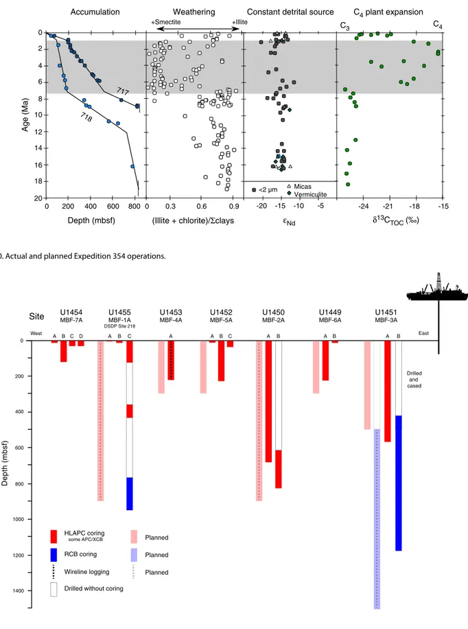
The operations plan and drilling strategy developed for Expedi-tion 354 is fully described in the Scientific Prospectus (France-La-nord et al., 2014). Because Expedition 354 started in Singapore and ended in Colombo, an east–west sequence of sites was the most ef-ficient. However, to better initiate overall shipboard laboratory op-erations and to best address the specific concern about the best approach to core in a sand-rich environment, we decided not to start with the easternmost site (U1451; proposed Site MBF-3A), which is the most challenging, deepest penetration site. Instead, we decided to start drilling at a short 300 m penetration location (SiteU1449; proposed Site MBF-6A) with the advanced piston corer (APC) system, followed by a 900 m penetration location (Site U1450; proposed Site MBF-2A), to determine the depth of APC penetration and quality of XCB coring. The initial operations and time estimates for Expedition 354 planned for 56 days of operations on a very tight schedule. Nevertheless, large uncertainties were ex-pected because of potentially poor recovery in sands and uncertain penetration rates that could affect good core recovery, feasibility of wireline logging, and overall hole conditions in rapidly deposited and loose sands. For these reasons and based on scientific interest, Site U1454 (proposed Site MBF-7A) was added during the expedi-tion as an alternate site to extend the transect west of Site U1455 (proposed Site MBF-1A; DSDP Site 218) to core the most recent le-vee sequence.
The initial coring plan and time estimate included using only APC/extended core barrel (XCB) at all sites, except for Site U1451 (proposed Site MBF-3A), where RCB coring would be needed for deep penetration. Time was allocated for only a single hole at each site to the total target depth. If coring conditions (recovery, core quality, and penetration rate) required, the half-length APC (HLAPC) would be used to obtain deeper high-quality cores, but the additional wireline time was not included in the pre-expedition time estimates. We also planned for orientation for all full-length APC cores, using nonmagnetic hardware as much as possible, and a basic program of formation temperature measurements. A second hole was planned at our deepest penetration site (Site U1451; pro-posed Site MBF-3A) consisting of rotary core barrel (RCB) coring through the Eocene unconformity estimated to be at ~1500 m. The option to stabilize this second hole with a preassembled reentry cone with 400 m casing was considered the best approach to achieve the deep coring and logging objectives, but the time to in-stall it was not included in the pre-expedition time estimates.
Wireline logging was planned for our three deepest penetration sites (Sites U1451, U1450, and U1455; proposed Sites MBF-3A, MBF-2A, and MBF-1A, respectively). These were intended to con-sist of two logging runs (triple combination [triple combo] and For-mation MicroScanner [FMS]-sonic tool strings) and a check shot (Versatile Seismic Imager [VSI]) if hole conditions allowed.
Sampling and data sharing strategy
The shipboard sampling strategy was defined with each labora-tory group to obtain the necessary shipboard observations and analyses. Special care was taken to obtain data from the differing lithologies. Because the exact nature of recovered sediment and quality of recovery was somewhat difficult to predict, we decided that the Scientific Party had to take a conservative approach to de-fine personal sampling and that the majority of sampling for per-sonal research had to be deferred until after the expedition. However, we defined some sampling objectives to conduct groups of exploratory analyses to test and refine sampling strategies to pre-pare for postexpedition sampling. This included large volumes of samples of sand to test heavy mineral separation and critical grain size, samples for preliminary δ13C of TOC analyses to determine the position of the C3–C4 transition in the deep sites, samples to deter-mine the feasibility of high-resolution analyses and relative dating with foraminifer δ18O of a levee sequence, samples to test terrestrialand oceanographic biomarkers, and samples to test the feasibility of optically stimulated luminescence (OSL) dating in Late Pleistocene cores. Some suites of samples were taken for grain size analyses in turbidites, nannofossil biostratigraphy, and high-resolution analyses
of specific hemipelagic horizons (including U-channels for paleo-magnetism studies).
Site summaries
Site U1449
Site U1449 (proposed Site MBF-6A) is part of a six shallow hole transect designed to document turbiditic transport and deposition processes in the Middle Bengal Fan at 8°N since the Pliocene. Sedi-ments will also be used to trace sources of eroded sediSedi-ments in the Himalaya and reconstruct erosion rates to tie erosion response to climate change. Site U1449 is located at 08°0.419′N, 088°6.599′E, in a water depth of 3653 m. The main Hole U1449A penetrated to
213.5 m drilling depth below seafloor (DSF) and was cored by a
combination of APC, HLAPC, and XCB. Hole U1449B was a single APC core from the mudline taken for microbiological studies.
Principal results
Different structural elements of the sedimentary fan, including a more than 40 m thick levee succession, interlevee turbidites, and sands and hemipelagic sequences were cored. General lithologic boundaries correlate well with downcore variability in all physical properties and could be attributed to major seismic facies types and reflectivity characteristics. Seismic and average core velocities are in close agreement, which confirms that the major lithologies were properly sampled and nonrecovered XCB sections likely contained unconsolidated sands.
Cored sediments allowed us to characterize the sedimentologi-cal, physisedimentologi-cal, and geochemical properties of the material delivered mostly through turbidity currents and likely originating from the source region of the Himalaya. Integration of lithology, physical properties, seismic facies, and geochronological data shows that sedimentation varies over several orders of magnitude between cen-timeters per thousand years for hemipelagic units, representing a complete absence of fan sedimentation, followed by episodes with much higher rates (>>10 cm/ky) when interlevee units form and le-vees build up rapidly.
High accumulation rates of turbiditic deposition in the lower 120 m of the hole since ~2 Ma were followed by a low-accumulation hemipelagic episode during the Pleistocene around 1 Ma. Interca-lated levee and interlevee deposits then formed until 300 ky ago, when hemipelagic sedimentation dominated again.
Operations
Hole U1449A was drilled to total depth of 213.5 m DSF. The APC system penetrated 57.1 m of formation and recovered 52.37 m (92%). The HLAPC penetrated 71.9 m of formation and recovered 74.98 m (104%). The XCB system penetrated 83.5 m of formation and recovered only 2.03 m (2%). Because of low recovery with the XCB system and because most objectives were achieved, drilling was terminated before reaching the initially planned depth of 300 m to save time. Hole U1449B was a single APC core from the mudline taken for microbiological investigations and recovered 7.91 m of sediments.
This first Expedition 354 drilling experience in the fan sedi-ments allowed us to refine the drilling strategy for subsequent drill sites. As expected, recovery of sands intercalated between muddy units was challenging, and the HLAPC proved to be particularly ef-ficient for sampling both turbiditic sequences and loose sand inter-vals.
Lithostratigraphy
The predominant lithology is siliciclastic and composed of nor-mally graded intervals of mica-rich quartz-dominant fine sand, silt, and clay of varying thicknesses (i.e., turbidites). The observed min-eralogical assemblage is characteristic of sediments found in Hima-layan rivers. Turbidite sequences are generally separated by clay- and silt-sized mottled pelagic and hemipelagic intervals containing foraminifers and by occasional glassy volcanic ash layers. Lithologic differences between siliciclastic units and variations in grain size and bed thickness reflect cycles of proximal turbidity current chan-nel activity, including activation, flow-stripping, avulsion, and aban-donment. Bioturbated pelagic and hemipelagic calcareous clay likely represent times of channel-levee inactivity and hence reduced deposition through the settling of suspended sediment from the pe-lagic zone.
Biostratigraphy
Calcareous nannofossils and planktonic foraminifers provide biostratigraphic constraints at Site U1449. Overall, the abundance and preservation of these microfossils is dependent on the type of lithology recovered. Coarser sandy intervals contain few to barren calcareous nannofossils and barren to <0.1% foraminifers, but abun-dance and preservation improve considerably in the pelagic and hemipelagic intervals. These intervals were discontinuous at this site because of the regular influx of turbidites and levee sedimenta-tion. Biostratigraphic controls are based on 53 nannofossil and 34 planktonic foraminifer samples, which provide a total of six biomar-ker horizons and a lower Pleistocene age at the bottom of Hole U1449A.
Paleomagnetism
Of the 38 cores collected from Hole U1449A, 30 were studied, avoiding deformed or sandy intervals. Most cores were unoriented, so inclination was used for core-to-core comparison and declina-tion data within each core, both from discrete samples and archive section halves. The upper 91 m core depth below seafloor (CSF-A) in Hole U1449A reveals normal polarity corresponding to the Brun-hes Chron (<0.781 Ma). A pelagic deposit between 88 and 97 m CSF-A contains several magnetic polarity zones corresponding to the Matuyama Chron and the Jaramillo and Cobb Mountain Sub-chrons. Interpretation of the magnetic polarity beneath the hemipe-lagic unit is difficult, but at least two cores (354-U1449A-20H and 22H) have reverse magnetization. Correlation between multiple holes in the Expedition 354 transect, particularly in pelagic and hemipelagic intervals, is expected to clarify the interpretation of the magnetostratigraphy of Hole U1449A.
Physical properties
Acquired data allow three lithologic groups to be distinguished. Sand-dominated lithologies reveal high acoustic velocity (~1700 m/s), high wet bulk density (~2.1 g/cm3), generally high magnetic
susceptibility (~50–200 SI), and intermediate levels of natural gamma radiation (NGR) (~70 counts/s). Silty clay lithologies show intermediate values of acoustic velocity (~1550 m/s), wet bulk den-sity (~2.0 g/cm3), and susceptibility (30–100 SI) and the highest
NGR levels (~90 counts/s). Hemipelagic lithologies are easily distin-guished by their low acoustic velocity (~1500 m/s), low wet bulk density (~1.6 g/cm3), very low magnetic susceptibility (0–20 SI), low NGR (~25 counts/s), and the lightest color. Detailed comparisons between lithology and physical properties on selected intervals
con-firm the predictive capabilities of the physical property data for high-resolution reconstruction of depositional processes. Also, the data show a particularly high variability in coarser grained intervals; thus, deviation from in situ properties cannot be excluded.
Geochemistry
Shipboard sampling allowed analysis of 39 interstitial water samples, including a detailed sampling of the upper 9 m in single-core Hole U1449B. Inorganic and organic geochemical analyses were acquired on 12 samples for major and trace elements and 37 samples for organic and inorganic carbon. Data from turbidite sedi-ments exhibit geochemical compositions similar to those observed for sediments from Himalayan rivers and from the upper fan levees and shelf. A total of 31 samples were taken for postexpedition mi-crobiological research.
Site U1450
Site U1450 (proposed Site MBF-2A) occupies a central position at 8°0.42 「 N and 87°40.25′E in the east–west transect across the Bengal Fan at 8°N. It is located at equal distance from Site U1451 above the Ninetyeast Ridge and Site U1455 above the 85°E Ridge. The overall thickness of the fan reaches ~4 km in this location (Cur-ray et al., 2003). Neogene sediment thickness decreases toward the two ridges, which is likely the result of ongoing deformation on both ridges during Neogene times (Schwenk and Spiess, 2009). At this central position of the transect, the upper Miocene and Pliocene– Pleistocene sections of the fan appear to be most expanded and were inferred to contain a higher resolution record, as well as accu-mulating, on average, coarser grained material. The shallow section at this site is one of the seven ~200 m thick sites of the 8°N transect that constrain the Middle Bengal Fan architecture in space, time, and sediment delivery rate during the Pleistocene. The deeper sec-tion at this site will document the delivery mechanisms of the fan and the climatically and tectonically influenced sediment supply from the Himalaya during the Neogene. Changes in the source re-gions in response to tectonic processes and climatic interactions in the Himalayan basin are expected to be reflected in the sediments’ mineralogical and geochemical compositions and geochronological data and by integrating accumulation rates across the transect. Principal results
HLAPC coring combined with 4.8 m advances with no coring was essential to combine sufficient recovery in difficult lithologies with reasonable drilling time to reach 812 mbsf. This approach proved to be particularly efficient in recovering loose sand that oth-erwise would have been washed out during RCB or XCB coring. Be-cause of remarkably low lithification of the sediment formation, this HLAPC approach permitted piston coring to 550 mbsf, and seven HLAPC cores were taken deeper, with the deepest at 688 mbsf.
As at other transect sites, the sedimentary succession is domi-nated by turbidites of siliciclastic composition with detrital carbon-ate content between 5% and 10%. These turbidites have high accumulation rates (5–10 cm/ky) from the upper Miocene to lower Pliocene. From the Pliocene to Pleistocene, turbidite accumulation peaks around 20–25 cm/ky. These turbidites have close mineralogi-cal and geochemimineralogi-cal affinities with sand and silt sampled in the Ganges, Brahmaputra, and lower Meghna Rivers. They carry all the mineral characteristics and major element composition characteris-tics of river sediments derived from high-grade metamorphic rocks of the Himalayan range. The representation of sand (41%) in Site
U1450 cores matches well the grain size spectrum expected from river-derived detrital material, and bias by turbiditic transport may be minor. As downhole logging at this site was not possible because of poor hole conditions, it remains difficult to estimate the exact proportion of sand, silt, and clay in this hole. Over the entire sec-tion, the mineralogical and chemical composition of the turbidites as the prevailing lithology appears almost uniform, but detrital car-bonate content tends to gradually increase deeper than the Plio-cene, reaching concentrations twice as high as in modern rivers. This increase suggests either an evolution in eroded lithologies and/or a change in weathering conditions. Another distinctive, more carbonate rich lithology is represented by about 10 relatively thin hemipelagic intervals composed of calcareous clays. These in-tervals correspond to periods of slow accumulation at the site when pelagic deposition is significant enough to be identified but is still diluted in variable proportions by a fine clay component. The affin-ity of this clay material with the fine-grain plume generated by sur-rounding turbidity currents assumed to originate from canyons and the slope offshore Bangladesh remains to be determined by geo-chemical and clay mineralogical approaches. These low-accumula-tion intervals allow precise geochronological work and will be important for evaluation of accumulation rates. Testing their conti-nuity across the transect will be a key element for the integrated study of fan construction dynamics and long-term detrital sedimen-tary input utilizing seismic correlation across the transect.
Site U1450 represents a reference section for shore-based stud-ies of the erosion of the Himalaya during the Neogene. The detrital sediments cored here present little evidence for evolution over the last 8 My, suggesting rather steady conditions of erosion in the Hi-malayan basin. This evolution would require a major mountain range undergoing fast erosion and a monsoonal climate that allows rapid transport to inhibit weathering of the sediment in the flood-plain. Unlike in the distal fan cored during Leg 116 (Cochran, Snow, et al., 1989), Site U1450 sediments show no clear change in accumu-lation rate, grain size, and clay mineralogy from 7 to 1 Ma. This sta-bility suggests that the smectite-rich fine turbidites recorded in the distal fan for this time period (Bouquillon et al., 1990) relate more to a change in the channel and turbidite routing to the distal fan than to a change in Himalayan erosion. Site U1450 also covers the inter-val of expansion of C4 flora (i.e., savanna to the expense of forest)
recorded in both the distal and the middle fan (Galy et al., 2010). Sediments recovered at Site U1450 will allow detailed studies of this process and its possible connection with climate changes or erosion conditions.
Operations
Site U1450 consists of two holes. Hole U1450A was cored to 687.4 mbsf using primarily the HLAPC system alternating with short (4.8 m) advances without coring. The APC and XCB systems were used in the shallow and deepest portions of the hole, respec-tively. Because of very low recovery at depth with the XCB system, we pulled out and planned for deeper penetration coring and log-ging in a second hole later in the expedition. Overall, 282.7 m of core was recovered for the 444.7 m cored in Hole U1450A. Hole U1450B was drilled without coring to 608.0 m DSF and RCB cored continuously from there to 811.9 mbsf. Coring in Holes U1450A and U1450B overlaps from 608.0 to 677.8 mbsf. This deeper section cored 203.9 m and recovered 46.7 m of sediment (23%). Downhole logging was attempted with a triple combo tool string. On the way down, the bottom of the tool string encountered an obstruction at