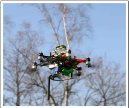
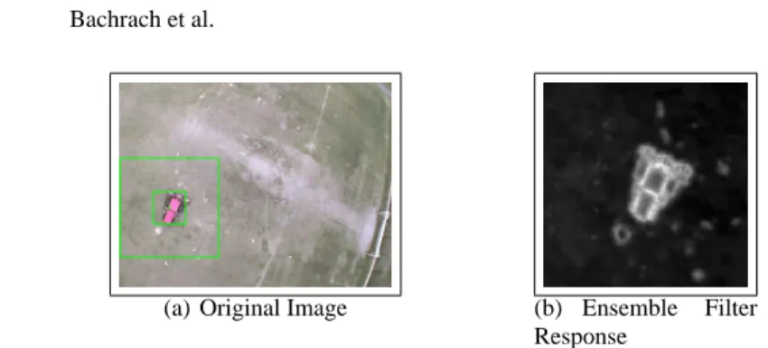
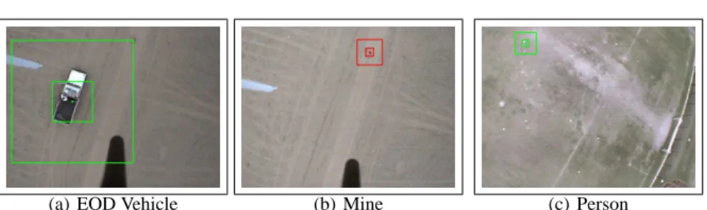
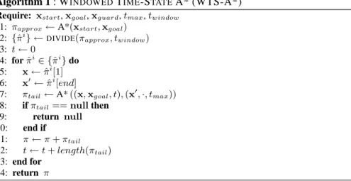
Co-ordinated Tracking and Planning Using Air and Ground Vehicles
Texte intégral
Figure


Documents relatifs
We present results of existence, regularity and uniqueness of solutions of the master equation associated with the mean field planning problem in the finite state space case, in
In order to represent a dynamic entity in the continuum model we create a set of timeslices, each corresponding to a representation of the entity during a determined period of
For example, within the cross-industry Agenda 21, which takes all sustainable and environmental dimensions into account, the French PLU could act as a lever, on such aspects as
Thus the challenge to expand family planning coverage is all the greater: not only is it necessary to reach those couples who have never practised contraception while
Results from a previous study (Grundén, 2017) in which teachers were interviewed with a focus on meaning in relation to planning in mathematics show that teachers refer to
Este artículo presenta un algoritmo de control de dirección para la planeación y seguimiento de trayectorias de un vehículo autónomo terrestre en escala (AGV), permitiéndole tener
We show how, using the precise contact information provided by a CCD algorithm, a randomized planner can be enhanced by efficiently sampling the contact space, as well as
Our findings of impaired import of mitochondrial-matrix proteins in the mutant strains shifted at non-permissive temper- ature confirmed the deleterious nature of the
