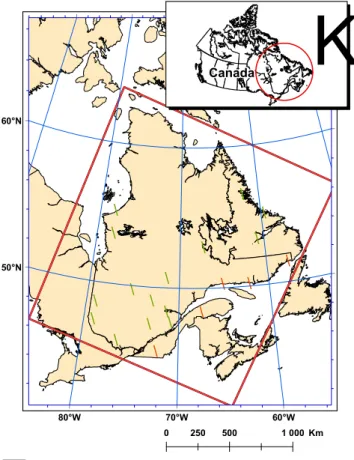
A Merging Algorithm for Regional Snow Mapping over Eastern Canada from AVHRR and SSM/I Data.
Texte intégral
Figure
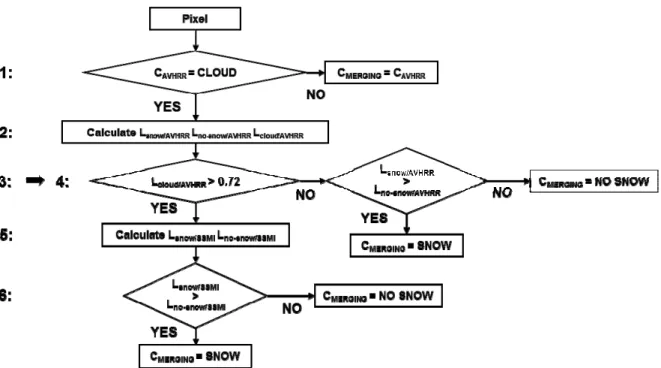
![Figure 2. Flow chart of the AVHRR algorithm (reprinted from [13]). NDVI, Normalized Difference Vegetation Index](https://thumb-eu.123doks.com/thumbv2/123doknet/2956509.80936/5.918.319.605.446.1082/figure-avhrr-algorithm-reprinted-normalized-difference-vegetation-index.webp)
Documents relatifs
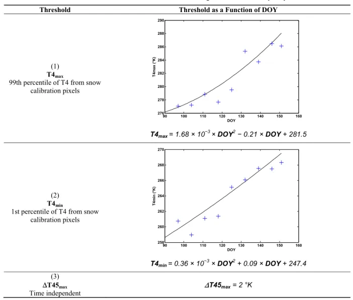
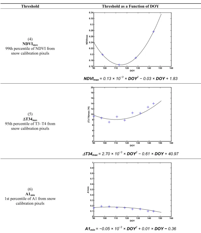
fc t Minimum clear pixels fraction (snow and no snow) in an elevation band used to define z s 0.100 f t Minimum snow fraction in the image to activate the pass 2 snow test 0.001 r
The static algorithm, which assumes a constant snow grain size in space and time does not correlate with the GSWP2 snow depth field (the correlation coefficient with GSWP2 data for
Effect of Digital Elevation Model Resolution on the Simulation of the Snow Cover Evolution in the High Atlas... Simulation of the Snow Cover Evolution in the
We used both in situ and remote sensing data to assess both Aqua and Terra MODIS daily snow cover binary products (snow/no snow) in the Pyrenees.. For the first time, we as- sembled
The number of recharging stations needed to support the fleet of BEVs is significantly greater than the number of gas stations needed to refuel conventional gasoline vehicles due
We vary the atomic density, cloud geometry, observation direction and polarization state of the laser field, and we report the system characteristics using three key parameters
The results will be discussed in terms of: (a) availability and potential of MODIS snow cover data for identifying RSLE changes during snowmelt runoff events, (b) spatial and
Now that a relation between the threshold friction velocity and the diameter of the po- tentially mobilized particles is available, the friction velocity in a powder snow avalanche
