Remote sensing and air quality in urban areas
Texte intégral
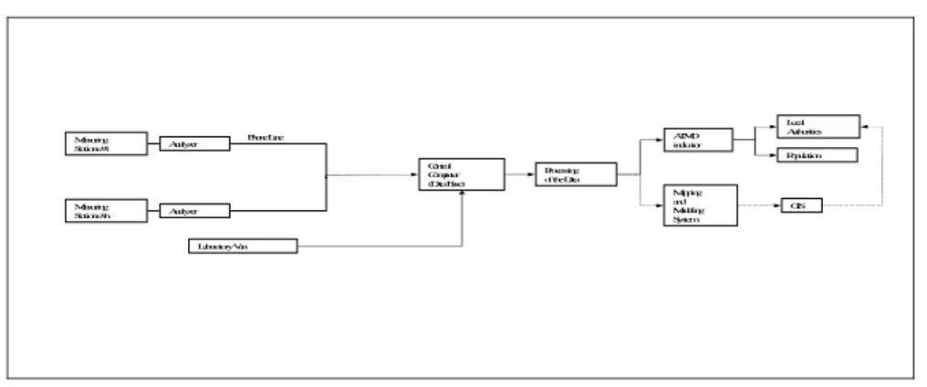
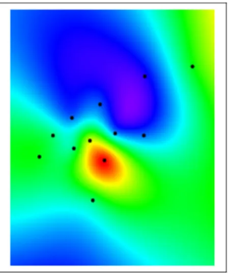
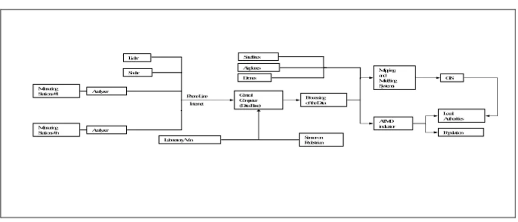
Figure
Documents relatifs
Ceci a été réalisé par l’activation d’un dialogue pluridisciplinaire entre scientifiques et autorités à différents niveaux pour d'une part identifier les méthodes
De SWOT-analyse, uitgevoerd in het kader van de Cluster Air Quality, die tot doel had de sterktes, zwaktes, opportuniteiten en risico’s te bepalen met
The use of the same questions related to indoor exposure and health outcome in the framework of the cluster have allowed performing a statistical analysis to
Table 8 presents the comparison of daily CAQI forecasting performance via LR models at the station of Agia Sofia, by using lagged observed numerical values and by
Results: This animal model of brain inflammation demonstrated two phases of edema development: an initial edema build-up phase during active inflammation that peaked after 3 days
The main climate effect responsible for this increase in surface ozone pollution in Europe is the increase in temperature and solar radiation leading to an increase in
With the ever growing computing facilities, such limita- tions are systematically pushed back and we are now able to introduce a continental scale atmospheric chemistry simula-
As we focus on the efficiency of emission reduction abatements on air quality in cities and wish to distinguish the contributions of emission sources ac- cording to the duration
