Viscoelastic relaxation: A mechanism to explain the decennial large surface displacements at the Laguna del Maule silicic volcanic complex
50
0
0
Texte intégral
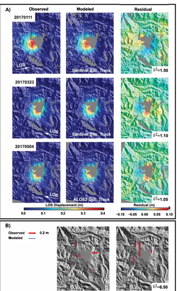
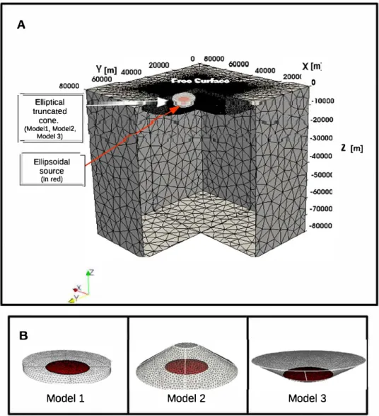
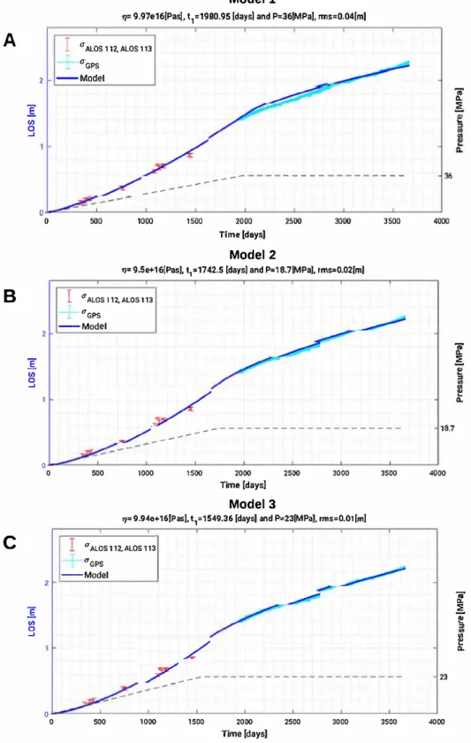
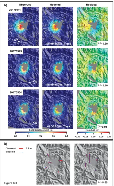
Figure
+7


Documents relatifs