Do Agrometeorological Data Improve Optical Satellite-based Estimations of Herbaceous Yield in Sahelian Semi-Arid Ecosystems?
Texte intégral
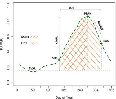
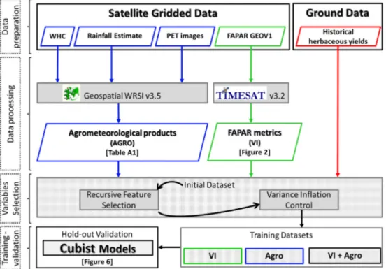
Figure
![Table 1. General Descriptions of Land Cover Classes [53,54]. Woody Cover Values were obtained from the Woody Cover Map Provided by [15] and Correspond to the Averaged Values of Pixels Covered by Classes](https://thumb-eu.123doks.com/thumbv2/123doknet/6760131.186780/4.892.163.728.862.1120/general-descriptions-classes-obtained-provided-correspond-averaged-covered.webp)


Documents relatifs
L’archive ouverte pluridisciplinaire HAL, est destinée au dépôt et à la diffusion de documents scientifiques de niveau recherche, publiés ou non, émanant des
A Decision Tree classification is then used to produce irrigation maps with several simulations based on these parameters, for three specific cases: a classification based on mean
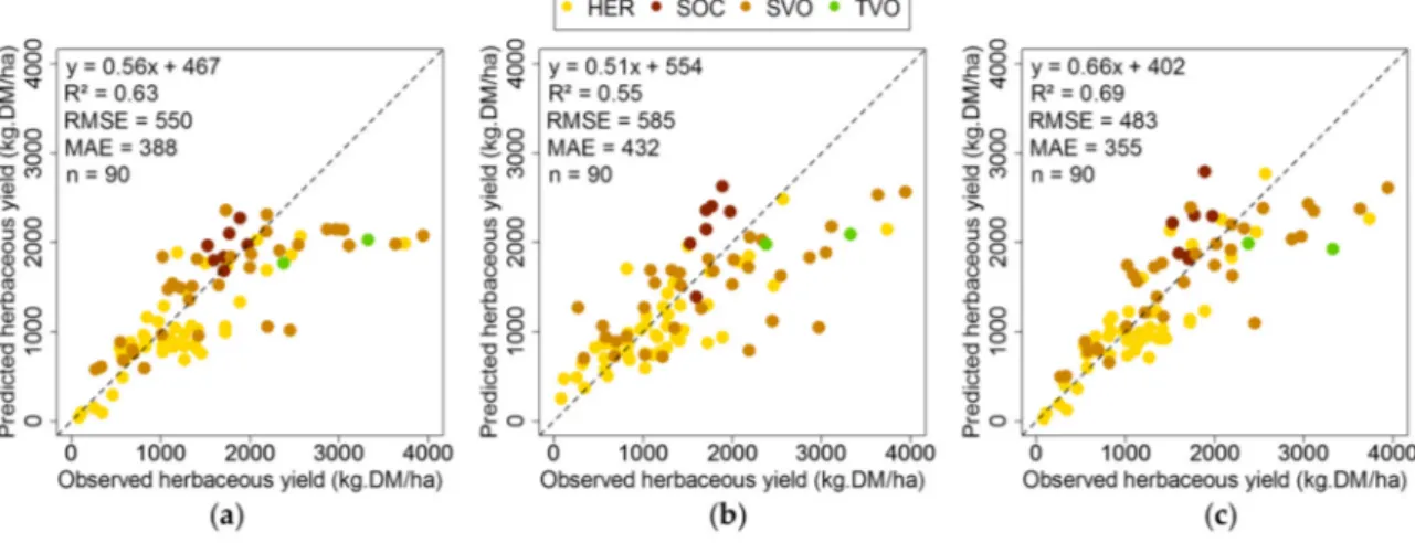
Comparison between yield estimations computed using statistical remote sensing analysis, and yields determined by combining remotely sensed data with the SAFY model. The difference
the slope of the even- ness line, U R , the index of uneven rainfall distribution (i.e. the sum of square of the distances of the actual cumulated rainfall points from the
Biomechanical tissue deformation models have been used for the validation of non-rigid medical image registration. One of the first applications was on the breast MRIs by Schnabel
The use of high performance concrete containing fly ash resulted in a more sustainable bridge deck with a longer service life, lower life cycle costs, and lower
structurel de ces derniers dans les grands récits en langue vulgaire : Meulenbeld avait déjà noté dans sa thèse que c’était un shuilu qui servait de « déclic »
In addition, ImmGen data browsers do host human datasets (including topical COVID-19-related datasets), and several ImmGen members partake in the Immune Cell Atlas within the
