Assessing winter storm flow generation by means of permeability of the lithology and hydrological soil processes
25
0
0
Texte intégral
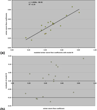
Figure
+6
Documents relatifs
