Modelling the behaviour of a large landslide with respect to hydrogeological and geomechanical parameter heterogeneity
12
0
0
Texte intégral
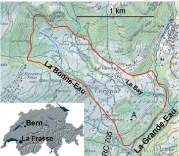
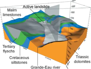
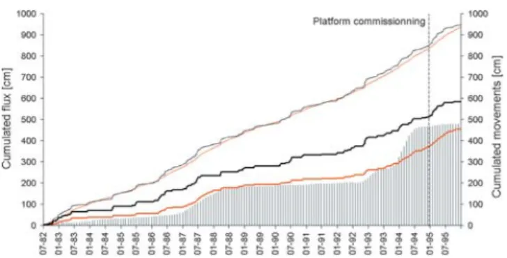
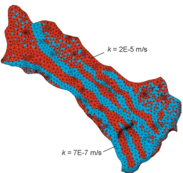
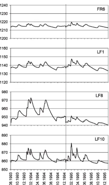
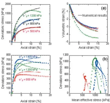
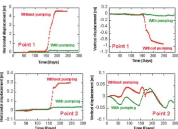
Figure
+7
Documents relatifs