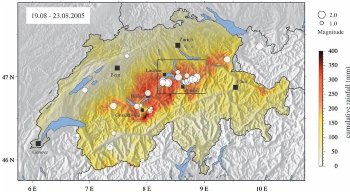
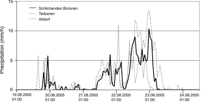
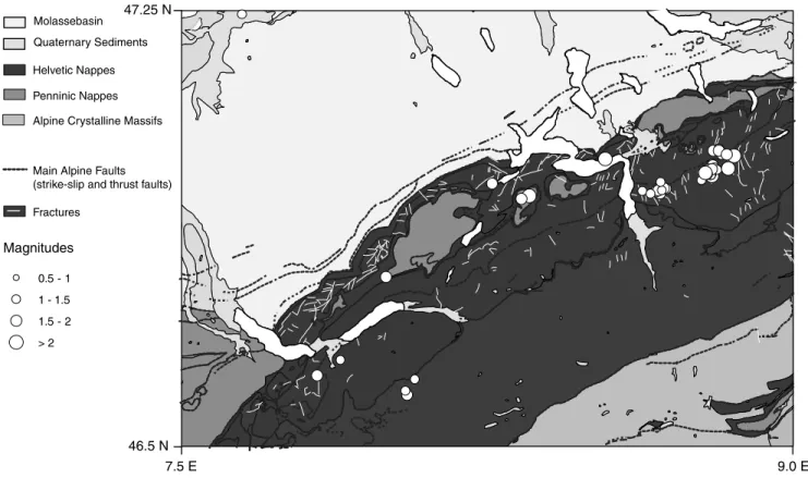
Locally triggered seismicity in the central Swiss Alps following the large rainfall event of August 2005
9
0
0
Texte intégral
Figure

+3


Documents relatifs