LAKE BASIN MANAGEMENT INITIATIVE
LAKE MALAWI / NYASA BRIEF
Harvey A. Bootsma, Ph.D. Great Lakes WATER Institute University of Wisconsin-Milwaukee
Sven Erik Jorgensen, Ph.D.
Department of Environmental Chemistry
Table of Contents
1. Introduction...3
2. Background...4
2.1 Biophysical Features...4
2.2 Political and Socio-Economic Features ...7
3. Biophysical Environment...10
3.1 Temporal Trends: Past vs. Current Conditions...10
3.2 Lake and Drainage Basin Resource Conflicts ...14
4. The Management Environment...16
4.1 Government Management...16
4.2 Development Programs...17
4.3 Community Based Natural Resource Management...21
5. Lessons Learned and Recommended Initiatives...22
5.1 The Need for an Ecosystem Approach ...22
5.2 The Need for Communication ...24
5.3 The Potential for Community Based Management...25
5.4 The Need for Knowledge and Education...26
5.5 Summary of Lessons Learned and Recommendations ...30
LAKE BASIN MANAGEMENT INITIATIVE LAKE MALAWI / NYASA BRIEF
Harvey A. Bootsma Great Lakes WATER Institute University of Wisconsin-Milwaukee
Sven Erik Jorgensen
Department of Environmental Chemistry
The Danish University of Pharmaceutical Sciences, Denmark
1. Introduction
Lake Malawi/Nyasa is the ninth largest and third deepest freshwater lake on Earth (Bootsma and Hecky 2003). In addition to its great size, the lake is distinguished by being home to a greater diversity of fish species than any other lake, with the majority of these species being endemic (Fryer and Iles 1972; Ribbink et al. 1983). As a result of these two qualities – its great size and biodiversity – the lake is recognized as a global heritage. At a time when both quantity and quality of freshwater are becoming issues of concern in many parts of the world, the value of a lake that contains nearly 7% of the Earth’s available surface freshwater is becoming increasingly obvious.
Within the Lake Malawi/Nyasa catchment, the lake’s fisheries are seen as its primary asset. These fisheries are an important source of protein for riparian populations within Malawi, Tanzania and Mozambique, and they make a significant contribution to the regional economy, especially within the country of Malawi. Other benefits of the lake include water for irrigation, transportation and hydroelectric generation.
Formal management activities of one form or another have been carried out on Lake Malawi/Nyasa since the 1930s, although local management practices were probably implemented for centuries before then (Munthali 1994). Virtually all management activities, and much of the research, have focused on the lake’s fisheries. Despite these management activities, total fish catches have declined, and the catch of some fish species has been dramatically reduced, especially in the southern part of the lake (Tweddle and Magasa 1989; Turner et al. 1995; Banda et al. 1996; Bland and Donda 1995). Hence there remains a need to refine and better implement effective fisheries management strategies.
While fish species composition has been altered as a result of fishing pressure, Lake Malawi/Nyasa has not experienced a decline in species numbers as have some other African lakes, such as Lake Victoria. Nevertheless, continued increases in fishing pressure, along with changes in plankton community structure and water quality, may lead to a decline in diversity and even losses of species if preventive action is not taken. Sediment core data and historic phytoplankton data (Hecky et al. 1999) suggest that
nutrient inputs to the lake may be increasing, and this may be causing changes in phytoplankton species composition.
Hence the current issues of primary concern for Lake Malawi/Nyasa are fisheries management, biodiversity conservation, and water quality. This brief provides a background on these issues, an overview of the historic and current management activities related to these issues, and, based on lessons learned from previous research and management activities, recommendations regarding management strategies to
promote sustainable fisheries management and the conservation of biodiversity and water quality.
2. Background
2.1 Biophysical Features
Lake Malawi ranks among the world’s largest lakes, being the third deepest and ninth largest by surface area. Its geography reflects the fact that it is situated in a rift valley.
The lake is long, relatively narrow, and deep. The lake basin consists of a series of half-grabens (blocks of earth that have tilted and dropped during rifting). Some parts of the lakeshore are bordered by steep
mountains, while in other parts the mountains that define the edges of the rift valley are separated from the lake by extensive lakeshore plains. As a result, nearshore topography varies between gently sloping beaches and steep, rocky coastline. In its deepest regions the lake is underlain by more than 4 km of sediment, reflecting its great age that has been estimated at several million years (Johnson and Ng’ang’a 1990; Owen et al. 1990).
Although some of the plateau regions around the lake contain thick colluvial soils, the drainage basin is dominated by metamorphic and igneous gneiss, schist and granite
(Carter et al. 1973). The northern two-thirds of the watershed are predominantly a
mixture of woodlands (evergreen, Brachystegia) and agriculture. The southern third is woodland on the Mozambique coast, but almost completely cultivated land within the
Malawi portion of the watershed, with the exception of the steep hillsides on the western side of the rift valley, which are forest covered. MALA TANZANI MOZAMBIQ MALAW I TANZANIA MOZAMBIQUE
Fig. 1. Map of Lake Malawi and its watershed, showing lake bathymetry and major tributary rivers.
The largest part of the lake’s watershed is within the country of Malawi, followed by Tanzania and Mozambique (Fig. 1). Within the watershed, the population density is greatest in the southern Malawian portion, although it is also relatively high at the northern end, in the Songwe and Kiwira River catchments. The watershed is more densely populated than that of Lake Tanganyika, but less so than that of LakeVictoria (Fig. 2).
Despite its large size, the lake does not have a high volume of outflow (Table 1). Of the approximately 68 km3 of water that enters the lake annually, only about 16% flows out
the Shire River; the remainder is evaporated directly from the lake surface. As a result, the lake has a very long flushing time (Table 1). This distillation effect results in the lake water being more concentrated with regard to conservative ions than are its inflowing rivers. The long flushing time has important ramifications for water quality. Any nutrients or other chemicals that enter the lake essentially become trapped in the lake, and can only be removed by burial in the sediments, loss to the atmosphere (if the chemical has a gaseous phase), or the very slow process of outflow through the Shire River.
The dominance of precipitation and evaporation in the lake’s hydrologic cycle mean that it is also very susceptible to changes in climate. A small increase in the precipitation : evaporation ratio can result in flooding, as occurred in 1979-80, while a small decrease in the ratio can result in the basin becoming closed with no
outflow, as was the case between 1915 and 1937 (Kidd 1983). In recent years, lake level has again been declining, and the lake came near to being closed at the end of 1997.
Figure 2. Human population densities in the watersheds of Africa’s largest three lakes. One dot = 100,000 persons. Estimates are for 1992 (Bootsma and Hecky 1993), based on official government figures and an assumed population growth rate of 2.8% per annum.
Table 1. Physical characteristics of Lake Malawi (Modified from Bootsma and Hecky, 2003)
Surface Area (km2) 29,500 Maximum Depth (m) 700 Mean Depth (m) 264 Volume (km3) 7,775 Altitude (m ASL) 474 Drainage Area (km2) 100,500 Altitude (m amsl) 474 River Inflow (km3 yr-1) 29 River Outflow (km3 yr-1) 12 Rainfall (km3 yr-1) 39 Evaporation (km3 yr-1) 57 Residence Time (years) 114
Flushing Time (years) 648
Lake Malawi is permanently stratified into three layers that are separated by differences in water density (which is controlled primarily by temperature). The top, warm layer (epilimnion) varies in depth between 40 and 100 m, being deepest during the cool, windy season (May – September). It is in this layer that most algal growth occurs, supporting the lake’s food web. The middle layer (metalimnion) is several degrees cooler than the surface layer, and extends from the bottom of the epilimnion to about 220 m. Within this layer there are strong vertical gradients of dissolved nutrients and oxygen. The deepest layer (hypolimnion) extends from about 220 m to the bottom of the lake. This layer is the coolest (most dense) and contains high concentrations of dissolved nitrogen, phosphorus and silica. It is completely anoxic (no dissolved oxygen), and therefore virtually no fish are found below 220 m.
While the lake has never been known to completely mix vertically, there is a slow
exchange of water between the three layers. The rate of this exchange varies with season and location. Generally, there is a greater upward flux of nutrient-rich waters from the hypolimnion and metalimnion to the surface during the cool, windy season when the southeast trade winds blow (known locally as the mwera). In addition to vertical
entrainment and mixing, upwelling can occur in parts of the lake during this season. Due to the lake’s morphometry (shape), upwelling tends to be strongest in the lake’s southeast arm. As a result, plankton production is usually greatest in the southeast arm during and shortly after the windy season (Bootsma 1993a; Patterson and Kachinjika 1995).
Phytoplankton species composition also varies with season and location. Diatoms are usually dominant during the windy season, and can be dominant for much of the year at the southern end of the lake (Hecky and Kling 1987; Bootsma 1993a; Patterson and Kachinjika 1995). Following the windy season, cyanobacteria (blue-green algae) often dominate during September to November. During this period, surface blooms of filamentous blue-green algae (Anabaena spp.) are often observed. Between December and April, the phytoplankton is often a mixture of small diatoms, blue-green algae, and green algae.
On a trophic scale (a scale commonly used to classify lakes according to productivity), Lake Malawi can be classified as oligotrophic to mesotrophic, i.e. low to medium productivity. Chlorophyll a concentrations (an index of algal abundance) are low – usually below 1 µg per litre.
Pelagic (offshore) waters of the lake are very clear for most of the year, due to low concentrations of dissolved organic compounds and suspended solids. However, large parts of the lake, particularly near shore, can become turbid during the rainy season when rivers bring in large amount of suspended solids.
Lake Malawi is the most species-rich lake in the world, with an estimated 500 to 1000 species of fish (Fryer and Iles 1972; Konings 1995). Eleven families of fishes exist in the lake, but one family – the Cichlidae – are by far the most speciose, making up over 90% of all fish species in the lake, almost all of which are endemic. Diversity of the pelagic cichlids is high by any standards, but it is in the nearshore communities that diversity is the greatest. In the rocky nearshore waters of Lake Malawi, more than 500 individuals and 22 species can be found in a 50 m2 area (Ribbink et al. 1983). Not only are the cichlid species endemic to each lake, but within each lake local endemicity is common among the nearshore fishes, so that certain species or color forms are confined to specific islands or isolated rocky segments of the shoreline (Fryer and Iles 1972; Ribbink et al. 1983; Konings 1995).
Total fish catch is difficult to estimate, due to the large number of small-scale fishers and the limited capacity of the government to collect sufficient catch data. Thompson (1995) has estimated that the total annual catch is approximately 30,000 tonnes (Thompson 1995), while Lewis and Tweddle (1990) earlier estimated that the annual catch of one species alone, Engraulicypris sardella (“usipa”), may have exceeded 50,000 tonnes. The majority of the artisanal fishery yield is made up of Copadichromis spp. (“utaka”), Engraulicypris sardella, and Lethrinops spp. (“chisawasawa”). Yields of catfish and “chambo” (Oreochromis spp.) have decreased and currently make up less than 20% of total catch (Irvine et al. 2002).
2.2 Political and Socio-Economic Features
Lake Malawi/Nyasa is shared by three countries – Malawi, Tanzania and Mozambique (Fig.1). The majority of the lake and its catchment lie within Malawi. The position of the Malawi-Tanzania border within the lake is contested; Malawi accepts the border to be along the eastern shore of the lake, while Tanzania accepts it to run through the lake. Approximately 25% of the catchment is within Tanzania (Kidd 1983). However, land use within Tanzania may have a disproportionate effect on the lake, because annual rainfall is greater at the northern end of the lake, and therefore river inputs are greater. Approximately 20 % of annual river inflow to the lake comes from the Ruhuhu River in Tanzania (Kidd 1983). About 7% of the catchment area is within Mozambique.
As mentioned above, population density is greatest in the southern part of the catchment within Malawi. According to the Malawi National Statistics Office, the total population
of Malawi in 1998 was 9.9 million, with an annual growth rate of 2.0%. The Northern and Central regions of the country, which make up most of the Malawian portion of the lake catchment, have 12% and 41% of the total population, respectively. However, population growth rate in the northern region is higher than the national average, at 2.8% per year. 14% of the population lives in urban areas, and the urban population growth rate is about 4.7% per year. Within the portion of the population that is considered “economically active” (68%), 78% are subsistence farmers while 13% are employees. In contrast to the Malawian portion of the catchment, the eastern and parts of the
northwestern shores of the lake have relatively pristine vegetation, low population densities, and are lightly exploited. These areas are relatively remote from the centres of Tanzanian and Mozambican government and so have been little developed. However, these two governments are making attempts to raise the economic standards of these regions through tourism and agricultural development.
Agriculture is the mainstay of Malawi’s economy, accounting for almost half of the GDP, and for almost all export revenues. Agriculture accounts for half of the GDP in Tanzania, and 35% of the GDP in Mozambique. Within Malawi, the fishing industry contributes between 1 and 2% to the GDP, and employs almost 300,000 people either directly or indirectly. The majority of the catch is caught by small-scale fishers. However, in the southern part of the lake there is a commercial fishery (MALDECO) that targets fish stocks further offshore than do most artisanal fishers. Within Malawi, fish are estimated to provide about 70% of dietary animal protein (Bland and Donda 1995), and the
majority of this fish comes from Lake Malawi/Nyasa.
In addition to fish and fresh water, other economic benefits gained from the lake are electricity, transportation, and an ornamental fish trade. The majority of electricity produced in Malawi comes from hydroelectric plants on the Shire River, which drains the lake. However, fluctuations in river discharge, which is controlled by lake level, make this power source precarious. The level of Lake Malawi/Nyasa is highly sensitive to climatic changes. Between 1915 and 1935, the lake was completely closes, with no outflow. More recently, as a result of low lake levels in 1997, electrical power was being rationed in October and November, at the end of the dry season. Currently there are plans to extend power lines from the Matambo power station in Mozambique’s northwestern Tete province to the southern region of Malawi.
Large scale transport on the lake is conducted almost exclusively by the government owned Malawi Lake Services, which operates passenger and cargo vessels. The business is currently being operated under a 20-year concession to a private firm. Vessel
operation is irregular due to frequent breakdowns and concerns about low draught in some of the ports.
Lake Malawi/Nyasa’s ornamental fish trade consists primarily of one business based at Senga Bay. While some exported species are directly from the lake, others are bred in tanks at Senga Bay. In 1994, the ornamental fish trade was valued at US $276,000 (Msiska 2001).
With a population of about ten million people, a growth rate of approximately 3% (Department of Research and Environmental Affairs, 1994), and the resultant density of about 106/km2, Malawi is one of the most densely populated countries in the sub-Saharan Africa. The associated impacts of the burgeoning human pressure are unsustainable agricultural and livestock grazing practices, occupancy of the shoreline for easy access to fish and water, and deforestation (Hecky, 1993).
Malawi is one of the least developed countries. The estimated per capita income is about US$ 230.00. According to the World Bank, 43% of smallholders do not have enough income to acquire their most basic needs, and 30% have insufficient income to meet their calorie needs. It is estimated that in rural areas, poverty is at 60%, while it affects 65% of the urban dwellers. The main causes of poverty are low agricultural productivity, low non-farm income, low education, and poor health (UNDP/GOM, 1993).
The implication of this low income is that farmers are unable to purchase inputs to improve their agronomic practices. Secondly, it means that during the growing season, farmers have to work as casual labourers on commercial farms at the expense of managing their own lands optimally.
Present experience in Tanzania shows that major sectoral water users like irrigated agriculture and hydropower generation, have been implementing parallel targeted development programmes independently. A coordination mechanism of implementing projects is require. It has been further realized that the country’s development programmes have emphasized only water supply and have not considered water resources management aspects as an integral component.
As part of the development of a water resources management capability, the country has been divided into nine basins. New water resources management initiatives are being developed using the nine basins for management units. A rapid appraisal was completed to rank the issues in order of importance for each basin. The basins that are within the Lake Malawi/Nyasa/Niassa catchment are currently not prioritized. Currently the Department is only able to provide resources for development of two of the basins based on the presence of hydropower or irrigation infrastructure. Basin Water Offices are being established which are envisioned to be self-financing.
Experience has shown that fragmented planning and management, lack of integrated sectoral approaches to development and conflicting sectoral policies are the main causes of conflicts in water use in Tanzania. These conflicts call for a need to manage the available water resources in a comprehensive manner taking into consideration integrated plans in cross-sectoral uses of water, land-use, pollution control, environment and public health considerations on a basin wide basis (World Bank, 1996).
As part of a sector wide review, a comprehensive Rapid Water Resources Assessment (RWRA) based on existing information was completed. The issues specifically identified
in the rapid appraisal for the Songwe and Ruhuhu basins include: water pollution, impact on fisheries, conservation of sensitive ecosystems (specifically wetlands found on the Songwe River system), and intensive cattle grazing in the catchment.
The small portion of the lake’s catchment that lies within Mozambique is within the province of Niassa. Land in this province is very fertile, but it is the country’s most sparsely populated province, with a total population of less than one million, despite attempts by the Mozambique to promote immigration to this province from other provinces. In an effort to promote development within this regions, an agreement was signed between Mozambique and South Africa in 1996 to make land within Niassa province available to South African farmers.
Mozambique’s economy has greatly improved since the end of the civil war. Between 1996 and 2000, the average annual inflation decreased from 47% to 2%, and GDP grew by almost 10% per year. In 2002, economic growth was 12% - the best on the African continent. Little of this development has extended to Niassa Province, but within this province there has been a recent rapid expansion of tobacco growing and curing. 95% of the cultivated land is traditional, family-run farms with an average size of 2 hectares.
3. Biophysical Environment
3.1 Temporal Trends: Past vs. Current Conditions
Due to its large volume and long hydraulic residence time (the annual inflow of river water to the lake is only 0.4% of the lake’s total volume), Lake Malawi/Nyasa may respond very slowly to increased inputs of certain contaminants, and therefore the detection of changes over time may be difficult if only the lake water is monitored. Monitoring of rivers and atmospheric inputs will provide a more sensitive analysis of temporal change, but historic data on river water quality is very sparse, and the earliest measurements of atmospheric nutrient deposition were made in 1990-91 (Bootsma et al. 1996). Nevertheless, historic limnological data suggest that the lake may be responding to changes in land use within its catchment.
Nutrient concentrations are low in Lake Malawi/Nyasa, and therefore phytoplankton concentrations are also low. Typically, the surface water concentrations of dissolved nitrogen and phosphorus are below 0.4 µmol L-1 and 0.1 µmol L-1 respectively, and chlorophyll a concentrations (used as an index of phytoplankton abundance) are below 1 µg L-1. There is no evidence that current nutrient concentrations are greater than
previously. However, the concentration of a nutrient is a poor indicator of the rate at which it is delivered to a lake, because nutrients are rapidly assimilated by
phytoplankton, and therefore their concentration may remain low even when delivery rates have increased. While there is insufficient historic data on nutrient inputs from rivers to determine if inputs to the lake have increased, analysis of sediments in the lake provides an alternative method of examining the lake’s history. Recent sediment cores suggest that phosphorus inputs to the southern half of the lake have steadily increased over the past half century (Hecky et al. 1999). A similar trend is not apparent for the
northern half of the lake, although there is some uncertainty as to whether the core data for this region adequately represents recent conditions.
Because phosphorus appears to be an important nutrient controlling phytoplankton production in the lake (Guildford et al. 2003), increased inputs of this nutrient might be expected to result in increased phytoplankton abundance. There is not strong evidence for this having occurred. However, a comparison of phytoplankton species composition in sediment cores and among various studies conducted over the past several decades suggests that there has been a shift in species dominance. In the southern part of the lake, the previously common Planktolyngbya nyassensis has been replaced by Planktolyngbya tallingi, a species that is more common under conditions of higher nutrient concentrations and lower light availability (Hecky et al. 1999). In addition, the potentially toxic species Cylindrospermopsis raciborski has recently been reported. Understanding of lower food web structure in the lake is insufficient to determine whether such changes may affect zooplankton and fish production. However, in October 1999 a massive fish kill occurred along the entire western shore of the lake, and toxic algae are one possible cause of this kill.
The most likely cause of the apparent increase in phosphorus input to the lake appears to be changes in land use. The majority of the Lake Malawi/Nyasa catchment is in Malawi, where the population has doubled in the past 25 years. Most of the population relies directly on subsistence agriculture for food, and the high population density is resulting in the expansion of subsistence agriculture to marginal land, including wetlands and steep hill slopes. Application of fertilizers to agricultural land is minimal, and therefore it is unlikely that fertilizer application is resulting in increased river loads of phosphorus. Rather, erosion of phosphorus-containing soils is the most likely cause of increased phosphorus inputs. An indication of the extent of erosion in the lake catchment is provided by a comparison of dissolved organic carbon (DOC) and particulate organic carbon (POC) concentrations in tributary rivers. In undisturbed rivers, the DOC concentration is generally about 10 times the POC concentration. In contrast, in many Lake Malawi/Nyasa tributaries, the POC concentration is much higher than the DOC concentration (Ramlal et al. 2003), suggesting exceptionally high erosion rates within the catchment. Not only do these erosion rates result in accelerated nutrient inputs to the lake, the high suspended sediment loads in rivers increase the turbidity of nearshore waters. Data collected by Duponchelle et al. (2000) indicate that greater turbidity leads to decreased body condition in rock-dwelling cichlids in Lake Malawi/Nyasa, and the work of Seehausen et al. (1997) on Lake Victoria has shown that increased turbidity can lead to loss of biodiversity among cichlids.
In addition to catchment erosion, a large proportion of the nitrogen and phosphorus entering the lake originate from the atmosphere. There are no historic data with which recent measurements may be compared, but a global comparison indicates that
atmospheric deposition rates of nitrogen and phosphorus in the Lake Malawi/Nyasa region (Bootsma et al. 1996, 1999) are among the highest in the published literature. There are several possible causes of these high deposition rates, including the large amount of biomass burning that occurs in this part of Africa (Andreae 1993), and the
increased exposure of soil to wind erosion following that is promoted by burning, deforestation and over-grazing of land.
Changes in land use not only affect erosion and nutrient inputs to the lake, they also appear to have had a significant effect on hydrology within the catchment. A review of historic lake levels, rainfall records, and land use change by Calder et al. (1995) indicates that between 1967 and 1990, forest cover in the lake catchment decreased from 64% to 51%, and this loss of forests resulted in increased water input to the lake, due to a
decrease in terrestrial evapotranspiration rates. As a result, lake levels in the early 1990s were approximately 1 m higher than they would have been had this deforestation not occurred. While this may appear to be a benefit to the lake, the implications for terrestrial systems and for streams and rivers are probably negative, since stream flow tends to be less stable in deforested catchments.
Lake Malawi/Nyasa has not experienced exotic fish species introductions, such as those that have so drastically altered the fish communities of Lake Victoria. However, the water hyacinth (Eichornia crassipes) was first introduced to Malawi in the 1960s, and it is now present in the lake and many of its tributaries. Within the lake the plant is not abundant, probably due to the low nutrient concentrations in the lake. However, there is potential for water hyacinth to become a problem in the lake if nutrient inputs increase. This may have serious implications for biodiversity, since the lake’s richest fish
communities are found in the nearshore zone. Currently, most of the water hyacinth found in the lake originates in tributaries, and dies out in the lake. However, within the tributaries, and in the out-flowing Shire River, water hyacinth is abundant, and it has resulted in problems at the Liwonde barrage and at the hydro-electricity generating plants on the Shire River. The Malawi government initiated a biological control program in 1995, using the weevil Neochetina spp. This appears to have some success (Phiri et al. 2001), although water hyacinth remains a problem.
There are few large cities in the immediate vicinity of Lake Malawi/Nyasa, and as a result industrial and urban influences on the lake appear to have been moderate to date. PCB and DDT levels in the lake are similar to or slightly lower than those measured in the Laurentian Great Lakes of North America (Kidd et al. 1999). However, measured concentrations of some organochlorines, lindane and dieldrin, in air and water indicate that the concentration of these contaminants will continue to rise in the lake, since it is not yet at equilibrium with the atmosphere with regard to these compounds.
Concentrations of pesticides, PCBs and mercury in most fish from Lake Malawi are low, although mercury levels in some of the larger fish species, such as mpasa (Opsaridium microlepis) and ncheni (Rhamphochromis spp.) are sufficiently high to be of potential concern to pregnant women and children (Kidd et al. 1999).
Although it has been given little attention to date, climate change has occurred within the Lake Malawi/Nyasa region over the past century, and it will likely be more dramatic over the next century. Vollmer (2002) has meticulously reconstructed historic deep water temperatures for the lake to show that the hypolimnion has warmed from 22.02oC to 22.74oC between 1939 and 1999. While this increase appears small, it is significant
when one considers that the lake is very weakly stratified during the cold, windy season. The implications for lake nutrient cycles, plankton production and fish production depend on whether the surface waters have warmed more or less than the deep waters. If the surface has warmed more than the deep water, vertical mixing will be reduced, resulting in less nutrient supply and lower plankton production. While the current effect of climate warming on the lake is uncertain, air temperatures in this part of Africa are predicted to increase by approximately 4oC over the next century, and this will certainly alter lake levels, lake hydrodynamics and biogeochemical cycles.
While fisheries catches have remained relatively stable in Lake Malawi/Nyasa, the catches of a number of larger, more economically valuable species have declined dramatically, especially in the southern arms of the lake where fish catches have
historically been the greatest. These include catfish (Bagrus and Bathyclarias species), mpasa (Opsaridium microlepis), nchila (Labeo mesops and L. cylindricus), and chambo (Oreochromis species) (FAO 1993; Turner 1994, 1995; Irvine et al. 2002). The reduction in numbers of catfish and chambo is due to overfishing, while the decline of
potamodromous fishes (mpasa and nchila) is likely due to a combination of overfishing and degradation of river and nearshore habitat. The persistence of relatively constant catch rates, despite the declines in several species, is due to increasing fishing pressure and a reduction in net mesh sizes, and as a result the catch per unit effort has declined, as has per capita income (Bulirani 2003). Fish consumption has declined from 14
kg/person/year in the 1970s to ledss than 6 kg/person/year (Malawi State of the Environment Report, 2002).
In attempt to identify potential new fisheries, an ODA/SADC project, Fishery Poetential and Productivity of the Pelagic Zone of Lake Malawi/Niassa, was implemented between 1987 and 1994 (field work commenced in 1992). This project identified untouched, deepwater pelagic fish stocks, consisting primarily of Diplotaxodon spp. and
Rhamphochromis spp. (Menz 1995). These stocks have not yet been targeted, due to the logistic difficulties associate with the development of a pelagic, deepwater fishery.
Lake Malawi/Nyasa supports an ornamental fish trade, which targets nearshore cichlids, primarily in rocky habitats. This trade provides foreign exchange for Malawi, although its economic significance is probably very minor relative to the artisanal fishery. There are few data to determine the impact of this trade on abundance and diversity of
nearshore fishes. However, as a result of escapes and dumping, some species have been introduced to parts of the lake in which they were not indigenous, resulting in disruptions of the structure of local fish communities (Ribbink et al. 1983).
Based on historic trends of fisheries, water quality, and hydrology, and recent data on river water quality, the main threats to the Lake Malawi/Nyasa ecosystem are:
- over-fishing in some areas (nearshore, especially southern end of lake) - increased nutrient inputs and changes in phytoplankton composition - sediment loading
- water levels (re: electricity)
The ultimate causes of these threats, in addition to over-fishing, are:
- deforestation
- sub-optimal agricultural practices - biomass burning
- climate change
3.2 Lake and Drainage Basin Resource Conflicts
Almost all resource conflicts within the Lake Malawi/Nyasa basin fall within four categories: 1) over-fishing; 2) poor agricultural practices; 3) deforestation; 4) biomass burning.
As outlined above, overfishing is the result of increased fishing activity and the use of illegal gear to catch smaller fish. This is primarily an issue in the southern part of the lake, as well as in Lake Malombe downstream from Lake Malawi. As such, the problem is largely confined to Malawi, and over-fishing is not a major concern in Tanzania or Mozambique. Within some parts of Malawi, the Fisheries Department is unable to collect sufficient data to allow estimates of maximum sustainable yield or to develop management strategies (e.g. Sipawe et al. 2001). Within the southern part of the lake, moderately good data on catch statistics are collected through trawl surveys and beach monitoring programs. While these data are used to develop legislation and management strategies for the fishery, the government does not have the financial resources required to enforce fisheries regulations. On its current track, the nearshore fisheries of Lake Malawi/Nyasa will continue to deteriorate.
Although the lake is shared among three countries, at present there is minimal conflict related to fish catches within the lake. The Mozambican coast has a low population density, and therefore fishing pressure is low in this region. The dispute over the border location between Malawi and Tanzania at the northern end of the lake is primarily a political one, and results in minimal conflict between fishers of the two countries. This is because the fisheries are confined to nearshore regions, and few Malawians have access to the east side of the lake. However, if efforts are made to exploit the pelagic fish stocks that have recently been identified, the potential for conflict will increase. This may become an even more contentious issue with the development of the Mtwara corridor, the goal of which is to promote transportation between Tanzania’s Indian Ocean port in Mtwara with the northeast lakeshore region (southwest Tanzania), and to expand industrial activities (including natural resource extraction) within this region.
The vast majority of people (80%) living within the Lake Malawi/Nyasa catchment rely directly on agriculture for subsistence. As a result of increasing population density, as well as land tenure reform that has allocated land to large estates and conservation areas, the amount of land available to rural populations has been decreasing, forcing people to
cultivate in marginal areas (wetlands, steep hill slopes, poor soils) that were previously untouched. This has negative social, economic and environmental consequences which will become more severe with time. Inevitably the governments of the riparian countries will need to promote economic diversification to lessen the direct dependence on land access, but currently more emphasis is being placed on maximizing agricultural
production. In Malawi a significant proportion of the land occupied by tobacco estates remains wooded because the land is being held by owners for future use. Because of the great need for land by smallholders, mechanisms to promote the agricultural utilization of this land are being considered. However, while this may promote agricultural
production, at least in the short term, it will have negative consequences with regard to soil erosion, water quality, and fuel wood supply.
In most developed countries, conflicts arise between agriculture and water management sectors because excessive application of pesticides and fertilizers has a negative impact on the water quality and ecology of rivers and lakes. In the Lake Malawi/Nyasa
catchment, the primary means through which agricultural activities affect the rivers and the lake is soil erosion. The impact of fertilizers and pesticides is relatively small on a whole lake basis, although there is potential for localized impacts, particularly in cotton-growing regions and near large sugar plantations. Because soil erosion is detrimental both to water quality and to crop production, there is no inherent conflict between the agricultural sector and the water management sector. Improved soil and water
conservation will benefit both sectors. The current challenge is to identify areas within the catchment where soil erosion is the greatest, and to implement feasible strategies to reduce erosion in those areas. Significant progress in this area has been made within the Lake Victoria catchment as a result of extension work conducted through the Lake Victoria Environmental Management Project (LVEMP), and lessons from that project would likely benefit managers within the Lake Malawi/Nyasa catchment.
As in the fisheries sector, the governments of the three countries have been unable to enforce forest management regulations or to adequately monitor and inventory forest resources. As a result much of the forest and woodland resources are openly accessible to the public. The great reliance on wood is a fuel source and building material,
combined with high population densities, is resulting in a rapid net loss of forests. While some of this loss is due to slash and burn activities associated with clearance of new land for agriculture, recent analysis of time-series satellite imagery reveal that much of the loss is through gradual attrition (2 to 3% per year) within forest reserves, conservation areas and national parks (Eastman and Toledano 1996). Some efforts have been made to promote forest and wildlife conservation in these areas through education and sustainable utilization (e.g. beekeeping and honey production), but as with agriculture, the heavy, direct reliance on natural resources for sustenance and income, along with high
population density, make it impossible to both preserve woodlands and ensure that the basic needs of people are met. This is perhaps most evident in Lake Malawi National Park, which includes five enclave villages that are almost completely dependent on trees within the park as a source of fuel and building materials. With regard to lake
management, there is a huge disconnect between forest management and water quality management. Although water conservation is recognized by managers as a benefit of
forests, catchment hydrology, water quality and fisheries production are not used to measure the success of forest management programs. To forest managers, the ecosystem is the forest, not the larger catchment basin.
The final resource conflict, biomass burning, is one whose impact on Lake Malawi/Nyasa has been under appreciated. Although extensive measurements have not been made in many parts of East Africa, several studies (Bootsma et al. 1996, 1999; Langenberg et al. 2003) indicate that a large portion of nitrogen and phosphorus entering the African Great Lakes originates from the atmosphere, and that atmospheric nutrient deposition rates are greater in this region than in many other parts of the world. There is strong evidence that these high atmospheric loads of nutrients are due directly and indirectly to burning (Bootsma et al. 1996). The region surrounding Lake Malawi/Nyasa is among the most frequently burned regions of Africa. The reason for this burning is not well documented, but there are probably multiple reasons, including the preparation of fields for cultivation, burning of woodlands to open up agricultural areas, the promotion of early growth of grass for grazing animals, hunting, accidental fires, and tradition. Although it is evident that burning results in increased nutrient input to the lake, the impact on lake nutrient cycles and on plankton production requires further study. If this input is considered undesirable, then reducing atmospheric inputs will be an even greater challenge than reducing river inputs, because atmospheric inputs are derived from a much larger area than the lake catchment, and their management will require a large effort to address the causes of biomass burning on a large, regional scale. Such an effort will only be successful if it is implemented from an agricultural perspective, since farmers and rural populations who are responsible for much of the burning have little incentive to change their practices for the betterment of the lake.
4. The Management Environment 4.1 Government Management
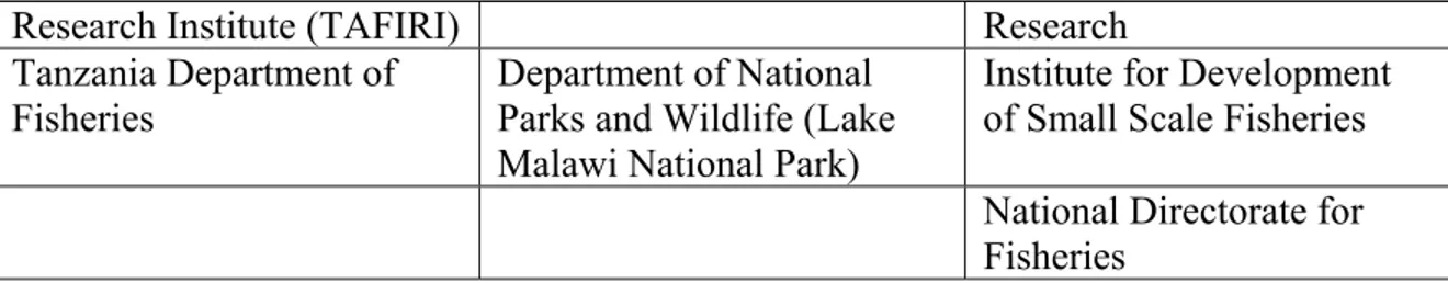
Within all three countries surrounding the lake, management of natural resources is done on a sector basis. Those government institutions directly involved with management of the lake and its resources are listed in Table 1. With the exception of Lake Malawi National Park, all management activities on the lake are focused exclusively on fisheries. While some of these departments have recruited staff with training in other areas such as water chemistry and plankton ecology, the relationship between fisheries and water quality, plankton ecology, and land use is given very little attention, and fisheries management is based almost exclusively on the analysis of catch data. Although the importance of biodiversity is recognized, the only management action to address biodiversity conservation has been the establishment of Lake Malawi National Park.
Table 1. Government departments in Tanzania, Malawi and Mozambique directly involved in the management of Lake Malawi/Nyasa and its resources.
Tanzania Malawi Mozambique
Research Institute (TAFIRI) Research Tanzania Department of
Fisheries Department of National Parks and Wildlife (Lake Malawi National Park)
Institute for Development of Small Scale Fisheries
National Directorate for
Fisheries
In addition to being strongly sectoral, natural resource management in the three countries is characterized by top-down management models with minimal stakeholder
involvement. While recent development programs have attempted to foster greater stakeholder input, ironically the lack of stakeholder involvement may be due to the large role that development organizations have played in the management of natural resources within the region. Management activities in the lake have been heavily supported by external development agencies, but these agencies have also had a strong hand in the direction of management activities, with the input of government agencies sometimes being post factum. Similarly, these donor initiatives may actually inhibit inter-sectoral collaboration because they are often developed with predetermined objectives and agendas that deal with specific sectoral problems but ignore larger, ecosystem-scale issues. In addition, externally funded programs may demand a large amount of time from senior government staff, detracting form longer term initiatives that the government is pursuing independently (Bulirani 2003).
4.2 Development Programs
Due to extremely limited financial resources for research and management within each of the three countries, activities supported directly by the governments have been confined almost exclusively to monitoring of fish catches and the use of catch data to develop fisheries regulations. Even these activities are limited, due to lack of adequate research vessels and frequent breakdowns of available vessels. As a result, most of the research carried out on the lake over the past four decades has been implemented through donor agencies, usually in collaboration with the regional fisheries departments. A list of some of the major projects is given in Table 2. This list is not exhaustive, but it provides a large enough basis from which an assessment of the benefits of such projects can be made.
Table 2. Development projects on Lake Malawi between 1970 and 2003.
Project Title Dates Organization Objective
Fishery Expansion Project 1977-1981 UNDP/FAO; Malawi government
Quantify potential yield of pelagic fish stocks in Lake Malawi/Nyasa
WWF LMNP Project
1992 government Chambo (Oreochromis spp.) in southeast arm of Lake Malawi, upper Shire River, and Lake Malombe
UK/SADC
Fisheries Project 1987 – 1994 UK ODA (now DFID) / SADC, governments of Malawi, Tanzania, Mozambique
Assess offshore fishery potential of Lake Malawi/Nyasa Lake Malawi Fisheries Development Project 1991-2000
World Bank Facilitate access to offshore fishery through privatization of boat construction industry, construction of plank boats, and establishment of credit facilities for fishers. Malawi
Environmental Monitoring Program
1993 -
1999 USAID; University of Arizona; Clark University, Malawi government
Assess current environmental status and rates of change, and improve capacity to assess environmental impact of specific policies. SADC/GEF Lake Malawi/Nyasa Biodiversity Conservation Project 1995 – 1999 SADC; GEF (implemented by World Bank), CIDA; UNDP; DFID, DANIDA, FAO
Map diversity and identify threats to lake’s biodiversity; propose conservation
management strategies; educate public with regard to conservations need; assess environmental legislation and recommend revisions with regard to biodiversity conservation. Ncheni Project 1996 - 2001 University of Hull; UK DFID, governments of Malawi and Tanzania
Determine diversity of pelagic cichlids and provide advice on sustainable exploitation. Comprehensive Study on Lake Malawi Ecology for Sustainable Utilization 1998 -
2001 JICA; Chancellor College (Malawi) Develop research facilities at Chancellor College; conduct research on fish genetics.
Preparation of a Preliminary Physical Processes and Water Quality Model for Lake Malawi/Nyasa
1999 - 2000
World Bank; Univ. of Waterloo; Delft Hydraulics; UNU/INWEH
Develop initial
hydrodynamic, water quality, and catchment models for Lake Malawi/Nyasa, and provide training in model use.
National Aquatic Resource
1997-2003
GTZ (Germany) Develop inland fisheries and aquaculture;
Management Programme (NARMAP) Conceptualization of participatory community fisheries management. Lake Malawi Artisanal Fisheries Development Project 2003 - 2008 African Development Bank
Enhance management and utilization of fisheries resources, and protect tributary watersheds
The general objective of many of the above projects has been to assess the status of various fisheries in Lake Malawi/Nyasa, and to promote better management of these fisheries. Exceptions are the Malawi Environmental Monitoring Program, which focused more specifically on monitoring of terrestrial resources within the lake catchment, and the SADC/GEF Lake Malawi/Nyasa Biodiversity Conservation Project, which focused on biodiversity conservation (one of the six focus areas of the GEF) and, like the MEMP program, took a broad ecosystem approach.
The working strategy of most development projects has been: 1) to carry out some form of research or survey to obtain data, 2) to use these data to better understand the various aspects of the Lake Malawi/Nyasa ecosystem, including the social and economic
conditions, and 3) to apply this understanding to the development of management strategies to maintain or improve the status of the system with regard to natural resource (especially fish) production, water quality / quantity management, biodiversity
conservation, and economic welfare of the riparian populations. Most projects have also included training components and outreach components. With regard to points 1 and 2, most projects have been reasonably successful. We know much more about the Lake Malawi/Nyasa basin ecosystem today than we did 30 years ago, primarily because of the work that has been carried out by the projects listed in Table 1, as well as work carried out within various government departments. The information and understanding that has resulted from this work is absolutely essential to management of the ecosystem and its resources. This lesson has been learned repeatedly in various parts of the world. In particular, the North American Great Lakes offer valuable lessons regarding the necessity of high quality scientific data for the effective management of large, aquatic ecosystems. Only after research showed which nutrients were responsible for eutrophication, and where these nutrients were coming from, was it possible to put in place management strategies to reduce the impacts of eutrophication on the Great Lakes. Fisheries cannot be managed without adequate data on catch trends, fishing effort, and fish ecology.
Biodiversity cannot be conserved in the face of intensive resource exploitation without understanding the mechanisms by which human activities may threaten biodiversity. The conservation of water quality and quantity, which is so critical for fish production,
biodiversity conservation, electric power generation, and human consumption, requires a thorough understanding of hydrology at the ecosystem scale, and of the biogeochemical processes that influence water quality. Research in the Lake Malawi/Nyasa ecosystem, including its drainage basin, has been a critical prerequisite to effective management, and it will continue to be essential.
In regard to point 3 – the implementation of management strategies based on data and understanding – most development projects have had limited success. Despite the fact that our understanding of the lake ecosystem is better today than it was 30 years ago, total fish catches in Lake Malawi/Nyasa have declined by approximately 25% (Malawi 2002 State of the Environment Report), and the catch of some species, such as Chambo (Oreochromis spp.) has declined much more. Although there are no reported species extinctions from the lake, the diversity of fish catches has greatly declined in some areas, and there is evidence that land use may be having a deleterious effect on water quality (Bootsma and Hecky 1999). Clearly there is a need to more effectively translate the results of research into effective management strategies. This implementation is inhibited in part by economic constraints. In the case of fisheries management, strategies require enforcement, and the governments of the riparian countries do not have the financial resources to enforce regulations. One potential solution to this problem is increased involvement of the community in fisheries management, an approach that is currently being tested in parts of Lake Malawi/Nyasa, and that has achieved some success on Lake Victoria through the Lake Victoria Environmental Management Project. This is further discussed below.
Although there is currently little integrated management of natural resources within the catchment and the lake, each government has structures in place to facilitate a transition to ecosystem-based management. In Malawi, a National Environmental Policy was approved by Cabinet in 1996, and is implemented through the Environment Management Act. It establishes a National Council for the Environment with powers to mediate conflicts, and it gives the Environmental Affairs Department responsibility for
coordination of environmental monitoring, investments in natural resource sectors, and environmental education. Collaboration within Malawi, and to some degree among Malawi and the other two countries, is also being promoted by the National Aquatic Resource Management Programme (NARMAP), implemented through the Department of Fisheries and funded by GTZ (Germany). While this programme does not consider the terrestrial part of the ecosystem, it does attempt to promote collaboration and information sharing among various government and non-government agencies working on the lake, and a research approach that goes beyond the conventional focus on fisheries.
In Tanzania, the National Environmental Management Council (NEMC) has proposed a National Conservation Strategy for Sustainable Development (NCSDD). This strategy includes an Environmental Action Plan which prioritizes natural resource problems, recommends actions, and identifies lead agencies for these actions. The environmental legislation to support this strategy is expected to be completed in 2004. As part of its National Environmental Action Plan, Tanzania has identified six priority environmental concerns, which include land degradation, deforestation, water supply and water quality, pollution, deterioration of aquatic systems, loss of wildlife habitat and biodiversity. Overall coordination of natural resource management policy within Tanzania is the responsibility of the Department of Environment, within the Vice President’s Office.
Within Mozambique, oversight of natural resource management is the responsibility of the Ministry for the Coordination of Environmental Affairs (MICOA). Management is
guided by a number of sectoral policies; those most relevant to the lake are the National Policy on Environment (1995), the National Water Policy (1995), and the National Policy on Fisheries (1996). These policies were developed within sectors, and drafts were circulated among sectors for comment before submission to the Cabinet. In 2003, Mozambique completed the development of a National Environmental Management Programme (NEMP) which defines Mozambique’s environmental policy, establishes the legal framework for this policy, and defines the institutional structures to implement the policy and enforce the laws.
Obviously, in each country significant progress has been made recently in defining long term environmental management strategies. It is now imperative that these strategies be used to ensure that externally funded development programs address the priority issues that have been identified, that they mesh with government programs and agendas, and that they are coordinated with each other.
4.3 Community Based Natural Resource Management
All three countries are currently implementing government “decentralization”. In Tanzania, decentralization policy is enacted through the Regional Administration Act (1997). In a 1999 revision of the Local Government Act, it is stated that local authorities are to provide for protection and proper utilization of the environment for sustainable development. In Malawi, decentralization was promoted through the 1998 Local Government Act. In Mozambique, the process of decentralization was initiated in the late 1980s, and it has gone through a number of phases in the past 25 years. In 1998 Mozambique conducted its first local government elections. In all three countries, the actual implementation of decentralization has been very slow, and although it is accepted in principle by many citizens, it is not always welcome by officials at regional or district levels, who may be unwilling or unable to assume increased responsibilities caused by decentralization. In Malawi, the process of decentralization, along with a series of frequent changes in government budgeting and accounting systems, has created confusion with the public service (Bulirani 2003).
One of the objectives of decentralization is to give communities greater control over management of local resources. While this has not been done with regard to terrestrial resources in the lake catchment, a large number of Beach Village Committees (BVCs) have been established in Malawi, both on Lake Malawi/Nyasa and on Lake Malombe, with the objective of promoting local management of artisanal fisheries. This was first initiated through the GTZ-funded National Aquatic Resources Management Program, and the initiative was formally recognized by the government with enactment of the Fisheries Conservation and Management Act in 1997. To date the success of these committees has been equivocal. Problems include internal conflict within BVCs, corruption, inadequate education of committee members, disparities between regulations for artisanal vs. commercial fishers, and the apparent unwillingness of the Fisheries Department to transfer authority to the local level (Dobson and Lynch 2003).
5. Lessons Learned and Recommended Initiatives 5.1 The Need for an Ecosystem Approach
Within each of the three riparian countries, research and management activities carried out by government institutions have been limited almost exclusively to fisheries, with the focus being on the use of catch per unit effort (CPUE) data to set fishing restrictions. In Malawi and Mozambique, this is work is carried out by the Fisheries Department and the Institute for Fisheries Research (Instituto de Investegação Pesqueira), respectively. In Tanzania, the Tanzania Fisheries Research Institute (TAFIRI) is responsible for fisheries research, with results being provided to the Fisheries Department. Although these agencies recognize that fish production and biodiversity conservation are linked to plankton ecology, nutrient cycling, physical limnology, and land-lake interaction, financial constraints restrict their activities to the most pressing concerns of fish
production and fish catches. While this approach has sufficed in the past, there are signs that fish production and biodiversity in the African Great Lakes may be influenced by factors other than fishing pressure. These include the atmospheric deposition of nutrients (Bootsma et al. 1996), increased inputs of nutrients and sediments from the catchment basin (Hecky et al. 2003), changes in plankton community composition (Bootsma and Hecky 1999), and climate change (Verburg et al. 2003). Therefore effective lake management will require an expansion from the focus on fishing activities to an
ecosystem approach that accounts for the relationship between fish and water quality, and the ways in which human activities are affecting water quality.
Currently, there is no government agency in any of the three countries that is responsible for monitoring or management of water quality in Lake Malawi/Nyasa. In each country there are departments that are responsible for overseeing water supply, but these agencies deal primarily with domestic water supply, and they do no monitoring of water quality in the lake. The fact that no agencies are responsible for monitoring or managing water quality in the lake reflects the narrow focus of each of the natural resource management agencies. Water is a medium that connects almost all natural resource management sectors, including forestry, agriculture, national parks, water supply, national parks and fisheries, with the lake and the fisheries being at the bottom (i.e. receiving end) of the hydraulic gradient. Therefore water quality cannot be managed within a sector, or within geographic boundaries that ignore hydrologic boundaries. Water quality problems in Lake Malawi/Nyasa cannot be managed within the lake; they must be addressed upstream, in the forests, farmland, parks, and cities. Water quality management (and therefore lake management) requires an ecosystem approach.
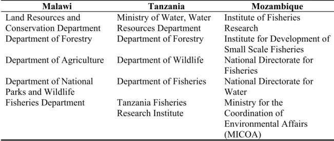
The ecosystem approach is, by definition, multidisciplinary, and requires the involvement of a number of different environmental sectors including fisheries, hydrology,
agriculture, and forestry. Various government agencies that might be involved in an ecosystem management approach for Lake Malawi/Nyasa are listed in Table 3. At a Lake Malawi/Nyasa modeling workshop held in Lilongwe, Malawi in 2000,
representatives from a number of these agencies discussed the need for an ecosystem approach to natural resource management in the Lake Malawi/Nyasa catchment. There
was unanimous agreement on the need for such an approach (results of this workshop are presented as an appendix in the Final Report: Preparation of a Preliminary Physical Processes and Water Quality Model for Lake Malawi/Nyasa, available at
http://www.uwm.edu/People/hbootsma/Lake%20Malawi/Model%20Report/Mdlind.htm).
However, it was also recognized that changes may be necessary in the approach that the various agencies take to natural resource management. In particular, it was pointed out that there is a large need for improved communication among the various sectors and among the three countries. It was recommended that this could be facilitated in part by regional workshops focusing on the theme of water quality conservation, by the
development of a Lake Malawi/Nyasa internet site, and by a “mini monograph” on Lake Malawi and its catchment, providing all relevant agencies with an overview of current management issues within the lake and its surrounding terrestrial catchment. However, the most urgent need is for the establishment of a regional organization devoted to the harmonization of management strategies within the Lake Malawi/Nyasa catchment. In recognition of this need, the three countries, with support from FAO, have recently (2003) developed a draft convention on the sustainable development of the lake and its basin. This draft convention proposes the establishment of a Lake Malawi/Niassa/Nyasa Basin Commission, which would be made up of a Council of Ministers, a Steering committee, a Permanent Secretary, and a number of Standing Committees dealing with fisheries management, water resources management, and catchment management. In addition, each country is to establish a National Committee that will be made up of representatives of various natural resource management institutions, academic
institutions, private sector, and local community representatives. The proposed mandate of the Commission would include data dissemination, promotion of training, public education and research related to the lake and to water resources, monitoring of environmental conditions in the lake basin, and enhancement of cooperation among various governmental and non-governmental agencies involved in activities related to natural resource management in the lake basin. This last activity is particularly critical. Currently, in each of the three countries, there are government institutions whose
mandate is to coordinate the activities of various sectors related to environmental management. These are the National Environmental Management Council (NEMC, Tanzania), the Department of Environmental Affairs (DEA, Malawi), and the Ministry for the Coordination of Environmental Affairs (MICOA, Mozambique). The efficacy of these agencies has been limited to date. NEMC has had some success in getting various sectoral agencies within Tanzania to adopt a more collaborative, holistic approach to environmental management, but little progress has been made in Malawi and
Mozambique. The need is not only to improve communication among departments, but to have a central body responsible for the overall gathering, processing, and
disseminations of environmental information at the ecosystem level. This was a lesson that was emphasized in the final report of the Malawi Environmental Monitoring
Program. The establishment of a lake basin commission with sufficient clout to promote better communication and collaboration within and between countries will be a major step forward in the management of the Lake Malawi/Nyasa ecosystem.
One potential pitfall of the ecosystem approach is that it is so large scale that objectives may seem out of reach. In many cases, problems are identified, and management
strategies are designed, but even though general objectives are defined (e.g. improved water quality, or reduced soil erosion), these objectives are not well quantified and timelines are not set. In the implementation of management strategies, it is critical that quantitative, realistic goals are defined, and that target dates for the achievement of these goals are set. This has rarely been done in natural resource management plans within the Lake Malawi/Nyasa ecosystem. Examples of quantitative goals include the specification of suspended solids loads in key rivers, the specification of nutrient concentrations in rivers, or a targeted catch for a given fish species. These goals and schedules need to be agreed to by all relevant management agencies in each riparian country. By setting specific goals and timelines, it becomes possible to determine the degree of success. Without some quantification of success, the management strategies become an end in themselves, and over time there is a loss of interest and motivation. Critical to this process is the monitoring of environmental conditions. Data collected through monitoring is the yardstick by which success is measured.
5.2 The Need for Communication
In addition to the need for more inter-sectoral collaboration, a number of agencies have stated a need for better communication between researchers and managers / policy makers within departments, between departments (such as TAFIRI and the Fisheries Department in Tanzania), and among countries. There appear to be two causes of this problem. In some cases, researchers are not proactive about providing the results of their work to managers and policy makers. This can be solved by setting schedules for the regular dissemination of research reports, and by organizing regular workshops. In addition, it appears that researchers often assume that their results will be understood and applied by managers, and researchers do not follow through to determine how the results of their work are implemented.
Table 3. National agencies in the Lake Malawi/Nyasa catchment that may potentially play a role in the development of an ecosystem management strategy. (Note: this list is not exhaustive).
Malawi Tanzania Mozambique
Land Resources and
Conservation Department Ministry of Water, Water Resources Department Institute of Fisheries Research
Department of Forestry Department of Forestry Institute for Development of Small Scale Fisheries Department of Agriculture Department of Wildlife National Directorate for
Fisheries Department of National
Parks and Wildlife
Department of Fisheries National Directorate for Water
Fisheries Department Tanzania Fisheries Research Institute
Ministry for the Coordination of Environmental Affairs (MICOA)
Department of Environmental Affairs (DEA) National Environment Management Council (NEMC)
Ministry of Agriculture and Rural Development
National Research Council National Directorate of Forestry and Wildlife University of Malawi University of Dar Es
Salaam
Niassa Provincial
Department of Water and Sanitation
The above problem is also common in development projects, which tend to last long enough to gather and analyze information, but not long enough to follow through with the implementation of results. This is because implementation is usually seen as the
responsibility of government. However, as mentioned above, many projects are not able to produce highly trained researchers and managers who are capable of independently continuing the research that was initiated by a project, or determining how the results of this research should be applied to management strategies. As a result, projects end with a final workshop, and final reports are provided, but little momentum is carried forward. This problem can be exacerbated by the lack of interest or political will in government agencies to follow through on project recommendations. Only if government agencies, and the individuals within those agencies, have heavily invested in the design and implementation of a project will they be committed to following through with the application of project results.
In recognition of the need for better communication, a recent NARMAP workshop was held in Malawi with the objective of defining the structure for a network for fisheries and aquatic research (with a proposed acronym of NETFISHAR). The objective would be to promote communication and the dissemination of information among network members, and the provision of information to the general public. While some progress has been made in defining the structure and membership of this network, the mechanisms for communication and information dissemination are not yet well defined.
5.3 The Potential for Community Based Management
The community based management approach seems very appealing, because it places more power in the hands of resource users, and it offers a potential solution to the problem of governments’ inability to enforce regulations. However, as pointed out above, efforts to promote community based management of fisheries through the
establishment of Beach Village Committees on Lake Malombe and Lake Malawi/Nyasa have met with limited success (Dobson and Lynch 2003).
In a recent workshop (NARMAP 2001), a number of recommendations were made to improve the success rate of this approach. These included:
- The “community” must be well defined
- A community based management approach must build on existing management systems in communities; e.g. traditional authorities
- There is a need to assess how committed migrant fishers are to this approach - Different fisheries may need different management models; there is no single
model that can be applied to all communities
- There is a need to better define the Department of Fisheries role in this new paradigm.
- Research results need to be better disseminated and explained to communities
In addition to these recommendations, the workshop pointed out that there is insufficient information on fish marketing at local and regional levels, and the economic links between fishing and local non-fishing communities are not well understood.
In a survey of fishers, Donda and Bell (1993) found that, while fishers are open to measures that will improve fishery income, they are often reluctant to adopt these measures if they involve short-term sacrifices and social disruption.
Co-management may resolve some fisheries management problems, but it will not get around two basic problems: 1) the demand for natural resources is exceeding supply, and 2) continued access to fisheries as a “commons” will always result in overexploitation (Brox 1992). Real relief will only come when there is a diversification of the economic base of rural communities, with decreased direct reliance on natural resources for sustenance and income (Hara 2001).
5.4 The Need for Knowledge and Education
Most development projects related to Lake Malawi/Nyasa have included some form of educational component (usually referred to as “capacity building”). In many cases, this capacity building takes the form of counterpart positions, in which one or more national trainees are assigned to work with an expert during the course of a project. In some cases, training has also included the provision of formal education at the Master’s or Ph.D. level. In general, this education is obtained at a foreign institution, usually in Europe or North America, but occasionally it is facilitated through a university in Malawi or another African country.
Training and education of qualified professionals are the primary prerequisites for effective lake basin management. Educated scientists are required to monitor water quality and the health of fish stocks, and to determine the processes that affect these properties. Educated managers are required to determine the strategic actions necessary to maintain high water quality and fisheries yields. Both scientists and managers are required to advise policy-makers on appropriate strategies that will facilitate conservation of water quality, fish production, and biodiversity. The education of highly qualified researchers and managers is probably the single most important contribution that
development projects can make to the sustained management of the Lake Malawi/Nyasa basin, and to the economic welfare of the region as a whole. As Osita Ogbu of the African Technology Policy Studies Network has pointed out, “With knowledge you