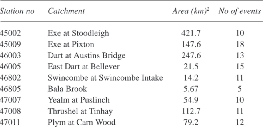
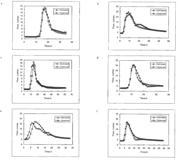
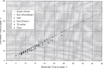
Regional analysis using the Geomorphoclimatic Instantaneous Unit Hydrograph
11
0
0
Texte intégral
Figure
Documents relatifs