The days of plenty might soon be over in glacierized Central Asian catchments
19
0
0
Texte intégral
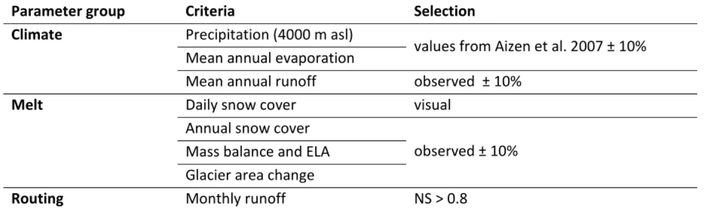
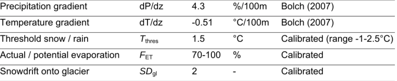
Figure


+3


Documents relatifs
