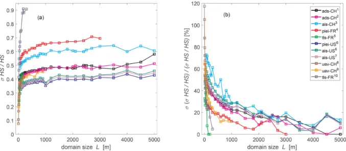
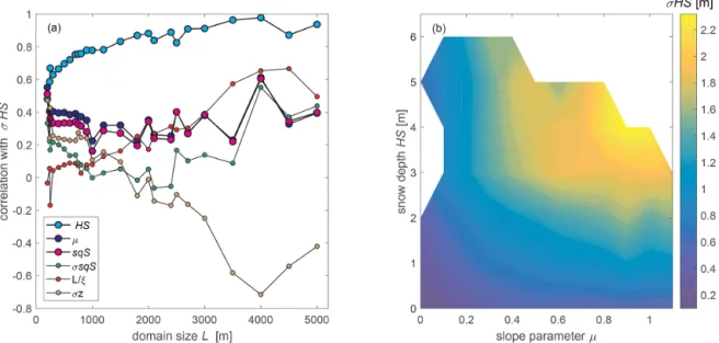
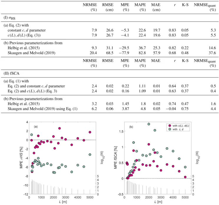
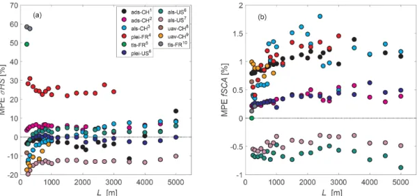
Fractional snow-covered area: scale-independent peak of winter parameterization
Texte intégral
Figure
Documents relatifs
A parameterization of the specific surface area of seasonal snow for field use and for models of snowpack evolution... A parameterization of the specific surface area of seasonal
(a) Quantitative RT-PCR analysis of basal expression levels of target genes in 4-week-old non-infected Col-0 plants.. Expression levels were normalized relative to the
[r]
Well quasi-orders and the shuffle closure of finite sets.. Flavio d’Alessandro, Gwenaël Richomme,
The technique is based on the synthesis of the inversion operator which can be used in noisy measurements where the success of classical regularization and optimal estimation
In this context and within the framework of the SudMed project (Chehbouni et al., 2008), we investigate the possibility of using remote sensing data to quantify the spatial and
[ 1 ] We report the results of a joint analysis of NDVI data derived from NOAA-AVHRR and snow parameters (snow depth and snowmelt timing) derived from satellite passive
(1968) Factors influencing expression of oxidant damage to plants. Micronutrients and cancer prevention. Dietary antioxidant flavonoids and risk of coronary heart disease:
