Correlation between equatorial Kelvin waves and the occurrence of extremely thin ice clouds at the tropical tropopause
15
0
0
Texte intégral
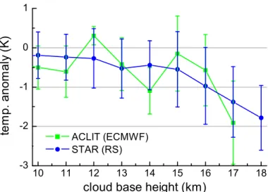
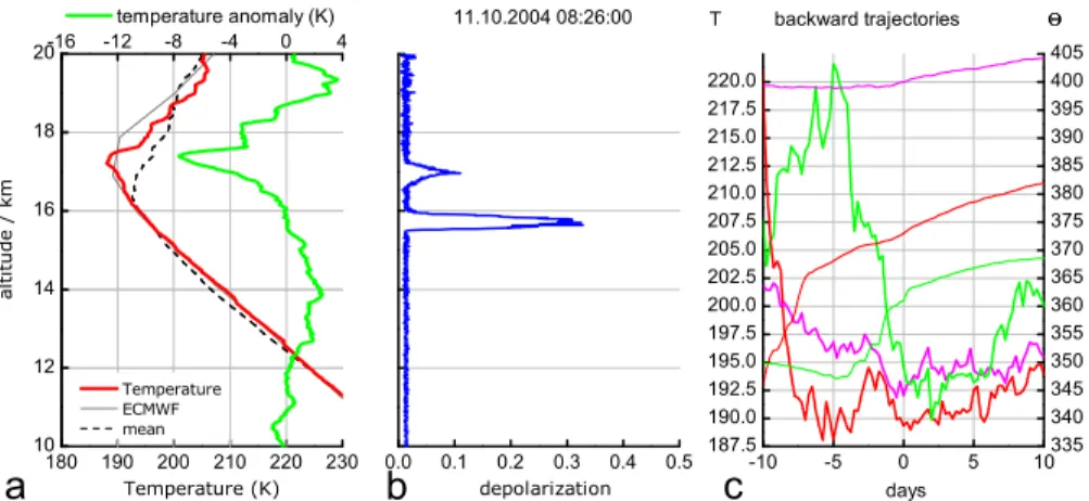
Figure
Documents relatifs
