DESIGNING AN INTEGRATED WATERFRONT: RESPONSIVE REDEVELOPMENT AT
THE PHILADELPHIA NAVY YARD
by
Elizabeth Woods
B.A. Government Smith College, 2006
SUBMITTED TO THE DEPARTMENT OF URBAN STUDIES AND PLA
PARTIAL FULFILLMENT OF THE REQUIREMENTS FOR THE DEC MASTER IN CITY PLANNING
AT THE
MASSACHUSETTS INSITUTE OF TECHNOLOGY JUNE 2012
©2012 Elizabeth Woods. All rights reserved.
The author hereby grants to MIT permission to reproduce and to distribute publicly paper and electronic copies of this thesis document in whole or in part in any medium now known or
hereafter created. NNING IN REE OF
ARCHIVES
/l~
Signature of Author:(.
S7~~ep
e k U a'st
udies andt May
Planning 24, 2012
Certified by:
Eran Ben-Joseph Professor of Landscape Architecture and Planning Thesis Supervisor
14
Designing an Integrated Waterfront: Responsive Redevelopment at the Philadelphia Navy Yard
by
Elizabeth Woods
Submitted to the Department of Urban Studies and Planning on May 24, 2012 in Partial Fulfillment of the Requirements for the Degree of Master in City Planning
ABSTRACT
Over the past half-century, the physical form and primary purpose of the American urban waterfront has profoundly changed. Due to the combined forces of de-industrialization, globalization, and military restructuring, urban waterfronts have transformed from industrial and manufacturing employment centers to tourist destinations, passive recreation areas, and luxury residential and corporate office districts. The wave of redevelopment efforts has resulted in a general sameness, both in physical design and economic function, across all urban waterfronts. The possibility of an integrated waterfront, in which traditional industrial and manufacturing uses intermingle with spaces for new non-industrial capital investment and public recreation and waterfront access, is the focus of this research.
Using the Philadelphia Navy Yard as its primary case study, this research explores the spatial dimensions of contemporary waterfront planning in a changing economic landscape. The research attempts to answer the following questions: Can a city effectively integrate industrial use, new capital investment, and public open space on its waterfront through specific regulations and site design? Does this form of waterfront redevelopment present a viable and meaningful alternative to the standard development models of the past? Through an in depth study of the Navy Yard's economic development policies and design principles, this thesis argues that such goals are difficult to achieve in the American planning and design process, which prioritizes capital investment over other waterfront functions. Nonetheless, the attempt at integration proves that it is possible to diversify our understanding of the contemporary waterfront and its place in urban development. Thesis Supervisor: Eran Ben-Joseph
Title: Professor of Landscape Architecture and Planning
Table of Contents
CHAPTER 1
I
THE CHANGING FORM OF URBAN WATERFRONTS
7
Waterfront Planning in Context 7
Four Standard Waterfront Forms 11
Case Study Research Method & Thesis Organization 14
CHAPTER 21 THE NAVY YARD IN CONTEXT
21
Geography And Historical Significance 21 Base Closure And 1994 Community Reuse Plan 24 The 2004 Master Planning Process And Outcomes 31
Comparative Navy Yard Redevelopment Projects In Boston And Washington, DC 34
CHAPTER 31 THE WATERFRONT AS EMPLOYMENT CENTER
41
Tax-based Incentives 42 Cluster Development and Anchor Institutions 47 Creative Class Attraction 51
Residential Development 53
Land Use and Design Implications 55
CHAPTER 41 THE WATERFRONT AS PUBLIC SPACE
61
The Pastoral, Passive Public Waterfront 62
The Festive, Recreational Public Waterfront 66
Land Use and Design Implications 71
CHAPTER 5
|
Towards an Integrated Waterfront
79
Revisiting the Research Questions 80
Mitigating Conflicts in Mixed-Use Environments 81
Reconciling Publicly Owned Private Space 84 Designing Edges to Minimize Separation and Uniformity 85
Potential Future Research 91
Thank You
To Eran and Brent, who provided keen insights and needed encouragement for this thesis and throughout my time at DUSP.
To Lili, who made thesis writing more fun than it had any right to be through her humor, intelligence, and frequent suggestion that we shop our feelings.
To Mom, who not only talked through my concerns and relieved my insecurities, but also read every single draft of this thesis. Thank you.
CHAPTER 1:
THE CHANGING FORM OF
URBAN WATERFRONTS
This research explores the spatial dimensions of contemporary waterfront planning in a changing economic landscape through a comprehensive study of the redevelopment of the Philadelphia Navy Yard. The research attempts to answer two related questions: Can a city effectively integrate industrial use, new capital investment, and public open space on its waterfront through specific regulations and site design? Does this form of waterfront redevelopment present a viable and meaningful alternative to the standard development models of the past? Through an in depth study of the Navy Yard's economic development policies and design principles, this thesis argues that integrating such disparate uses is difficult to achieve in the American planning and design process, which prioritizes capital investment over other waterfront functions. Nonetheless, the attempt at integration proves that it is possible to diversify our understanding of the contemporary waterfront and its place in urban development.
WATERFRONT PLANNING IN CONTEXT
The combined forces of de-industrialization, globalization, and, in some cases, military restructuring over the past few decades have had a profound effect on the spatial organization of American cities. Waterfronts in particular have undergone
significant physical transformation, from industrial and manufacturing employment centers to tourist destinations, recreation areas, and luxury residential districts. For many American cities, the waterfront was the genesis of the settlement; they were locations of production and transportation of goods and essential to the industrial economy of the 19* and early 2 0th centuries. Economic changes and demographic shifts in the mid-twentieth century fundamentally shifted this purpose. As both industry and residents left the city for the surrounding suburbs, many cities began to use the redevelopment of the waterfront as a visible place for creation of meaning and identity (Marshall 2001, 5). Since that time, academic and professional interest in the redevelopment of waterfronts has grown exponentially, to the point where it is nearly its own discipline within the field of planning and urban design (Malone 1996, 4). Waterfront development literature can generally be divided into two camps: academic studies which analyze the political, social, and economic context of waterfront projects, and more celebratory, illustrated volumes with descriptive articles about particular locations (Desorf and Laidley 2011, 4).1 Studies of waterfront development also vary as to their adherence to particular theoretical frameworks, including neoliberal or neo-Marxist economic philosophy or New Urbanist design critiques.2 The study of the waterfront redevelopment process is therefore not tied to one particular school of thought, but is used to ground the study of different theories and practices of urban redevelopment in a physical place.
The prevalence of academic and professional literature indicates that, over the past half-century, the reclamation of the waterfront has become a familiar site for both public and private
investment in the city. However, over time the form and means of that investment has shifted, mirroring wider patterns in urban development. As Malone argues:
"Neither the factors that have created the opportunities for redevelopment, nor the processes of renewal, fall outside the common frameworks for urban development. In this respect the waterfront is not unique. It is a new (or retrieved) frontier for conventional development processes; albeit that these processes change over time. Both the types of development and the forms of capital that have colonized the waterfront are common to other parts of the urban structure." (Malone 1996, 2-3)
The popularity of the waterfront as a point of analysis is due to
it being one of most visible spaces for the manifestation of these
political and economic forces (Marshall 2011, 5). Particular waterfront projects, such Baltimore's Inner Harbor or the London Docklands, have come to symbolize particular means and forms
of development, and are referenced frequently in the literature.
The initial waterfront redevelopment projects were a response to both the deindustrialization of the waterfront and the decline of the city's downtowns. Baltimore's Inner Harbor, planning for which began in 1965, is widely considered the "first of the modern waterfronts" (Shaw 2001, 163). The redevelopment of the Inner Harbor was primarily a public sector led initiative, in which a centralized city government and a powerful and committed mayor attempted to combat the city's decline. The Harborplace festival-market and aquarium anchored the development and "embedded the area in local consciousness, and so attracted further development" (ibid) (Figure 1.1). The success of the Inner Harbor, which draws millions of visitors a year, influenced
cities across the country and inspired a wave of waterfront projects over the next few decades. The next phase of waterfront projects attempted to replicate the success of the Inner Harbor, but with a much-reduced role for the central government. The 1980s saw a number of waterfront projects led by quasi-public or wholly private entities that were set up specifically to develop waterfront areas.
Figure 1.1 Baltimore's Inner Harbor
(By Iracaz CC-BY-SA-3.0 via Wikimedia Commons) The London Docklands Development Corporation
(LDDC), which oversaw the development of Canary
Wharf in London, is perhaps the best known of these (Figure 1.2). While all development projects require a balance of public-sector regulatory power and private-sector financial investment, the post-Baltimore waterfront projects saw that balance shift more towards the latter than the former. These projects reflected neoliberal economic development principles, and rejected the top-down, public sector led efforts that characterized efforts like those in Baltimore just a decade earlier (Shaw 2001, 165). These projects also differed from earlier efforts in their primary purpose and means for achieving it; earlier efforts used festival markets and other recreational amenities to encourage people to return to the downtown (with the expectation that such activity would entice office and residential development) whereas the LDDC took a much more direct approach to incentivizing business development; it was among the first to use enterprise zones and other tax and financial incentives to lure
Figure 1.2 Canary Wharf, London businesses to the waterfront (Brownill 2011, 125).
1990s did not lessen the popularity of the quasi-public development corporation (Shaw 2001, 165). Learning from past efforts, many recent waterfront projects have attempted to blend both public and private roles in the redevelopment and public and private purpose in the site. Massive waterfront projects, like the HafenCity development in Hamburg, boast complete public waterfront
Fi~
access and recreation activities as well as millions (By San A
of square feet of new residential and commercial development, while being run by large
public-private partnerships (Desorf 2011, 2) (Figure 1.3). Indeed, providing space for new capital investment and ensuring a wealth of public open space, trails, and access have both come to be expected characteristics of all urban waterfronts. Yet the working waterfront is still a vital part of the regional economy, as it helps diversify the economic base and provide jobs for a wide range of skill sets. As the expectation for a public, consumption-driven recreational waterfront becomes evermore ensconced in the view of political elites and the public at large, the challenge of maintaining the waterfront as a space of diverse economic activity and programmed space remains.
FOUR STANDARD WATERFRONT FORMS
Even as the political means for waterfront development have evolved over the past half-century, the forms those waterfronts take have remained fairly static. After examining a wide survey of waterfront conditions, I posit that four standard forms of urban waterfronts currently exist: the forgotten or underutilized
gure 1.3 HafenCity, Hamburg ndreas CC-BY-SA-3.0 via Wikimedia
Figure 1.4 Lower Schuylkill River, P
I (PIDC)
post-industrial waterfront, the industrial working waterfront, the pastoral passive park, and the consumption-driven festive market. These forms have developed either organically through market forces and/or in interaction with deliberate redevelopment planning processes; while there has generally been a progression away from the industrial employment center and the post-industrial wasteland to the pastoral park and festive market forms, these forms do not adhere to a particular timeframe (Breen and Rigby 1996, 20). Most important, these different waterfront forms are almost always completely distinct from one another. For example, little attempt has been made to integrate working waterfront forms with the festive marketplace.
The following figures illustrate the four standard waterfront forms. Each is drawn from one city - Philadelphia - to demonstrate how these forms exist simultaneously but physically separated from one another. The lower Schuylkill River is typical of the forgotten or underutilized post-industrial waterfront model that inspired much of the revitalization efforts of the
past decades (Figure 1.4). While not necessarily wholly abandoned, this waterfront model is characterized by a patchwork of low-value uses, like storage facilities and parking lots, alongside publicly inhospitable uses like refineries and waste incinerators. These waterfronts usually are marked
by the infrastructure of past industry, like highways
and railroads. Generally considered unpleasant and under-used, when considered at all, the forgotten waterfront nonetheless offers an important element
hiladelphia of discovery and potential to city environments. Despite the decades of industrial decline that led to
many waterfront redevelopment projects, working waterfronts like the Port of Philadelphia (Figure
1.5) are still sites of industrial employment. This
model is used by particular industries - especially shipping and fishing - which are wholly water dependent. They are characterized by particular infrastructure - cranes, railroads, and large dry docks - and activities that exclude public access, even while they remain active spaces for work and
prodution.Fi~
economic production. (Phila
The two other forms are friendlier to public access.
The peaceful waterfront path that follows the Upper Schuylkill River in Philadelphia (Figure 1.6) is representative of the pastoral, passive waterfront park model. Its primary purpose is one of tranquil contemplation and waterfront vistas, made possible through modest landscaping, benches and other seating areas, and a meandering path for walking or jogging. The passive waterfront trail has come to be an expected feature any waterfront redevelopment effort, as the waterfront has shifted from a space for production and trade to public access
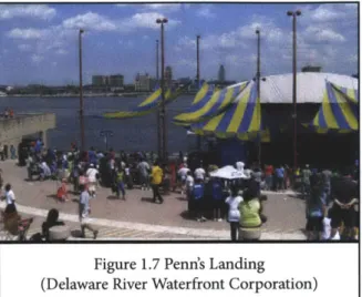
and enjoyment. More active recreation facilities meant for major events can be found at Penn's Landing (Figure 1.7) in Center City Philadelphia. With its large amphitheater, nearby museums and restaurants, and near-constant programming, Penn's Landing is typical of the festival market model of waterfront development. The large-scale public recreation facilities of the festival waterfront
are frequently used to spur development of Figure residential and commercial activity around it. Like (By Jeffrey M.
gure 1.5 Port of Philadelphia Jelphia Regional Port Authority)
1.6 Schuylkill River Banks Park
Vinocur CC-BY-SA-2.5 via Wikimedia Commons)
Figure 1.7 Penn's Landing (Delaware River Waterfront Corp
the passive waterfront park, this model has become ubiquitous, generating a sameness of look and feel across many different types of cities.
The persistent replication of these four models from place to place may have exhausted the inherent possibilities of each; a new synthesis is beginning to be pursued that seeks a more diverse understanding of what the waterfront can be. I propose a new oration) model, one I call the integrated waterfront. The integrated waterfront blends elements of the forgotten, working, open, and festive waterfront models to create a whole that is greater than the sum of its parts. This is not just a matter of promoting mixed-use developments, whereby the waterfront becomes a backdrop for high-density commercial and residential development for a specified range of users. The integrated waterfront model repurposes the divergent advantages of the waterfront site across a range of uses and amenities. In this way it offers the possibility of a sustainable economic development model with a positive and unique city-specific identity. While cities and states have put forward policies intended to retain industrial maritime uses on urban waterfronts (such as the Designated Port Areas in Massachusetts or New York City's recent adoption of the Vision2020 plan), very few examples exist of the integration of multiple uses on a single waterfront site. The Philadelphia Navy Yard, the primary case study of this thesis, illustrates the challenges to achieving the promise of this model.
CASE
STUDYRESEARCH METHOD
&
THESIS
ORGANIZATIONThis thesis is the result of a qualitative study ofwaterfront planning and design and economic development theory and policy. The secondary literature mentioned in the preceding sections and in the following chapters provided the theoretical underpinnings for a close examination of one particular waterfront redevelopment project. The Philadelphia Navy Yard, a 1,200-acre commercial and industrial campus in South Philadelphia, serves as the primary case study for this research. Decommissioned as a Naval Base in 1996, its ownership was transferred to the quasi-public Philadelphia Industrial Development Corporation (PIDC), which undertook a master planning process in 2004. Currently, the campus is home to 115 companies housed in a mix of newly constructed factories and offices and renovated historic buildings, with additional commercial and new residential development still slated for construction.
The Navy Yard presents a dynamic case for studying multi-functional waterfront spaces, and was chosen for this study for a number of reasons. While not necessarily typical of all waterfront redevelopment projects, the size and scale of the site and the fact that it was entirely publicly owned presents a case in which the City can experiment with a range of waterfront uses and forms. Likewise, the recent timeframe of its transformation allows the consideration of both the successes it has achieved thus far as well as an examination of the ways in which it has adapted the site to changing circumstance. Finally, unlike many waterfront redevelopment projects of recent years, the protection and promotion of industrial uses at the Navy Yard was a central
element of the Plan. By attempting to blend this goal with that of more traditional economic development and public open space provision, the Navy Yard is a particularly interesting example of the potential of the integrated waterfront model.
In studying the Navy Yard, I refer extensively to the 2004 Master Plan and to a series of focused interviews I conducted with six high-level individuals involved in the Navy Yard's development and operation. They are:
. John Grady, President, Philadelphia Industrial Development Corporation
. Mark Seltzer, Director of Management and Development for the Navy Yard, Philadelphia Industrial Development Corporation
. Brian Berson, Director of Leasing and Development for the Navy Yard, Liberty Property Trust
* Graham Wyatt, Principle, Robert A. M. Stern &
Associates Architects (Principle designer for Navy Yard Master Plan)
. Joe Hare, Director of Shipyard Operations, Rhoads Industries (Navy Yard tenant)
. Dave Ziel, Chief Development Officer, URBN (Navy Yard tenant)
The interviews were conducted in January and February of 2012 and often involved follow up exchanges over email. The knowledge generated from these interviews was augmented with that gained reading news and opinion articles from local media outlets written over the course of the Navy Yard's development. Finally, my personal observations and photographs from a series of visits I conducted to the Navy Yard in August 2011, November
2011, and February 2012 provide an additional layer of analysis
The study of the Philadelphia Navy Yard is organized into three chapters, each exploring a different facet of the Navy Yard's design and development and drawing connections to the wider patterns of waterfront planning in the United States. The next chapter outlines the history of the Philadelphia Navy Yard, beginning with its role as an employment base and regional industrial anchor for much of the 20t century. It explores the political and economic ramifications of the Department of Defense's decision in the early 1990s to close the Naval Base, the City's initial plans for its reuse, and its transfer of ownership to the Philadelphia Industrial Development Corporation (PIDC) in 2000. An analysis of the 2004 Master Plan focuses on the major players in the site's redevelopment, their objectives for the planning process, and the outcomes of those efforts. Finally, the chapter provides context to the efforts in Philadelphia by comparing the objectives and design to similar projects in Boston (the Boston Marine Industrial Park in the recently redeveloped Seaport District) and Washington, DC (the Yards, formerly part of the Washington Navy Yard). The BMIP supports exclusively water-dependent industrial uses and the Yards provides a mix of residential and high-end office space. The two projects, both of which are located on former military bases, are representative of more standard forms of waterfront districts and provide a valuable comparison to the Philadelphia Navy Yard.
The third and fourth chapters go into a deeper analysis of the two major functions that the redeveloped Navy Yard is intended to perform: as a campus-like environment for both industrial and non-industrial businesses, and as a public park providing waterfront access and recreation to the City's residents. These purposes parallel three of four standard waterfront forms
discussed earlier: the industrial employment center, the pastoral open green space, and the consumption-based festive destination. Chapter Three will outline the strategies PIDC has employed to retain and attract businesses to the site. These strategies are discussed in the context of wider patterns of economic development policy in the United States, particularly the increased competition for businesses between and among cities. The chapter concludes with an analysis of the urban design implications of these strategies, specifically the ways in which the different users interact with each other and the physical environment of the site. The fourth chapter follows the same general outline as the third, but focuses on the public spaces in the Navy Yard and how they contribute to the Plan's stated objectives. The site employs a mix of open parkland and trails and more programmed active spaces, some of which have been fully built out and some of which are still in the planning stages. These spaces will be discussed within the context of the accepted waterfront redevelopment paradigm, which emphasizes complete public access. The chapter examinees how these public spaces contribute to or hinder the (private) interests of the businesses in the Navy Yard, with a particular emphasis on security concerns and parking and transit issues.
The final chapter assesses the success with which the Philadelphia Navy Yard, as it has been developed thus far, has integrated its industrial uses, new business, and public open space along the waterfront. It examines how much of the development of the site has been a true synthesis of the three typical forms, and how much these forms are still distinct and separate. It also offers some conclusions as to the inherent conflicts of the integrated waterfront model, specifically mixing industrial and
non-industrial uses and promoting both public space and private use in one location. Finally, it offers some projections and recommendations for future waterfront redevelopment efforts that attempt to embrace the integrated waterfront model.
CHAPTER 2:
THE NAVY YARD IN CONTEXT
GEOGRAPHY AND HISTORICAL SIGNIFICANCE
"Of all the institutions of the city, [the Navy Yard]
may well have been the most important, and certainly the most overlooked."
- Buzz Bissinger, A Prayer for the City
Located approximately three miles due south of Center City Philadelphia at the confluence of the Schuylkill and Delaware Rivers, the Philadelphia Navy Yard has played a significant role in both United States military history and the economic growth of its city (Figure 2.1). Encompassing nearly 1,200 acres, the Navy Yard occupies almost as much land as the City's Central Business District and in its heyday was nearly as important for the city's economic production. Its history as both shipyard and naval base has given the site an unusual mix of architectural
and landscape features; the heavy industrial equipment of the shipyard sits adjacent to a line of charming, turn-of-the-century officers' housing, while the far east end features an abandoned airplane hanger lying next to deserted workers' quarters overrun with weeds. Unlike the Delaware and Schuylkill River waterfronts that frame Center City, the Navy Yard's waterfront was rarely seen by
most Philadelphia residents. Yet its importance to Figure 2.1: The Navy Yard within the Conext of
special place in the city's identity.
The first shipyard built for the newly established U.S. Navy, the Philadelphia Naval Shipyard (PNSY) was constructed in 1801 at the base of Front Street in the heart of the city. In response to the rapid growth of the city during the 1 9th century, the shipyard
moved to its current location on the swampy League Island in 1871. The remote location and inhospitable environment provided the Navy with a natural security system that was compounded by the city's infrastructure investments over the years. These included the freight rail yard that served the nearby Port of Philadelphia and Interstate 95. While such projects were essential for the growing logistics needs of the industrial waterfront, they also served to further physically isolate the Navy Yard from the activity of the rest of the city.
Despite its physical remoteness, the Navy Yard became a significant part of the city's industrial identity. Situated between the political power of Washington, DC and the financial might of New York City, Philadelphia in the 19th and early 2 0 th Century
was an industrial powerhouse. Known as "the Workshop of the World' Philadelphia was a city where things were made. In many ways, the Shipyard represented the pinnacle of the city's production capacity, churning out 119 warships over its almost two-hundred-year history. As the U.S. military expanded during and after World War I, so too did the Shipyard, eventually reaching its peak employment of 58,434 employees during the Second World War (Dorwart 2001, 54). In a book published for the 1 5 0th anniversary of the naval base in 1951, Secretary of the
Navy Francis P. Matthews wrote, "I have every confidence that one hundred and fifty years from today Americans will repeat
this salute to the Philadelphia Naval Shipyard when it celebrates three hundred years of distinguished service to the fleet and to the nation" (Bissinger 1997, 54).
In just a few decades, however, the Secretary's confidence in the Navy Yard's resilience would prove to be wildly optimistic. The latter half of the twentieth century saw a steady decline in both the employment in and the production of the Philadelphia Navy Yard. Particularly following the end of the Vietnam War, the changing nature of U.S. military action and equipment needs led to a reduction in the demand for the services of the Shipyard. This mirrored a larger trend of deindustrialization in the United States that was affecting cities like Philadelphia, that relied on low-skilled manufacturing as it economic base, in profound ways. As factories and plants across the city shut their doors and laid off workers, politicians fought hard to keep the Navy Yard open and in the face of a steady stream of rumors and threats of closure from the Pentagon.
The end of the Cold War marked the death knell for the Navy Yard as a public shipyard and many others like it across the country, as the Navy, and indeed the entire U.S. military, underwent a massive restructuring and downsizing. By 1991, when the Department of Defense recommended that the Philadelphia Naval Complex be closed, the Shipyard was a leader among public shipyards in most measures of efficiency and timeliness. More important to the Philadelphia economy, it was an anchor for an ever-shrinking industrial base, attracting new firms and maintaining the region's blue-collar workforce. At the time of its closing, the Navy Yard directly provided employment for over
$362.2 million in direct income, and $113 million in annual
state and local tax revenue, according a report commissioned by Pennsylvania Economy League (Dorwart 2001, 218). The loss of jobs and revenue for the region that would result from its closing was potentially catastrophic.
BASE CLOSURE AND
1994
COMMUNITY REUSE
PLAN
"The entire process of shrinking the defense establishment down to its right size was very, very anxiety-prone and there was a lot of anger involved."
-Joe Hare, Rhoads Industries
The closing of the Philadelphia Naval Shipyard was but one small part of a large-scale reduction and reorganization of military bases across the country made in response to the end of the Cold War and changing global security realities of the late 2 0 th century
(Frieden and Baxter 2000, v). While previous administrations had attempted to reign in the Pentagon's budget through eliminating unneeded facilities, those efforts were frequently thwarted by Congressional Representatives more interested in saving jobs in their districts than cutting redundancies in the Department of Defense (New York Times 1985). The fall of the Soviet Union provided the necessary impetus for a comprehensive, politically palatable military base realignment plan. The Defense Base Realignment and Closure (BRAC) Act, passed in 1990, outlined the process by which the politically delicate decisions of which bases to close or reuse would be made. Between 1988 and 1995, a series of BRAC commissions released reports that resulted in the closing of nearly one hundred major domestic military bases
and the realignment or reduction in size of many others (Hess et al. 2001, 11).
The BRAC legislation provided an ostensibly objective and transparent process by which to determine which bases would be closed, as well as a standard set of procedures for the mothballing, disposal, and mainstreaming of military facilities and equipment. Additionally, the Department of Defense's Office of Ecohomic Adjustment offered some funds for environmental remediation and other efforts necessary to bring a military site in line with the rest of the city. Despite these carefully considered procedures, the base closure process was inherently complex and invariably contentious. The closing of the Philadelphia Naval Shipyard was no exception.
The PNSY was selected for closure during the 1991 BRAC round due to the duplication of shipyard functions at other bases on the East Coast, especially the Naval bases in Norfolk and Newport News which had more direct access to the Atlantic Ocean, and the more general goal the Navy had to move 30% of its repair work to private shipyards. The PNSY was also hampered by its inability to perform nuclear overhauls on aircraft carriers, and the fact that funds for the necessary retrofit were unavailable (Hess et al. 2001, 12). The BRAC commission recognized that, despite these shortcomings, the PNSY played an important role for the Philadelphia region and that its closure would not be well received:
"The impact on the city of Philadelphia would be severe, particularly when added to proposed closures of other Philadelphia-area bases. The community believes that this is too large an impact for any single region to bear. If Philadelphia
Naval Shipyard is closed and mothballed, the community stated that it would vigorously pursue legislative relief to force reversion or outleasing of shipyard property to the city." (Defense Base Closure and Realignment Commission 1991, 49)
The community responded just as it had promised. Protests against the closure focused on both economic and legal justifications for its continued operation (Hess et al. 2001, 15). The economic justifications were well known: the Navy Yard was a significant employer of lower-skilled workers and was anchor for the industrial sector in the city. Its closure would lead to a potentially catastrophic loss of employment in a city that was already struggling economically. Additionally, some argued that the process by which the Philadelphia Naval Complex had been selected for closure was illegal. In fact, then-Senator Arlen Specter undertook a protracted legal case against the BRAC commission that eventually made its way to the U.S. Supreme Court. While Specter's case was ultimately unsuccessful, it was indicative of the passion with which both citizens and politicians responded to the base closure news.
Even as Senator Spector's lawsuit was going forward then-Mayor of Philadelphia Ed Rendell set up the Office of Defense Conversion (ODC) within the City's Department of Commerce. Rendell took a less combative approach to the news of the Navy Yard's closing than did Specter. Rather than fight against the decision in court, Rendell sought to make the inevitable closure of the PNSY as painless for Philadelphia as possible. To that end, Rendell and his administration focused on removing any impediments to the shipyard's reuse and ensuring that the rest of the site be redeveloped for new businesses as soon as possible.
In its initial recommendation, the BRAC commission suggested that the shipyard not just be decommissioned and turned over to the City but be mothballed and put out of use entirely. Already facing a city in which vacant industrial land was alarmingly prevalent, Rendell fought hard against adding another 1200 acres to that, especially given the valuable (if slightly out-of-date) shipbuilding equipment it included. Through his lobbying efforts, the Navy eventually agreed to keep the shipyard operational and allow its reuse by the City.
Mayor Rendell charged the Office of Defense Conversion with the task of collecting and synthesizing the city's options for the Navy Yard's repurposing and then producing a Community Reuse Plan that would set forth recommendations for the site's redevelopment. After months of work, the ODC released the Community Reuse Plan in late 1994. Its recommendations were based on two over-arching goals:
. Preserve the level of employment and economic activity currently generated at the shipyard by preserving the industrial capacity of the yard, by converting it to civilian activities and by supporting the creation of new jobs and economic activity
. Develop the excess land and facilities of the yard to further the city's and region's goals of job creation and revenue generation (Hess et al. 2001, 22) From the very beginning, then, Philadelphia's primary objective for the redevelopment of the Navy Yard was to maintain it as site for employment and economic development. Concerns for public open space, housing, historic preservation, or other forms of reuse were considered secondarily or not at all (Philadelphia Office of Defense Conversion 1994). The Community Reuse
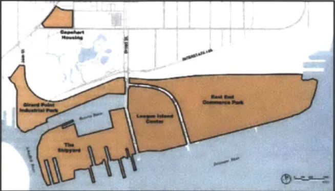
Figure 2.2: Development Plan for Le (Philadelphia Office of Defense Convei
Figure 2.3: League Island as Indust (Philadelphia Office of Defense Convei
Plan sought to leverage the unique environmental and infrastructural facilities of the Navy Yard to attract specific types of new businesses, including traditional manufacturing firms, research and development activities, start-up companies, and commercial services. The development plan focused on the central portion of the site, assuming that the City would find a private-sector shipbuilding tenant ague Island
sion 1994, 4) to take over its heavy industrial facilities of the shipyard and that the eastern edge of the site would be developed at a later date (ibid) (Figure 2.2). The Plan made no effort to lift the deed restriction the Navy had placed on residential development or to push for public waterfront access or recreation facilities. Rather the Navy Yard was intended to remain a gated industrial park, cut off from the city but providing employment opportunities for its workers (Grady, John 2012) (Figure 2.3).
rial Park In 1995, the Office of Defense Conversion sion 1994, 1 became a division of the Philadelphia Industrial Development Corporation (PIDC), the City's quasi-public, non-profit economic development agency (Hess et al. 2001, 20). PIDC occupied a unique position within Philadelphia, as it was a joint venture between the City and the Chamber of Commerce. PIDC was identified as the City's primary agent for the development of the Navy Yard. Given the complexity of the process, PIDC's experience with land management and infrastructure improvements as well as its ability to offer direct financing made it the clear choice to manage the conversion (Frieden and Baxter 2000, 27). PIDC's years of
experience in land reuse and redevelopment distinguished it from other cities' local redevelopment authorities, most of which were formed at the time of a base closure and whose authority was limited to the redevelopment of one site. However, PIDC's responsibilities in the case of the Navy Yard were similar to other local redevelopment authorities charged with base conversion.
PIDC functioned as both real estate developer and economic
development planner. It was the agency primarily responsible for overseeing the normalization of base property and developing business-attraction strategies (ibid, 43).
The goals of the Community Reuse Plan clearly point to the City's emphasis on maintaining the Navy Yard as an industrial district, ensuring continued employment for its blue-collar workforce. A Master Lease signed in 1994 allowed the city to sublease space to prospective tenants during closure process, and they did seek out smaller firms to move into some existing facilities. The City's primary focus, however, was finding a large firm to take over the west end of the Navy Yard, where the major infrastructure for shipbuilding was located. Between 1994 and 1997, the City took aggressive action to attract a commercial shipbuilding firm to the site. After an unsuccessful attempt to secure a deal with the German shipbuilding firm Meyer-Werft, public officials were able to finalize a deal with the Norwegian construction conglomerate Kvaerner. The deal, signed in 1997, provided nearly $400 million in public funding for the modernization of the shipyard and job training for shipyard employees. Given the large amounts of public funding provided, local and state politicians made sure to emphasize that the investment would go into permanent improvements to the site and local human capital, as well as the fact that the yard would continue to be
owned by the public (Gorenstein 1997). The money came from the City of Philadelphia ($60 million), the Delaware River Port Authority ($65 million), the federal government ($100 million), and the Commonwealth of Pennsylvania ($200 million). In return, Kvaerner contributed approximately $135 million, and agreed to a 99-year lease of the site and promised to provide a certain level of employment for the first 15 years (Marder 1997). From the beginning, the deal with Kvaerner was criticized for laying only ambiguous and easily avoided obligations on Kvaerner (Hess et al. 2001, 61). Indeed, there was great fear that the deal would be broken completely when, only a few years after the deal was finalized, Kvaerner came near to bankruptcy and had to be sold to another Norwegian shipping conglomerate, Aker. To this day, the shipyard continues to struggle in a changing economy, with Pennsylvania extending Aker a $42 million loan in February of 2011 in order to assure its continued local operations (Lloyd
2011). Among politicians and business leaders in Philadelphia,
there is still a strong effort to maintain skilled industrial jobs at the Navy Yard.
While the Navy Yard was decommissioned in a grand ceremony in 1995, the official transfer of ownership of the Navy Yard to the city did not take place until 2000. The Navy ended up spending over $300 million to close the Navy Yard. Almost a third of that was spent on workforce-related costs, including pension payouts and worker retraining programs. The rest was spent on selling or otherwise disposing of plant equipment, mothballing unused ships, shutting down facilities, mainstreaming the utility grid, and undertaking environmental remediation of the site. While the Navy has maintained a presence in the Navy Yard in the form
of some research and development initiatives, its role as a major regional employer is over.
THE
2004
MASTER PLANNING PROCESS AND
OUTCOMES"I think when the city and ultimately when PIDC got involved in [asking] 'what are we going to do with the Navy Yard,' there was an immediate focus on jobs. This place was always about jobs. It needs to be about jobs."
-John Grady, PIDC
Between the announcement of the base's closure in 1991 and the transfer of ownership in 2000, Philadelphia's primary focus on the Navy Yard's physical redevelopment was on modernizing the shipyard and securing a tenant for it. After the Kvaerner deal was finalized and the Navy relinquished ownership, however, PIDC's focus shifted to the development of the non-shipyard portion of the site. As the owner of the site, PIDC responsibilities included both master development (reconfiguring site for civilian use, subdividing base into development parcels, preparing parcels for development, marketing them, and installing or upgrading core infrastructure) and component development (developing sites for specialized uses such as housing or offices) (Frieden and Baxter 2000, vii). In approaching these objectives, PIDC sought to follow the guidelines and site plan established in the 1994 Community Reuse Plan.
In order to facilitate the development process, PIDC released a Request for Proposals for a private-sector developer to partner with them. Out of twelve submissions, PIDC chose Liberty
Property Trust, a publicly traded real estate investment trust headquartered in the Philadelphia suburbs. Liberty is known for its development and
management of office and industrial space, much of it located in suburban business parks. The deal, Navy Yard which originally was only for the development of a
70-acre corporate office park at the entrance to the Navy Yard, quickly expanded into a full partnership between Liberty and PIDC for the development of the entire non-shipyard portion of the site. The result was the Master Plan for the Navy Yard, released in September 2004, which sought to establish an overarching vision for the transformation of the place (Figure 2.4).
In undertaking a master planning process for the Navy Yard, PIDC was shouldering a new responsibility. The agency was known for being opportunistic and transactional in its real estate deals, very rarely engaging in long-term visioning or planning efforts. John Grady, the President of PIDC, credits Liberty with pushing the agency to rethink the Community Reuse Plan and its rather staid approach to industrial development. By the early 2000s when the deal between Liberty and PIDC was established, the economic conditions of the city were better than they were when the CRP was written and the perception (both external and internal) of Philadelphia was improving. Liberty believed that they could push the boundaries of what was expected at the Navy Yard, creating more of a neighborhood and less of an isolated office park. They were the first to suggest the possibility of including residential development in addition to commercial and industrial space.
The resulting document was a significant departure from previous visions of the Navy Yard. The design of the 2004 Master Plan for the Philadelphia Navy Yard was done by Robert A. M. Stern Architects, which had worked with Liberty Property Trust in the past and is perhaps best known in the urban planning field for its work on the planned community of Celebration, Florida developed by the Walt Disney Corporation. In its introductory section, the Master Plan set out four guiding principles for the Navy Yard's development:
1. The Navy Yard should develop, over time, as an urban,
mixed-use community, active 24-hours a day and 7 days a week
2. Development at the Navy Yard should capitalize on and enhance the Navy Yard's unique historical building and landscape assets
3. Development at the Navy yard should set a high standard
for environmental sustainability
4. Development at the Navy Yard should aim to make the site a regional asset and reopen as much waterfront as possible to convenient public access (PIDC 2004, 4) These principles present a contrast to the goals outlined in the Community Reuse Plan of 1994 and much of the rhetoric surrounding the Navy Yard's redevelopment since then. In the Master Plan, the Navy Yard is envisioned as responding to multiple needs and desires of the city: for a vibrant, mixed-use community, for a public open space along the waterfront, and for sustainable, environmentally friendly development. It was also much more ambitious than the CRP, depicting significant amounts of residential development and an expensive marina project.
At the time of this writing, PIDC has again partnered with Liberty and Stern to produce an update to the Master Plan in response to the changing dynamics of the Navy Yard and the Philadelphia market. In the years since the Master Plan's release, the Navy Yard has attracted a lot of attention - both from firms looking to invest in the site and from media outlets looking to highlight its transformation. Its success in both industrial and commercial development has prompted PIDC to scale back many of the more ambitious and tangential elements of the original Plan and to refocus on developing office and laboratory space.
PIDC's success in attracting businesses to the Navy Yard has had
a particularly significant effect on the vision of the waterfront. In the 2004 Plan, the Navy Yard's waterfront was intended primarily for residential use, but is now being thought of as a place for more commercial space. While PIDC still hopes to lift the Navy's deed restriction on residential development, they are focusing on loft conversions and rental units - a more palatable option for both the Navy and the other industrial tenants of the Navy Yard. Significantly, all discussion of including residential uses in the site is justified by the improvements it will offer to commercial and industrial users. Residential development will allow for the small-scale amenities (banks, restaurants, cafes, and dry cleaners), and that will improve the overall character of the site. Even while embracing new uses, then, the Navy Yard is still first and foremost a place of work.
COMPARATIVE NAVY YARD REDEVELOPMENT PROJECTS IN BOSTON AND WASHINGTON,
DC
"We looked a whole series of precedents [for the design of the Navy Yard] and none of them is
relevant in every way but we've looked at these because they're relevant in different, individual ways.
-Graham Wyatt, Stern Architects
The preceding sections outline a history of military base reuse and waterfront redevelopment in Philadelphia over the past two decades. This includes the vision for Philadelphia's Navy Yard transitioning from a pure industrial park to a mixed-use neighborhood to something in between: a waterfront that is still primarily for work, but that incorporates elements of public place and residential amenities. In order to place this evolution in context, it is helpful to compare the story of the Philadelphia Navy Yard to similar naval base closures in which the community chose a different path for their waterfront. Both the Boston and the Washington, DC Navy Yards began the conversion process earlier than Philadelphia, but have seen similar reinvestment and re-envisioning in the past two decades. Each is representative of a purer form of waterfront purpose and design, and therefore is a helpful comparison to the integrative approach being taken in Philadelphia.
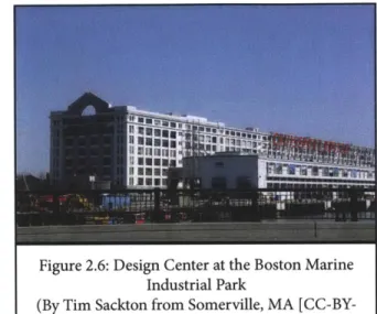
The Boston Marine Industrial Park is a 191-acre industrial park that lies at the edge of the rapidly developing Fort Point and South Boston Waterfront neighborhoods (Figure 2.5). Purchased T
by the Department of Defense in the early 2 0th century to accommodate the expanding workload of the Boston Navy Yard located in Charlestown, the South Boston Naval Annex, as it was then
called, played a similar role in Boston's economy Figure 2.5: as the Philadelphia Naval Shipyard did in its city. (Bost
S y cl #ntohational Frelght Torminal
Map of Boston Marine Industrial Park
Figure 2.6: Design Center at the Bost Industrial Park
(By Tim Sackton from Somerville, M SA-2.0, via Wikimedia Comm
It was a used for shipbuilding and repair as well as the manufacture and distribution of a wide variety of military goods. At its peak during World War II provided employment for tens of thousands of people. Post-war economic changes and military restructuring led to the closure of Naval Annex in
1974. The Economic Development and Industrial Corporation (EDIC), a quasi-public agency that has o since become part of the Boston Redevelopment
Authority (BRA), purchased the area in two
A [CC-BY- agreements with the Department of Defense in
1977 and 1983. Since then the BMIP has had the
stated goal of maintaining and promoting it as a place of maritime and industrial employment for the city.
Most of the BMIP lies within a Designated Port Area, which, under Massachusetts' law, requires that it preserve its maritime industrial capacity. As the BMIP explains on its website:
"The BRA/EDIC is committed to carefully regulating land use at BMIP by actively promoting the development and utilization of waterside parcels for water-dependent use and the development and utilization of interior parcels for compatible industrial use (i.e., non-water dependent uses with direct benefits to the water-dependent activity occurring in the park). (Boston Marine Industrial Park 2012)
The result of these statutes is that this section of the Boston waterfront has remained purely industrial in character and use, even as the area around it transforms rapidly (Figure 2.6). Recent infrastructure projects, most importantly the Big Dig which resulted in the new Ted Williams Tunnel linking East
Boston and Logan Airport with South Boston, have served both to improve the commercial accessibility of the BMPI and provide further infrastructural barriers to its public use. Those same infrastructure projects, in conjunction with a recent push from the Mayor and the BRA to redevelop the surrounding neighborhoods of South Boston and Fort Point, have led to a massive investment in new residential and commercial real estate in the area. It will be interesting to see how the BMIP adapts to these changing circumstances, and whether it responds to pressure to become more open and accessible or further walls
itself off.
Unlike the Boston and Philadelphia naval bases, the Washington,
DC Navy Yard is still an operating federal facility. Located
in the southeastern section of the city along the Anacostia River, the Washington Navy Yard was at one point the Navy's largest shipbuilding center. Since World War II, the Navy has consolidated its operations and gradually sold off portions of the site for development by private businesses or transferred them to other federal agencies. Consequently the area has transformed from an industrial district where military weapons were designed and built to a ceremonial and administrative space for the Navy's bureaucracy. Similar to Philadelphia, infrastructure investments in the mid-20th Century, particularly the construction of 1-395 and the corresponding displacement of much of the local community, served to divide the waterfront from the rest of the city. In the past decade, the surrounding neighborhood has undergone significant city-led reinvestment, most noticeably the construction of a new Major League Baseball stadium for the Washington Nationals in 2008.
Figure 2.7: Rendering of Anacostia Riv Yards (http://www.dcyards.co
Figure 2.8: Site Plan for the Y
(http://www.dcyards.com/
The Yards, a 42-acre residential and commercial venture currently in development by Forest City Washington and the Capital Riverfront Business Improvement District, is indicative of the larger pattern being promoted along the Anacostia River waterfront (Figure 2.7). A mixed-use development, the plan for the Yards emphasizes public open space, waterfront access, and recreational activities
rfront at the along the river. The site, which was transferred
m/) from the Navy to the federal General Services Administration in the 1960s and then from the
GSA to Forest City in 2008, sits between the
recently completed Nationals Baseball Stadium and the Navy Yard. While construction of the planned
2,500 residential units and 1 million square feet
of office space is still underway, the development team and the city recently unveiled the 5.8-acre riverfront park that is the centerpiece of the project (Figure 2.8). The park features a wide, open lawn ards for passive recreation and will link to the Anacostia Riverwalk, a planned 20-mile waterfront trail that is currently in development. These features, along with the intended retail, depict a waterfront meant for recreation
and consumption.
Undoubtedly there are limitations to the comparison of the experiences in Boston and Washington with those ofPhiladelphia. The Philadelphia site is considerably larger and suffers from even greater physical isolation than either the Boston Marine Industrial Park or the Washington Navy Yard. Each city has its own history, economic landscape, and specific local institutions
that make the waterfront planning and military base reuse process unique. Yet the decisions made in each case regarding what uses to promote in the redevelopment reflect the values of the community and exemplify the varying formal elements those values take in waterfront design. The Boston case provides a rare example of pure industrial waterfront remaining in a rapidly changing city landscape. The Washington plan is more typical of recent waterfront developments in its blending of pastoral open spaces and consumption-based retail and residential real estate. These projects fall easily into the standard forms of waterfront redevelopment outlined in introductory chapter. The following chapters analyze the ways in which the design and redevelopment of the Philadelphia Navy Yard both adheres to and obfuscates these divisions of use and form.
CHAPTER 3:
THE WATERFRONT AS
EMPLOYMENT CENTER
Waterfront development and the Philadelphia Navy Yard exist within a context of wider urban economic development theory and practice that has grown in response to the increase in global economic competition. The previous chapter described the decline of traditional military shipbuilding activity at the Philadelphia Naval Shipyard that coincided with a nationwide decline in manufacturing and heavy industrial production. The resulting closing of the Shipyard led to the decision to transform the site into a waterfront district that would remain a place of employment for the Philadelphia region. PIDC embraced two goals for the economic development of the new Navy Yard: retaining traditional industry (such as shipbuilding and repair, machine and metal fabrication, and manufacturing) and attracting new service-oriented office tenants (including banking and pharmaceutical industries, research and development initiatives from educational institutions, and creative firms). These strategies are very much in line with established patterns and tools of economic development used by municipalities across the United States. However, they have particular consequences for the physical design and development of a large waterfront site like the Navy Yard.Figure 3.1: Street Design within the (Author's Photo)
have employed to accomplish their development goals for the Philadelphia Navy Yard. Four different strategies for attracting and retaining jobs to the Navy Yard are considered: the use of tax incentives to lure new business to specific locations; the use of cluster theory and industrial anchors to strengthen the remaining manufacturing enterprises in the city; the provision of amenities, such as restaurants and cafes, to attract the "creative class;" and the possibility of including residential uses as a means of encouraging the generation of those same amenities. The final section discusses the implications of these strategies on the design of the built form of the Navy Yard.
TAX-BASED INCENTIVES
As the previous chapter detailed, the effort to attract and retain capital investment in the Navy Yard was from the very beginning a publicly financed undertaking. In order to persuade the Norwegian shipping conglomerate Kvaerner to bring shipbuilding back to Philadelphia, local, regional, state and federal government agencies all contributed public funds to the shipyard's rehabilitation and the retraining of employees. Since that time, PIDC has continued to offer both direct and indirect financial incentives to companies looking to relocate to the Navy Yard. In keeping with its role as the site's redevelopment authority, PIDC has made significant physical improvements throughout the site, including building and improving roads, upgrading electrical and other utilities, and enhancing the landscape Navy Yard through tree plantings and property maintenance (Figure 3.1). These efforts, along with the grants
for workforce retraining mentioned earlier, are in keeping with traditional means of economic development by public agencies
(McGahey 2008, 5).
In recent decades, with increased competition for capital between cities, jurisdictions have taken more aggressive approaches to improve their competitive advantage in business attraction. The most significant change has been the widespread use of the tax system to lower the cost of investment. The Philadelphia Navy Yard employs this approach generously. Offering tax credits, tax abatements, and other fiscal incentives for locating in the Navy Yard, PIDC has embraced a strategy that is not without controversy. The following section outlines the debate over tax-based economic development strategies in the United States broadly, and describes how they are employed at the Navy Yard.
The idea that cities compete with one another for capital investment - and the jobs and tax revenue that come with it - is nearly universally accepted as fact, especially among policymakers at the state and local levels. Even those who dispute the premise of territorial competitiveness and argue that its broad acceptance has resulted in ineffective and wasteful policies acknowledge the fact that because so many municipalities have adopted competitiveness policies, "significant strategic disadvantages accrue to those localities that attempt to opt out of such policies, or to adopt alternatives to them" (Brenner and Wachsmuth 2012, 2). Within this framework of constant competition, localities must continually upgrade their place-specific assets in order to attract businesses. These assets may come in the form of socioeconomic resources, like quality infrastructure or an educated workforce (the traditional tools employed by the public sector to encourage
economic growth). However, in the last thirty years, more and more jurisdictions at both the state and local levels have taken a more neoliberal approach to economic development policy, seeking to lower the cost of investment by offering tax relief to companies that locate within their borders (ibid, 13). Yet the question of whether such incentives induce significant new investment or jobs has not been conclusively answered. In fact, as one recent review of the literature concluded: "there are very good reasons - theoretical, empirical, and practical - to believe that economic development incentives have little or no impact on firm location and investment decisions" (Peters and Fisher 2004, 32).
While the academic literature presents a gloomy picture, it has had little noticeable effect on the use of incentives by states and municipalities. Indeed, incentives are alive and well at the Philadelphia Navy Yard. On its website, PIDC prominently displays a wide variety of state and local incentives businesses can take advantage of by locating in the Navy Yard (PIDC 2011). These include:
* Tax credits (through Keystone Innovation Zone Tax
Credits for firms working within particular technology sectors; Historic Tax Credits for the renovation of historic buildings in the site, which is on the National Register of Historic Places; and Research and Development Tax Credits, again offered to firms in the technology industry, especially small start-ups);
. Tax abatements (through the Keystone Opportunity Improvement Zone, and Real Estate Tax Abatements offered by the City); and
. Direct financing and loans at below-market interest rates offered by PIDC.
tenants, from the metal fabrication firm Rhoads Industries to the clothing retailer Urban Outfitters (Hare, Joe and Ziel, Dave 2012).
Of particular interest for the case of the Philadelphia Navy Yard
are tools known as either "enterprise zones" or "empowerment zones." These tools are meant to direct investment to particularly troubled or difficult areas of the city. As Peters and Fisher point out, enterprise zones should be one of the best forms of economic development, since they target generous incentives at small places. Research, however, does not support this assumption. Often the unfavorable factors that result in an area being designated an enterprise zone are not mitigated by the incentives offered (Peters and Fisher 2008, 31). The Navy Yard is designated as a Keystone Opportunity Improvement Zone (KOIZ), a classification given by the state of Pennsylvania that exempts qualifying businesses from a wide range of city and state taxes, including corporate income taxes, business privilege taxes, and sales and use taxes, until 2018. The Keystone Opportunity Zone program (of which the KOIZ is one particular classification) was developed by the state in the late 1990s to encourage investment in particularly troubled areas. PIDC operates many of the KOIZs in Philadelphia, each of which must be approved the City Council. According to Mark Seltzer, PIDC's Director of Management and Development for the Navy Yard, there was little controversy in awarding the designation to the Navy Yard, given the City's strong interest in improving its attractiveness to investors (Seltzer, Mark 2012). Since the Navy Yard's first KOIZ designation in the early 2000's, there have been a series of expansions and additions over the years. Today, nearly 1/3 of the Navy Yard enjoys the KOIZ designation, though due to the