Ports in a world maritime system: a multilevel analysis
Texte intégral
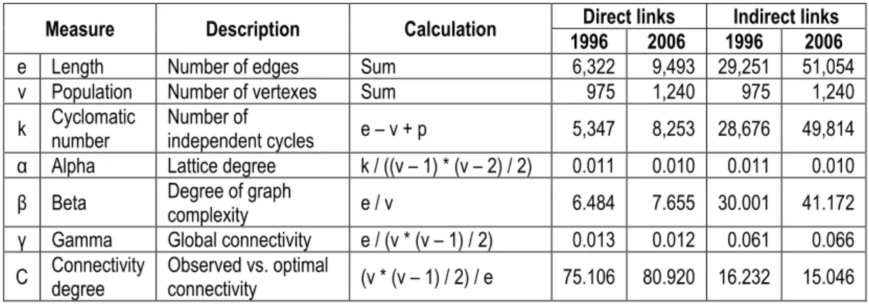
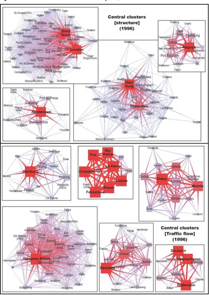
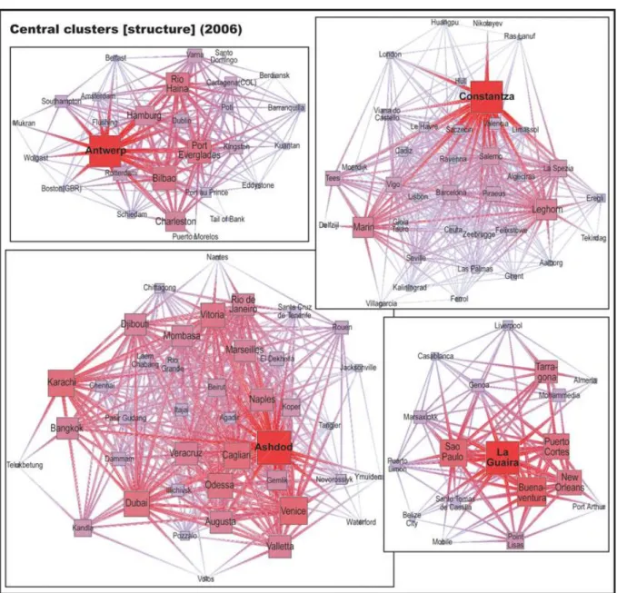
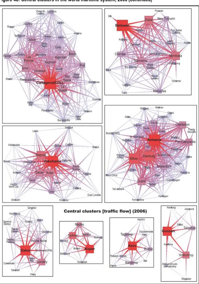
Figure
Documents relatifs
Visualizing Multilevel Networks for the Analysis of Superposed Levels of Collective Agency..
Taylor's series equivalent to second difference interpolation which requires only tabulated values of the functions is:. The maximum error due to neglecting third differences
We investigated the role of rat dispersal in plague spread, by carrying out a comparative study of plague seroprevalence levels and the genetic structure of rat populations in
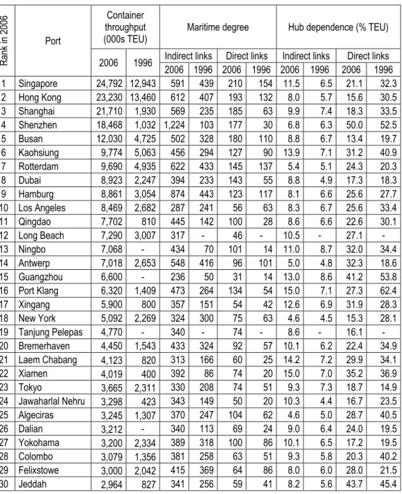
The national port system, composed by 28 port authorities that manage 46 ports, includes one of the most important Mediterranean hubs (Barcelona, Algeciras), the largest
In other words, the data concerning a given level is embedded in the data at a higher level: we have two groups in each country and, in turn, each group has engaged in a number
BACKGROUND: We assessed the association of anxiety with cigarette dependence over time, depending on smoking status (daily, occasional or ex-smoker); and the association of anxiety
34 Finally, spatial multilevel modelling proved to be a proper technique to incorporate both contextual and worksite level factors into a regression model, to explore the role
Output of the Cascaded H Bridge Multilevel Inverter (CHB-MLI) In order to minimize the output voltage harmonics, the width of each level is calculated in a similar way used for the
