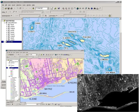
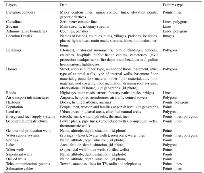
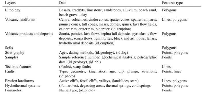
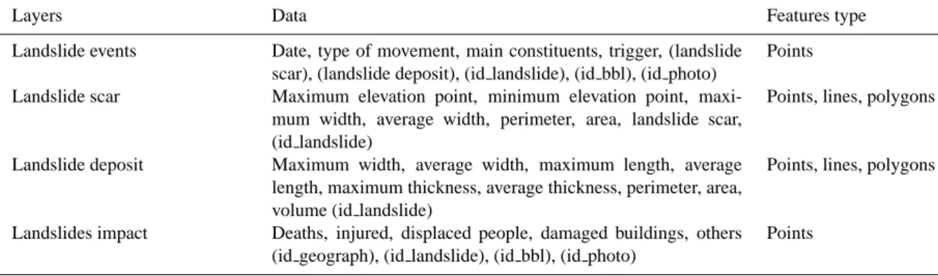
Dynamic structure and data sets of a GIS database for geological riskanalysis in the Azores volcanic islands
Texte intégral
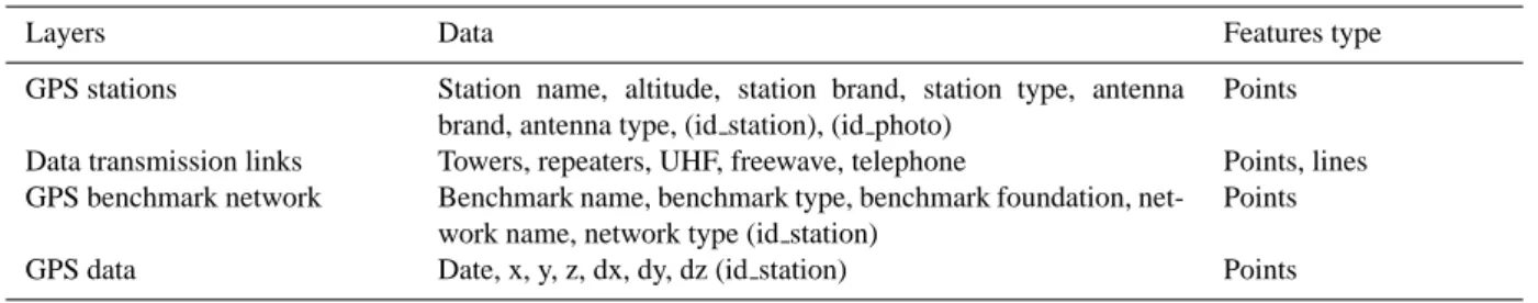
Figure


Documents relatifs
where C d is the data covariance matrix describing the data errors and it is here assumed to be adequately represented by uncorrelated Gaussian data errors of a known standard
2 Bt protein content (mean ± SE) over the three experimental days in leaves of N4640Bt (Cry1Ab) and DKC5143Bt (Cry3Bb1) used for the feeding experiment. Black symbols show Bt
Figure 4 shows the configuration obtained without cross- field flow, V 0 = 0, and without net electric potential differ- ences across the TD interfaces, φ ( ±∞ ) = 0, for a slab
It shows that a strong external electric potential difference in- variably leads to monopolar electric field signatures at both cold–hot and hot–hot interfaces, whereas for smaller
The sensitivity studies, performed on BIRA data of 4 July 2009, revealed several possible optimisations of the HCHO DOAS retrieval, in order to minimise interferences and
3.3 presents how a combination of zenith de- lays and horizontal delay gradients measurements can im- prove the time and space resolution of the 2-D field of delay observed by
The major regional ozone depletion events that were visible at all coastal stations, and discussed above, can also be seen in Fig. The August event is clearly evident in Site C as
Cette température (1100°C) pour laquelle le film de zirconium se transforme totalement est la même dans le cas du carbure malgré la différence des paramètres thermodynamiques où
