Assessing the rock glacier kinematics on three different timescales: a case study from the southern Swiss Alps
14
0
0
Texte intégral
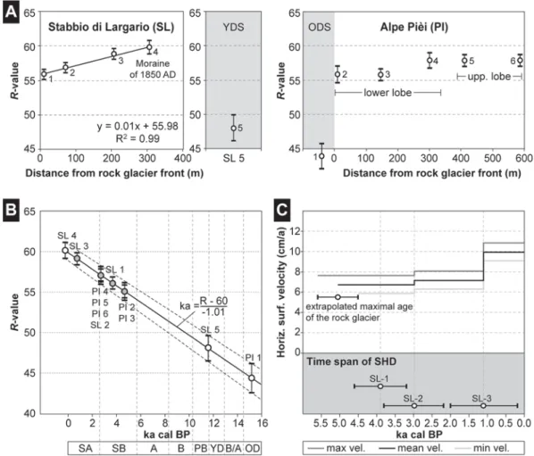
Figure

+2
Documents relatifs