Contributions on Hybrid Localization Techniques For Heterogeneous Wireless Networks
Texte intégral
Figure
Documents relatifs
Hence, a periodic sensor which does not skip any awake period hears the k corona identities in a specific order which depends on the parameters d, L, and on the time slot s at which
Hence, a periodic sensor which does not skip any awake period hears the k corona identities in a specific order which depends on the parameters d, L, and on the time slot s at which
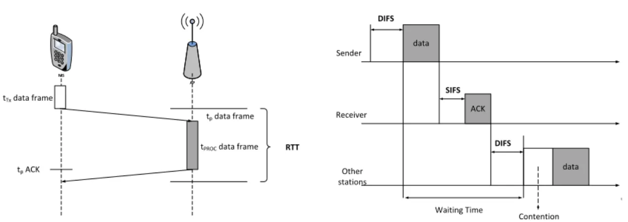
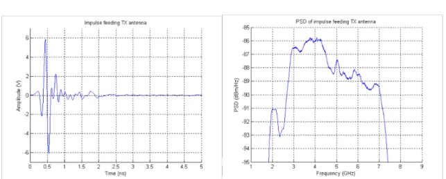
In order to have an accurate way to correct time error between the two receivers, a synchronization protocol has been developed, based on the periodic emission of a
de nœuds, avec un taux d’activité de 0.5 % (à gauche) et un taux d’activité de 1 % (à droite) lorsque la période de génération de trafic est de 5 s, pour les protocoles de
Pillar I - “serbia’s Human development: dimensions and challenges” is dedicated to the dimensions of human development (Hd), largely covering the issues under Goals 1-5 and
ةياور « كوكناب ينطايش » قازرلا دبعل ةّيرهاوط ميقلاو ينماضلما في ةسارد فوّصلاوب ظيفلحا دبع ةعماج – ةليم – ...:عجرلما ... يبرعلا بدلأاو ةغّللا
The gateway estimates the frequency of the n-th sampled interference after receiving it from the satellite. Due to the movement of the satellite, each estimated frequency includes
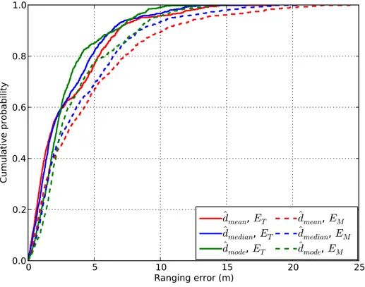
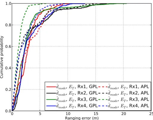
Abstract: In Electronic Warfare, and more specifically in the domain of passive localization, accurate time synchronization between platforms is decisive, especially on systems
