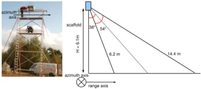
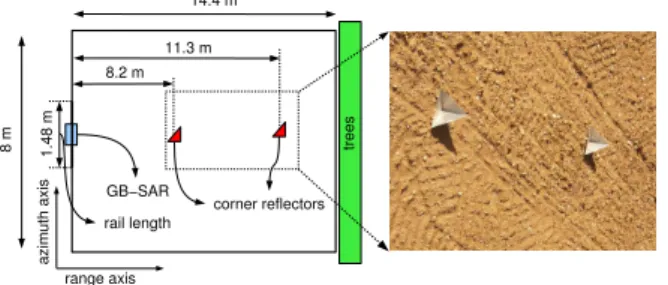
Multi-angular ground-based SAR system for soil surface roughness characterization
Texte intégral
Figure
Documents relatifs
For (even partially) regular dynamics, the many pilot atom method takes the risk of having initial condition that do not cover the entire accessible ground state en- ergy surface,
The purpose of this letter is to provide a record of the material transfer, to memorialize the agreement between the Provider Scientist (identified below) and
The book explores a variety of conceptions of imagination and examines ways in which education can develop imagination to the benefit of individuals and society.. It
The surface topographies of both low-spatial-frequency LIPSSs (LSFLs) and high-spatial-frequency LIPSSs (HSFLs) at oblique incidence and various polarization states (linear,
Binding at equilibrium involving two components (signal versus total ligand concentration).. Kinetics of binding involving two components, treatment as single-step relaxation
L’archive ouverte pluridisciplinaire HAL, est destinée au dépôt et à la diffusion de documents scientifiques de niveau recherche, publiés ou non, émanant des
ABSTRACT- The growth mechanism and the optical properties of hydrogenated amorphous silicon (a-Si:H)films, deposited from silane plasma decomposition, are studied in situ by real
From Figure 5, it can be found that the simulated curves obtained by interpolation in the first scale have good fractal characteristics, and the slopes are close , but with the
