HAL Id: halshs-00662856
https://halshs.archives-ouvertes.fr/halshs-00662856
Submitted on 25 Jan 2012
HAL is a multi-disciplinary open access archive for the deposit and dissemination of sci-entific research documents, whether they are pub-lished or not. The documents may come from teaching and research institutions in France or abroad, or from public or private research centers.
L’archive ouverte pluridisciplinaire HAL, est destinée au dépôt et à la diffusion de documents scientifiques de niveau recherche, publiés ou non, émanant des établissements d’enseignement et de recherche français ou étrangers, des laboratoires publics ou privés.
Distributed under a Creative Commons Attribution - NonCommercial| 4.0 International License
To cite this version:
Fabienne Dugast, Iwona Gajda. Report on fieldwork - Preliminary survey in Tigray Region, Ethiopia (March 22nd - April 2nd 2010): To the Federal Democratic Republic of Ethiopia (ARCCH). [Research Report] French-Ethiopian project of archaeological and epigraphic investigations in Tigrai region, Ethiopia Pre-Aksumite and Aksumite period (8th c. BC-AD 7th c.). 2010. �halshs-00662856�
in Tigrai region, Ethiopia
Pre-Aksumite and Aksumite period
(8
thc. BC-AD 7
thc.)
REPORT ON FIELDWORK,
FIRST PRELIMINARY SURVEY
(March 22
nd- April 2
nd2010)
presented by
Iwona Gajda & Fabienne Dugast
TO THE FEDERAL DEMOCRATIC REPUBLIC OF ETHIOPIA
MINISTRY OF YOUTH, SPORT, AND CULTURE
AUTHORITY FOR RESEARCH AND CONSERVATION
OF CULTURAL HERITAGE
17 April 2010
Head of mission:
Name Specialty Institution
Dr Iwona Gajda Epigraphy and History centre national de la recherche scientifique (cnrs ) / France
Title of project:
Archaeological and epigraphic investigations in Tigrai region, Ethiopia (Pre-Aksumite and Aksumite period)
Dates of fieldwork:
March 22nd-april 2nd, 2010
Field of research:
historical archaeology / archaeological and epigraphic investigations
List of field team members:
Name Specialty Institution Degree
Dr Iwona Gajda Epigraphy and History cnrs / France phD
Dr Fabienne Dugast Archaeology cnrs / France phD
Yohannes Gebre sellassie History of Aksumite period University of paris-sorbonne to be submitted in phD
2010
hiluf Berhe Archaeology University of aksum Ma
amare driver ethiopian studies, French centre for
addis ababa
-Official representative:
INTRODUCTION & BACKGROUND
since the 1970’s, aksum stands in area under discussion since the development of culture in the ethiopian highlands appears to be, even now, the subject of much debate. What role did it play, when did it emerge to prominence, and what were its relations with pre-existing societies and cultures? and above all, to what extent was aksum a conduit for external influences, Mediterranean and south arabian, or even vice versa? the history of the kingdom of aksum, between the end of the 2nd and the end of the 6th century, is only
known by few various sources: Ge’ez, pseudo-sabaean and Greek inscriptions found in ethiopia; sabaean and himyarite inscriptions discovered in Yemen which make mention of conflicts in the 3rd and 6th centuries;
archaeological data, especially around aksum; Greek and roman sources which relate the conversion of ethiopia to christianity in the 4th century, as well as the crisis of the 6th century. several aksumite kings are
though already known among others by numerous coins.
In the same way, several sites of the so called “pre-aksumite” civilization have been established in tigrai region between the 8th and the 5th c. Bc. this civilization had significant contacts with south arabia. script,
architecture and cult of several deities have been brought by sabaean immigrants in the first half of the
Ist millennium Bc. recent excavations at Maqabər Ga’əwa (near Wukro) revealed, for example, the remains of
a temple to almaqah, whose cult existed in the kingdom of saba (see I. Gajda, Y. Gebre sellassie and h. Berhe, “pre-aksumite Inscriptions from Maqabər Ga’əwa (tigrai, ethiopia)”, in Annales d’Éthiopie, 24, 2009: 33-48). south arabian influence is as well obvious in economy, trade and social structures. though, data are still insufficient to make it clear.
this first mission (March-april 2010) consisted in a preliminary visit. the aim of it was a general survey of pre-aksumite and aksumite sites (Yeha and around, adowa and around, hawzen and Gulo Makada, the eastern part of tigrai, the region of atsbi-Dera’ and the one of Medri senafe), and also a geographical study of the kingdom of aksum, to assert the identification of tribes and regions mentioned in the descriptions of military campaigns.
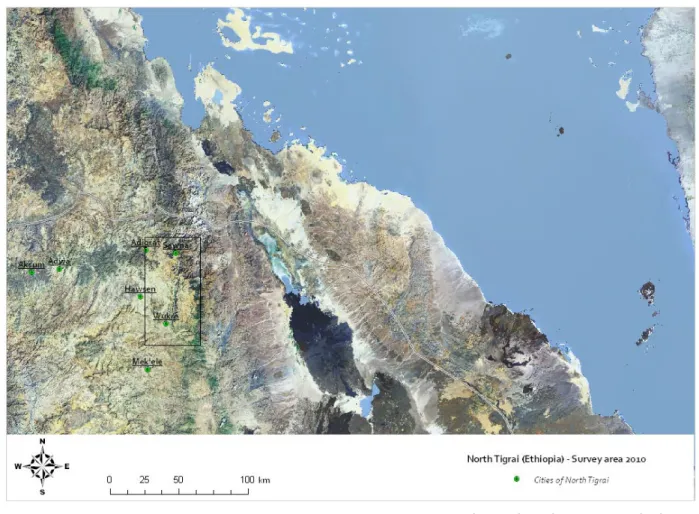
as several pre-aksumite and aksumite sites around aksum and within the study area proposed for a first survey have recently been excavated or surveyed by other teams, we have only paid a short visit to some of them: Yeha (Iris Gerlach, since november 2009), haulti (holger hitgen, since 2009-2010), Maqabər Ga’əwa (ricardo eichmann & pawel Wolf, since 2009). thus, in agreement with ato Kebede amare Belay, General Manager of the tigrai culture and tourism agency at Mekelle, this preliminary survey concentrated on documenting several sites first surveyed by the ethiopian team in the region of atsbi-Dera, east of Mekelle (fig. 1), and took place from 22 March to 2 april 2010.
the investigations are directed by Dr Iwona Gajda of the centre national de la recherche scientifique (cnrs) in paris and team members included:
Dr Fabienne Dugast, centre national de la recherche scientifique, paris (archaeology), Yohannes Gebre sellassie, University of paris-sorbonne (history of aksumite period), hiluf Berhe, University of aksum (archaeology),
habtamu Mekonnen, tigrai Bureau of culture and tourism (survey), amare, French center for ethipian studies, addis ababa (driver).
the methodological approach of this first project was to collect artefact samples, in order to make a preliminary location of pre-aksumite and aksumite sites without undertaking any excavations. the final objectives will be to enable the prioritization of areas of eastern tigrai for survey and mapping, and of sites for excavation.
I. OBJECTIVES AND METHODOLOGY
the main tasks were to initiate an archaeological survey.
specific fieldwork objectives were to implement a sampling design and initiate the archaeological survey which employed geomantics techniques including Gps (Global positioning system) and GIs (Geographic Information system).
artefact samples have been systematically collected and registered: pottery shreds, iron slag, and even bones. the objectives were to try to identify each site as well as to insure their size by Gps outlining. as pre-aksumite and aksumite artefacts are still not well known, the fieldwork objectives were as well to implement a sampling of each type of ceramics in order to produce dating references. In this sight, this preliminary sampling has been completed with a visit to the national Museum at addis ababa (F. anfray’s excavations at Matarā, near senafe, 1963-1974), and the Museum at aksum.
II. SURVEY AND COLLECTION OF ARTEFACT SAMPLES
the survey is based on a few sites randomly found and selected by the tigrai Bureau of culture and tourism, at Mekelle (habtamu Mekonnen) and hiluf Berhe (University of aksum). local people has been interviewed
to try to get some more information about any ancient objects, structures, megaliths that could have been found recently.
some 15 sites have been visited (see annexes I-III): 5 aksumite, and perhaps pre-aksumite sites, 5 sites with megalithic stelae or standing stones, 5 so called “roc churches”.
except adi Ba’ekel, east aksum, most of them are concentrated on the eastern side of the road from Wukro to adigrat, and on the edge of a plateau closed to the east by a mountain range, before sloping on the other side to the red sea (fig. 2).
Description of some archaeological sites of Eastern Tigrai (from south to north)
Aggula Čerkos
-
situated about 10 kms south of Wukro, 13°41’29”6 n / 39°35’03”2 e (altitude 2005 m).
ruins of an aksumite church, erected on a hillock about 1 m high – or even covered with alluvium (?) (phot. 1, 2).
the structure was still visible at the end of the 19th century (cf. carlo conti rossini, Storia d’Etiopia,
Milano, 1925, vol. I, pl. Xl). the author described it as a podium built in freestone, having the outer
walls marked by massive corner stones, with a length of somewhat 1 or 1,50 m. the complex’ indented plan resulted in a suite of rooms approached on the western side by a stairway of freestone. pillars or columns on stone bases supported the ceiling (fig. 3).
very little remains today as the ruins were further devastated since then.
the actual hillock has an extension of some 20 m e/W by 10 m n/s. on top of the it, apparent walls about 0,50 m thick, delineate a complete structure, made up of a suite of two adjoining rooms about 4 x 11 m square each, leading by a kind of anteroom some 4 x 2 m square (phot. 4). a stairway of somewhat 10 steps seems to approach it on its western side, of which hardly any masonry remains (phot. 5). probably columns or pillars on stone bases supported the ceiling, one of which still remains (phot. 6).
Phot. 1: Aggula Čerkos, the hillock to the South. Phot. 2: Aggula Čerkos, the hillock to the East.
Phot. 3: Aggula Čerkos, the site seen in 1895. Phot. 4: Aggula Čerkos, the visible structures on the hillock.
recently the inhabitants intended to construct a new church on the site. In order to prevent an eventual destruction of archaeological remains and to check the limits of the site, the tigrai Bureau of culture and tourism at Mekelle (tekle hagos and habtamu Mekonnen) made a test excavation next to the church and unearthed pottery shreds and bones.
the local administration actually retains the right to inspect a somewhat large area in order to preserve the remains and hopefully allow for a better understanding of its original structure. samples: a few shreds have been collected. Black paste and grey slip allow to date back to the pre-aksumite period and orange ware to the pre-aksumite one.
- Addi Akaweh
situated about 5 kms east of Wukro and near the aksumite site of Maqabər Ga’əwa, discovered in 2007 thanks to the rescue excavation directed by hiluf Berhe (report published in Annales
d’Éthiopie, 24, 2009) and then excavated by a German team (report of r. eichmann & p. Wolf, 2009),
13°45’22”5 n / 39°34’05”3 e (altitude 1993 m).
the church of enda abba Garima in addi akaweh contains three stone incense burners with pre-aksumite inscriptions: see RIE 9 and RIE 10, edited by r. schneider. a third inscription, addi akaweh 1, has been published by I. Gajda and Y. Gebre sellassie. the text of the inscription is identical with the inscription RIE 9, and enables a minor emendation of the reading.
three limestone architectural ornaments of different size were collected from farmlands around the village of addi akaweh and in its vicinity. two of these stones were reused in the construction of the south-west side of the church.
see: I. Gajda and Y. Gebre sellassie, “pre-aksumite inscribed Incense Burner and some architectural ornaments from addi akaweh (tigrai, ethiopia), in Annales d’Éthiopie, 24, 2009: 49-61.
samples: a few shreds have been collected in front of the church area, black paste and orange slip as well as orange ware including mica (dating back to the aksumite period?).
In the area of Atsbi-Dera’:
- Habes
situated about 10 kms north-east of Wukro, on the way to Dera’, 13°48’40”4 n / 39°41’06” e (altitude 2575 m).
Megalithic stele (or standing stone), about 3 m length visible, broken on top, and leaning to the north in front of a local house (Gebre Medhen Gebre egzi’abeher). It is an undecorated but hewn monolith of granite, rectangular in cross-section (phot. 7). see :tekle hagos’ and habtamu Makonnen’s report.
situated about 10 kms north-east of Wukro, opposite to habes (on the other side of the road), near the village asab’ali, 13°49’13”6 n / 39°41’00”5 e (altitude 2575 m).
Megalithic stele, lying down to the northeast, and broken into two massive pieces. It is an undecorated but hewn monolith of granite, rectangular in cross-section, totalizing more than 3 m length, similar as the one of habes (phot. 8). the base is missing (slight pieces just around), and the head is buried for most of its length:
- the lower part is 1,35 m length, 0,525 m wide, and 0,30 m thick;
- the top part is 2,20 m length, 0,525 m wide, and 0,15 m thick.
samples: several pottery shreds have been collected immediately around, all the most dating back to the aksumite period: black ware, of which an amphora (?) handle, black paste and orange slip, orange and grey ware.
- Abreha wa Asbeha
situated about 7 kms northwest of Wukro (1 hour trail), 13°50’49”3 n / 39°32’11”1 e (altitude 2002 m), at the eastern side of the mountain.
“roc church”, rectangular in plan : its indented plan results in 3 sections, approached on its western side by a monumental stairway, and open to the west by 3 entrances, north for men, south for women (phot. 9-10). the central entrance consists in a double wooden doorway (phot. 11), and runs through the keddest.
Phot. 8: May Tərəro, monolithic stele.
Abreha wa Asbeha
Inside, the sections are decorated with peculiar architectural ornaments (phot. 12) and paintings with colorful religious scenes that may be dating back to the 4th century, or maybe 12th (phot. 13).
samples: none.
- Maryam Kadih
situated about 7 kms north of Wukro (1/2 an hour road), 13°52’09”9 n / 39°36’11”7 e (altitude 2266 m). church and tombs. peculiar stones with
a hole are standing round the modern church.
on the opposite side of the road and the modern church, a monolith flagstone of schist is lying on the earth, partly buried, but maybe 3 m total square (phot. 14). the priest assures it a royal tombstone.
samples: none can be seen round the church. on the contrary, several pottery shreds could be collected on the opposite site of the church, in the tombstone area, all the most dating back to the aksumite period: black paste and orange slip, rough and fine orange ware.
the Italians cut the ancient site and tombs to build the actual road to adigrat. on the northern side of the road, a few bones are still visible (phot. 15): 3 samples have been collected to hopefully be analyzed in addis ababa and make sure they are human’s (no possible dating 14c).
Phot. 12: Abreha wa Asbeha, architectural ornament. Phot. 13: Abreha wa Asbeha, part of a religious scene.
Phot. 14: Maryam Kadih, tombstone.
Phot. 15: Maryam Kadih, remains of (human?) bones still visible on the side trench of the road.
situated about 15 to 20 kms northeast of Wukro (1/2 an hour trail), 13°51’59”3 n / 39°44’09”9 e (altitude 2689 m).
Monolithic stele, standing on the side of the trail.
It is an undecorated but hewn monolith, rectangular in cross-section, totalizing less than 2,50 m length (phot. 16). Its head seems to have been broken, even slightly.
samples: none.
- Gulgul Na’la
situated about 2 kms north of atsbi, 13°53’03” n / 39°43’57”2 e (altitude 2732 m).
three monolithic stelae, standing on both side of the trail. these are undecorated and unhewn monoliths, somewhat 2 m length (phot. 17).
samples: none.
- Zarema Giorgis
situated about 10 kms northwest of atsbi (1 hour trail), 13°56’17”3 n / 39°40’30”2 e (altitude 2822 m).
some 100 m north of the church, flat rocs (limestone) one on the other show a suite of holes, conic in section (phot. 18). this type of holes are also reported by researchers on different archaeological sites.
Phot. 16: Atsbi, monolithic stele.
Phot. 17: Gulgul na’la, monolithic stelae.
ancient church: as the priest says, it shelters pre-aksumite artefacts. But no visit was possible and none would be, as, according to the inhabitants, the priests are very conservative.
samples: several pottery shreds have been collected all around, near the church as well as near the flat roc, all the most dating back to the aksumite period: black paste and orange slip, black ware, one of which with a ornament, black paste and external as well as internal orange slip.
- Maryam Madhaniti
situated about 30 kms north of Wukro, 15 mn west of Der’a, 13°59’52”6 n / 39°42’42”6 e (altitude 2849 m).
Monolithic stelae, two of which are on the south side of the mountain, another one is standing near the actual church, a few meters to the south.
on the south side of the mountain, the stelae are undecorated but hewn schist monolith, rectangular in cross-section. one is still standing, leaning to the west, somewhat 4 m length, but its head may be broken (phot. 19).
on the same side of the mountain and less than 5 m to the north, a second stele is lying above the ground on one side. the most part of it with rounded head is visible, leaning to the west. Its base is still in its original dressed position, leaning to the west and broken at a length of 0,50 m. Its total length is some 6 m (phot. 20).
near the church, a third stele is dressed, undecorated and unhewn, less than 3 m length (phot. 21).
samples: several pottery shreds have been collected all around, near the stelae as well as near the church, all the most dating back to the aksumite period: black paste and orange slip, black paste and external as well as internal orange slip, orange ware including mica, fine orange ware.
Phot.19-20: Maryam Madhaniti, two monolithic and hewn stelae.
- Addi Gelemo
situated about 40 kms north of Wukro, 2 hours trail from edaga hamus, and ½ an hour walk, just near Magbar Weldi negus, 14°04’27”6 n / 39°44’37”5 e (altitude 2920 m).
the site is situated in the district of tabia hawila, in the region of asseraw, at the edge of the eastern plateau of tigrai. In 1953/1954, the local people discovered by chance, under a slab of stone looking to the east, several pre-aksumite and aksumite objects of different origins (phot. 22-24).
see: e. Bernand, a. J. Drewes and r. schneider, Recueil des inscriptions de l’Éthiopie des périodes
pré-axoumite et pré-axoumite, paris, 1991 [RIE], who describe the site (p. 43) and the inscribed objects:
- a pre-aksumite incense burner with a royal inscription of the rbh sovereign (mukarrib) of Da’amat and of saba’, reigning in the 7th or in the 6th century Bc: RIE 8: 76-77, pl. 5-6 (phot. 22);
- a pre-aksumite statue of a woman on an inscribed base dating from the 7th century Bc: RIE 52:
131-132, pl. 42 (pho. 23);
- a bronze votive object with a royal inscription of the aksumite sovereign Gadarat reigning in the 3rd century aD: RIE 180: 219-220, pl. 89 (phot. 24);
- several bronze bowls coming from the nile valley.
It is difficult to understand why these objects which come probably from different sites and dating from different periods have been found together in this remote place in the high mountains. the researchers supposed, that it had been hidden there by robbers.
the use of the site is largely hypothetic as no structures are visible (phot. 25).
all the same, several pottery shreds have been collected all around, on the terraced land, and make it possible to have been inhabited in the aD 1srt c., maybe after. the area seems to cover about 2000 m²:
shreds have been collected on the slope of the hill, but result probably of erosion (phot. 26).
Addi Gelemo
samples: several pottery shreds have been collected, all the most dating back to the aksumite period, maybe the pre-aksumite one: black paste and orange slip (1 vase’s rim = pottery beaker?), black paste and external as well as internal orange slip, orange ware including mica (1 vase’s rim, 1 with stripe pattern [chevron], other patterns), fine orange ware.
- Wakarida
situated about 70 kms north of Wukro, 2 hours trail from edaga hamus, east and near sawna, 14°16’56”4 n / 39°43’31”9 e (altitude 2343 m) – surrounded by chain of mountains, according to habtamu Mekonnen, and from north to east and south to west: Daima, afedadae, Dagaraebe and arebata.
surveyed in 2004 by the tigrai Bureau of culture and tourism at Mekelle (tekle hagos and habtamu Mekonnen): see their report, 2004: 16-18.
several structures are still apparent on the hill, consisting on a regular suite of adjoining rooms, somewhat 3 m square, along the slope. the walls are about 0,50 m thick, and made of rubble-stone (phot. 27). the area could cover some 5 ha, from top to mid-slope of the hill, looking north and east, on the valley. trails open north and east on the red sea direction.
local people use the stones as building material for their own houses, which are erected mostly on ancient structures. a complex has been found on the north side of the hill, and consists of 4 adjoining
Phot. 25: Addi Gelemo, the place of the discovery. Phot. 26: Addi Gelemo, the place of the discovery on top of the hill.
destroyed by the inhabitants. More structures arose on the both sides of the complex.
samples: local people have found several objects, most of them nearby the pillar like wall, actually destroyed (phot. 29-30):
- small stone figurine, engraved on both sides, 0,14 m length, 0,03 m wide (phot. 31) ; - ceramic figurine, without head, 0,08 m length, 0,06 m wide (phot. 32);
- piece of a ceramic figurine (pelvis) (phot. 33); - bronze coin, diam 0,15 m (phot. 34) ;
- funeral urn (phot. 35).
Phot. 29: Wakarida, objects found by the local people before 2004. Phot. 30: Wakarida, objects found by the local people since 2004. Wakarida
Phot.31: Small stone figurine, engraved. Phot. 32: Ceramic figurine, without head. Phot. 33: Ceramic figurine, piece of the pelvis.
several pottery shreds have been collected all over the site, all the most dating back to the pre-aksumite and pre-aksumite periods: black paste and orange slip, orange ware including mica, fine orange ware… (phot. 36). a few fragments of a (?) footwasher have been also collected (phot. 37).
Near Feresmay:
- Adi Ba’ekel
situated about 40 kms east of aksum, 1 hour trail, 14°11’42”9 n / 39°04’19”7 e (altitude 2042 m). the site has been surveyed by hiluf Berhe and his students (University of aksum), on inquiry of local people who had excavated an inscription on a megalith stone (phot. 38).
three sites have been surveyed:
1/ near the trail, where the fragmentary pre-aksumite inscription was found, as well as several other building stones some 0,20 m underground – 14°11’42”9 n / 39°04’19”7 e (altitude 2042 m): none is visible but several pottery shreds indicate an area of somewhat 2000 m² (phot. 39).
the identification of the site remains hypothetic: the inscription and the building stones are maybe of a public monument.
Phot. 36: Wakarida, several pottery shreds with pattern. Phot. 37: Wakarida, fragments of a footwasher.
Adi Ba’ekel
Phot. 38: Fragmentary pre-Aksumite inscription.
black and orange ware (including a handle…).
2/ some 100 m northeast, at the edge of the plateau, a stelea field leaning on the slope and looking northeast – 14°11’44”7 n / 39°04’32”1 e (altitude 2031 m): nearly 10 stelae are visible, broken, lying on the side. they are undecorated but hewn, and most of them have rounded head (phot. 40-42).
samples: similar pottery shreds have been collected, in good condition.
3/ less than 50 m east, past the stelae field, next to a hillock which h. Berhe would like to hide a ancient structure – 14°11’38”5 n / 39°04’32”8 e (altitude 2020 m): there is no structure visible, but numerous pottery shreds in front of the hillock, to the west. the area may be of some 2000 m² (phot. 43).
samples: similar pottery shreds have been collected, of which different types of handles and patterns (phot. 44). the local people have also collected several artefacts (unseen).
Phot. 40-42: Adi Ba’ekel, stelea field on the slope of the plateau.
III. STORAGE OF SAMPLES
the collection consisted, at this stage, in artefact samples with a systematic register and localization. though, as this first survey was a preliminary study, the samples have been limited (very small volume), and consisted mostly in pottery shreds, some iron slags and bones.
they are stored in plastic wrap with mention of the origin, and entrusted to ato Kebede amare, head of the tigrai culture and tourism agency at Mekelle.
Register:
Site plastic wrap pottery shreds iron slag bones
NMI rim handle pattern
aggula Čerkos 1 4 - - - -
-addi akaweh 1 few - - - -
-May tərəro 3 several - 1 (black ware) - -
-Maryam Kadih 1 few 1 - - 2 3
Zarema Giorgis 1 few - - 1 (black ware) -
-Maryam Madhaniti 1 few - - - -
-addi Gelemo 3 several 3 1 3 -
-Wakarida 4 several 3 5 8 5
-adi Ba’ekel 1 1 few - 1 - -
-adi Ba’ekel 2 (stelae field) 2 several - 2 - - -adi Ba’ekel 3 (hillock) 2 several - 1 1 1
-Type of ceramics:
Site Black ware Grey ware Fine orange ware Black paste / orange
slip Black paste / orange slip ‘in-out’ Orange ware + mica aggula Čerkos x x - - - x addi akaweh - - - x - x May tərəro x x - x - x Maryam Kadih - - x x - x Zarema Giorgis x - - x x -Maryam Madhaniti - - x x x x addi Gelemo - - x x x x Wakarida x x x x - x adi Ba’ekel 1 x - - - - x
adi Ba’ekel 2 (stelae field) x - - - - x
this first visit in tigrai, at the beginning of our project, was a very short and preliminary survey, which enabled to project archaeological investigations in the future. the objectives will be to clarify the landscape-scale distribution of ancient human activity. We are convinced that beside the most important pre-aksumite and aksumite sites, numerous other sites can be investigated and can reveal more data about rural life and possibly about trade, including local exchanges and the long distance trade. the regions situated along the modern road from Wukro to adigrat, which followed probably an ancient road, deserve a detailed survey as several sites show. thus the region of senafe, including the site of Wakarida, near the village of sawna could be interesting for this study: the region of senafe is fertile, well cultivated land and it is situated on the ancient trails leading from the inland to the east, towards the red sea coast.
We have got in touch with certain teams working in tigrai on the pre-aksumite and aksumite periods. We also plan to contact very soon the other teams, as we are convinced that the fieldwork of several groups of researchers can be complementary and that their collaboration, exchange of data and of ideas can accelerate the progress of research on ethiopian history.
Iwona Gajda Fabienne Dugast
ANNEXE I.
ANNEXE III.
FEW REFERENCES
Abel A.
1974 “l’Éthiopie et ses rapports avec l’arabie préislamique jusqu’à l’émigration de ca. 615”, in IV Congresso
Internazionale di Studi Etiopici, roma : academia nazionale dei lincei (1974): 405-420. Anfray F.
1963 “campagnes de fouilles à Matarā près de sénafé”, in Annales d’Éthiopie, 5 (1963): 92-112. 1968 “la poterie de Matarā”, in Rassegna di Studi Etiopici, 22 (1968).
1994 “considérations sur quelques aspects archéologiques des relations de l’Éthiopie et de l’arabie antiques”, in Beyene Y., Fattovitch r., Marrassini p., triulzi a. (eds.), Etiopia e oltre: studi in onore di
Lanfranco Ricci, napoli (1994): 17-25. Berhe H.
2009 New Archaeological Sites from Feresmay and its surrounding (Ahferom Wereda, Tigray Region), archaeological report, axum University (2009).
2009 “preliminary report on the archaeological excavation of Mäqabər Ga’əwa at addi akaweh (tigrai, ethiopia)”, in Annales d’Éthiopie, 24 (2009).
Bernand E. , Drewes A. J. , Schneider R.
1991 Recueil des inscriptions de l’Éthiopie des périodes pré-axoumite et axoumite, paris, 1991 [rIe].
Conti Rossini C.
1925 Storia d’Etiopia, Milano, 1925.
Gajda I., Gebre Sellassie Y., Berhe H.
2009 “pre-aksumite Inscriptions from Maqabər Ga’əwa (tigrai, ethiopia)”, in Annales d’Éthiopie, 24 (2009): 33-48.
Gajda I., Gebre Sellassie Y.
2009 “pre-aksumite inscribed Incense Burner and some architectural ornaments from addi akaweh (tigrai, ethiopia), in Annales d’Éthiopie, 24 (2009): 49-61.
Godet E.
1977 “répertoire de sites pre-axoumites et axoumites du tigré (ethiopie), in Documents Histoire
Civilisation Ethiopienne, rcp 230, fasc. 8, paris (1977): 19-58. Mekonnen H.
2004 Archaeological Survey Expedition in Ganta-Afeshume and Hawezene Woredas, archaeological report to the tigrai tourism and culture commission, Mekele (dec. 2004).