LIDAR vs. GEODAS land elevation data in hurricane induced inundation modelling
17
0
0
Texte intégral
(2)
(3)
(4)
(5)
(6)
(7)
(9)
(10)
(11)
(12)
(13)
(14)
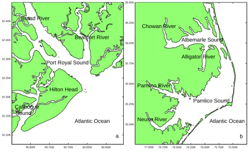
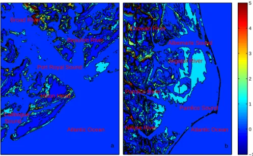
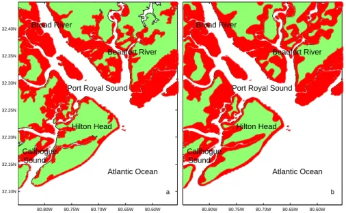
Figure

+2

Documents relatifs
A simple kinetic model of the solar corona has been developed at BISA (Pier- rard & Lamy 2003) in order to study the temperatures of the solar ions in coronal regions
liberation of al-Bu Kamal from ISIS in early November 2017, thanks to the Syrian Army and Hezbollah coming from the west and Iraqian Shiite militias coming from the east, has
Seven main land use/cover classes have been find namely agriculture, barren land, forest, settlements, scrubland, water body and wetland in the study area
- Regardless of the agricultural method, in equilibrium, an increase in the size of markets (increase in c leading to a parallel outward shift in demand) increases price,
– Entail a transfer of rights to use, control or ownership of land through sale, lease or concession.. – Have been initiated
Based on the history of research in the Mauguio area, and no doubt influenced by the general habits of researchers who work on Mediterranean landscapes, the
Ce reportage est consacré au May the Fourth Be With You Festival qui se déroule sur plusieurs jours dans le Kerry et à Malin Head 1 dans le comté du Donegal, où des scènes des
- In-vivo: Students enrolled in a course use the software tutor in the class room, typically under tightly controlled conditions and under the supervision of the
