Estimating nutrient concentrations from catchment characteristics across the UK
10
0
0
Texte intégral
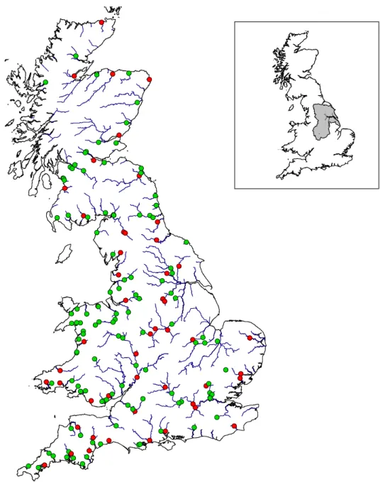
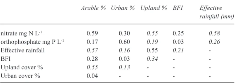
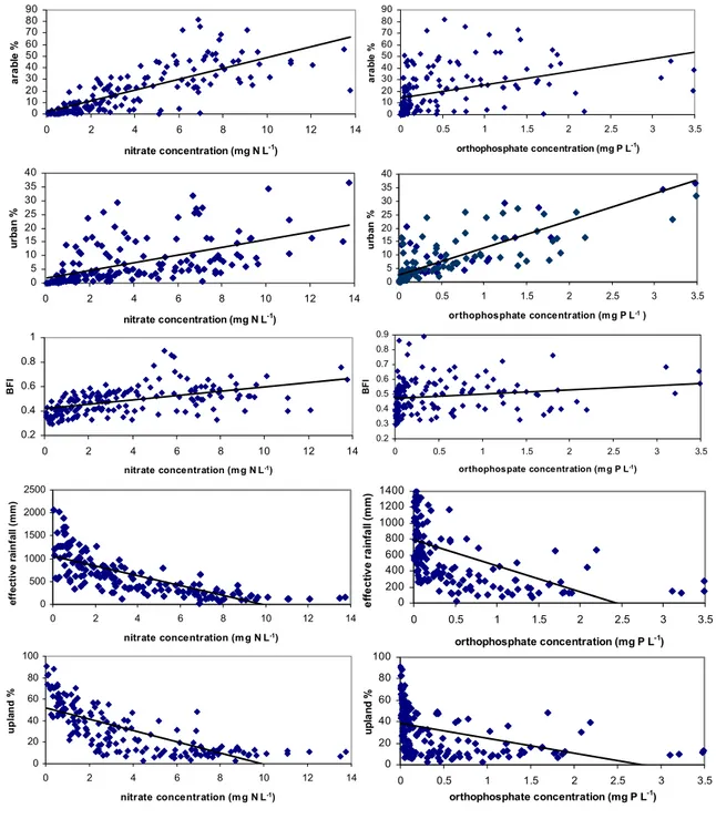
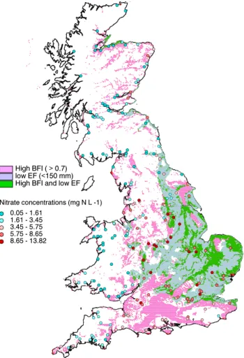
Figure

+2
Documents relatifs