A database of worldwide glacier thickness observations
15
0
0
Texte intégral
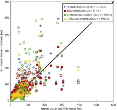
Figure

Documents relatifs
