THZ CUMRLAND BASIN 0 DIPOSITION
by
WIUIAM SIMON SRAW
3.o., St. Franeis Zavier University (1945)
SUOMITTID IN PARTAL IULZ1LMillT O? Tu 3340%IBGWIS FOR TIM DJGEM Or
D00TOR OP PHILOSOPHT
at
the
MASSACESITTS INSTITUTS OP TERHOLOTf (1951)
Signature of Author . . ....
tment of eology, May 13, 1951. Certified by ... .".-.'..rtv. . ...
thesis Supervisor
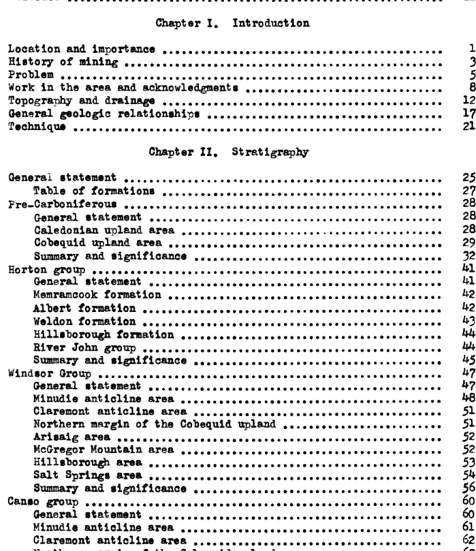
P4norale View of the Joggins 8ootica
(frM Coal MI PoInt looking norlhumrd)
Biographical Note
William Simon Shaw, son of the late Simon Shaw and Johanna Shaw, nee Morrison, was born at Glace Bay, N.S., Canada, Oct. 20th, 1924. He graduated from St. Anne's High School in 1941 and in the same year entered St. Francis Xavier University at Antigonish, N.S. He was graduated from St. Francis Xavier in 1945 with the degree of B.Sc. (Physics major) and joined the Canadian army immediately afterward. In 1946 he was retired from the army with the rank of lieutenant and
returned to St. Francis Xavier to teach courses in mathematics and physics.
He entered the Graduate School of the Massachusetts Institute of Technology in 1947 and spent the following two years there pursuing graduate studies in geology. During the summer seasons he was employed with the Geological Survey of Canada in geological work in the Yukon and in Nova Scotia. In 1949 he joined the staff of the Geological Survey and spent the following two years in a detailed investigation of the Cumberland coalfield in N.S. On April 22nd, 1950 he was married to Mary Barbara Palmer of Monoton, N.B.
Abstract
The chief problems posed by the Cumberland Basin of deposition weres (1) the sedimentary and structural development of the basin and
(2) the nature of the controls exerted on the deposition of coal and oil. Coal is being mined on a large scale while the existence of large oil reserves is still hypothetical.
The Cumberland Basin of deposition is an intermontane basin which originated at some time between the Lower Devonian and Mississippian
periods. The outlines of the basin probably were determined by the Acadian orogeny which seems to have reached its peak in the Maritime
region in late Lower Devonian time.
The axis of the subsiding basin extends from the mouth of Chignecto Bay northeasterly across Prince Edward Island. The total thickness of Carboniferous strata near Joggins, in the axial region of the basin, is believed to have exceeded 30,000 feet. The upper two-thirds of this total is subject to accurate measurement and approximately 15,000 feet is exposed on the Joggins shore in one continuous, uniforaly dipping section. Northeasterly the thickness probably increases. At Prince Edward Island and beyond the configuration of the basin becomes obscured and the relationship of the Cumberland Basin to the smaller basins of western Cape Breton is vague. The distribution and forms of the
Carboniferous basins and uplands of the 1
aritime Provinces suggest a shear pattern. A theory of origin is presented and within it the role of the Cumberland basin is indicated.
iii
The remnants of the uplands which bordered the Cumberland Basin
of deposition are represented today by the Cobequid and Caledonian Uplands. Although their relative positions have been altered somewhat from the
positions of the original uplands that controlled deposition during the Carboniferous period, they serve to indicate the approximate dimensions
and form of the basin.
The greater part of this immense thickness of strata thins and
feathers out on the flanks of these bordering uplands and within most
time units a distinct lateral coarsening toward the upland borders can be observed. Sedimentation continued in the axial region throughout the
Mississippian period and into late Pennsylvanian time without an observable break but, along the margins of the basin, unconformity is much in
evidence.
The basin experienced two marine transgressions which attained
their farthest extensions in mid-Horton and in mid-Windsor times: Marine strata represent only a small percentage of the total strata in the apical region of the basin but it is believed that, northeast of the Joggins area, a much larger proportion of marine strata cooupy the axial region of the basin.
The best developed sedimentary unit of continental origin is the Cumberland group of mid-Pennsylvanian age. The latter has been
subdivided, on the basis of distinctive lithologio characteristics, into five principal facies, described briefly, in order of decreasing age, as
iv
(1) a lower, coarse, dominantly conglomerate, facies that
marks the base of the Cumberland group over a large area.
(2) a fine facies, dominantly sandstone and shale, enclosing
a sone of ooal seams of workable thiokness and quality.
This zone is contemporaneous with the upper part of (1). (3) a fine non-ooal-bearing facies, dominantly sandstone with
minor conglomerate, that is contemporaneous with the lower part of (4).
(4) an upper, coarse, dominantly conglomerate and sandstone,
facies.
(5) a fine facies, dominantly rei sandstone and shale that is, in part, contemporaneous with the upper part of (4). Ideally, these five facies may be envisaged as a series of interlocking
wedges with the thin edge of each of the fine facies lying along the margins of the bordering uplands.
Large scale and local structural control on deposition is
particularly well demonstrated in the Cumberland group. The tectonically
positive uplands, that bordered the basin, controlled the major features
of deposition. In the Springhill district local control was exerted by a series of southeasterly trending folds that were recurrent during
deposition. These folds were particularly effective in delimiting the areas of deposition of ooal-forming peat and thus the coal reserves of
these folds which have up to now limited the area of high quality coal in each seem to a narrow belt not exceeding 6,000 feet in width. Workable
coal seems are confined exclusive to the coal-bearing facies of the
Cumberland group. The latter is widely distributed over the basin area and offers strong possibilities for the existence of workable coal seams other than those being exploited at present.
The Cumberland Basin possesses in abundance most of the
sedimentary and structural features which are considered to be particularly
favourable for the existence of oil. A great volume of sediments; evidence of two marine transgressionsi unoonformitiesi a teotonically active basin and similarly active bordering platforms or ridgesi and the probable
existence of belts of porosity in the form of sand wedges or organio reefs all favour the formation and accumulation of oil. Probably the only
unfavourable factor related to the possible existence of oil is the lack of evidences of oil or gas associated with the exposed marine strata. The most favourable area for future exploration has been deduced from a
CONT1!NTS
Page
Biographical Note ...
Abstract ...
Chapter 1. Introduction
Location and importance ... ... ...
History of mining
Problem ...
Work in the area and acknowledgments ...
Topography and drainage.
General geologic relationships ...
Technique...
Chapter II. Stratigraphy
General statement
Table of formations . . .
Pre-Carboniferous ...
General statement
Caledonian upland area
Cobequid upland area ... Summary and significance ...
Horton group ... c.e.o be... c.e.o bce.. e.e.c e* cee e oceece ccc... beebe. ccecCo ceeeee ceccec .. ... C . ... ... ... ... ... General statement ... Memramcook formation Albert formation ... Weldon formation Hillsborough formation ...
River John group
Summary and significance
Windsor Group ...
General statement ...
Minudie antiline area ...
Claremont anticline area ... Northern margin of the Cobequid upland Arisaig area ... ... ee. McGregor Mountain area
Hillsborough area...
Salt Springs area....e...
Summary and significance ... Canso group
General statement
Minudie anticline area ...
Claremont anticline area
Northern margin of the Cobequid upland
ceecCe ecceoc oceoce ce eec. ececo. ececee cOCcO. cecoce COCOeC ceece, coCoce ccc... .0.0cc eceOco ececee .0.~cc occe.. cc. cc. c0e ccc ceccee ecceec ... ... ... ... ... ... ... ... ... ... ... ... .e.... ... ... ... e ... ... ... .... e... .. e... ... ... ... c e... ... o ... C... ... ... ... ... e ... ... e ... e 1
3
5 8 12 17 ... 25 27 28 28 28 29 32 41 41 42 42 43 44 44 45 47 47 48 51 51 52 52 53 54 5660
60
6162
63Arisaig area ... ... . .
Hillsborough area ,...,.0..0 . ... .... * . ... ...
Summary and significance ... ... . ...
Riversdale group ...
General statement .
Minudie anticline area ... ...
Salt Springs area o.... ... ...
Northern margin of the Cobequid upland ...
Southern margin of the Caledonian upland .
Summary and significance ...
Cumberland group ... ... ,..,
General statement ...
Lower coarse facies ...
Coal-bearing facies ...
Fine, non..coal-bearing facies Upper coarse facies ...
Fine, dominantly red facies
... 0 ... ... ... ... 0... .g... ... ... ,.. ... ...
Summary and significance ...
Pictou group...
General statement ... ,...
Summary and significance ... ,...
Page
63
6364
65
65
66 69 7375
77
79
79
83 9097
98 100 101 103 103 106Chapter III. Structure
General statement ...
Structure of the Cumberland basin of deposition
The Athol synclinal area...
Springhill-Salt Springs area...0
Albert County area .. ,...
Mechanics of structural development ...
Tectonic framework of Carboniferous deposition .
108 109 112 113 116 118 1119
Chapter IV. loonomic Geology
General statement 0.000....000.0.0...0.0...0...
Possible future coal reserves ...
Summary of coal reserves
Recommendation for exploration... ...
Possible future oil reserves ...
Summary of oil reserves
Recommendations for exploration .,,...
125 125 134 134 135 146 147 Chapter V. Bibliography References ... 148
Page
Illustrations
Map 1. Maritime Provinces; G.S.C. Map 910A.
2. Cumberland basin of deposition with
structure-sections , ...
3. Springhill sheet; G.S.C. Map 51.11 with
structure-sections ...
4. Springhill coal area with structure-sections ...
Plate 1. Panoramic view of the Joggins section looking northward from Coal Mine Point ... 2. Contact at Spicer Cove.
3. A. Massive sandstone lens splitting into several
thin sandstone beds; in the Joggins section, about 1,000 feet south of McCarren's River
bridge ...
B. Closeup at one end of the sandstone lens in A. ...
C. Outcrop of resistant bituminous shale bearing
shell and fish remains; in the Joggins section at oal Mine Point ... ... D. Thin coal seams eneloqed in a tyrical sequence
of grey shales, underolays, sandstones, etc.;
in the Joggins section at Coal Mine Point 4. A. Upier coarse facies near New Salem ...
3. Upper coarse facies; South Branch Apple River
5.
Large tree trwnk enclosed in sandstone; Jogginssection
6. Photomiarograph of the matrix of the lower coarse
facies (Cumberland group) at Leamington Brook 7. Photomicrograph of the matrix of the lover coarse
facies (Cumberland group) at Leamington Brook 8. Photomicrograph of the matrix of the lower coarse
facies (Cumberland group) at Henry Brook
9. Photomicro raph of the matrix of the lower coarse
facies (Cumberland group) at Reid Brook
10. Photomicrograph of the matrix of the lower *oarse facies (Cumberland group) at South Brook .
11. Photomicro raph of the matrix of the lower coarse
facies Cumberland group) at South Brook ...
12. Photomicrograph of the matrix of the lower coarse facies (Cumberland group) at Lawrence Brook
13. Photomicrograph of a fine.grained lens within the lower coarse facies (Cumberland grou) at
Lawrence Brook ...
14. Photomicrograph of sandstone in upper part of the lower coarse facies (CNberland group) near the mouth of Reid Brook ...
In pocket In pocket In pocket In pocket Frontispiece 84 93 93 93 93 99 99 127 161 162 163 164 165 166 167 168 169
Page
Plate 15. Vertical aerial photograph showing well marked strike..ridges torn by massive grey sandstone beds in the fine non..coal-bearing facies
of the Cumberland group; one mile west of the mouth of Kelly River ...
Figure 1. Generalized stratigraphic column for the Cumberland
basin ...
2. Gross relationships of coal to the elastic sediments ...
3, Cumberland basin, illustrating the tectonic control
on coal deposition ...
4. Maritime Provinces, showing the tectonic framework
of Carboniferons deposition
5.
Gravity contours over the Cumberland basin ofdeposition ... .
6. Correlation chart of coal seams; Joggins.-Chignecto. North Springhill in the C0uberlanI coal basin ...
170 In pocket In pocket In pocket In pocket In pocket In pocket
CHAPTER I
INTRODUCTION
Locat ion and Importance
The Cumberland Basin of deposition oooupies the major portion of Cumberland County in northern Nova Scotia. It extends easterly into Colohester County, and westwardly to occupy a narrow strip of land on the
New Brunswick side of Chignecto Bay. The economic importance of this basin is attributed chiefly to its coal deposits, mined at Springhill and along a twenty-five mile belt extending from Joggins on Chignecto
Bay eastward to North Springhill. The only other mineral found in mineable quantities is salt, which is presently mined at Nappan and Malagash.
During the past twenty-five years interest in the oil and gas possibilities of the basin has ebbed and flowed. The greatest activity in oil prospect ing was expe rienced during the period 1944 to 1947 when two deep holes were drilled without success. The first, drilled in
Hillsborough Bay just off the mouth of Charlottetown harbour, Prince Edward Island, bottomed, at 14,696 feet, in a sequence of flat-lying gypsum,
salt, and red beds. In the upper part of the hole, the drill out a monotonous series of red to chocolate shale, siltstone, and sandstone with minor grey coloured zones that included thin coal seams. The entire sequence was apparently without sharp breaks of any kind and lack of fossils left the
correlation in doubt. It is generally assumed that the evaporites represent deposition in Windsor time and this on the assumption that there was no post-Windsor marine deposition in that area.
Nappan on the crest of the Minudie Antioline. It passed through more than 6,000 feet of contorted beds of salt, gypsum, anhydrite and red shale into an entirely continental facles made up dominantly of red to brown shale and sandstone and light grey sandstone. The change was apparently transitional. At 10,000 feet the drill penetrated a 12 foot bed of conglomerate consisting domintly of pebbles of quarts and chart and at 10,221 feet it passed through a bed of volcanio ash. Although the evidence is no$ conclusive, these lower continental strata may
represent the phas of deposition of coarser sediments that constitutes the Hillsborough and Weldon formations of Upper Horton age in New Brunswick. The volcanic ash also suggests this correlat ion, a inoe similar depos its
are unknown in this basin in sediments younger than Upper Horton. It is thought that this section also correlates with part of the River John
group, exposed in Piotou and Colohester counties. The great thicknesses of salt encountered in this latter borehole led to the establishment of a modern plant for its extraction.
Of the two major ooal mining districts In the Cumberland area, Springhill is the larger and more consistent producer. The present area of operations constitutes a rough square of approximately four square miles. Its eastern margin lies on the outskirts of Springhill.
The Springhill district is entirely controlled and operated by the Cumberland Steel and Coal Company, a subsidiary of the Dominion Steel and Coal Company. At the present time, four seams are being worked from two main slope entrances and the whole operation maintains a produo-tion ranging from 2,000 to 2,500 tons daily, barring serious disruptions
- 3
-although not now being mined, is slated for exploitation in the near future. The Joggins-Chignecto-North Springhill district supports a
number of smaller, independent operations with the major portion of the mining presently concentrated in Joggins and River Habert at the western extremity of the distriot. The present combined operations are capable
of producing about eight hundred tons per day. Two new operations are undergoing development and are expected to increase this figure to about
sixteen hundred tons per day.
fistory of Minins
An old map of the Joggins Minos area indicates the oldest
workings in the Cumberland Coal Basin by the notation "old French workings". Presumably this was the work of the French settlers of Fort Beausejour and Annapolis during the early part of the 18th century. These people
could hardly have failed to note the coal seams outcropping in the
prominent cliffs at Joggins. The first written account of mining in the area, known to the author, is that by Jackson and Alger (1828), who mention
the mining of coal and quarrying of grindstone at Joggins.
The British government, in 1825, magnanimously granted to the Duke of York all the mineral rights in Nova Scotia that were not already
reserved. The Duke exchanged the grant with his creditors in return for cancellation of large debts. These creditors formed the General Mining Association for the purpose of prospecting and exploiting their newly acquired wealth, but the Cumberland area was ignored for some years, and mining activity was restrioted to 'bootlegging' on a small scale in the
4
-Meanwhile, the eoal seams in the Springhill district went unknown until about 1836, when, as related by Gesner, a seam about ten feet thiok outcropping in a small brook and dipping northward, was being worked by a poor farmer (Gesner 1836). The direction of dip and the
thiokness seems to indicate that the seam referred to was the No. 2 seam where it outcrops on Mill Brook. However little interest was shown by the G.M.A. and nothing was done toward exploiting the deposit at this time.
By 1840, with population stead ily increas ing in northwestern Nova Scotia, the need for coal beeame aeute and strong representations were made to the government of Nova Sootia that the G..A. produoe'eoal or relinquish at least a portion of the area. The result was that in
1847 they did open the "Joggins ines" but production was small and inadequat4 The turning point in the mining development of the region came
in 1858, when, by mutual agreement with the Nova Scotia Government, the G.M.A. relinquished its rights to the coal areas of Cumberland County with the exception of four square miles in the Springhill district and a similar
area in the Joggins district. Whether by chance or design, the Springhill
area that they retained proved to be, by fir, the most valuable piece of ground yet found in the entire area.
Wth large areas now open, a number of companies undertook operations and by 1865, the average annual production of the 'fifties' had been trebled in the Joggins-Chigneato-North Springhill distriete In the Springhill district development was retarded even yet, principally because of the distanee to navigable waters. However, the sommeneement
- 5
-of the coal reserves since at once it provided a market and means of transportation to outlying areas. In 1872 the Springhill and Parraboro Railway Company was incorporated and started development in two major slopes. By 1879 the G.M.A. relinquished all its rights in the Springhill district to the Springhill add Parrsboro Railway Company. A new slope was opened in 1882 and from that date progress was much in evidence. In
1884 the Springhill and Parraboro Railway Company sold out to the Cumberland Railway and Coal Company, which progressed steadily. In
1911 the Dominion Coal Company took over the Cumberland Railway and Coal
Company and have operated the mines up to the present.
In the Joggins district, after 1858, the greatest single impetus given to production was the construction of the Joggins-Macoan railway connection which led to the re-opening of many small collieries and
enabled the mines to work through the winter. The effect was to increase production by twice or more, and later years saw production steadily
increase. The most consistent and largest producers have been the opera-tions owned by the Joggins Coal Mining Association and its successors
(at present the Maritime Coal, Railway and Power Company).
Problem
Mineral development in northern Nova Scotia and southern New Brunswick has centred about three products of sedimentary deposition, namely, coal, oil, and salt. These products have been found in sediments that are widely separated in the stratigraphic section but are all con-tained within the Carboniferous period, and their deposition has been eacntrolled by the Carboniferous subsiding basin of deposition that is designated as the Cumberland Basin of Deposition.
6
-The coal deposits have been, to date, the most important from an economic standpoint. In the Springhill district each seem is oharacterized by a restricted band of high quality coal which extends, from the outcrop in each case, along a centreline that runs approximately southwesterly from Springhill. Underground workings have been limited on the north and on the south by rapidly deteriorating coal. In No. 2 seam, in which the workings have progressed over two miles along the dip of the seam, the high quality coal is apparently in danger of wedging out entirely, as serious deterioration has already limited development along a line that is drawing close to the south side of the auxiliary slope, while deterioration on the north side maintains its normal course that was well established in the older abandoned workings. In order to provide some guidance for the future development of these seams it was necessary to establish the significant trends in the coal seams. This necessitated an understanding of the physiographio and other environmental conditions which controlled the acoumulation of the vegetable material which was the source of the coal.
The group of coal seams, which extends from Joggins to North Springhill, dips in a southerly direction toward the axis of a broad
syncline. The seamr are generally thin but, in one or two areas, the seams thicken usually as a result of the joining of two or more smaller seams. Deterioration In all seems is apparently erratic and can only be predicted
over short distances. It is significant that some of these seams persist for long distances along their outcrops while operators are, in general, pessimistic about their continuance at depth. A great multitude of small
mines have robbed a narrow band parallel to the outcrop of each work-able seam and rarely, if ever, has anyone developed more than 4,000 feet along the dip. A close examination does not reveal any significant
change in the nature of the coal at depth, and stoppage of most operations can be ascribed, mainly, to increasing costs of power required for haulage and pumping as depth of mining increases.
The seams of the Springhill district dip northward toward the
axis of the synoline that intervenes between it a d the Joggins-North
Springhill district, but along the outcrops of both groups of seams the coal grades laterally into barren rook in the northeast oorner of the map-area (Map 3) and the relationship between the two coal groups is not
readily apparent. Great speoulation has arisen concerning the extension of these coal seams and their possible relationship across the inter. vening synoline.
At a point near Newille Lake, which lies about sixteen miles southwest of Springhill, a deep borehole out a section of coal-bearing rooks which includes, reportedly, a seam of considerable thickness. Its possible relationship to the Springhill district is of great interest in so far as it may represent an extension of the coal-bearing sediments that outcrop there.
These problems, briefly outlined above, indicate that the distribution of coal deposits has not been olarified and past mining development possibly has nibbled only at the exposed parts of a much
larger area. An understanding of the controls exerted on peat deposition in the basin is necessary to indicate the possible future areas for
- 8
-Next to coal in their possibilities for future development, stand oil and natural gas. In a basin of sedimentary deposition which
has experienced at least two invasions of marine waters, the probabilities of finding these valuable materials should be strong. The two major
drilling operations, mentioned in an earlier section of this report, rendered valuable structural and stratigraphio information which should serve as a guide to future attempts.
The problem of locat ing oil reservoirs in this baein w1l1 b.w one of outlining the shape and extent of the basin, particularly during the period which saw the transgression and regression of the marine waters. In an area such as this, where a high degree of teotonio control on the sedimentation is in evidence, a thorough understanding of its structural make-up is essential. In recent years a considerable amount of gravity data has accumulated and, as will be shown, the evidence has an important bearing on the problem.
Salt has been found in large quantities in the Cumberland Basin of deposition. The probable nature of its acoumulation has already been discussed by Dr. W. A. Bell (Bell, 1924 and 1944) and little can be added except in so far as the broad control of sedimentation may indicate the
limits of deposition.
Work in the area and aaknowledgmnts
The Cumberland Basin of deposition provides one of the show-pieces of North American geology in its well-known Joggins Section that, for over a hundred years, has elicited the attention and admiration of
- 9
-The first record of geological investigation seems to have
been that of Jackson and Alger In the year 1828 (Jackson and Alger 1828).
About the same time two engineers, Brown and Smith, in the employ of
the G.M.A., described the section along the shore (Brown and Smith, 1829)
and they were the first to point out its similarity to the Carboniferous
sequence in England. They correlated the limestones at the base of the section with the Lower Carboniferous of their native England; and the succeeding sandstones and coal-bearing zones with the English Millstone Grit and Coal Measures respectively.
Shortly afterward Gesner (1856) carried out geological explora-tions in an area which included the Spiinghill distriot, He was the first
to record the occurrence of coal there.
Charles Lyell, in 1842, examined the section from Minudie to
Joggins, described the fossil trees, and collected and named various
fauna and flora. These observations were recorded in his book on his
travels in North America (Lyell, 1845).
Sir William Logan, in 1843 his first year as director and only
geologist of the newly formed Geological Survey of Canada, undertook to
measure, bed by bed, the entire section (Logan 1843). Because of vigorous
wave cutting activity upon the Joggins cliffs and great local variation
of the strata, the section cannot now be exactly duplicated but his measure-ments are entirely representative of the section as it stands today. He
divided the continuous section arbitrarily into eight divisions, basing the division on predominance of one or another features such as colour, presence of coal seams, relative coarseness, etc.
- 10
-Sir William Dawson, after an initial visit to the Joggins
section with Lyell, returned many times to enlarge on his collections of the fauna and flora. He has incorporated their descriptions in his
excellent accounts of the general geology of the region (Dawson, 1855,
1894, etc.).
Scott Barlow (1873-741 1875-76) made the first attempt at a detailed study of the area. In 1871 he began tracing the coal seams of
the Springhill district and spent the greater part of the following six years in a study of the rooks of that district.
Walter McQuat began, in 1873, a study of the northern portion of the area which he continued till his death two years later.
R. W. Ells studied the regional geology of northern Nova Scotia
and southern New Brunswick and published a report with a geological map
which covers the area under discussion (Ella, 1885).
Of the many workers who have studied the rooks of this region,
probably none exceeded in seal, in perseverance, and in volume of data,
the work of Hugh Fletcher. In 1892 he began a study of the Cumberland
Coal Basin and muoh of the following sixteen years was spent in this area until his work was terminated by his death at Lower Cove in 1908. In the Springhill distriot he contributed greatly to knowledge of the rook
structure by painfully tracing small seams outward from the worked areas
and around the nose of the Claremont Antialine. He also published maps
of areas lying along the southern margin of the Cumberland Basin (Fletcher, 1892-1909).
- 11
-W. A. Bell made a detailed study of the Joggins section in
1911 and 1912. This work, together with later studies of the
Carboni-ferous stratigraphy of the Maritime Provinces, culminated in a division of the Carboniferous stratigraphy in that region (Bell, 1911, 1912, 1913,
1924, 1927, 1944, etc.).
The most recent systematic mapping in the area, prior to the present investigation, was carried out by F.A. Kerr, in 1924, and
I. W. Jones, in 1928. The former mapped and reported on the eastern
half of the Springhill sheet and the latter on the western half. Their work was incorporated in one map-sheet which, after some revision by Bell, was published in 1935, (Bell, Jones, and Kerr, 1935).
The study of the Cumberland Basin of deposition was begun by
the author in the spring of 1949 and has occupied his attention con-tinuously since that time. Systematic detail mapping was restricted to
the rooks underlying the Cumberland Coal Field which is bounded roughly as follows: on the north by latitude 450 45' on the south by the
Cobequid Uplandl on the east by longitude 640 00'; and on the west by
Chigneoto Bay. A map covering this area, on a scale of 2 miles equals
one inch, is presented with this report.
Numerous key sections and localities outside this map-area
were visited, which includes the northward extension of the Joggins section; the shore of Maringouin Peninsula and of Albert County in New Brunswick;
various brook sections along the northern margin of the Cumberland Uplands; the shore of Minas Basin particularly in the vicinity of Parreboro and west-ward. Available to the author were various Geological Survey maps of the
- 12
-sheets of New Brunswick and the Shinimeoas, Oxford, Bass River, and Londonderry sheets in northern Nova Sootiag also were the many map-sheets published by Hugh Fletcher between 1890 and 1909. The-e, to-gether with the unpublished reports of I.W. Jones and F.A. Kerr on the Springhill map-area, were very helpful in furthering the author's study. The are* studied by the author in the field does not encompass the entire area occupied by the Cumberland Basin of deposition but, as will be more evident later, the area under detail discussion holds the key to the development of the bas in. The a ignificance of the features observed here can be extended to the entire basin of deposition. Complications that develop in its eastern extremity will be discussed only briefly, the area being too far out of the range of the author's work and having already been described in detail by Bell (1940).
The author gratefully acknowledges the encouragement and advice of Dr. W. A. Bell, Director of the Geological Survey of Canada, &nd
Dr. W. L. Whitehead, professor of geology at the Massachusetts Institute of Technology. The author is also greatly indebted to all the workers who have contributed to the geological knowledge of the area in the past and he wishes to acknowledge his dependence on their great volume of infor-mation and ideas in forming his conception of the geology of the area.
Topography and Drainage
Three major physiographic elements are immediately obvious to one entering the area. They are commonly termed the Cobequid Upland, the Cumberland Lowland, and the Caledonian Upland. The two upland areas
- 13
-enolose the Cumberland Lowland and, in plan view, present a decidedly angular aspect. The Caledonian Upland of Southern New Brunswick trends
a few degrees north of east, in northwestern Nova Scotia. Chignecto Bay,
an arm of the Bay of Fundy outs through the apical sone and strethes northeastward almost thirty miles before it is split, by Maringouin
Peninsula, into two arms known as Shepody Bay and Cumberland Bas in, on the west and east respectively.
The Cohequid Upland is a long, narrow, flat-topped highland
that extends from Cape Chigneoto about 100 miles in a direction about X. 85 1. into Piotou County. Over its length it ranges in height from
800' to 1,000' and rarely exceeds 12 miles in width. Its steep flanks
are deeply incised by rapid flowing streams that tumble over a multitude
of falls till they reach the lowland where they merge to form gently flowing rivers.
The Caledonian Upland rises from the shores of Chignecto Bay at a point opposite Cape Chignecto and extends, with an average width of 15 miles, northeastward about forty-five miles and ends abruptly a few miles west of the Petitoodiac River. Although rising to a slightly higher elevations the upland is similar to the Covequid Upland in its
even skyline, its flat top, and steep slopes.
These major upland areas are oo-extensive with areas of pre-Carboniferous rocks that consist of intrusive rocks and metamorphosed sediments and volcanics. These rocks are hard and resistant in contrast with the softer Carboniferous rooks that floor the Cumberland Lowland. It is notable that, in the upland areas, the flat surface trunoates all
- 14
-expression of their differences in hardness. This feature has been noted by almost every worker in the general area and the surface of the uplands has been recognized as part of a regional peneplain which culminated in Cretaceous times (Goldthait, 1924). The present relief is attributed to Tertiary uplift with subsequent deeper erosion of the softer raoks that occupy the lowland areas.
The Cumberland Lowland extends from the base of the uplands northeastward to the shores of Northumberland Strait. Its gentle,
rolling surface of mature relief rises to elevations averaging little over 200 feet with few interruptions. The hill occupied by the town of Springhill, Claremont Hill and the Salem Hills from the important eminences which breach the general level.
Springhill, rising to 610 fest, is situated on the southwesterly plunging nose of the Claremont Antioline where the tough grey sandstones and shales at the base of the coal-bearing zone are brought to the surface. The dominantly red, loosely cemented conglomerates, sandstones and shales that flank the structure have been easily eroded to the level of similar rooks that spread out to the west from Springhill.
Claremont Hill is a long narrow ridge that extends for about three miles along the outcrop of vertically dipping beds of the Claremont conglomerate. It rises about two miles northeast of Springhill and main-tains an elevation of about 500 feet for a large part of its length. The hill is flanked on the north by the soft red shales, gypsum, and salt beds of the Windsor group and on the south by the southward dipping beds of the Boss Pt. formation.
- 15
-The Salem Hills lie just north of the northern margin of the map-area and their trend approximately parallels the margin. They
consist of four summits that rise to elevations exceeding 500 feet and are separated by gently sloped saddles. They are genetically related to the low rounded ridge that extends eastward from Boss Pt. on Chigneoto Bay to the village of Chignecto where the ridge rises to higher elevations to form the Salem Hills that extend as far as Little River, a few miles northwest of the town of Oxfurd. Exoept at the points wher the Maocan River and River Hebert out through, the ridge forms the drainage divide over its length.
The tough, resistant, rooks of the Boss Pt. formation underlie the ridge. They lie with medium dips in the south flank of the Iinudie Anticlins. Their superior resistance to erosion is well illustrated in the shore seotion where it protrudes in great reefs to form the jaVged
promontory of Boss Pt. The soft red shales and red sandstones of the Maringouin and Windsor formations on the north and the equally soft red sandstones and shales of the lower part of the Joggins format ions were no match for the tough Boss Pt. rooks when subjected to the vigorous action of the waves.
Throughout the lowland area and particularly in the vicinity of Chignecto Bay numerous low parallel ridges mark the outcrop of bafids
of massive grey sandstones, These show up well in aerial photographs
which were used to great advantage by the author in traoing the rook
structure in that area. Eastward from Chignecto Bay they become fewer and less pronounced, their relief being clamped out by sheets of glacial drift
- 16
-which cover the inland areas. It may be noted also that the zone in whioh the ridges are most pronounced was the seene to one of the most devastating forest fires in this part of the country. Consequent rapid
erosion of the unprotected soil left bare rocky ridges that show remarkably clear on the photographs.
Occupying the greater part of the central area, between the Boss Pt. Ridge and the Cobequid Upland, are the relatively soft ronks of the Shulio formation which were preserved from deeper erosion by the
broad open synclinal fold that has been named the Athol Syncline by Fletoher. These rooks have been worn down to form a broad valley which is roughly
coincident with the synelinal axis. In Pleistocene tiw the entire area was covered by a mantle of glacial drift, thickest in the region between the Maooan River and River Rebert where morainal deposits are everywhere in evidence.
The drainage of the map-area (Map 2) does not fall into a well-defined pattern. Over the greater part it presents a dendritic aspect. In the eastern part of the area the Maccan River is the major channel. Flowing westward along the base of the Cobequid Upland it collects the waters of a multitude of sub-parallel streams that flow rapidly from the steep slope. At Southampton the river turns abruptly and flows northward
across the general strike of the rooks, collecting on its way the waters of its two major tributaries East Brook and Little Forks River, and empties into Cumberland Basin a short distance north of the northern margin of the map-area. A small area bordering the eastern margin of the map-area is drained by Black River sa d Polly Brook which flow eastward to join River
- 17
-The central area is drained by the northward flowing River Hebert. It is fed by the waters of three principal tributaries, namely,
Halfway River, Kelly River, and Atkinson Brook. Halfway River, flowing easterly along the base of the Cobequid Upland, collects the waters
draining from the slopes of the upland and empties into Newville Lake
which forms the head of River Hebert. Kelly River and Atkinson Brook, both flowing northeasterly, join River Hebert at points lying about 3.2
and 4.4 miles, respectively, upstream from the village of River Hebert.
The western portion of the map-area lying east of Chignecto Bay is drained mainly by the Apple River, Sand River, and Shulie River, all of which empty into Chigneoto Bay. At the shore the mouths of these
rivers are separated by intervals of about six miles, while inland they
converge till their upper reaches are practically fused.
One broad generalization may be made concerning the
relation-ship of drainage to geological structure and that concerns th e consistency with which the major channels maintain a direct ion normal to the general
strike of the rooks. The tributary streams parallel the strike in many instances but in general present an irregular, dendritio configuration.
General Geologic 9elationships:
The Cumberland Basin of deposition is an intermontane basin
which originated at some tim between the Lower Devonian mid early Carboniferous periods. The outlines of the basin were most probably determined by the Acadian orogeny which, in the Maritime district, seems to have reached its peak in late Lower Devonian time. The remnants of the bordering uplands are represented today by the Cobequid and Caledonian
- 18
-Uplands and, while their relative positions have been somwwfhty-u.twrrd-from the positions of the original uplands that controlled Carboniferous deposition, they serve to indicate the approximate dimensions and shape of the basin.
The generalized stratigraphio column (Fig. 1) indicates the sequence, age, thickness and lithologio characteristics in the basin with a graphical representation of the facies relationships within given time units. The rooks of the upland areas have been ocombined into one group under the heading "pre-Carboniferous" mainly because it was not possible, in the time available, to study these rooks in detail.
It is quite possible that unmetamorphosed sedimentary rooks of Middle and Upper Devonian age lie buried in the axial region of the basin but the total lack of exposures of such rook anywhere in the basin render it safer to exclude it from the sections.
The itotal thickness of the Carboniferous rocks in the auial region of the basin at a point near Joggins is believed to have exoeeded 30,000 feet. The upper two-thirds of this thickness is subject to accurate measurement and, in fact, approximately 15,000 feet of strata may be
measured in one continuous section. In a northeasterly direction the axis probably continues to pitch deeper. At Prince Edward Island, and beyond, the configuration of the basement becomes less definite and the
relationship of the Cumberland Basin to the smaller basins of western Cape Breton is still vague.
By far the greater part of this immense thickness of strata thins and feathers out on the flanks of the bordering uplands and within
- 19
-most time units a distinct lateral coarsening toward the uplands can be detected. The periodic rejuvenation of uplift of the bordering masses and complementary subsidence of the basin area is clearly illus-trated in the generalized stratigraphic column (Fig. 1) by the periodic
influx of coarse sediments. During certain periods of regional subsidence and/or extreme aggradation of the bordering masses sediments were probably deposited over the crests of the uplands and the limits of the basin
probably were defined only by isolated islands along the general trend of the positive axes. This condition existed at least during the marine transgression of early Windsor time and possibly to a lesser extent for a part of the period during which the Albert formation was deposited. As noted in the Joggins section, the transition from marine to continental deposition was affected in late Windsor time. There and in the area enclosed by the bordering upland areas to the south and to the west no further evidence of marine transgression has been found in the later sediments. It is assumed that non-marine sedimentation kept pace with subsidence and maintained the Carboniferous seashore some distance north of the Joggins' locality, a distance which undoubtedly varied under the
control of intermittent movements of the crustal masses.
The large area to the north, presently inundated by the waters of the Gulf of St. Lawrence or covered by the wholly continental beds of the Pictou group, holds the secret of the post-Windsor history of the Carboniferous sea and it is not yet known with assurance whether it was maintained in a large embayment in that area or whether it was drained entirely during the renewal of uplift in the bordering uplaids. The final answer to this question bears strongly on the oil possibilities of the region.
- 20
-The only hint of a marine environment later than Windsor comes in the coal-bearing sequence of the Joggins area where black bituminous shale, bearing shells and fish remains, are found overlying many of the coal seems. The actual environment significance of the contained fossils is controversial but a brackish condition is probable and a good case may be made for a lagoonal environment during the deposition of this particular facies.
Little information is to be had concerning the igneous activity of the Carboniferous period in this area. In New Brunswick a volcanic
ash bed has been found in the Hillsborough formation of Upper Horton age.
Volcanic flows have been noted in the River John group, also of Upper Horton age, which is exposed on the northern margin of the Co'hequid
Upland near its eastern extremity. An ash bed was also out in the Nappan borehole, as was mentioned earlier in this report, and the strata
associated with it is considered to be of Upper Horton age. 'T.Y. Williams notes that in the Arisaig district diabase intrusives out the McAras
Brook formation of Lower Windsor age but not the overlying Ardness forma-tion that is also Windsor age (Williams, 1914). Further evidence of early Windsor igneous activity is noted by Bell on the Magdalen Isleads where he has described basic lavas and fragmental and tuffaceous volcanic
rocks interbedded with gypsum, limestone, caloareous shale, red and grey siltstone, and mudstone of lower Windsor age (Bell, 1949). No evidence of later ignnous otivity has, to date, been found in the sediments constituting the Curmberland Basin of Deposition. It must be mentioned however, that little detail work has been carried out in the complex
- 21
-that forms the bordering upland areas. In the Cobequid Upland
particularly, there is good reason to doubt that all of the
metamor-phosed sedimentary and volcanio rooks present are older than Carboniferous. Bell has found an argillite horizon bearing upper Windsor fauna in an
exposure on Harrington River, north of Five Islands. He also observed sheets of pink rhyolitic rock intruded into interbedded quartzites and argillites of similar lithology to that bearing the Windsor fossils (Bell, 1927). This indicates, quite definitely, igneous activity in Upper Windsor or in a later period. The possibility that it may be ascribed to the igneous activity of the Triassic period is suggested by the proximity of this locality to the scene of well developed Triassic extrusives a short distanne to the south. Because of this uncertainty the latter igneous activity cannot be definitely associated with the development of the Cumberland Basin of deposition.
Technique:
The study carried out in the Cumberland Basin may be divided, for the purpose of description, into two main phases: (1) a regional study of the sedimentary and structural features of the rooks
oon-stituting the Cumberland Basin in order that a more complete understand-irg of its origin Bad development might be had. (2) a detail study of the coal deposits in order that the significant trends in the quality of the coal together with the structural features may be defined and in particular to indicate how these features will affect the progress of extraction.
mapping on a base map on a scale of
$
mile equals 1 inch within the area outlined above. Rapid lateral variation of rook facies within given time units made precise location of formations impossible except when definite unconformities or fault traces were located. The coalseems of wide extent formed the only well defined "time lines" and while these seams are restricted to a comparitively short interval
in the stratigraphic section they were of great value in outlining the structural trends, as in the case of the Forty Brine - Chignecto
seam which provided a reference horizon for a distance of about twenty miles across the northern margin of the map area. Also of great value
in facilitating the establishment of structural trends were the long strike ridges formed by the massive sandstones. These were of particular importance in the area south of the village of Joggins where the long
ridges bend around a broad embayment in the north flank of the Athol synoline. Throughout the mapping program particular emphasis was placed
on the lithological characteristics such as colour, grain size roundness and constitution of the rock. In the Cumberlmnd group this attack proved particularly profitable in thpt it enabled the author to subdivide the group into its coarse and fine components. As will be seen later the transgressive and regressive characteristics so well outlined in the rock provide an illuminating picture of the tectonic history of the basin.
The second phase of the investigation, that of a detail study of the coal seans, was beg-un in both districts by a long period of com-pilation of all the avFilable data from bore hole recores, mine plans, mine offic.'als, etc., supplemented by actual measurement over all parts of the mine workings still accessible.
- 23
-In the Springhill district, where there was a great con-centration of data, the preliminary work was carried out on a scale of 400' : l". On this scale two types of maps were constructed for each mineable seem: (1) coal facies map on which representative sections of the seem were plotted. On the basis of these sections and a multitude of supplementary thickness measurements isopaohs were drawn using a thickness interval of 6 inches. (2) contour map with contours plotted for the pavement of the seam. These were carried beyond the worked area for long distances where dependable structure-soctions could be constructed. The contour interval was always 100'.
Facies maps werv also compiled for important sections of the strata, usually limited on top and bottom by readily recognized
coal seams.
(1) and (2) were reduced to a scale of 1,000' a 1" and the individual sheets were brought together on one map so that both structural contours and seam isopachs might be viewed together.
In the Joggins district a similar procedure was followed for the more important sections of the district, but in general the information was compiled on the 1,000' saale, the density of information not being sufficient to warrant use of the larger scale over the entire district.
In both districta surface "master plans" were constructed showing seam outcrops and mine openings together with the detail g;eology of the respective areas. These are accompanied by batteries of cross-sections constructed at regular intervals to demonstrate the sedimentary
- 24
-and structural relationships in the subsurface. The last mentioned nap and seotions have been included in this report sinoe they vividly demonstrate on a large scale the marginal phenomena associated with coal deposition and particularly coal deposition close in to the base of a rising upland.
- 25
-Chapter II Stratigph
General Statement:
The rocks involved in the development of the Cumberland Basin of deposition are readily divisible into major groups: (1) the crystalline rocks that constitute the bordering masses of the Cobequid and Caledonian Uplands and (2) the unmetamorphosed sedimentary rocks that occupy the intervening Cumberland Lowland. The distribution of these rocks outlines approximately the original positive and negative elements that controlled the formation of the thick wedge of sediments that constitutes the Cumberland Basin of Deposition.
For mapping purposes the rocks of the upland areas have been grouped under "pre-Carboniferous" since no attempt was made by the author to differ-entiate them. Portions of these areas have been mapped and descriptions may be found in the reports accompanying the maps (Kerr, 1924; Jones, 1928; Norman, 1941; Weeks, 1948). The rocks have been broadly differentiated in the Table of Formations, (p.11) and will be described briefly.
The Carboniferous rocks of the basin area have received the greatest
attention and will require detailed description. The continuous exposure in the Joggins section illustrates, in a general way, depositional conditions in the axial region, although it is certain that the axis of the subsiding trough shifted considerably during deposition. The rocks that may be intim-ately examined in this section range from Middle Windsor well into the upper part of the Cumberland group. Throughout this section there are no well
- 26
-formations is not possible and consequently the position of formational boundaries must be considered as arbitrary. Divisions are, however, essential to analysis and description.
From the axial region outwards toward the marginal areas of the basin rapid coarsening in grain size is evident, marked unconformities appear and thinning over the bordering land masses is well defined, particularly in the Cumberland Group. In the coarser sediments, where the constituents are readily recognizable, the various lithologic types can generally be associated with a parent rock in the source area. Close to the contact with the crystalline rocks the clastic Carboniferous sediments are composed almost exclusively of the rock immediately underlying it. In general the elastic material in contact with the basement is a strongly cemented breccia that
probably represents the product of "in situ" weathering before burial by the -overlapping fluvial deposits.
With increasing distance from the source area the sediments are characterized by a higher degree of rounding and greater heterogeneity that is consequent upon longer transport and fluxing of materials eroded from a large area exposing a variety of rock types.
The correlation of the formations is taken unchanged from the work of Bell who has presented the fossil evidence in detail form and need not be repeated here, (Bell, 1944).
The author's chief aim is to describe the development and the nature of the facies changes, changes which are intimately related to the structural evolution of the region.
-- 27
-TABLE OF FORMATIONS
ERA PERIOD GROUP FORMATION
CENOZOIC MESOZOIC PALAEOZOIC QUATERNARY TRIASSIC PENNSYLVAN IAN Unconformity Unconformity PICTOU Unconformity CUMBERLAND Disconformity - - and Unconformity RIVERSDALE Disconformity I and
(5)
(2) (2) (1) BOSS POINT CLAREMONT MISSISSIPPIAN Unconformity CANSO SHEP ? ODIWmINSO
Disconformity -- and PRE-CARBONIFEROUS (Mainly) Unconformity HORTON Unconformity COBIQUID COMPL HILLSBOROUGH WELDON ALBERT 4EMRAMCOOK INTRUSIVE ROCKS METAMORPHIC ROCKS PALAEOZOIC OR PRECAMBRIAN CALEDONIAN INTRUSIVE ROCKSPRECAMBRIAN CALEDON IAN
METAMORPHIC ROCKS !? ROUN ZONE C ZONE B ZONE A 11
- 28
-Pre-Carboniferous General Statement :
There are two major areas of pre-Carboniferous rocks which, as noted above, are co-extensive with the Cobequid and Caledonian Uplands. The long axis of these areas, if projected, would intersect in the Bay of Fundy near the mouth of Chignecto Bay. The nature of their joining is somewhat speculative because the larger part of the Caledonian Upland is composed of metamorphosed sedimentary and volcanic rocks that are much older than the metamorphic rocks of the Cobequid Upland. Also it is noted that, in the Cobequid Upland, intrusive rocks are exposed over a much
greater area, proportionately, than they are in the Caledonian Upland. In fact, the Caledonian intrusives are exposed only in relatively small linear areas scattered rather uniformly over the entire upland.
Determination of the relative age of the intrusive series becomes of great importance in deciphering the pre-Carboniferous history. Its significance will be considered after the general description of the rocks. Caledonian Upland Area:
1. Metamorphic rocks: Distributed rather uniformly over the upland is a series of bedded rocks, dominantly volcanics, with minor amounts of
interbedded non-fossiliferous sedimentary rocks. The volcanics rocks, consisting of flows, tuffs, and breccias, are for the most part highly schistose and much altered to chlorite, epidote, uralite and white mica.
- 29
-with some conglomerate. Obscured structural relationships have precluded estimates on the thickness of the series. The lithologic similarity of this group of rocks to the Coldbrook group that underlies the Lower Cambrian strata near St. John New Brunswick, at the southwestern extension of the upland, places the group in the Precambrian (Norman, 194).
2. Intrusive rocks: The metamorphic rocks are cut by intrusive rocks that are exposed in relatively small northeasterly trending linear areas that are well distributed over the surface of the upland. Mainly, they consist of quarts diorite and albite granite, the latter being the most prevalent. According to Norman (1941), the diorite grades into the
granite in places but in other localities granite dykes cut the diorite. Granites of two types can be differentiated on the basis of their content of ferromagnesian minerals. One type contains nearly twenty per cent biotite and hornblende, whereas the other is practically free from ferro-magnesians. At the margins of the intrusive bodies sills and dykes invade the metamorphic rocks and locally there is evidence of intense shearing. In the Caledonian Upland area these intrusives have been observed to cut only Precambrian rocks. Unmetamorphosed Mississippian and Pennsylvanian rocks flank the upland. The age of these intrusive rocks is therefore bracketed between Precambrian and Lower Mississippian.
Cobequid Upland Area:
1. Metamorphic rocks: The metamorphic rocks are exposed over a much smaller area than the intrusive rocks, the ratio being roughly 1 to
3,
- 30
-that is, considering the entire expanse of the upland. It may be significant to note also that the metamorphic rocks occupy narrow, fairly continuous areas concentrated on the southern margin of the upland (See Map 1). Where the exposure of crystalline rocks narrows down in the western extremity of the upland, metamorphic rocks pre-dominate but still maintain the same trend. At its western extremity the upland apparently was overlapped from the north a much greater distance than is true farther eastward or else the eastern part of the upland was uplifted farther in post-Cumberland time, than the western extremity and the overlapping formations eroded.
The rocks of this series are composed of grey to green argillites and quartzites, few impure grey limestones interbedded with grey, green and reddish flows, tuffs and breccias. 'hfsses latter volcanic rocks apparently constitute a major portion of the total thickness. Locally, the rocks are highly sheared and schistose.
On West and Brown Brooks, near the conitact with the unmetamorphosed Cumberland rocks, impure grey limestone beds have been found which carry Silurian fossils (Jones, 1928). Toward the eastern extremity of the upland other horizons have been definitely correlated as Silurian. The general similarity of the rooks throughout the metamorphic series would seem to place them all in the Silurian. However, a serious objection to such a generalisation has been raised by Bell's discovery of Upper Windsor fossils in an argillite horison on Harrington River, just north of Five
- 31
-affected all strata which became involved in the tectonically active belt marked by the Cobequid Upland. Sheets of pink rhylolitic rock are also noted by Bell to have intruded rocks that are similar to those enclosing the Windsor fossil horison and would seem to indicate that the metamorphism was furthered by igneous intrusion.
2. Intrusive rooks: A rather heterogeneous group of rock types form the intrusive series. No area is exposed sufficiently well to
indicate definite lines of gradation but, in general, there seems to have been a great deal of assimilation of the iaetamorphio rocks and this factor is probably largely responsible for the variations. Probably the most couaon type observable on the northern margin, away from the areas of metamorphic rocks, is a coarse grained granite made up almost entirely of quarts and pink to red orthoclase. Teh Pennsylvanian sediments that flank this area on the north have a great abundance of this material mixed with lesser amounts of green-tinted metamorphosed sediments and volcanic rook. The most basic intrusive rook that occurs fairly exten-sively is a greenish rook made up largely of grey CValdspara and ferro-magnesian minerals, mainly, hornblende and biotite. All gradations exist between the acid and basic types of intrusives.