Building the Civic
R e a lm
by
Patrick W. Donnelly
B.A. University of Washington 1984
SUBMITTED TO
THE DEPARTMENT OF ARCHITECTURE IN PARTIAL FULFILLMENT OF THE
REQUIREMENTS FOR THE DEGREE MASTER OF ARCHITECTURE
AT THE
MASSACHUSETTS INSTITUTE OF TECHNOLOGY
FEBRUARY 1993
@Patrick W. Donnelly 1993. All rights reserved
The author hereby grants to
Massachusetts Institute of Technology
permission to reproduce and to distribute publicly copies of this thesis document in whole or in part.
Signature of author Patrick W. Dontelly Department of Architedure January 15, 1993 Certifiedy Richar&'Tremaglio Adjunct Professor of Architecture Thesis Supervisor
Acceped
byThomas Chastain
Chairman Departmental Committee on Graduate Students
MASSACHUSETS INSTITUTE OF TECHNOLOGY
MAR 0 9 1993
LIBRARIESAcknowledgements
I would like to express my sincere thanks to the following individuals who helped make this thesis
possible:
The members of my committee: Renee Chow, Ron Lewcock, and especially, my advisor Richard Tremaglio.
Josh Diamond - for five months of good humor and three years of last minute suggestiions.
Anoma, Emily, Charleston, Cynie, Pam, and J.P. - for handling the photographic work, and Ned - for his "double pumping" computer help.
And to my family; especially my grandmother, Margaret Swick.
Table of Contents
A b stractb...--... . --- 7
The C ivic R ealm ... 8
The Space of Public Claim... 9
O rganic Solidarity ... 10
Control of Public Space... 11
L egib ility ... 13
Order and Fragmentation ... 14
The Urban Instrument ... 16
Building as Instrum ent .... ... ... ... ... 17
Prim ary Elem ents ... ... ... ...18
South Framingham...-19
U rban A nalysis... ... ... ... .- ... 20
Streets as Primary Elements ... ... 23
T he C om m on ... ... .... ... ... .27
Rail as Armature... ... 28
Lot Subdivision - Public Space... ... 29
ReconnectingThe Parts...33
Scope of Intervention...35
The Site .... ... ... 37
D esign ... ... ... ... ... ... ... ...--- 41
The Open Block... ...41
Wall / Filter Configuration...o ... o ... o ... 42
The Final Scheme... ... 45
The Urban Configuration...57
Conclusion... 58
Building the Civic Realm
byPatrick Donnelly
Submitted to the Department of Architecture in partial fulfillment of the requirements for the degree of Master of Architecture.
Abstract
This thesis is concerned with the relationship between urban structure and architecture. The question that I seek to answer through the act of designing is the following: How can the individual work, while maintaining a degree of autonomy, become an instrumental, constituent element of the urban structure? This concern is applied to the general problem of the redefinition or extension of urban structure through the process of urbanization. The problem is approached by focusing on a
middle ground - between urban planning and
the design of individual buildings. The intention is to design an architectural "insertion" that responds to specific features of the existing urban structure, and which will
01
... ... 10
Sebastiano Serlio, The Comic Scene, c. 1537
function as a framework for social life.
The architectural proposition is an attempt to insert into an existing urban fabric a continuous pattern of interface between public and private spaces; between outdoor space and building interiors; and between access networks and inhabitable space.
Thesis Supervisor: Richard Tremaglio Title: Adjunct Professor of Architecture
The Civic Realm
Think what it would be to have a work conceived from outside the self, a work that would let us escape the limited perspective of the individual ego, not only to enter into selves like our own but to give speech to that which has no language, to the bird perching on the edge of the gutter, to the tree in spring and the tree in fall, to stone, to cement,to plastic...- Italo Calvino1
The primary assumption of this thesis is that any architectural intervention in an urban context must recognize the overlap of the physical and spatial field of the built environment with patterns of use and cultural significance. "The problem of physical planning in general is to recognize the nature and limits of the interaction of people with
their environment - not the polar conditions
of presumed total irrelevance or absolute physical determinism. The physical environment must be seen as both a cultural system entailing the scope and qualifications or our aspirations and our resignation and a support system for our literal needs and
actions..."2
The idea of the civic realm is meant to describe a structured environment which supports the physical and social conditions which we
ordinarily recognize as defining a
heterogeneous, intensely active, inclusive and publicly controlled field of social activity .The definition of the civic realm encompasses three concepts relevant to descriptions of urban form and social organization: (1) the
space of public claim, (2) organic solidarity and (3) immageability.
The Space of Public Claim
The space of public claim, as defined by Anderson is that publicly accessible space which includes "all spaces that are in any way, directly or sequentially, accessible from the
public realm, including spaces that are only visually accessible; it excludes spaces, even those of group use, where their existence or accessibility is not communicated to those spaces that are part of the publicly accessible
space. "3
This "space of public claim" is thus not uniquely bounded by buildings since it often extends into them; nor by ownership since private space can be publicly accessible, and publicly owned space can be withheld; nor by the limits of physical access since visually accessible spaces can be important elements in the form, activity, and significance of streets.4 The civic realm should be understood to
include this space of public claim, with the exclusion of those accessible, open spaces -such as parking lots and undeveloped land, which are not either clearly defined, intensively used, or appropriated for public use.
Organic Solidarity
The concept of organic solidarity and its usefulness in defining the civic realm raises the issue of form and its influence on community. Durkheim defines two categories
of "social solidarity" - mechanical and
organic. Mechanical solidarity "celebrates the difference between an individual and his spatial neighbors by calling him of her, but not them, to a separate locale in which this identity can be expressed. Separation is crucial to such identities."5 Organic solidarity is based on "instrumental differences that arise from the division of labor into specialist trades, and the interdependence that this brings in its
train. "6
2.View of site, facing north
Hillier compares two building types in London - medieval guild buildings and churches, to
demonstrate how buildings can embody the two types of social solidarity. The churches are relatively prominent in public space. Many are located on significant axes, and their presence in public space is evident, even when partly concealed by neighboring buildings.
"The guild buildings, on the other hand, are
much more discreet. One is hardly aware of
them from the public spaces. They make little
show to the outside, and the courtyards which are a common formal feature tend to be
separated from public space by narrow
passages. It is only when one arrives in the courtyards that the buildings begin to express themselves as architecture. If one looks further for the halls that constitute the main
ceremonial meeting places of the guilds, then this impression is stronger: halls are several steps deep from the outside spatially, even when they have physical adjacency to the courtyard." 7
The guild buildings, by virtue of their emphasis on the spatial isolation of their members from the those outside , represent a spatial embodiment of mechanical solidarity. "Its catchment area is not defined by space, but
by categorical similarities among
individuals."8
The churches, in contrast, operate on the opposite socio-spatial principles. Each church belongs to a parish - a group that is spatially defined. Membership in the parish takes no account of the categorical differences that might exist among the people of that parish.
The spatial community that exists within the church is dependent upon a field of interaction. This field exists at the interface of the domain of the church and the surrounding public circulation. This relation between streets and buildings interiors constitutes a space of organic solidarity.
This is an essential component of the civic realm - continuity between public circulation networks and building interiors such that the result is an interactive and spatially defined group of individuals independent of any categorical similarities.
Control of Public Space
An environment which supports the
conditions of organic solidarity must be accessible and publicly controlled. A
community which is characterized by a spatial domain which includes individuals regardless of categorical similarities is inherently accessible. Furthermore, in order to guarantee access to all individuals the urban space must not be controlled by powers that
have an interest in denying access to any individuals or groups in particular.
This is in sharp contrast to a form of "urban" space which is becoming more and more prevalent in cities and suburbs in many countries - the shopping mall. The "street" in the shopping mall should not be considered as a substitute for the traditional street. The mall is a private domain in that it is controlled by powers who have an interest in denying access to any individuals who might interfere with the sole purpose for the mall's existence -consumption.
The selective environment of the mall does not promote diversity and it cannot tolerate the range of behaviors that, however unsavory they may be on occasion, are tolerated in genuinely public environments. "These indoor spaces, which tend to be privately held and managed, are harbingers of the increasing privatization of places offered for public use."9 The abandonment of urban space for secure and segregated private realms is not limited to shopping malls. As Davis points out, entire
cities are threatened by this kind of restructuring:
The universal consequence of the crusade to secure the city is the destruction of any truly democratic urban space. The American city is
being systematically turned inward. The
"public" spaces of the new megastructures and
supermalls have supplanted traditional and cultural complexes, public activities are sorted into strictly functional compartments under
the gaze of private police forces. This
architectural privatization of the physical public sphere, moreover, is complemented by
a parallel restructuring of electronic space, as
heavily guarded, pay-access databases and subscription cable services expropriate the
invisible agora.10
Koute ij5, lacing west
Legibility
The final criteria upon which I am basing my definition of the civic realm is legibility. According to Lynch, an image can be analyzed into three components: identity, structure, and meaning.
Identity allows one object to be identified as distinct from other objects. Structure means that there exists some" spatial or pattern relation of the object to the observer and to other objects."1 1 These two criteria are
concerned primarily with the legibility of the image.
A legible environment is one in which individuals can identify the constituent elements and orient themselves accordingly. The recognition of boundaries between public and private territories is dependent upon the degree to which these boundaries are clearly identifiable. Furthermore, the rate of encounter which the spatial domain of organic solidarity is dependent upon is a function of the legibility of the structure or spatial pattern of that domain.
As a cultural artifact, the urban environment is a reflection of the minds which created it. A rich and diverse environment is a complex layering of elements and patterns which have acquired meaning over time. " A distinctive
and legible environment heightens the potential depth and intensity of human experience."12
Returning again to the definition of the civic realm: it is a spatial domain of equal access and democratic control. The structure of this realm
reflects the agreements that individuals make in order to make collective dwelling both possible and meaningful. It is a milieu of
possibilities where agreements among
individuals "imply common interests and values and form the basis for a fellowship or society."13
Order and Fragmentation
This thesis focuses on the urban core of the relatively small community of Framingham, Massachusetts. Framingham is a particular manifestation of a more general condition which can be observed in urban environments across the country: the erosion of the viability of an urban core due to the twin forces of growth and fragmentation.
Growth in itself is not necessarily bad. The problems arise when the urban structure cannot accommodate an increase in the intensification of use, or when additional development results in a weakening of the
existing configuration. Architectural decisions can influence the degree to which an urban structure can maintain its viability in the face of the extension of formal patterns and the intensification of use.
Concord street, facing east
Fragmentation occurs at several scales. At the largest scale it is characterized by the geographic separation of developments
according to function - business parks,
shopping malls, residential subdivisions, etc. At a more local scale it is characterized by the
Building the Civic Realm
segregation of districts within the city through discontinuities in street patterns, pedestrian access networks, and building configurations. At the scale of the individual building, fragmentation is characterized by the tendency to conceive of each building as an autonomous, internally focused environment. If architecture is to convey a public idea, it must function as an element in a larger, collective structure. Agreements of form, orientation, scale, access, and relation to surrounding patterns each represent vital strategies for connecting the individual to the collective.
I have taken the position that urbanization is preferable to fragmentation. By urbanization I mean the concentration of diverse activities in a clearly bounded, meaningfully structured,,
and dense urban center - a civic realm.
An urban settlement can serve as framework for social life; a fragmented settlement cannot. Furthermore, most regions of the United States are experiencing a conflict between the
continued existence of open space and the encroachment of fragmented developments. If a meaningful distinction between the city and the countryside is to be maintained, we must embrace the idea of the urban environment and continue to seek new forms for its realization.
Concord street, west side
Building the Civic Realm
The Urban Instrument
I would like to distinguish between two models for conceiving of the relationship between form and the civic realm: The first sees community as essentially determined by the existence of a collection of shared images; the second model posits that the built environment acts primarily as an instrument which provides the conditions under which the civic realm may be realized. The first model is analogous to a stage set - a scene; the second is analogous to a stage - the scene is yet to be determined.
Clearly these models are not adequate to fully represent the relation between form and the social milieu which it supports. But they do represent two distinct ways of understanding the built environment and its relevance as a cultural artifact.
The operation of the first model can be seen everywhere in the construction of theme-oriented commercial areas and urban districts rendered as historical tableaux. Developments
of this type seek to replace the messy reality of the contemporary city with a scenographic fantasy which "attempts to regain a centered world, to reestablish a mythical base on which American moral, political and social traditions might stand."1 4 They rarely seek to integrate
with the larger context; in fact the preservation of the tableau usually requires that the new thedevelopment be seen as discreet and separate from its surroundings.
Downtown Framingham
Building the Civic Realm
dMAdMM1L-The idea that urban form is an instrument of the civic realm is based on a conservative view of the relation between form and community. The model seeks, not to create community, but to produce the conditions under which diversity and interaction may occur. The instrument is a stage on which many plays may be enacted simultaneously.
The civic realm is realized through the interface of access networks, buildings, and streets; not through the representation of a scene. It is characterized by continuity of access and extension of the field of encounter, not by separation and enclosure. The architecture of the civic realm is not merely scenographic: it is a framework which supports social life.
Route 135 Strip
Building as Instrument
An instrumental definition of urban structure implies that buildings and their surrounding context are not separate and distinct, but are constituent elements of a larger order. The individual building itself is an instrument which takes part in the larger urban order. de Sola Morales speaks of the city as "an open field for the new architecture without the latter losing its own connotation as an instrument of urban structuring."15 He identifies five points that characterize
architectural works which display an instrumental relationship with their urban context:
1.) Territorial effects outside their area of intervention; 2.) Complex and interdependent character of the contents; 3.) Intermediate scale, to be completed within a limited time scale of a few years; 4.) Voluntarily assumed commitment to adopt an urban architecture, independently of the architecture of the buildings; 5.) A significant public component in investments and in collective uses of the program.16
Primary Elements
The concept of primary elements is useful in
identifying the features of an urban
environment which can guide the production of new artifacts. Primary elements are characterized by a combination of permanence and adaptability. Rossi defines them as "nuclei of aggregation..." which "participate in
the evolution of a city in a permanent way over time."17
The essential characteristic of primary elements is that they accommodate new functions over time, and yet retain some of their original significance. This may apply to individual buildings - Rossi cites the theater at Arles and the Palazzo della Ragione; infrastructural elements such as street patterns - as in the case of Savannah, GA; and rail lines or even patterns of lot subdivision.
"This, in the end, is the meaning of preexisting elements: the city, like the biography of an
individual man, presents itself through certain clearly defined elements such as a house,
school, factory, church, monument. But this geography of the city and of its buildings
apparently so clearly defined, has in itself
sufficient imagination and interest - deriving
precisely from their reality,ultimately to
envelop it in a fabric of artifacts and feelings
that is stronger than either architecture or form, and goes beyond any utopian or
formalistic vision of the city. ""18
Building the Civic Realm
South Framingham
But the funniest thing was
When I was leavin' the bay I saw three ships a-sailin' They were all heading my way
I asked the captain what his name was
And how come he didn't drive a truck He said his name was Columbus I just said "Good Luck" - Bob Dylan
From its inception in the late 17th century Framingham has consisted of several geographically distinct settlements. The first settlement, in Saxonville, developed adjacent to the Sudbury River which supported the first
mills. Later settlements - Framingham Center
and South Framingham, were tied to either industry or transportation infrastructure.
Framingham Center developed in parallel to the early colonial highway which connected Boston to points east. The enlargement of this early highway into Route 9 at the beginning of the 19th century further consolidated Framingham Center as a major commercial and residential center. Framingham Center evolved as the civic center, with a good-quality residential area, and South Framingham grew as a turnpike center (Route 135) and, after 1834, as an important railroad junction.
In the early - modern period, growth
continued to be centered at South
Framingham. The establishment of dozens of industries brought prosperity and new residents to South Framingham. By 1880 there were over one hundred trains entering south Framingham daily.
Urban Analysis The introduction of the automobile as the
primary mode of transportation greatly changed the nature of South Framingham. The paving of Route 9 and the construction of the Mass Pike to the north rapidly eroded the importance of the railroad. "Since World War II, the automobile and truck have caused the declension of the railroad by all but taking over its two prime functions, transportation and freight transport. "19
Downtown traffic congestion
The analysis and design documented in this thesis represent one particular way of viewing the town of Framingham. It is, of course, not exhaustive; but it does attempt to present a complex view which includes relevant physical, social, and historical information. The choice of the site and program are products of this complex view. The decision to design a train station arose from several sources, including the recognition of the importance of rail and vehicular transport to the various historical stages of Framingham's development. This recognition led to the assumption that rail transport would again become important in the future of this town. The accuracy of this assumption is not a concern of the thesis.
The analysis began with the establishment of four parameters for evaluating the urban structure: The first three were previously identified as the essential elements of the civic
realm - the space of public claim, organic
solidarity, and legibility. The fourth was the question of which elements of the urban structure could be defined as primary elements. With these parameters in mind, the analysis proceeded from a focus on the entire town to a specific site.
The wall along Concord street
Streets as Primary Elements
Parking lot adjacent to site.
Figure 1. Model showing the three main parts of Framingham, connecting roads, residential
grids, and the effect of the railroad on the
adjacent blocks.
As previously mentioned, there are three parts to Framingham: Saxonville, Framingham Center, and South Framingham. A reading of the global form calls attention to the main vehicular connections between these three disparate parts. From the point of view of South Framingham, these routes are clearly recognized as elements which provide a physical and conceptual connection between the local and global scales.
These routes, known as Concord street and Union avenue, connect South Framingham to
Saxonville and Framingham Center
respectively. At their point of convergence Concord street becomes the major spine of
commercial development in South
Framingham. Union street, as it branches off of Concord toward Framingham Center, is a newer and, at present, more active line of development. The importance of these streets as frameworks for development can be seen even in the maps dating from the early 19th
century.
Building the Civic Realm
2323Imoo
j~
-4--op
TowN
orFRX~INGIM
yrE ELEVAE1'. ARE FROMl EEA LE'UM. - 1
is~s-;0t1
Figure 2. Map of Framingham in 1872.
Saxonville is in the upper right hand area of the map, Framingham Center is in the middle , and south Framingham is toward the lower -right corner.
The ability of these streets to both foster movement and inhabitation of their edges has been stretched to the breaking point by the volume of traffic which now courses continuously along their lengths. The traffic problem is exacerbated by the fact that Concord street. serves as a conduit between Route 9, the Mass Pike, and communities south of South Framingham. Whereas at one time Concord street served the dual purpose of conduit and edge, it now fails to fulfill either one of these roles.
The edges of Concord street as it passes through the middle of South Framingham represent the most densely built section of town. It is on this section of Concord street where one observes the most consistent relationship between the street and buildings. As Framingham has evolved over time, these streets have provided a persistent framework for the aggregation of buildings and the definition of a zone of public space between street and building. They can be considered primary elements in the evolution of the urban structure.
Building the Civic Realm
25
25J~q Ig
7/
I /Li a
On6 3 13 ( 1The Common
Figure 3. 1982 map of South Framingham
showing the two main squares. The railroad clearly divides the town into two halves.
The only public open space in this part of South Framingham is the town common which is located on Concord street only a block from.the town hall. With the main streets, the common is one of the most persistent elements of the plan.
The figural and social importance of the town common in the New England village is well documented. It is doubtful that the town common is as meaningful as it once was in the cultural and social life of the town. Its significance, beyond that which is derived from its symbolic component, is largely dependent on a high degree of pedestrian
traffic - a condition that no longer exists.
While the common may not currently function as it once did, its form can be incorporated into a new pattern of more extensive open spaces that bear a clear relationship to the original common.
Building the Civic Realm
27
27Rail as Armature
Another salient feature of South Framingham, both historically and currently, is the railroad. As mentioned above, the railroad served as the backbone of the commercial and industrial development of South Framingham. From its inception it has exerted considerable influence on the adjacent block structure and the way in which the buildings on these blocks relate to
the streets.
A look at maps of 19th century Framingham reveals that, between the tracks and Clinton street, there developed an industrial zone which was formally distinct from the adjacent residential pattern. The industrial buildings in this zone do not exhibit a consistent relationship with the streets, but appear rather to "float" in mid block. The railroad acts as a formal generator in that the buildings which arose in its wake exhibit a tendency to align themselves with the tracks, and to claim a large area of open space on all sides - these characteristics being achieved independently of
the influence of major streets and adjacent residential grids.
Railroad tracks and adjacent buildings
Like Concord St. the railroad acts as a nucleus of aggregation. In its shadow one finds not just industrial buildings, but an entire community of commercial and residential development. As a primary element, the railroad promotes the conditions of urbanity
through formal, economic, and social means.
28
Building the Civic Realm
Building the Civic Realm
...... ...... ... ... ... K K
Lot Subdivision - Public Space
The pattern of building frontage along Concord and Union streets is another persistent feature of South Framingham. Prior to the extensive commercial development which exists today, the buildings fronting onto these streets in the center of town were primarily residential. The subdivision of the lots accommodated the smaller dimension of residential construction. As the density of the downtown area increased, these lots were aggregated to accommodate commercial buildings. The result of this process of evolution is that both sides of Concord street are comprised of contiguous lots which are packed tightly together to form a continuous wall.
View along Concord toward town hall
This wall has "ossified," so to speak, resulting in a street defined on both sides by hard and relatively impenetrable edges. The space of public claim is limited to the sidewalk, and does not extend across lot lines into building interiors or outdoor open spaces.
The position and dimensions of the common are consistent with this reading of the urban structure. This space can be 'seen as a removal from the otherwise continuous street wall. Here the rigid boundary of the public space enjoys a temporary extension across the
Building the Civic Realm
29
29Building the Civic Realm
View of railroad and immediate block to north.
Figure 4. The diagram to the left illustrates the thin strip of public space which is confined to the sidewalk. The common is the only public space of any appreciable size. The diagram to the right shows the position of an early
industrial building situated in the middle of
the block and separated from Concord street by the zone defined by the residential buildings.
public/private boundary. The common
represents an anomalous condition: otherwise the space of public claim is extremely "thin" and limited to the zone between the street and the building facade.
Throughout the urban center, the blocks exhibit a strong front/back quality. This can be interpreted as the result of the strength of the main streets in defining the form and location
of the public space. Much attention has been paid to the facades which front the main streets, while the backs of the buildings do not display any recognition of a public idea. Furthermore, the space behind most buildings usually includes a fairly generous setback which is either occupied by a poorly defined parking area or left unused altogether. Clearly these spaces are not intended to be included in the space of public claim.
The result of the combined facts of the strong frontal orientation of the buildings and the rigidity of the street wall is a sense that the urban, public space is limited exclusively to the sidewalks on both sides of Concord and Union
-- Ii
*. I
Figure 5. Facing page. This diagram shows two
primary elements - the railroad and Concord
street. The long block dimension appears to
have developed because of the barrier to cross access presented by the railroad..The blocks become more even in their dimensions as they get farther from the rail line. The streets
running perpendicular to Concord street are
relatively minor routes, and often are dead ends. This emphasizes the importance of
Concord street and Union Ave. as primary
elements.
As one moves out of this narrowly defined zone there is a discernible decrease in the consistency of the formal and spatial definitions.
ReconnectingThe Parts
Finally, the analysis has focused on two aspects of the existing conditions which must be addressed in any discussion of reurbanization in South Framingham. These are the destructive effect of the high volume of traffic and the bifurcation of South Framingham by the rail line and Route 135.
The traffic problem has two causes: The first is the fact that Concord street and Route 135 serve as major routes of commuter traffic. The streets are constantly clogged with cars that are passing through en route to distant destinations. The second cause of congestion is the railroad. Whether passing through or stopping at the station (and blocking Concord street in the process) the train prevents traffic from moving through the urban core unimpeded.
Building the Civic Realm
33
33
Figure 6. The large white areas adjoining Concord and Union streets are the areas identified as the best sites for development. Mid-block access between these areas could be linked to a series of more open public spaces. The present condition confines almost all pedestrian access in the north/south direction
to Concord Ave. This would also result in the opening of some blocks which presently have
ill-defined and inaccessible interiors.
Scope of Intervention
Several sites in the urban core were identified as areas where new developments should be located if they are going to make a contribution to the urbanization of the town One such area is just north of the town hall and bounded by Union Ave. to the south, Concord street to the east, and Lincoln St. to the North. Recent
The railroad and Route 135 act as barriers to more than just auto traffic. They amount to a conceptual barrier between the Concord Square and Irving Square districts. There is little continuity of form across this boundary, with the exception of the main buildings on Concord street. Street patterns, pedestrian and auto access, views, indeed, any measure of continuity, is lost in the wide swath of inhospitable space which divides the town in two.
Building the Civic Realm
35
35
/
I
3 6
developments have been located in this vicinity, including a new public library and additions to a large medical center.
The convergence of the three streets here
forms a "loop" which addresses the three main
sections of town and facilitates the movement of traffic between them. The cross streets which connect Union Ave. and Lincoln St. provide a series of pedestrian access routes through an area characterized by low-scale, mostly residential buildings and light traffic. They also connect several important public buildings, including the town hall, the public library , the hospital, and the police station - a large and attractive Romanesque building. Another area where a new intervention could have an important impact on the urban core is the site adjacent to the railroad and directly across Concord St. from the town common. This site exhibits several qualities which make it attractive: It is in direct proximity to the rail and the common; the low scale and setback of the existing building are departures from the prevailing conditions on Concord Ave.; and it includes a fairly large expanse of open space
which is adjacent to the urban core and situated between the north and south sides of South Framingham.
My interest was not simply to identify a site which would accommodate a new project, but to suggest an intervention which would influence the largest possible area -establishing physical and conceptual links beyond the boundaries of the site. The two sites should be thought of as different scales of the same intervention. Simultaneous development in both areas could result in a greater sense of connection between them. Although the design ultimately focused on the site adjacent to the railroad, this should be seen as only one part of a larger order.
The Site
Figure 7 is a model of the center of South Framingham, showing the site above the railroad as open space, with the train now running below ground. The model is an exploration of several issues, including the opening of the building wall along Concord to
Building the Civic Realm
37
3738
Building the Civic Realm
II
figure 8. This is a model of the the site above
the rail line, with extensions of the site to the north and south. This study explores the ideas of opening up one edge of the block to the north of the railroad. The two blocks now define a large open space which also reads as
an extension of the common. The
construction above the train line acts as a sort of filter which allows continuous access across
its length. The existing residential lot
dimension of fifty feet is deployed in an effort to explore the possibility of establishing a degree of dimensional coherence between the new intervention and the existing fabric.
provide access to the block interior, and the extension of street grids across the rail line. The site that was ultimately chosen is the area
presently occupied by the railroad and the adjacent block to the north. The choice of this site was motivated by several concerns: 1.)
Traffic congestion on Concord St. and Route 135; 2.) The railroad as a generator of form; 3.) extension of the open space of the town common; 4.) continuity in the building fabric fronting Concord St. 5.) building a connection between the two halves of South Framingham The traffic problem was addressed by putting the railroad and Route 135 underground as they pass through the town. This allows the traffic on Concord St. to proceed uninterrupted over the railroad.
The persistence of the railroad and its effect on the dimensions and orientation of the blocks which formerly comprised the industrial area suggest that it can continue to be recognized as
an important element of the urban
configuration. Its linear nature is recognized in the surrounding context.
Building the Civic Realm
39
39Buildings adjacent to site - reduction of scale;
discontinuity in facade "wall" of Concord street.
The town common, previously identified as a primary element of the urban structure, is directly across Concord St. from the northern block of the site. The lack of public open space could be addressed by an extension of the open space of the common onto the adjacent site. This would allow two separate blocks to define between them an open space of a much wider dimension than presently exists. It also creates a situation whereby, through the mediation of
the open, shared space, a relationship between the edges of two separate blocks is constructed. Any attempt to revitalize the area must address the fact that Concord St. is the hub of South Framingham. The building fabric is almost entirely continuous along Concord St. as it passes through Concord and Irving squares, with the exception of the block adjacent to the railroad. The building presently on this site is a departure from the norm in that it is set back from the street by a small parking lot and is a couple of stories lower than other buildings. This scale change is also true of the building across Howard St. to the south.
Design
A city is much more than a representation: it is something
to be reckoned with, in both senses of that term
-something to be coped with and -something to be thought
with. - Donald Preciosi
The design method which I have employed has consisted primarily of the making of models which are intended to be both analytic and synthetic. As stated earlier, I began with the intention of deriving a set of supports and constraints from the existing context which would guide the design process. The process has been iterative and non-linear: each model and drawing has sought to reveal something about both the existing structure and the new intervention. The question of program was postponed until late in the process, and even then was addressed rather loosely.
The Open Block
The condition of the space of public claim being confined almost exclusively to a narrow zone between the street and the building wall was addressed through a strategy of opening up one side of the block to define more generous open spaces and to provide access into the block interiors. On the northern block of the site, the south edge is opened up. This results in the recognition of a larger dimension between blocks than is found elsewhere in South Framningham. It also sets up a relationship between the two edges which now define the newly created open space.
Wall / Filter Configuration
The concept of a block defined by two distinct
edges - one comprised of a continuous, less
permeable edge, and the other comprised of a more open fabric was applied to the entire site. This suggests that the form of the train station is indeed open, and allows pedestrian access to filter across the site. The connection between the north and south sides of South Framingham is made by an open building form which participates in a network of public access.
In addition to the concept of the wall and filter configuration, the urban fabric was treated abstractly in a series of models and drawings in an attempt to derive from the existing material some consistent dimensions and patterns, such as access, enclosure, view, and section.
Figure 9. p.4 3 Model of the train station
showing the dominant direction of the streets and the rail line. The model is made of wood and Plexiglas. The wood pieces represent more solidly built zones registered against a more
open linear zone.
Building the Civic Realm
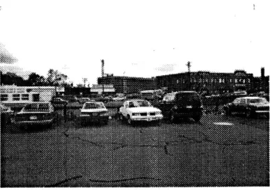
OAAW"Nft WON*View of site, facing south.
Figure 10. p.43, Model of the three blocks
which comprise the site. This is one of several
iterations in which one long side of the block
is modeled as a more or less continuous wall while the other edge opens, creating a mid-block space which is defined by the hard edge of each block. In this model there is an
attempt to suggest a repetitive pattern of
formal and spatial definitions across three blocks.
A fair amount of design work had been
conducted before it became clear that the wall and filter idea should be the guiding concept for the overall configuration. Figure 10 is one such model. This model shows the three blocks that comprise the site. It is an abstract treatment of the site in an attempt to suggest some formal or spatial properties of the two distinct edges of each block. It was after working with this model that the idea surfaced of applying the dialectic between open and closed edges to the entire three block configuration.
The Final Scheme
In the final scheme, no program has been suggested for the buildings in the southern portion of the site. Of primary importance here was the provision of some regularity to the haphazard pattern of streets and blocks, with the intention of improving the pedestrian and vehicular links to the north side of the town.
Building the Civic Realm
45
45 Building the Civic Realma
Building the Civic Realm
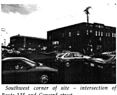
-Southwest corner of site - intersection of
Route 135 and Concord street.
Figure 11. A further exploration in drawing of the idea of establishing some relationships between the wall building and the filter building. A first attempt is made to introduce
the geometry of the southern-most part of the
site into the scheme. The wall building
remains fairly enclosed on the north side but begins to become more open on the side facing the large open space. The lot lines are
abstracted to become regulating lines which
establish a consistent dimension throughout the scheme.
...
.........
......
Building the Civic Realm
47
47As is evident in the final plan, it also became important to allow some of the geometry which is found in the south side to extend across the middle block. This results in a stronger territorial exchange between the two sides of the tracks and allows the different geometry's to be experienced in a large, open space. South street has become a view corridor, increasing the legibility of the plan and extending the territorial reach of the new configuration.
The ground level of the train station consists of a two story open space which provides visual and literal access across the site. This space is generous enough to accommodate a variety of uses, including temporary markets or other such uses which are unrelated to the rail function but which add to the complexity of the space.
The main structural elements extend from the underground platform to the commercial levels above. The vertical access runs through the open space and connects the lower platform level to the upper levels. This access is open to the main public space - the space of
MAN-Figure 12. Plan and longitudinal section of the
train station. Ground level remains open;
Upper levels become more private.
public claim is expanded to visually include the somewhat more private upper levels. The wall building has several salient features. First, as mentioned earlier, it defines one edge of the open space. Programmatically, at the ground level it would need to accommodate functions that enliven the adjoining open space. Another feature of the wall building is that, while it does allow cross access in several locations, this access is "buried" within the building - in other words, it is not visible from the exterior. This is done in order to emphasize the fact that the wall building defines the end of the three block configuration. But the network of access continues through the building, linking the site to city beyond.
The wall building also exhibits a degree of openness which should be seen as the midpoint on a continuum starting with the existing fabric at the "closed" end and ending with the train station which is the most open. The notion of building into the structure of the intervention a pattern of interiors which are progressively more open is derived from a reading of the existing structure as everywhere
Building the Civic Realm
49
49exhibiting a rigid separation of building interiors from the external environment. This is related to the idea of the space of public claim, where the more open a building is to the outside, the more it participates in the public realm. So the wall building is modeled as beginning to exhibit a greater degree of openness in plan and section along its southern edge. The next step in this progression is the train station which is almost entirely open at the ground level save for the large structural walls.
Figure 13. The Final Plan. This plan is
decidedly less "architectural" than some of the
earlier drawings and models.. This is in
recognition of the fact that the value of the this approach to designing urban architecture is precisely that the focus is not on an individual
building, but on a field that possesses its own
formal and spatial content. With this plan I
have attempted to define a pattern of spatial
events.
Access through the wall building occurs
regularly, but it is not recognizable from the
exterior because it occurs on and angle which obscures the line of sight as one faces the
building. This angle is the same as that at
which the end of the building turns in order to address the cross street which connects this site to the south side.
The west end of the middle block is left open because this is a major route of access across the site from both directions. The end is defined by a tall building which is rotated to align with the geometry of South street as it
intersects with the middle block.
The main structure of the mid block consists of parallel walls which reinforce the direction perpendicular to the long side of the block.
Building the Civic Realm
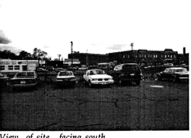
View of site, facing south
Figure 14. Model of the final scheme. A
development of earlier models, the material of the city is rendered as a repetitive system of
"walls" whose spacing is based on the lot dimensions. The addition of facades to these elements results in their being read as continuous walls along the street front. This
complete definition is progressively eroded,
resulting in a greater degree of exchange or
interface between interior and exterior.
In the same manner that the geometry of the
infrastructure influences the orientation of the buildings, the direction and spacing of the
"wall" elements was determined by horizontal pieces which were spaced so that the walls could slot into them. This establishes the first level of definition. Subsequent levels of
definition - Plexiglas and wire screens
maintain a high degree of transparency. In the
section which represents the train station, the
walls remain legible because no opaque
enclosures are applied to this section.
Figure 15. Close-up view of the train station section of the model. The main vertical
elements provide connection between the
upper and lower levels and mark the zones of greatest enclosure. The screen elements define an open interior zone along the south edge and between more enclosed areas. The open
interior is an extension of the exterior public
space.
The wall building has several salient features. First, as mentioned earlier, it defines one edge of the open space. Programmatically, at the ground level it would need to accommodate functions that enliven the adjoining open space. Another feature of the wall building is that, while it does allow cross access in several locations, this access is "buried" within the building - in other words, it is not visible from the exterior. This is done in order to emphasize the fact that the wall building defines the end of the three block configuration. But the network of access continues through the building, linking the site to city beyond.
The wall building also exhibits a degree of openness which should be seen as the midpoint on a continuum starting with the existing fabric at the "closed" end and ending with the train station which is the most open. The notion of building into the structure of the intervention a pattern of interiors which are progressively more open is derived from a reading of the existing structure as everywhere exhibiting a rigid separation of building interiors from the external environment.
Building the Civic Realm
55
55
This is related to the idea of the space of public claim, where the more open a building is to the outside, the more it participates in the public realm. So the wall building is modeled as beginning to exhibit a greater degree of openness in plan and section along its southern edge. The next step in this progression is the train station which is almost entirely open at the ground level save for the large structural walls.
Figure 16. Site section showing the
below-grade train platform.
The Urban Configuration
Although I have mentioned that the program includes a train station and a mixed-use office/commercial building, it is more accurate to define the actual program that is relevant to the thesis as a consistent pattern of interface between public spaces, both interior and exterior, and a network of access which visually and instrumentally connects these spaces to each other and to the surrounding urban structure.
The final scheme attempts to address the following issues: 1.) Integration of the intervention into the surrounding order through relationships with primary elements.
2.) A degree of interdependence and
complexity among the elements of the urban structure. 3.) Extension of the territorial effects of the new configuration beyond the boundaries of the site. 4.) A degree of openness and accessibility such that the outdoor spaces and portions of interior space possess a truly public quality.
Building the Civic Realm
57
57 Building the Civic Realm
Conclusion
The distinguishing characteristic of urban architecture is that it must satisfy the demands not only of the internal program, but of the urban program as well. It must achieve simultaneously a degree of autonomy and adaptability.
There exists, between the poles of the autonomous urban object and the city which is merely an aggregation of individual elements, a middle ground that recognizes the interdependence between the urban project and the material and spatial form of the city. It is here, in this middle ground, where individual action supports the collective existence, that the civic realm is realized.
The design has focused on this middle ground
by taking as its raw material the actual physical
and spatial form of the city. By deriving architectural form from constraints which "precede" those which are associated with more limited programmatic concerns, we can
arrive at individual works which function as instruments of urban structuring.
Figure. 17. Longitudinal section through train
station, facing north. Vertical elements are
visible markers indicating vertical access and access across site.
-a
Building the Civic Realm
59
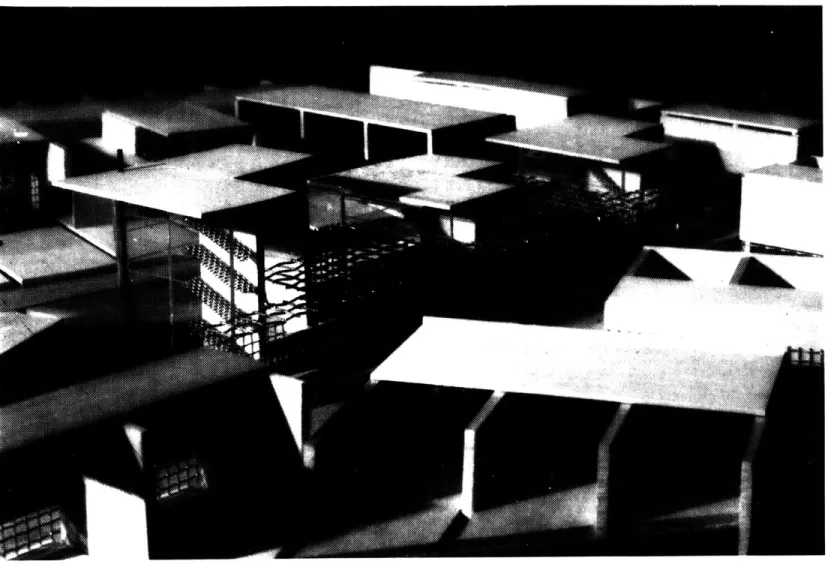
59Figure 18. View of final model showing
Notes
1. Italo Calvino. Six memos for the next millenium, Harvard University Press, Cambridge, 1988 2Stanford Anderson, preface, On Streets, (MIT Press, Cambridge, 1986)
31bid. 280. 4Ibid. 280.
5Bill Hillier, "The Architecture of the Urban Object," Ekistics,(334-335,January - April, 1989) 18 6Ibid. 18
7Ibid. 17 8Ibid. 18
9Michael Brill. "An Ontology for Exploring Urban Public Life Today," Places (vol.6, no.1, 1986) 29 1 0Mike Davis. "Fortress Los Angeles: The Militarization of Urban Space," Variations On a Theme Park
(Noonday Press, NY, 1992) 29.
1 1Kevin Lynch. The Image of the City, (MIT Press, Cambridge, 1960) 8. 121bid. 5.
13Christian Norberg-Schultz, "On the Way to Figurative Architecture," Places, (vol.4, no.1, 1987) 20. 14
M. Christine Boyer, "Cities For Sale," Variations On a Theme Park, (Noonday Press, NY, 1992) 190.
15Manuel de Sola Morales, "Another Modern Tradition," Lotus International, (no.64, 1989) 7. 16Ibid. 15.
1 7Aldo Rossi, "The Architecture of the City," (MIT Press, 1982) 86. 181bid. 18.
19Daniel Radler, Redevelopment in Downtown Framingham, (Thesis, BS Urban Studies, MIT, 1979) 1.
Bibliography
Anderson, Stanford. editor, On Streets, MIT Press, Cambridge, 1986
Anderson, Stanford. "Criticism of Place: A Symposium," Places, Vol.4 no.1 1987. Berman, Marshall. All That is Solid Melts into Air, Simon & Schuster, NY, 1982
Brill, Michael. "An Ontology For Exploring Urban Public Life Today," Places, Vol.6, no.1, 1989. Calvino, Italo. Six Memos For the Next Millenium, Harvard University Press, Cambridge, 1988. de Sola Morales, Manuel. "Another Modern Tradition," Lotus International, no.64, 1989.
Duany, Andres, & Plater-Zyberk, Elizabeth, Towns and Town Making Principles, Rizzoli, NY, 1991. Hillier, Bill. The social Logic of Space, Cambridge University Press, NY, 1984.
Hillier, Bill. "The Architecture of the Urban Object," Ekistics, 334, January/February, 1989, 335, March/April, 1989.
Lynch, Kevin. The Image of the City, MIT Press, Cambridge, 1960.
Miller, Donald. editor, The Lewis Mumford Reader, Pantheon Books, NY, 1986.
Nijinhuis, Wim. "City Frontiers and Their Disappearance," Assemblage, no.16, MIT Press, Cambridge, 1991.
Radler, Daniel. Redevelopment in Downtown Framingham, Thesis, BS, Urban Studies, 1979 Rossi, Aldo. The Architecture of the City, MIT Press, Cambridge, 1982
Siza, Alvaro. Poetic Profession, Lotus Documents, Milano, 1986
Sorkin, Michael. editor, Variations On a Theme Park, The Noonday Press, NY, 1992 Testa, Peter. "Unity Of the Discontinuous," Assemblage, no.2, feb. 1987.