Any correspondence concerning this service should be sent
to the repository administrator:
[email protected]
This is an author’s version published in:
http://oatao.univ-toulouse.fr/22662
Official URL
DOI :
https://doi.org/10.1007/978-3-030-03098-8_28
Open Archive Toulouse Archive Ouverte
OATAO is an open access repository that collects the work of Toulouse
researchers and makes it freely available over the web where possible
To cite this version: Chapuis, Kévin and Taillandier, Patrick and
Gaudou, Benoit and Drogoul, Alexis and Daudé, Eric A Multi-modal
Urban Traffic Agent-Based Framework to Study Individual Response to
Catastrophic Events. (2018) In: 21st International Conference on
Principles and Practice of Multi-Agent Systems (PRIMA 2018), 29
October 2018 - 2 November 2018 (Tokyo, Japan).
A multi-modal urban traffic agent-based
framework to study individual response to
catastrophic events
Kevin Chapuis1,4, Patrick Taillandier2, Benoit Gaudou1,3,4, Alexis Drogoul1,4,
and Eric Daud´e5 1
Sorbonne University, IRD, UMMISCO, F-93143, Bondy, France
2
MIAT, University of Toulouse, INRA, Castanet-Tolosan, France
3
University Toulouse Capitole, IRIT, Toulouse, France
4
USTH - AVAST, ICTLab, Hanoi, Vietnam
5
CNRS, Rouen University, UMR IDEES, Rouen, France
Abstract. Urban traffic is made of a variety of mobility modes that have to be taken into account to explore the impact of catastrophic event. From individual mobility behaviors to macroscopic traffic dynam-ics, agent-based modeling provides an interesting conceptual framework to study this question. Unfortunately, most proposals in the domain do not provide any simple way to model these multi-modal trajectories, and thus fell short at simulating in a credible way the outcomes of a catas-trophic event, like natural or industrial hazards. This paper presents an agent-based framework implemented with the GAMA modeling platform that aims at overcoming this lack. An application of this model for the study of flood crisis in a district of Hanoi (Vietnam) is presented.
1
Introduction
The Agent-Based Modeling paradigm has been used for several decades to model urban traffic. This well-established field of research has seen many frameworks populating the scientific landscape such as MATSim [13], SUMO [14] or SimMo-bility [2] to name only a few. Those generic toolkits make it possible to build a traffic model to study several phenomena from nanoscopic – e.g. lane change and cross section – to macroscopic dynamic – e.g. mass congestion and residen-tial relocation. Thanks to the agent paradigm, it is possible to explicitly repre-sent the decision making process and action of heterogeneous actors, including transportation providers, political institutions or end users like pedestrians and drivers.
However, most of the influential proposals in the domain focus on demand, supply and control of traffic transportation system [3]. While this covers almost all urban planners’ concerns about problems such as how to design, maintain and expand traffic systems, they are not suitable for studying the outcomes of un-common and/or extreme [11, 7]. Indeed, mobility in a crisis context is radically different from mobility in a normal situation: individuals can change destina-tion goals and/or modes of transport very quickly; they may adopt a specific
attitude, for example nervousness, fear, impatience according to their mode of transportation; finally, the transport networks can themselves be affected either by the hazard directly (flood or earthquake) or indirectly (traffic lights interrup-tion). Unfortunately, adapting generic toolkits to this type of context requires to build extensions using a generic programming language like C++ or JAVA, which is out of reach of most modelers. The framework presented in this paper aims at being able to simulate this type of situation with easy to use modeling tools.
The paper is structured as follows: Section 2 discusses about the other agent-based models and frameworks proposed in recent years. The model we proposed is presented in Section 3. Section 4 illustrates the use of the framework by pre-senting the case of the evacuation of a district of Hanoi, Vietnam. Finally, Sec-tion 5 serves as conclusion.
2
Agent-Based Model and Simulation of urban traffic in
crisis situation
2.1 Agent-based urban traffic framework
The most important multi-agent traffic frameworks like MATSim, SUMO and SimMobility are based on highly efficient multi-modal traffic model to study de-mand, supply and control of traffic systems. Several extensions of these platforms have been proposed in order to investigate the impact of catastrophic event on transportation system. However, those proposal exhibit two drawbacks for our concern: they are either based on the O-D paradigm or use very simple model of pedestrian mobility. For example, [15] propose a mass evacuation model based on MATSim that requires to use pre-calculated evacuation trips, hence failing to capture individual response; [8] design a SUMO extension (VEBEN++) to study individual response to catastrophic event where pedestrian follow a path on a network without any direct interaction with other road users (including other pedestrians), which does not reflect actual people movement in crisis situation [4].
In order to tackle this issue, a solution consists in using a generic agent-based modeling platform. Among the existing open-source generic platforms such as Mason, Netlogo or Cormas, one of the most suitable for traffic simulation is GAMA [10]. Indeed GAMA provides modelers a complete modeling language (GAML: GAma Modeling Language) and different features that can be used by modelers to develop traffic models [20]. It has already been used for several traffic models such as the ones proposed by [7, 16].
2.2 Crisis event in urban traffic agent-based model
While aforementioned frameworks make it possible to model regular urban traf-fic, most of them do not propose extended features to study the disruption induced by crisis events [7]. On the other hand, even if there are several agent-based models that study evacuation model, there is no dedicated framework to
the best of our knowledge [11]. Netlogo is still widely used but does not pro-vide native features to handle large scale traffic models [17]. Furthermore, agent based traffic model that study crisis situation and evacuation do not incorporate complex transportation system often [21]. Those multi-agent evacuation models usually come with limitations, such as a narrowed area – e.g. buildings [5] – or a limited number or only one mode of transportation – e.g. pedestrian in a crowd [18].
GAMA has been recently used to study evacuation and traffic under catas-trophic event [7, 1] as an alternative to Netlogo. The platform has several well suited features such as GIS native integration and simple and efficient primitives for car as well as pedestrian mobility over network and continuous topography. In the next section we describe the tools we developed to further enhance GAMA accuracy to model multi-agent large-scale traffic and evacuation during catas-trophic event.
3
An ABMS framework of multi-modal urban mobility
in crisis events
Our proposal is an attempt to bring easy to use, flexible and scalable modeling features to study multi-modal traffic systems during crisis events. An example of implementation and an instance on a real case study (described in Section 4) are implemented using the GAMA platform [10].
3.1 Proposal - Desiderata
The key agent type of our framework is the human being. The main corollary and our main contribution is that the human agent will always be an entity distinct from its vehicle. Hence, we need to distinguish the decision-maker human agent and its various mobility ways all over the simulation. To this end, we designed our template for the human agent to have full autonomy on the strategical and tactical level of mobility decision process. The activity paradigm provide enough flexibility to cope with immediate danger (e.g. stop the current activity to go to a safe place) but agents also have the capacity to define how they should go to their destination, including the ability to adapt their current course of action to the uncommon circumstances (e.g. to continue evacuating at foot considering a mass car congestion).
3.2 The environment
The environment is composed of the spatial and physical entities that drive, support or constrain the human mobility. The studied system must be made of two main entities that are buildings and mobility environment (e.g. road net-work and walking area), but can optionally be made up of non buildings areas like park, parking, water, etc. Our framework provides a complete adapter for
OpenStreetMap (OSM) data, meaning that any case study road network, build-ings and walking area can be easily setup using raw OSM data. Alternatively, modelers can setup the environment using classical shapefile that will required several mandatory attributes for buildings and roads to be define within file
The buildings. The buildings are related to human activity, so they can drive agent mobility: go to the workplace, go home, go to shopping center, etc. Each building is made of a localized shape and should at least have a building type (the human activity), like dwelling, amenity, school or office. Building can have model related feature, like being a shelter or the number of floors, that can be used to shape agent response to catastrophic event.
Mobility environment. We design mobility environment to be adapted to each mobility modes: pedestrians, cars, bikes or trains can obviously not move on the same support. However these supports are not always mutually exclusive as roads can be used by pedestrians, cars or bus. Hence, we organize mobility environment in two different topology: a two-dimensions continuous walking area and a roads network. The former is exclusive to pedestrian while the later can be used by every vehicle and pedestrian.
Road network. The roads are considered to be one-dimension spatial entities (i.e. polyline) organized as a graph. Each road has a speed limit and a number of lanes while intersection manage traffic light and priority. There are both agent so they can have pro-active behavior, e.g. deterioration due to a catastrophic event.
Walking area. Pedestrian area mixes all walkable space, such as parks, public places or parking. Those spaces can have a great impact on the traffic during catastrophic event: parks can turn into safe area during earthquake, near river or seaside can become dangerous area during flood event, etc. Opposite to the road network, the walking area is made of two-dimensions geometrical shape. We provide with the framework tools to compute and generate this walking area from available data (more details can be found in the next Section).
3.3 Mobile entities: people and vehicle agents
People. Realistic traffic simulations need statistically realistic population of agents. To this purpose, we use an open source synthetic population generator called Gen* [6] that will initialize agents demographic attributes like age and gender. This generation also provide agent with the mandatory location for home place and optional other places like school or workplace.
Meso-traffic related features. Every agent must be provided with an agenda in the form of a list of localized activities associated with an appointment and a desired mobility mode. During simulation, activities will trigger agent mobility:
the time of departure is calculated based on expected travel time and time of appointment considering walking and motorized movement with constant speed. The path and modes to use are computed using behavioral rules and shortest path algorithm: agent will choose the most efficient mode in term of time, while computing shortest path using NBA* algorithm [19]. On the tactical level, each agent is able to update its path when changes in the environment does not let them move to their current destination, including the ability to change the mode of transportation. Triggering event, like congestion, overwhelming travel time or impracticable street, are flexible and must be stated by the modelers.
Micro-traffic related features. Agent are able to walk on a continuous space, while following the shortest path on a virtual pedestrian network. Thus, the mobility support is made of the defined walking area minus all obstacles, like building and water body, the virtual network being build automatically from it: we design an algorithm using Delaunay’s triangulation to scattered the walk-ing area and connect triangle to each other to build the network. Regardwalk-ing pedestrian movement, we design an algorithm inspired by the social force model [12]. It define how people move on the continuous space, avoiding collision and adapting direction and speed to other pedestrian.
Vehicles. They are the mean by which people agents will move on the road network. The driving capacities are handled by vehicles although adjusted by people agent attributes: e.g. the tendency to overstep speed limit depends on people agent attributes. Hence, a vehicle needs a driver people agent to define destination and to adapt its behavior, while it can also contain some other people agents that will only be passengers. Vehicle operational level rely on the GAMA advanced driving skill, which consists in attributes and methods dedicated to the driving behavior of agent. [20] proposal provides more details about additions brought by the advanced driving skill.
3.4 Catastrophic event
At the moment, the integration of hazard event modeling is under active de-velopment and already provide static and basic dynamic models of catastrophic event. The static approach is the most simple and consists in defining the cen-tral localization of the event and a radius. To further enhance realism, modelers can import GIS data to characterize the spatial spread of the event over time. Alternatively, modelers can use a cellular automata diffusion dynamic to mimic the dispersion of the zone impacted by the event. The algorithm has already been used to simulate flood and fire spread [1, 9], and can be initialized using input data.
4
Case study: multi-modal evacuation in a ward of Hanoi
Authorities of the Vietnam city capital have launched in 2018 a large project to mitigate risks that could potentially result from natural as well as industrial
disasters for Hanoi. Management and control of such extreme events in large urban area is a huge challenge [11]. In this paper we consider the ward of Phuc Xa, located between the dyke and the Red River, in the North of the Old Quarter of Hanoi.
4.1 Input data and parameters
For GIS data we had to transpose cadastre image to vector-based road network and buildings. School, university, market and hospital were extracted from OSM data, but because of lack of data, we assume amenities (like shops or workplace) to be uniformly distributed among building with a high probability.
To illustrate the use of our framework we design a proof of concept experi-ment. The generated population is a simplification of the actual one with 15 767 agents with a probability of 0.15 to be under 18, and a probability of 0.52 to be a woman. To locate them, we used an uniform spatial distribution. Agents are also bound with a workplace or school depending on age, respectively between 18 and 65 years old and under or equal to 17 years old. Each people under 18 is considered as having a motorbike.
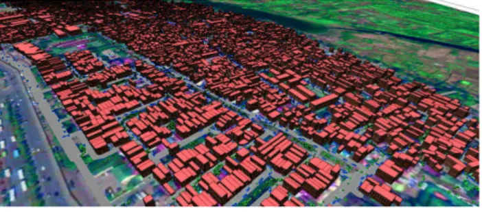
Fig. 1.Simulation snapshot: the green triangles represent the people agents, and the blue rectangles the motorbikes
We built three types of agenda according to age: one for scholarship, active people and retired. The first two ones are made of a main activity every day week – respectively school or work – and the last template is made of wandering activities in the morning and the afternoon. All the three end the day after the last activity in the afternoon with the return to the home place.
4.2 Simulation of multi-modal traffic and evacuation model
The normal course of the simulation is a work day of the week, agent follow-ing their agenda. Each step of the simulation represents 1 second in real life (86400 simulation cycles for a whole day) because micro-traffic dynamic needs to keep simulated time in a short scale: indeed, the time frame for human and vehicle agent to avoid obstacle and other agents must remain credible in terms
of distance and speed because they act sequentially. Moreover, we know that individual behavior during a catastrophic event can change rapidly according to the local context and behaviors of the neighbors.
In order to test the capacity of our framework to simulate a complete evac-uation of the area, we triggered a signal for the people agents to evacuate the simulated area at 8am. We defined all three exits of the quarter to be at the opposite of the Red River. For the choose of mode to evacuate, agent will choose the less time consuming mode, meaning at foot if there are close to exit or using motorbike if there expects to get to exist quicker.
The batch simulation took less than 44 minutes (average duration of a simu-lation cycle: 0.35 seconds on a personal computer) on the computer used for the experiment. This computation time is acceptable, especially as there are many possibilities to decrease it, in particular by using parallel computing.
5
Conclusion and perspectives
Our framework gathers tools to model multi-modal urban traffic and individual response to catastrophic event with Gama. In this proposition, we detailed some of the new built-in features we bring to the platform to ease the design realistic pedestrian and vehicle behavior. Furthermore we incorporated additional tools to add catastrophic event and model agent response within traffic simulation. We applied the framework to a case study mixing pedestrian and motorcycle mode for evacuation of a dense urban area.
To further refine our proposal, we plan to add a richer cognitive architecture to human agents coupling BDI classical mechanics with emotions and social norms to help modeling traffic rules and transgression during egress. Finally, we plan to apply our framework to case study involving public transport in day-to-day mobility as well as special freight for evacuation purpose.
Acknowledgment
This work is supported by the ANR ESCAPE project, grant ANR-16-CE39-0011-01 of the French Agence Nationale de la Recherche.
References
1. Adam, C., Gaudou, B.: Modelling Human Behaviours in Disasters from Interviews: Application to Melbourne Bushfires. JASSS 20(3), 12 (2017)
2. Adnan, M., Pereira, F.C., Azevedo, C.M.L., Basak, K., Lovric, M., Raveau, S., Zhu, Y., Ferreira, J., Zegras, C., Ben-Akiva, M.: Simmobility: A multi-scale integrated agent-based simulation platform. In: 95th Annual Meeting of the Transportation Research Board Forthcoming in Transportation Research Record (2016)
3. Bazzan, A.L., Kl¨ugl, F.: A review on agent-based technology for traffic and trans-portation. The Knowledge Engineering Review 29(3), 375–403 (Jun 2014)
4. Beck, E., Dugdale, J., Truong, H.V., Adam, C., Colbeau-Justin, L.: Crisis Mobility of Pedestrians: From Survey to Modelling, Lessons from Lebanon and Argentina. In: ISCRAM-Med. pp. 57–70. LNBIP, Springer, Cham (Oct 2014)
5. Bo, Y., Cheng, W., Hua, H., Lijun, L.: A Multi-Agent and PSO Based Simulation for Human Behavior in Emergency Evacuation. pp. 296–300. IEEE (Dec 2007) 6. Chapuis, K., Taillandier, P., Misslin, R., Drogoul, A.: Gen*: a generic toolkit to
generate spatially explicit synthetic populations. International Journal of Geo-graphical Information Science 32(6), 1194–1210 (2018)
7. Czura, G., Taillandier, P., Tranouez, P., Daud´e, ´E.: MOSAIIC: City-Level Agent-Based Traffic Simulation Adapted to Emergency Situations. In: Takayasu, H., Ito, N., Noda, I., Takayasu, M. (eds.) Proc. of the Int. Conference on Social Modeling and Simulation, plus Econophysics Colloquium 2014, pp. 265–274. Springer (2015) 8. Fl¨otter¨od, Y.P., Erdmann, J.: Dynamic reroute modeling for emergency evacuation: Case study of brunswick city, germany. Int. Journal of Mechanical, Aerospace, Industrial, Mechatronic and Manufacturing Engineering 12(4), 99 – 109 (2018) 9. Gasmi, N., Grignard, A., Drogoul, A., Gaudou, B., Taillandier, P., Tessier, O.,
An, V.D.: Reproducing and exploring past events using agent-based geo-historical models. In: Int. Workshop on MABS. pp. 151–163. Springer (2014)
10. Grignard, A., Taillandier, P., Gaudou, B., Vo, D.A., Huynh, N.Q., Drogoul, A.: Gama 1.6: Advancing the art of complex agent-based modeling and simulation. In: Boella, G., Elkind, E., Savarimuthu, B.T.R., Dignum, F., Purvis, M.K. (eds.) PRIMA 2013. pp. 117–131. Springer Berlin Heidelberg, Berlin, Heidelberg (2013) 11. Hawe, G.I., Coates, G., Wilson, D.T., Crouch, R.S.: Agent-based simulation for large-scale emergency response: A survey of usage and implementation. ACM Com-puting Surveys 45(1), 1–51 (Nov 2012)
12. Helbing, D., Molnar, P.: Social Force Model for Pedestrian Dynamics. Physical Review E 51(5), 4282–4286 (May 1995)
13. Horni, A., Nagel, K., Axhausen, K.W.: The multi-agent transport simulation MAT-Sim. Ubiquity Press London (2016)
14. Krajzewicz, D., Erdmann, J., Behrisch, M., Bieker, L.: Recent development and applications of SUMO - Simulation of Urban MObility. International Journal On Advances in Systems and Measurements 5(3&4), 128–138 (December 2012) 15. L¨ammel, G., Kl¨ugl, F., Nagel, K.: The MATSim Network Flow Model for Traffic
Simulation Adapted to Large-Scale Emergency Egress and an Application to the Evacuation of the Indonesian City of Padang in Case of a Tsunami Warning. In: Timmermans, H. (ed.) Pedestrian behavior: models, data collection and applica-tions. Emerald (2009)
16. Lucien, L., Lang, C., Marilleau, N., Philippe, L.: Multiagent hybrid architecture for collaborative exchanges between communicating vehicles in an urban context. Procedia Computer Science 83, 695–699 (2016)
17. Mayrhofer, C.: Performance, scale & time in agent-based traffic modelling with netlogo. GI Forum 2015, 567–570 (2015)
18. Mordvintsev, A.S., Krzhizhanovskaya, V.V., Lees, M.H., Sloot, P.M.A.: Simulation of City Evacuation Coupled to Flood Dynamics. In: Pedestrian and Evacuation Dynamics 2012, pp. 485–499. Springer, Cham (2014)
19. Pijls, W., Post, H.: Yet another bidirectional algorithm for shortest paths p. 9 20. Taillandier, P.: Traffic simulation with the GAMA platform. In: International
Workshop on Agents in Traffic and Transportation. p. 8 (May 2014)
21. Wang, H., Mostafizi, A., Cramer, L.A., Cox, D., Park, H.: An agent-based model of a multimodal near-field tsunami evacuation: Decision-making and life safety. Transportation Research Part C: Emerging Technologies 64, 86–100 (Mar 2016)