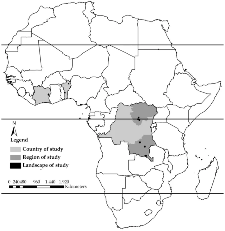
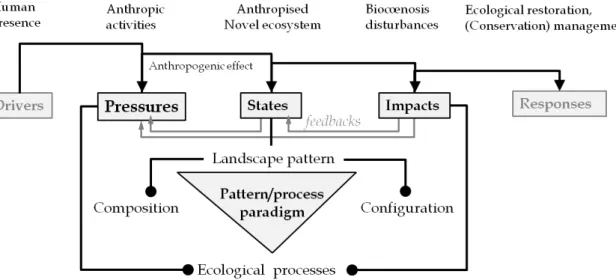
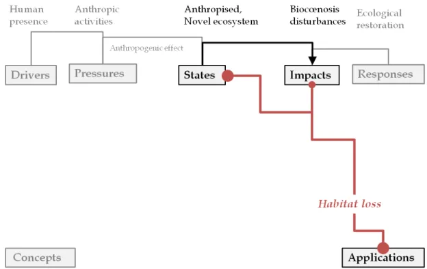
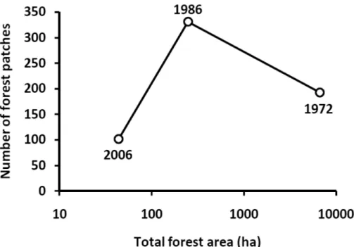
Quantifying landscape anthropisation patterns: concepts, methods and limits
Texte intégral
Figure


Documents relatifs
The study focus on habitat availability and landscape connectivity (Urban and Keitt, 2001 ; Pascual-Hortal and Saura, 2006), under the assumption that connectivity is
A main finding of this study is that, although the landscape scale beta diversity patterns of the three microbial domains investigated are all related to plant community
2) similarly to above, one has to determine positions of atoms decorating 5D elementary unit cell, which after projection onto real space would give us the coordinates of
In the selected green roofs, those with a lower sedum cover are associated with higher plant richness and bigger open areas surface.. The absence of bees on BG could be explained
Conformément aux principes énoncés par la "Budapest Open Access Initiative"(BOAI, 2002), l'utilisateur du site peut lire, télécharger, copier, transmettre, imprimer, chercher
Based on secular field study in survey region and combined with supervised classification methods, we used Erdas Image software to interpret the images and
panel b, we can see that the runaway current density increases with time at each altitude: the electric field accelerates the electrons and so the runaway current density
In a previous study (Constancias et al. under revision), the distribution of microbial abundance and bacterial commu- nity diversity (richness, evenness and Shannon’s index)
