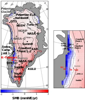
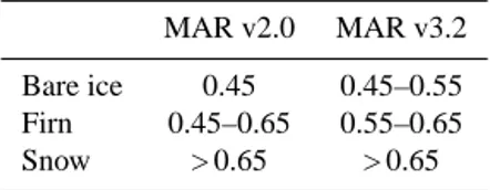
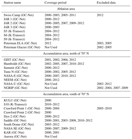
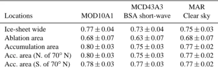
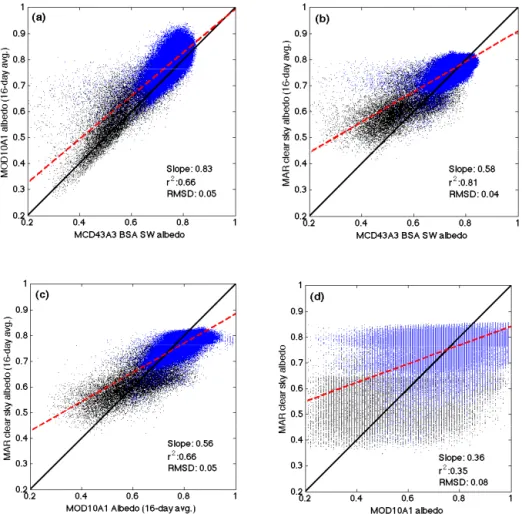
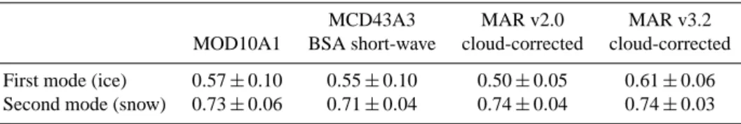
Assessing spatio-temporal variability and trends in modelled and measured Greenland Ice Sheet albedo (2000–2013)
Texte intégral
Figure
Documents relatifs
In men, hostility levels were also strongly associated with BMI at baseline but results of the interaction term between time and hostility also suggest that this association
The representative image of each facet value is dynamically computed from the fine-grained matching graph so as to adapt it to the previous user search actions.. This is sim- ply
Associations n:m 1,n 0,n Personne SECU Nom Prénom Date de naissance Lieu de naissance Sexe Domicile Numéro Etage Superficie Sur Cour Possède Date d'achat NUMERO = NUMERO SECU =
Par exemple, section//paragraphe sélectionne tous les éléments paragraphe descendant d'un élément section fils direct du nœud courant5. sélectionne le
such as gaze awareness and deictic gestures, how new collaboration scenarios can benefit from side-by-side collaboration, how telepresence robots can be used in large interactive
The literature on continuous-state and continuous-time control on networks is recent: the first two articles were published in 2012: control problems whose dynamics is constrained to
Summary of Model Characteristics Model Attribute Model AgroIBIS BEPS Biome ‐BGC Can ‐IBIS CN ‐CLASS DLEM DNDC Ecosys ED2 EDCM Temporal Resolution Half ‐hourly Daily Daily
Jonathan Beuvier (1) ([email protected]), Isabelle Taupier-Letage (2) ,Jean-Luc Fuda (2) , Marie Drévillon (1) , Yann Drillet (1). 1 Mercator Ocean
![[PDF] Cours bureautique complet Excel 2007 pdf | Cours informatique](data:image/gif;base64,R0lGODlhAQABAIAAAP///wAAACH5BAEAAAAALAAAAAABAAEAAAICRAEAOw==)