UNIVERSITE DE POITIERS
Faculté des Sciences Fondamentales et
Appliquées
UNIVERSITY OF POITIERS
Faculty of Basic and Applied Sciences
THESE
Pour l’obtention du Grade dePhD THESIS
For obtaining the Rank of
DOCTEUR
DE L’UNIVERSITE DE POITIERS ED Sciences pour l’Environnement
Gay Lussac
Spécialité : Hydrogéologie
DOCTOR OF PHILOSOPHY UNIVERSITY OF POITIERS ED Sciences pour l’Environnement
Gay Lussac
Specialization: Hydrogeology
Présentée par - Submitted by
WAKGARI FURI KONCHI
Hydrogeology of complex volcanic systems in continental rifted zone.
Integrated geochemical, geophysical and hydrodynamic approach. Middle
Awash basin, Main Ethiopian Rift, Ethiopia.
Hydrogéologie des complexe systèmes volcaniques en zone de rift continental.
Approche couplée géochimique, géophysique, et hydrodynamique. Bassin Central
d'Awash, Rift éthiopien majeur, Ethiopie.
Directeur de thèse : Moumtaz RAZACK, Université de Poitiers Co-Directeur de thèse : Dagnachew LEGESSE, University of Addis Ababa
Soutenue le 7 octobre 2010 - Defended on 7th october 2010 Devant la commission d’examen - Before the board of examiners
JURY
Christelle MARLIN Professeur, Université Paris-Sud Rapporteur Jacques MUDRY Professeur, Université de Franche-Comté Rapporteur Tamiru ALEMAYEHU Professor, University of the Witwatersrand,
South Africa Examinateur
Christian LEDUC DR IRD, UMR G-EAU, Montpellier President
Bernard LE GALL CR CNRS HDR, UMR 6538, Brest Examinateur
Moumtaz RAZACK Professeur, Université de Poitiers Examinateur
Dagnachew LEGESSE Associate Professor
iiii
Abstract
Middle Awash basin, located in the complex volcanic centre of the Ethiopian Rift valley, is one of the drought prone areas marked by considerable water supply problems. Due to lack of surface waters, groundwater remains the sole resource supplying water for domestic and livestock. However, its effective use has been hampered due to the complex aquifer system of this basin. In this study, multidisciplinary method has been applied to characterize the hydrogeological system of this complex volcanic basin.
The combined results from datasets show two distinct aquifer systems linked to geology and physiographic location. The Ca-alkaline rocks like basalt, ignimbrite, and trachybasalt form aquifers in the mountain regions whereas the Na-alkalne rocks which include scoria, pumice, tuff, and volcanoclastics are main aquifers in rift floor. Ground waters circulating in the highland areas are slightly mineralized and are Ca-Na-HCO3 type. On the other hand, ground waters in the rift floor are Na-HCO3-Cl types and are highly mineralized as well as contain high load of fluoride much higher than the permitted standard.
Rivers hydrograph, hydrochemistry, environmental isotope, and 2D tomography are in good agreement showing fast percolation of rainfall and strong interaction between surface waters and ground waters. Result from numerical groundwater flow modeling further indicates the strong interaction between groundwater and surface waters in the form of losing and gaining.
ii ii ii ii Résumé
Le bassin central d'Awash, situé dans le centre volcanique complexe de la Vallée du Rift éthiopien, est un des secteurs les plus touchés par la sécheresse et par des problèmes considérables d'approvisionnement en eau. En raison du manque d'eau de surface, l'eau souterraine reste la ressource unique fournissant l'eau potable. Cependant, l'exploitation effective de l'eau souterraine s'est heurtée à la méconnaissance du système hydrogéologique complexe de ce bassin. Dans cette étude, une approche pluridisciplinaire a été mise en oeuvre pour caractériser l'hydrogéologie de ce bassin volcanique complexe.
Les résultats couplés de l’ensemble des données montrent deux systèmes aquifères distincts liés à la géologie et à la localisation physiographique. Les roches Ca-alcalines comme le basalte, l'ignimbrite et le trachybasalte forment des aquifères dans les régions de montagne tandis que les roches Na-alcalines qui incluent les scories, la pierre ponce, les tufs et les volcanoclastiques constituent les principaux aquifères au niveau du plancher du rift. Les eaux souterraines circulant dans les secteurs montagneux sont légèrement minéralisées et sont de type Ca-Na-HCO3. Par contre, les eaux souterraines du plancher du rift sont de type Na-HCO3-Cl, sont fortement minéralisées et contiennent une charge en fluorure beaucoup plus élevée que les normes permises.
Les résultats de diverses approches (hydrogrammes des fleuves, hydrochimie, isotopes environnementaux et tomographie 2D) sont concordants et montrent une percolation rapide des eaux de pluie et une forte interaction entre les eaux de surface et les eaux souterraines. Les résultats de modélisation numérique confirment la forte interaction eau souterraine - eaux de surface.
iii iii iii iii ACKNOWLEDGMENTS
I would like to thank the Earthscience Department of the Addis Ababa University for initiating MAWARI (Sustainable Management of Water Resources in East African Rift System) project and giving me the opportunity to pursue my Ph.D. The generous support from French Ministry of Foreign Affairs for granting the project through CIFEG (Centre International pour la Formation et les Echanges en Geosciences) is greatly appreciated. With regard to this, I would like to make a special reference to Mr.Françoise PINARD and Madam Sylvie ORLYK for their commitment and good assistance in facilitating the field works in Ethiopia and my stay in France.
It is my pleasure to express my special thank to my supervisor Prof. Dr. Moumtaz Razack for giving me an opportunity to write my Ph.D thesis at his prestigious university under his supervision. The trust and freedom he gave me created comfortable and a convivial place to work. Besides his genial hospitality, he was always helping, even when he had burdens of works. We worked together both in the field and office with ease and enjoyment throughout the course of the research. I was pleased to have him as director of my thesis. Thanks.
Joining university of Poitiers was not only a turning point in my research skill but also an opportunity to experience French’s beautiful culture and popular language.
I am heartily thankful to my co-advisors Prof. Tamiru Alemayehu and Dr. Dagnachew Legesse whose encouragement, supervision and support from the preliminary to the concluding level enabled me to produce this thesis. I was delighted to have them as co-advisors who were closely attending my research and spend much of their time in reviewing the manuscripts of this thesis. Their rich advising experience broadened my perspective research. I wish to thank Dr Seifu Kebede and Prof.Tenalem Ayenew for sharing me their research skill and invaluable assistance. My special thanks to Dr Seifu Kebede who invested much of his time in analaysing the isotope data used in this study. I have got an opportunity to work with Dr Tigistu Haile and I admire his rich of patience, caring and research skill. He is considerate person with attractive spirit of friendship as unique personal possession.
I am grateful to Oromia Water Resources Bureau, in particular East Shoa Water office, Ministry of Water Resource, Ministry of Mines and Energy, National Meteorological Agency, Water Works Design and Construction Enterprise, Earth Science Department of the Addis Ababa University, and Wonji Sugar Factory for their unreserved support and assistance to my study. With regard to this, I would like to express my thanks to Dr Birhanu Gizaw, Tilahun Azagegn, Engida Zemedikun, Muktar Mahammed, and Lemessa Mokonta for their great contribution in providing me valuable data. I would like to thank Dr Andarge Yitbarek not only for his contribution in editing the manuscripts of this thesis but also for his good encouragement when we were together in France.
iv iv iv iv
All members of the Earth Science Department of the Addis Ababa University deserve special thanks. Especially I want to thank Dr Dereje Ayalew and Dr Balmewal Atnafu who were my constant source of encouragement during my study. This is not forgetting the amiable contribution of drivers of this same department, in particular Hailu Dibabe, for their good understanding and cautious driving through difficult terrains to reach data points and take samples. Had it been not their energetic and excellent driving skill, access to remote data would not have been possible. I am also indebted to Mr Claude FONTAINE from University of Poitiers, France, for his valuable laboratory assistance.
My deepest love and gratitude goes to my beloved families, in particular, my daughters Feben and Abenezer, who had lost me for long time. This dissertation was simply impossible without their understanding, patience and unflagging love.
I am indebted to my father and mother for their care and love. As a typical family, they sparse no effort to provide the best possible environment for me to grow-up and attend school. They had never complained in spite of all the hardships in their life. Although my father is no longer with us, he is forever remembered. I have no suitable word that can fully express the everlasting love of my mother, Kalbishe Dajje, to me. She is simply prefect. Mother, I love you.
My brother Kissi Buli with his family, Salmon Alemayehu, Kumara Wakjira, Tesfaye Beyene, and Tofiq Sabit were always been there giving me a moral boost as well as any assistance I need from them. Thank you.
I would like to thank Ethiopian colleagues who live in Poitiers, France, for their good friendship and hospitality during my three years of stay. My special thanks to Madam Anisha BARATHIEU and her family for their special caring, heartfelt hospitality and inspiring me to feel at home. I treasured all precious moments I shared with them and would really like to thank them.
I cherished the prayers and spiritually support of my Christian brothers and sisters. God bless you.
Lastly, I offer my regards and blessing to all whose names are not mentioned who supported me in any respect during my study. Without their genuine support, this thesis would certainly not have been possible. Thanks.
Fear of God is the beginning of Knoweldge.
Wakgari Furi Konchi
Poitiers, France October, 2010
v vv v Table of Contents Abstract ... i 1. General Introduction ... 2
1.1 Background and Concept ... 2
1.2 Rationale and Relevance of the study ... 3
1.3 Previous works ... 4
1.4 Objective ... 5
1.5 Limitation ... 6
1.6 Methodology ... 6
1.7 Materials and Tools ... 8
1.8 Structure of the thesis ... 10
2. Physical Description of the study area ... 12
2.1 Location ... 12
2.1 Physiography ... 13
2.2 Land cover of the study area ... 15
2.3 Slope Analysis ... 18
2. 4 Soil type ... 20
2.5 Geology and geological structures ... 21
2.5.1 Introduction ... 21
2.5.2 General geological setting of the study area ... 23
2.5.3 Stratification ... 24
2.5.3.1 The Cretaceous formation ... 24
2.5.3.2 The Miocene-Pliocene formation ... 24
2.5.3.3 The Pliocene-Pleistocene formation ... 25
2.5.3.4 The Quaternary Formation ... 25
2.5.4 Geological structures ... 28
3. Analysis of Hydrometeorology and Recharge ... 32
3.1 Introduction ... 32
3.2 Evaluation of meteorological data of the study area ... 32
3.2.1 Classes of meteorological stations ... 34
3.2.2 Distribution of stations and data quality. ... 34
3.3 Precipitation ... 35
3.3.1 General Occurrence in Ethiopia ... 35
3.3.2 Rainfall pattern of the study area ... 38
vi vi vi vi
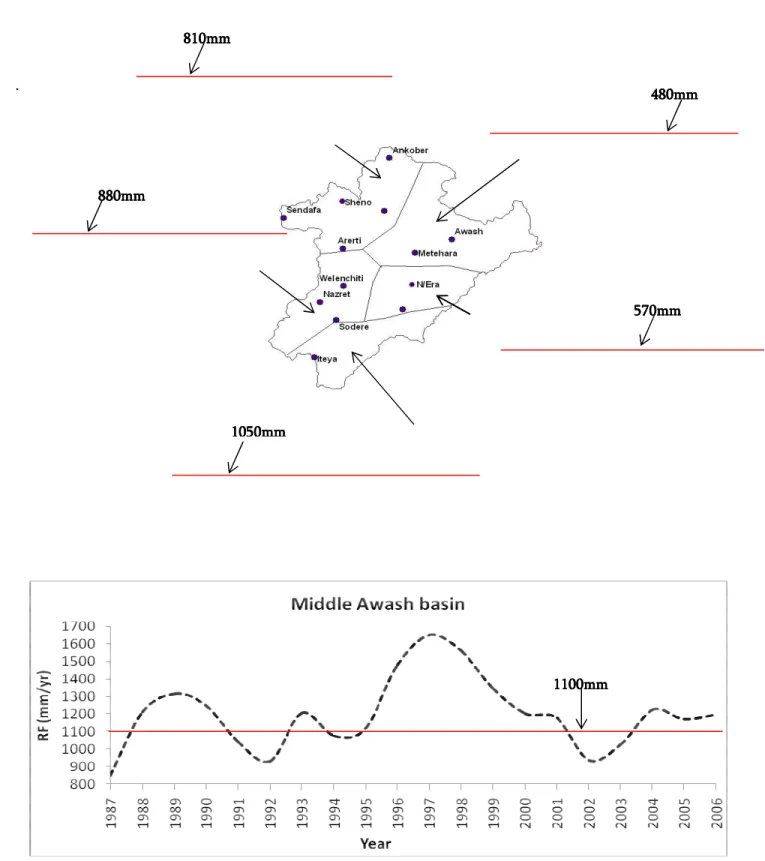
3.3.4 Analysis of rainfall trend ... 44
3.4 Temperature and Sunshine ... 46
3.5 Evapotranspiration ... 48
3.5.1 Introduction ... 48
3.5.2 Potential Evapotranspiration (PET) ... 49
3.5.2.1 Heat index method ... 49
3.5.2.2 Penman Method ... 50
3.5.3 Estimation of Actual evapotranspiration (AET) ... 52
3.5.3.1 Estimation of AET from river discharge ... 53
3.5.3.2 Semi distributed soil-water balance method ... 54
3.6 River hydrograph and recharge estimation ... 60
3.6.1 Introduction ... 60
3.6.2 Hydrograph of the major rivers ... 62
3.6.3 Analysis of flow duration curve (FDC) and recession rate ... 67
3.7 Concluding remarks ... 69
4. Hydrochemistry ... 72
4.1 Introduction ... 72
4.2 Sampling technique ... 73
4.3 Measurements of field parameters ... 74
4.3.1 Temperature ... 74
4.3.2 Electrical Conductivity (EC) ... 75
4.3.3 pH and alkalinity ... 75
4.3.4 Eh ... 75
4.4 Assessment of field measured water quality ... 78
4.5 Laboratory analysis of hydrochemical variables and result ... 82
4.6 Multivariate statistical analysis of hydrochemical variables ... 82
4.6.1 Descriptive statistics ... 84
4.6.2 Hierarchical Cluster Analysis (HCA) ... 85
4.6.3 Principal Component Analysis……….……….92
4.7 Water quality, Hydrochemical facies, and inverse geochemical modelling ... 99
4.7.1 Introduction ... 99
4.7.2 Water types of the study area ... 99
4.7.3 Groundwater flow paths, hydrochemical evolution and inverse geochemical modeling ... 103
4.7.3.1 Horizontal flow paths and inverse geochemical modeling ... 107
vii vii vii vii 4.7.4 Fluoride ... 114
4.7.4.1 Previous study in Ethiopia ... 115
4.7.4.2 Fluoride and its health implication ... 117
4.7.4.3 Source and mechanism of Fluoride distribution in the study area ... 118
4.7.4.4 Hydrochemical reaction and fluoride enrichment process in groundwater 119 4.7.4.5 Geospatial distribution of F- concentration ... 125
4.8 Concluding remark ... 129
5. Isotope Hydrology ... 130
5.1 Introduction and principles ... 130
5.2 Result and Discussion ... 136
5.3 Tritium (3H) ... 146
5.4 Concluding remark ... 149
6. Characterization of the aquifer system ... 152
6.1 Introduction ... 152
6.2 The hydrostratigraphic units ... 153
6.2.1 Aquifer systems of the highland areas ... 158
6.2.2 Escarpment aquifers ... 159
6.2.3 Rift floor aquifers ... 160
6.3 Role of geological structures on groundwater flow ... 161
6.4 Hydraulic property of rocks ... 164
6.5 Conceptual model of groundwater flow system of the Middle Awash basin ... 169
6.6 Concluding remarks ... 173
7. The hydrogeology of Adama-Wonji Basin ... 174
7.1 Introduction ... 174
7.2 Description of Adama-Wonji basin ... 176
7.3 Geological setting ... 176
7.4 Hydrogeological setting ... 178
7.5 Methods and material ... 182
7.6 Results and Discussions ... 184
7.7 Concluding remark ... 197
8. Numerical groundwater flow modelling ... 198
8.1 Introduction ... 198
8.2 Model design ... 200
8.2.1 Model grid ... 201
8.2.2 Model boundary conditions ... 202
viii viiiviii viii
8.2.2.2 Constant flux and general head boundary ... 202
8.2.2.3 Wells ... 203 8.2.2.4 Sinks ... 203 8.2.2.5 River boundary ... 203 8.2.2.6 Constant head ... 204 8.2.3 Model Property ... 205 8.2.3.1 Hydraulic conductivity ... 205 8.2.3.2 Groundwater evapotranspiration ... 206 8.2.3.3 Groundwater Recharge ... 206 8.2.4 Model geometry ... 208 8.2.5 Aquifer type ... 209
8.3 Model simulation and Discussion ... 210
8.3.1 Model Calbiration ... 210
8.3.2 Model sensitivity analysis ... 212
8.3.3 Model converegence and performance assessment ... 213
8.4 Head distribution and groundwater contours ... 216
8.5 Modelling selected sub flow systems ... 217
8.5.1 Adama-Wonji sub basin ... 219
8.5.2 Welenchiti sub basin ... 222
8.5.3 Beseka basin ... 225
8.6 Model limitation ... 230
Conclusion and Prospects ... 234
ix ixix ix
LIST OF FIGURES
Figure 1. 1 Outlined methodology and workflow ... 9
Figure 2. 1 Location map of study area ... 12
Figure 2. 2 Physiographic classes of the area ... 13
Figure 2. 3 Major land use and land cover ... 17
Figure 2. 4 Classified slopes ... 19
Figure 2. 5 Soil profil and waterlog in Welenchiti plain ... 20
Figure 2. 6 Geological map of study area ... 26
Figure 2. 7 Simplified geological set-upof study area ... 27
Figure 2. 8 A conceptual model showing role of geological structures on groundwater flow ... 29
Figure 3. 1 Location of meteorological stations and river gauges. ... 33
Figure 3. 2 Seasonal change of ITCZ... 36
Figure 3. 3 Sources of Ethiopian rainfall and its seasonal variation ... 37
Figure 3. 4 Mean monthly rainfall of the study area ... 38
Figure 3. 5 Spatial rainfall and temperature pattern ... 39
Figure 3. 6 Correlation of rainfall with altitude ... 40
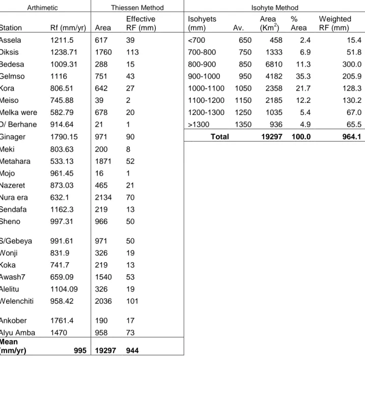
Figure 3. 7 Comparison of rainfall and temperature with altitude for selected stations . 41 Figure 3. 8 Thiessen polygon and Isohytes ... 44
Figure 3. 9 Twenty years of annual aerial rainfall trend of selected stations ... 45
Figure 3. 10 Temperature and sunshine at selected stations ... 46
Figure 3. 11 Relative humidity and windspeed of selected stations ... 47
Figure 3. 12 Semi distributed soil-water balance model ... 55
Figure 3. 13 Water balance at different physiographic regions ... 58
Figure 3. 14 Hydrological balance computed by soil-water balance method ... 58
Figure 3. 15 Drainage system of the study area ... 61
Figure 3. 16 River daily hydrograph ... 65
Figure 3. 17 Correlation of rainfall with baseflow ... 66
Figure 3. 18 Flow duration curves of rivers ... 68
Figure4. 1 Water sampling sites ... 73
Figure4. 2 pH and alkalinity of water samples ... 78
Figure4. 3 Titration curves of representative water samples ... 79
Figure4. 4 EC and water temperature ... 81
Figure4. 5 Dendrogram of water samples. ... 86
x xx x
Figure4. 7 Diagrammatic representations of PCs ... 95
Figure4. 8 Projection of variables on PC plane ... 98
Figure4. 9 Piper plots of hydrochemical data ... 100
Figure4. 10 Water types at different physiographic locations. ... 100
Figure4. 11 Plots of hydrochemical variables on Durov diagram ... 101
Figure4. 12 Groundwater flow direction and evolution of hydrochemical facies ... 102
Figure4. 13 Main flow paths and hydrochemical facies. ... 106
Figure4. 14 Mole ratio of Na+ to Ca2+ against mole ratio of HCO3- to H4SiO4 plotted on mineral alteration curves. ... 109
Figure4. 15 Mexaqoma well log ... 111
Figure4. 16 Burqa Hora spring and reconstructed host ... 114
Figure4. 17 Fluoride level in water samples ... 119
Figure4. 18 Bivariate plots of water variables. ... 122
Figure4. 19 Distribution of fluoride and hydrochemical facies across the rift valley ... 124
Figure4. 20 Fluoride data fitted to exponential variogram ... 126
Figure4. 21 Geospatial distribution of fluoride in Middle Awash basin ... 127
Figure4. 22 Kriging standard error map of fluoride distribution ... 128
Figure5. 1 Partial charts of elements. ... 130
Figure5. 2 Isotope composition of evaporated surface water water, the original precipitation prior to evaporation, and the evaporated vapor. ... 133
Figure5. 3 Isotopic variations of local meteoric waters ... 134
Figure5. 4 Water sampling sites for stable isotope analysis ... 137
Figure5. 5 Local meteoric waters and recharge system ... 139
Figure5. 6 Plots of stable isotopes. ... 140
Figure5. 7 Mechanisms of rock-water reactions involving isotope exchanges ... 144
Figure5. 8 Isotope composition of Lake Beseka in different years ... 145
Figure5. 9 Tritium sampling sites... 147
Figure5. 10 Tritium content in selected samples ... 148
Figure5. 11 Hydrochemical and isotope of waters at different locations... 150
Figure 6. 1 Location of wells and VES sites ... 154
Figure 6. 2 Geoelectric sections and groundwater flow direction at selected sites. ... 157
Figure 6. 3 Effect of geological structures on groundwater miniralization... 163
Figure 6. 4 correlation of transimissivity computed by empirical equation and analytical methods ... 167
Figure 6. 5 Exponential variogram model fitted to hydraulic data ... 167
xi xixi xi
Figure 6. 7 Main groundwater flow direction of the study area ... 171
Figure 6. 8 Conceptual groundwater flow models along regional flow and across the rift floor ... 172
Figure 7. 1 Location map of Adama-Wonji basin ... 176
Figure 7. 2 Geological map of Adama-Wonji basin ... 178
Figure 7. 3 Location of groundwater monitoring wells and groundwater level in different years ... 181
Figure 7. 4 2D imaging transects and stations ... 183
Figure 7. 5 Interpreted 2D inversion ... 186
Figure 7. 6 Geoelectric sections from 2D imaging ... 189
Figure 7. 7 1D curve and its corresponding lithology ... 190
Figure 7. 8 Electrical sounding stations and geoelectric sections ... 191
Figure 7. 9 Conceptual model of the hydrological system of Adama-Wonji basin ... 196
Figure 8. 1 Finite difference model grid ... 201
Figure 8. 2 Model boundary conditions ... 205
Figure 8. 3 Model properties ... 209
Figure 8. 4 Residual statistics for uncalibrated model ... 211
Figure 8. 5 Model calibrated statistics ... 212
Figure 8. 6 Plot of observed vs residual and cumulative sum of squared residuals .... 215
Figure 8. 7 Groundwater head contour contour from calibrated model ... 217
Figure 8. 8 Location of sub basins ... 218
Figure 8. 9 Adama-Wonji basin groundwater head distribution from calibrated model (and model sensitivity ... 220
Figure 8. 10 Adam-Wonji basin groundwater head profile and flow direction along selected direction ... 220
Figure 8. 11 Head statistics for calibrated model ... 221
Figure 8. 12 Welenchiti basin groundwater head distribution from calibrated model and model sensitivity plot ... 223
Figure 8. 14 Welenchiti head statistics for calibrated model ... 224
Figure 8. 13 Welenchiti basin groundwater head profile and flow direction along selected directions... 224
Figure 8. 15 Beseka lake level changes ... 226
Figure 8. 16 Beseka basin groundwater head distribution from calibrated model and model sensitivity plot. ... 227
Figure 8. 18 Beseka basin calibrated model head statistics ... 228
xii xii xii xii LIST OF TABLES
Table 3. 1 Effective rainfall of the study area ... 43
Table 3. 2 PET by Heat index method... 50
Table 3. 3 PET by Penman method ... 52
Table 3. 4 Major land cover, soil type and field capacity ... 56
Table 3. 5 AET, P, PET and recharge for representative regions ... 57
Table 3. 6 Hydrograph components of rivers and catchment effective rainfall ... 63
Table 4. 1 Field measured water parameters ... 76
Table 4.2 Descriptive statistics of hydrochemical variables; EC is in µS/cm, T in 0c and the others are in mg/l ... 84
Table 4.3 Summary statistics of major hydrochemical variables of cluster groups; Water type is based on the dominant ions. T (0C) and the rest (mg/l) ... 90
Table 4. 4 Correlation matrix of variables ... 91
Table 4. 5 Eigenvalue of PC before varimax rotation ... 94
Table 4. 6 R-mode varimax of PC loadings after rotation ... 94
Table 5. 1 Approximate ground waters recharge age for continental areas based on tritium values ... 147
Table 7. 1 Groundwater level measured in Wonji irrigation ... 180
Table 8.1 Estimated recharge for four physiographic regions imposed to the model .. 208
Table 8. 2 Water balance of the Middle Awash basin (M3/yr) ... 216
Table 8. 3 Adama Wonji sub basin model calibration statistics and water balance ... 221
Table 8. 4 Welenchiti sub basin model calibration statistics and water balance ... 225
xiii xiii xiii xiii LIST OF APPENDICES
Appendix 1 Land use and land cover map processed from MSS Landsat image ... 257
Appendix 2 Major soil types of the study area ... 257
Appendix 3 Simplified geological map of Ethiopia ... 258
Appendix 4 Rainfall data ... 259
Appendix 5 Effective rainfall of the stations computed by Thiessen method ... 260
Appendix 6 Mean daily temperature of selected Stations ... 260
Appendix 7 Sunshine ... 261
Appendix 8 Monthly mean Wind speed measured above 2 m ... 261
Appendix 9 Relative humidity ... 261
Appendix 10 AETfrom river discharge ... 262
Appendix 11 Plot of total Monthly River discharge ... 263
Appendix 12 River total monthly flow ... 264
Appendix 13 Hydrochemical data ... 266
Appendix 14 Distribution histogram of variables and their correlation with field parameters ... 268
Appendix 15 Fluoride data obtained from Water Resources Bureau used as supplementary data in geospatial kriging ... 269
Appendix 16 Boreholes in Adama-Wonji basin ... 270
Appendix 17 Well data, with T determined from specific capacity (Sc) ... 271
Appendix 18 Transmissivity determined by analytical method ... 275
Appendix 19 Simplified hydrogeological map of the Middle Awash basin ... 277
xiv xiv xiv xiv ABBREVIATIONS
AET Actual Evapotranspiration
CIFEG Centre International pour la Formation et les Echanges en Geoscience DEM Digital Elevation Model
EC Electrical Conductivity
EELSS Electrolytic Enrichment and Liquid Scintillation Spectrometry
Eh Redox Potential
ET Evapotranspiration
FAO World Food Organization FDC Flow Duration Curve
Fig Figure
GIS Geographic Information System GMWL Global Meteoric Water Line
GNIP Global Network of Isotopes in Precipitation
GV Groundwater Vistas
HCA Hierarchial Cluster Analysis
HS Hydrograph Separation
ITCZ Inter-Tropical Convergence Zone K Hydraulic conductivity
LMWL Local Meteoric Water line LWIA Liquid-Water Isotope Analyzer m asl meter above sea level
m bgl meter below ground level
MAWARI Management of Water Resources in East African Rift System
mcm million cubic meters
mS Milli Siemen
m/s meter per second
MER Main Ethiopian Rift Mg/l Milligram per litre
xv xv xv xv
OWRB Oromia Water Resource Bureau
P Precipitation
PCA Principal Component Analysis PET Potential Evapotranspiration
pH Pondus Hydrogenium
RF Rainfall
RH Relative Humidity
Sc Specific capacity
SMOW Standard Mean Ocean Water TDS Total Disolved Solids
TU Tritium Unit
VES Vertical Electrical Sounding
VSMOW Vienna Standard Mean Ocean Water WFB Wonji Fault Belt
WHO World Health Organization
WMO World Meteorological Organization
WWDSE Water Works Design and Supervision Enterprise YTVL Yerer Tulu walel Volcanic Lineament
µS/cm Micro Siemens per centimeter
Ωm Ohm-meter
Location with synonyms name
1 11 1
2 22 2 CHAPTER ONE General Introduction 1.1 Background and Concept
Ethiopia is thought to have abundant groundwater resources that can be useful for domestic, industrial and agricultural purposes. The availability of high rainfall, favorable environmental features including geology, topography and climate conditions could be factors for the occurrence of voluminous groundwater resources in the country. Ethiopian aquifers are categorized into three broad groups as sedimentary, volcanic and metamorphic aquifers (Alemayehu, 2006). The sedimentary aquifers are widely common in east and north central regions of the country. The ground waters from this aquifer are generally mineralized compared to ground waters from other aquifers. The volcanic aquifers occupy the central part including the Ethiopian Rift valley and extend to southwest, west and northwest. Volcanic aquifers are commonly considered as productive aquifers due to their location in high rainfall region as well as the acceptable chemical constituent of water from this aquifer. The Metamorphic aquifers are limited to north, west and southern periphery of the country. These are the least productive aquifers mainly due to the non water bearing nature of the metamorphic rocks.
Middle Awash basin is one of the drought prone areas marked by considerable water supply problems. Due to the erratic nature of rainfall, surface waters are general scarce and unreliable thus groundwater remains the sole resource supplying water for domestic and livestock. However, the effective use of groundwater has been hampered due to the complex nature of aquifers of this basin. The geological system is much complex and the functioning of groundwater with this multifaceted volcanic rocks is not adequately explored which leads to difficulties in identifying productive aquifers. Broadly, three common hydrogeological challenges are recognized in the Middle Awash basin: 1) Groundwater flow is strongly controlled by geological structures, a condition leading to equal chance of a “hit or miss” opportunity of productive aquifers. 2) Strong interaction of groundwater with magmatic materials is impairing groundwater quality 3)
3 33 3
Perturbation of hydrological systems induced by recent tectonics and anthropogenic activities. These leads to escalation of water supply shortage, financial wastage while drilling unproductive wells, and retard development.
These are some of the reasons for selecting Middle Awash basin as the study area mainly to describe the hydrogeological system of the basin towards improving the understanding of aquifer system and its function with environmental features.
1.2 Rationale and Relevance of the study
The hydrogeological functioning and aquifer system of the Ethiopian Rift Valley are generally complex compaired to other aquifer systems located outside of this rift system. This is mainly due to the occurrence of groundwater in complex rift volcanic products highly controlled by geological structures. A project, called MAW ARI (Sustainable Management of W ater Resources in the East African Rift System), a jointed project between Ethiopia, Kenya, and Djibouti funded by French Ministry of Foreign Affairs was initiated in 2003 to study the groundwater resources in East African Rift. The Ethiopian component of this project was to undertake systematic groundwater investigation in selected sites of the Ethiopian Rift towards understanding the hydrogeology of the rift and adjacent highlands which includes the Middle Awash basin, and this Ph.D is part of this project.
Middle Awash basin is one of the drought hubs of the country where groundwater becomes the sole water supply sources for nearly one million populations living in this basin. However, aquifer system and groundwater occurrence including mode of its interaction with rift volcanic products are not yet adequately explained. Existing well data show that groundwater distribution and quality are highly variable over short distance and drilling of productive and non productive aquifers has got equal chances in this basin. Tectonic structures are playing profound control on groundwater movement acting either as barrier or conduit as well as cause preferential flow system.
4 44 4
Thus, understanding the hydrogeological system and characterization of quifers according to their mode of occurrence and groundwater quality is crucial for sustainable and effective use of groundwater resources of the area. To this end, this research intended to describe such hydrogeological information towards reducing the uncertainty of understanding the hydrogeological systems of the basin. It is anticipated that this research provide valuable hydrogeological information useful for sustainable and effective use of groundwater resources as well as it can be a reference for hydrogeological studies that will be conducted in similar hydrogeological settings.
1.3 Previous study
Previous hydrogeological and related studies conducted in the Middle Awash basin and its adjacent areas have been assessed and some of them relevant to this research are summarized below. Kebede et al., (2005) conducted hydrogeological study towards understanding groundwater origin and flow along selected transects in Ethiopian volcanic aquifers. This study partly discussed on the origin and hydrodynamics of ground waters draining the western watershed of the study area. The study explains that ground waters are getting recharge from recent rains that falls on plateau areas and fast groundwater circulation system via faults. Alemayehu et al., (2006) reported the hydrochemical and lake level changes in Ethiopian Rift induced by anthropogenic activities together with recent geological activities with particular emphasis given to Lake Beseka. Similar study by Ayalew (2009), show that Lake Beseka is getting excess inflow of groundwater much higher than its outflow component. Ayenew (2004), Legesse and Ayenew (2006) reported the improper water resources utilization practices and environmental problems in the Ethiopian Rift. According to these studies, excessive land degradation, deforestation and over-irrigation are changing the hydrometeorological setting of the Ethiopian Rift. A number of studies (Haimanot et al., 1987; Gizaw 1996; Ayenew 1998; Cherent et al., 2001; Wondwossen et al., 2004; Rango et al., 2009), reported high level of fluoride in ground waters of the Ethiopian rift valley causing serious health problem.
5 55 5
The geology with geological structures of the Main Ethiopian Rift including the study area have been described by different studies including Kazmin, (1979), Damte et al., (1992), Abebe et al., (1998), Boccaletti et al., (1999), Acocella et al., (2002), Coulie et al., (2003), Chorowicz, (2005), Abebe et al., (2005), and Abebe et al., (2007). The geological map of the study area is developed from these studies.
In general, previous hydrological studies were focused on the hydrochemistry of lakes, interaction of ground waters with lakes, assessment of anthropogenic impact on natural lakes and groundwater origin and its flow dynamics in the western part of the watershed and none of them described the general hydrogeological system of the Middle Awash basin. All the previous studies relevant to this work are referenced in this thesis.
1.4 Objective
Being located in the active volcano-tectonic centre of the East African Rift valley, Middle Awash basin has complex hydrogeological systems. Groundwater occurs in multifaceted manner and its quality is highly variable affected by the volcanic and geothermics. Thus, the main objective of this study is to assess and characterize the aquifer systems, mode of groundwater movement and functioning with volcanic materials as well as evaluate the interaction of groundwater with surface waters.
Specific objective includes:
• Describe the major water bearing units and characterize aquifers systems
• Analyze recharge-discharge system with various environmental factors controlling groundwater movement
• Assess physiochemical property of groundwater with source and mode of distribution of hydrochemical variables.
• Study surface water- groundwater interactions.
• Assess the impact of human activities on groundwater flow regimes
• Characterize aquifer systems according to physiographic location, lithology and hydrochemical properties.
6 66 6
• Analysis role of rift volcanic products on the circulation of groundwater
• Assess the groundwater mass balance (water budget) of the study area including selected sub basins which have more hydrogeological importance.
1.5 Limitation
Scarcity of data, access to sampling sites, unevenly distribution of the data point and lack of geological information at adequate scale were the major encountered problems. Data limitations and the encountered problems are elaborated under their respective chapters of this thesis.
1.6 Methodology
Middle Awash basin is an area where geological formations, tectonic structures and relief features are highly complex. In such volcanic environment where geology, geological structures, physical features and hydrogeological conditions are highly diversified, application of single method could not properly address the actual field condition. Hydrogeology of complex volcanic system can be more explored through application and integration of multiple disciplines. Thus, an effort has been made to apply various disciplines and synchronize results from each datasets to describe the hydrogeological system of the study area representing the most likely field condition (Figure 1.1).
Prior to field data acquisition, preliminary surveys were conducted including literature review, interpretation of physical features from satellite images, geological descriptions, well data analysis, understand the geomorphologic and environmental features. Field observation, measurement and data collection from available sources were conducted to get the most reliable result.
7 77 7
Literatures and previous relevant researches were assessed to learn more on major issues to be addressed as well as methods to be applied in describing volcanic aquifers. Satellite images were used as baseline to identify geological structures, relief features and topographic slopes to understand geospatial hydrological factors. Land use and land covers were generated from satellite image processed under IDRISI Andes and GIS software. Land cover features together with meteorological elements were used to assess recharge system and hydrological process of the area. Geological structures including faults, lineaments and fissures controlling groundwater movement were traced in the initial stage from Landsat image with 30m ground resolution which was later validated from literatures and field observations. Hydrological data including meteorology and river discharge were used to assess varies form of hydrological components including recharge.
Hydrochemical and isotopic data were used to understand groundwater origin, spatial variation and aquifer characteristics as well as groundwater flow processes. Spatial variations of aquifer parameters, aquifer type, piezometeric surface, lithostratigraphy of the aquifer including boundary condition and lateral extension were examined by combining with geophysical result. Details of methodology, sampling and analytical techniques have been discussed under their respective chapters and sections.
As the lateral and vertical units of volcanic formations are highly variable, geophysical survey was conducted to improve the understanding of the role of subsurface geological materials on groundwater movement. Toward this, 2D tomography and deep electrical sounding were carried out at selected areas where further information on subsurface hydrogeological conditions was required. Result from geophysical survey was combined with other datasets such as well data, geology and hydrochemistry to characterize the aquifer system and subsurface geological structures according to their
8 88 8
hydrogeological significance. These were the integeral part of the study towards proper characterization of the hydrogeological system of the basin. Methodology and workflow is outlined in Figure 1.1
1.7 Materials and Tools
Water samples were collected in clean and dry standard HDPE plastic bottles. Geophysical survey was conducted using the SYSCAL R1 PLUS Switch-72 IRISI unit which has typical resistivity accuracy of 0.5% and performs noise reduction through continuous stacking selectable from 1 to 255 stacks.
Various softwares were employed to assist processing and mapping of the datasets. Land use and land cover features were classified from satellite images under IDIRSI Andes, while hydrochemical variables were analyzed under Aquachem V.5.1(W aterloo 2006) and STATISTICA data analysis software version 8 (Stat Soft Inc.2008). Geophysical anomalies were processed under PROSYS and RES2DINV soft wares which perform pseudo-section inversion to true resistivity and 2D pseudo-section respectively (www.iris-instruments.com). Aquitest Pro (W aterloo 2002) and MODFLOW soft ware (McDonald and Harbaugh, 1988) build in Groundwater Vista (GV) were used to analyze aquifer parameters and perform numerical groundwater flow modeling, respectively. GIS soft wares such as ArcView 3.2 and ArcGIS 9.2 (www.esri.com), Surfer 8 (www.goldensoftware.com), VarioW in (www-sst.unil.ch/research/varioW in/index.html), and Excell were other softwares used for quarrying, analyzing and mapping spatial data.
9 99 9 FDC FDC FDC FDC
River hydrographRiver hydrographRiver hydrographRiver hydrograph anly.anly.anly.anly.
Hydrodynamics HydrodynamicsHydrodynamics Hydrodynamics Rock-water interaction Geology O ut li n ed h y d ro ge o lo gi ca l sy st em o f M id d le A w as h O ut li n ed h y d ro ge o lo gi ca l sy st em o f M id d le A w as h O ut li n ed h y d ro ge o lo gi ca l sy st em o f M id d le A w as h O ut li n ed h y d ro ge o lo gi ca l sy st em o f M id d le A w as h b as in b as in b as in b as in Hy d ro lo H y d ro lo H y d ro lo H y d ro lo b al an ce b al an ce b al an ce b al an ce
Geophysics (2D Tomography & VES) Subsurface stru. & Aquifer geometry
Well data
(Aquifer property, lithology))))
Recharge syst.Recharge syst.Recharge syst.Recharge syst.
Recharge/Source analy.Recharge/Source analy.Recharge/Source analy.Recharge/Source analy.
Water isotope
Water isotopeWater isotope
Water isotope
Flow dynamicsFlow dynamicsFlow dynamicsFlow dynamics Recharge Syst.Recharge Syst.Recharge Syst.Recharge Syst. Aquifer Charact. Aquifer Charact. Aquifer Charact. Aquifer Charact. Hydrochemical SystemHydrochemical SystemHydrochemical SystemHydrochemical System
Water qualityWater qualityWater qualityWater quality
Hydrochemistry
Recharge estimRecharge estimRecharge estim. Recharge estim
Rationale & Objective Methodology Output
• Aquifer characterizationAquifer characterization Aquifer characterizationAquifer characterization
• Hydro.connectivityHydro.connectivity Hydro.connectivityHydro.connectivity
• Recharge systemRecharge system Recharge systemRecharge system
• Mass balanceMass balance Mass balanceMass balance
Literature review
Satellite image
Physical Des. Physical Des.Physical Des. Physical Des. Surface aspect Surface aspectSurface aspect Surface aspect RF & T analys. RF & T analys.RF & T analys. RF & T analys.
Lithological Lithological Lithological Lithological Structural Des. Structural Des.Structural Des. Structural Des. Meteorology (RF, T, SS, RH, WS) River hydrology Drainage system Drainage system Drainage system Drainage system
10 10 10 10
1.8 Structure of the thesis
This thesis is structured into 8 chapters. The first two chapters provide general overview starting with the background of the study area and objective of the study whereas chapters 3 to 8 are about observations and implications. Main problems, objective and methodology are outlined in chapter 1 whereas general introduction including location and description of physical features including geology of the area are provided in chapter 2.
Chapter 3 is devoted in description of meteorological and river hydrograph towards understanding the hydrological behaviour of the study basin. In this chapter, main meteorological elements including precipitation, humidity, temperature, windspeed and sunshine and evapotranspiration are discussed in details to realize the various hydrological components.
Chapter 4 is the subjects of hydrochemistry which deals about the statistical association among hydrochemical variables and water families classified according to their chemical behavior. Hydrochemical characteristics of aquifers in different location with their hydraulic relationships and geochemical reactions are elaborated under this chapter. Chapter 5 describes result from water isotopes with detail discussion on the implications of isotopic data from different locations and sources.
Chapter 6 explains the aquifer system of the basin and provides the conceptual groundwater model from the converging evidence of different datasets. This conceptual model is transformed to numerical groundwater flow model which is described under Chapter 8. In chapter 7, detail description of the hydrogeological system of Adam-Wonji sub basin is elucidated which includes the hydraulic relationship between irrigation water and groundwater in Wonji wetland. Groundwater in this sub-flow system show sign of rise in water table thus 2D tomography was conducted to understand the position of groundwater head under wonji irrigation field and its lateral profile to
11 11 11 11
understand the extent of hydraulic connection between irrigation water and groundwater. Major hydrgeological factors like faults and fissures are mapped and their hydrological roles have been illustrated under this chapter.
The thesis ends with conclusion and prospects giving emphasis on basic issues to be improved for further detail hydrogeological study of this same basin.
12 12 12 12 Chapter 2
Physical description of the study area 2.1 Location
The study area, Middle Awash basin, is located in north central part of the Main Ethiopian Rift (MER) within the geographic limits of 70, 50’ to 90, 40’N latitude and 380, 55’ to 400, 45’E longitude and has an area of 19,297 Sq km (Fig 2.1)
Figure 2. 1 Location map of study area
13 13 13 13 2.1 Physiography
The Miocene massive geological process of the rift generates the buildup of three distinct slices of geomorphologic series in central Ethiopia recognized as plateau, escarpment and rift floor ranging in altitude from 700 to 4200 meter above sea level (Figure 2.2).
A AA A
14 14 14 14
These physiographic configurations create three distinct river basins bordering the study area. The Blue Nile basin located northwest of the study area drains westward from northern highlands whereas the Wabeshebelle basin drains eastwards from Arsi, Bale and Hararghe highlands. The south part of the study area drains to lakes basin
For the study area, the intermittent volcano-tectonic processes of the rift forms land deformations into successive pieces of stratum land masses stacked one after the other each with physio-climatic varieties. These pieces of land masses can be grouped into three main physio-climate divisions based on the relative frequency of air mass within geographic location.
The plateau (Highlands)
This physiographic group shares about 12% of the study area and includes mountain masses above 2000m a.s.l. It is characterized by humid climate with annual rainfall above 1500mm and temperature below 16 0c. The northwestern margin of the study area around Sendafa, Ankober and the Arsi highland in southeastern margin belongs to this group.
The escarpment
This region shares about 14% and marked by moist climate with air temperature ranging from 160C to 240C and annual rainfall of 1000 to 1400mm. It is sited between plateau and rift floor and comprises landmass with elevation ranging from 1500-2000m a.s.l.
The rift floor
This physiographic group shares 74% of the total area and encompasses the main rift valley with elevation below 1500m a.s.l. This land group is notable by flat terrain with patch of volcanic dome and calderas widely distributed witin the area. As this region shares large portion of the study area, the hydrogeological systems of the basin is largely tailored by surface physical conditions and geological systems of this physiographic group. The rift floor
15 15 15 15
can be considered as hot and arid zone as it has the highest temperature above 240C with low annual rainfall below 900mm.
Watersheds of the Middle Awash basin function according to semi-arid, two-season tropical type climate, with cool wet summer and dry warm-to-hot winter. Air moisture is greatest at the highlands and decreases towards the rift floor. High precipitation occurs between June to September, with rainfall magenitude varying significantly throughout the watershed affected by topographic features.
2.2 Land cover of the study area
Rift valley including the study area is a typical environment whereby land features co-exist in complex manner. Physical features lack textural variability but found highly intermixed. In such environmental conditions where land cover features lack discrete boundaries, digital satellite images can be a useful tool for land cover discrimination (Lillesand and Thomas 2000).
Land features are important hydrological factors. Type, size, location and attribute of land covers play significant role on hydrological flow conditions. Type of surface features and their location determine the recharge condition, have impact on water budget of the area through triggerring varies hydrological processes such as runoff, infiltration, recharge, discharge and evapotranspiration (Sikdar et al., 2004). Land covers determine the amount of rainfall infiltrating into the soil (Melesse et al., 2003). Thus, identification of physical surface features is essential for proper understanding of the hydrgeological system of a basin as land cover features are the initial factors in hydrological processes. Detailed morphometry of land surface information is especially important to understand the initial hydrological condition and characterize the area according to their hydrological response.
16 16 16 16
MSS Landsat image with 30m resolution acquired in 2004 was used for land cover classification of the study area. Prior to land feature classification, images were processed and enhanced to improve the visual interpretation capability. Automated classification was performed by supervised classification methods whereby signatures groups from composite image have been evaluated with known selected ground features. Six major land cover types have been identified as lakes, irrigation land, open forest, Agricultural land, rock exposure and grass and bush land and these land features were assigned as signature groups with which the software compares and classify the whole land cover features of the study area.
The automated output provides much diffused land features highly interspersed to each other which is difficult to discern and classify features in accordance to their hydrological response(Appendix 1). To enhance the discrimination between land features groups, the automated results were further reclassified into major land features groups under GIS in accordance to their frequency of occurrence that can be readily interpreted (Fig 2.3).
17 17 17 17
Figure 2. 3 Major land use and land cover
From the classified land features shown on Figure 2.3, rocky outcrops occupy large part of the study area principally at escarpments and rift floor. This corresponds to the mountain volcanic massive and volcanic deposits in the rift floor.
18 18 18 18 2.3 Slope Analysis
Local topographic features such as slope and topographic aspect play a crucial role in hydrological processes (Martin et al., 2009). Surface runoff, infiltration and evaporation processes are affected by topographic slope and hillside condition. The routing of water over a surface is closely tied to surface form (Wood, 1996). Hydrological responses on the valley-head and hill slope reflect their respective topographic characteristics and varied with the slope, hillside condition and rainfall magnitude (Martin et al., 2009). Runoff from the plateau and escarpment occurs rapidly while rift floor shows little response in storm runoff. The differences in the runoff responses could be caused by differences in the hill slopes.
Understanding the linkage between hydrological flow processes and hill slope is important to realize the various hydrodynamics components of the area. Physiographic features with steep slope triggers surface runoff while gentle slope and flat plains favor either vertical recharge or evaporation depending on their physical features and attributes. Topographic slope was generated from the DEM of the study area processed under IDRISI Andes software and this has been further reclassified into three major topographic groups under GIS based on the ranges of inclination (Fig 2.4).
19 19 19 19
As shown on Figure 2.4, about 74% of the study area is flat terrain with slope less than 3°. Thus, vertical local recharge and strong rock w ater reaction are normally expected in this region because of low hydraulic energy leading to long residence time and slow moving of ground waters. On the other hand, highlands and escarpments are characterized by gentle slope (3 to 10°) which coul d enhance both infiltration and surface runoff depending on their physical attributes and land cover types. The northwest, south and east plateau areas have steep slope greater than 10°. Surface runoff can be the main hydrologic component to be triggered in these terrains. However, these areas are relatively covered by dense vegetation that can deter runoff and enhance infiltration. These physiographic slopes have been considered in assessment of the hydrogeological system of the study basin.
Rift floorRift floorRift floorRift floor
SlopSlopSlopSlopeeee <3<3<3<30000
EscarpmentEscarpmentEscarpment Escarpment
SlopSlopSlopeeee 3Slop 333----101010100000
PlateauPlateauPlateauPlateau
SlopSlopSlopSlopeeee>10>10>10>100000
Alt (m a.s.l)
20 20 20 20 2. 4 Soil type
Soil has significant role in altering the natural water that has come in contact with soil layer. As soil is the top part of ground layers with which surface water and rainwater interact in the first time during its downward movement, it has an ultimate effect in altering the hydrochemistry of water (Freeze and Cherry, 1979). Depositional places and soil composition, thickness, and soil textures can have significant influence on hydrological processes.
According to FAO (1998) soil classification, nine major soil groups are identified in the study area (Appendix 2). Leptosols and cambisols are the predominant soil group in central lowlands where hydraulic gradient is very low. These soil group composed of thick silty-clay (Fig 2.5, left) which can retain water on the surface for prolonged time period (Figure 2.5, right), a condition which allows water to lost through evaporation
The poorly developed sandy cambisols covers large areas of the central north low lands in the rift floor. This soil has thin horizons and often found with rock fragments. The southeast highlands and some localities in western plateau are mainly covered by vertisols soil group.
Surface waterlog Surface waterlogSurface waterlog Surface waterlog
21 21 21 21
2.5 Geology and geological structures 2.5.1 Introduction
Precambrian basement is the oldest formation found underlying all rocks in Ethiopia. Few exposure of this formation is found in south, west and north periphery of the country (Appendix 3). Paleozoic period is generally marked by non depositional and erosional period, thus only few units of this period as lower sandstone and clay stone are observed in north, west and in the eastern Ogaden region (Alemayehu, 2006). Following the Paleozoic period, land subsidence took place in the beginning of the Mesozoic period which caused transgression of the sea to the land. This brought vast accumulation of different types of continental sedimentary rocks including limestone, sandstones, shales, mudstone and marl over the Precambrian basement (Kazmin, 1979).
Following Mesozoic, stretching forces driven by very slow creep of rocks hundreds of kilometers deep initiated in Afro-Arabian landmass (W illiams et al., 2004). This created the uplifting of Afro-Arabian continent with subsequent dissection and spreading of landmass which resulted in the opening of the main rift in the Pliocene period (Coulie et al., 2003; Abebe et al., 2005; Chorowicz, 2005). This geologic venture starts from the Red sea and Gulf of Aden in north and runs for about 6400 km southward. In Ethiopia, it forms a triangular depression of the Afar Triangle in northeast and runs across the country splitting the central Ethiopian lands into eastern and western mountain blocks with low-lying rift floor in the middle. As land dissection and spreading continued in response to tensional forces, extensive episodic volcanic eruptions took place accompanied by series of faulting which resulted in extensive extrusion of basalts along the tensional zones (Mohr and Wood, 1976; Abebe et al., 2005). This extrusive flood basalt associated with ignmbrite, trachyte, bereccia and rhyolite occupies large part of the Ethiopian plateau (Cornwell et al., 2006; Maguire et al., 2006). In the
22 22 22 22
rift, this rifting process is still ongoing which is believed to split the east African plate apart along the axis of the Rift Valley and will form a new ocean (Chorowicz, 2005). The date of the extrusion flood basalt in Ethiopian is not exactly known but it is believed to have taken a bit earlier to the rifting (Rogers et al., 2000), or connected with the onset of rifting in the Red sea and gulf of Aden (Coulie et al 2003). Rift and rift-like zones have undergone a complex evolution, with its historical roots in the early Precambrian
(Milanovsky, 1987). But, the Ethiopian rift system is believed to be initiated at
the end of the Mesozoic or beginning of the Tertiary which has developed to its current land form by episodic extensional tectonics (Backer and Wohlenberg 1971; Kazmin 1979; Kazmin et al., 1980; W oldegebriel et al., 1990; Abebe et al 2005). The episodic volcano-tectonic activities produced diverse volcanic sequences largely fissural basalts stocked one over the other with volcanoclastic deposits (Jon et al., 1982).
The Ethiopian highlands are largely underlain by trap series of the Oligocene-Miocene age which rest uncomformably over the Mesozoic sedimentary rocks (Woldegebrielet al., 2001). This Trap series volcanic consists series of lava flows mainly flood basalt ignmbrite, trachyte and rhyolite (Mohr, 1970). In the central and southern plateau margins, these rocks are mainly basalts trachyte, ignmbrite rhyolite, ash and pyroclastic deposits.
During rift development, rapid subsidence of rift floor was accompanied by the formation of shield volcanoes in central part of the Main Ethiopian Rift and on both side of the mountains bounding the rift (Kunz et al., 1975). The eruptive phase of crustal extension to the east of the proto-rift gave rise to the extinct Pliocene trachyte shield volcanoes of the eastern highlands which rest on the trap basalts. This includes the Chilalo and Badda volcanoes.
23 23 23 23
2.5.2 General geological setting of the study area
The geology of the study area and its lithostratigraphic profile (Fig 2.6) is constructed from the combination of varies geological maps including geological map of Nazert (Kazmin and Berhe, 1978), geological map of main Ethiopian rift (Abebe et al., 2005), geological map of Dera (Damte et al.,1992) as well as geological information from publications (Abebe et al., 1998; Woldegeabriel et al., 1992; Kinnaird 1998; Mahatsente et al., 1999; Mario et al., 1999; W hite 2001; Acocella et al., 2002; Acocella et al., 2003; Korme et al., 2003; W illiams et al., 2004; Abebe et al., 2007).
Middle Awash basin is marked by diversified geology and complex geological structures resulted from immense and versatile volcano-tectonic activities of the Oligocene period (Milanovsky 1987; Chorowicz 2005). In place, trace of this volcano-tectonics is still manifested in rift floor in the form of new volcanic eruptions, steams, thermal waters and fissures. This ongoing extensional rifting is causing a progressive crustal thinning in the rift floor and spreading of landmasses (W illiams et al., 2004; Pan et al., 2002).
In general, rocks ranging in age from Cretaceous to recent form the geological framework of the study area (Fig 2.6). Vast areas of the rift floor are covered by highly intermixed volcanic products of recent age including pumice, scoria, tuff, ignimbrite and volcanic ashes. In many places of the rift floor, the fissural basaltic lava flows stacked over these volcanos-ejects (Abebe et al., 1998). In highland area, the plateau basalt is found interspersed with large accumulation of ignimbrite and rhyolite which unconformably overlay the trachyte (Abebe et al., 2007).
24 24 24 24 2.5.3 Stratification
The geological activity of the rift valley resulted in the formation of two major land groups. The central main rift valley trending NNE-SSW and the mountain block bounding the rift floor. The rift valley is covered by recent formation mainly the volcano-clasts (Acocella et al., 2002). The massive volcanic formation commonly basalt, trachyte and ignimbrite that range from Oligocene to Holocene occupies the mountain blocks (Kazmin, 1979).
2.5.3.1 The Cretaceous formation
This is the lowest formation in the study area found unconformably overlying the crystalline basement (Abebeb et al., 2005). It consists of the Amba Aradam sandstone, conglomerates and shale. The volcanic shield mainly basalt and trachybasalt of the Gumbi chains found overlying this formation. An outcropping of Cretaceous formation is limited to the north east margin of the study area south of Bordede.
2.5.3.2 The Miocene-Pliocene formation
This is the Alajae volcanic group that consist of the transitional and sub alkaline basalts associated with rhyolite and trachyte. Exposures of these units are observed at Bordede and Abomsa highlands in the east and Ankober and Chefe Donsa in the west. The major unit of this formation is the Neogene group which occupies wide area of the study area. This group comprises the Malba Arba Gurcha formation, Termaber Megezez formation, Afar series, Nazert series, Chilalo formation, Mursi and Bofa basalts. The Malba and Arba Guracha formation is the oldest of this group found in northwest mountain chains of Sendafa, Ankober and in north east escarpments of Abomsa, and Sire highlands. The dominant unit of this group is the rhyolite domes with subordinate basalt. The transitional and alkaline basalt of Termaber Megezez formation unconformably overlies this unit and
25 25 25 25
few exposures are observed in some localities of north-west highlands of the study area.
The Nazert series covers the west and southeast area forming as buffer zone between escarpment and rift floor. This group consists of ignimbrite, unwelded tuffs, ash flow, rhyolite and trachyte. The Chilalo formation comprises the trachyte, trachybasalt, peralkaline rhyolite with subordinate alkaline basalts. Few exposures of this group are observed in central south and north marginal areas around Awash 7 town. The younger Mursi and Bofa basalt of the Neogene group is typically alkaline basalts and exposure is limited to south central part of the study area.
2.5.3.3 The Pliocene-Pleistocene formation
These formations make up the alkaline basalt and trachyte of the Bishoftu group. This unit is very rare in the study area but few exposures are found as volcanic hills in various places of the central east of the study area.
2.5.3.4 The Quaternary Formation
These are the youngest rock groups in the study area and comprise the late Pleistocene, Holocene and upper Quaternary formations. Vast areas of the rift floor are covered by the inter-spread of these geologic formations. The ignimbrite, tuff, pumice, scoria and pyroclastic rocks, commonly the Dino formations are the lower unit of this group. Exposure observed as volcanic domes in the central part of the rift floor while the undifferentiated alluvial, lacustrine and beach sediments of the Holocene formation cover the north central margin of the study area adjacent the Awash River. The plateau basalts are spatially distributed within the rift floor as volcanic hills. The alluvial and lacustrine deposits consists of sand, silt, clay, diatomite and beach sand deposited in south-central margin around lake Koka and in low land area near W onji, Merti, Abadir and Metahara.
26 26 26 26
27 27 27 27
In general, geology of the study area is grouped into three major units based on the chronology of main rocks that make-up the land masses (Fig 2.7).
The Western landmass: This landmass is generally composed of the young volcanic
product of the Miocene formation. The Nazert series of this group is exposed in south part near Nazert, north of Koka, and east of Addis Ababa, while the oldest Termaber-Megezez formation is exposed in northern part at Sendefa, Debre Birhan and Ankober plateau.
The Rift floor landmass: This is the youngest formations of the rift valley, composed of
rocks ranging from Chilalo and Badda trachyte of the upper Pliocene to youngest aphyritic basalt of the recent Quaternary formation. These groups are highly interspersed by the ongoing tensional volcanic activities.
The eastern landmass: This landmass is largely made up of the oldest rock unit that
ranges from the oldest Cretaceous Ambardam formation to the lower Miocene Anchar basalt. Exposure of this unit is not observable in western land masses and rift floor.