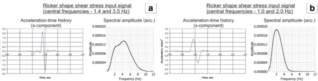
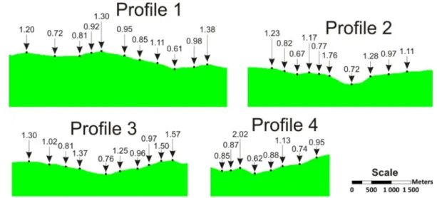
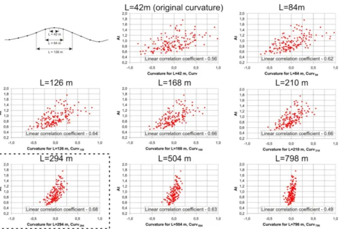
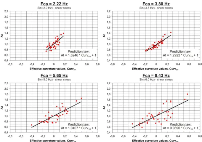
2D dynamic studies combined with the surface curvature analysis to predict Arias Intensity amplification
Texte intégral
Figure


Documents relatifs
Our model is composed of three parts: A structural model allowing the temporal representation of both topology and geometry; an event model that aims at detecting
Niculescu, “Survey on recent results in the stability and control of time-delay systems,” Journal of dynamic systems, measurement, and control, vol.. Niculescu, “Global asymptotic
On the other hand, the existing identification techniques for time delay systems (TDS) (see (Ren et al., 2005) for a modified least squares technique and a survey in (Belkoura
L. ON THE DISTRIBUTION FUNCTION OF SURFACE CHARGE DENSITY WITH RE- SPECT TO SURFACE CURVATURE.. A supplemntary elucidation is given in this paper t o explain why this
Secondly, given a confining magnetic field, we use Agmon-like estimates to reduce its spectral study to magnetic Laplacians, in the semiclassical limit.. Finally, we use this
In particular, the comparison between the volume entropy of the ambient space and that of the hypersurface will also gives a positive answer if the hypersurface M has bounded
Theorem 1 There exists a complete, properly embedded minimal surface in euclidean space R 3 which has unbounded Gauss curvature.. It has infinite genus, infinitely many catenoid
Crucial ingredients are the fact that a Cauchy–Lipschitz theorem for differential systems holds over divided power rings (Proposition 3.4) and the fact that Newton iteration can be
