HAL Id: tel-01586147
https://tel.archives-ouvertes.fr/tel-01586147
Submitted on 12 Sep 2017HAL is a multi-disciplinary open access
archive for the deposit and dissemination of sci-entific research documents, whether they are pub-lished or not. The documents may come from teaching and research institutions in France or abroad, or from public or private research centers.
L’archive ouverte pluridisciplinaire HAL, est destinée au dépôt et à la diffusion de documents scientifiques de niveau recherche, publiés ou non, émanant des établissements d’enseignement et de recherche français ou étrangers, des laboratoires publics ou privés.
Urban Transformations in the West Bank of Palestine,
Drivers and Consequences : a case of Ramallah Area
Mohammad Muhsen
To cite this version:
Mohammad Muhsen. Urban Transformations in the West Bank of Palestine, Drivers and Con-sequences : a case of Ramallah Area. Geography. Université d’Angers, 2017. English. �NNT : 2017ANGE0001�. �tel-01586147�
MUHSEN Mohammad
Mémoire présenté en vue de l’obtention du Grade de Docteur de l'Université d'Angers Sous le sceau de l’Université Bretagne Loire
École doctorale : Droit, Économie, Gestion, Environnement, Sociétés et Territoires
Discipline : Géographie physique, humaine, économique et régionale
Spécialité : Géographie humaine
Unité de recherche : Espaces et sociétés ESO-Angers (UMR 6590)
Soutenue le 21 mars 2017
Thèse N° : 133108
JURY
Rapporteurs : Raymonde SECHET, Professeur émérite, Université Rennes 2 Ahmad Abu HAMMAD, Professeur, Université de Birzeit
Examinateurs : Jean SOUMAGNE, Professeur émérite, Université d'Angers
Chadia ARAB, Chargée de recherche au CNRS, UMR ESO 6590
Directeur de Thèse : Christian PIHET, Professeur de géographie, Université d'Angers
Co-directeur de Thèse : Mustapha El HANNANI, Maitre de conférences, Université d’Angers
Les Transformations Urbaines en Cisjordanie ‘Palestine’
Facteurs explicatifs et conséquences :
1
Dedication
I would like To Dedicate This Thesis To My Country the Blessing Palestine.
2
Acknowledgement.
I would like first of all, to express my sincere gratitude and great appreciation for Professors Christian Pihet and Mustafa El Hanani for their wise, invaluable advice and supervision to achieve this thesis.
In addition, I am very grateful to the Department of Geography staff at Birzeit University-Palestine, particularly to Professor Ahmad Abu Hammad, for his advice, guidance and financial support to achieve this thesis.
I would like also to express my greatest thanks to my parents, to my family members, for sharing the burden of this research and utmost support while I was going through some tough times pursing my study. In addition, to all my friends who has supported me.
Finally, Special thanks to the French consulate in Jerusalem and Angers University for giving me the opportunity to accomplish my Ph.D. study into a cultural and social French academic atmosphere.
3
Abstract.
In the past two decades, Ramallah area have witnessed profound urban transformation, with increasing the percentage of urbanization. The advent of the PA in 1993 and the uneven political development amongst the Palestinian cities leads to the internal migration to the new urban area. This study is an attempt to understand and represent the process of transformation in recent Ramallah area during 1997 and 2015.
The process of transformation has been studied in particular case (Israeli Occupation) so as to understand its interrelation with the sensitive geopolitical situation on one hand, and the most urban and socio-economic transformation that accompanied this process on the other hand.
The study has been done to investigate the main objectives and to prove/ disprove the hypothesis of the study. To achieve this, the study analyzed the demographic changes by looking at the internal migration in two level, the impulsion and consequences. The study has then spatiotemporally analyzed the urban shifts during 1997 and 2015.
The study found that the advent of PA has accelerated the process of urbanization in Ramallah area due to the urban-urban and rural-urban internal migration, in fact; this process has been shown to be higher in Ramallah area than into other Palestinian cities.
Moreover, the finding emphasis on the urban expansion changes and trends, associated with the influence of the geopolitical factor as an important driver for the Palestinian urban and rural expansion.
A chronological analysis of the urban expansion characteristics of the study area had carried out, according to aerial photos analysis, at the same time has been combined with a number of urban models. The modelling has revealed that the urban expansions in Ramallah area has increased and lead to a distinctive urban pattern.
The study concluded that both the expansion demographically and spatially during 1997 and 2015 is an important period during which urbanization in Ramallah area significantly. The increasing population of Ramallah area has been resulted from the internal migration, and consequently led to an expansion of the built-up area, and the creation of new suburban areas that meet the requirement to become urban area as new rural-urban cities.
In sum, this study has provided a distinctive case for the theme of urban and socio-economic transformation under the case of political crisis into different domains and levels.
4
Le résumé.
Introduction
.Cette étude présente des éléments de compréhension du processus de transformation de la zone de Ramallah en Palestine après 1993, suite aux accords d'Oslo. L'introduction souligne l'énoncé du problème, les principaux objectifs de l'étude et l'importance de la méthodologie
L'avènement de l'Autorité palestinienne en 1993 suite au accord d’Oslo a conduit a une forte inégalité de développement entre les différentes villes palestiniennes et la région de Ramallah (qui comprend les localités de Ramallah, Al bireh et Betuniya) - ce qui a mené a des flux migratoires internes vers cette nouvelle zone urbaine. Durant les deux dernières décennies, les localités de cette zone ont connu une profonde transformation urbaine liée à l’augmentation de l'urbanisation. Cette étude tente de comprendre et de représenter le processus des transformations urbaines de la nouvelle zone moderne de Ramallah entre les années 1997 et 2015 sur le plan urbanistique et socio-économique, en tenant compte de la situation géopolitique, et en particulier l’occupation israélienne.
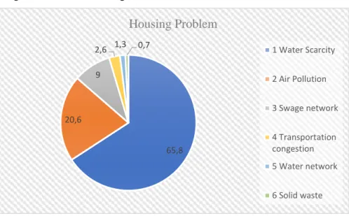
La région de Ramallah connait un taux d’urbanisation supérieur de 60 % à la moyenne nationale et internationale, et une densité de population de plus de 600 habitants/km² (à comparer avec la moyenne nationale qui est de 480 habitants/km²). Le nombre d'unités de logements construits entre 1997 et 2007 a été de 5916, ce qui représente un taux largement supérieur aux autres villes. Cette inégalité de répartition de la population pose de grandes difficultés à l’Autorité Palestinienne en terme de service public, par exemple les domaines de l’eau, l’électricité, ou encore le réseau d’eaux usées.
Selon le bureau palestinien de la statistique, la répartition en 2012 de la population palestinienne était la suivante :
53,5 % en zone urbaine. 30,3 % en zone rurale. 16,2 % en camp de réfugiés.
5
La région de Ramallah se positionne comme la plus séduisante pour attirer les candidats palestiniens à l’émigration interne, les conditions socioéconomiques s’y étant améliorées depuis 1993 avec l’établissement de l’Autorité Palestinienne dans la région.
Les statistiques sur l’ensemble de la Cisjordanie indiquent que 25.5% des migrants choisissent la région de Ramallah depuis 1993, alors que les régions à Hébron et de Bethléem étaient les plus attractives avant 1993.
Les années 90 ont connu de fortes vagues de déplacement interne vers la région de Ramallah, pour rechercher de meilleures conditions de vie et améliorer les revenus,selon les données de 2009 du Bureau Palestinien des Statistique on peut distinguer ici deux grandes périodes :
1-La première (1990-1993) correspond au temps précèdent l’arrivée de l’Autorité Palestinienne avec une immigration de 19,3 %.
2-La deuxième (1994-1997) après l’arrivée de l’Autorité Palestinienne, a vu cette immigration passée à 37,8%.
Les données de 2010 indiquent que la répartition des migrants selon leur provenance est la suivante 55,2 % des migrants internes sont issu des zones urbaines, 23,6 % des zones rurales et 21,2 % des camps de réfugiés.
Ces données révèlent de plus que 33 % des migrants sont généralement jeunes étant entendu qu’avec une moyenne d’âge qui ne dépasse pas 30 ans. Il y a une forte corrélation entre cette tranche d’âge et le niveau d’éducation, cela signifie que la majorité des migrants de moins de 30 ans ont un niveau élevé d’éducation, ce qu’il leur permet de prétendre à un meilleur emploi dans la région de Ramallah.
Le travail proposé ici s'intéresse aux changements que la Cisjordanie a subits depuis 1993, Notre champ d’étude concerne premièrement l’impact du facteur géopolitique dans la modification de l’urbanisme de la région de Ramallah, deuxièmes les conséquences socio-économiques de ce changement, et pour finir, le nouveau paysage urbain qui domaine cette région. L’étude est divisée en deux parties, contenant chacune trois chapitres.
La méthodologie utilisée pour répondre a nos différentes problématiques est basée sur les éléments suivante :
6
*Un travail sur le terrain avec des questionnaires.
*L’analyse de données statistique de différentes institutions.
*Le traitement d’images aériennes entre les années de 1997 et 2015. *Des références bibliographiques.
Ce travail à duré quatre années et a été réalisé grâce a la collaboration entre l’université d’Angers en France et l’université de Birzeit en Palestine.
Partie 1-L’évolution Histoire de la Palestine 1918-1993
Cette première partie donne une brève description de l'évolution chronologique du peuple palestinien et des enjeux socio-économiques urbains, ainsi qu’une analyse en profondeur de la zone d'étude avec un focus sur le rôle de l'occupation israélienne qui a contribué à la démarcation de la zone palestinienne.
1-1 historique du paysage urbain de la Palestine
Le paysage urbain et socio-économique de la Palestine entre 1918 et 1993 a connu trois changements, chacune de ces étapes ayant leurs caractéristiques et spécificités.
1-Le mandat Britannique 1918-1948
Cette période commence après la chute de l’empire ottoman et la prise du pouvoir par la Grande Bretagne .elle se caractérise par l’importance accordé par les Britanniques (sur les plans urbain et socio-économique) aux villes de Jaffa, Haïfa et plus encore Ramallah à la ville de Jérusalem. Les autres villes Palestinienne jouaient alors un rôle comme secondaire.
2- La gouvernance Jordanienne 1948-1967
La fin du mandat Britannique en 1948 a donné naissance à une nouvelle division de la Palestine en trois zones :
‘Etat d’Israël’ qui domine 76% du territoire avec comme principales villes Haïfa et Jaffa
Les 24% du territoire qui restant concernent la Cisjordanie, Jérusalem est demeurant principal pôle économique et urbain.
7
3- Le paysage politique palestinien 1967-1993.
Le paysage géopolitique durant cette période change avec la domination d’Israël sur l’ensemble du territoire palestinien. Cette situation a conduit à un changement radical de la Cisjordanie et de la bande de Gaza sur le plan urbain et socio-économique. Ce nouveau paysage a été dirigé et conduit par l’occupation israélienne. La Cisjordanie ce situe au centre de l’ancienne Palestine avec une superficie 5655km² et une population de 3 millions d’habitants. Elle est composée de onze agglomérations urbaines, comme la montre la carte ci-dessous, et des 121 colonies Israéliennes et plus de 500 mille colons.
2.1. Description de la région de Ramallah :
La région de Ramallah se trouve au milieu de la Cisjordanie avec 881 km² et une population 350,000 habitants. Elle représente 12% de la population de la Cisjordanie elle a comme ville principale Ramallah, Al Bireh et Betuniya . Ces trois villes seront le champ de notre étude.
8
3.1. Les changements profonds dans le paysage palestinien (urbain et socio-économique) A. Le paysage politique palestinien à partir 1993 :
Les accords d’Oslo en 1993 ont bouleversé le paysage politique de la Palestine avec l’arrivée de l’Organisation pour la Libération de la Palestine au pouvoir et le début du processus de paix. Le coté palestinien a décidé de prendre la région de Ramallah comme pole décisionnelle économique et politique. Cette décision a conduit les institutions gouvernementales à prendre la région de Ramallah comme siège et a consacré de forts investissements public et privé, offrant de nouvelles perspectives au développement de la ville.
B. Le nouveau découpage politique après l’accord Oslo
Selon les accords d’Oslo, la Cisjordanie est découpé en trois zones géopolitiques
Zone A : Elle est sous le contrôle de l’OLP à 100% et comprend 11 villes palestiniennes. Zone B ; sous un contrôle mixte Israélo Palestinien (50%/50%)
Zone C : sous contrôle israélien à 100%.
Zone Administration Superficies eu 100%
A Palestinienne 17%
B Palestinienne 26%
C Israelienne 61%
Ce découpage a conduit un développement inégal des différentes villes palestiniennes et à la concentration de la population Palestinienne dans les zone A et B.
Partie 2. Le processus des transformations après 1993.
La deuxième partie de cette étude analyse les facteurs qui ont affecté le processus de migration interne et la croissance urbaine. L'étude tente ensuite d'enquêter sur les principaux changements intervenus dans le modèle urbain à travers différents modèles.
9
Le premier chapitre analyse les causes et conséquence de l’immigration interne dans la région de Ramallah.
Le deuxième chapitre expose la transformation urbaine de la région de Ramallah sur une période de 17ans à partir de photos aériennes prises entre 1997-2015.
Le troisième chapitre présente la spécificité du paysage urbain de la région de Ramallah à partir de l’analyse de différents modèles urbains.
1.2-Analyse du contexte lié aux conséquences de l’immigration interne en Palestine.
Une enquête sur le terrain partant sur plus des 500 questionnaires a été réalisée. Quinze entretiens directs avec les ministères et les mairies de la région de Ramallah ont également complété l’analyse.
La distribution des questionnaires a été choisie selon des échantillons bien précis, la région de Ramallah ayant découpé en dix zones, la méthode dite ‘Snowball random sampling technique’ a été retenue : pour chaque zone, cette méthode consiste à distribuer 50 questionnaires, l’échantillon a été choisie au hasard.
L’analyse des questionnaires a été réalisée avec le logiciel SPSS.
L’analyse des questionnaires et de l’entretien met eu évidence une augmentation de l’urbanisme causée par l’immigration interne durant les vingt dernières années. En ce qui concerne la densité de population elle est 980 habitants/donum, ce qui est très élevé si on le compare aux autres régions palestiniennes autour de 480 habitants au km².
La raison principale de cette forte augmentation est d’abord politique avec l’arrivé de l’Autorité Palestinienne après les accords d’Oslo, mais aussi économique, avec l’implantation de plusieurs entreprises publiques et privées, tous cela conduisant à des changements socioéconomiques.
2.2- La transformation urbaine de la région de Ramallah.
Une analyse de sept photos aériennes des années 1997-2000-2004-2007-2010-2012-2015 en plus de la carte de 1943, a été utilisée pour suivre l’évolution de la surface urbaine dans un
espace-10
temps ( built-up area). Cette méthode pose première image de 1997 comme référence, puis suit l’évolution sur chaque période jusqu’à 2015 comme le montre le tableau suivant.
Apres analyse des images on constate une évolution de 52 % de la superficie : entre 1997 et 2015 elle est passée de 7250 donum à 11000 donum soit une augmentation de 3750 donum. Cette augmentation a eu des répercussions sur les espaces verts avec une diminution 27%.
La chose la plus importante durant cette période est la création de nouvelle villes à la compagne, ces villes ont été construites sur des zones agricoles sur une superficie 3000 donum.
3.2- le nouveau paysage urbain.
A partir des sept photos aériennes prisent entre 1997 et 2015, plusieurs modèles urbains ont été réalisés pour comprendre les changements urbains durant une période spatiotemporelle. Le nouveau visage urbain de Ramallah est caractérisé par un développement anarchique ‘urbain sprawl pattern’. La zone nord-ouest est celle qui a été le plus touché par ces nouvelles constructions, car le plus facile d’y obtenir permis de construire, en comparaison des autre zone contrôlés par les autorités israéliennes.
Discussion.
L'étude a permis de constater que la zone de Ramallah a été témoin au cours des deux dernières décennies, d’un processus de transformation urbaine ; elle coïncide avec des transformations en termes sociaux, économiques et politiques. En outre, l'avènement de l'Autorité palestinienne dans les années 1990 à Ramallah est un point important pour les Palestiniens du point de vue de leur territoire, avec également des répercussions néfastes sur le modèle urbain et sur le paysage.
Cette thèse révèle un mécanisme de « leapfrog », une accélération dans le processus de croissance urbaine et l'expansion territoriale, pour faire face à ces changements et à l'émergence de demandes urbaines en raison de la migration interne.
L’étude démontre aussi l’impact des accords d’Oslo sur les plans démographique et socioéconomique. Les accords d’Oslo ont en effet conduit à une augmentation de la population de la région de Ramallah, qui est passée le 55380 en 1997 à 180000 en 2015 une progression 125% en 18 ans. Cette augmentation est due à une immigration interne après le processus de paix engagé entre l’Autorité Palestinienne et le gouvernement israélien, ce qui prouve que les accords ont eu
11
des conséquences sur la situation démographique. L’immigration interne a eu des impactes sur les traditions, les coutumes, le niveau d’déduction et la diversité culturelle. L’amélioration de l’activité économique avec de nouvelles créations d’entreprises publics et privées ce qui a créé de nouveaux emplois, a aussi entrainé une mutation de la régions de Ramallah est devenue le centre de la vie économique et politique de la Palestine ‘elle est surnommé la capital provisoire de la Palestine’ le taux d’urbanisation entre 1997 et 2015, a augmenté de 33%, le taux actuel d’urbanisation est 64%, et l’augmentation de la superficie construite de 52%.
La densité de population est passée à 900 habitant / km² alors qu’elle ne dépassait pas 500 habitant/km² en 1997. La région de Ramallah a pris à nouveau visage urbain : avant 1997 le modèle urbain était horizontal, le modèle est devenu vertical après les accords d’Oslo, et de nouvelles villes font ont fait apparition sur la partie nord-est de la région.
Cette transformation Cette transformation a conduit a l’apparition de nouveaux problèmes : Une forte augmentation des besoins de la population en matière d’hôpitaux, d’éducation, d’électricité avec saturation des services publics. Une augmentation du chômage chez les jeunes surtout chez les diplômés. Une augmentation du prix du marché immobilier, les prix ont été multipliés par trois. Le changement du visage urbain durant la période d’urbanisation L’augmentation de la demande de logements par les nouveau arrivants dans la région de Ramallah, a conduit un changement du visage urbain avec une accélération des constructions souvent accompagné d’un non-respect des normes de construction et du paysage urbain d’avant, entrainant une urbanisation anarchique
Les perspectives de la région L’analyse des données démographiques et urbaines montre que le nombre d’habitant en 2025 atteindra les (128.450 habitant) ce qui demandera superficie 2300 donum pour la réalisation de nouvelles constructions.
Conclusion.
Le cas de la région de Ramallah est un excellent exemple pour comprendre les changements urbains et socio-économiques sous l’occupation israélienne et le rôle des accords d’Oslo après 1993 dans l’élaboration de ce nouveau modèle. La région de Ramallah a connu durant les vingt dernières années de profonds changements sur tous les aspects économique, sociaux et politique C’est dans
12
ce contexte que cette étude a été menée, alors le but de comprendre les raisons de cette transformation du visage urbain et son impact socioéconomique. L’arrivée de l’Autorité Palestinienne dans la région de Ramallah a donné à celle-ci l’occasion de devenu attractive pour les palestiniennes para rapport aux autres régions palestiniennes. La région de Ramallah a réussi à être le centre de décision pour des raisons politiques.
13
Acronyms.
WB: West Bank.
PA: Palestinian Authority.
14
Table of Content
Dedication……….1 Acknowledgment………..……2 Abstract……….…3 Le Résumé………...….4 Acronyms……….………..………..…...…13 Table of Content………...……..…14 General Introduction………...……17Part One: Chronological Development of the Palestinian Case.
Chapter One: Palestine in Chronological Context. Introduction………..………..281. The Chronological Development of Palestine……….……..…….…30
1.1.The British Mandate: 1918-1948………..………....30
2.1The Jordanian Rule of the West Bank: 1948-1967………...………...41
3.1. The Palestinian Scene: 1967-1993………...………...…….45
Summary……….………...….52
Chapter two: Study Area General Description: Introduction……….………...54
1. A General Description of Palestine Geography……….…54
1.1. Palestine on the Map………..………...…..54
2.1. Sitting of the West Bank………...….55
3.1. Ramallah District Physical and Human Landscape………...…...60
1.3.1. Ramallah Area of the West Bank………...…61
15
Chapter three: Geopolitics and Transformations Response: Ramallah Area.
Introduction………...…..78
1. The Creep of Israeli Colonies as a model to access the urban Palestinian situation………..……….79
2. Facts of Colonies………....……….81
3. The objectives behind Israeli Colonies……….………..…….…84
4. The Oslo Process and the Dilemma of Colonies………...………..…….84
5. The Separation Wall………..………..…87
6. The direct effect of the colonies and the Separation Wall………..89
7. Geopolitics of Oslo Accord……….………...…….89
8. The Economic Situation……….………...……..93
9. The Case of Ramallah Area in the Geopolitical Context……….…...…………..…96
Summary. ………...…100
Part two: The Process of the Transformation
Chapter Four: Analysis of the context and consequences Of Internal Migration. Introduction………...………….…..102
1. Attraction and Repulsion……….…….……….103
2. Drivers of Movement……….……….………..106
3. Respondents Profile……….…………...………..109
4. A New Phase of Transformation as Consequences of the Immigration Process………112
Summary……..………...………121
Chapter Five: Ramallah Area Urban Development. Introduction……….………...……..124
1. Aggregate Urbanization Change……….……….……124
2. Spatial Transformation: Reshaping the Urban landscape………....137
3. Factors Affecting Urbanization of Ramallah Area………...……141
16
5. Urban Transformation Implications……….……...……….…150
Summary……….…………165
Chapter Six: Spatiotemporal urban pattern characteristics Introduction………...………...…168
1. Quantifying spatiotemporal urban patterns of urbanization……….169
1.1. Directionnel distribution (Standard Deviational Elilipse)...169
2.1. Different urban growth modes across distance and time...…170
2. Predicting Scenario of Ramallah area of Urban Expansion……….…181
Summary………..…….…………181 General Conclusion. Finding………...……..………184 The Conclusion………...……….188 Recommendations………..……….………190 Bibliography………...……….193 The Index………...…………...…...204 List of Map………...…………..….204 List of Figures…...204 List of Table………...………...………..205 List of Photo………...………...………..205 Annexes ………...………..……...…..….206
17
Introduction.
The distribution of Palestinian population by type of community in 2012 is divided into 53.5% urban, 30.3% rural and 16.2% refugee camp (PCBS, 2012). At the same time, the urbanisation rate of Ramallah area reached about 60 %, which is much higher than the national and international average, with a population density that is more than the national average 456 inhabitant/ km², reaching more than 600 inhabitant/ km². The number of housing unit that has been constructed between 1997 and 2007 is about 5916 units, exceeding that of other cities too. This situation has added a great pressure on the available services and infrastructure.
During the nineties, migration to Ramallah area was characterized by individual internal migration that driven by the hope for a better chance to get job and increasing the income. According to the survey of PCBS in 2009 about immigrants in Ramallah, it revealed that 37.8% of the migrants had immigrated after the advent of PA during the period 1994 and 1997, 19.3% between 1990 and1993. The data also indicated that 55.2% of the migrants moved to urban communities, while 23.6% moved to rural communities and 21.2% to camps.
The 2010 statistics revealed that migrants are usually young, 33 % less than 30 years old (PCBS, 2009), this is correlated with the education level of immigrants have where the majority are well educated and are active labour force or economically active. Therefore, roughly they migrate from their original living places to find better opportunity for jobs.
Ramallah area is being considered as the most attractive place for the Palestinian immigrants among other districts of the WB. This preference is due to its political and socio-economic situation after 1993. Statistics indicated that 25.5% of internal migration moved towards Ramallah area, while Hebron and Bethlehem cities in the south of the WB is less attractive than the center and north of the WB according to Palestinian census 1997. Population density of Ramallah area was the lowest density in the WB area in 1961, about 2.8 inhabitant/ km²., whilst, if compare with Jerusalem, it was 9.2 inhabitant/ km², and increase to 11.9 inhabitant/ km² after 1967 as compared to Jerusalem that reached 7.4 inhabitant/ km².
In the 2007 census, Ramallah area was still the main attractive center for internal migrants in the WB, it is worth noting that the net immigration to Ramallah district equal to 13.500 person and comprised about 5.1% from population of the governorate 2007. In addition to Ramallah district, there are another two districts that are attractive for the internal migrants but to a lesser extent to
18
Ramallah, these are Bethlehem and Qalqilya that have the second and third rank respectively with regard to internal migrants. Jericho and Jerusalem cities are both characterized a “Negative Net Immigration”, which indicates that these cities are the least attractive cities for internal migration, especially after 1993.
The growing importance of Ramallah area is first and foremost associated with the unique geographical situation; Ramallah is located mid of Palestine and it is adjacent to Jerusalem, it also plays an economic role by the remittances which are transferred by its expatriates in diaspora. Such transfers left its imprint on the economic situation, since the municipality have addressed these remittances at the beginning to develop the infrastructure and flourish the city in fifths of 20th century. At later stage, it had invested in commercial activities. More likely, in cadastral or real estate sector since 1995.
Ramallah area, is not only comprising the interim political and economic city of the WB, but also with the largest concentration of international and local educational and cultural institutions, encouraging Palestinian from diverse economic, social and cultural background spurred people to 'depopulate' their urban or rural origin toward Ramallah area as a favourite migration destination. High percentage of internal migration towards Ramallah area might be indicator for the divergence or gap of the developmental amongst the WB cities, which encourage Palestinian to think of displacing their residency to Ramallah area. In contrast, there is no plan or policy yet for a better management of the newcomers into the city.
Simultaneously, the peripheries areas of Ramallah area are mostly resided by migrants since 1948, like Um-Alshrayte area; nowadays uncontrolled population growth had led to create alternatives to cope with this increasing, like newly urban areas like Al-Jinan and Al-Ghadeer around Ramallah that have all public services and infrastructures, and in which neither rich nor poor are residing, comprising a model of the new urban-rural life style of the countryside.
As a result, migrants had come from all over the WB districts because Ramallah area had become after 1993 the main destination for other cities due to its attractiveness. . This large immigration had resulted in a short-period population expansion that increase the population of the district from 550380 in 1997, according to PCBS 19997, to 180.000 inhabitant live in Ramallah area according to the municipalities’ statistics in 2015. This high population increase was largely due to the advent of the PA in the mid of 1990s, which has reshaped the urban and socio-economic texture of the
19
city by considering Ramallah as the interim political capital. For that, Ramallah area has become the first destination of migrants from all over the WB districts for several reasons such as: its mid location in the WB; its vicinity to the main road axis; its proximity to Jerusalem, the multiple and diverse job opportunities that were being offered by the PA after 1993; and finally, better access to services and social, educational and cultural facilities, which enables open level of liberty that had characterized the city.
The selection of Ramallah as a case study for this Ph.D. thesis was governed by the following principles: Firstly, the city represented a distinctive case that represents high and rapid urbanization rate of more than 60%, with a population growth that is connected to this internal migration since many decades; secondly, the sensitive geopolitical situation of the area in term of Oslo accord geopolitical divisions (Area A, B, and C), and how Jerusalem city supplanted by Ramallah area since the onset of the PA, and in accordance to the holistic perspective and implemented plan by the Israeli policy, aiming at the separation of the Palestinian communities around Jerusalem from its vital capital, and at the same time put more focus on Ramallah area to the extent that ; Ramallah area has become the interim Capital of the Palestinian Statehood; thirdly, since the 1990s insufficient attention and studies has been conducted to discuss the implications of internal migration and its current and future problems that affects Ramallah ; fourthly, the ease with which one can conduct the field work without any risks, especially with regard to security and political situation in the Palestinian territories.
According to a comparative analysis between aerial photos of 1997 and 2015 in addition to the British map of land use 1943, the result has revealed large changes that took place in Ramallah area. The changes and diversion of Ramallah was from agricultural and agrarian society, to a newly urbanized area, which is evident from comparison of current and old aerial photos.
The primary aerial photos analysis that has been done to identify the changes that has happened during the last 18 years. Since 1943 shortly and particularly 1997, agricultural land decreased to thee favor of intensive urbanization, which was resulted from increasing demand on housing by the new immigrants to the new liberal area.
The Analysis has also shown an overall increase in developed urban area versus agricultural land use and high density of buildings around the center core. Moreover, the recent population growth has associated with new urban areas that expanded into the surrounding and suburban areas.
20
In addition to the suburban expansion that constructed on agricultural land in Ramallah area, a number of other rural-urban cities has been constructed in the periphery of the study area such as Surda, Abu Qush in the northwestern direction, where the east part is restricted by the Israeli colonies. This large urban expansion and transformation from rural has also its effect on the landscape of Ramallah area and the surrounding villages, where the scenery had changed from green natural to urban cemented blocks of landscape.
Furthermore, a number of studies by Ibrahim Abu-Lughod Institute for International Studies (2013); Leinwand (2001); Duraidi (2009); Lisa (2008); Khamaisi (2006); Roy (2004) Coon (2001); Hilal (1977 had addressed the issue of the Palestinians population and demographic development since 1967 up today, with strong trend of large socio-economic and urban transformation consequences.
The distribution and urban development of the Palestinian cities and landscape, Since the beginning of Palestinian Israeli peace process in 1991, has distinctively overshadowed Ramallah area with its effects, resulting with changes and transformation from a regional to a national and international focal city, as result of the aforementioned reasons and consequences that are associated with the geopolitical factors and the pace of economic development, creating Ramallah as the de facto of the capital of the Palestinian statehood.
Problem Statement.
Many refugees had come from the occupied Palestinian territories to live in Ramallah area after 1948 and 1967 war, but the political situation was stand still without any changes until the onset of the PA. The most important changes occurred after the formation of the PA according to Oslo Accord in 1993.As result, urban, and socio-economic transformation have occurred since the beginning of 1993 (Roy, 2001). Furthermore, demographic changes that occurred in the WB cities, especially in Jericho city and was connected with the beginning of the PA establishment as a result of the agreement of Gaza and Jericho First, but after 1995 Jericho has been supplanted with Ramallah area.
There is consensus among scholars like (Taraki, 2010; Harker, 2010; Khamaisi, 2006) that Jerusalem the political, cultural, religious center and the capital city of Palestine has been
21
supplanted by Ramallah area, the new headquarter of the PA. For that reason and since 1995, Ramallah has become more socially diversified than it was at the onset of PA (Taraki, 2008). Central and unique geographical location of Ramallah area into the WB, its closeness to Jerusalem, just 16 km, were among the strong reasons for choosing Ramallah to be administrative and political center for the PA in the mid of 1990s (Hacker, 2010), coincide with the increasing rate of population, all returnees back to live in Ramallah area, and immigration has begun from the rest of the cities of the WB, coupled with a dramatic increase in the number of residential dwellings that have been built; all of these changes have confronted unduly with the available land .
The arrival of the PA has had important consequences on the physical apparent of Ramallah area (Taraki,2010), agglomeration of governmental centers and buildings, roads and NGOs, in addition to the new stereotype of life that has met wide socio-economic and cultural transformation, and this demographic-related changes have also been accompanied with urban fabrique and landscape change.
Ramallah area unlike other WB cities have soared in population’s boom accompanied with significant pressure on services, job opportunities and accommodations, unduly, as result of internal migration from all over the WB cities.
However, the rate of the urban development peaked after 1993, with high level of urbanization of more than 65% as compared with worldwide rate of 50%, Pertinently because Ramallah area are the most attractive cities to internal migration among othe r WB cities according to the census of 1997 and 2007 (PCBS, 2009). Thus, the study area have faced influx of internal migration coupled with socio-economic rate of transformation and high rate of urbanization.
More shocking, the total number of population raised from 45989 in 1997 to 65662 inhabitants in 2007 according to the PCBS statistic; whilst the increase is more if based on the statistic of the municipalities with about 180.000 inhabitant in 2015. More noticeably, net immigration is equal to 7451 inhabitant with about 3.5% from total Pop in 1997, while the rate increase to about 13500 inhabitant, about 5.1% from total Pop in 2007 (PCBS, 2009), such high rate of population growth was mainly due to the rural-urban and urban-urban
22
migration from north and south districts of the WB to the more urbanized area (Ramallah area).
In addition, a significant increase in urbanization was reported after signing Oslo accord , which occurred in the geopolitical area A where the PA has control over both civil and security matters (Noubani, 2010). This expansion is evident in Ramallah area, which is apparent through high density and sprawl of building that has been taken vertical type of expansion in a form of high sky buildings, and as a consequent, it had caused a decrease in the green area and an increase the administrative centralization, without any legislative restrictions.
As a result of such urban sprawl, the green area has decreased to 18%, and most of the remaining area (Kittaneh, 2009) was used to satisfy the needs of the increasing number of population (PCBS, 2011), concomitant with such sprawl, increasing urbanized area in all direction in random and condensed manner is also evident.
Due to the Israeli policy after the second Intifada (Second Palestinian Uprising), many restrictions and obstacles had been imposed by Israeli occupation, such as the cities military invasions in 2002, the closures, curfews and the checkpoints that imposed tough restrictions on movement between the WB cities. Moreover, this issue had been coupled with Israeli decisions in 2002 to start building the Separation Wall that has a major role in spatial fragmentation of Palestinian cities and villages, which looks like insular barrier.
Furthermore, confiscated agricultural land is more than 10% of total of the WB that is equal to5655 km². In addition, preventing the Palestinians workers to get into the Israeli
labor market, had led to a dramatic increase in poverty, in this regard, about 10% of Palestinian labor force lost their position (Ministry of economic and industry, 2004). Such restrictions on labor force were evident all over the WB generally, whereas in the cities adjacent to armistice line like Jenin particularly, Tulkarem and Qalqilya north of the WB, and Hebron and Bethlehem in the south.
However, affected people by the Israeli measures has moved to search Jobs in other places especially in the new cosmopolitan cities, as well as in Ramallah area where there are opportunities and places for jobs with more services.
23
This study is designed to get better broader perspective and understanding of the process of urbanization and urban transformation due to the internal migration after 1993. Through investigating the main causes and consequences. Further, shaping the complex topology of the WB under Israeli occupation.
Research Questions.
To investigate and analyse the study problem and achieve objectives of the study, the following questions are developed:
What is the role of geopolitical factors in reshaping the urban and socio-economic de facto of Ramallah area since 1993?
What are the main socio-economic and landscape sequences of this transformation process?
What are the major spatiotemporal trend and characteristic of urban expansion in Ramallah area during 1997 and 2015?
Research Hypothesis.
Three principal hypothesis guided the study:
Demographic and socio-economic profile of Ramallah area has been affected directly since 1993.
Geopolitics is a critical factor that mediate how other factors have driven Ramallah area transformation process.
The urban pattern of Ramallah area has changed after 1993, associated with socio-economic transformation.
Research Objectives.
To investigate the main factors of Geopolitics, socio-economy and environmental factors that prompted Palestinians immigration to Ramallah area.
To Investigate the role of Oslo accord as a geopolitical factor that had affected the urbanization rate in Ramallah area.
24
To investigate the main consequences (urban and socio-economic) due to the transformation process.
To investigate the probability to create a model for the quo situation and scenarios for the near future.
Research Methodology.
A mixed methods approach had used in the study to obtain relevant data, and to provide cross-validation of data, as follow:
First: Data Collection.
Historical documents from archived data, relevant Palestinian ministries and institutions that explore the situation in Ramallah area since the past up-today, such as; documents, old statistics, maps and aerial and digital photos, aiming at getting a historical background.
Qualitative Method, The process of research involves open-ended question (Interviews Question) that will be collected from participants like, official formers (decision makers), scholars, landowners and contractor, immigrants who are related to the study objectives.
Quantitative methods, it often involves developing research hypothesis and testing through examination of relationship among different variables. The study had used this method in the model analysis and creation by questionnaire.
Mixed-methods research is an approach to inquiry that combines both qualitative and quantitative forms to strengthen the study.
Second: Data Analysis.
The concurrent procedure used both types of method at the same time and converges or merges quantitative and qualitative data. The purpose is to produce a holistic analysis of the research topic. The researcher collects both forms of data simultaneously and then integrates the collected data in the interpretation of the overall results. The Statistical
25
Package for Social Science (SPSS) was used as the main tool for analysis of quantitative data.
Geographical Information System has been used to analyze aerial photos, to detect the actual physical and urban changes that have occurred over the time, likewise in exact span of time, and then had obtained data about the past and quo situation through spatial analysis process, and finally t o produce maps for the present urban pattern of Ramallah area.
Numerical model are becoming increasingly common in human research, modelling techniques permit complexity among variables to be e -actively managed (Rob and Nicholas, 2000). Through affordable data, the study had built a model for the process of urban transformation according to multi -agents, for current situation and for future scenarios as simulation.
The study-adopted number of aerial photos to compute the urban area that had increased during 1997 and 2015, by digitizing the increasing areas, included the main urban surface that has been classified for residential use only. The rest asphalted and concrete areas have been excluded.
It is worth noting that the term “green area” that has been used for the land classification, which included agricultural land, forest and arable land.
The term of Ramallah area includes the three main cities of Ramallah dis trict (Ramallah, Al-Bireh and Betunyia) as a case study.
The uncultivated or Vacant land, include the land that not cultivated such as bare land.
The Study Limitation.
As any study in the field of science have a number of problems and limitation that are being encountered during the process of data collection, writing and analysis data and the fieldwork on one hand. On the other hand, the financial problem, since arrived France there was not enough financial resources due to the low monthly salary of the French scholarship, which affected negatively to achieve the study in suitable time.
26
Exceptionally, the fund for the fieldwork that has been provided by the geography department at Birzeit University.
Other challenges that have been faced are related to the limited and small amount of quantitative and qualitative data on Ramallah area, especially within the urban context and the complex geopolitical situation. In addition, to the scarcity of practical studies on this topic, further the contradiction of statistics between the municipalities and other official Palestinian institutes, which increased the time of work particularly for the urban surface area.
Research Outline.
The study contains the introduction, which introduce the research problem, objectives etc., and two parts each part have three chapter. Part one included the first chapter as a general historical-geographical description of the Palestinian urban, socio-economic situation. While, in the second chapter an in-depth analysis about the Ramallah area chronological urban development. Chapter three gives an overview of the geopolitical situation of the West Bank regarding the Israeli occupation and Oslo accord and their implications for the urban and socio-economic situation of the Palestinian landscape.
The second part included another three chapter, chapter one analyzed and examined the main result of the quantitative and qualitative analysis about the characteristics of the internal migration in Ramallah area. While, the second chapter analyzed the aerial photos of Ramallah area to detect the main changes during 1997 and 2015. Chapter three, presents the results of the spatiotemporal landscape changes and the urban expansion pattern of Ramallah area, then described the urban pattern and the near-future probability of Ramallah area urban growth.
Finally, the findings, the conclusions and the recommendations, particularly targeting the decision makers.
27
The first Part
Chronological Development of the Palestinian Case.
Chapter One
Palestine in Chronological Context
Chapter Two
Study Area General Description
Chapter Three
28
Chapter One: Palestine in Chronological Context.
Introduction
.This chapter aims to present a brief visual depiction of some of the major issues and characteristics surrounding the general situation and the process of urbanization in Palestine over many decades ago. Moreover, it sheds light on the most important phases as chronological transformation in the Palestinian scene. Whereas, a number of variables affected the process, such as the British Mandate, temporal Jordanian Rule and followed by the Israeli occupation since then up-today. Number of the oldest cities in the Palestinian territory, like Jerusalem, Nablus, Bethlehem and Hebron, played a prosperous role whereas other cities existed with limited importunacy.
By the end of the 18th century, the Palestinians lived in villages were estimated at about 268.242 inhabitant; and who lived in cities or urban areas estimated to make up about 90.000 inhabitant in 1860 (Scholch, 1985). After 1917, a distinctive feature of transformation occurred when the Grand Britain gave the right for who doesn't have it (Balfour Declaration: for the establishment of "a national home for the Jewish people" in Palestine) that had stipulate for statehood for Zionists in Palestine.
Then it was followed by the British Mandate over Palestinian land according to Sykes-Picot Anglo-Franco secret agreement. Since then the spread of urbanization has remarkably taken another form, as it will be discussed later. Therefore, within such a short period the urban fabrication began to change relatively with the number of population. The proportion of the urban population slowly began to grow due to the new political administration in the country, indeed; urban plans were achieved by the authority of mandate depending on the Ottoman plan. In addition, at that time, the policy of mandatory facilitated the process of ‘stolen’ or purchasing large areas from absente Arab landowner and even the Palestinian who were living in their land thereafter displaced.
The Palestinian territory as one of the developing countries and as an occupied one differs markedly of urbanization rate due to the geopolitical situation and the Israeli occupation that replaced the British Mandate after its withdrawal from Palestine mid May 1948 . For example, the network of roads was west-east and north-south before 1948, but after this date, it was deployed to serve the policy and aims of the Israeli occupation in WB and Gaza strip (Coon, 1990).
29
Map (1): Palestine Survey Map 1944
30
The Land management and urban planning strongly were affected historically by the events and administrative apparatus that ruled Palestine more particularly after the British Mandate who adopted the urban plan of the Ottoman period with a number of modifications which designed and demarcated the border and the urban policies to serve their objectives. Then, the Temporal Jordanian Rule, which was ended by the Israeli occupation plans, followed it.
For that, the planning system according to Coon 1990 had a significant effect on the pattern of development when Israel controlled the entire of the WB in 1967, through expropriation and confiscation of land to construct colonies, road network and military bases. In the contrary, it prohibited the Palestinians from using their land or building over 60% of total area of the WB, especially in the towns and villages. Moreover, it left the area in a deplorable condition.
1. The Chronological Development of Palestine.
The regime has influenced the structure and system of urban process and the law that drawn up the urban planning on the de facto. In the history context of Palestine, three distinctive periods had identified the situation:
The British Mandate 1918-1948. Jordanian Rule 1948-1967. Israeli Administration 1967-1993.
1.1. The British Mandate: 1918-1948.
After the advent of the formal British Mandate on 29 September 1923 in Palestine which was done with General Allenby after fourth centuries of the Ottoman-Turk Empire, series of changes have occurred as well as political and socio-economic which affected the urban fabrication. The initial intervention or change was that the Palestinian notables began to come towards Jerusalem instead of Damascus as a new political pole and begun to build the governmental apparatus there (Joel, 1980).
Otherwise, farming was still the main profession in Palestine depending on sufficient local security as well as agrarian society, particularly in the central Palestinian mountain region where the majority of it was classified as villages, but after 1919 farmers were forced to pay the taxes in cash (Kamal, 2015), and at the same time they tried to create self-agrarian society.
31
1.1.1. The three Primate cities of the Palestinian Urban Core.
During the era of the British Mandate, the urbanization process took the direction from east (Bethlehem, Nablus, Hebron) to west (Western coast), as a movement for the Palestinian peasants to urban areas out controlled the old elites as notables who controlled the socio-economic life of villages in some cases as heritage of social class of the Ottoman Empire. Those families, like Al-Hussaini and Al-Nashashebi, lived in in Jerusalem and Abed-Alhadi family in Nablus (Ayad, 2004). However, the urbanization process as other parts of the world was along in public work sector accused the internal migration, through east-west; towards Jaffa, Haifa where there were no ties or links for Palestinian notables.
The internal migration or the transition to the urban areas as Jaffa and Haifa cities produced shifting in the percentage of population. The cities were growing rapidly as well as, Haifa grew at 87% between 1922 and 1931 and Jaffa at 63%, and they continued to grow until the 1940s. This growth was in term of urban expansion and urbanized society, for example, more than 11,000 workers lived in huts (Nadan, 2006).
In 1922, statistics revealed and indicated that there was a decline in the dominance of Jerusalem. It was containing over 38% of the total population like other largest cities (Jaffa, Haifa), but by 1944, the percentage declined to 32%, Contrarily, Haifa grew by 87% and Jaffa 63% in the same period. That supported the assumption of centrality of these two cities in this era more than Jerusalem as economic cities (Khamaisa, 1997).
Table (1): Estimated Rural and Urban Population of Palestine.
Year Rural Population
Urban Population
Total Percent of Jews
1922 531.515 285.523 817.038 11.4 %
1931 648.530 387291 1.035.821 16.8
1944 872.089 825.880 1.697.969 32.6
(Nadan, 2006)
According to table .1, the majority of the Palestinian population were residing in rural areas that estimated about 11.4% of Jews in 1922, and then by 1944, the number of urban population increased to 825.880 due to the Zionists immigration towards Palestine who resided in the urban area and nearest rural area.
32
By 1931, the number of Zionists in Palestine increased to 174.610 some of 17% of the total population; while it was about 84.000 before this year some of 11% of total population and by the end of 1947, the number of Zionists increased to be 246% ((Rowley, 1977) within 12% of total population live in urban area (Frank and Ernest, 1945).
Map.2, gives a glimpse of the urban situation of Palestine at that time through population density, whereas the most three important cities were Jaffa, Haifa and Jerusalem that topping and promote the Palestinian urban scene.
However, it is important to take in consideration that the increasing had happened since then up to today resulted to the Zionist immigration towards Palestine from worldwide, to prove that between 1989-1993 about 470.000 Zionist (Gil, 1993) and 1993-2000 about one million Zionist had immigrated to Palestine after the collapse of Soviet Union and so on. This policy embodied the doctrine of Zionists in the context of demography conflict.
In addition, from table.2, could be notice that the number of Jerusalem population district estimated in the era of British Mandate. The statistics below comprises the population of Ramallah and Al-Bireh, because in that time the two cities fit within Jerusalem district. In addition, the number includes the three religious sectarian; Muslims, Christian and Palestinian Jewish.
Table (2): Estimated Population of Three Palestinian Cities.
Cities/Population Ramallah Al-Bireh Jerusalem-Area
1922 3014 1479 147809
1931 4286 2292 198931
1945 5080 2640 395230
1961 14759 14510 344270
(Dabagh, 1991).
According to table.2, Ramallah could be defined as rural area, so it might be classified as a village. While, Jerusalem according to the number of its residents was integrated as a city and it was a major economic and political center. Further, it has been the major city in the urban hierarchy of the region since then up today regardless of its religious status. After the official mandate of Palestine at the end of 1922, Jerusalem acquired more socio-economic and political identity when it became the main center for the government of mandate and centralized most of administrative apparatus in the city (Tamari, 2002).
33
Map (2): The Population density of Palestine in 1931.
Office of Population Research, Princeton University.
Due to the increase in population and the economic growth, particularly among refugees, commercial centers began to emerge outside the Old City walls. At one point, the Old City was the center of economic, housing and administrative life in Jerusalem. However, the Old City has become a part or a quarter of the many quarters in the New Jerusalem, which started to grow as a
34
residential and administrative city. Attempts were made to renovate some of the important sites in it, such as Damascus Gate and the Citadel, and the new city formed an economic administrative center for foreign communities in Particular (khamaisi, 1997).
However, the mandate classified Palestine into six regions known as districts and sub-district, which were administered by the office of the British High Commissioner for Palestine, as shown in table, 3.
Table (3): Regional Classification of Palestine Mandate.
District Sub-District
Haifa Haifa
Galilee Acre Beisan Nazzareth Safad Tiberias
Lydda Jaffa Ramle
Samaria Jenin Nablus Tulkarm
Jerusalem Hebron Jerusalem Ramallah
Gaza Beersheba Gaza
According to the data abstracted from regional classification map.
Moreover, the growing importance of Jerusalem under the changing socio-economic and political forces constituted a typical example for primary and centralized city of Palestine that time (Roger, 1982).
This study shows like the above quotation for the same Palestinian urban planning expert Rassem Khamaisi, but for Ramallah city not for Jerusalem, which represents the aim of this chapter. It gives a brief description for the situation of Palestine during the era of the British Mandate in which the most important city was Jerusalem, additionally, as the most importance religious place for Muslims, moreover, for the Christianity and Judaism. Then it was followed by Jaffa and Haifa as same as those two cities saved their status since then up- toady, contrary for Jerusalem that supplanted by Ramallah.
The urban regulations seen in Jerusalem when the Military governor of Jerusalem imposed new plan as a law that was written in Arabic, English, French and Hebrew, declaring that “No person shall demolish, erect, alter, or repair the structure of any building in the city of Jerusalem or its
35
environ within a radius of 2500 meters from Damascus gate (Bab-al-Amud) until he has obtained a written permit from military governor”, Moreover, the materials of construction had defined also. As highlighted, the British Mandate also drawn a number of regional plans for Palestine including the West Bank nowadays to meet needs and condition of that time as a statutory tool to issue legal permit for building:
(S15): The Samaria regional plan covers the northern part of the West Bank. (RJ5): The Jerusalem regional, which cover the rest part of the West Bank. (R1): Regional plan for Gaza Strip (Home, 2003).
The three zones are identified as, Agriculture, Development and Nature reserves, Judean Desert in the RJ5 identified as natural reserve along the Jordan Valley and ‘State domain’, but in reality the main reason to issue those regional plan to limit the Palestinian urban growth, then to provide more lands for future Israeli urban expansion in the count of Palestinians lands as the picture nowadays (Coon, 1990).
As mentioned previously, British urban plans that is considered as city planning ordinance either regional or local tiers had still after the advent of the Jordanian Rule. Then it was followed by Israeli occupation who used these plans and ordinance to impose and justify the policy of land confiscation under the pretext of development or security area.
To conclude: The British Mandatory period paid more attention to modify or add a number of new urban regulations to reform urban situation and morphology of Palestine after ending the era of Ottoman Empire, particularly in Jerusalem and Jaffa cities and for the Palestinian towns of Jerusalem, Jaffa, Haifa, Nablus, Bir Al-Sabe’ and Gaza (Abedlhamid, 2006). Since the Ottoman administrative left Palestine without any future urban plans (Tamari, 2002 and Coon, 1990), at the same time to serve the aims of Israeli occupation in the later stage.
In the main last brief description, there is no mention for the city of Ramallah area, not even here but when the study made the bibliography. It was existed but not as nowadays just as agrarian society like other cities in the central Palestinian mountains. It was classified as a region contains 58 villages and two cities The number of Ramallah population did not exceed more than 5000 inhabitant (Dabagh, 1991) comparing with population of Jerusalem and Jaffa. The following photos between 1900 and 1945 proved this assumption.
36
Map (3): Regional Classification of Palestine 1872-1948.
37
Ramallah city Landscape 1945 Daily Life Pattern
Al-Bireh old city Ramallah old city
Ramallah Landscape 1945
Harvest Season
Photo 1: Ramallah Area Historical Photos between 1900 and 1945. According to the American Colony and Eric Matson Collection Volume 1.
38
2.1.1. Socio-Economic Life style.
The policy of the British Mandate could be described toughly and sharply towards the Palestinian merchant peasants. Meanwhile; lenient policy with the Zionists who came as immigrants to Palestine insofar to Balfour declaration or inspired by the Zionist dream (Nadan, 2006) under aegis of the British Mandate. Whereas, there was harmful to the Palestinians, ignorance of the native residences without paying any attention to the right of properties or equality and the right to an adequate standard of living such as; urban development, water resources, economic agricultural development etc., Conversely, giving the Zionist the access to construct the newborn state as they claim since then to today (home, 2003).
However, the mechanism of the above policy for taking control of Palestine land and illegal colonies construction was by pilfering the land of peasants in most cases (Al-Kialy, 1968). Indeed, they were built by the governmental approval with various supports such as the Jewish Agency for land purchase or land expropriation (Ayad, 2004). Ostensibly, in the light of its political nature, on the one hand, they froze construction of colonies; on the other hand, they endorsed or gave the Zionists the incentives to violate Palestinians land as a bias policy.
Most directly, the mandate took the policy of dismantling the Palestinian socio-economic texture, according to Nadan. 2006. The majority of the Palestinians were peasants (Fallahin) as a rural economy in the same it was the period of socio-economic transition, when a large number of peasants moved from rural areas to urban centers, like Ramallah to Jaffa that time, as a socio-economic mobility.
The crux of the situation that time was the (Tanzimat) application or notable Palestinian as aforementioned, which caused serious changes in urban social structure, such as Abdul Hadi Family from Nblus was one governor of Haifa but at the same time they had another controlling on Arraba on Jenin nowadays (Seikaly, 1995). Another example was Al-Hussyni family in Jerusalem who had controlled some parts of the rural areas of Jerusalem and Jericho. Since then up- today, Al-hussyni family have a number of lands in Rural area of Ramallah like (Ein Sinya) and in Jericho city, and the same for Abdul Hadi in Nablus.
As number of studies mentioned the system of Tanzimat which was affected by the end of Ottoman Empire and coming the British Mandate. New class was brought to the society as foreigner and Palestinian merchants as a reflection for the modernization process that accompanied by the
39
mandate policy and newborn of social class (Atran, 1989). At the same time, the notables stayed depending on the rural areas, but their strangulation practices forced number of peasants to immigrate to the most urbanized cities like, Jaffa, Haifa and Jerusalem (Ayad, 2004).
As aforementioned, there were seven district comprised sixteen cities, as well as, there was differentiation among those cities according to number of factors; geographical and political, but since the era of Ottoman empire there were three important cities ‘Jerusalem, Jaffa and Beersheba’ as a transect north-south (Tamari, 2002). At the end of 1917, physical, socio-economic, and demographic transformation addressed on Jerusalem that change the urban fabrication by the advent of British Mandate which encouraged the continued growth of Jerusalem both spatially and in term of infrastructure (Davis, 2002)
However, the de facto of urban areas at the end of 1940, it is apparent that; Jaffa, Jerusalem and Haifa were subdivision of modern development and the most populated cities. For example, the population density increased from 434 to 972 person/km² in Jaffa 1940 (Frank and Ernest, 1945). The new administration of the ‘British Occupation’ on one hand brought more importance and opportunities for Jerusalem.
Nevertheless, on other hand these new merits took them into competition with other Palestinians cities. Jerusalem became the headquarter and the civil administration center (Henry, 1980). In addition, Jerusalem acquired a new political position beside its religious position (Davis, 2002), coinciding with new urban areas and services to cater the demand of new immigrant either Palestinian or Zionists who come to live in the city whether rented or owned a home (Henry, 1980). According to the British Mandate about the economic condition report 1931, Jerusalem witnessed a leap on building process outside the old walled city; around 1.836.740 Palestinian Pounds (£) were invested in the this process, if compared with Haifa about 193,000 £, and Jaffa 79.000 £ the two major cities more to Jerusalem in the era of Ottoman Empire. This number gives indices that the unduly transition or urban transformation process in the city and new social class and mobility (Davis, 2002).
New Neighboring area outside the wall of old the city expanded and was constructed like, Al-Talbiya, Al-Baq’a, Al Qatamon, Sheikh Jarrah and Wadi al-Joz quarters, to cater or absorbed the additional population growth of the city. As well as, the number rose from 62.000 to 164.000