Publisher’s version / Version de l'éditeur:
Vous avez des questions? Nous pouvons vous aider. Pour communiquer directement avec un auteur, consultez la première page de la revue dans laquelle son article a été publié afin de trouver ses coordonnées. Si vous n’arrivez pas à les repérer, communiquez avec nous à PublicationsArchive-ArchivesPublications@nrc-cnrc.gc.ca.
Questions? Contact the NRC Publications Archive team at
PublicationsArchive-ArchivesPublications@nrc-cnrc.gc.ca. If you wish to email the authors directly, please see the first page of the publication for their contact information.
https://publications-cnrc.canada.ca/fra/droits
L’accès à ce site Web et l’utilisation de son contenu sont assujettis aux conditions présentées dans le site LISEZ CES CONDITIONS ATTENTIVEMENT AVANT D’UTILISER CE SITE WEB.
Technical Memorandum (National Research Council of Canada. Division of Building Research); no. DBR-TM-7, 1947-03-01
READ THESE TERMS AND CONDITIONS CAREFULLY BEFORE USING THIS WEBSITE. https://nrc-publications.canada.ca/eng/copyright
NRC Publications Archive Record / Notice des Archives des publications du CNRC : https://nrc-publications.canada.ca/eng/view/object/?id=dd8cdc2d-a176-41f0-a643-f4b915aeb001 https://publications-cnrc.canada.ca/fra/voir/objet/?id=dd8cdc2d-a176-41f0-a643-f4b915aeb001
NRC Publications Archive
Archives des publications du CNRC
Access and use of this website and the material on it are subject to the Terms and Conditions set forth at
Preliminary notes on "MUSKEG' from Churchill Radforth, N. W.
CONFIDENTIAL NATIONAL RESEARCH COUNCIL OF CANADA
ASSOCIATE COMMITTEE ON SOIL AND SNOW MECHANICS
TECHNICAL MEMORANDUM NO. 7
PRELIMINARY NOTES ON "MUSKEG" FROM CHURCH ILL (being the first Progress Report
on the "Muskeg Project")
by
Norman W. Radforth
Head, Dept. of Botany, McMaster University and
Director, Royal Botanical Gardens Hamilton, onb ,
Ottawa, Canada March 1947.
=, 1 =
TABLE OF CONTENTS
Page
Foreword by Ro Fa Legget (Chairman of Committee) 3
Extracts from official Report on automotive
exercises at Churchi119 Mana? 1946 5
Preliminary Notes on Churchill Peats by
NoWo Radforth 21
Appendix: Report on tests on Soil Samples from
= 3 =
NATIONAL reseセセセ COUNCIL
Qf
CANADAASSOCIATE COMMITTEE ON SOIL AND SNOW MECHANICS
Teclmical Memorandum Noo "7
Preliminary Notes on "Muskeg" from Churchill FOREWORD
The Associate Committee on Soil and Snow Mechanics of the National Research Council of Canada was set up during
the war to investigate9 initiallY9 the problems involved in
the inter=relation of vehicle mobility with the terrain
being traversedo Recognition that in Canada this would
involve materials other than Soil is to be found in the
inclusion of "Snow" in the nam.e of the Connnittee o Studies
have been made by the Committesp and are continuing9 of the
inter=relation of both Soil Mechanics and Snow Mechanics with the operation of wheeled and tracked vehicleso
Early in the deliberations of the Committee9 it
became apparent thatp if the operation of vehicles through=
out Canada was to be studiedp セィ・イ・ was a further type of
terrain which would have to be investigated = that connnonly
called "Muskeg"o Preliminary investigations were made
during 19459 about the only result of which was to show the
confusion Which existed with regard even to the meaning of
the term "Muskeg"o It was not possiblep at thattims9 to
pursue the matter further but in 1946 further consideration
had to be given to the problem in view of certain trials of
Inilitary automotive equipment Which were carried ッオエセ during
the sunnner of that year>; in the vicinity of Churchillp
Manitobao
The Committee was asked to assist with certain
aspects of these exercisesv notably in relation to defini=
tion of the terrain to be traversed in the testso The
Committee was fortunate in securing the cooperation of the
Department of Public Works 9 Canada? (Mro Robert Blais9
Acting Chief Engineer) Who provided the services of a member of the staff of their Test Boring Section for assisting with tbEi procurement of samples of soil and "muskeg" from the
trial areaso At a later dateD the samples so procured were
same Depar-bment , The cooperation of Messrso Eo Viens" Ho Davyp Jo Wo Lucas and Ho Fitzgerald of the Department
of Public Works staff in this work is gratefully acknowledgedo The pages immediately following this foreword
have been abstracted", by permission", from the official
Report upon the Churchill trialso Details of the terrain
encountered are described and the taking of the samples is
outlinedo It will be noted that those in charge of the
tests p and responsible for the preparation of the Report9
gave much thought to the describing of the terrain which
they encounteredo Quite clearlY9 however9 detailed study
of this terrain goes far beyond the confines of ordinary
Soil Mechanics0 This fac,t is reflected in the Report
upon the soil tests made upon the samples secured9 a copy
of which concludes this Memorandum as an Appendixo
The attention of the Committee was therefore again focussed upon the general problem of "Muskeg"!0 the impor=
tance of which = in connection with all travel in the North
except during winter = was made very evident by experiences
on the Churchill trialso By good fortune", the Committee
was able to secure the cordial cooperation in this task of one of the relatively few paleobotanists in Canada"
Dro Norman Wo Radforthp head of the Department of Botany
of McMaster University", and Director of the Royal Botanical
Gardens9 both of Hamilton", Ontario0 With the approval of
his University and the Directors of the Botanical Gardens p Dro Radforth was able to arrange to undertake a stUdy of tile samples of peat obtained from the Churchill area 9 and to initiate a stUdy into the terminology and character of
materials called "Muskeg"o Dro Radforth?s initial Investi=
gations confirmed previous indications as to the confusion regarding even the name but it proved possible to put the Churchlll samples to some use in a pr-e Ldmfnar-y study of the
materials Which they contalnedo This Memorandum iS 9 in
effect9 a first progress report on his studies from Dro
Radfortho The Committee are gratefUl for the work which
Dro Radforth has already done 9 they are glad to arrange for the pUblication of these preliminary notes 9 and they hope that this report will prove to be but the first step towards a thorough investigation of a material of such impor.tance to the Dominiono 3loIIIog47 University of Toronto Robert F0 Legget Chairman
Assoco Committee on Soil and Snow
CHURCHILL PROJECT - セセゥャゥr 1946
OBJECTIVES
The purpose of the summer trials at Churchill
were:-A 1. To determine, under summer conditions, the traversing ability of vehicles, presently available to the Canadian Army, pro-duction vehicles and prototypes, unloaded and loaded, with and without towed loads, over terrain in the Churchill area.
2. To test, concurrently, certain representative UoS. vehicles, in order to obtain standards of comparison.
3. To obtain an indication of what modifications can be made to above vehicles to improve their traversing ability in the Churchill area.
4. To determine if, and what, ancillary equipment would aid traversing.
B As a further objective, to carry out the trials in such a manner that Users would be given some indication
of:-(a) The mobility of forces in the Churchill area in the summer, uSing presently designed equipment0
(b) The possibility of increasing movement for civilian purposes. (c) The action necessary to increase the. mobility.
C To enable, as a result of the
trials:-(a) Recommendations to be made as to the trend of vehicle design for satisfactory traversing of the Canadian Arctic, as represented by Churchill terrain, in the summer0
(b) Recommendations to be made for future trials and activity in the north related to vehicle development.
CHURCHILL PROJECT - SUMMER 1946
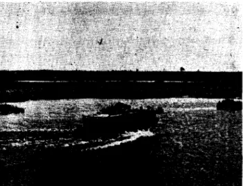
FIG.:5 - AERIAL VIEW LOOKING
NORTH TOWARDS AIRPORT
FIG. 5 - SNOWMOBILES IN セセsh
FIG. 7 _ VEHICLES IN SLOUGH
FIG. 4 - MUSKEG SH01"TING IMPRESSION
OF SNOWMOBILE TRACKS
FIG. 6 - SNOWMOBILE IN FLOATING BOG
FIG. 8 - PERMAffiOST TABLE REVEALED
CHURCHILL PROJECT - SUWlER 1946
sャtィセy OF EXISTING CONDITIONS
A brief description of conditions as they existed in the Churchill Area at the time of the trials are included here in order that the "Pinding" and "Conclusions" which follow may be better appreciated. A more detailed des-cription of the terrain is given in Part II of this report.
1. TERRAIN
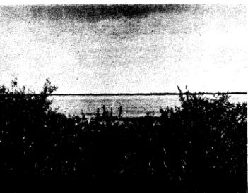
The Terrain in Churchill Area is characterized chiefly by a high water table and soft conditions for vehicle travel (Fig. 3).
In order that the terms used to describe the terrain in this report may be better understood the following definitions are given: Muskeg: Ground covered by a mossy growth, which is above the water table but has a high water content. The colour of the moss varies in proportion to the water content, the drier it is the lighter its colour. In the Churchill district the moss grows on a peat-like top-soil about 1211 thick. Below the peat there is clay or clay and gravel
(Fig. 4).
Marsh: Grassy growth with partially exposed water table. Grass grows, generally, on a peat-like top soil, below which is wet soft clay and fine gravel (Fig. 5).
Floating Bog: A grass or moss growth floating on a pool of water with high content of decayed vegetation, grass and moss roots. These areas are flat and the grass or moss is a lighter green than that on the surrounding muskeg (Fig. 6).
sャッオセィウZ Small pools of stagnant water 6" to 30't in depth 'with bo t.t.om
of clay and gravel covered with a 6" - 12" layer of black muck made up of decayed vegetation. Where the muck is exposed it is covered with a
thin layer of reddish brown matter (Fig. 7).
Permafrost: That portion of the ground whioh is permanently frozen. The top of this frozen portion is referred to as the permafrost tablE!
(Fig. 8).
The Churchill Area traversed on tests and exercises is shown on the map reproduced as the frontispiece to this report. This area may be divided into five general types of terrain.
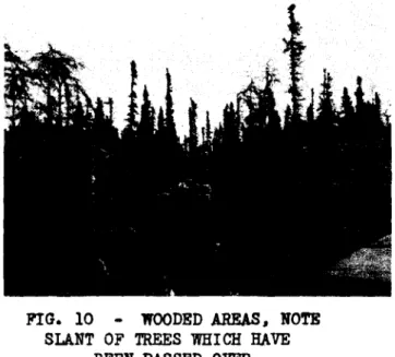
(a) Rock and gravel ridges (Fig. 9) (b) Wooded areas (Fig. 10)
(c) Open Marshland (Fig. 11) (d) Barrens (Fig. 12)
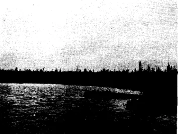
(e) Lakes, creeks and rivers (Fig. 13 &' 14).
.CHURCHILL PROJECT • sャZALZセセ QYTセ
PIG. 9 - DUD OW ROCKY. RIDGE
rI G. 11 - TRAVELLING IN OPEN MARSBLABD
PIG. 13 - CROSSIBG DEER RIVER
a
FIG. 10 - WOODED AREAS. NOTE SLANT OF TREES WHICH HAVE
BEEN PASSED OVER
FIG. 12 - BARRENS
CHURCHILL PROJECT - SUMMER 1946 SUMMARY OF EXISTING CONDITIONS (Cont'd) 1. TERRAIN (Cont'd)
The rock and gravel ridges, which are found close to Hudson Bay> are to a great extent moss and peat covered. The rock is exposed on some of the ridges and the surface is littered with boulders. The sides of the イゥ、セ・ウ are often steep and rough.
In the wooded areas spruce is predominant varying from 2" to g" in diameter and 4' to 15' in height. The roots are shallow and extend along the surface. In some areas the underbrush is heavy. The ground is for the most part muskeg in the form of large hummocks, but con-siderable marsh, floating bog and sloughs are also encountered.
The open marshland occurs principally along the coast and lower Churchill River. Sometimes these marshy areas are covered with 'Yillow brush which may hide boulders and narrow creeks. Interspersed in the marshy areas are stretches of hummocky muskeg.
The barrens, which are inland above the tree line, consist prin-cipally of muskeg interspersed with sloughs and floating bog.
The lakes are numerous but are shallow, varying from 3 ' to 8' in depth. They ure usually fed and drained by creeks and have bottoms of rocks, gravel, sand and clay. Some of the more or less stagnant lakes have mucky bottoms like the sloughs. The creeks are shallow with rock and gravel bottoms. The only river deep enough to require a vehicle to be fully amphibious is the Churchill river itself.
The a.erial view shown (Fig. 3) gives an indication of the pro·" portion of lakes and sloughs to land.
Permafrost is encountered in all areas but at different depths, On land above the water table that is covered by an insulatinE coat of peat and moss, permafrost is met at 18t! during the summer months. In wet areas the permafrost table is lower. A test was made in one of the floating bogs and permafrost was not encountered at a depth of 8 feet.
Soil samples were taken in several locations which were con-sidered typical of the various types of terrain in the Churchill Area. (See Detailed Description of Terrain for further information on this).
It should be emphasized that this description of northern ter-rain is that of the Churchill area itself. From what was seen by air, other districts are quite different.
Prior to the Churchill Project all available sources of in-formation on the terrain were investigated. These were found to be extremely limited and subsequent experience on the test site showed them to be of little value. Some suggestions for rectifying this are included under IIRc-commendations".
CHURCHILL PROJECT - SUMMER 1946
10
FIG. 15
EFFECT OF PREVAILING WINDS ON STUNTED SPRUCE GROWTH
FIG. 16
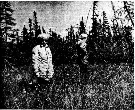
HEAD NETS USED FOR PROTECTION AGAINST INSECTS
FIG. 17 MOS QUI TOE S
CHURCHILL PROJECT - SUMMER 1946 DESCRIPTION 010' THE TERRAIN
Up to the present time most overland travel in the north country has been by dog teams and sleds in winter. Summer travel has been restricted to limited trips by canoe over the known waterways. As a result, practically nothing has been learned by the inhabitants of the problems of travelling any distance on land or of the details of the ground. With the advent of the low ground pressure type of vehicles, which will make inland travel pos-sible in summer, it will be necessary to make an extensive study of the types of ground to be encountered.
After initiation of the Churchill summer project, but before final plans had been made for selection or the test vehicles, an effort was made to obtain as much information as possible on the terrain from government representatives who had worked in this area. Representatives of the En-tineering Division of the Department of Transport and of the Harbour Boar'd
were interviewed. However, they were able to supply limited information only on the terrain aside from that observed at the town site, whi ch was not considered typical. Aerial photographs from the files of the Topographi;81 Survey Branch were viewed but they were taken at such high levels. 10.000 and 20,000 feet that, aside from identifying well definited Landrne r-ks bud, 10,8
rocky ridges, lakes and rivers, they were of little value in assessing the terrain in relation to vehicle traversability.
The reconnaissance trip to Churchill made by representatives of the various D.N.D. 'Directorates towards the end of June and prior to the test project, gave D.V.D. representatives an opportunity to assess the terrain from the air and some limited examination on foot. Later experience ゥョセ
dicated that the impressions gained on this reconnaissance were セ[HIュ・[ャOィヲャ t
misleading as the frozen table was much nearer the surface at this period than it was later. It was found also impossible to assess the terrain fl.;,
the air wi thout ha.ving had more experience on the ground.
The description of the northern terrain e;i ven hereunder is that of 1;1;6 Churchill area itself and it is not known definitely whether or not this is representative of the general northern terrain. From a limited amount of air reconnaissance it is believed that other districts are quite different. This matter is discussed further below.
I - DEFINITIONS
At first there was much difficulty in describing any particular type of area. Vocabulary seemed inadequate. Vvords such as "muskeg" were used to define many types of ground since each member of the testing party had a different idea of just what muskeg was. Therefore for the purpose of accurate description it became necessary to define such terms as Muskeg, Marsh, Floating Bog and Permafrost. The defin-itions of these terms has already been given in Part I "Summary of Existing Conditions" so it is not necessary to repeat them here. II - VEHICLE TEST AREAS
In order to determine the capabilities of the various vehicles before attempting any extended cross-oountry treks, three areas were
selected in the vicinity of Churchill Camp. These areas referred to as Test Areas uAIt
, "Bit and
ite"
are shown on the map which forms theCHURCHILL PROJECT -1 BG⦅セ _ _SUN'.:.',;'..セNセ ..⦅Nセ • .BBG⦅N⦅セ⦅セセ⦅ .L14e s ,
,
FIG. 67 - AREA "A" - TRACKED JEEP CROSSING SLOUGH
_PI G. 69 .;. AREA "B" - TRACKED JEEP WEASEL AND JroDCAT CROSSING SLOUGHS
-FI G. 61 - AREA
"c" -
GENERAL VIEW40
FIG. 58 - AREA "Alt
- HOLE SHOWING CROSS SECTIONAL VIEW OF GROUND - NOTE WET CLAY UNDER PEAT-LIKE TOP SOIL
FI G. 60 - AREA nA" - LUMPS OF FIBROUS.
PEAT-LIKE TOP SOIL
.FIG. 62 - SHOWS HOW CLAY AND FINE GRAVEL ARE CHURNED up. WHEN PEAT-LIKE
CHURCHILL PROJECT - suQセセr 1946 DESCRIPTION OF THE TERRAIN (Cont'd)
IV - EFFECT ON GROUND OF REPEATED VEHICLE TRAVERSING
In order to determine the effect on the ground of repeated ve
l.-i cle traversl.-ing. a serl.-ies of tests were run on Area "A". /1. Snownobile ,
'Neasel and Tracked Jeep ran over a route about half u rni Le lone; 50
times. each to its own course. Right from the start ruts ::commenced
to appear and water from surrounding sloughs drained into them 」ヲョjゥNNZ[ゥAゥAセ
the ruts to t;et deeper rapidly. As can be seen from the photographs
(Page 46) the vehicles were dragging the bottom 0,2 their hulls and t, ,e
going was very difficult before all the runs were completed. At t.he
start the vehicles travelled 10-15 mspsh , usinr; 1/4 to l/::throhleo
Toward the finish they travelled 3-5 m,psh , in their l.owest,,; r at
full throttle.
These tests conf'Lrmed our experience that £;oing on "vvet" land
is much easLar if the vehicle is kept out of' the tracks mode by ctL;r
vehicles. On the other hand. the goine; is easier on "dryll lanel or
through brush and wooded areas i f the vehicle follows the tr acks r:lt:ti';
by other vehicles.
v - SOIL SAMPLES
A representative of the Public Works Dept •• Ottawa ar-ri ved at
Churchill during the summer trials and took test samples from various
locations considered typical of the terrain. Test pits were dug in
five locations and ten samples were collected for laboratory anaLysi s ,
A separate report is beine; prepared by the Public Works Dept. on t.his
analysis.
On Page 49 are depicted graphically the sections of the ,';round
from >,,-hi ch these samples were taken. Photographs on PaGe 48 show
the type of terrain where the test pits were dug.
VI - COMPARISON OF CHURCHILL DISTRICT WITH NORTHERn TERRAIN IN GEh'ERA.L Near the completion of the test programme an opportunity was afforded to discuss the northern terrain generally with members of the Geodetic survey who have flown over various parts of the north. They expressed the opinion that the Churchill area is more difficult
to traverse than other northern areas. Howe ver- their opinion was
based on observations from relatively fast flying aeroplffiles plus
limi ted movement on foot in those areas accessible to lakes and r i ve rs .
Two Churchill Test Officers. representatives of D'Armd. ffild D!
made an air reconnaissance between Churchill and Bake s Lake on B COi: ',;e
following the Hudson Day coast and concluded that this area nortL of
Churchill was quite different from that of the Churchill district 「、ゥセ
did not believe i t would be easier for vehicles to t.r-aver se , Fr-om
Eskimo Point to Baker Lake the land appeared firmer wi th many rocky
ridges but a vehicle would have to be wholly amphibious in order tc
cross stretches of ,yater. Their observations and con oLusion s wOJ:"'J
as follows:
CHURCHILL PROJECT - Suln.&R 1946
FIG. 77 - SOIL SAMPLES - LOCATION OF TEST PIT NO.1 AT BYLOT.
FIG. 79 - SOIL SAMPLES - TEST PIT NO.2 SHOWING TOP OF PERMAFROST TABLE
FIG. 81 - SOIL SAMPLES - LOCATION OF TEST PIT NO. 3(a) IN AREA "An
48
FIG. 78 - SOIL SAMPLES - LOCATION OF TEST PIT NO.2 NEAR FARNWORTH LAKE
スセgN 80 - SOIL SAMPLES - LOCATION OF TEST PIT NO.3 IN AREA "A"
FIG. 82 - SOIL SAMPLES - LOCATION OF TEST PIT NO.4 IN FLOATING BOG
CHURCHILL PROJECT - Sffi1MER 1946
DESCRIPTION OF THE TERRAIN (Cont'd)
"Observations:
Land:- There are belts of land which are very questionable from the air as they resemble floating bog. These belts are measured in miles in length and width and should be considered vehicle barriers until proven otherwise. The top layer is generally moss,
supporting no growth of any kind. It varies from a light bilious green to a deep paddy green in color o It is supported on a rock or gravel base except in areas where it appears to be floating. Low ridges appear widely separated over surface. In firm areas large boulders are strewn across terrain. In panorama the picture is a maze of circular looking sloughs and land which are sometimes confusing if one tries to pick a route エィイッオ・セ them. In Baker Lake area high rocky ridges are general.
The gravel layer in the immediate Churchill Area appears to run out a short distance from the coa st , The rocky plateau, surf·"'ce boulders, and exposed sャouセャs reveal that gravel is at least 40 miles inland in places.
Water:- Water table covers large areas of land particularly along the gentle Sloping coast line. The bャッオセャウ vary from small ponds to enormous lakes with unknown depthso They present a wide front to any movemento
Sea Coast:- For a two mile area from high tide mark it is an almost completely exposed water table, definitely not suitable tor vehicles. The tidal beach extends from a 1/2 to 2 miles in places and is a mass of huge boulders which are impassible. Conclusions:
(1) Churchill testing area bears no resemblance to this terrain. (2) It is thought that only a completely amphibious vehicle
could traverse this area.
(3) The present maps are not sufficiently detailedo
(4) To fix position accurately, a knoWledge of astro naviEation is nece ssary."
CHURCHILL PROJECT - sュセ、er 1946
FIG. 89 - FLOATING BOG - ROD RESTING ON FIBROUS MAT SURFACE
FIG. 90 - FLOATING BOG - ROD RESTING ON CLAY
6 FT. FROM SURFACE
CHURCHILL PROJECT ooi1 SUMMER 1946
CROSS SECTIONAL ViEWS OF GROUND FROM WHICH SOIL SAMPLES WERE TAKEN
AUG. 14'" 21 1946
HOLE nセ 1 AT 8YLOT
SAMPLE N9 1. UNFROZEN PEAT TOPPED WITH MOSS
SAMPLE nセ 2. FROZEN PEAT
SAMPLE nセ 3. FROZEN BLUE CLAY, STREAKED WITH
ICE AND TRACES OF ROTTED VEGETATION
HOLE nセ 2 IN HIGH GROUND NEAR FARNSWORTH LAKE
セ
セ PEAT AND MOSS
..i...--SAMPLE He:! 4. FROZEN GRAVEL, STREAKS OF ICE AND TRACES OF CLAY
IN LOW GROUND OF AREA ''A-'
MOSS AND CRASS
SAMPLE He:! 5. UNFROZEN PEAT GRAVEL
SAMPLE hセ 6. UNFROZEN SLUE CLAY. SAND
AND TRACES OFROTTED VEGETATION
FROZEN BLUE CLAY ETC.
HOLE HI! 3A IN HIOHER GROUND OF AREA セaGi
CRAVEL AND CLAY
HOLE nセ 4
MZZ]セ MMMMセM]ZZM セ]ANAZNNNAZャ ...nBBセZNNNNNNNNオャiqN GROWINO GREEN MOSS ON SURFACE
セZNNZNZNZNM]]MZNZNnアNZNNNNNZXN UNFROZEN GRASS. MOSS AND MATTED ROOTS
SAMPLE nセ 9. DECAYED MOSS AND GRASS ROOTS SUSPENDED IN WATER
FIG. 83 - SHALLOW ROOTEO SPRUCE TREES
.FIG. 85 - WILLOW BRUSH ON BANK OF CHURCHILL RIVER
FIG. 87 - VEHICLES BOGGED IN SLOUGH
WITH SOFT CLAY BOTTOM
FIG. 84 - TREES ARE LOPSIDED - EXCEPT
THOSE WHI CH ARE PROTECTED FROM
PRE-VAILING WINDS IN TEl CKLY WOODED ARF.AS
.FIG. 86 - HEAVY DEPOSIT OF MUCK ON
SHORE OF SMALL LAKE
FIG. 88 - TOP LAYER OF MOSS AND PEAT
REMOVED WIIEN CHAFFEE TANK
CHURCHILL PROJECT - SUMMER 1946 DESCRIPTION OF THE TERRAIN (Cont'd) Area "An (see Fig. 57)
This area may be described as open marshland interspersed with stretches of hummocky muskeg. Grass and moss Grows on a peat-like' black topsoil about 81t to 12" thick (see Fig. 58). Beneath this peat
is a wet mixture of clay and fine gravel. If a vehicle track cuts through the layer of peat this clay and gravel is soon stirred up into a soft cement-like mixture (see Fig. 62). Permafrost is met at various levels depending on the amount of water present. In muskeg areas above the water table, covered with a thick coat of moss and peat, it is en-countered at RWBセM In marshy areas, at water table level, it is about 43" deep and under sloughs it is still deeper. About 10% of the area consists of sloughs with exposed water 61t to 12" deep. The bottoms of
the sloughs are clay and gravel, but are often covered with a layer of black muck, 4" 'to 8" thick, made up of decayed vegetable matter. When these sloughs are stirred up a sulphurous smell is noticed.
Area "B" (see Fig. 59)
This is a lightly wooded distri ct with about 25% of the area
con-sisting of sloughs and small lakes. The ground is musket>; with an occasional boulder on the surface. The maxLmum depths of the Lakes if,
3 ft. except for セセイョキッイエィ Lake which is about 8 ft. deep in places. Small spruce trees with a maximum diameter of 5 in. and a maximum height of 12 ft. cover some of the area but were not dense enough to obstruct vehicle travel. These trees can be knocked over easily since the roots do not go deeper than the black peat-like topsoil. pVイュ。セ
frost was encountered at 16 inches in one high, well drained area but generally it is lower as in Area "A".
Area "Cit (see Fig. 61)
This is a marshy area similar to Area "At' but more level witt fewer hummocks of muskeg and fewer and smaller sloughs.
Area "A" was used for preliminary trials of all tracked vehicles, Those that performed satisfactorily were then tried out on Area "B". Area IIC", whi ch was considered the least difficult to traverse, was Lib'cd
principally for trials of the wheeled vehicles. III CHURCHILL AREAS COVERED BY EXERCISES
After the completion of trials on Test Areas near Churchill Camp, a number of cross-country exercises were undertaken to explore the country and determine if any new terrain conditions existed that would be tlifficult r'rom a vehicle traversing standpoint. The route taken on the four exercises is depicted on the frontispiece map. A detailed report of these ・セ・イ」ゥウ・ウ is included in Part III.
The areas traversed on these tests may be divided into five セ・ョ・イ。ャ types:
(1) Rocky ridges (2) Wooded areas (3) Open Marshland
(4) Barrens
(5) Lakes, Rivers, Creeks
CHURCHILL PROJECT - ST}MM.'{t' 1946
s ⦅L⦅NBGLセBBG⦅N⦅ .• _ _
FIG. Vセ - ROCD' RIDGE
fIG. 65 - OPEN MARSHLAND - ENCOUNTERED
OB EXERCISE "WHITE WBALB"
EI G. 67 - SMALL LAKES - NOTE
SHALLOW-NESS 0 F WATER
42
FI G. 64 - WOODED AREA - ENCOUNTERED ON EXERCISE CARIBOU
FIG. 66 - THE BARRENS - ENCOUNTERED ON
EXERCISE CARIBOU
21 =
セイ・ャゥュゥョ。イケ Notes on Churchill Peatso
BY Norman Wo Radfortho
Reference has already been made to lack of clarity
in connection with the definition andD thereforeD stru0tural
interpretation of tfMuskegtto This situation gathers signifl=
cance when viewed in relation to problems of terrain encoun=
tered in the Churchill area9 as shown on the preceding pageso
The present investigations on test samples from the area are being made with the hope that increased knowledge will provide the lead to appropriate reference terms useful to
those who must designate similar terrain in relation to
technical problemso Fundamental to the adoption of suitable
reference terms is a complete statistical study of the plant
constituents in the terraino It is essentia19 tooD that in
the many analyses which this involves an effort be made to relate the statistical description to the environmental·
description9 the latter being recorded in the form of pic=
torial and physiographical data including profile diagramso It is clear at the outset that the Muskeg Project is not a single investigation, it is constituted of a complex of
problems0 Among these is the question of the proper selec=
tion of a name for the immediate designation of the terraino
The answer to this lies in a valid interpretation of muskeg9
and necoossitates an inquiry into the Ld.ter-atrur-e of plant
ecologyo
THE MEANING OF MUSKEGg
Lewis and Dowding (1926)9 reporting their treat=
ment of the vegetation of certain areas near Edmonton9
Alberta£! used the term "muskeg" in the title of their p ap er-,
It is significant to note that in employing the name they
enclosed it in inverted commaso It is significant also to
note that the word "muskeg" does not appear in the index of one of the most widely used reference books on plant
・」ッャッァケセ that by Weaver and Clements (1938)0 These facts perhaps encourage the view that the term 1s an empirical
expression andD therefore9 invalid from a strictly scienti=
fic point of viewo
This9 however9 is not to say that the term should
be dropped o It is undoubtedly of Indian derivation9 and9
when given a literal translation9 means "swamp" or "bog"o
= 22 =
term when they defined muskeg as "practically synonymous
with ー・。エセ「ッァBッ The vegetation covering the peat may
vary somewhato It is instructive to observe that "most of
these muskegs are clad D to a varying extent9 by fairly
large trees of black spruceD birch and larch" (Lewis and
Dowdingp 1926)0 The dominant portion of the typical
herbaceous flora is spィ。セセb but there also may be present
a range of flowering plan S9 chief among which is the
shrlwby Ledum groenlandicumo In an account by Lewisp
Dowding and
Moss
D HQYRセIb where the flora of Alberta isdealt with further D Ledum moor9 young bog forest and mature
bog forest are all InCIuded under the heading of "muskeg"o
Before discussing the desirability of the term
"muskeg" for the Chur-ch.LLl, ber-r-aLn , reference should be
made to the geographical position of the area relative to
the question of floral zone limitso The importance of
thir, is apparent When it is noted that the boreal forest
. in which the muskeg is said to occur (Lewis and Dowdings
1926) is separated from the west coast of Hudson Bay by
a broad band of tundra (Weaver and ClementsD 19389 po 482)0
However .. the latter authors also state (19389 po 487) that
trie boreal forest runs "from the Mackenzie delta to the east of Great Bear and Great Slave Lakes to Fort Churchill on
Hudson Bay"o According to the former conclusion9 the area
under investigation here is possibly mainly in tundra;) and according to the latter statements it seems logical to conclude that the area occurs in the transition zone
where boreal forest meets the tundrao In either case one
ュゥァィセ expect tundra to be a major component of the terraino
PRELIMINARY EXAMINATION OF saQセles OF THE terrainセ
In the table below is listed a set of terrain
sampls3 from cィオイ」ィゥャャセ the description indicated is that
000=100 Moss9 grass
&
muskeg9 unfrozen DoPoWoLabo Sample Noo A 6 A 7 AlO A12 A13 Field Noo 1 2 5 7 8 Hole No" 1 1 3 3A 4 = 23 = Depth in fto 0.,0=1.,4 104=200 002=007 RemarksUnfrozen Peat topped with dry mosso Frozen Peat
Unfrozen Peat
300 fto east from Hole NOo3
A14 A15
A16
9
10
4 100=605 Roots
&
very wet muskeg20 fto east of Hole No.,4 on slightly higher ground, growing green moss on
surface 0
Sample of dry moss taken at Byloto
Sample A16 in a 10=lb syrup 」。ョセ the remainder in cardboard
cylinders 15 emo x 8 cm09 stoppered with a wad of paper and
tapedo All in good 」ッョ、ゥエゥッョセ no signs of ュッオャ、セ etco
In this table it is important to note the term "moss" (in all likelihood referring to the dominant
ccn-stituent Cladonia9 a lichen) 0 Note also the mention of
"grass"0 Each of these macr-oscopLc c.onstituents may favour
the designation tundra rather than muskego
As indicated in the introduction9 it is the in=
tent ion of the writer to attempt the botanical contribution to the interpretation of the terrain chiefly on the basis
of microscopic analyses as a fundamental step., In this
connection Sample A7 was selected for testingo An experi=
mental technique similar to that used by Radforth (1945)
has been developed., The material responds favourably to
treatment0 The first results of a test analysis on sample
= 24 Lセ
The grasses typify the herbaceous angiospermso Sphagnum
and fungus spores are also presento
Among the coniferous representatives Picea (Spruce)
shows dominance9 and with Pinus far outnumber the hardwoodso
The relative frequency of grass pollen is noticeably higho While relative frequency figures have been compiled they have been withheld partly because precise quantitative
resul t.s have not yet been completely r-ecne cked , Also9 by
reason of the fact that the samples which reached McMaster University laboratories represented only a remainder of the
originals9 numerical results of A7 analysis could hardly
apply to the original bore sarnple9 and9 therefore9 possibly
would be misleadingo The qualitative results9 however!! are
relevant0
DISCUSSION AND CONCLUSIONSg
Reviewing the definition and description of "mus=
keg" by Lewis and DOWding it would seem logical to conclude
that the term has validity as an empirical expressiono If9
howeverp it is desirable to designate terrain in more
precise termsD the expression might be misleadingo This
perhaps becomes clear when attention is drawn to the fact
that9 typicallY9 muskeg usua.Ll.y supports tree growth0 In
the Churchill area there are peat bog areas which do support
tree growth according to available reportso The treeless
band extending in from the Hudson Bay shore is,J however9
designated as t.undr-a , Pur-bhe r-mor-e , the presence of Cladonia and grasses as macroscopic constituents in some of tne
samples supports the use of the word tundra for the Churchill
area terraino Ro Ruggles Gates,9 (1928)9 who comments on the
similarity between parts of the flora of Northern Finland and Canada describes a tundra supporting Cladonia with tree growth0
From this discussion it seems logical to refer to
the Churchill terrain as peat bog whLch , in some ar-e as , is
muskeg=like!) and in others is simply tundrao Corroboration
of this is necessary through field observationso The possi=
bility that at least two categories probably exist is im= portant to confirm because of its bearing on the fundamental aims of the investigationo
The microscopic examination of the samples has
led to encouraging preliminary resultso Firstly!) it is
evident that there is a good possibility of constructing complete microfossil spectra for the peats which will serve
Lセ 25
to characterize themo These peats may then be correlated
with those elsewhere (it is possible even at this early
stage to conclude that A7 differs markedly from the majority
of peats examined elsewhere in Canada) 0 The possibility of
expressing this relationship in physical terms based on the botanical should then be exploitedo
It is highly significant to note that spectra
characterizing the peats may not only lead us to a desirable technical description of the terrain., but they might also be employed in the interpretation and prediction of climatic
factors and drainage patternso Indeed9 it is not idle
speculation to suggest that the consideration of knowledge gained from spectra over wide areas would express terrain
patterns just as soils would on non=peaty surfaceso To
accomplish the purpose of these investigations the writer desires complete bore samples taken and packed according to
prescribed specificationo Firsthand knowledge of the sur=
face vegetation is also desirableo On the basis of the
results attained to date an expansion of the work to include the above suggestions is recommendedo
The writer gratefully acknowledges the assistance
of Mro Eo Johnson., technical assistant for the ftMuskegtl
Projecto
McMaster UniversitY9
Department of Botany and Research Headquarters
for Royal Botanical g。イ、・ョウセ
HAMILTON., Canada0
REFERENCES
Gates9 Ro Ruggles (1928) Notes on the Tundra of Russian
Lapland; JOQro Ecolo XVIj NOolo
Lewis9 Fo Jo and Dowding., Eo So (1926) The Vegetation and
Retrogressive Changes of Peat Areas
("Muskegs") in Central Alberta9
Jouro Ecole xivセ N0020
Lewis, Fo J0 9 Dowding9 Eo So and MossD Eo Hu (1928) The
Vegetation of Alberta 110 The Swampv Moor and Bog Forest Vegetation of
Ceritir-al, Alberta0
• Jour 0 Ecole xviセ NOe 10
Weaver9 Jo E"and Clementsp Fe Ee (1938) Plant EcoLogy ,
McGrawc H i l 1
= 26 =
A P PEN D I Xo
Report on Samples received from Churchill by Mro Jo Wo Lucas9
of the Testing Laboratories9 Department of Public Works of
Canada9 submitted by Mro Eo Vienss Director of the Laboratorieso
10 Please see Table Noo 1 and Chart Noo 1 for field data
taken from sample cans and results of Laboratory testso
20 It was only possible to determine the Atterberg limits
(Liquid and Plastic Limits and Plasticity Index) for Labo
NOSa A8/46 to All/460 Labo Noo A9/46 was not plastic due
to the large percentage of gravel and sandp whereas the
balance of the samples consisted of grassp rootsp moss or
partly decomposed mixture of these materials and were not plastico
30 A sieve and hydrometer analysis was made on Labo Noso
A8/469 A9/469 and All/46 and the results are shown in
Table Noo 1 and Chart Noo 10
40 Except for Labo Noo A6/46 which was packed in a waxed
cardboard carton (concrete specimen mould) the samples were all received in lO=pound syrup pails to which the tops had
been soldered or brazedo The inside of the pails had been
coated with wax which unfortunately was melted from the ends of the cans on which the soldering or brazing had been
done and the wax had run down into the sampleso This wax
was found very difficult to remove completely from the samples and hence the results of the tests are affected to a slight extent due to the presence of some waxo
50 No attempt has been made to offer any classifications of
the samples submitted as it is thought that the descriptions found on the labels of the cans serve as well as any Which might be offered o
TABLE 1«). 1
--_.
J'1eld
Hole Field Description of Meterial
Lab. Sample Depth C M LL PL PI GR 'sand Silt Clay
No. No. lb. Taken from SalTille Cans
i1b/46 1 1 0.0 - 1.4 Unfrozen peat topped with 、イセ moss. 827
¥47/46 2 1 1.4 - 2.0 lIrozen peat 534
N3/46 3 1 2.0 - 7.0 Frozen blue clay streaked \,itil ice and 2.65 67 29.0 20.2 8.8 1 14 58 27
traces of Imlskeg.
A9/46 4 2 1.0 - 1.4 Erozen Gravel, streaks of ice and 2.68 27 49 .3B 10 3
traces of clay.
Alo/46 5 3 0.2 - 0.7 U'ntrozen peat. 203
All/46 6 3 1.5 - 3.7 Blue clay, sand. traces of ;:J.u&:eg 2.62 14 17.2 14.2 3.2 16 30 33 21
( l!IOft ) •
&.2/46 7 3A
-
300 re. east from aole ;.0. 3-undisturbed moss and peat to clay. .2l6
Al3/46 8 4 0.0 - 1.0 L:Oss. grass, and muskeg, unfrozen. 1474
Al4l46 9 4 1.0 - 6.5 Ibots and very wet muskeg. 1234 .:.15/46 10
-
20 ft. east or Hole La. 4 on slightly 997bigher Cround. growing green IOOSS on IlUrface.
Al6/46 11
-
Sample of dry l;IOSS taken at Bylot. 9 G • Ab801ute Speciric GravityK • IWroeDt-ee of water contained in sample on Noelpt.
セ •...s u • percentage or oveD dry _laht of 1IUIple.
11 = Liquid lゥセエ PL =Plastic lゥイイセエ
PI =Flasticity Index
GR • Percentage or gravel
II/I
ciiaセt
- Nil
/.
MECHANICAL; ANLiLYS IS OF
sal
LSLAB_NflAB