Integration of spatial and temporal data for the definition of different landslide hazard scenarios in the area north of Lisbon (Portugal)
15
0
0
Texte intégral
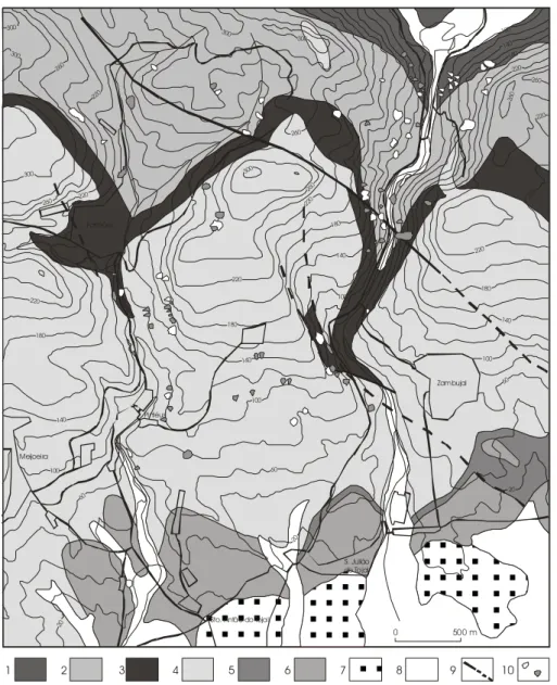
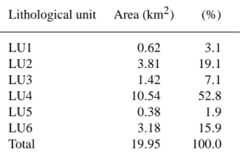
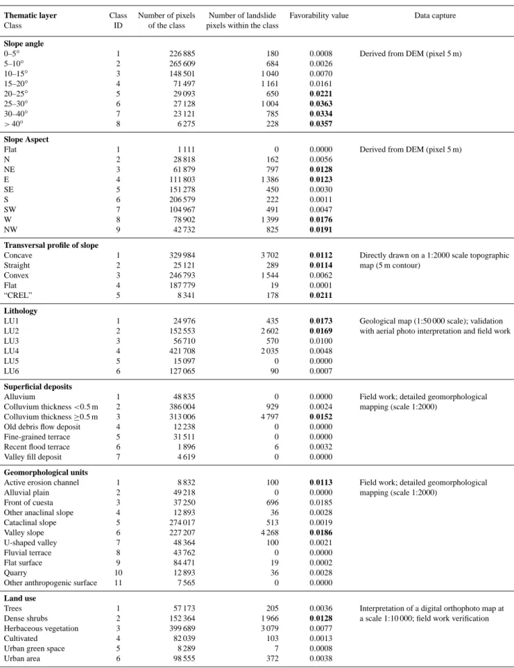
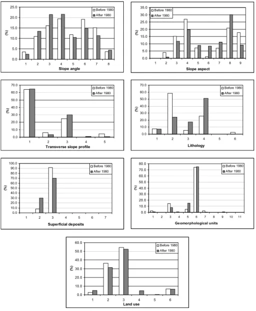
Figure

+7


Documents relatifs