HAL Id: hal-01090438
https://hal.archives-ouvertes.fr/hal-01090438
Submitted on 3 Dec 2014
HAL is a multi-disciplinary open access
archive for the deposit and dissemination of
sci-entific research documents, whether they are
pub-lished or not. The documents may come from
teaching and research institutions in France or
abroad, or from public or private research centers.
L’archive ouverte pluridisciplinaire HAL, est
destinée au dépôt et à la diffusion de documents
scientifiques de niveau recherche, publiés ou non,
émanant des établissements d’enseignement et de
recherche français ou étrangers, des laboratoires
publics ou privés.
To cite this version:
Sandra Bardot, Anke Brock, Marcos Serrano, Christophe Jouffrais. Quick-Glance and In-Depth
exploration of a tabletop map for visually impaired people.
IHM’14, 26e conférence
franco-phone sur l’Interaction Homme-Machine, Oct 2014, Lille, France.
ACM, pp.165-170, 2014,
�10.1145/2670444.2670465�. �hal-01090438�
Quick-Glance and In-Depth exploration
of a tabletop map for visually impaired
people
Abstract
Interactive tactile maps provide visually impaired people with accessible geographic information. However, when these maps are presented on large tabletops, tactile exploration without sight is long and tedious due to the size of the surface. In this paper we present a novel approach to speed up the process of exploring tabletop maps in the absence of vision. Our approach mimics the visual processing of a map and consists in two steps. First, the Quick-Glance step allows creating a global mental representation of the map by using mid-air gestures. Second, the In-Depth step allows users to reach Points of Interest with appropriate hand guidance onto the map. In this paper we present the design and development of a prototype combining a smartwatch and a tactile surface for Quick-Glance and In-Depth interactive exploration of a map.
Author Keywords
Map exploration, visual impairment, accessibility, tabletop, smartwatch, spatial cognition
ACM Classification Keywords
K.4.2. [Computers and Society]: Social Issues - Assistive Technologies for Persons with Disabilities; H.5.2. Information interfaces and presentation: User Interfaces- Input Devices and strategies.
Sandra Bardot
IRIT, CNRS & University of Toulouse sandra.bardot@irit.fr
Anke Brock
Inria Bordeaux anke.brock@inria.fr
Marcos Serrano
IRIT, CNRS & University of Toulouse marcos.serrano@irit.fr
Christophe Jouffrais
IRIT, CNRS & University of Toulouse christophe.jouffrais@irit.fr
© ACM, 2014. This is the author's version of the work. It is posted here by permission of ACM for your personal use. Not for redistribution. The definitive version was published in Actes de la 26ième conférence francophone sur l'Interac-tion Homme-Machine, 2014.
Introduction
For visually impaired people, it is a challenge to understand the surrounding and to navigate
autonomously, which significantly reduces mobility and independence. Preliminary exploration of a tactile map of the environment [12] and preparation of the journey may both improve autonomy. However, tactile maps present important limitations. First, in order to improve tactile perception and reduce cognitive load, the amount of information on the map is limited. It is also limited by the fact that Braille legend takes a lot of space. Second, once the maps are printed, the content cannot be adapted dynamically. Tactile maps are thus quickly out of date [15]. Free digital online maps (for example Open Street Map) are nowadays largely available, but are most often not accessible to visually impaired people. Dedicated accessible interactive maps have been developed based on different interactive devices [2]. It has been shown that interactive maps enable visually impaired people to efficiently acquire knowledge about unknown environments [3]. However there is still little research work aiming to provide visually impaired users with advanced non-visual interaction techniques for map exploration.
The goal of our project is to speed up the exploration process of a large tactile interactive map with non-visual interaction techniques. Although the use of large tabletops is more and more common, it has so far been rarely explored for presenting accessible maps to visually impaired people [5]. The large size of the screen induces increased exploration time, and thus impacts interaction [4], behavioral and cognitive processes.
In this work we propose a two steps non-visual interaction that mimics the visual processing of a map. The first step (Quick-Glance) allows quickly acquiring a global but sparse mental representation of the map by using mid-air gestures. In a second step (In-Depth), users can select a point of interest (POI) to which the hand is guided. The interaction is provided via the combination of a smartwatch and a multi-touch tabletop. In this paper we present the design and implementation of the prototype, and propose future directions for evaluations.
Related work
Interactive Maps for visually impaired people
In the past years interactive maps dedicated to visually impaired people have been developed based on the use of different interactive technologies such as touch screens, haptic feedback, speech recognition, mouse, keyboard and/or tangible interaction [2]. Many prototypes are based on the use of different types of touch-sensitive devices combined with audio feedback. We focus here on those interactive maps providing touch-based interaction. Touch-screens of the size of a regular computer screen have been used in several prototypes [3,7,14]. Fewer projects were based on large tabletops [5]. Recently the use of mobile devices, such as smartphones and tablets, has emerged [9,15]. In some accessible map prototypes, the touch-sensitive surface was combined with raised-line map overlays [7] or with vibro-tactile stimulation [9,15] in order to add tactile information which is not provided by the touch screen per se.
Interaction Techniques for on-Map Hand Guidance
The above-mentioned prototypes generally provide the possibility to obtain information about points of
interests (POI) and streets by executing finger taps. Kane et al. [5] proposed three techniques for assisting visually impaired users’ map exploration on a large tabletop: “Edge projection” (projection of the POIs onto the vertical and horizontal edges of the map),
“Neighborhood Browsing” (separation of the map into several areas containing exactly one POI), and “Touch and Speak” (verbal directions from the current touch location to the POI).
Vibration-based guidance techniques
Tactons are structured, abstract vibro-tactile signals that convey information when modifying different parameters (frequency, amplitude, waveform, duration, and rhythm) [1]. Their advantage lies in the possibility to communicate information, even when ambient noise level is too high, when privacy should be guaranteed or when auditory environmental cues should not be masked. The latter is especially interesting for visually impaired people who use to rely on audio stimuli for many tasks. Different studies have used tactons for whole-body guidance, and may still hold for hand guidance. A first approach consisted in displaying tactons onto different body locations indicating the direction to follow. It has, for instance, been used with a tactile belt and spatialized vibrations on the chest [13]. A second approach used different vibration patterns that indicate directions. For example, the Tactile Compass [8] used one vibrational motor to indicate directions on a 360° circle by varying the length of two subsequent pulses within one pattern. Third, NaviRadar [11] used a single vibrator on a mobile device. When the user made a circular swipe on a touch screen, vibrational feedback was used to confirm the direction of travel.
Wearables for visually impaired people
Wearable devices have emerged in the past years and are now used in different contexts. For instance bracelets, such as the Jawbone Up, or smartwatches allow measuring heart rhythm, number of paces or sleep rhythm with the aim to contribute to a healthier life. Aside from the intended usage, they enable the design of new interaction concepts. These devices can have different forms, being integrated into clothing, gloves, glasses, jewelry, etc. [13]. The interest of wearable bracelets for visually impaired people has recently been demonstrated [16].
Quick-Glance and In-Depth Exploration
Approach overview
In order to explore a new map, we designed a two-step exploration technique including vocal and vibration feedback. The first exploration movement, called Quick-Glance in reference to the corresponding visual process, is performed above the map in mid-air. It supports the creation of a sparse but usable mental representation of the map. Interestingly, relying on mid-air
movements, visually impaired people can explore a map without being stopped by physical objects located on the map. Thus, this method is compatible with tangible interactions on the map surface. The second step, called In-Depth, allows the user to select a POI in a given zone, and then reach it (Figure 1).
For the interaction between the user and the map, we used a smartwatch (Figure 3). This device presents multiple advantages. For instance, Profita et al. [10] showed in a recent study that wearing a device on the wrist was more acceptable than on any other body part. A smartwatch also contains a vibration mode that can easily be used for hand guidance. Furthermore, we
Figure1. Illustration of the 2-step
process: Quick-Glance exploration followed by In-Depth guidance.
believe that in the near future, these devices will be largely adopted by visually impaired users.
Quick-Glance exploration
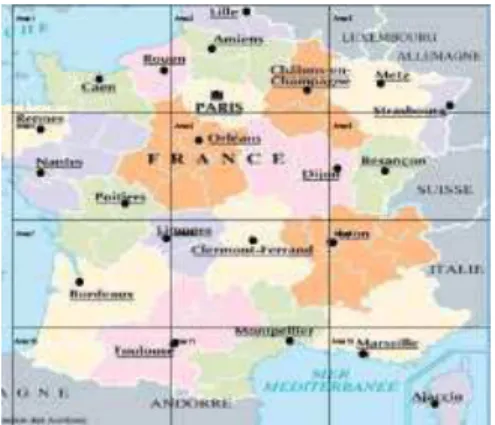
By skimming over the map with the smartwatch, users gain access to the names of the different zones as well as the number of POIs that they contain. We
partitioned the map in twelve areas (Figure 2). These zones were arranged in a 3x4 grid, which was inspired by Kane’s Neighborhood Browsing [5] with the
difference of the grid being rectangular in our case. We suggest that this layout is easy to memorize because it corresponds to a T12 layout of a mobile phone
keyboard. Indeed it has been observed, that visually impaired users appreciate the use of well-known keyboard layouts [6]. In our map, each zone could hold one or several POIs.
Figure 2. Map of France partitioned in 12 areas arranged in a
3x4 grid as in our prototype.
When moving the watch over an area, the number of POI that it contains is announced. In addition, POIs contained in this area are sent to the smartwatch. A
succession of finger swipes on the smartwatch touchscreen reads out the names of these different POIs. When users are interested in knowing the exact location of a given POI, they tap on the screen and the system switches to the In-Depth guidance mode.
In-Depth hand guidance
Once a POI is selected, the hand is guided towards the corresponding location with vibrations on the
smartwatch. We chose this feedback in order to avoid annoying users with too much vocal information [3]. In our design, we had to guide the hand on small distances within a given area. Hence precision was important. We designed hand guidance following Rümelin’s work on NaviRadar [11]. The NaviRadar technique provides information on directions and not distances. In a previous study on guidance with vibrational feedback, it has been shown that users preferred directional over distance information [8]. Figure 4 illustrates the method that we designed. Users perform clockwise circle with the finger on the screen. The smartwatch vibrates when the angle corresponds to the direction towards the selected POI. Users then move the finger in this direction. When the POI is reached, the smartwatch vibrates. At any moment, if they are not sure about the direction to follow, users can perform a new circle.
Prototype development
The Quick-Glance exploration technique requires knowing the position of the hand above the map. We used infrared tracking and placed markers around the map and on the smartwatch (Figure 3). We used a Sony Smartwatch 2 connected via Bluetooth to an Android smartphone. The smartphone was necessary
Figure 3. Smartwatch
for executing the application and also for the audio output (the smartwatch provided only vibrational feedback). Our aim was to display the map on a large diffused illumination multi-touch table. However, the built-in infrared projectors underneath the surface interfered with the infrared tracking of the smartwatch. Thus in the current prototype, we used a tactile 22’’ screen (3M M2256PW). We plan to overcome this limitation by changing the position of the infrared cameras or using a multi-touch tabletop that is not based on infrared technology.
Discussion
Mid-air tracking
In order to create the final version of our technique, we will have to detect mid-air position of the hand. Two types of approaches can be used: inside-out or outside-in. Inside-out corresponds to the smartwatch being able to locate its own position above the table. This could be performed with magnetic sensors. Outside-in corresponds to using an external tracking of the hand. This could be done by using depth sensors such as Kinect or Leap Motion.
Detection of the fingertip position in mid-air
One problem of the current implementation is that infrared markers are attached to the smartwatch. Thus the wrist is actually located and serves as the point of reference. This is probably not as intuitive as the fingertips. Indeed, it could be confusing and disturbing for mental mapping. On the other hand, we suppose that a learning effect would occur after some training. Another solution could rely on a system attached to a finger. This solution might however be more
cumbersome for the user as wearing a device on the fingertip may hinder exploratory movements. Yet,
these hypotheses have to be evaluated in future studies.
Conclusions and Future work
In this paper we presented a non-visual interaction method for improving the accessibility of geographic maps on large tabletops for visually impaired users. This interaction method consists in two steps: a “Quick-Glance” step to quickly acquire an overall knowledge of the map; and an “In-Depth” step to finely guide the hand towards a selected POI. The prototype has been implemented with a touchscreen and a smartwatch with auditory and tactile feedback.
Future work will consist in evaluating this prototype, in order to determine usability and accessibility for visually impaired people. This evaluation will be done in collaboration with the Institute for Blind Youth (CESDV-IJA) in Toulouse. Concerning the “Quick-Glance” technique we aim to evaluate whether it allows visually impaired users to quickly acquire usable knowledge about the map. Time needed for exploration and the quality of spatial learning will also be evaluated. It is indeed necessary to evaluate whether the T12 layout enables the creation of a usable mental representation. It will also be interesting to study whether this
technique results in a higher cognitive load or physical fatigue (resulting from holding the arm in mid-air). Furthermore, as mentioned above, it will be necessary to investigate whether the tracking of the wrist instead of the finger impacts the map exploration process. Concerning the “In-Depth” technique we aim to explore the design space for hand guidance techniques. In addition to improving accessibility of maps on large surfaces to visually impaired people, we believe that
Figure 4. In-Depth finger guidance
technique: 1) the user draws a circle clockwise; 2) when reaching the intersection with the line, the smartwatch vibrates;
3) the user moves his finger towards the target; and 4) the smartwatch vibrates as the finger reaches the target.
this work may contribute to the design space of spatial non-visual interaction.
Acknowledgments
We thank Julie Ducasse for helpful assistance regarding the design and Dr. Eric Barboni who mentored the internship of the first author (Master 1
Human-Computer Interaction at University of Toulouse, France) during which this work has been developed.
References
[1] Brewster, S. and Brown, L.M. Tactons: structured tactile messages for non-visual information display. Proc. of AUIC’04, Australian Computer Society, Inc. (2004), 15–23.
[2] Brock, A.M., Oriola, B., Truillet, P., Jouffrais, C., and Picard, D. Map design for visually impaired people: past, present, and future research. Médiation et information - Handicap et communication 36, 36 (2013), 117–129.
[3] Brock, A.M., Truillet, P., Oriola, B., Picard, D., and Jouffrais, C. Interactivity Improves Usability of Geographic Maps for Visually Impaired People. Human-Computer Interaction, (to appear 2014).
[4] Buxton, W. Multi-Touch Systems that I Have Known and Loved. 2007.
[5] Kane, S.K., Morris, M.R., Perkins, A.Z., Wigdor, D., Ladner, R.E., and Wobbrock, J.O. Access Overlays: Improving Non-Visual Access to Large Touch Screens for Blind Users. Proc. of UIST ’11, ACM Press (2011), 273–282.
[6] Kane, S.K., Wobbrock, J.O., and Ladner, R.E. Usable gestures for blind people. Proc. of CHI ’11, ACM Press (2011), 413–422.
[7] Miele, J. a., Landau, S., and Gilden, D. Talking TMAP: Automated generation of audio-tactile maps using Smith-Kettlewell’s TMAP software. British Journal of Visual Impairment 24, 2 (2006), 93–100.
[8] Pielot, M., Poppinga, B., Heuten, W., and Boll, S. A tactile compass for eyes-free pedestrian navigation. Interact 2011, LNCS 6947, Springer Berlin Heidelberg (2011), 640–656.
[9] Poppinga, B., Magnusson, C., Pielot, M., and Rassmus-Gröhn, K. TouchOver map: Audio-Tactile Exploration of Interactive Maps. Proc. of MobileHCI ’11, ACM Press (2011), 545–550.
[10] Profita, H.P., Clawson, J., Gilliland, S., et al. Don’t mind me touching my wrist. Proc. of ISWC ’13, ACM Press (2013), 89–96.
[11] Rümelin, S., Rukzio, E., and Hardy, R. NaviRadar: a novel tactile information display for pedestrian
navigation. Proc. of UIST ’11, ACM Press (2011), 293. [12] Tatham, A.F. The design of tactile maps:
theoretical and practical considerations. Proc. of international cartographic association: mapping the nations, ICA (1991), 157–166.
[13] Tsukada, K. and Yasumura, M. ActiveBelt: Belt-Type Wearable Tactile Display for Directional Navigation. UbiComp 2004, LNCS Vol 3205, Springer Berlin Heidelberg (2004), 384–399.
[14] Wang, Z., Li, B., Hedgpeth, T., and Haven, T. Instant Tactile-Audio Map: Enabling Access to Digital Maps for People with Visual Impairment. Proc. of Assets ’09, ACM Press (2009), 43–50.
[15] Yatani, K., Banovic, N., and Truong, K.
SpaceSense: representing geographical information to visually impaired people using spatial tactile feedback. Proc. of CHI ’12, ACM Press (2012), 415 – 424. [16] Ye, H., Malu, M., Oh, U., and Findlater, L. Current and future mobile and wearable device use by people with visual impairments. Proc. of CHI ’14, ACM Press (2014), 3123–3132.