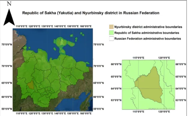
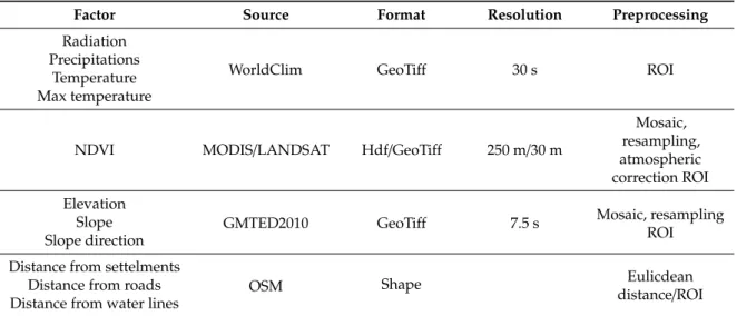
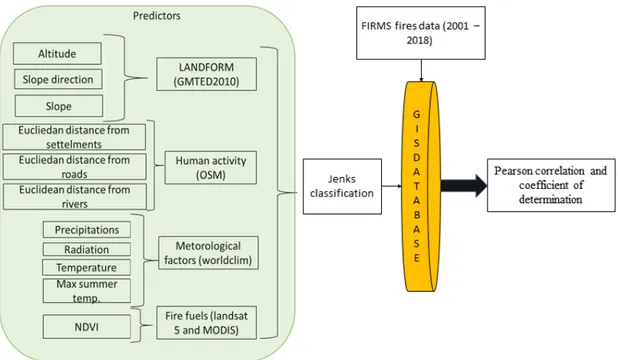
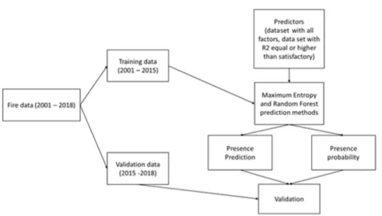
A Comparison of Two Machine Learning Classification Methods for Remote Sensing Predictive Modeling of the Forest Fire in the North-Eastern Siberia
Texte intégral
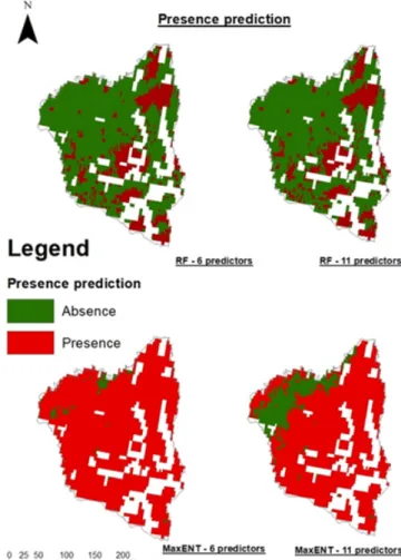
Figure
Documents relatifs
A versatile dual spot laser scanning confocal microscopy system for advanced fluorescence correlation spectroscopy analysis in living cell... for advanced fluorescence
The online database ( http://forest-observation-system.net/ ) provides open access to the canopy height and biomass estimates as well as information about the plot PIs who have
In order to answer this need, this paper aims (i) to assess the potential of multisource, multi-indicator and open access remote sensing in modelling and mapping aboveground biomass
Based on light detection and ranging (LiDAR) data it has been shown for tropical forests that the bias in the selection of small inventory plots may severely hamper extrapolation
We used a random forest regression tree to explore the performance of the different remote sensing data sources and derived indicators for AGB modelling and mapping.. Regression
The instruments give four kinds of “light” variables: (1) the plant area index (PAI) is measured by the LAI- 2000 PCA, hemispherical photographs, and the LAIL; (2) the sky
L’archive ouverte pluridisciplinaire HAL, est destinée au dépôt et à la diffusion de documents scientifiques de niveau recherche, publiés ou non, émanant des
A striking feature in the land cover class dynamics is the shrinking by more than 50% of the area occupied by dense forest between 2006 and 2013, followed by the multiplication by 20
