1881 and 1949 earthquakes at the Chios-Cesme Strait (Aegean Sea) and their relation to tsunamis
10
0
0
Texte intégral
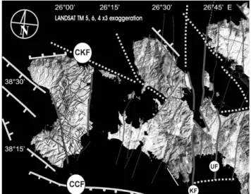
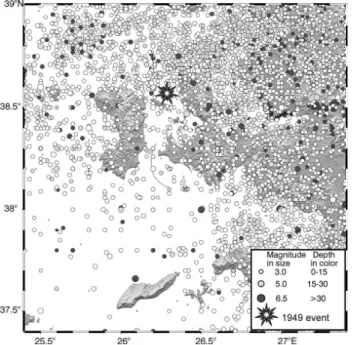
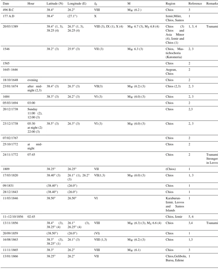
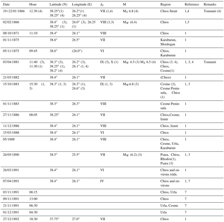
Figure
+3
Documents relatifs