by
MARY JOSEPHINE RICHARDSON A.B., Saith College
(1975)
SUBMITTED IN PARTIAL FULFILLMENT OF THE REQUIREMENTS FOR THE
DEGREE OF DOCTOR OF PHILOSOPHY
at the
MASSACHUSETTS INSTITUTE OF TECHNOLOGY and the
WOODS HOLE OCEANOGRAPHIC INSTITUTION May 1980
Signature of Author:
Joint Progitam in Oceanogiaphy
Massachusetts Institute of Technology - Woods
g1
efceanographic Institution,_May 1980 Certified by:Thesis Supervisor Accepted by:
Chairman, Joint Oceanography Committee in the Earth Sciences, Massachusetts Institute of
Technology - Woods Hole Oceanographic Institution
-2-COMPOSITION AND CHARACTERISTICS OF PARTICLES IN THE OCEAN: EVIDENCE FOR PRESENT-DAY RESUSPENSION
by
MARY JOSEPHINE RICHARDSON
Submitted to the Massachusetts Institute of Technology - Woods Hole Oceanographic Institution Joint Program in Oceanography
on May 2, 1980, in partial fulfillment of the requirements for the degree of Doctor of Philosophy
ABSTRACT
This study of particulate matter in the water column and the underlying surface sediments verifies the occurrence of local,
present-day resuspension in the deep sea. The location of the major portion of this work was the South Iceland Rise, a region influenced by the flow of Norwegian Sea Overflow Water. Measured current
velocities exceeded 20 cm/sec in the axis of the bottom current for the duration of the deployments, approximately two weeks.
Particulate matter was sampled with Niskin bottles, to obtain the standing crop of suspended matter and with sediment traps, to obtain the material in flux through the water column. Box cores were taken to obtain surface sediment samples for comparison with the trap samples.
Suspended particulate matter (SPM) and light-scattering studies demonstrate that in the Iceland Rise area the correlation of the L-DGO nephelometer to concentration of SPM differs between clear water and the nepheloid layer. Correlations of light scattering to
SPM concentration also differ regionally, but for predicting concentration from light scattering, regression lines at two
locations are indistinguishable. Particle size distributions have lower variance in the nepheloid layer than those in clear water which have roughly equal volumes of material in logarithmically
increasing size grades from 1-20 im. Apparent density differences between SPM in clear water and the nepheloid layer are not
distinguishable in the Iceland Rise study; apparent densities increase in the nepheloid laser in the western North Atlantic. An apparent density of 1.1 g/cm adequately separates clear water
from nepheloid layer samples in this region. Compositional
variations seen between clear water and the nepheloid layer include a decrease in small coccoliths and an increase in clays and mineral matter. These compositional variations are more dramatic in the western North Atlantic region, due to dissolution of carbonate at the seafloor, later resuspended into the nepheloid layer.
Sedimentological evidence of resuspension and redistribution of material are: 1) presence of sediment drifts throughout the Iceland Basin; 2) occurrence of coarse, glacial age sediments beneath the axis of the bottom current; and 3) differences in mineralogy, carbonate and organic carbon contents between surface sediments beneath the bottom current and those in a channel.
A comparison of the vertical flux of material measured by sediment traps at 500 meters above bottom (mab) with the
accumulation rate in cores, shows that the present-day surface input is an order of magnitude smaller than the accumulation rate. This observation suggests transport of material into some sections of the region by bottom currents or by turbidity currents.
The horizontal flux of particulate matter into and out of the region by the bottom current is 100 kg/sec. This material may contribute to the formation of Gardar sediment drift downstream. The trends in % CaC03 and % organic carbon through the water column and in the surface sediments suggest that dissolution of carbonate and decomposition and consumption of organic carbon occurs primarily at the seafloor. These data also suggest preferential preservation at channel stations and/or preferential erosion beneath the bottom current.
A comparison of sediment-trap samples with box-core surface samples' further supports present-day resuspension. Benthic foraminifera, iron-oxide coated planktonic foraminifera and the glacial, subpolar planktonic foraminifera (Neogloboquadrina
pachyderma (sinistral)) in traps at 10, 100 and a few specimens at 500 mab, provide conclusive evidence for local resuspension. The coarse fraction (>125 Pm) of the sediment trap material collected at 10 mab comprises 21-34% of the samples. Calculations indicate that this material is locally derived (few kilometers) resuspended
material.
Thesis Supervisor: Dr. Charles D. Hollister Title: Senior Scientist
ACKNOWLEDGEMENTS
Many people have contributed in helping me make this thesis a reality. To all, I am grateful, particularly to any whom I've forgotten to specifically mention.
Charley Hollister, my thesis advisor, has guided, encouraged and financially supported my research. I thank Charley for his tutelage through the years, and for many stimulating discussions on land and at sea. I am especially appreciative of his concern for me as a scientist and as a friend.
I thank Ed Laine, Wilf Gardner, Roger Flood and Sandy Shor, (Charley's other students when I began the Joint Program) for their part in our cooperative ventures and especially for being surrogate advisors in Charley's absence.
The crew and scientists aboard AII-96 made this study possible. In particular, I am grateful for the organization and assistance provided by Dave Johnson, the chief scientist, and Sandy Shor, (a fellow student whose thesis was also derived from that cruise). Al Driscoll, Rick Chandler and Rod Davies were extremely helpful in
technical assistance at sea. Mary Lee Bremer and Kristin Rohr aided in collection of Coulter Counter data, without whose help I never would have slept. I also thank Ted Spencer and Bobby Weeks for teaching and encouraging me in the art of machining, for
-6-This work was financially supported by the Woods Hole
Oceanographic Institution, ONR through contracts N00014-79-C-00-71 NR 083-004, N00014-74-C0262 NR 083-004, and N00014-75-C-0291 and ERDA through contracts 13-7923 and 13-2559.
Data reduction was helped immeasurably by Brian Von Herzen. Lois Toner and Roy Smith kindly allowed use of their laboratories and balances. I am grateful to Chuck Denham and Derek Spencer for assistance with my statistical problems. I thank Bruce Corliss for help in identifying foraminifera, and for perpetual (and
occasionally helpful) haranguing. The assistance of Kozo Takahashi with radiolaria and dinoflagellate identification, and that of
Carol Parmenter and Margaret Goreau, who operated the SEM for this study, is gratefully acknowledged.
My thesis committee, C.D. Hollister, J.B. Southard and D.W. Spencer and other readers, W.D. Gardner, S. Shor, D.A. Johnson, I.N. McCave, P. Biscaye and S. Honjo, have been superb in reading my material promptly and commenting liberally. I am appreciative of their efforts which have improved this thesis substantially.
My thanks to Caki Herrity and Cindy Brown-Stanton who saved me infinite hours by typing the manuscript and tables on the Wang Word Processor. They transformed my arrows and inserts into a finished document. Rick Chandler also helped on the Word Processor. I thank Laurie, Mike, Chic and Dave at WHOI Graphic Arts for quickly and accurately drafting and photographing the figures.
encouragement and friendship through the years. Specifically I thank Alice, Jim, Jerry, Sally, Lin, Peter, Marti, Sharon and Nina.
Finally, I specially acknowledge and thank Wilf Gardner. Wilf has aided my intellectual, emotional, psychological, physical and
spiritual well-being. I thank him for working with me, traveling with me, running with me, and for so many times driving from New York just to be with me.
-8-TABLE OF CONTENTS Page ABSTRACT ... . . . ... 2 ACKNOWLEDGEMENTS .o. . . . ... . . . ... 4 LIST OF FIGURES. . . . . . . . . . . . . . . .. 11 LIST OF PLATES . . . . . ... . . .... 14 LIST OF TABLES . . . . . ... . . .... 15 CHAPTER I - INTRODUCTION. . ... . . .... 16
CHAPTER II - REGIONAL SETTINGS, HYDROGRAPHY AND SAMPLING SCHEMES 19 A. REGIONAL SETTING: ICELAND RISE ... . ... 19
B. REGIONAL SETTING: WESTERN NORTH ATLANTIC. ... 28
C. HYDROGRAPHY. . . . . . . . . . . . ... 31
D. SAMPLING SCHEMES AND APPROACHES . . . . ... 36
Current Competence. . . ... . . .... 36
Suspended Matter .... . . . .. .... 37
CHAPTER III - CHARACTERISTICS OF SUSPENDED PARTICULATE MATTER FROM NISKIN BOTTLES. ... . . ... 40
A. INTRODUCTION . . . 1. . . .. .. .... 40 Nepheloid Layers . . . ... . . .... 41 Historical Perspective ... . . . .... 42 B. OBJECTIVES . . ... . . . .. . .... 46 C. OBSERVATIONAL TECHNIQUES ... . . . .... 46 Concentration of SPM . ... . . . .... 47 Size Distributions. . ... . . . .... 48 Light Scattering . ... . . .... 49 Compositional Analyses ... . . . .... 50 D. RESULTS *. . . . ... . .... ... 51 SPM Concentration . .... . . . .... 51 Iceland Rise . . . .. .. . .... . . .. 54
Western North Atlantic. .... ... 62
Light-scattering Observations ... ... 62
Size Distribution Analyses ... . ... 77
Iceland Rise ... . . . .. .... 77
Western North Atlantic. .... ... 78
Composition of SPM. .... . . .. .... 83
Iceland Rise ... . . . .. .... 83
Western North Atlantic. .... ... 96
E. DISCUSSION . . .. . .... a. 96 Correlation of Light-Scattering Measurements with SPM Concentrations ... . . .. .... 96
Size Distribution Variations ... . ... 106
Volumetric Histograms ... . . ... 107
Apparent Density ... ... .. .... 115
Iceland Rise . ... . .... 119
Western North Atlantic. .... ... 119
Compositional Differences ... ... 125
Iceland Rise ... . .... 125
Western North Atlantic. .... ... 128
F. CONCLUSIONS. ... .. .... 129
CHAPTER IV - COMPARISON OF SEDIMENT TRAP SAMPLES AND THE SURFACE SEDIMENT: EVIDENCE FOR LOCAL RESUSPENSION . . 132
A. INTRODUCTION ... .. .... 132
B. OBJECTIVES ... .. .... 134
C. METHODS . . ... . . . .. . ... 134
Suspended Particulate Matter. ... ... . . 134
Surface Sediment Samples. o ... .. 140
Size Distribution Analyses . .... ... 146
Optical Identification ... . .... 146
Mineralogy . . . . ... . .... 147
Carbonate Determinations. ... ... 147
Organic Carbon and Nitrogen Analyses. . . .... 147
D. RESULTS o...o... . . . ... . . .. 148
Mass Collected by the Sediment Traps. o. .. .. 148
Particle Size Distributions. ... o.. 152
Sediment Traps . . o... . . . .... 152
Surface Sediments ... . .... 155 Optical Identification ... . .... 156 Sediment Traps ... . .... 156 Foraminifera ... . .... 156 Radiolaria . ... . .... 163 Pteropods . ... . .... 164 Diatoms ... . .... 164 Dinoflagellates ... ... 167 Fecal Pellets ... . .... 167
Unidentified Biogenic Material ... 170
Volcanic Glass. . .. . . ... 170
Mineral Grains and Aggregates. ... 170
Surface Sediments ... . .... 171
Foraminifera ... . .... 171
Radiolaria ... . .... 175
Pteropods ... . .... 175
Diatoms . ... . . .... 176
Dinoflagellates, Fecal Pellets and Unidentified Biogenic Material.. .... 176
Volcanic Glass. . .. . . . . .. . 176
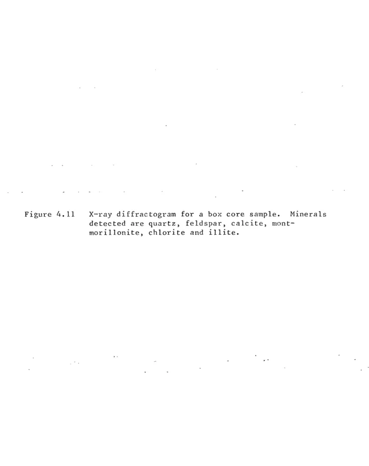
-10-Page Mineralogy ... ... 179 Sediment Traps ... . .... 179 Surface Sediments ... . .... 179 Carbonate Content . . .. . .. ... . .... 182
Organic Carbon and Nitrogen Contents. . .... 190
E. DISCUSSION ... ... 197
Present Day Resuspension of Sediments. 0... .... . 197
Advective Transport by the Bottom Current . .... 200
Relationship of the Bottom Water to Suspended Particulate Matter ... . .. ... 201
Quantity and Variability of Advection Transport . 206 Horizontal Versus Vertical Fluxes. . ... 207
Estimates of the Quantity of Resuspended Material 209 Dissolution and Degradation at the Seafloor . 213 Regional Patterns of Surface Sediments . .... 214
Distance of Transport. ... . .... 215
F. CONCLUSIONS. ... ... 220
CHAPTER V - SUMMARY AND CONCLUSIONS .... ... 222
REFERENCES ... ... 227
Figure Page
CHAPTER II
2.1 Generalized flow of bottom water in the North Atlantic
with study area locations .... ... 21
2.2 Bathymetry, station locations and current measurements in the Iceland Rise study area .. ... 24
2.3 Bathymetry of the northeastern North Atlantic showing
the major sediment drifts ... . . .... 26
2.4 Station locations and current patterns in the western
North Atlantic study area .... ... 30
2.5 Stick diagrams of current meter velocities on the
East Katla Ridge ... . ... 34
CHAPTER III
3.1 Idealized nephelometer profile .. ... 44
3.2 Cross-section of concentration of suspended matter for
the western Atlantic Ocean.... ... .4 56 3.3 Profiles of concentration of SPM for the northern and
southern lines in the Iceland Rise region. .... 58 3.4 Profiles of concentration for stations 28-29, 40 and
85 in the Iceland Rise region... . . ... 61 3.5 Cross-sections of SPM for the northern and southern
lines. ... ... ... 64
3.6 Cross-section of SPM for the western North Atlantic
region ... ... 66
3.7 Nephelometer profiles from the Iceland Rise region. . 69 3.8 Nephelometer profiles from stations 28, 40 and 84 . . 74 3.9 Cross-section of light-scattering for the Iceland
-12-Figure Page
3.10 Particle size distributions at station 25 from clear
water and nepheloid layer samples . ... 80 3.11 Particle size distributions at station 39 from clear
water and nepheloid layer samples .. .... 82 3.12 Particle size distributions at station 718 from clear
water and nepheloid layer samples . ... 85 3.13 Compositional variability of suspended particulate
matter -- Iceland Rise . ... -. 88
3.14 Compositional variability of suspended particulate
matter -- western North Atlantic. .. .... 98 3.15 Correlation of light-scattering to concentration of
SPM for Iceland Rise data .... ... 102 3.16 Correlation of light-scattering to concentration of
SPM from Biscaye and Eittreim (1974; 1977) . . - - 105 3.17 Particle size distributions from 700 and 1479 m for
station 67 .... . ... -.-.-.-.-. 109
3.18 Particle size distributions and associated
parameters . . . . . . . - -. . - - - - 112 3.19 Slopes from normalized differential volume
distributions versus depth. . . . . . ... . 114 3.20 Individual profiles of normalized differential
volume distributions. . .... -.-. -.-.-. 117 3.21 Apparent density of samples from the Iceland Rise . . 121 3.22 Apparent density of samples from the continental rise
southeast of New York . .... -.-.-.-.-. 124 CHAPTER IV
4.1 Box core and sediment trap mooring locations. . . . 137 4.2 Mooring diagram of sediment traps for northern
Figure Page 4.3 Mooring diagram of sediment traps for the canyon
station . . . . . . . .. . - . - - - 142
4.4 Schematic diagram of the sediment trap used . . . . 144
4.5 Apparent vertical fluxes of material through the
water column ... ... .. ... 151
4.6 Particle size distributions for sediment trap samples. 154 4.7 Particle size distributions for surface sediment
samples ... ... -. 158
4.8 Energy dispersive X-ray spectroscopy of sediment
trap material ... ...-.-.-...- 169
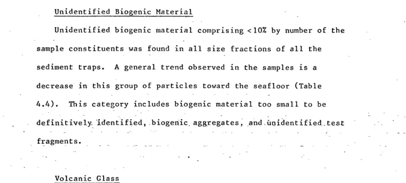
4.9 Energy dispersive X-ray spectroscopy of surface
sediments . ... . . .. .-. 178
4.10 X-ray diffractogram for a sediment trap sample . . . 181 4.11 X-ray diffractogram for a surface sediment sample . . 185 4.12 Calcium carbonate percentages in sediment trap
and box core samples. . -.-... -. -.-.-.-.-. 187 4.13 Calcium carbonate percentages for box core surface
samples . ...--.-.-.-.-.-.-.-. 189
4.14 Organic carbon percentages in sediment trap and
box core samples .. . . -.-. -.-.-.-. 192 4.15 Organic carbon percentages for box core surface
samples ... . - . -.-. -.-.-.-.- .194
4.16 Potential temperature and light-scattering plot. . 203 4.17 Potential temperature versus salinity . .... 205
-14-LIST OF PLATES
Plate Page
CHAPTER III
3.1 SEM photomicrographs of suspended particulate matter
from the Iceland Rise and western North Atlantic . . 53 3.2 SEM photomicrographs of suspended particulate matter
from clear water and nepheloid layer samples. . . . 91 CHAPTER IV
4.1 SEM photomicrographs of components of the >63 Pm
fraction of the sediment traps .. ... 161 4.2 SEM photomicrographs of components of the >63 ym
fraction of the sediment traps and surface sediments . 166 4.3 SEM photomicrographs of components of the >63 ym
LIST OF TABLES Table CHAPTER I 2.1 CHAPTER I 3.1 3.2 3.3 Page I
Current meter data summary from the Iceland Rise. II
Percentage of SPM by particle type from the Iceland Rise and western North Atlantic
Chi-square analysis of compositional data from the Iceland Rise and western North Atlantic.. ... Least-square regression equations for light-scattering versus concentration correlations.. . ... CHAPTER IV
4.1 Sediment trap mooring data... ... 4.2 Box core data . . . .
4.3 Mass of sediment trap samples. .. ... 4.4 Percentage of sediment trap samples by particle type 4.5 Foraminifera in the sediment trap and surface
sediment samples
4.6 Percentage of surface sediments by particle type. . 4.7 Semiquantitative mineralogy of surface sediments. . 4.8 Carbonate, organic carbon and nitrogen from sediment
traps . . . . . . . .... . . .. .
4.9 Carbonate, organic carbon and nitrogen from surface
sediments... . ....
4.10 Calculated percentage of resuspended material from mass, carbonate and organic carbon . . . . . . 4.11 Particle fall velocities from mooring 2, trap 10 mab
32 89 95 100 135 145 149 159 162 172 183 195 196 210 217
-16-CHAPTER 1 INTRODUCTION
Voluminous sediment drifts in the northern North Atlantic (e.g., Feni, Gardar, and Hatton sediment drifts; Jones et al., 1970;
Hollister et al., 1978; McCave et al., 1980) are evidence for the transport and redistribution of massive quantities of deep-sea sediments through geologic time. The working hypothesis of this thesis is that resuspension of deep-sea sediments continues to occur in the northern North Atlantic, specifically in the Iceland Rise region, and is measurable on time scales of days to months.
This investigation, to study present-day resuspension and its influence on the characteristics of suspended particulate matter, was principally conducted on the south Iceland Rise. This region is
particularly suitable for three reasons: 1) Norwegian Sea Overflow Water flows roughly parallel to contours through the region at velocities in excess of 20 cm/sec (Steele et al., 1962; Shor,
1978). Laboratory experiments indicate that these speeds are capable of eroding cohesive shelf sediments and abyssal clays
(Lonsdale and Southard, 1974; Young and Southard, 1978), and so they are probably capable of eroding the local sediments. 2) Near-bottom nepheloid layers are present with high concentrations of suspended particulate matter. The existence of these features is indicative of an ongoing process keeping material in suspension near the
erosion and redistribution through the Recent. For example, beneath the axis of the bottom current, the small amount of Recent sediment present is coarse--grained, winnowcd of its fines. Also, the Katla Ridges (Malmberg, 1974), which are sedimentary features in the study
area, have been constructed and shaped by both bottom currents and turbidity currents through geologic time (Shor, 1979). In addition, farther downstream lies the Gardar sediment drift, a huge pile of sediment formed by deposition from bottom currents (Hollister et al., 1978; McCave et al., 1980).
A large portion of this work focuses on the transport and properties of suspended particulate matter. Particulate matter in
the water column was collected with both water bottles and sediment traps in two regions, the Iceland Rise and the continental rise southeast of New York. The suspended particulate matter was examined to determine and interpret the changes in particles that occur from mid-water depths through the near-bottom nepheloid
layer. Surface sediments recovered in box cores were compared with trapped material to estimate the fraction of resuspended material and to assess the changes occurring to particles from transit
through the water column to residence on the seafloor. Current-meter measurements and CTD lowerings were used to determine the spatial extent and magnitude of the bottom current, and together with measurements of the suspended particulate matter concentra-tions, to estimate the horizontal transport of particulate matter.
Specific questions addressed in this thesis are:
(1) Where are the present bottom-current velocities sufficient to erode the local surface sedinents?
(2) What are the composition and characteristics of material settling from the surface waters, and how do they differ from those of material being transported in the near-bottom
nepheloid layer?
(3) What processes are responsible for the observed changes in suspended particulate matter in the water column?
(4) What fraction of nepheloid-layer particles are resuspended? (5) How far can particles travel in single episodes of
resuspension?
The structure of the thesis in answering these questions is as follows. Chapter II details the regional settings, summarizes the hydrography, and explains the rationale for the sampling schemes selected. Chapter III discusses the horizontal and vertical spatial variability in characteristics of suspended particulate matter in the Iceland Rise region and along the continental rise in the western North Atlantic. It emphasizes the existence and
interpretations of the differences between near-bottom nepheloid waters and the overlying clear water. Chapter IV deals with resuspension and advection by bottom currents as inferred from a comparison between the composition of the contents of sediment traps
in the lower portion of the water column and that of the surface sediments. Chapter V is a summary of the conclusions of the thesis.
CHAPTER II
REGIONAL SETTINGS, HYDROGRAPHY AND SAMPLING SCHEMES
The principal study region for this thesis work is the Iceland Rise. To broaden the scope of the work beyond a regional study, a comparison of the Iceland Rise results of suspended particulate matter is made with the results of a similar study in the western North Atlantic across the continental rise southeast of New York. This comparison allows the site-specific results to be
differentiated from those perhaps more generally applicable. A detailed description of the Iceland Rise region and a summary of the applicable regional and hydrographic differences in the western North Atlantic continental rise region follows.
REGIONAL SETTING: ICELAND RISE
Previous investigations have shown that Norwegian Sea Overflow Water dominates the abyssal circulation of the northern and western North Atlantic (Figure 2.1; Lee and Ellett, 1965; Worthington, 1969; Worthington, 1976). In the Arctic basins and shelves north of
Iceland, surface water is cooled and mixed downward by convective overturning in the winter (Peterson and Rooth, 1976). This cold, dense water mixes with warmer, more saline North Atlantic water as it cascades over sills in the ridge from Greenland to Scotland (Steele et al., 1962; Crease, 1965; Lee and Ellett, 1965;
-20--Figure 2.1 Generalized western boundary, bottom-water circulation in the North Atlantic. Study areas south of Iceland and southeast of New York. denoted by the box and triangle respectively, are located in the path of a bottom current.
-22-Swift et al., 1980). Water flows southward along the eastern flank of the Reykjanes Ridge, and westward through the Charlie-Gibbs Fracture Zone at approximately 530 (Worthington and Volkmann, 1965; Garner, 1972; Schmitz and Hogg, 1978; Shor et al., 1980). From this latitude southward, the overflow water is mainly restricted to the western basin of the North Atlantic and flows along the western boundary.
The south Iceland Rise, the study area for this work (Figure 2.1), is directly in the path of the Norwegian Sea Overflow Water. This water flows southwestward through the region directed upslope from the contours of the East Katla Ridge by 300 to 450 (Figure 2.2; Steele et al., 1962; Worthington, 1970; Shor et al., 1977).
Significant transport of Norwegian Sea Overflow Water, with current velocities on the order of 20-30 cm/sec (Shor, 1979), has been
documented through this region.
Geologic effects of the Norwegian Sea Overflow Water are seen in abundance in the Iceland Basin region (Figure 2.3). Gardar Drift on the western side of the Iceland Basin, Feni Drift in Rockall Trough, and Hatton Drift on the western flank of Rockall Plateau are all thought to be formed and molded by deposition and redistribution of sediments from the overflow water (Johnson and Schneider, 1969; Jones et al., 1970; Davies and Laughton, 1972; Ellett and Roberts, 1973; Lonsdale and Hollister, 1979; McCave et al., 1980).
The detailed study region, the Katla Ridge province (Figure 2.2; Malmberg, 1974) in the south Iceland Rise, consists of two
Figure 2.2 Bathymetry of the Iceland Rise study area. Contours are in corrected meters. Current measurements were made along the northern transect across the eastern flank of the East Katla Ridge. Current velocities show westward to southwestward flow with an upslope component. The southern transect of stations extends
from the nose of the West Katla Ridge into the Iceland Basin.
-24-49*W 18* 17* 16*W
o
CURRENT
METERS
* CTD/ NEPHEL/ HYDRO
STATIONS
CURRENT VELOCITY
20 4062*N
6i*N
-2--Figure 2.3 Location of the major sediment drifts in the
northeastern North Atlantic. Arrows trace the flow of bottom water through the region. From McCave et al.
-26-28*W
24
0W
4
00
620N~
60*N
-58*N -1 1 00 56*N54
0N
1977). The East Katla Ridge, striking NNE, has smooth parallel contours along its eastern flank from 1200-2100 m. Along this flank, the overflow water flows as a geostrophic current, roughly parallel to the regional contours (Steele et al., 1962). East Katla Ridge is separated from West Katla Ridge by a narrow
turbidity-current canyon. The West Katla Ridge, oriented approximately N-S, has a wide, blunt nose and is separated from Gardar Drift to the southwest by a second turbidity-current canyon (Figures 2.2 and 2.3).
The south Iceland Rise is a region where both a strong surface source and a resuspended input of particulate matter are to be expected. Biogenic material in the surface waters and terrigenous material from volcanic and glaciofluvial sources are probable components of the flux of primary particulates (i.e. those of
surface origin) through the water column. These sources are likely to have peak inputs during the spring and summer months, during the period of sampling for this study. The input of resuspended
material is likely to be high due to the strong flow of Norwegian Sea Overflow Water through the region. The bottom current may be sporadic (Steele et al., 1962), but it has been observed in both winter and summer (Crease, 1965; Lee and Ellett, 1965; Shor, 1979). A mean velocity in the current core greater than 20 cm/sec was
--28-REGIONAL SETTING: WESTERN NORTH ATLANTIC
The area chosen for comparative study of the characteristics of particulate matter was the continental rise southeast of New York in the western North Atlantic (Figure 2.1). Hydrographically, this region is influenced by the deep northeastward-flowing Gulf Stream Gyre System (Worthington, 1976; Luyten, 1977; Laine and Hollister, 1980), and the southwestward-flowing Western Boundary Undercurrent (Figure 2.4; Hollister, 1967; Zimmerman, 1971; Richardson, 1977). Through geologic time, deep contour-following currents have shaped and developed the continental rise of eastern North America (Heezen et al., 1966; Field and Pilkey, 1971; Eittreim and Ewing, 1972; Hollister and Heezen, 1972). This continental boundary is dissected by many canyons which may have disgorged vast amounts of terrigenous debris into the deep sea during lower stands of sea level;
presently, however, most of the sediment transported by rivers is trapped in estuaries and does not escape the continental shelf (Meade, 1972). Some terrigenous material may be supplied at
mid-water depths by horizontal transport from the continental slope (Drake et al., 1972; Pierce, 1976). The introduction of biogenic material from the surface waters decreases rapidly from the highly
productive, nutrient-rich slope waters to the unproductive Sargasso Sea. Particle input to the water column from the seafloor by
resuspension and advection of sediments in this region, is possible from either the Gulf Stream Gyre System or the Western Boundary Undercurrent.
Figure 2.4 Locations of hydrographic stations in the western North Atlantic. Stations were taken from the base of
the continental slope to the lower continental rise. Arrows indicate the abyssal flow of the Western Boundary Undercurrent and the Gulf Stream Gyre.
800 750 70*
450
400
350 30* - 250 50*65*
60*
55*0
HYDROGRAPHY
The Iceland Rise study, of which this thesis work is a part, was a multidisciplinary, cooperative effort. As part of a comprehensive study of bottom currents and abyssal sedimentation south of Iceland, Shor (1979) described the hydrography of the region. The specifics of the instruments and methods used and calculations made for his work are contained in Shor (1979). A summary of his results which are pertinent to this study follows.
Six current meters were deployed for approximately one week, each during a two week period, at 10 m above bottom (mab) down the eastern flank of the East Katla Ridge from 1200 to 2171 m at 200 m isobath intervals (Figure 2.2). The meters between 1393 and 1796 m recorded velocities in excess of 20 cm/sec for the duration of the experiment (Table 2.1). The direction of flow was predominantly to the west-southwest, tending approximatly 300 upslope with a
maximum speed of 29 cm/sec (Figure 2.2). To the northwest and southeast of this inferred core of the overflow current, the mean current speed was 10 cm/sec or less, and flow directions were more variable. At the 2000 m mooring, the current record indicates velocities below threshold (<2 cm/sec) for two days. Prior to and following this event, currents exceeded 20 cm/sec (Figure 2.5).
Current meter data are restricted to a single transect of stations across the region, referred to as the northern transect (see Figure 2.2). Photographic evidence of currents agrees well
TABLE 2.1: Current meter data. (from Shor,
HT ABOVE
BOTTOM DURATION VECTOR MEAN MEAN SPEED VELOCITY @ 2170
(meters) (hours) speed direction (cm/sec) (cm/sec)
162 151 144 156 152 132 LATITUDE 62017.4'N 62028.3'N 62034.9'N 62010.8'N 62023.2'N 62030.8'N 10.6 cm/sec 20.9 cm/sec 13.3 cm/sec 5.8 cm/sec 20.0 cm/sec 18.7'cm/sec LONGITUDE 17024.6'W 17053.5'W 18015.0'W 17003.6'W 17042.4'W 18004.8'W 22 70T 2260T 2820T 2730T 2470T 2650T 14.0 21.0 14.5 8.8 20.4 21.5 WATER DEPTH 2000 (meters) 1600 1177 2171 1796 1393 10.4 13.7 5.4 3.2 17.3 12.5 GMT 2300/26 June-1900/03 July 0400/27 June-1330/03 July 0820/27 June-1000/03 July 0300/04 July-1800/10 July 0825/04 July-1200/10 July 1930/04 July-0800/10 July CM 1 CM 2 CM 3 CM 4 CM 5 CM 6 CM I CM 2 CM 3 CM 4 CM 5 CM 6 1979)
Figure 2.5 Current velocity vectors plotted against time. Current meter locations are shown in Figure 2.2. Measurements are 30-minute averages. Tidal components have not been removed. Note the consistency of velocities in
the three meters at 1393, 1600 and 1796 m, located in the core of the overflow water. From Shor (1979).
9 A~D ILJIIA*01 (1-086 WO) 033dS i i : 0 C 0
.:\
I- I /
IIA-17
jJW) W0091 *W LLII 2 Vo IA-LZ ot GaV///A\\\ \\\ k
I
I
III
//
I
/,
4 1
-indicated for canyon stations.
Geostrophic calculations made from hydrographic sections generally show southwestward velocities increasing with depth for individual pairs of stations. Calculated velocities are highest between 1600 and 1800 m for the northern transect and between 1800 to 2100 m for the southern transect, which corresponds with the minima in potential temperature (see Shor, 1979; Figures 2.5 and 2.6). Volume transport through the northern transect is calculated
6 3
to be 5.0 x 10 6m /sec; and through the southern line, is
6 3 6 3
4.2 x 10 m /sec. A small eastward flow, 0.8 x 10 m /sec, was indicated between stations 31 and 76.
Isothermal bottom mixed layers along the northern transect of stations were observed to be 30-50 m thick in the axis of the bottom current; off-axis and along the southern line, the layers were
10-20 m thick. These layers are thought to form by turbulent mixing at boundaries (Armi, 1978). In this study, the thickest mixed
layers occur in conjunction with the highest velocities or in the canyon. Mixed layers are absent where current velocities are
inferred from direct measurements and geostrophic calculations, to be low (see Shor, 1979; Figure 2.8).
-36-SAMPLING SCHEMES AND APPROACHES
A primary purpose of this thesis is to determine whether
resuspension is presently occurring and to examine the influence of resuspension on the composition and characteristics of suspended particulate matter. Approaches to this problem and the rationale
for using particular sampling schemes are discussed in this section.
CURRENT COMPETENCE
Resuspension is generally acknowledged to be responsible for the existence of nepheloid layers in the deep sea (Heezen et al., 1966; Betzer and Pilson, 1971; Eittreim and Ewing, 1974; Biscaye and
Eittreim, 1977). However, it is difficult to predict the conditions under which a deep-sea current is competent to actively resuspend
seafloor sediments. Laboratory flume experiments have estimated critical erosion velocities for deep-sea clays and oozes to be in
the range of 15-35 cm/sec (Southard et al., 1971; Lonsdale and Southard, 1974; Young and Southard, 1978). Within the axis of the overflow current, from 1400-1800 m along the flank of the East Katla
Ridge, velocities were within this range for the duration of the experiment. Upslope and downslope of the axis, velocities are
usually less than 15 cm/sec (Figure 2.5). This observation suggests that resuspension may be occurring during the entire time of the experiment in the current core, and occasionally when velocities exceed those critical for erosion, at the stations further removed.
Since the laboratory experiments of Southard and co-workers represent idealized circumstances and were not performed with sediment or biota from this particular study area, a comparison of the field and laboratory measurements alone cannot be used to conclusively establish that resuspension is actively occurring. Instead, it simply indicates that resuspension is likely. Suspended particulate matter in the study area was examined to determine
whether changes in the composition and characteristics of the particles in the lower portion of the water column were indicative of resuspension.
SUSPENDED MATTER
Suspended particles are usually measured by filtration of water samples collected with Niskin bottles (Brewer et al., 1976). This method gives only an instantaneous point measurement of concen-tration, and with the small volume of water collected (5-30 liters), does not provide a representative sample of the rare larger
particles in suspension (Bishop, 1977). Large particles may be major contributors to the mass flux of material through the water column (McCave, 1975). The two principal means of collecting these large particles are large-volume filtration systems and sediment traps (Bishop, 1977; Gardner, 1977a; Honjo, 1978; Spencer et al., 1978). Large-volume filtration has been restricted to shallow depths (<1500 m), precluding sampling in the deep-sea near-bottom nepheloid layer. Sediment traps can be used at all water depths.
-38-Niskin bottles were used to collect the standing crop of small particles. Based on SEM photomicrographs of filtered samples and particle size distributions measured with a Coulter counter, most material collected in Niskin bottles below the surface water in the
study region is less than 20 pm. Based on the assumption of Stokes-law settling, the vertical fall velocities of particles in this size range, (5 x 10⁻⁵ to 1.3 x 10⁻² cm/sec), are more than three orders of magnitude less than the horizontal velocities in the core of the bottom current south of Iceland. This suggests that the material collected by the Niskin bottles in the high current areas of this study is a quasi-conservative property of the water.
Sediment traps were used to collect time-integrated samples of the suspended material in flux. The size of material caught by the sediment traps ranged up to a few millimeters, indicating that there are large particles in flux through the water column which are not collected by water bottles. However, sediment traps are not only
large particle collectors: 5-42% of the trap samples are composed of particles less than 20 pm. One problem with sediment traps is that
the state of aggregation of particulate matter when it enters the traps is unknown. Loose aggregates may break up and with the high concentration of material on the floor of the sediment traps, aggregates may form. Size fractionation by sieving reveals small particles, particularly volcanic glass, adhered to large pteropods,
foraminifera, diatoms, and organic matter. This agglomeration may have occurred in the sediment trap. The presence of intact and
collapsed fecal pellets on filters from the sieved fractions indicates that these aggregates maintain their integrity through wet-sieving, but filtration and drying of the samples may cause pellets to collapse.
Measurement of concentrations of suspended particulate matter from water bottles is limited by the number of bottles per cast. Nephelometers provide nearly continuous measurements of light
scattering through the water column. To give a more detailed view of the distribution of suspended particulate matter,
light-scattering observations were made during this study and correlated with concentrations of suspended matter from samples obtained at the
same time.
These three instruments, Niskin bottles, sediment traps, and the nephelometer, were used to obtain information on suspended
particulate matter during this study. The results are discussed in the following chapters.
-40-CHAPTER III
CHARACTERISTICS OF SUSPENDED PARTICULATE MATTER FROM NISKIN BOTTLES
INTRODUCTION
The distribution and redistribution of marine particulate matter is of great importance in interpreting the biological, chemical and geological processes acting in the deep sea. Particulate matter
from the productive surface layer descends through the water column slowly by individual particle settling and rapidly by fecal-pellet transport, providing organic-rich food to the benthic communities. Adsorption of dissolved species and scavenging of chemical elements by the particulate matter may affect the distribution of chemical tracers and radioisotopes throughout the water column.
Geologically, the suspended material in flux to the seafloor may ultimately become part of the sedimentary record.
Presently, a primary source of particulate matter to the deep ocean is the surface waters. Rivers, and off Iceland, glaciers, deliver high suspended loads of terrigenous material as well as dissolved nutrients necessary for the proliferation of plankton. Phytoplankton and zooplankton dominate the particles present in the surface waters. Their skeletons and pellets sink, comprising a
large fraction of the material in transit through the water column. Other components, such as volcanic and wind-blown detritus, are regionally important constituents of the suspended matter.
processes are responsible for changing the characteristics of the particulate matter during descent through the water column to the seafloor.
Suspended material is also derived from the seafloor. Only infrequently does freshly deposited material become permanently incorporated into the sedimentary record at its first place of deposition. More commonly, animals living in and on the seafloor reprocess and transport the sediments through feeding and
bioturbation. Deep-sea currents can also resuspend and transport the surface sediments. Both these mechanisms, animals and currents, re-introduce previously deposited material into the water column. This recurrent resuspension can result in vast redistribution of material (Ewing and Hollister, 1972).
Suspended matter originating from the surface waters may differ in its characteristics of particles from that originating at the sea floor. Assessing and interpreting the differences in particles settling from the surface waters versus those resuspended from the seafloor is the purpose of this chapter.
NEPHELOID LAYERS
In many areas of the oceans, after a decrease in concentration of suspended particulate matter (SPM) with depth due to dissolution,
-42-decomposition, and consumption in the water column, there is an increase in the concentration of SPM near the seafloor. This layer of increased concentration of SPM (the near-bottom nepheloid layer) is thought to be due to resuspension of sediment from the seafloor (Heezen et al., 1966; Betzer and Pilson, 1971; Feely 1975; Brewer et al., 1977; Biscaye and Eittreim, 1977). The depth of minimum concentration of SPM above the near-bottom nepheloid layer is termed the "clear-water minimum" (Biscaye and Eittreim, 1977; Figure 3.1). Below this level, there is an increase in the resuspended component of the SPM. By sampling in clear water and the nepheloid layer below, the increasing influence of resuspended sediment can be examined.
HISTORICAL PERSPECTIVE
The characteristics of marine particulate matter have been
studied extensively only in the past decade. With the initiation of the GEOSECS program, a detailed examination of the geochemistry of abyssal ocean water and SPM was begun. The GEOSECS program
collected SPM for chemical, mineralogic, and microscopic analyses (Brewer et al., 1976). Since GEOSECS began, numerous techniques have been employed to determine the properties of suspended material. Compositional analyses have been performed with the scanning electron microscope for morphologic identification (Honjo et al., 1974; Honjo, 1976; Feely, 1976; Bishop et al., 1977), X-ray diffraction for mineralogy (Feely, 1975), and neutron activation and
Figure 3.1 Idealized nephelometer profile. The unit Log E/ED
is a measure of scattering made by comparing the scattered light to a direct beam. Cross-batched area represents the near-bottom nepheloid layer. Note the
-44-LIGHT- SCATTERING
LOG E/ED
0.8
1.2
CLEAR WATER
-MI
NIMUM
NEPHELOID
-
LAYER
0.4
1000
C~)q)
K
2000
atomic absorption for elemental determination (Spencer et al., 1972; Krishnaswami and Sarin, 1976; Bishop et al., 1977). Size
distributions of suspended matter have been determined with
instruments which count and discriminate particles by volume, e.g., a Coulter counter (Carder et al., 1971; Plank et al., 1972; Sheldon et al., 1972; Brun-Cottan, 1976). Optical devices, nephelometers and transmissometers, have been widely used to indirectly measure the concentration of SPM. Nephelometers, which measure scattered light, have been used to document the existence of near-bottom nepheloid layers in many areas of the world's oceans (Ewing and Thorndike, 1965; Eittreim et al., 1972; Eittreim and Ewing, 1972; Biscaye and Eittreim, 1974; Kolla et al., 1976; Biscaye and
Eittreim, 1977). Transmissometers, which measure transmitted light (a function of both absorption and scattering by SPM and water), have been used to monitor variations in the quantity of SPM, particularly in surface waters (Pak and Zaneveld, 1977; Bartz et al., 1978). Using data on SPM concentration and size, models have been formulated for the vertical flux of particles in the ocean (McCave, 1975; Bishop, 1977).
These techniques have been used to gain a global perspective of the distribution of SPM, gross compositional information, and
preliminary ideas about its dynamics. Now that this base-line information has been established, it is possible to examine in detail those characteristics of marine particulate matter that may yield insight into its behavior and provenance.
-46-OBJECTIVES
Geological and physical-oceanographic data were obtained in the North Atlantic along the Iceland Rise (cruise ATLANTIS 11-94) and in the western North Atlantic along the continental rise (cruises
DALLAS, KNORR-58, and OCEANUS-6) with the following objectives in mind:
(1) to determine the differences between clear-water particles and nepheloid-layer particles with respect to size distribution, composition, density, and light-scattering characteristics in limited study regions;
(2) to identify properties of particles which might be useful in distinguishing their prior source;
(3) to determine whether differences observed between properties of nepheloid-layer particles and clear-water particles are
regionally site-specific;
(4) to identify those processes which most strongly influence particle characteristics, e.g., dissolution, decomposition,
deposition, and resuspension.
OBSERVATIONAL TECHNIQUES
This investigation is a comparison of the characteristics of the SPM in two regions: the Iceland Rise and the continental rise
southeast of New York (Figure 2.1). A total of thirty-two
occupied on the Iceland Rise during June and July 1977 (Figure 2.2), and seven hydrographic stations were occupied in the western North Atlantic along a transect southeast of'New York in the summer of
1976 (Figure 2.4). Each hydrographic station employed six to twelve 5 or 30 liter Niskin bottles for collection of SPM. Samples were collected from the lower portion of the water column from both clear water and the near-bottom nepheloid layer. Reversing thermometers
were used to obtain accurate records of sample depth in mid-water; a pinger was used to determine the height of the bottom bottles above the sea floor. Simultaneous nephalometer profiles using an
L-DGO-Thorndike deep-sea photographic nephelometer (Thorndike, 1975) were taken at most Iceland Rise stations to ensure that samples were from a known position relative to the nepheloid layer (if present).
CONCENTRATION OF SPM
A 250 ml aliquot was taken from the Niskin bottles immediately on retrieval for size distribution determination of SPM. The remaining water was filtered with an in-line vacuum filtration system through a preweighed 47 mm diameter, 0.4 pm Nuclepore
filter. Filters were washed ten times with filtered distilled water to remove salt and reweighed upon return to the laboratory to
determine the mass of particles. For the Iceland Rise, water beneath the spigot was filtered onto a separate filter to collect the
"dregs" (Gardner, 1977b). For the western North Atlantic, the entire water bottle was filtered onto one filter by tilting the
-48-bottle to remove all the water. Concentrations reported as
"corrected" concentration include this "dregs" material. Combined errors in filter weighing and volume readings amount to ±9% for
concentrations of 20 11g/l and +5% at 100 pg/l.
SIZE DISTRIBUTIONS
Size distribution of SPM was determined with a Model TA II Coulter counter. With this instrument, particles suspended in an electrolyte (seawater) are drawn through a small aperture. When a
suspended particle passes through the aperture, it decreases the
volume of electrolyte in the aperture, thereby increasing the resistance and decreasing the current in the circuit. The percent current change is proportional to the ratio of the particle volume
to the aperture volume. This relationship is linear for particles having diameters between 2% and 40% of the aperture diameter
(Sheldon and Parsons, 1967).
Coulter-counter data are recorded in terms of either total
number or total volume of particles counted and are subdivided into
logarithmically increasing size grades, each grade representing a doubling of volume. A 50pm aperture and a 2.0 ml sample size were used in this study to measure the size distribution of particles
LIGHT SCATTERING
Light-scattering was measured with a L-DGO-Thorndike deep-sea photographic nephelometer (Thorndike, 1975), designed to measure relative forward light scattering from 80 to 240. Although
light scattering is dependent on all the optical properties of the particles (Jerlov, 1968), forward scattering is most sensitive to variations in concentration of SPM and least sensitive to variations
in particle size and index of refraction (Thorndike, 1975).
The nephelometer is composed basically of a light source and a camera lens. An attenuator is situated between the source and lens
to calibrate direct light. Scattered light as well as the
attenuated direct light are measured by the nephelometer. A ratio is formed between the intensity of the scattered light, E, and that of the attenuated direct light, ED, to form a scattering index, E/E . Forming this ratio circumvents problems involved in
correcting the scattering values due to variation in the intensity of the source and direct beam attenuation losses. Nephelometer readings are most often reported in terms of log(E/E *
D
Nephelometers are optical instruments and cannot directly yield absolute concentrations of SPM. However, nephelometer readings in a
few instances have been calibrated by sampling and filtering water for SPM from nephelometer lowerings (Beardsley et al., 1970; Baker et al., 1974; Carder et al., 1974; Sternberg et al., 1974). The L-DGO-Thorndike nephelometer has been calibrated by Biscaye and Eittreim (1974) through their work in a limited region of the
-50-Blake-Bahama Outer Ridge and the Hatteras Abyssal Plain (BBOR-HAP). A slightly different calibration for this instrument was obtained by
them from the eastern North American lower continental rise (LCR) (Biscaye and Eittreim, 1977).
COMPOSITIONAL ANALYSES
Composition of the SPM collected from the near-bottom nepheloid layer and overlying clear water was studied by photographing
sections of filters with a scanning electron microscope. Five stations in the Iceland Rise area and two along the western North Atlantic transect were selected for quantification of the
composition of SPM. A sample from the nepheloid layer and one from clear water for each station were photographed for optical
identification of the SPM. Four or five random photographs were taken in each of four sections of a filter to determine homogeneity of the SPM on the filters.
Additionally, "dregs" filters from two of the Iceland Rise samples were photographed and counted to allow a valid comparison with the western North Atlantic samples, where the entire sample was collected on one filter. A comparison of "dregs" composition to that of the above-spigot sample was made for the Iceland Rise
samples to examine the differentiation of the SPM while settling in the water samplers (Gardner, 1977b).
Twelve classes of particles were identified and counted: small coccoliths (<4 pm), large coccoliths (>4 ym), centric diatoms,
pennate diatoms, dinoflagellates, organic macter, plankton
fragments, fecal pellets, aggregates, clays, mineral matter, and unidentified particles (Plate 3.1). Particles smaller than two microns were not included in the counts since positive
identification was impossible.
Chi-square analysis of the compositional data was performed: a) to determine whether the random photographs represented
subsamples of a homogeneous population of material on the filters; b) to determine whether compositional differences between
clear-water samples and nepheloid-layer samples for individual
stations were statistically significant; c) to determine whether the clear-water samples from all stations were statistically different from each other and whether the nepheloid-layer samples from all stations were statistically different from each other; and d) if all the above are true, to determine whether collectively the
clear-water samples statistically differ from the nepheloid-layer samples.
RESULTS
SPM CONCENTRATION
High concentrations of SPM in the lowest few hundred meters of the water column extend from the sill depths along the
Greenland-Scotland ridge, at approximately 620N, southward along the western side of the North Atlantic basin outlining the path of
SEM photographs of suspended particulate matter.
Samples (la,lb) are taken from clear water (a) and the nepheloid layer (b) from the western North Atlantic. Note the decrease in percentage of small coccoliths and increase in percentage of clays and mineral matter between these two samples. Samples (2a,2b) are
"dregs" filters from the Iceland Rise. Note the aggregates of coccoliths and diatoms and the large mineral grains. Approximate scale is given below each photograph. X 1100.
-54-.
bottom-water flow (Figure 3.2; Brewer et al., 1976). This detailed study of SPM across the bottom-current axis south of Iceland and along a transect across the western North Atlantic margin is an attempt to compare SPM characteristics from areas widely separated, but perhaps influenced by the same bottom current.
Iceland Rise
Profiles of concentration of SPM were obtained in the lower 1000 m of the water column along two transects across the axis of the bottom current from the crests of the East and West Katla Ridges (1200 and 1500 m) into the Iceland Basin (2500 m)(Figure 2.2). In water depths greater than 2000 m the profiles are characterized by low concentrations (<30 pg/l, corrected concentration of ',40 yg/1) in mid-water depths with sharp increases in concentration in the lowest hundred meters of the water column (Figure 3.3). Shallower then 1800 m, concentrations in mid-water are higher (,50 Pg/l, corrected concentration of
%70
pg/1) with thicker nepheloid layers (up to 300 m)(Figure 3.3).Stations 29, 40, and 85 are reoccupations of a station at approximately 2000 m. The character of the SPM profile changed dramatically over a ten-day period (Figure 3.4), even at mid-water depths. Station 29 showed a gradual increase in concentration
towards the seafloor to concentrations up to 120 pg/1 (corrected concentration >200~yg/1). Mid-water concentrations exceed 40 pg/1 (corrected concentration of %50 Pg/l). Four days later, station 40
Figure 3.2 Distribution of suspended particulate matter in the western Atlantic Ocean. High concentrations in the nepheloid layer, seen from the Denmark Straits to 450N, outlines the flow of the Norwegian Sea
-- 56--DEPTHI (4FEEPS') o C 0 0 0 o 0 0 0 C) 0 o 0 0 C) 0 0 V)J cl lV (0
)
)
w + V)l + V) k' - 0 -0 r(nIn + + -0 D I ; JI~A co 4' 4' Lb't 1v) .+. inFigure 3.3 Profiles of suspended particulate matter from the Iceland Rise. Most profiles show nepheloid layers. a) Stations from the northern transect, both standard and corrected concentrations; b) stations from the
southern line with standard and corrected concentrations.
NORTHERN
/ INE
STA STA
19,20 22,23
0 100
F-
0 100F-T-1STA STA STA
25,26 28,29 30,39 0 200
f-r-
- 0 100ITT~'I 0 100l~T~T'
STA 36 0 1007,
CONCENTRA TON
(Ig/I)
STA STA 33,34 31,32 0 100 0 100
7~/
~~
0 100 0 2000 200FT
A 0 200 1 1 1 1 1-7 0 200CONCENTRATION (pg//)
STA 17,18 0 100 "' T1 1000 1-2000F-0 200
1000
I-) 200 0 100 0 t0o 2000
H
CORRECTED
SOUTHERN
LINE
STA 65 STA 67 STA 68 STA 72 STA 74 STA 75
0
100
0
10
0 - -r-1 -rim0
711-IIWI0
O
r-
10001-2000
F-0
o
100
-r-,0
100
-r,
)
rr-1,100
"I,',100
200
CONCENTRA TION
(g//)
0100
0 100
0 100
0 100
0
100
0
200
7//CORRECTED CONCEN TRA T/ON
(pg/I)
STA 76
0 too
rr-rm
0
200
Fm-Fr-1
K
Q.
0 100
-60--Figure 3.4 Profiles of suspended particulate matter from
reoccupation of the station at 2000 m from the Iceland Rise. Note the temporal variability in both mid-water concentrations and nepheloid layer concentrations over a ten-day period.