DEEP-SST-EDDIES: A Deep Learning framework to detect oceanic eddies in Sea Surface Temperature images
6
0
0
Texte intégral
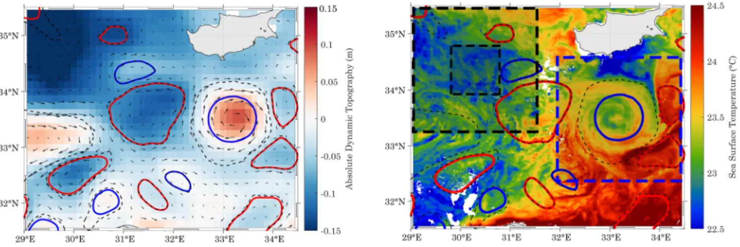
Figure

Documents relatifs