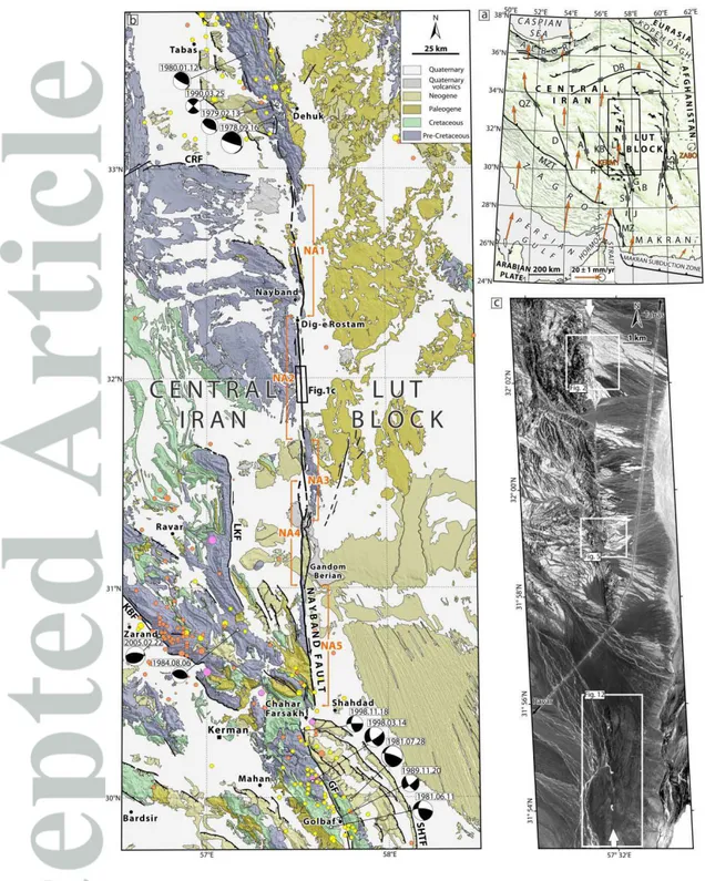
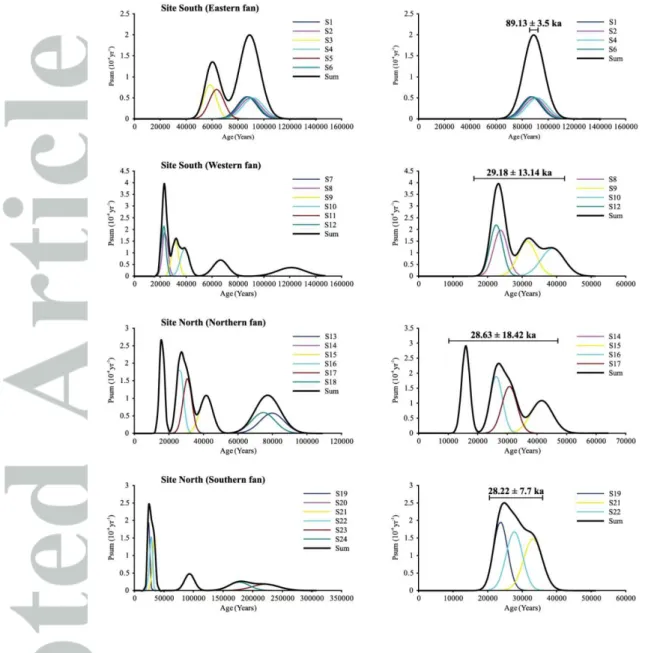
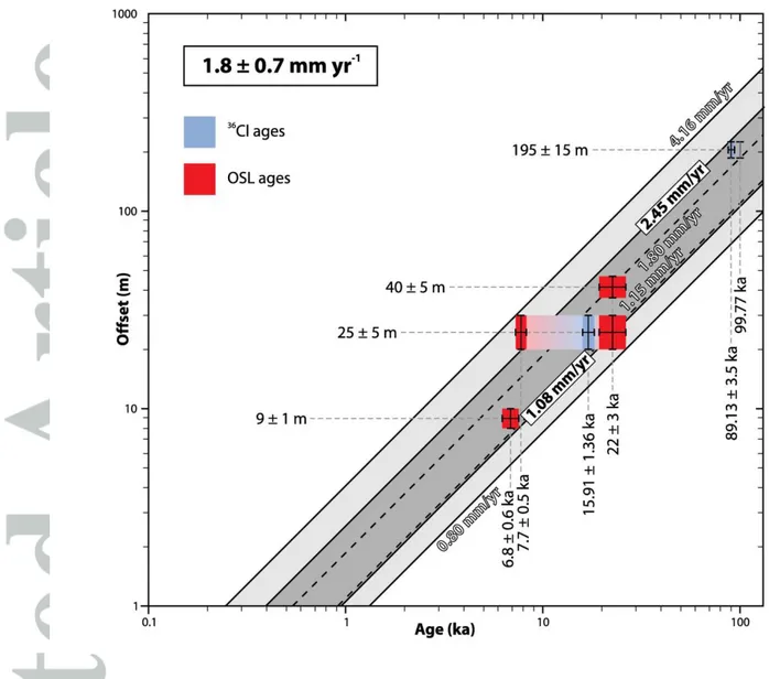
Late Pleistocene-Holocene right-slip rate and paleoseismology of the Nayband fault, western margin of the Lut block, Iran
Texte intégral
Figure


Documents relatifs
éthiques, existentielles, anthropologiques, mais aussi sociales et même politiques des greffes qui seront rencontrées dans leur mise à jour progressive dans la marche
By trading stability robustness and performance, adding states, and opening sensor/actuator control channels a family of tuned controllers will be generated from the
Cinq types de représentations des descripteurs audio à partir de « Eros noir 1 » extrait de Toupie Dans Le Ciel de François Bayle (de haut en bas) : corrélation hiérarchique, nuage
For the densest cases, B4 and T2, statistical wind profiles exhibit the same main characteristics as profiles usually observed in continuous vegetated canopies: a strong vertical shear
However, modeling saltation intermittency from a LES approach is still chal- lenging because saltation occurs near the surface, within a layer not exceeding 1 m height, where
It has been established that this defects is related to the change in mineralization form from hexagonal aragonite to orthorhombic vaterite.. SEM picture of pearl surface at
The share of the total number of remains of the three dominant species (70–79%) in the faunas of the eastern slope is the lowest over the whole Late Pleistocene period in the
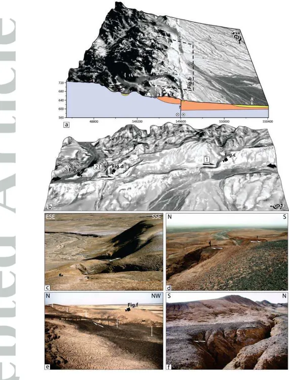
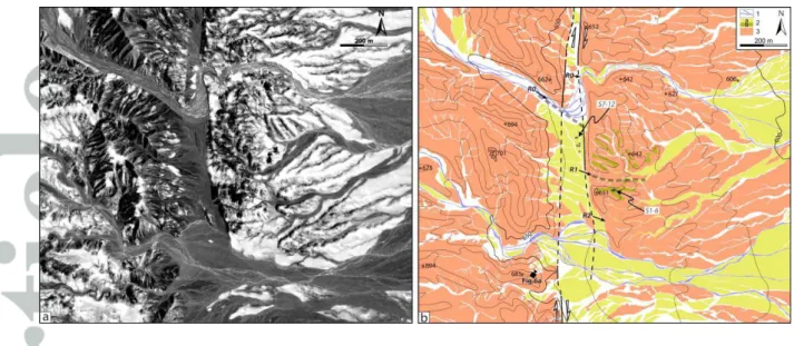
Measurements at Majia Wan (Site 1) North of Song Shah, along the central swath, the fault trace strikes N100 ø- 105ø E and shows mostly horizontal displacement (Plate
