SCIAMACHY validation by aircraft remote sensing: design, execution, and first measurement results of the SCIA-VALUE mission
19
0
0
Texte intégral
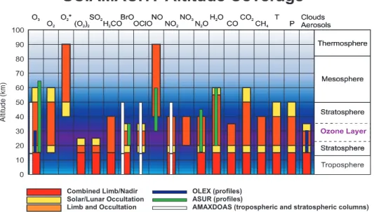
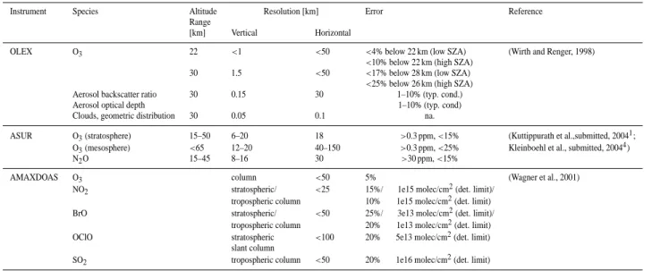
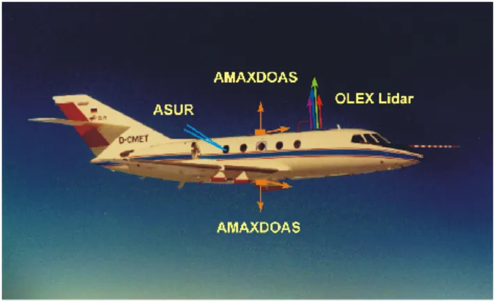
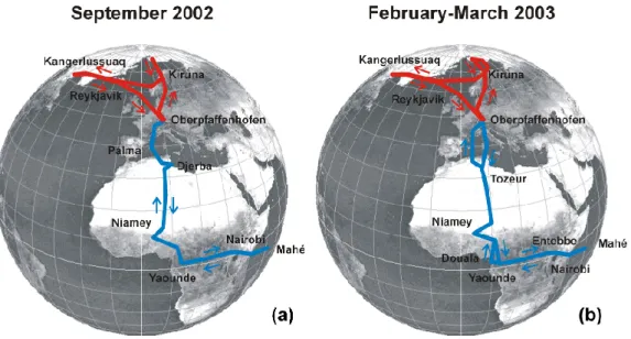
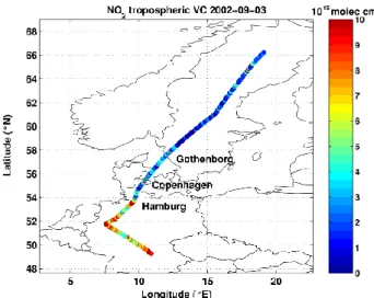
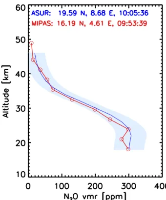
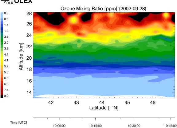
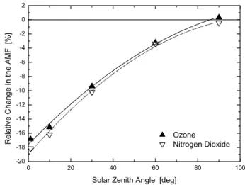
Figure

+7

Documents relatifs
